Items Similar to Antique Map of Eastern Russia in Asia by Kuyper, 1880

Want more images or videos?
Request additional images or videos from the seller
1 of 5
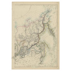
Antique Map of Eastern Russia in Asia by Kuyper, 1880
$61.71
$77.1420% Off
£46.03
£57.5420% Off
€52
€6520% Off
CA$85.89
CA$107.3720% Off
A$92.15
A$115.1920% Off
CHF 49.43
CHF 61.7820% Off
MX$1,109.47
MX$1,386.8320% Off
NOK 623.09
NOK 778.8620% Off
SEK 568.17
SEK 710.2120% Off
DKK 396.28
DKK 495.3520% Off
About the Item
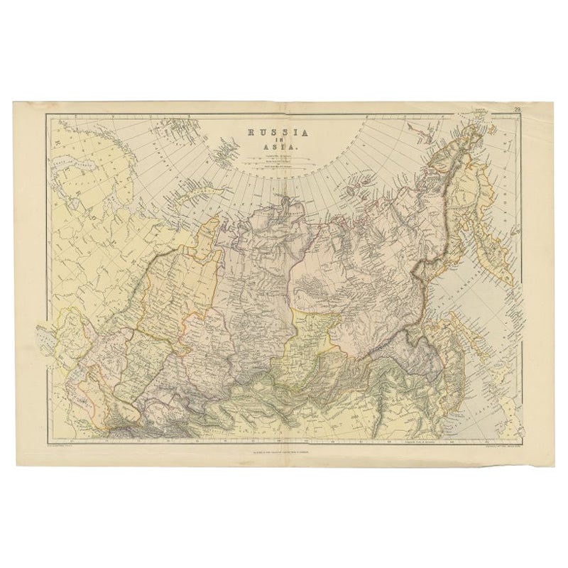
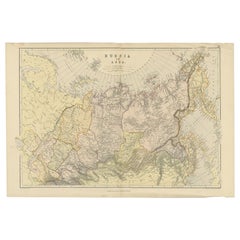
Antique map titled 'Aziatisch Rusland. Oost'. Original antique map of Eastern Russia in Asia. This lithographed map originates from: 'Wereld-atlas voor Kantoor en Huiskamer' (transl: World Atlas for the office and living room), by J. Kuyper, published in 1880 - 1882 in Amsterdam, The Netherlands by G. L. Funke.
Artists and Engravers: Jacob Kuyper (1821 - 1908), Dutch cartographer.
Condition: Original middle fold as issued. General age-related toning and occasional light stains from handling. Please study image carefully.
Date: c.1880
Overall size: 7.5 x 9.3 cm.
Image size: 0.001 x 6.1 x 8.1 cm.
We sell original antique maps to collectors, historians, educators and interior decorators all over the world. Our collection includes a wide range of authentic antique maps from the 16th to the 20th centuries. Buying and collecting antique maps is a tradition that goes back hundreds of years. Antique maps have proved a richly rewarding investment over the past decade, thanks to a growing appreciation of their unique historical appeal. Today the decorative qualities of antique maps are widely recognized by interior designers who appreciate their beauty and design flexibility. Depending on the individual map, presentation, and context, a rare or antique map can be modern, traditional, abstract, figurative, serious or whimsical. We offer a wide range of authentic antique maps for any budget.
- Dimensions:Height: 3.67 in (9.3 cm)Width: 2.96 in (7.5 cm)Depth: 0 in (0.01 mm)
- Materials and Techniques:
- Period:
- Date of Manufacture:circa 1880
- Condition:
- Seller Location:Langweer, NL
- Reference Number:Seller: PCT-256821stDibs: LU3054325634472
About the Seller
5.0
Recognized Seller
These prestigious sellers are industry leaders and represent the highest echelon for item quality and design.
Platinum Seller
Premium sellers with a 4.7+ rating and 24-hour response times
Established in 2009
1stDibs seller since 2017
2,830 sales on 1stDibs
Typical response time: 1 hour
- ShippingRetrieving quote...Shipping from: Langweer, Netherlands
- Return Policy
More From This Seller
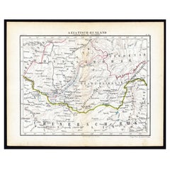
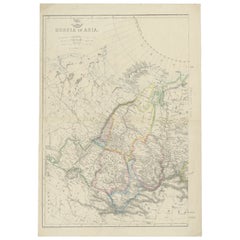
View AllAntique Map of Russia in Asia by Kuyper, c.1880
Located in Langweer, NL
Antique map plate 48 : 'Aziatisch Rusland. Balkasj Meer en omstreken.' Original antique map of Russia in Asia, showing Lake Balkhash and surroundings. This l...
Category
Antique 19th Century Maps
Materials
Paper
$56 Sale Price
20% Off
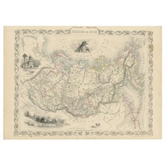
Antique Map of Russia in Asia by Weller, 1882
Located in Langweer, NL
Antique map titled 'Russia in Asia'. Old map of Russia originating from Blackie's The Comprehensive Atlas & Geography of the World'. Artists and Engravers: Engraved by E. Weller. Pub...
Category
Antique 19th Century Maps
Materials
Paper
$99 Sale Price
20% Off
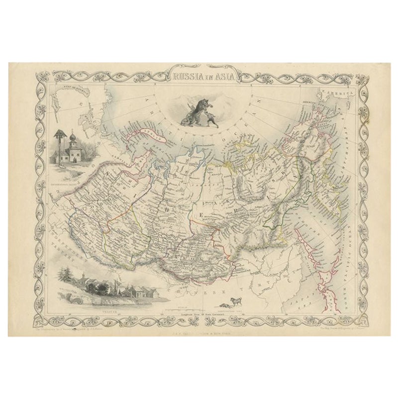
Antique Map of Russia in Asia by Tallis, c.1851
Located in Langweer, NL
Antique map titled 'Russia in Asia'. Map of Russia in Asia. Showing vignettes of a polar hunting scene, Skorskarskoi Pagost, Troitsk and Kamchatkan Dogs. Originates from 'The Illustrated Atlas, And Modern History Of The World Geographical, Political, Commercial & Statistical, Edited By R. Montgomery Martin'. Published; John Tallis London, New York, Edinburgh & Dublin. 1851. Drawn and Engraved by J. Rapkin. Artists and Engravers: John Tallis (1817-1876) was a British map...
Category
Antique 19th Century Maps
Materials
Paper
Antique Map of Russia in Asia by Lowry, c.1865
Located in Langweer, NL
Antique map titled 'Russia in Asia, E Sheet'. Old map of Russia originating from the 'Weekly Dispatch Atlas'. Artists and Engravers: Engraved by J.W. Lowry.
Artist: Engraved by J....
Category
Antique 19th Century Maps
Materials
Paper
$84 Sale Price
20% Off
Antique Map of Russia in Asia by Weller, c.1865
Located in Langweer, NL
Antique map titled 'Russia in Asia'. Old map of Russia originating from the 'Weekly Dispatch Atlas'. Artists and Engravers: Engraved by E. Weller.
Artist: Engraved by E. Weller.
...
Category
Antique 19th Century Maps
Materials
Paper
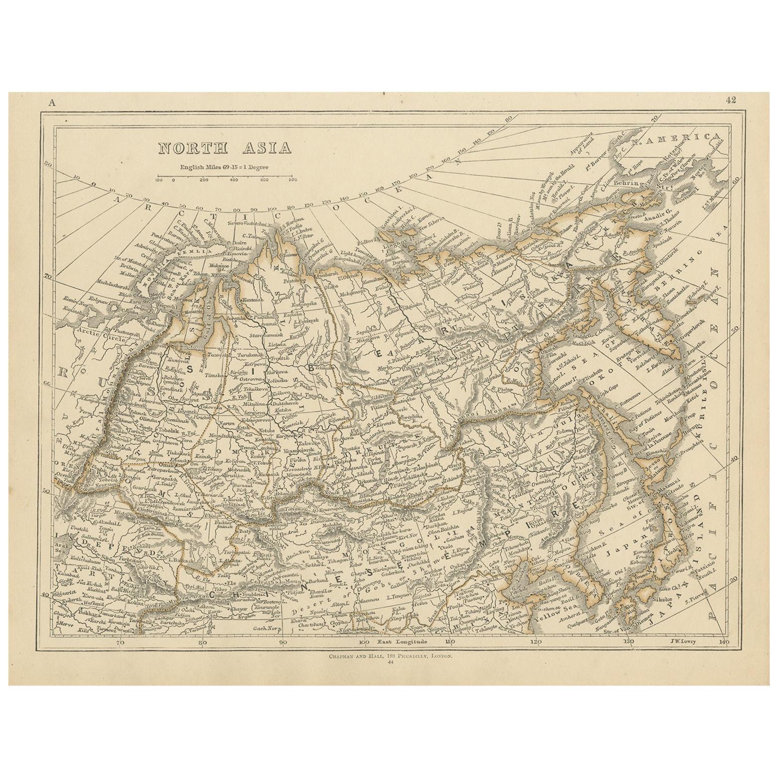
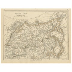
Antique Map of Northern Asia by Lowry, 1852
Located in Langweer, NL
Antique map titled 'North Asia'. Original map of Northern Asia. This map originates from 'Lowry's Table Atlas constructed and engraved from the most recent authorities' by J.W. Lowry...
Category
Antique Mid-19th Century Maps
Materials
Paper
$94 Sale Price
20% Off
You May Also Like
1860 Large Map "Carte De La Siberie Russie D
asie, " Ric.R0001
Located in Norton, MA
Large 1860 map "Carte De La Siberie Russie D'Asie," R-0001
" Authentic" - 1860 map "Carte De La Siberie Russie D'Asie,"
Dimension: Paper: 68 cm W x 51 cm H ; Sight: 51cm W x 4...
Category
Antique 19th Century Unknown Maps
Materials
Paper

1849 Map of "Europaische Russland",
Meyer Map of European Russia
, Ric. R017
Located in Norton, MA
1849 Map of
"Europaische Russland"
( Meyer Map of European Russia)
Ric.r017
A lovely map of European Russia dating to 1849 by Joseph Meyer. It covers the European portions of...
Category
Antique 19th Century Unknown Maps
Materials
Paper

Large1852 Map "Russian Empire" Ric.r0011
Located in Norton, MA
Large
1852 map "Russian Empire"
George Phillips & Son 1852
Ric.r0011
Dimension: Paper: 67 cm W x 52 cm H ; Sight: 60cm W x 50 cm H
Condition: Good Condition with aged tonin...
Category
Antique 19th Century Unknown Maps
Materials
Paper

Antique 1803 Italian Map of Asia Including China Indoneseia India
Located in Amsterdam, Noord Holland
Antique 1803 Italian Map of Asia Including China Indoneseia India
Very nice map of Asia. 1803.
Additional information:
Type: Map
Country of Manufacturing: Europe
Period: 19th centu...
Category
Antique 19th Century European Maps
Materials
Paper

$438 Sale Price
39% Off
1851 Map of "Independent Tartary", Ric. R018
Located in Norton, MA
1851 Map of
Independent Tartary
"Russia"
Ric.r018
A highly decorative 1851 map of Independent Tartary by John Tallis and John Rapkin. Covers the regions between the Caspian Sea and Lake Bakquash and between Russia and Afghanistan. These include the ancient Silk Route kingdoms of Khiva, Tartaria, Kokand, and Bokhara. Today this region roughly includes Kazakhstan, Uzbekistan, Turkmenistan, Kyrgyzstan, and Tajikistan. This wonderful map offers a wealth of detail for anyone with an interest in the Central Asian portion of the ancient Silk Road. Identifies various caravan routes, deserts, wells, and stopping points, including the cities of Bokhara and Samarkand. Three vignettes by W. Bragg decorate the map, these including an image of Tartars on a Journey, a horseback Bride Chase, and a tartar camp site. Surrounded by a vine motif border. Engraved by J. Rapkin for John Tallis's 1851 Illustrated Atlas .
Tartary Antique Map...
Category
Antique 19th Century Unknown Maps
Materials
Paper

Original Antique Map of China, Arrowsmith, 1820
Located in St Annes, Lancashire
Great map of China
Drawn under the direction of Arrowsmith
Copper-plate engraving
Published by Longman, Hurst, Rees, Orme and Brown, 1820
Unfr...
Category
Antique 1820s English Maps
Materials
Paper

More Ways To Browse
Antique Map Of Egypt
Map Of Austria
New Zealand Map
Antique Linen Map
19th Century World Map
Antique Ohio Maps
Antique Texas Furniture
Military Map
Antique Maps New Zealand
Birds Eye View Map
North Africa Map
West Africa Map
Antique Compass Map
Antique Maps California
Biblical Maps
Hungary Map
Maps Of Mediterranean
Treasure Map