Items Similar to Antique Map of Eastern Seram, Part of the Maluku Island in East Indonesia, 1726


Want more images or videos?
Request additional images or videos from the seller
1 of 5
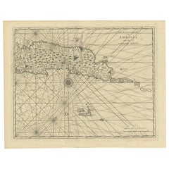
Antique Map of Eastern Seram, Part of the Maluku Island in East Indonesia, 1726
$538.49
£402.20
€450
CA$741.87
A$808.50
CHF 428.14
MX$9,710.99
NOK 5,420.32
SEK 4,983.45
DKK 3,428.22
About the Item
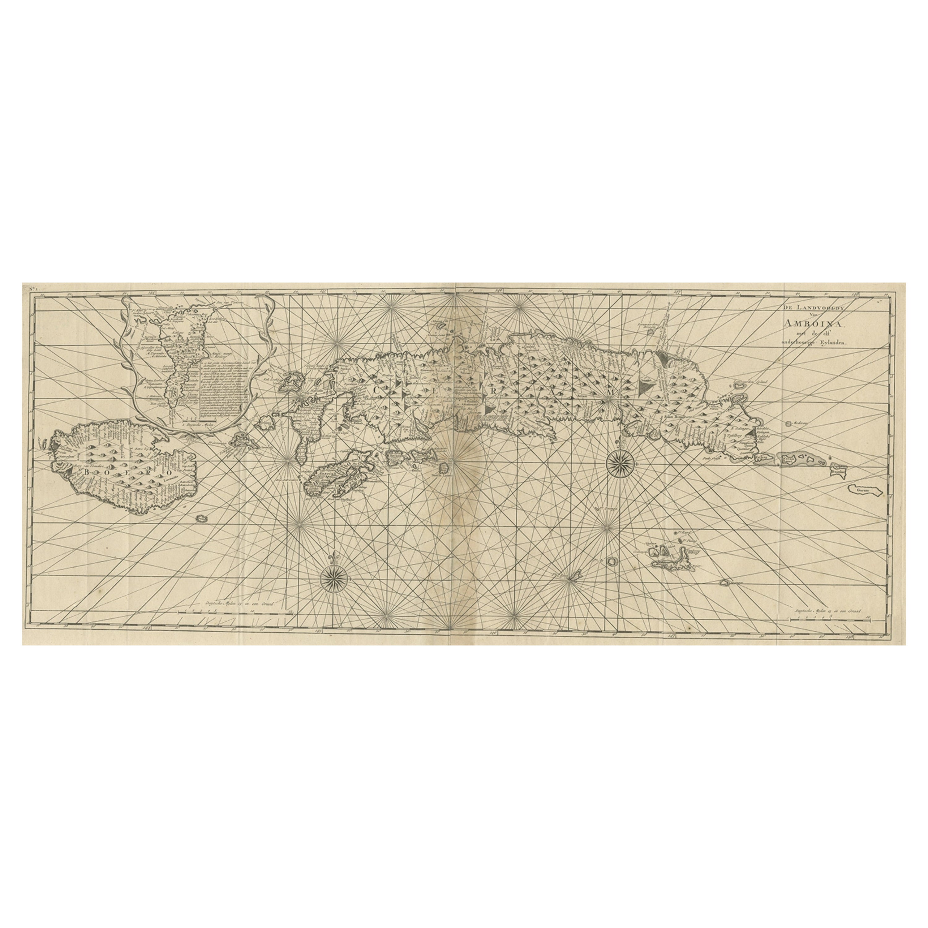
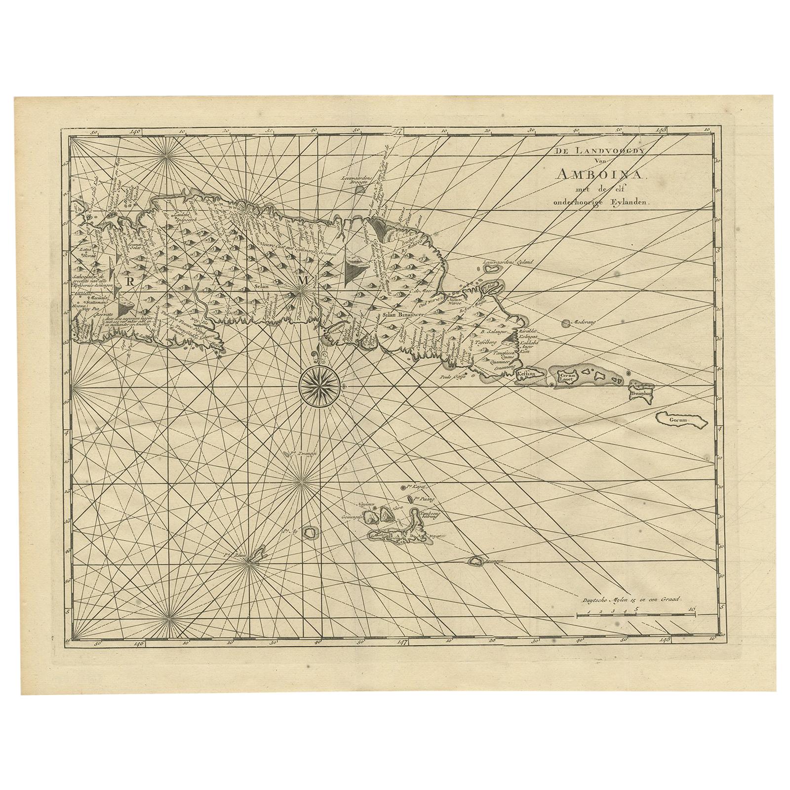
Antique map titled 'De Landvoogdy van Amboina met de elf onderhoorige Eylanden.' Detailed map of the eastern part of Seram in Indonesia, part of the Maluku islands. Map of the southern part of Seram with the city of Lonthoir. From the monumental: ""Oud en Nieuw Oost-Indiën (..)"" by François Valentyn / Valentijn, published in 1724-1726. VOC.
Artists and Engravers: The author François Valentijn (1666-1727), was a Dutch missionary, worked at Amboina from 1684 to 1694 and 1705 to 1713 and traveled extensively in the VOC's lands.
Condition: Very good, given age. Original fold as issued. Three tiny pinholes in print, reinforced using contemporary paper backed with acid free archival tape. General age-related toning and/or occasional minor defects from handling. Please study image carefully.
Date: 1726
Overall size: 38.9 x 31 cm.
Image size: 37.6 x 29.5 cm.
We sell original antique maps to collectors, historians, educators and interior decorators all over the world. Our collection includes a wide range of authentic antique maps from the 16th to the 20th centuries. Buying and collecting antique maps is a tradition that goes back hundreds of years. Antique maps have proved a richly rewarding investment over the past decade, thanks to a growing appreciation of their unique historical appeal. Today the decorative qualities of antique maps are widely recognized by interior designers who appreciate their beauty and design flexibility. Depending on the individual map, presentation, and context, a rare or antique map can be modern, traditional, abstract, figurative, serious or whimsical. We offer a wide range of authentic antique maps for any budget.
- Dimensions:Height: 12.21 in (31 cm)Width: 15.32 in (38.9 cm)Depth: 0 in (0.01 mm)
- Materials and Techniques:
- Period:
- Date of Manufacture:1726
- Condition:
- Seller Location:Langweer, NL
- Reference Number:Seller: PCT-511481stDibs: LU3054326172292
About the Seller
5.0
Recognized Seller
These prestigious sellers are industry leaders and represent the highest echelon for item quality and design.
Platinum Seller
Premium sellers with a 4.7+ rating and 24-hour response times
Established in 2009
1stDibs seller since 2017
2,788 sales on 1stDibs
Typical response time: <1 hour
- ShippingRetrieving quote...Shipping from: Langweer, Netherlands
- Return Policy
More From This Seller
View AllAntique Map of Ambon Island in the Moluccas, Indonesia, c.1760
Located in Langweer, NL
Antique map Ambon titled 'Carte Particuliere de l 'Isle Amboine'. Old map showing Ambon, in the Moluccas Islands, better known as the Spice Islands. Ambon was the headquarters of the...
Category
Antique 18th Century Maps
Materials
Paper

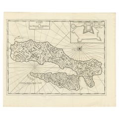
Antique Map of the Moluccas or the Famed Spice Islands of Indonesia, 1724
Located in Langweer, NL
Antique map Spice Islands titled 'De landvoogdy van Amboina met de elf onderhoorige Eylanden'.
This map depicts the central islands of the Maluku Arc...
Category
Antique 1720s Maps
Materials
Paper
$852 Sale Price
20% Off
Antique Map of Ambon and Surroundings by Valentijn
1726
By F. Valentijn
Located in Langweer, NL
Antique map titled 'De landvoogdy van Amboina met de elf onderhoorige Eylanden'. Decorative map of the eastern tip of the islands of Ambon, Indonesia. This print originates from 'Oud...
Category
Antique Early 18th Century Dutch Maps
Materials
Paper
$526 Sale Price
20% Off
Antique Map of Java and Madura Island, Indonesia, c.1760
Located in Langweer, NL
Antique map titled 'Idee de l'Isle de Java.'
Well engraved and attractive chart of the island shows all principal harbors and coastal details, plus rivers, mountains and volcanoe...
Category
Antique 18th Century Maps
Materials
Paper

Antique Map of the Island Java, Indonesia, c.1650
Located in Langweer, NL
Antique map titled 'Insulae Iavae cum parte insularum Boreno Sumatrae (..)'.
Beautiful map of the island of Java and part of Borneo, Bali, Madura and Sumatra. With decorative carto...
Category
Antique 17th Century Maps
Materials
Paper

$3,111 Sale Price
20% Off
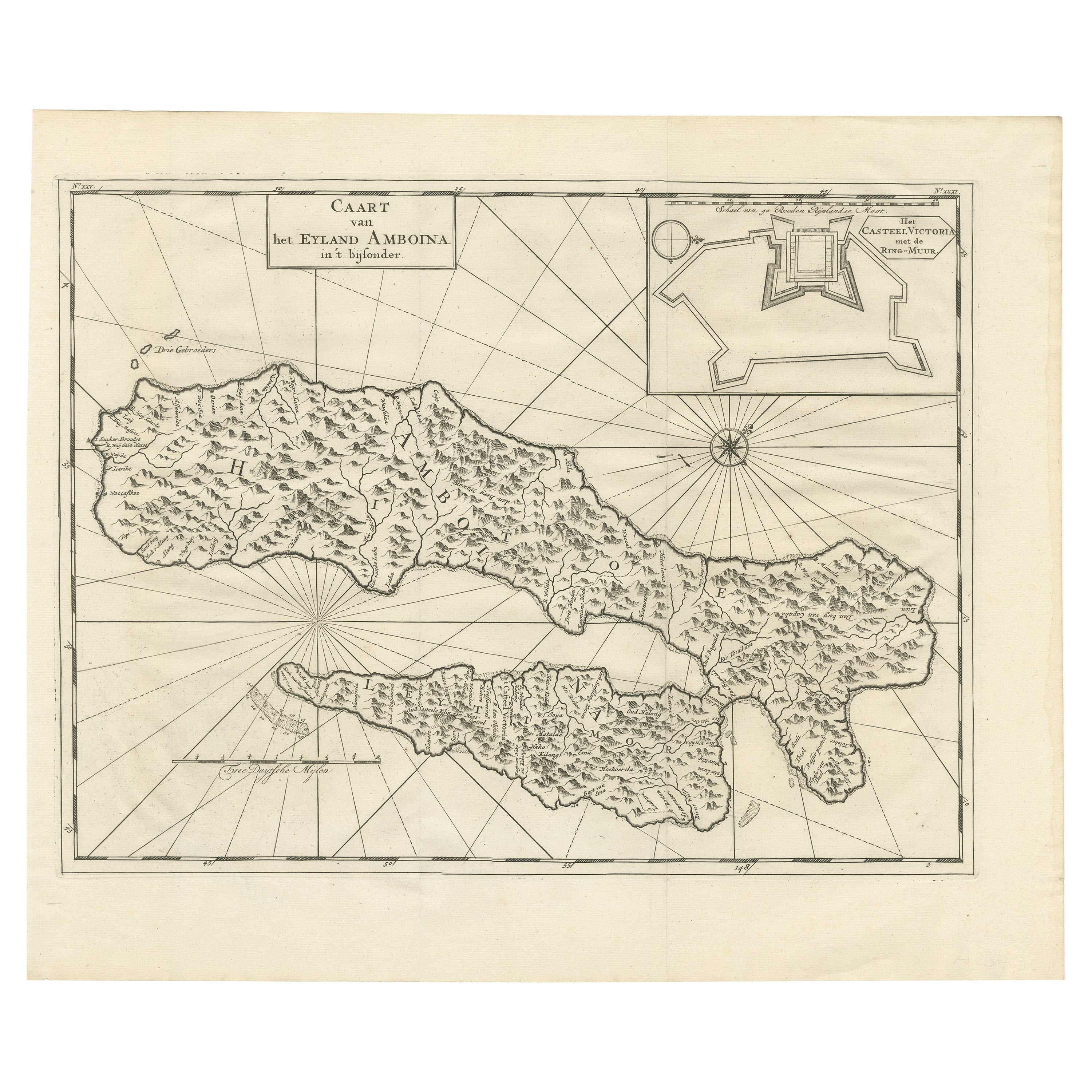
Antique Map of Ambon with Inset of the Victoria Castle, Moluku, Indonesia, 1726
Located in Langweer, NL
Antique map titled 'Caart van het Eyland Ambonia in het bijsonder. ' This is a print of an antique map of the Islands Ambon and Timor, one of the Moluccan Islands, Indonesia, with an...
Category
Antique 18th Century Maps
Materials
Paper
You May Also Like
Original Antique Map of South America. C.1780
Located in St Annes, Lancashire
Great map of South America
Copper-plate engraving
Published C.1780
Two small worm holes to left side of map
Unframed.
Category
Antique Early 1800s English Georgian Maps
Materials
Paper

Map Of The Island Of Cuba - Guillaume Thomas Raynal (1711-1796)
Located in Porto, PT
This historical map of the Island of Cuba was produced in the late 18th century and is taken from an edition of “Atlas de toutes les parties connues du globe terrestre” by the French...
Category
Antique 18th Century Prints
Materials
Glass, Paper

Antique Map - Mare Pacificum - Etching by Johannes Janssonius - 1650s
By Johannes Janssonius
Located in Roma, IT
Mare Pacificum is an antique map realized in 1650 by Johannes Janssonius (1588-1664).
The Map is Hand-colored etching, with coeval watercolorang.
Good conditions with slight foxing...
Category
1650s Modern Figurative Prints
Materials
Etching

Original Antique Map of South East Asia by Thomas Clerk, 1817
Located in St Annes, Lancashire
Great map of South East Asia
Copper-plate engraving
Drawn and engraved by Thomas Clerk, Edinburgh.
Published by Mackenzie And Dent, 1817
Unframed.
Category
Antique 1810s English Maps
Materials
Paper

Antique French Map of Asia Including China Indoneseia India, 1783
Located in Amsterdam, Noord Holland
Very nice map of Asia. 1783 Dedie au Roy.
Additional information:
Country of Manufacturing: Europe
Period: 18th century Qing (1661 - 1912)
Condition: Overall Condition B (Good Used)...
Category
Antique 18th Century European Maps
Materials
Paper

$486 Sale Price
40% Off
Map of the East Indies: An Original 18th Century Hand-colored Map by E. Bowen
Located in Alamo, CA
This is an original 18th century hand-colored map entitled "An Accurate Map of the East Indies Exhibiting the Course of the European Trade both on the Continent and Islands" by Emanu...
Category
Mid-18th Century Old Masters Landscape Prints
Materials
Engraving

$1,020 Sale Price
20% Off