Items Similar to Antique Map of Eastern Siberia by Bellin
1768


Want more images or videos?
Request additional images or videos from the seller
1 of 5
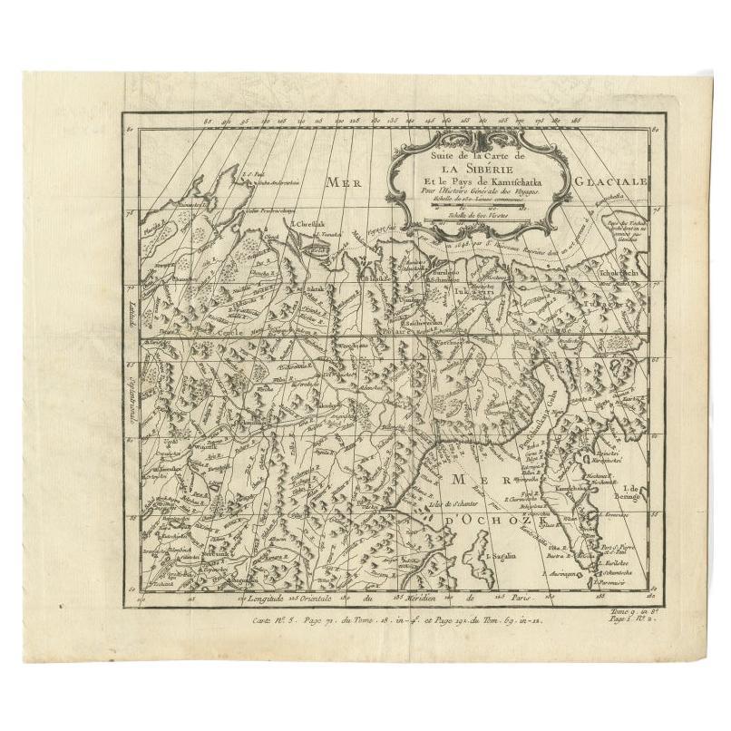
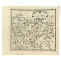
Antique Map of Eastern Siberia by Bellin
1768
$288.24
$360.3020% Off
£213.51
£266.8920% Off
€240
€30020% Off
CA$394.38
CA$492.9820% Off
A$429.12
A$536.4020% Off
CHF 227.21
CHF 284.0220% Off
MX$5,162.60
MX$6,453.2620% Off
NOK 2,885.11
NOK 3,606.3820% Off
SEK 2,639.67
SEK 3,299.5920% Off
DKK 1,829
DKK 2,286.2520% Off
About the Item
Antique map titled 'Suite de la Carte de la Siberie et le Pays de Kamtchatka'. Original antique map of the eastern portion of Siberia, centered on eastern Russia and the Mer d'Ochozk (Sea of Okhotsk) showing the Kamchatka Peninsula and I. de Beringe and I. Sagalin. The map shows the tracks of Russian ships voyage to Kamschatka: "voyage fait par mer en 1648 par 3 vaisseaux Russiens dont un est parvenu a la Kamtschatka" (1648 voyage by 3 Russian ships, one of which arrived in Kamchatka). Engraved by J.N. Bellin for 'Histoire Générale des Voyages'. Published 1768.
- Dimensions:Height: 9.85 in (25 cm)Width: 14.57 in (37 cm)Depth: 0.02 in (0.5 mm)
- Materials and Techniques:
- Period:
- Date of Manufacture:1768
- Condition:General age-related toning. Original folding lines. Minor wear/creasing, blank verso. Please study image carefully.
- Seller Location:Langweer, NL
- Reference Number:Seller: BG-12645-61stDibs: LU3054323728462
About the Seller
5.0
Recognized Seller
These prestigious sellers are industry leaders and represent the highest echelon for item quality and design.
Platinum Seller
Premium sellers with a 4.7+ rating and 24-hour response times
Established in 2009
1stDibs seller since 2017
2,816 sales on 1stDibs
Typical response time: 1 hour
- ShippingRetrieving quote...Shipping from: Langweer, Netherlands
- Return Policy
More From This Seller
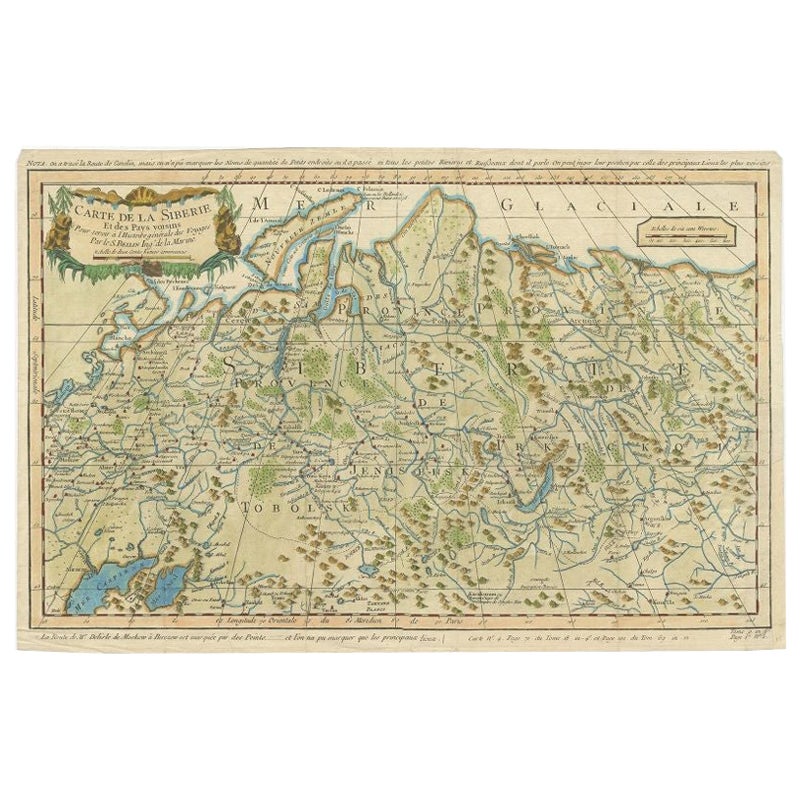
View AllAntique Map of Eastern Siberia Extending to Kamtchatka, Russia, 1764
By Jacques-Nicolas Bellin
Located in Langweer, NL
Antique map titled 'Suite De La Carte De La Siberie Et le Pays de Kamtchatka'. Detailed map the Eastern portion of Siberia, extending to Kamtchatka. Shows the Russian voyage of 1648 in the NE Passage region. Includes a decorative title cartouche. Originates from Prevost d'Exiles influential travel book, 'L'Histoire Generale des Voyages'.
Artists and Engravers: Jacques-Nicolas Bellin (1703-1772) was among the most important mapmakers of the eighteenth century. In 1721, at age 18, he was appointed hydrographer (chief cartographer) to the French Navy. In August 1741, he became the first Ingénieur de la Marine of the Depot des cartes...
Category
Antique 18th Century Maps
Materials
Paper
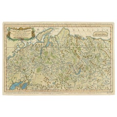
Antique Map of Siberia by Bellin, 1754
Located in Langweer, NL
Antique map titled 'Carte de la Siberie'. Detailed map of Siberia, extending from the White Sea and the Caspian Sea in the west to Irkuckoi Province, Jakutky on the Lena River and regions just to the east. Centered on the Jenisi River. Originates from Prévost's 'Histoire Générale des Voyages'. Artists and Engravers: Jacques-Nicolas Bellin (1703-1772) was among the most important mapmakers of the eighteenth century. In 1721, at age 18, he was appointed hydrographer (chief cartographer) to the French Navy. In August 1741, he became the first Ingénieur de la Marine of the Depot des cartes...
Category
Antique 18th Century Maps
Materials
Paper
$336 Sale Price
20% Off
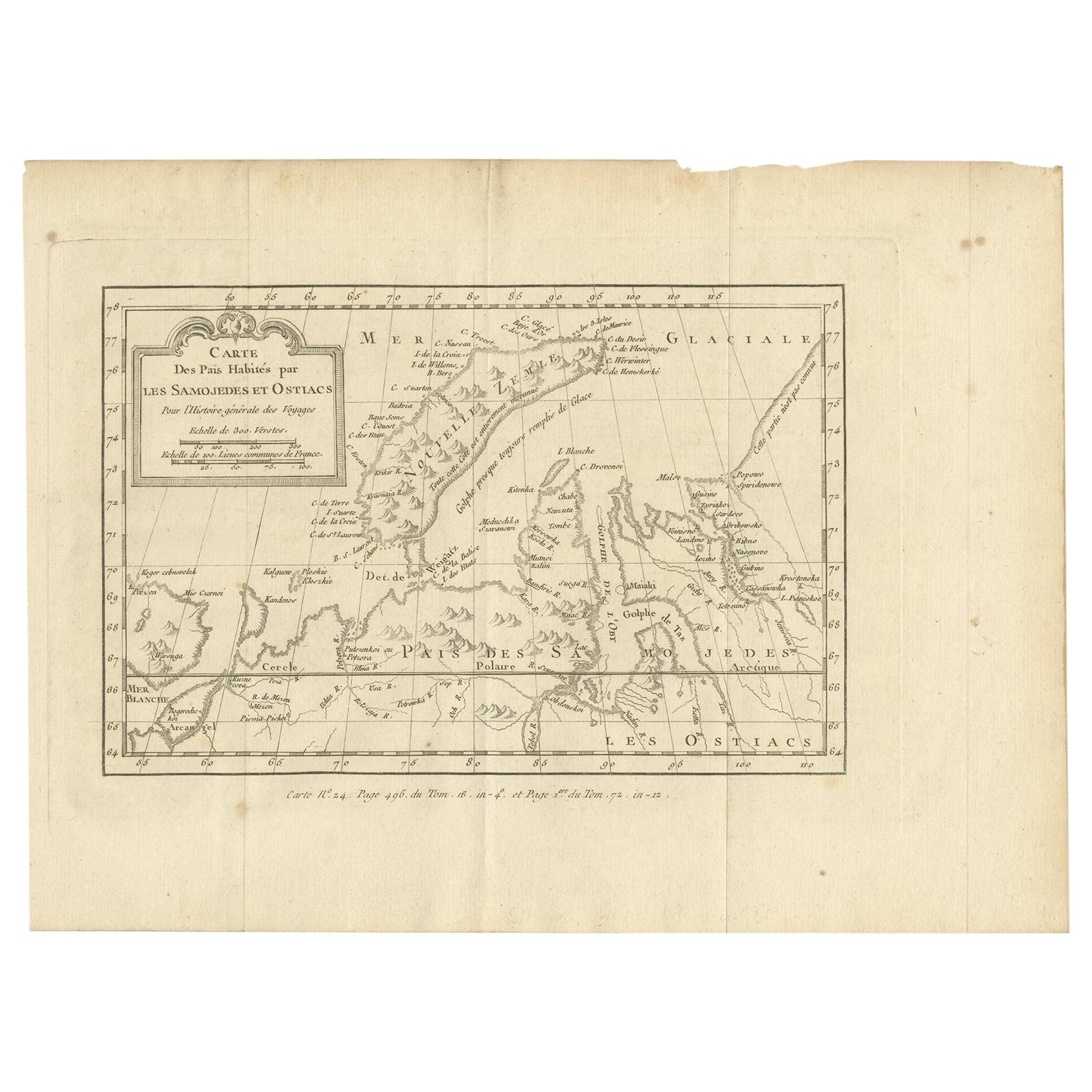
Antique Map of the Country Inhabited by the Samoyedic and Khanty People
1768
Located in Langweer, NL
Antique map titled 'Carte des Païs Habités par les Samojedes et Ostiacs'. Original antique map of the country inhabited by the Samoyedic and Khanty (Ostyak) peoples. Engraved by J.N....
Category
Antique Mid-18th Century Maps
Materials
Paper
$192 Sale Price
20% Off
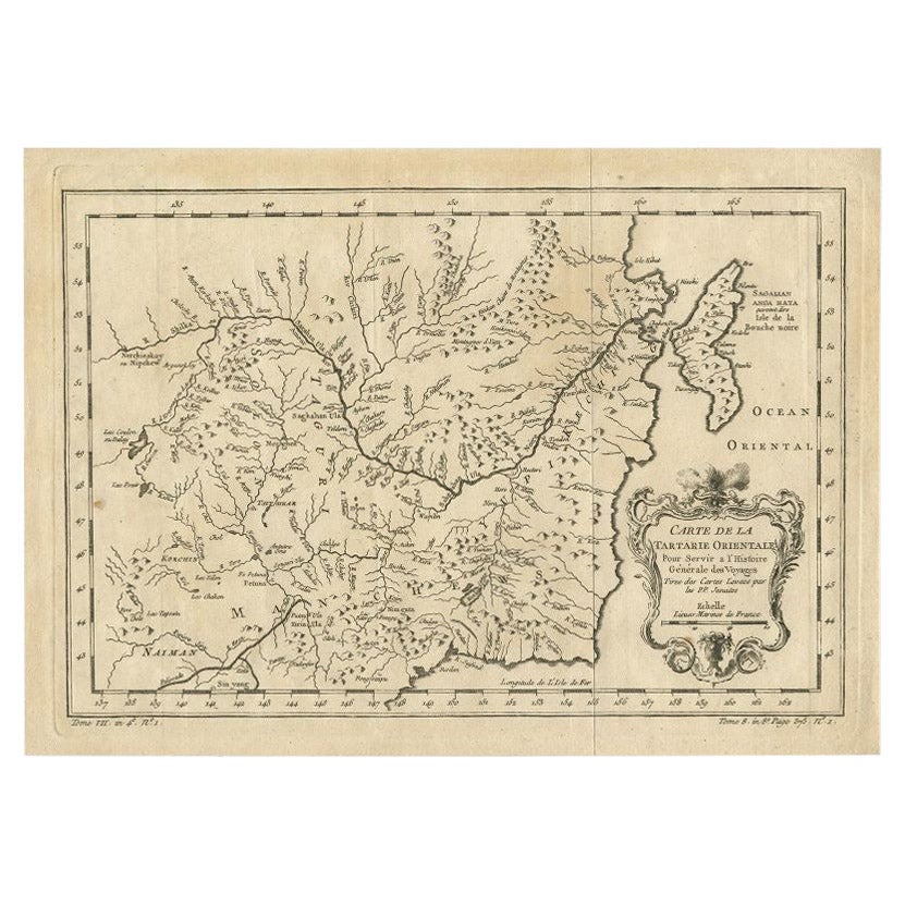
Antique Map of Northern China and Far Eastern Russia Around the Amur River, 1754
Located in Langweer, NL
Antique map titled 'Carte De La Tartarie Orientale (..)'. A map for this far eastern portion of what is present day northern China and far eastern Russia...
Category
Antique 1750s Maps
Materials
Paper

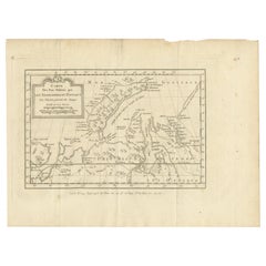
Antique Map of Nova Zembla
Russia
by J.N. Bellin, 1757
Located in Langweer, NL
Decorative map of Nova Zembla and environs in the Arctic Sea. Includes a large decorative title cartouche. One of the maps produced by Jacques-Nicolas Bellin for Prevost d'Exiles inf...
Category
Antique Mid-18th Century Maps
Materials
Paper

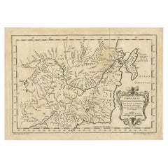
Antique Map of Northern China and Eastern Russia by Bellin, 1757
Located in Langweer, NL
Antique map titled 'Carte de la Tartarie Orientale (..)'. Original antique map of what is present day northern China and far eastern Russia. Centered on...
Category
Antique 18th Century Maps
Materials
Paper
You May Also Like
Siberia as Explored by Behring: Original 18th Century Hand-colored Map by Bowen
Located in Alamo, CA
This is an original 18th century hand-colored map entitled "An Exact Chart of all the Countries through which Capt. Behring Travelled from Tobolski, Capital of Siberia to the Country...
Category
Mid-18th Century Old Masters Landscape Prints
Materials
Engraving

Von Reilly Map of the Russian Empire, 1796
Located in Savannah, GA
A map of the Russian Empire in Europe by Von Reilly. Published in Vienna, 1796.
32 inches wide by 24 ½ inches tall
Category
Antique 1790s Austrian Prints
Materials
Glass, Wood, Paper

1814 Map of "Russian Empire" Ric.r032
Located in Norton, MA
1814 Map of
"Russian Empire"
Ric.r032
Russian Empire. Description: This is an 1814 John Thomson map of the Russian Empire. The map depicts the region from the Baltic Sea, Prussia, and Sweden to the Aleutian Islands and from the Arctic Ocean to the Yellow River. Highly detailed, myriad cities, towns, and villages are labeled throughout, including St. Petersburg, Moscow, Minsk, Kiev, and Kharkov. Rivers and mountain ranges are also identified, as are islands and numerous locations along the coastlines. It is important to note that the long-disputed sea between Korea and Japan is identified as the 'Sea of Japan.
Historical Context:
In 1815, Tsarist Russia emerged from the Napoleonic Wars economically insolvent and politically fearful of the Revolutionary fervor that had just swept through Europe. In order to shore up Russia's economic position, the Tsars began an aggressive series of expansions into the Caucuses and Central Asia that would vastly increase the landmass of the Russian Empire.
Publication History
Thomson maps are known for their stunning color, awe inspiring size, and magnificent detail. Thomson's work, including this map, represents some of the finest cartographic art...
Category
Antique 19th Century Unknown Maps
Materials
Paper

1790 Thomas Stackhouse Map, Entitled "Russia in Europe, " , Ric.a004
Located in Norton, MA
1790 Thomas Stackhouse map, entitled
"Russia in Europe"
Ric.a004
Stackhouse, Thomas
Russia in Europe [map]
London: T. Stackhouse, 1783. Map. Matted hand-colored copper engraving. Image size: 14.5 x 15.25 inches. Mat size: 22.75 x 23.75 inches. A beautiful example of this map of Eastern Europe...
Category
Antique 17th Century Unknown Maps
Materials
Paper

1714 Henri Chatelain "Nouvelle Carte Des Etatas Du Grand.Duc De Mos Moscovie Eur
Located in Norton, MA
A 1714 Henri Chatelain map, entitled
"Nouvelle Carte Des Etatas Du Grand Duc De Moscovie En Europe,"
Ricb001
Henri Abraham Chatelain (1684-1743) was a Huguenot pastor of Parisi...
Category
Antique Early 18th Century Dutch Maps
Materials
Paper

Map of the Russian Empire: An Original 18th Century Hand-colored Map by E. Bowen
Located in Alamo, CA
This is an original 18th century hand-colored map entitled "A New & Accurate Map of The Whole Russian Empire, As Contain'd Both In Europe and Asia, Drawn from Authentic Journals, Sur...
Category
Mid-18th Century Old Masters Landscape Prints
Materials
Engraving

More Ways To Browse
Antique Mediterranean Map
Antique Map Mexico
Antique Map Paris
Antique Puerto Rico
West Indies Antique Furniture
Map Of Ireland
Antique Indian Maps
Antique Map Ortelius
Antique Roman Map
D Plan
Roman Map
Map Of Paris
Large Vintage Map
Antique Map Of Ireland
Antique Maps Persia
Map Of Holy Land
Migeon Migeon
Antique Maps Of Canada