Items Similar to Antique Map of the Empire of the Assyriens by Mallet, 1683


Want more images or videos?
Request additional images or videos from the seller
1 of 5
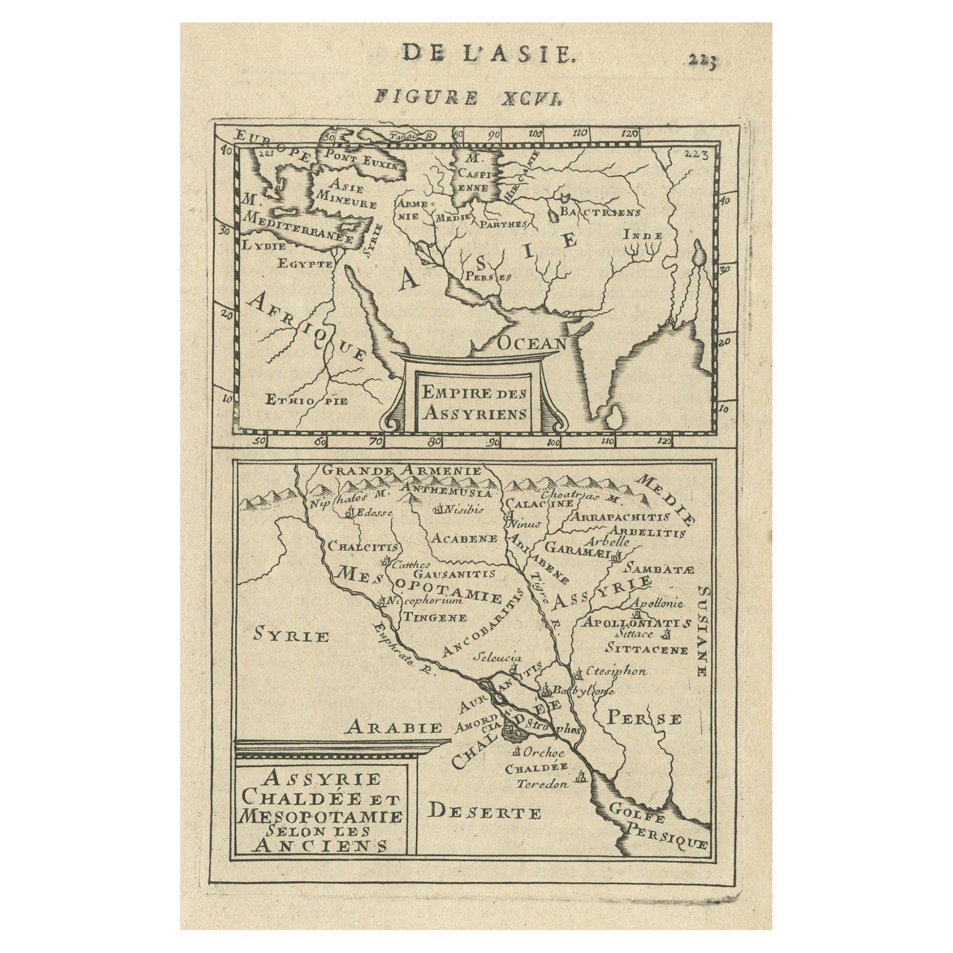
Antique Map of the Empire of the Assyriens by Mallet, 1683
$333.65
£248.52
€280
CA$459.46
A$500.11
CHF 264.99
MX$6,014.56
NOK 3,369.28
SEK 3,087.57
DKK 2,133.41
About the Item
Antique map titled 'Empire des Assyriens' and 'Assyrie Chaldee et Mesopotamie selon les Anciens'. Two maps on one sheet, the upper sheet showing the Empire of the Assyriens and the second showing the region of the Tigres and Euphrates Rivers. This map originates from Alain Manesson Mallet's 'Description de l 'Univers'.
Artists and Engravers: Alain Manesson Mallet (1630–1706) was a French cartographer and engineer. He started his career as a soldier in the army of Louis XIV, became a Sergeant-Major in the artillery and an Inspector of Fortifications. He also served under the King of Portugal, before returning to France, and his appointment to the court of Louis XIV. His military engineering and mathematical background led to his position teaching mathematics at court. His major publications were Description de L'Univers (1683) in 5 volumes, and Les Travaux de Mars ou l'Art de la Guerre (1684) in 3 volumes. His Description de L'Universe contains a wide variety of information, including star maps, maps of the ancient and modern world, and a synopsis of the customs, religion and government of the many nations included in his text. It has been suggested that his background as a teacher led to his being concerned with entertaining his readers. This concern manifested itself in the charming harbor scenes and rural landscapes that he included beneath his description of astronomical concepts and diagrams. Mallet himself drew most of the figures that were engraved for this book.
Condition: Good, age-related toning. French text on verso, please study image carefully.
Date: 1683
Overall size: 13 x 21 cm.
Image size: 10.5 x 15 cm.
We sell original antique maps to collectors, historians, educators and interior decorators all over the world. Our collection includes a wide range of authentic antique maps from the 16th to the 20th centuries. Buying and collecting antique maps is a tradition that goes back hundreds of years. Antique maps have proved a richly rewarding investment over the past decade, thanks to a growing appreciation of their unique historical appeal. Today the decorative qualities of antique maps are widely recognized by interior designers who appreciate their beauty and design flexibility. Depending on the individual map, presentation, and context, a rare or antique map can be modern, traditional, abstract, figurative, serious or whimsical. We offer a wide range of authentic antique maps for any budget
- Creator:Alain Manesson Mallet (Artist)
- Dimensions:Height: 8.27 in (21 cm)Width: 5.12 in (13 cm)Depth: 0 in (0.01 mm)
- Materials and Techniques:
- Period:
- Date of Manufacture:1683
- Condition:
- Seller Location:Langweer, NL
- Reference Number:Seller: BGJC-0891stDibs: LU3054327793602
About the Seller
5.0
Recognized Seller
These prestigious sellers are industry leaders and represent the highest echelon for item quality and design.
Platinum Seller
Premium sellers with a 4.7+ rating and 24-hour response times
Established in 2009
1stDibs seller since 2017
2,824 sales on 1stDibs
Typical response time: 1 hour
- ShippingRetrieving quote...Shipping from: Langweer, Netherlands
- Return Policy
More From This Seller
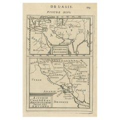
View AllOld Map of the Empire of the Assyriens
the Tigres and Euphrates Rivers, 1683
Located in Langweer, NL
Antique map titled 'Empire des Assyriens' and 'Assyrie Chaldee et Mesopotamie selon les Anciens'.
Two maps on one sheet, the upper sheet showing the Empire of the Assyriens and the second showing the region of the Tigres and Euphrates Rivers. This map originates from Alain Manesson Mallet's 'Description de l 'Univers'.
Artists and engravers: Alain Manesson Mallet (1630–1706) was a French cartographer and engineer. He started his career as a soldier in the army of Louis XIV, became a Sergeant-Major in the artillery and an Inspector of Fortifications. He also served under the King of Portugal, before returning to France, and his appointment to the court of Louis XIV. His military engineering and mathematical background led to his position teaching mathematics at court. His major publications were Description de L'Univers (1683) in 5 volumes, and Les Travaux de Mars ou l'Art de la Guerre (1684) in 3 volumes.
His Description de L'Universe contains a wide variety of information, including star maps...
Category
Antique 1680s Maps
Materials
Paper
$266 Sale Price
20% Off
Antique Map Eastern Mediterranean by D. Stoopendaal
circa 1710
Located in Langweer, NL
Antique map Middle East titled 'De Beschryving van de Reysen Pauli en van de Andere Apostelen'. Antique map of the Eastern Mediterranean with details of the travels by Apostle Paul...
Category
Antique Early 18th Century Dutch Maps
Materials
Paper

Antique Map of Eastern Mediterranean and Asia Minor by a Benedictine, c.1725
Located in Langweer, NL
Antique map titled 'Byzondere Afbeelding der Landschappen, van de Apostelen bevaren en doorwandelt om het Evangelium J. C. te Prediken.' Map of the lands travelled by the Apostles to...
Category
Antique 18th Century French Maps
Materials
Paper

Original Antique Map of Syria Phoenice by Van Dùren
1749
Located in Langweer, NL
Interesting Antique map published in Germany titled 'Neue Vorstellung von Phoenice und Syrien (..)' This map is engraved with a lot of details. It is an original antique map of Syria...
Category
Antique Mid-18th Century Maps
Materials
Paper

$285 Sale Price
20% Off
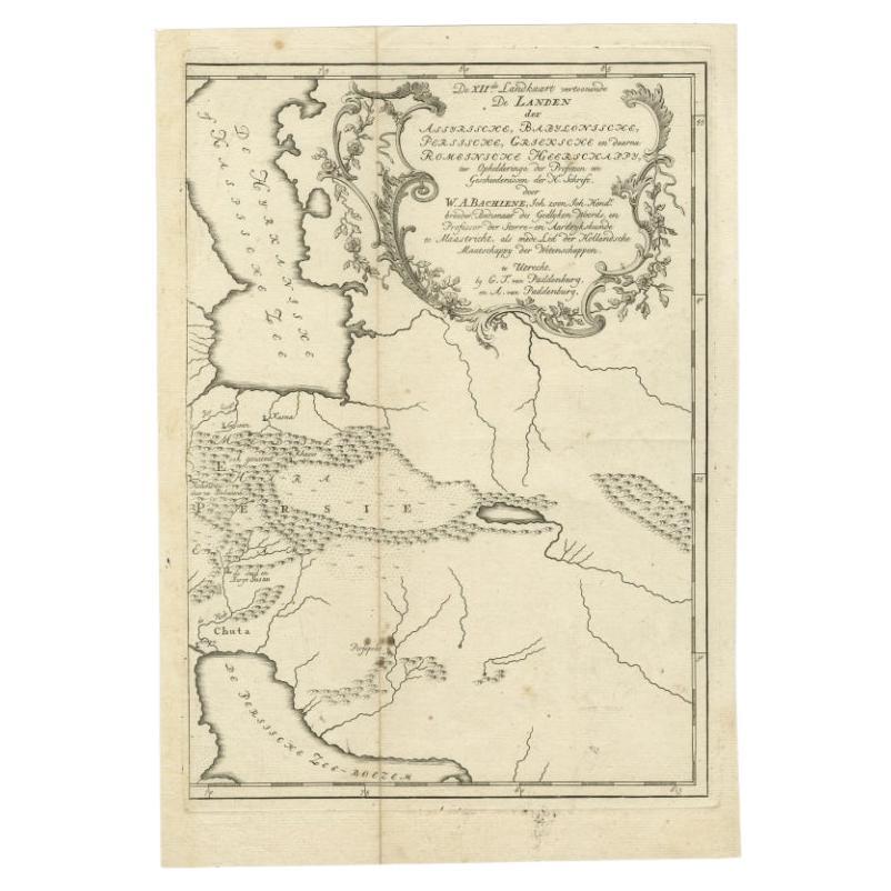
Ancient Persia, Assyria and Babylon – Willem Albert Bachiene, c.1760
Located in Langweer, NL
Ancient Persia, Assyria and Babylon – Willem Albert Bachiene, circa 1760
Antique map depicting the territories of the Assyrian, Babylonian, Persian, Gr...
Category
Antique 18th Century Dutch Maps
Materials
Paper
Antique Map of Western Asia by Van Dùren
1752
Located in Langweer, NL
Antique map titled 'Neue Geographische Vorstellung von Asien'. Original antique map of Western Asia. This map originates from 'Neue Sammlung der merkwürdigsten Reisegeschichten, inso...
Category
Antique Mid-18th Century Maps
Materials
Paper

$428 Sale Price
20% Off
You May Also Like
1718 Ides
Witsen Map "Route D
amsterdam a Moscow Et De La Ispahan Et Gamron
Located in Norton, MA
1718 Ides & Witsen map, entitled
"Route D'Amsterdam A Moscow Et De La Ispahan Et Gamron,"
Ric.b005
Subject: Eastern Europe and Central Asia
Period: 1718 (published)
Publicati...
Category
Antique Early 18th Century Dutch Maps
Materials
Paper

Original Antique Map of Ancient Greece, Achaia, Corinth, 1786
Located in St Annes, Lancashire
Great map of Ancient Greece. Showing the region of Thessaly, including Mount Olympus
Drawn by J.D. Barbie Du Bocage
Copper plate engraving by P.F Tardieu
Original hand color...
Category
Antique 1780s French Other Maps
Materials
Paper

Original Antique Map of Ancient Greece- Boeotia, Thebes, 1787
Located in St Annes, Lancashire
Great map of Ancient Greece. Showing the region of Boeotia, including Thebes
Drawn by J.D. Barbie Du Bocage
Copper plate engraving by P.F T...
Category
Antique 1780s French Other Maps
Materials
Paper

Persia, Armenia
Adjacent Regions: A 17th Century Hand-colored Map by De Wit
By Frederick de Wit
Located in Alamo, CA
A large 17th century hand colored copperplate engraved map entitled "Novissima nec non Perfectissima Scandinaviae Tabula comprehendens Regnorum Sueciae, Daniae et Norvegiae distincte...
Category
Antique Late 17th Century Dutch Maps
Materials
Paper

Southern Greece: A Large 17th C. Hand-colored Map by Sanson and Jaillot
By Nicolas Sanson
Located in Alamo, CA
This large original hand-colored copperplate engraved map of southern Greece and the Pelopponese Peninsula entitled "La Moree Et Les Isles De Zante, Cefalonie, Ste. Marie, Cerigo & C...
Category
Antique 1690s French Maps
Materials
Paper

Antique French Map of Asia Including China Indoneseia India, 1783
Located in Amsterdam, Noord Holland
Very nice map of Asia. 1783 Dedie au Roy.
Additional information:
Country of Manufacturing: Europe
Period: 18th century Qing (1661 - 1912)
Condition: Overall Condition B (Good Used)...
Category
Antique 18th Century European Maps
Materials
Paper

$486 Sale Price
40% Off
More Ways To Browse
Caucasus Map
Framed London Map
J Warren
Large Framed Maps
Map Of Jamaica
Map Of Madagascar
Map Of Normandy
Map Of Singapore
Map Of Vienna
Missouri Map
Nantucket Map
Old School Maps
Santa Cruz Used Furniture
Ukraine Antique Map
Used Office Furniture Cincinnati
Antique Map Of Cuba
Antique Map Vietnam
Antique Maps Colorado