Items Similar to Antique Map of England with Inset Maps of the Region of Liverpool and London

Want more images or videos?
Request additional images or videos from the seller
1 of 6
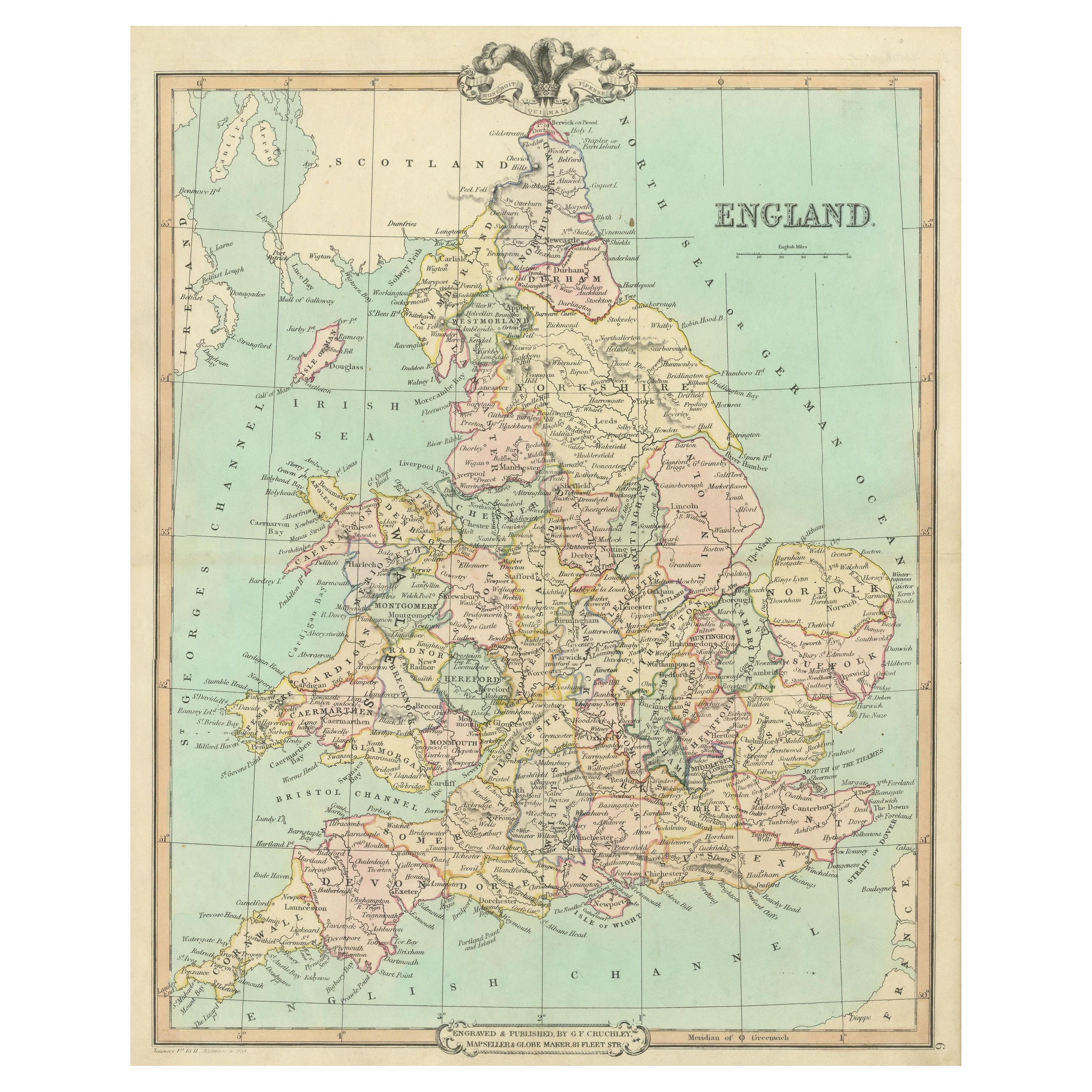
Antique Map of England with Inset Maps of the Region of Liverpool and London
$363.86
$454.8320% Off
£270.36
£337.9520% Off
€304
€38020% Off
CA$498.42
CA$623.0220% Off
A$543.75
A$679.6920% Off
CHF 288.39
CHF 360.4920% Off
MX$6,550.94
MX$8,188.6720% Off
NOK 3,660.27
NOK 4,575.3320% Off
SEK 3,351.07
SEK 4,188.8420% Off
DKK 2,315.83
DKK 2,894.7920% Off
About the Item
Antique map titled 'England'. Original antique map of England, with two inset maps of the region of Liverpool and London. This map originates from Tanner's 'Universal Atlas'. Published by Carey
Hart, 1842.
- Dimensions:Height: 17.33 in (44 cm)Width: 13.86 in (35.2 cm)Depth: 0.02 in (0.5 mm)
- Materials and Techniques:
- Period:
- Date of Manufacture:1842
- Condition:Original/contemporary hand coloring. Age-related toning, minor wear and soiling. Stain in left margin. Blank verso. Please study image carefully.
- Seller Location:Langweer, NL
- Reference Number:Seller: BG-13395-101stDibs: LU3054334168972
About the Seller
5.0
Recognized Seller
These prestigious sellers are industry leaders and represent the highest echelon for item quality and design.
Platinum Seller
Premium sellers with a 4.7+ rating and 24-hour response times
Established in 2009
1stDibs seller since 2017
2,820 sales on 1stDibs
Typical response time: 1 hour
- ShippingRetrieving quote...Shipping from: Langweer, Netherlands
- Return Policy
More From This Seller
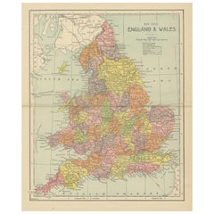
View AllAntique Map of England and Wales, Also Showing the English Channel
Located in Langweer, NL
Antique map titled 'England and Wales'. Original antique map of England and Wales. Drawn and engraved by J. Dower. Originates from 'A General Descriptive Atlas Of The Earth, Containi...
Category
Antique Mid-19th Century Maps
Materials
Paper

$143 Sale Price
20% Off
Antique Map of England and Wales, Also Including the Isle of Man
Located in Langweer, NL
Antique map titled 'England'. Original antique map of England and Wales from Northumberland to Cornwall from the St. George Channel east as far as the Strait of Dover. The Isle of Ma...
Category
Antique Mid-19th Century Maps
Materials
Paper

$373 Sale Price
20% Off
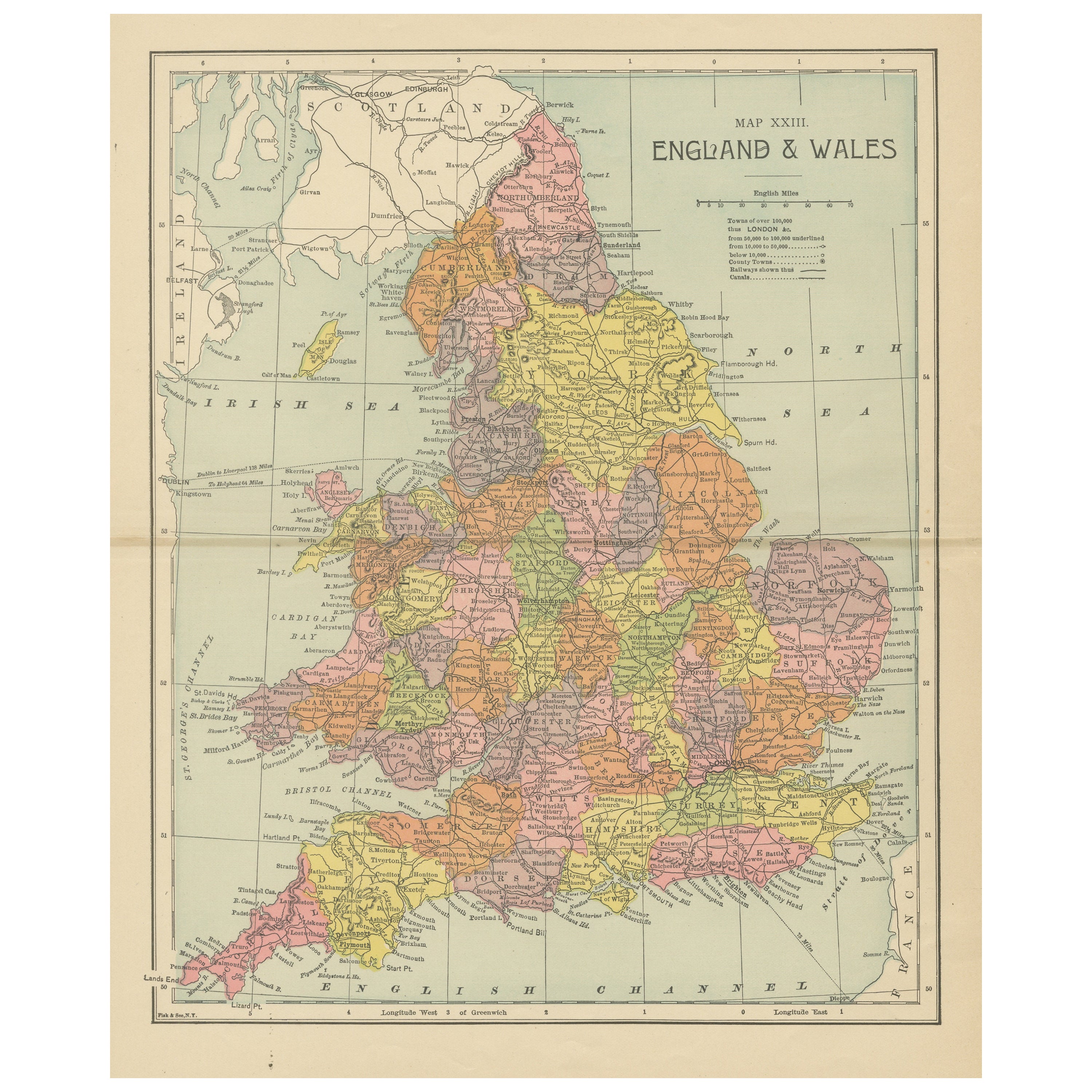
Lithographed Antique Map of England and Wales
Located in Langweer, NL
Original antique map titled 'Map XXIII England & Wales'. Lithographed map of England and Wales. Published by Fisk & See, circa 1890.
Category
Antique Late 19th Century Maps
Materials
Paper
$181 Sale Price
20% Off
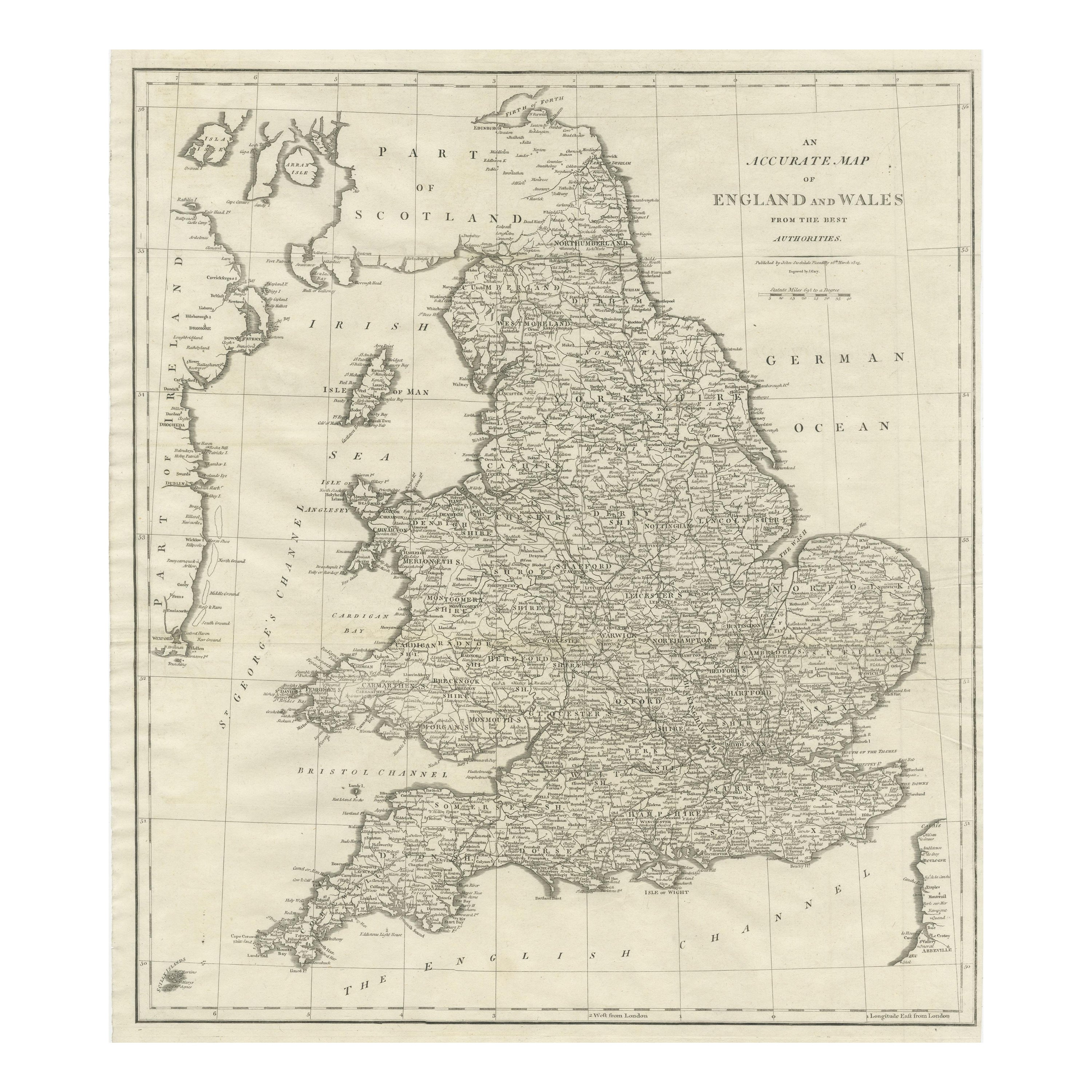
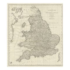
Large Antique Map of England and Wales
Located in Langweer, NL
Antique map titled 'An Accurate Map of England and Wales'. Original old map of England and Wales. Engraved by John Cary. Originates from 'New British Atlas' by John Stockdale, publis...
Category
Antique Early 19th Century Maps
Materials
Paper
$315 Sale Price
20% Off
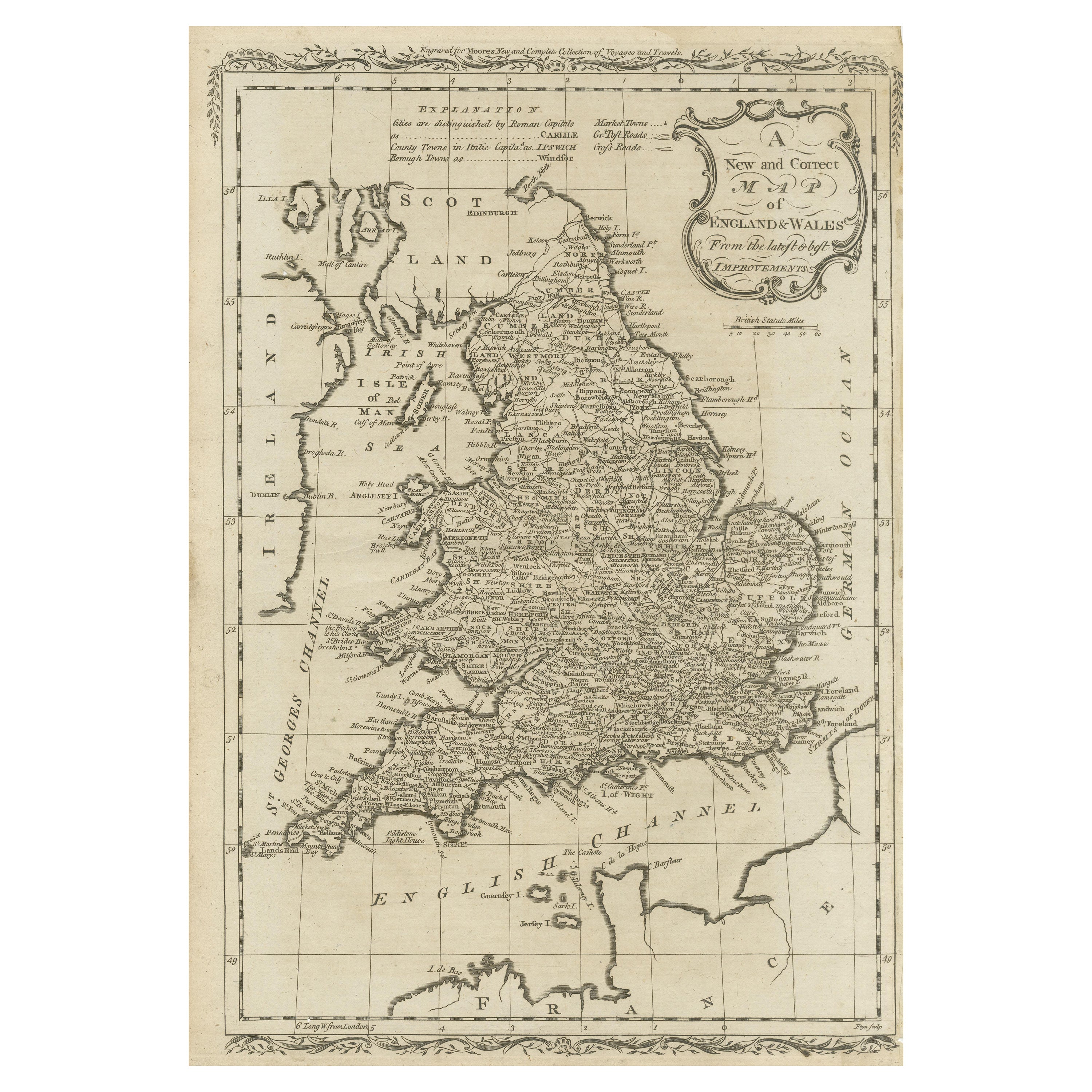
Original Antique Map of England and Wales
Located in Langweer, NL
Antique map titled 'A New and Correct Map of England and Wales from the Latest and Best Improvements'. Original antique map of England and Wales. Printed by Alex Hogg, London for George Henry Millar's 'New, Complete and Universal System...
Category
Antique Late 18th Century Maps
Materials
Paper

$229 Sale Price
20% Off
Detailed Antique Map of Britain, Wales and the Coast of Ireland
Located in Langweer, NL
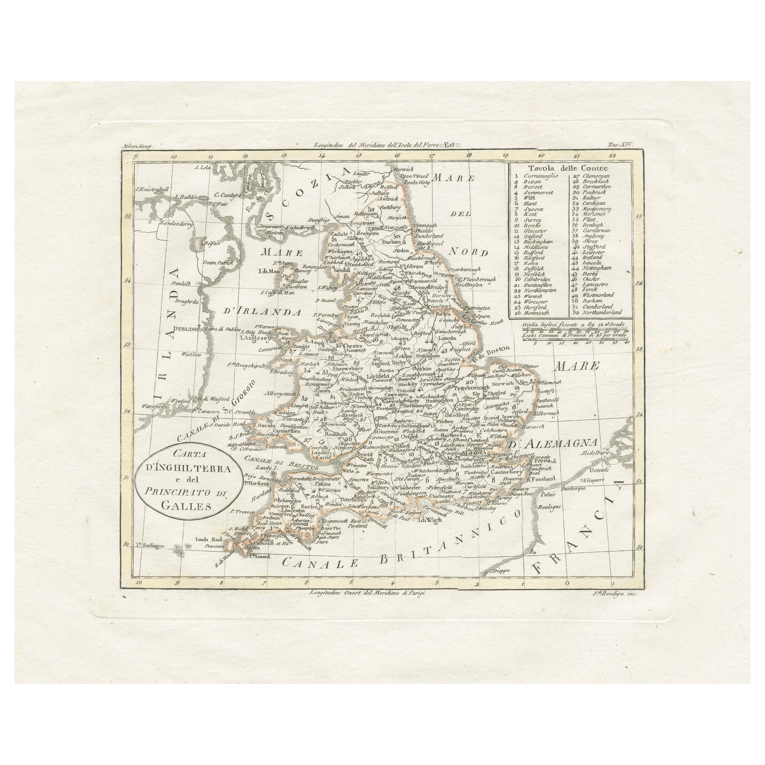
Antique map titled 'Carta d'Inghilterra e del Principato di Galles'. Detailed map of Britain, Wales and the coast of Ireland with a list of counties. This map originates from 'Nuovo ...
Category
Antique Mid-19th Century Maps
Materials
Paper

$248 Sale Price
20% Off
You May Also Like
Large Original Vintage Map of the United Kingdom, circa 1920
Located in St Annes, Lancashire
Great map of The United Kingdom
Unframed
Original color
By John Bartholomew and Co. Edinburgh Geographical Institute
Published, circa 1920
Free shipping.
Category
Vintage 1920s British Maps
Materials
Paper

England and Wales, Northern Part. Century Atlas antique vintage map
Located in Melbourne, Victoria
'The Century Atlas. England and Wales, Northern Part'
Original antique map, 1903.
Central fold as issued. Map name and number printed on the reverse corners.
Sheet 29.5cm by 40cm.
Category
Early 20th Century Victorian More Prints
Materials
Lithograph

England, Scotland
Ireland: A Hand Colored Map of Great Britain by Tirion
By Isaak Tirion
Located in Alamo, CA
This is a hand-colored double page copperplate map of Great Britain entitled "Nieuwe Kaart van de Eilanden van Groot Brittannien Behelzende de Kon...
Category
Antique Mid-18th Century Dutch Maps
Materials
Paper

$700 Sale Price
20% Off
Old Horizontal Map of England
By Tasso
Located in Alessandria, Piemonte
ST/520 - Old rare Italian map of England, dated 1826-1827 - by Girolamo Tasso, editor in Venise, for the atlas of M.r Le-Sage.
Category
Antique Early 19th Century Italian Other Prints
Materials
Paper

Map of Lancashire
Located in Cheshire, GB
Saxton Map of Lancashire hand coloured. Encased in an ebonised frame.
Dimensions
Height 21 Inches
Width 24 Inches
Depth 1 Inches
Category
Early 20th Century British Maps
Materials
Paper

$763 Sale Price
20% Off
Original Antique English County Map, Nottinghamshire, J
C Walker, 1851
Located in St Annes, Lancashire
Great map of Nottinghamshire
Original colour
By J & C Walker
Published by Longman, Rees, Orme, Brown & Co. 1851
Unframed.
Category
Antique 1850s English Other Maps
Materials
Paper

More Ways To Browse
London Antique And Collectable London
Antique Furniture Liverpool
Map Tuscany
St Eustatius
Sumba Map
Used Furniture Denver Co
Used Furniture Leominster
Vintage Long Island Map
Vintage World Map Desk
Vintage World Map Mirror
Antique Furniture Toledo Ohio
Antique Maps Washington Dc
Blaeu World Map
Cape Cod Map
F Colton
Irish Antiques 16th Century
Ithaca Antique Map
Leonard Jones