Items Similar to Antique Map of England and Wales, 1903, with Detailed Counties and Railways


Want more images or videos?
Request additional images or videos from the seller
1 of 10
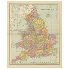
Antique Map of England and Wales, 1903, with Detailed Counties and Railways
$336.25
£249.04
€280
CA$459.97
A$500.59
CHF 265.36
MX$6,022.53
NOK 3,365.67
SEK 3,079.35
DKK 2,133.65
About the Item
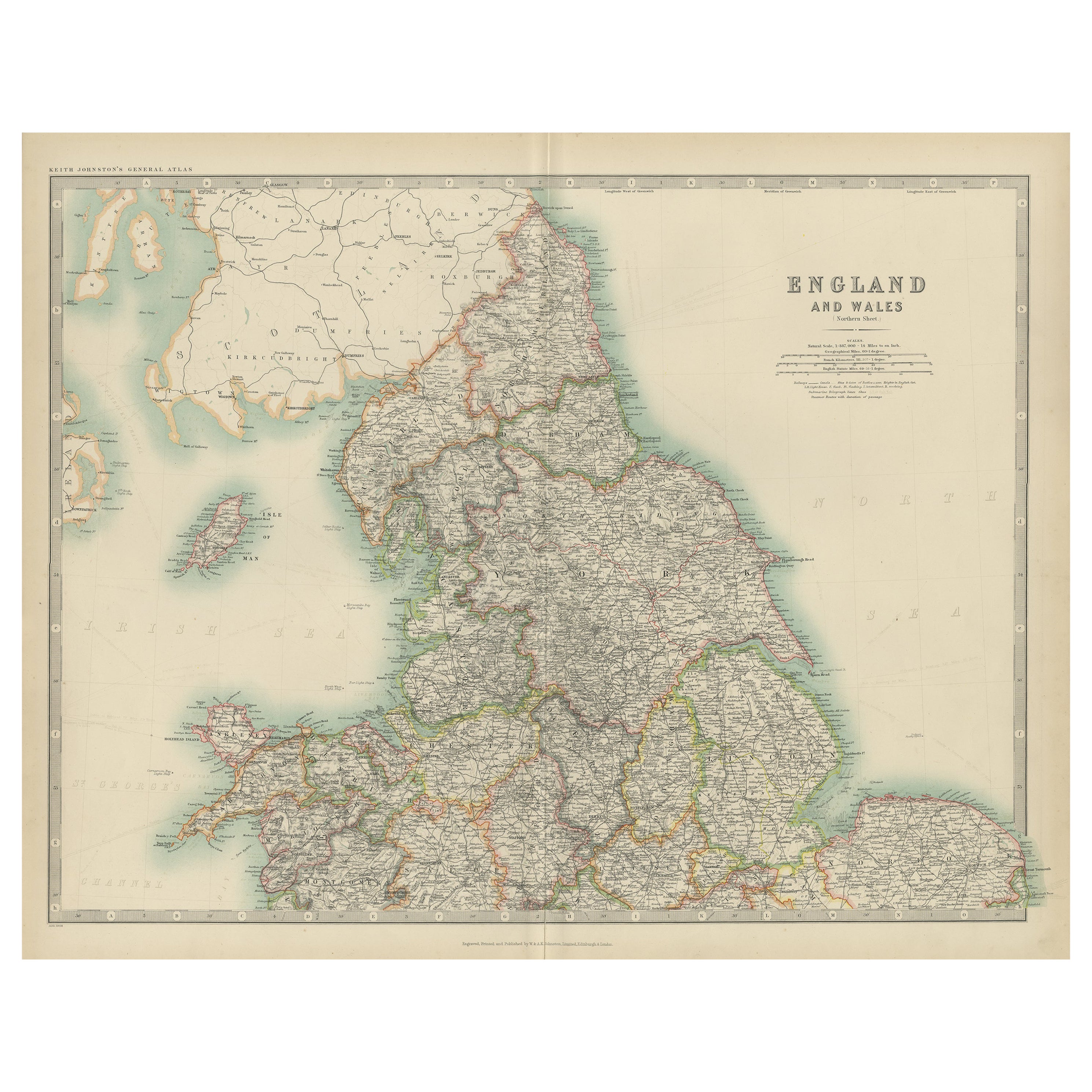
Title: Antique Map of England and Wales, 1903, with Detailed Counties and Railways
Description:
This beautifully detailed antique map, titled "England and Wales," was engraved and published in 1903 by the esteemed cartographic firm W.
A.K. Johnston in Edinburgh and London. It offers a comprehensive and precise depiction of England and Wales at the turn of the 20th century, capturing the dynamic infrastructure and geography of the era.
The map intricately delineates county boundaries with delicate coloring in pastel hues of pink, green, and yellow, each carefully engraved to create a visually striking and harmonious composition. Major cities, towns, and an extensive network of railways are all clearly marked, reflecting the rapid industrial expansion and urban growth that characterized this period. The fine detail also highlights the natural geography of the region, from mountain ranges and rivers to coastal features and offshore islands.
This map is not just a piece of historical documentation—it is a glimpse into a time when the United Kingdom was at the peak of its industrial might and global influence. Railways, noted with precision, underscore the transformation of the landscape and the vital role of transportation in connecting communities and fostering economic growth.
For collectors, this map is a testament to the artistry and accuracy of Johnston’s cartography, combining technical excellence with an aesthetic that remains timeless. It’s an ideal centerpiece for anyone interested in British history, geography, or antique maps.
Condition report:
The map is in very good antique condition, with only minor age-related foxing and slight edge toning that do not detract from its clarity and charm. The colors remain vivid and the paper is well-preserved. Folding line as issued.
Framing tips:
A classic wooden frame in rich mahogany or walnut will add warmth and sophistication to this antique map. Use a light cream or off-white matting to enhance the fine details and bring out the soft pastel colors, creating a refined and elegant presentation for any setting.
- Dimensions:Height: 14.49 in (36.8 cm)Width: 18.9 in (48 cm)Depth: 0.01 in (0.2 mm)
- Materials and Techniques:
- Period:
- Date of Manufacture:1903
- Condition:This map is in very good antique condition. Minor foxing and light toning around the edges, consistent with its age, do not detract from its beauty. The colors remain fresh and the paper stable. Folding line as issued.
- Seller Location:Langweer, NL
- Reference Number:Seller: BG-13577-41stDibs: LU3054345241002
About the Seller
5.0
Recognized Seller
These prestigious sellers are industry leaders and represent the highest echelon for item quality and design.
Platinum Seller
Premium sellers with a 4.7+ rating and 24-hour response times
Established in 2009
1stDibs seller since 2017
2,816 sales on 1stDibs
Typical response time: 1 hour
- ShippingRetrieving quote...Shipping from: Langweer, Netherlands
- Return Policy
More From This Seller
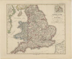
View AllOriginal Antique Map of England and Wales from the 1909 Royal Atlas
Located in Langweer, NL
The antique map titled 'England and Wales' is a historical cartographic representation of these two nations. This original antique map of England...
Category
Early 20th Century Maps
Materials
Paper

$240 Sale Price
20% Off
Antique Map of, Northern England and Wales by Johnston, 1882
Located in Langweer, NL
Antique map titled 'England and Wales'.
Old map of England and Wales. This map originates from 'The Royal Atlas of Modern Geography, Exhibiting, in a Series of Entirely Original an...
Category
Antique 19th Century Maps
Materials
Paper

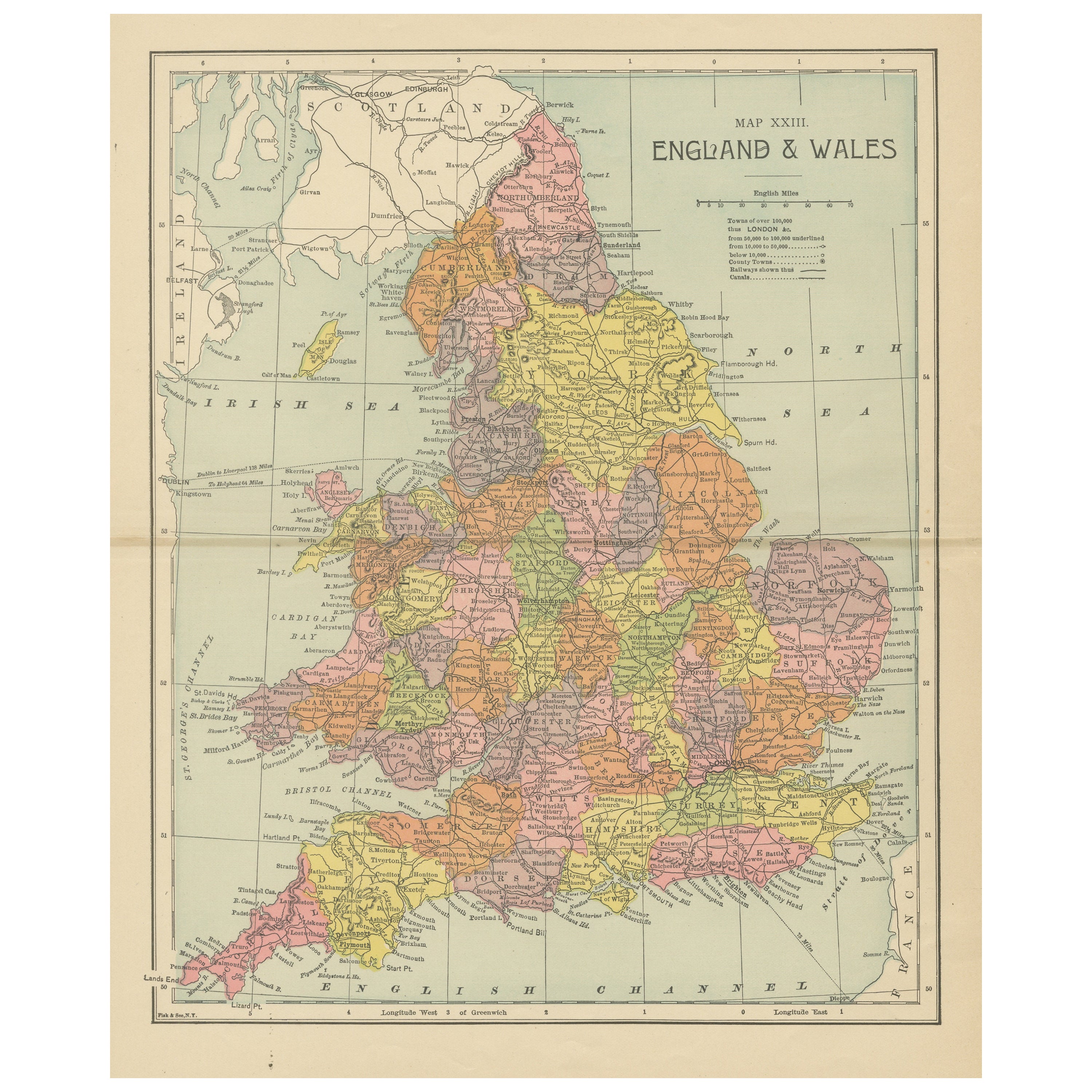
Lithographed Antique Map of England and Wales
Located in Langweer, NL
Original antique map titled 'Map XXIII England & Wales'. Lithographed map of England and Wales. Published by Fisk & See, circa 1890.
Category
Antique Late 19th Century Maps
Materials
Paper
$182 Sale Price
20% Off
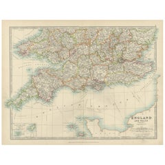
Antique Map of Southern England
Wales, 1903, with Coastal Details and Railways
Located in Langweer, NL
Title: Antique Map of Southern England and Wales, 1903, with Coastal Details and Railways
Description:
This detailed antique map, titled "England and Wales (Southern Sheet I)," was ...
Category
Early 20th Century Maps
Materials
Paper
England
Wales in 1857 – Decorative Antique Map with Rail Routes
Located in Langweer, NL
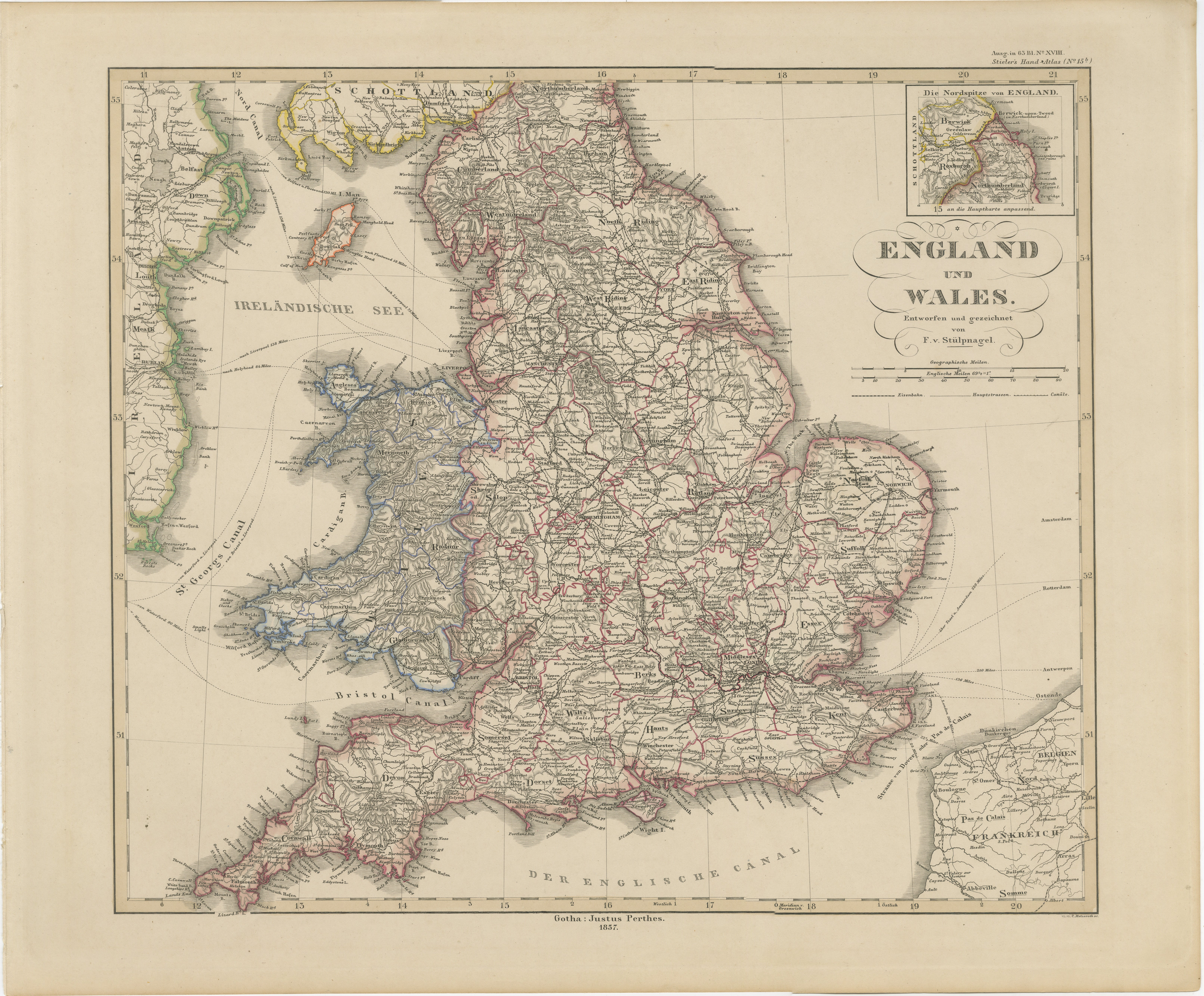
Antique Map of England & Wales – Hand-Colored Engraving by Stülpnagel, 1857
Fine 19th-century map titled "England und Wales", drawn and engraved by Friedrich von Stülpnagel and publ...
Category
Antique Mid-19th Century German Maps
Materials
Paper
Antique Map of England and Wales
North
by A.K. Johnston, 1865
Located in Langweer, NL
Antique map titled 'England and Wales (Northern Sheet)'. This map originates from the ‘Royal Atlas of Modern Geography’ by Alexander Keith Johnston. Published by William Blackwood an...
Category
Antique Mid-19th Century Scottish Maps
Materials
Paper

You May Also Like
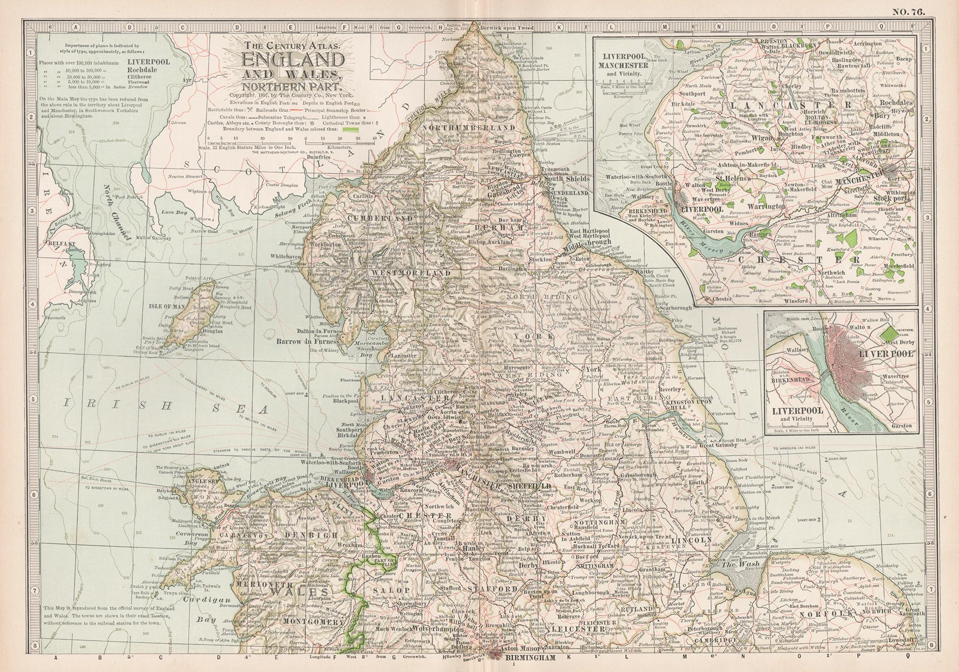
England and Wales, Northern Part. Century Atlas antique vintage map
Located in Melbourne, Victoria
'The Century Atlas. England and Wales, Northern Part'
Original antique map, 1903.
Central fold as issued. Map name and number printed on the reverse corners.
Sheet 29.5cm by 40cm.
Category
Early 20th Century Victorian More Prints
Materials
Lithograph

Large Original Vintage Map of the United Kingdom, circa 1920
Located in St Annes, Lancashire
Great map of The United Kingdom
Unframed
Original color
By John Bartholomew and Co. Edinburgh Geographical Institute
Published, circa 1920
Free shipping.
Category
Vintage 1920s British Maps
Materials
Paper

Vicinity of London, England, United Kingdom. Century Atlas antique map
Located in Melbourne, Victoria
'The Century Atlas. Vicinity of London, England, United Kingdom.'
Original antique map, 1903.
Central fold as issued. Map name and number printed on the reverse corners.
Sheet 29.5...
Category
Early 20th Century Victorian More Prints
Materials
Lithograph

England, Scotland
Ireland: A Hand Colored Map of Great Britain by Tirion
By Isaak Tirion
Located in Alamo, CA
This is a hand-colored double page copperplate map of Great Britain entitled "Nieuwe Kaart van de Eilanden van Groot Brittannien Behelzende de Kon...
Category
Antique Mid-18th Century Dutch Maps
Materials
Paper

$700 Sale Price
20% Off
Original Antique English County Map, Derbyshire, J
C Walker, 1851
Located in St Annes, Lancashire
Great map of Derbyshire
Original colour
By J & C Walker
Published by Longman, Rees, Orme, Brown & Co. 1851
Unframed.
Category
Antique 1850s English Other Maps
Materials
Paper

Original Antique English County Map, Nottinghamshire, J
C Walker, 1851
Located in St Annes, Lancashire
Great map of Nottinghamshire
Original colour
By J & C Walker
Published by Longman, Rees, Orme, Brown & Co. 1851
Unframed.
Category
Antique 1850s English Other Maps
Materials
Paper

More Ways To Browse
Railway Map
Round Table Base
Cream Soup
Early English Silver
James Bond
Paisley Rugs and Carpets
Antique Pagoda
Black And Chrome Lounge Chair
Ceramic 1960s Italy
Vintage 1930 Dining Room Set
Antique Brass And Copper
Antique Cow
Antique Harvest
Antique Victorian Dining Tables
Environment Furniture
Italian Plastic Chairs
Made In Belgium
Black Crystal Glasses