Items Similar to Antique Map of France – Divided into 89 Departments by Andriveau-Goujon, 1861


Want more images or videos?
Request additional images or videos from the seller
1 of 10
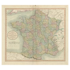
Antique Map of France – Divided into 89 Departments by Andriveau-Goujon, 1861
$466.46
£346.38
€390
CA$640.85
A$696.73
CHF 369.41
MX$8,352.07
NOK 4,695
SEK 4,301.26
DKK 2,973.05
About the Item
Antique Map of France – Divided into 89 Departments by Andriveau-Goujon, 1861
This finely engraved and beautifully hand-colored map titled “France divisée en 89 Départements” was published in Paris in 1861 by E. Andriveau-Goujon. It presents an elegant and detailed administrative view of France during the Second Empire under Napoleon III, showing the country fully divided into its 89 departments, a system first introduced during the French Revolution.
Each department is clearly delineated with its own color, making the internal borders immediately legible. Cities, towns, rivers, and major transport routes are all precisely engraved, offering a comprehensive view of the infrastructure and geography of France in the mid-19th century. Paris is marked prominently, and a circular inset in the upper right corner provides an enlarged view of the Paris metropolitan area, revealing the intricate network of roads and surrounding communes.
To the lower left, a printed table titled “Tableau de la Population des Principales Villes de France” lists the largest cities in the country, ranked by population. This includes Paris, Lyon, Marseille, Bordeaux, Toulouse, Nantes, and others — providing valuable historical demographic data for the era.
Borders with Belgium, Germany, Switzerland, Italy, and Spain are also shown with clarity, giving the map both domestic and international context. Longitude is measured from the Paris meridian.
The map is engraved with fine precision and finished with pastel hand coloring that brings out the administrative divisions without overwhelming the eye. It is framed by a decorative border typical of Andriveau-Goujon’s Atlas Universel, plate number 20 appearing in the top right.
This is an ideal piece for collectors of antique French cartography, educators, or anyone with an interest in the administrative history of France. Its balance of aesthetic appeal and historical depth makes it suitable for both display and reference.
Condition: Very good condition. Light toning around edges and some minor foxing in blank margins. Original centerfold as issued. Sharp plate impression and original hand coloring preserved. No tears or repairs.
Framing tips: Best paired with a gold or dark wood frame and an ivory or cream mat to complement the pastel colors. A secondary red or blue inner mat can be used to highlight the inset of Paris.
Technique: Engraving with original hand coloring
Maker: E. Andriveau-Goujon, Paris, 1861
- Dimensions:Height: 20.91 in (53.1 cm)Width: 27.64 in (70.2 cm)Depth: 0.01 in (0.2 mm)
- Materials and Techniques:Paper,Engraved
- Place of Origin:
- Period:
- Date of Manufacture:1861
- Condition:Condition: Very good condition. Light toning around edges and some minor foxing in blank margins. Original centerfold as issued. Sharp plate impression and original hand coloring preserved. No tears or repairs.
- Seller Location:Langweer, NL
- Reference Number:Seller: BG-14099-51stDibs: LU3054346185282
About the Seller
5.0
Recognized Seller
These prestigious sellers are industry leaders and represent the highest echelon for item quality and design.
Platinum Seller
Premium sellers with a 4.7+ rating and 24-hour response times
Established in 2009
1stDibs seller since 2017
2,823 sales on 1stDibs
Typical response time: 1 hour
- ShippingRetrieving quote...Shipping from: Langweer, Netherlands
- Return Policy
More From This Seller
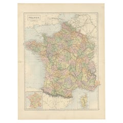
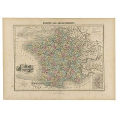
View AllDecorative Antique Map of France in Departments – Collectible Print, 1884
Located in Langweer, NL
Antique Map of France in Departments – Black’s Atlas, 1884
This finely engraved and hand-colored map of France was published in the New and Revised Edition of Black’s General Atlas ...
Category
Antique 1880s Scottish Maps
Materials
Paper
Antique Map of France by A
C. Black, 1870
Located in Langweer, NL
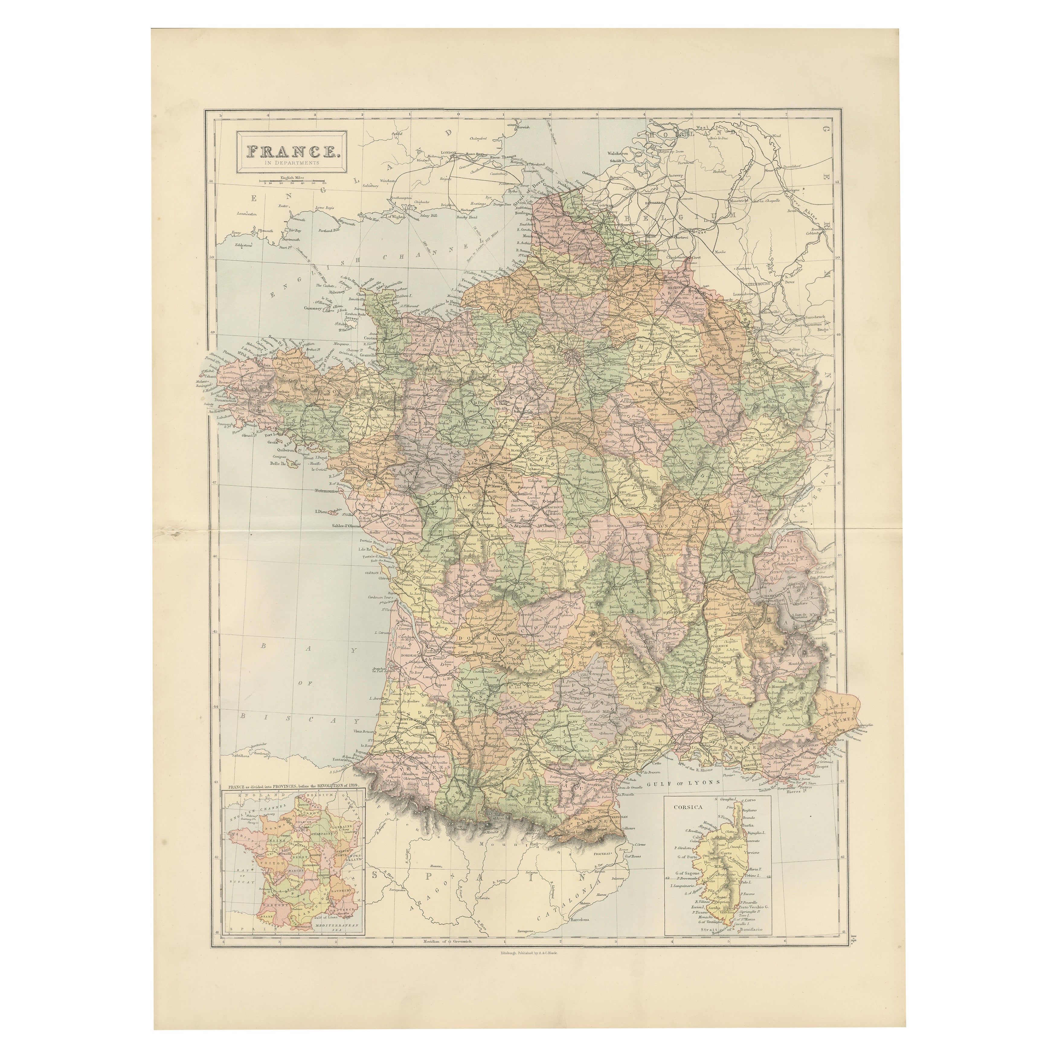
Antique map titled 'France'. Original antique map of France with inset map of France as divided into provinces, before the revolution of 1789 and map of Corsica...
Category
Antique Late 19th Century Maps
Materials
Paper

$263 Sale Price
20% Off
Antique Map of France, 1903, with Inset of Paris and Corsica
Located in Langweer, NL
Title: Antique Map of France, 1903, with Inset of Paris and Corsica
Description:
This antique map, titled "France," was engraved and published in 1903 by the renowned W. & A.K. John...
Category
Early 20th Century Maps
Materials
Paper

Antique Map of France Divided into Departments, with Original Hand Coloring
Located in Langweer, NL
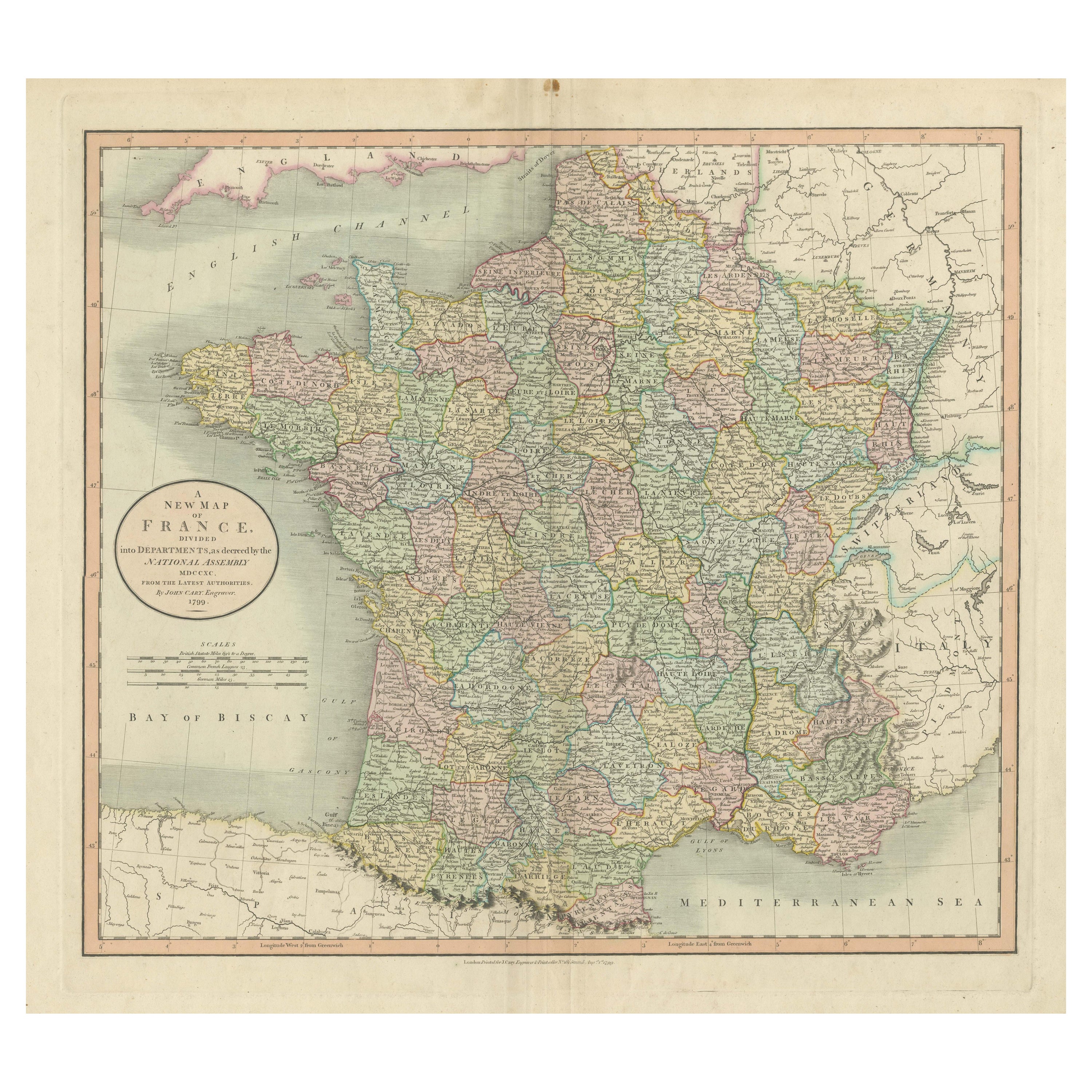
Antique map titled 'A New Map of France (..)'. Original old map of France, divided into departments. With original/contemporary hand coloring. Published by John Cary, 1799. John Cary was an important and prolific London map seller...
Category
Antique Late 18th Century Maps
Materials
Paper
$421 Sale Price
20% Off
Antique Map of the Departments of France by Migeon, 1880
By J. Migeon
Located in Langweer, NL
Antique map titled 'France par Départements'. Old map of France with a decorative vignette of Strasbourg and an inset map of Corsica. This map originate...
Category
Antique 19th Century Maps
Materials
Paper
Antique Map of France by Migeon, 1880
Located in Langweer, NL
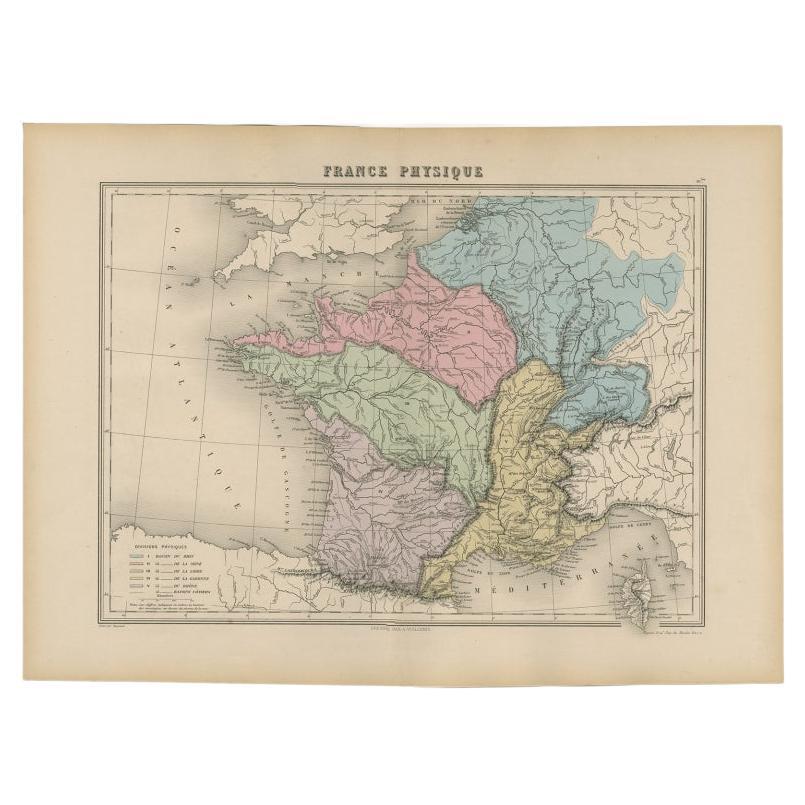
Antique map titled 'France Physique'. Old map of France. This map originates from 'Géographie Universelle Atlas-Migeon' by J. Migeon.
Artists and Engravers: Published by J. Migeon...
Category
Antique 19th Century Maps
Materials
Paper

You May Also Like
France, Northern Part. Century Atlas antique map
Located in Melbourne, Victoria
'The Century Atlas. France, Northern Part.'
Original antique map, 1903.
Inset maps of 'France in Provinces' and 'Paris and Vicinity'.
Central fold as issued. Map name and number pr...
Category
Early 20th Century Victorian More Prints
Materials
Lithograph

Large 19th Century Map of France
Located in Pease pottage, West Sussex
Large 19th Century Map of France.
Remarkable condition, with a pleasing age worn patina.
Recently framed.
France Circa 1874.
Category
Antique Late 19th Century French Maps
Materials
Linen, Paper

France in Departments - Lithograph - 1872
Located in Roma, IT
France in Departments is a map realized by an artist of the 19th century.
Lithograph, printed in 1872 by Milliam Mackenzie, London.
Category
1870s Modern Figurative Prints
Materials
Lithograph
France in Departments - Lithograph - 1872
Located in Roma, IT
France in Departments is an artwork realized by an artist of the 19th century.
Lithograph, printed in 1872 by Milliam Mackenzie, London.
Good condition.
Category
1870s Modern Figurative Prints
Materials
Lithograph

$167 Sale Price
30% Off
Map of France - Etching - 1820
Located in Roma, IT
Map of France is an Original Etching realized by an unknown artist of 19th century in 1820.
Very good condition on two sheets of white paper joined at t...
Category
1820s Modern Figurative Prints
Materials
Etching

Antique Map of France
Located in Dallas, TX
Nice antique map of France in wood frame. This would make a great gift for a collector. A wonderful accessory!
Category
Early 20th Century Decorative Art
Materials
Glass, Wood, Paper

$1,760
More Ways To Browse
Tableau Antique
French Second Empire
Pair Of Danish Chairs
Veneer Dining Tables
1970 Italian Armchair
Furniture Uk
House Of Denmark Table And Chairs
Louis Marble Top Side Table
Antique Russian Rugs
Baker Furniture By
For Kids
Sterling Silver Flatware Set Service For 12
Tufted Bar
Pair Of French Antique Armchairs
1970s Brass Glass Coffee Table
Antique Column Base
Charles Rennie Mackintosh For Cassina
Glass Salt