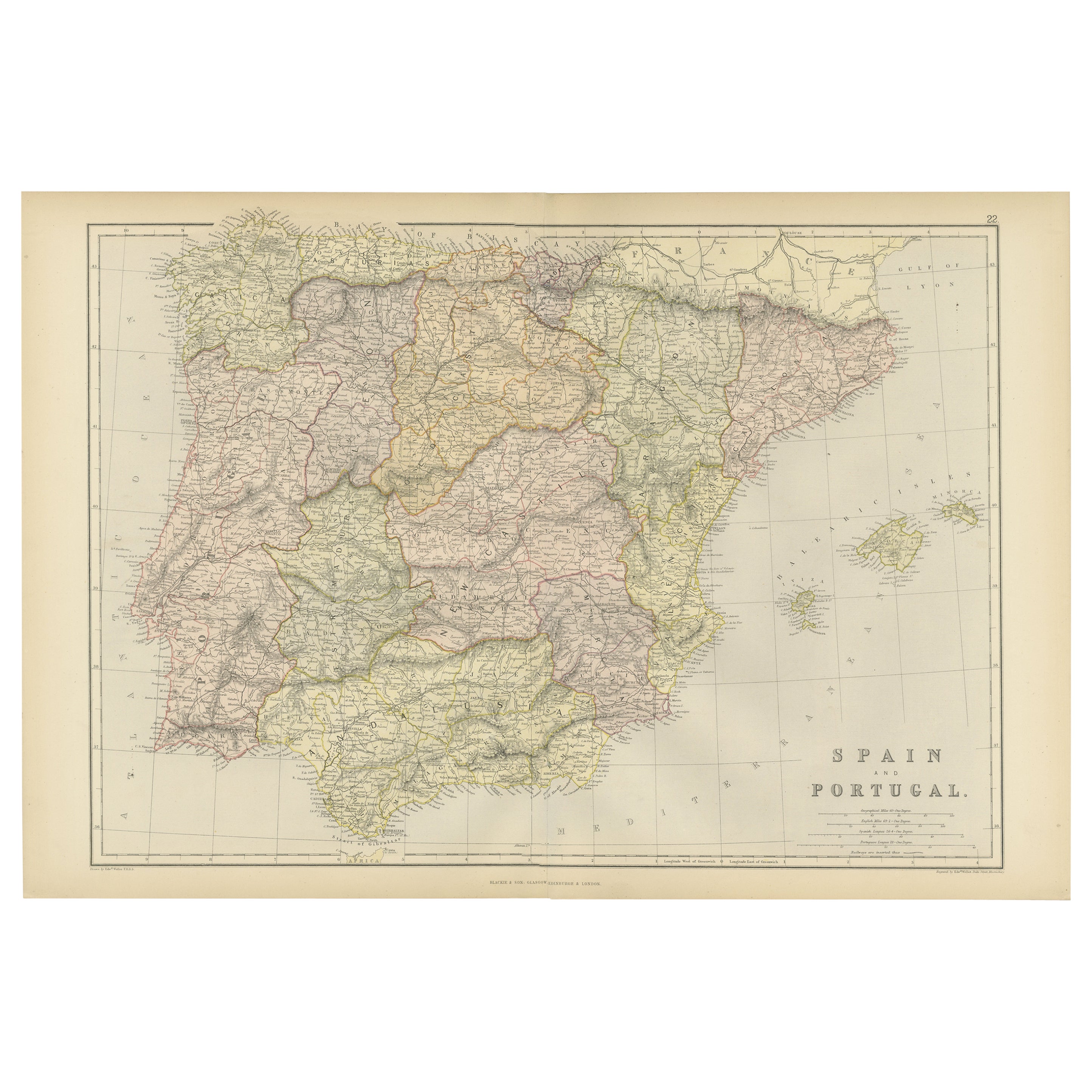
Items Similar to Antique Map of France, Spain and Portugal by Johnson, 1872


Want more images or videos?
Request additional images or videos from the seller
1 of 10
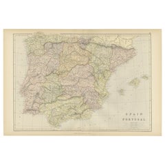
Antique Map of France, Spain and Portugal by Johnson, 1872
$239.43
$299.2920% Off
£179.06
£223.8220% Off
€200
€25020% Off
CA$329.93
CA$412.4120% Off
A$359.94
A$449.9320% Off
CHF 190.59
CHF 238.2420% Off
MX$4,313.16
MX$5,391.4520% Off
NOK 2,427.25
NOK 3,034.0620% Off
SEK 2,219.54
SEK 2,774.4220% Off
DKK 1,523.24
DKK 1,904.0520% Off
About the Item
Antique map titled 'Johnson's France (..)'. Original map showing France, Spain and Portugal. With inset maps of Corsica and Gibraltar Rock. This map originates from 'Johnson's New Illustrated Family Atlas of the World' by A.J. Johnson. Published 1872.
- Dimensions:Height: 26.38 in (67 cm)Width: 18.12 in (46 cm)Depth: 0.02 in (0.5 mm)
- Materials and Techniques:
- Period:
- Date of Manufacture:1872
- Condition:General age-related toning, shows minor wear and creasing. Some soiling. Original folding line. English text on verso. Please study images carefully.
- Seller Location:Langweer, NL
- Reference Number:Seller: BG-12592-341stDibs: LU3054321467102
About the Seller
5.0
Recognized Seller
These prestigious sellers are industry leaders and represent the highest echelon for item quality and design.
Platinum Seller
Premium sellers with a 4.7+ rating and 24-hour response times
Established in 2009
1stDibs seller since 2017
2,792 sales on 1stDibs
Typical response time: <1 hour
- ShippingRetrieving quote...Shipping from: Langweer, Netherlands
- Return Policy
More From This Seller
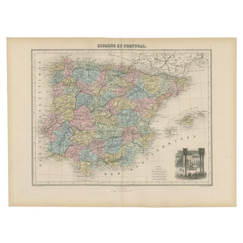
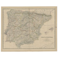
View AllAntique Map of Spain and Portugal by Levasseur,
1875
Located in Langweer, NL
Antique map titled 'Carte générale de l'Espagne et du Portugal (..)'. Large map of Spain and Portugal. This map originates from 'Atlas de Géographie Moder...
Category
Antique Late 19th Century Maps
Materials
Paper

$359 Sale Price
40% Off
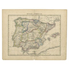
Antique Map of Spain and Portugal by Migeon, 1880
Located in Langweer, NL
Antique map titled 'Espagne et Portugal'. Old map of Spain and Portugal with a decorative vignette with a view of Alhambra. This map originates from 'Géographie Universelle Atlas-Mig...
Category
Antique 19th Century Maps
Materials
Paper

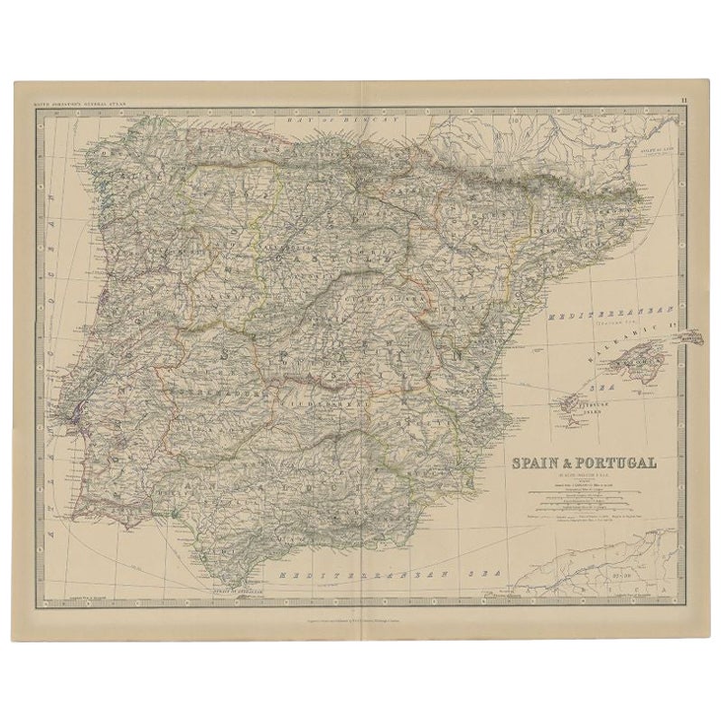
Antique Map of Spain and Portugal by A
C. Black, 1870
Located in Langweer, NL
Antique map titled 'Spain and Portugal'. Original antique map of General map of Spain and Portugal with inset map of Gibraltar. This map originates from ‘Black's General Atlas of The...
Category
Antique Late 19th Century Maps
Materials
Paper

$197 Sale Price
40% Off
Original Antique Map of Spain and Portugal, 1882
Located in Langweer, NL
Embark on a historical voyage with an original Antique Map of Spain and Portugal from the esteemed 'Comprehensive Atlas and Geography of the World,' meticulously crafted in 1882. Thi...
Category
Antique 1880s Maps
Materials
Paper
$162 Sale Price
20% Off
Antique Map of Spain and Portugal, 1882
Located in Langweer, NL
"Antique map titled 'Spain & Portugal'.
Old map of Spain and Portugal. This map originates from 'The Royal Atlas of Modern Geography, Exhibiting, in a S...
Category
Antique 19th Century Maps
Materials
Paper
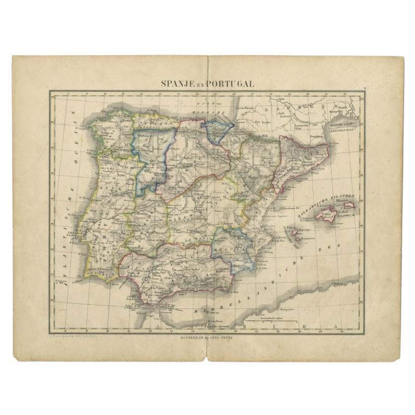
Antique Map of Spain and Portugal by Petri, c.1873
Located in Langweer, NL
Antique map titled 'Spanje en Portugal'. Old map depicting Spain and Portugal. This map originates from 'School-Atlas van alle Deelen der Aarde'. Artists and Engravers: Published by ...
Category
Antique 19th Century Maps
Materials
Paper
$92 Sale Price
20% Off
You May Also Like
Large Original Vintage Map of Spain, circa 1920
Located in St Annes, Lancashire
Great map of Spain
Original color.
Good condition
Published by Alexander Gross
Unframed.
Category
Vintage 1920s English Maps
Materials
Paper

Map of Spain and Portugal - Etching by Pierre François Tardieu - 1837
Located in Roma, IT
Map of Spain and Portugal is an Etching realized by Pierre François Tardieu in 1837.
Good conditions.
The artwork is realized in a well-balanced composition. the artwork and belong...
Category
1830s Modern Figurative Prints
Materials
Lithograph

Map of Spain and Portugal - Original Etching - Late 19th Century
Located in Roma, IT
This Map of Spain and Portugal is an etching realized by an anonymous artist.
The state of preservation of the artwork is good with some small diffused stains.
Sheet dimension: 28...
Category
Late 19th Century Modern Figurative Prints
Materials
Etching

17th Century Lithograph Framed Map of Spain
Located in Atlanta, GA
In giltwood frame, dated 1652.
Category
Antique 18th Century and Earlier Spanish Baroque Prints
Materials
Ink, Paper

1751 Map of Spain Castilla Robert De Vaugondy 1st Edition, Ric.a001
Located in Norton, MA
Large Spain Castilla Robert De Vaugondy
1751 1st Edition
-Colored- Ric.a001
Coming from a family of cartographers, a descendant of the famous Nicolas Sanson and ordinary geographer of the king, Gilles Robert de Vaugondy makes himself known by his maps of the French provinces.
He published an Essay on the History of Geography (1755) from which he excluded the physical geography "too systematic". After a Small Atlas (1748), he draws a universal Atlas (1758), a portable Atlas (1762).
His Atlas of the revolutions of the globe remains unpublished. His warnings and prefaces, his book reviews reveal a Cartesian mind and solid knowledge.
Very early, he associates with his works his son Didier who publishes, since 1742, the methodical tables of Nicolas Sanson, two Globes, one terrestrial, the other celestial (1752).
He is credited with a map of Poland...
Category
Antique 18th Century Unknown Maps
Materials
Paper

Spain and Portugal: A Hand-colored 17th/18th Century Map by Visscher
By Nicolaus Visscher
Located in Alamo, CA
This is an early 18th century map of Spain and Portugal, with attractive original hand-coloring, entitled "Hispaniae et Portugalliae Regna per Nicolaum Visscher cum Privilegio Ordinum Hollandiae et Westfrisiae" first published by Nicolaes Visscher II (1649-1702) in 1688, and later re-published from Visscher's original copper plate by Peter Schenk, Junior in Amsterdam in 1725. The cartouche in the right lower corner depicts a coat of arms representing one combined kingdom of Spain and Portugal before their break-up. Putti hold up the coat-of-arms of Phillip II on the right and a queen reaches for it on the left. There is a scale cartouche in the lower left corner surmounted by two putti and a wheel. This is an outstanding depiction of the Iberian peninsula, showing Spain and Portugal and Balearic Islands. The map includes portions of North Africa and the Strait of Gibralter.
This copperplate engraved map is presented in a cream-colored mat. It is printed on fine chain-linked, laid paper. The mat measures 26.5" high by 30" wide and the sheet measures 21.75" high by 26.375" wide. There is a central fold, as issued. The lower portion of the fold is reinforced on the verso. There is a small paper defect at the lower edge of the fold and another at the edge of the right corner, as well as a few small tears along the lower edge; none affecting the map and all covered by the mat. There are a few small faint spots in the upper margin and on the left. The map is otherwise in very good condition.
The Visscher family were one of the great art and cartographic printing families of the 17th century. Begun by Claes Jansz Visscher...
Category
Late 17th Century Other Art Style Landscape Prints
Materials
Engraving

More Ways To Browse
Map Of Corsica
Gibraltar Antique Map
Map Railroad
Antique Railroad Maps
Antique Maps Of Greece
Brazilian Antiques
Turkey Map
Map Of Japan
Antique Nautical Charts
Denmark Map
Antique Macedonia
Hemispheres Map
Java Map
Miniature Maps
Antique Maps Of Wales
Swiss Antiques And Collectables
Map Stand
Caribbean Antique Furniture