Items Similar to Antique Map of Friesland after the Floods of the 13th Century, 1718


Video Loading
Want more images or videos?
Request additional images or videos from the seller
1 of 11
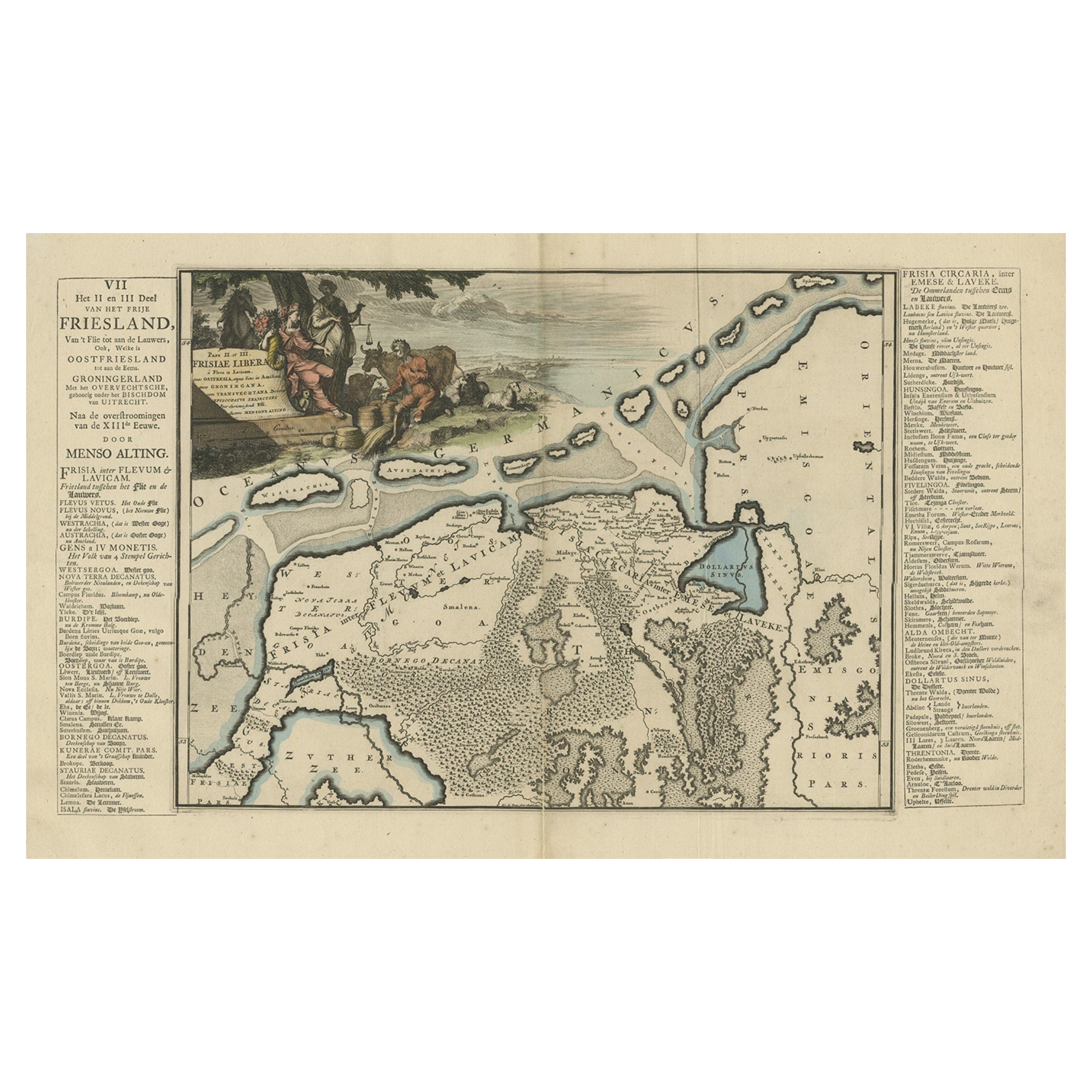
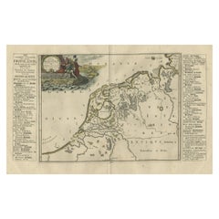
Antique Map of Friesland after the Floods of the 13th Century, 1718
$426.90
£316.22
€355.19
CA$583.99
A$636.52
CHF 336.52
MX$7,662.46
NOK 4,271.29
SEK 3,915.90
DKK 2,706.35
About the Item
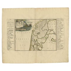
Antique Map of Friesland – “Pars II et III Frisiae Libera” by F. Halma, 1718
This beautifully hand-coloured map titled “Pars II et III Frisiae Libera” presents a detailed depiction of Friesland in the Netherlands, showing the coastal regions and islands after the great floods of the 13th century that reshaped much of the Frisian landscape. The map originates from Bernardus Schotanus à Sterringa’s celebrated atlas Uitbeelding van de Heerlijkheid van Friesland, published in Leeuwarden by François Halma in 1718. This atlas is widely regarded as the finest cartographic work ever produced on Friesland, combining geographical precision with rich historical and heraldic embellishments.
The central panel displays Friesland’s northern coastline, the Wadden Sea islands, and inland waterways, with settlements, dikes, and poldered areas meticulously engraved. The map is flanked by extensive text columns in Dutch and Latin, listing towns, villages, and notable features. In the upper left corner, an elaborate decorative cartouche features allegorical figures in vibrant attire, a cow, and a rural backdrop, symbolising Friesland’s agricultural prosperity and maritime connections.
The work captures the transformation of Friesland’s geography after centuries of flooding, particularly the catastrophic 13th-century storm surges, which permanently altered its coastline and created new tidal inlets and islands. Schotanus à Sterringa’s maps were not only functional but also served as proud representations of regional identity, produced for both local government and wealthy patrons.
Condition: Very good for age. Light toning and some spotting to margins, central fold as issued, and minor handling marks. Plate impression strong, colours bright and well-preserved.
Framing tips: Best presented in a wide, dark walnut or oak frame with a natural linen mat. A gold fillet can draw attention to the rich hand-colouring of the cartouche and map borders.
Technique: Hand-coloured copper engraving
Maker: F. Halma, Leeuwarden, 1718
- Dimensions:Height: 21.66 in (55 cm)Width: 25.99 in (66 cm)Depth: 0 in (0.01 mm)
- Materials and Techniques:Paper,Engraved
- Place of Origin:
- Period:
- Date of Manufacture:1718
- Condition:Condition: Very good for age. Light toning and some spotting to margins, central fold as issued, and minor handling marks. Plate impression strong, colours bright and well-preserved.
- Seller Location:Langweer, NL
- Reference Number:Seller: BG-04716-261stDibs: LU3054326281822
About the Seller
5.0
Recognized Seller
These prestigious sellers are industry leaders and represent the highest echelon for item quality and design.
Platinum Seller
Premium sellers with a 4.7+ rating and 24-hour response times
Established in 2009
1stDibs seller since 2017
2,813 sales on 1stDibs
Typical response time: 1 hour
- ShippingRetrieving quote...Shipping from: Langweer, Netherlands
- Return Policy
More From This Seller
View AllAntique Map of Friesland after the Floods of the 13th Century, 1718
Located in Langweer, NL
Antique map Friesland titled 'Pars II et III Frisiae Libera(..)'. Old map of Friesland, the Netherlands, after the floods of the 13th century. Originates from 'Uitbeelding van de Hee...
Category
Antique 18th Century Maps
Materials
Paper

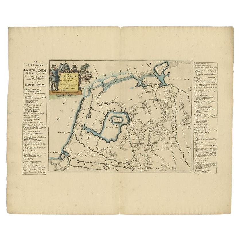
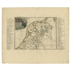
Antique Map of Friesland During Its Widest Spread, 1718
Located in Langweer, NL
Antique map Friesland titled 'Summaria descriptio Fresiae Universae (..)'. Old map of Friesland, the Netherlands. Depicts the general delineation of Friesland during its widest sprea...
Category
Antique 18th Century Maps
Materials
Paper
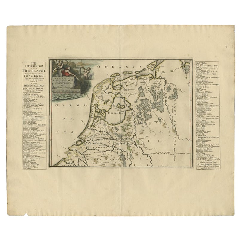
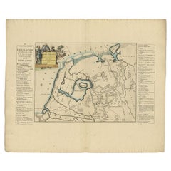
Antique Map of Friesland in the Time of the Franks, 1718
Located in Langweer, NL
Antique map Friesland titled 'Descriptio Frisiae sub Francorum reditum (..)'. Old map of Friesland, the Netherlands, in the time of the Franks. Originates from 'Uitbeelding van de He...
Category
Antique 18th Century Maps
Materials
Paper
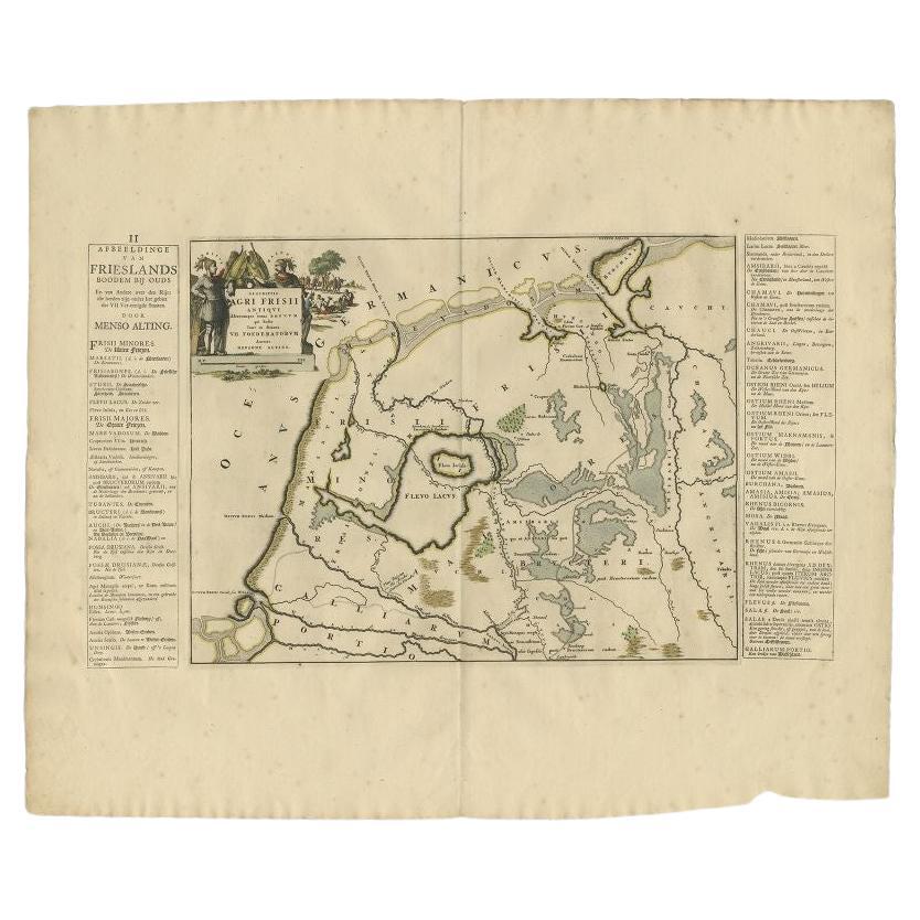
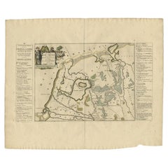
Antique Map of the Old Lands of Friesland by Halma, 1718
Located in Langweer, NL
Antique map Friesland titled 'Descriptio Agri Frisii (..)'. Old map of Friesland, the Netherlands. This map depicts the old lands of Friesland. Originates from 'Uitbeelding van de He...
Category
Antique 18th Century Maps
Materials
Paper
Antique Map of the Old Lands of FriesLand by Halma, 1718
Located in Langweer, NL
Antique map Friesland titled 'Descriptio Agri Frisii (..)'. Old map of Friesland, the Netherlands. This map depicts the old lands of Friesland. Originates from 'Uitbeelding van de He...
Category
Antique 18th Century Maps
Materials
Paper
Antique Map of the West-Frisian part of independent Friesland by Halma, 1718
Located in Langweer, NL
Antique map Friesland titled 'ars I. Frisiae Liberae quae Westfresia post eluviones seculi XIII (..)'. Old map of the West-Frisian part of the independent Friesland, the Netherlands ...
Category
Antique 18th Century Maps
Materials
Paper
You May Also Like
1752 Vaugoundy Map of Flanders : Belgium, France, and the Netherlands, Ric.a002
Located in Norton, MA
Large Vaugoundy Map of Flanders:
Belgium, France, and the Netherlands
Colored -1752
Ric.a002
Description: This is a 1752 Didier Robert de Vaugondy map of Flanders. The map de...
Category
Antique 17th Century Unknown Maps
Materials
Paper

1643 Willem&Joan Blaeu Map NW Flanders "Flandriae Teutonicae Pars Prientalior
Located in Norton, MA
1643 Willem and Joan Blaeu map of northwest Flanders, entitled
"Flandriae Teutonicae Pars Prientalior,"
Ric0012
" Authentic" - Map of the northwest Fl...
Category
Antique 17th Century Dutch Maps
Materials
Paper

Rare Original Map of New Amsterdam (New York) – “Restitutio”, ca. 1674 –
Located in Dronten, NL
An exceptionally rare and original 17th-century engraving of New Amsterdam, now New York City, published by the renowned Amsterdam cartographer Carel (Carolus) Allard around 1674. Kn...
Category
Antique 17th Century Dutch Maps
Materials
Paper

1646 Jansson Map Entitled "Procinvia Connactiae, " Ric.a006
Located in Norton, MA
1646 Jansson map entitled
"Procinvia connactiae,"
Ric.a006
Description: The PROVINCE of CONNAVGT 490 x 380From vol 4 of Jansson's Atlas Novus 1646, published in Amsterdam with...
Category
Antique 17th Century Unknown Maps
Materials
Paper

Hand-Colored 18th Century Homann Map of Denmark and Islands in the Baltic Sea
By Johann Baptist Homann
Located in Alamo, CA
An 18th century copper plate hand-colored map entitled "Insulae Danicae in Mari Balthico Sitae utpote Zeelandia, Fionia, Langelandia, Lalandia, Falstria, Fembria Mona" created by Joh...
Category
Antique Early 18th Century German Maps
Materials
Paper

$620 Sale Price
20% Off
1633 Map "La Souverainete De Sedan Et De Raucourt, Et La Prevoste Ric0011
Located in Norton, MA
1653 map entitled
"La Souverainete de Sedan et de Raucourt, et la Prevoste de Doncheri,"
Ric0011
Description:
Lovely map centered on Sedan and Doncheri and the Meuze River fr...
Category
Antique 17th Century Dutch Maps
Materials
Paper

More Ways To Browse
Maps Balkans
Antique Map Of Jerusalem
Map Of Corsica
Solomons Temple
Antique Map Of Korea
Map Of Jerusalem
Prussia Map
Antique Maps Caribbean Islands
Antique Wine Maps
Used Furniture Wisconsin
Antique Furniture Michigan
Antique Maps Of Cape Of Good Hope
Antique Maps Of Texas
Antique Virginia Furniture
Otto Petri
American West Antiques
Antique Furniture Brunswick
Antique Map Ceylon