Items Similar to Antique Map of Germany from an Old English Atlas, c.1802


Want more images or videos?
Request additional images or videos from the seller
1 of 6
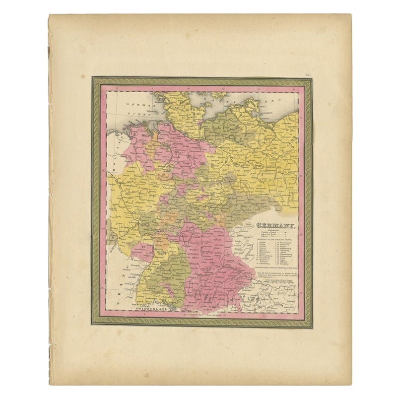
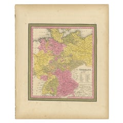
Antique Map of Germany from an Old English Atlas, c.1802
$154.25
£115.16
€130
CA$214.30
A$230.51
CHF 123.19
MX$2,717.10
NOK 1,553.18
SEK 1,419.90
DKK 990.75
About the Item
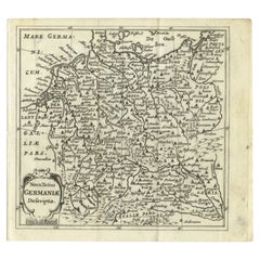
Antique map titled 'Germany'. Antique map of Germany engraved for 'Atlas to Walker's Geography'. Artists and Engravers: Engraved by W. Darton.
Artist: Engraved by W. Darton.
Condition: Very good, please study image carefully.
Date: c.1802
Overall size: 25.5 x 21 cm.
Image size: 22 x 18 cm.
We sell original antique maps to collectors, historians, educators and interior decorators all over the world. Our collection includes a wide range of authentic antique maps from the 16th to the 20th centuries. Buying and collecting antique maps is a tradition that goes back hundreds of years. Antique maps have proved a richly rewarding investment over the past decade, thanks to a growing appreciation of their unique historical appeal. Today the decorative qualities of antique maps are widely recognized by interior designers who appreciate their beauty and design flexibility. Depending on the individual map, presentation, and context, a rare or antique map can be modern, traditional, abstract, figurative, serious or whimsical. We offer a wide range of authentic antique maps for any budget.
- Dimensions:Height: 8.27 in (21 cm)Width: 10.04 in (25.5 cm)Depth: 0 in (0.01 mm)
- Materials and Techniques:
- Period:
- Date of Manufacture:circa 1802
- Condition:
- Seller Location:Langweer, NL
- Reference Number:Seller: BG-093231stDibs: LU3054326345782
About the Seller
5.0
Recognized Seller
These prestigious sellers are industry leaders and represent the highest echelon for item quality and design.
Platinum Seller
Premium sellers with a 4.7+ rating and 24-hour response times
Established in 2009
1stDibs seller since 2017
2,836 sales on 1stDibs
Typical response time: 1 hour
- ShippingRetrieving quote...Shipping from: Langweer, Netherlands
- Return Policy
More From This Seller
View AllAntique Map of Germany from an American 19th Century Atlas, 1846
Located in Langweer, NL
Antique map titled 'Germany'. Old map of Germany. This map originates from 'A New Universal Atlas Containing Maps of the various Empires, Kingdoms, States and Republics Of The World ...
Category
Antique 19th Century Maps
Materials
Paper
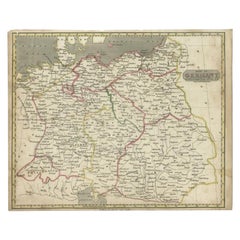
Antique Map of Germany by Walker, 1820
By R. Walker
Located in Langweer, NL
Antique map Germany titled 'Map of Germany as defined by the Peace of Paris'. Detailed antique map of Germany.
Artists and Engravers: Engrav...
Category
Antique 19th Century Maps
Materials
Paper
$61 Sale Price
20% Off
Antique Map of Germany from a 17th Century Pocket Atlas, 1685
Located in Langweer, NL
Antique map titled 'Nova Totius Germaniae descriptio.' Miniature map of Germany, from the pocket atlas 'Introductionis in Universam Geographiam tam Veterem...
Category
Antique 17th Century Maps
Materials
Paper
Antique Map of Germany During the Mid-18th Century, Published in 1747
Located in Langweer, NL
Antique map Germany titled 'A New & Accurate Map of Germany'. It covers Germany during the mid-18th century, which included all of modern day Germany, Austria, Switzerland, Czech Rep...
Category
Antique 18th Century Maps
Materials
Paper

Antique 1842 Map of Germany by Pierre M. Lapie, Mid-19th Century
Located in Langweer, NL
Antique map titled 'Carte de la Germanie Ancienne'. Map of Germany. This map originates from 'Atlas universel de géographie ancienne et moderne (..)' by...
Category
Antique Mid-19th Century French Maps
Materials
Paper

Antique Map of Part of Germany by Moll, c.1740
Located in Langweer, NL
Antique map Germany titled 'The North West Part of Germany; Containing ye Dominions of ye Arch: and El: of Cologne, Westphalia, / Juliers, Cleeves,...
Category
Antique 18th Century Maps
Materials
Paper

$109 Sale Price
20% Off
You May Also Like
German Empire, Northern Part. Century Atlas antique vintage map
Located in Melbourne, Victoria
'The Century Atlas. German Empire, Northern Part.'
Original antique map, 1903.
Central fold as issued. Map name and number printed on the reverse corne...
Category
Early 20th Century Victorian More Prints
Materials
Lithograph

Original Antique Map of Europe, Arrowsmith, 1820
Located in St Annes, Lancashire
Great map of Europe
Drawn under the direction of Arrowsmith.
Copper-plate engraving.
Published by Longman, Hurst, Rees, Orme and Brown, 1820
...
Category
Antique 1820s English Maps
Materials
Paper

1790 Thomas Stackhouse Map, Entitled "Russia in Europe, " , Ric.a004
Located in Norton, MA
1790 Thomas Stackhouse map, entitled
"Russia in Europe"
Ric.a004
Stackhouse, Thomas
Russia in Europe [map]
London: T. Stackhouse, 1783. Map. Matted hand-colored copper engraving. Image size: 14.5 x 15.25 inches. Mat size: 22.75 x 23.75 inches. A beautiful example of this map of Eastern Europe...
Category
Antique 17th Century Unknown Maps
Materials
Paper

1853 Map of "Russia in Europe Including Poland" Ric.r016
Located in Norton, MA
Description
Russia in Europe incl. Poland by J Wyld c.1853
Hand coloured steel engraving
Dimension: Paper: 25 cm W x 33 cm H ; Sight: 22 cm W x 28 cm H
Condition: Good ...
Category
Antique 19th Century Unknown Maps
Materials
Paper

German Empire, Southwestern Part. Century Atlas antique vintage map
Located in Melbourne, Victoria
'The Century Atlas. German Empire, Southwestern Part'
Original antique map, 1903.
Central fold as issued. Map name and number printed on the reverse co...
Category
Early 20th Century Victorian More Prints
Materials
Lithograph

17th Century Hand-Colored Map of a Region in West Germany by Janssonius
By Johannes Janssonius
Located in Alamo, CA
This attractive highly detailed 17th century original hand-colored map is entitled "Archiepiscopatus Maghdeburgensis et Anhaltinus Ducatus cum terris adjacentibus". It was published ...
Category
Antique Mid-17th Century Dutch Maps
Materials
Paper

More Ways To Browse
Old English Antique Furniture
Map Of Jerusalem
Antique Maps Caribbean Islands
Antique Wine Maps
Used Furniture Wisconsin
Antique Furniture Michigan
Antique Maps Of Cape Of Good Hope
Antique Maps Of Texas
Antique Virginia Furniture
Otto Petri
American West Antiques
Antique Furniture Brunswick
Antique Map Ceylon
Antique Map Of The Philippines
Antique Mississippi Map
Celestial Map
Map Of Middle East
17th Century American Furniture