Items Similar to Antique Map of Germany, Netherlands, Belgium
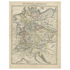
Switzerland – Stülpnagel, 1857
Video Loading
Want more images or videos?
Request additional images or videos from the seller
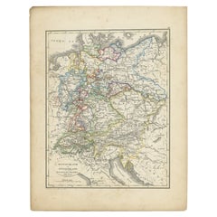
1 of 11
Antique Map of Germany, Netherlands, Belgium
Switzerland – Stülpnagel, 1857
$344.10
£256.89
€290
CA$478.06
A$514.22
CHF 274.82
MX$6,061.22
NOK 3,464.78
SEK 3,167.47
DKK 2,210.13
About the Item
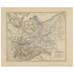
Antique Map of Germany, Netherlands, Belgium
Switzerland – Stülpnagel, 1857
Fine mid-19th century map of Central Europe titled "Deutschland, Niederlande, Belgien, Schweiz", drawn and engraved by F. von Stülpnagel and published by Justus Perthes in Gotha in 1857. This detailed political map captures the patchwork of states and territories that characterized Germany and its neighboring regions prior to the unification of the German Empire in 1871.
The map extends from the North Sea and the Netherlands in the northwest to Austria and parts of Northern Italy in the southeast. It includes present-day Germany, the Netherlands, Belgium, Switzerland, Luxembourg, and parts of France, Austria, Poland, and northern Italy. Each political entity within the German Confederation is outlined in hand-colored borders, emphasizing the fragmentation of the region into various kingdoms, duchies, electorates, and principalities such as Prussia, Bavaria, Saxony, Württemberg, Baden, and Hanover.
Notable features include the finely rendered topography, especially the Alpine regions to the south, and the careful delineation of river systems such as the Rhine, Elbe, and Danube. Major cities like Berlin, Vienna, Amsterdam, and Brussels are prominently marked, and the dense road and railway networks reflect the rapid modernization of the era. A legend in the lower-left corner categorizes the different political entities, adding to the educational value of the piece.
This map is a product of the esteemed publishing house of Justus Perthes in Gotha, known for high-quality cartographic works. It serves not only as an important historical document but also as an attractive decorative piece for those interested in the geopolitical evolution of Europe.
Condition report:
Very good condition. Minor age-related toning in the margins. Centerfold as issued. Hand-coloring is clean and well-preserved. No significant tears or repairs. Please examine the image carefully for further details.
Framing tips:
This map would look refined in a classic black or dark walnut wood frame with a soft ivory or antique white mat. Consider using non-reflective UV-protective glass to preserve the clarity of the engraving and the delicate hand-coloring. Its clean lines and historical content make it ideal for a study, library, or office.
Technique: Engraving with original hand-coloring
Maker: F. von Stülpnagel, published by Justus Perthes, Gotha, 1857
- Dimensions:Height: 14.77 in (37.5 cm)Width: 17.88 in (45.4 cm)Depth: 0.01 in (0.2 mm)
- Materials and Techniques:Paper,Engraved
- Place of Origin:
- Period:
- Date of Manufacture:1857
- Condition:Very good condition. Minor age-related toning in the margins. Centerfold as issued. Hand-coloring is clean and well-preserved. No significant tears or repairs. Please examine the image carefully for further details.
- Seller Location:Langweer, NL
- Reference Number:Seller: BG-05552-261stDibs: LU3054346115862
About the Seller
5.0
Recognized Seller
These prestigious sellers are industry leaders and represent the highest echelon for item quality and design.
Platinum Seller
Premium sellers with a 4.7+ rating and 24-hour response times
Established in 2009
1stDibs seller since 2017
2,838 sales on 1stDibs
Typical response time: 1 hour
- ShippingRetrieving quote...Shipping from: Langweer, Netherlands
- Return Policy
More From This Seller
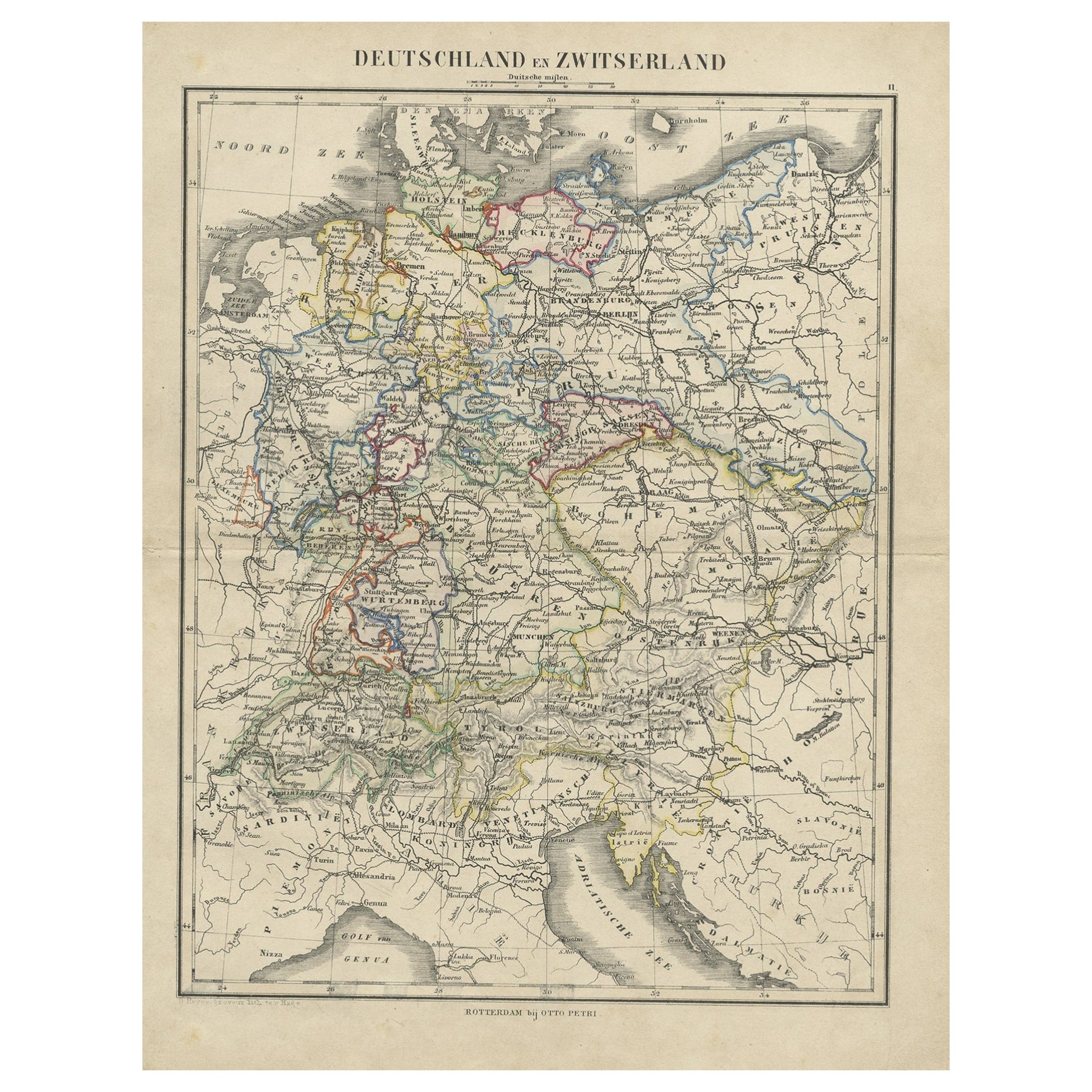
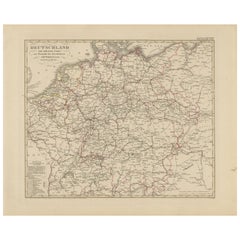
View AllAntique Map of Germany and Switzerland from an Old Dutch School Atlas, c.1873
Located in Langweer, NL
Antique map titled 'Deutschland en Zwitserland'. Old map depicting Germany and Switzerland. This map originates from 'School-Atlas van alle Deelen der Aarde'. Artists and Engravers: ...
Category
Antique 19th Century Maps
Materials
Paper
Antique Map of Germany
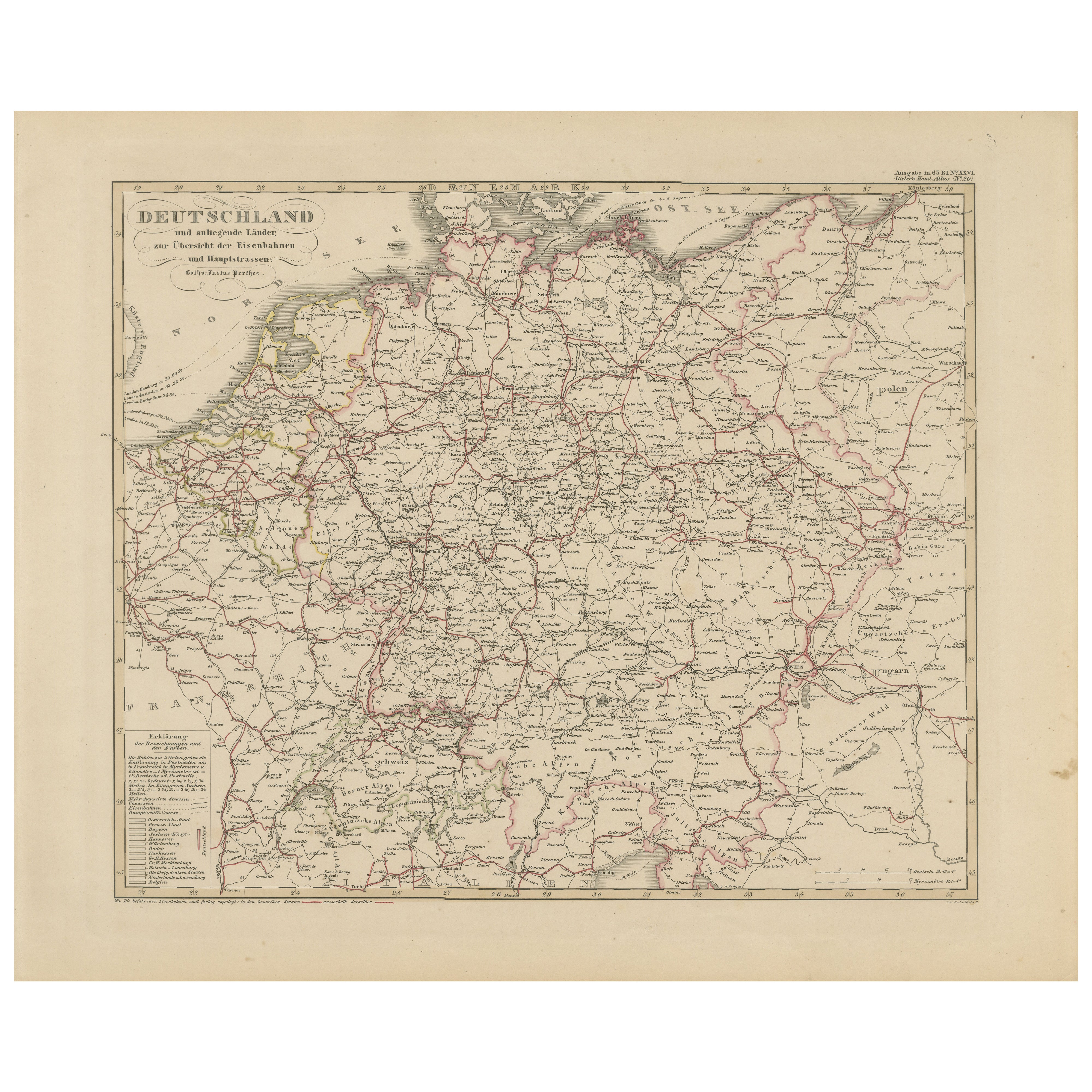
Railways – Transport Network Overview, 1857
Located in Langweer, NL
Antique Map of Germany & Railways – Transport Network Overview, 1857
Striking 19th-century map titled "Deutschland und angränzende Länder zur Übersicht der Eisenbahnen und Hauptstra...
Category
Antique Mid-19th Century German Maps
Materials
Paper
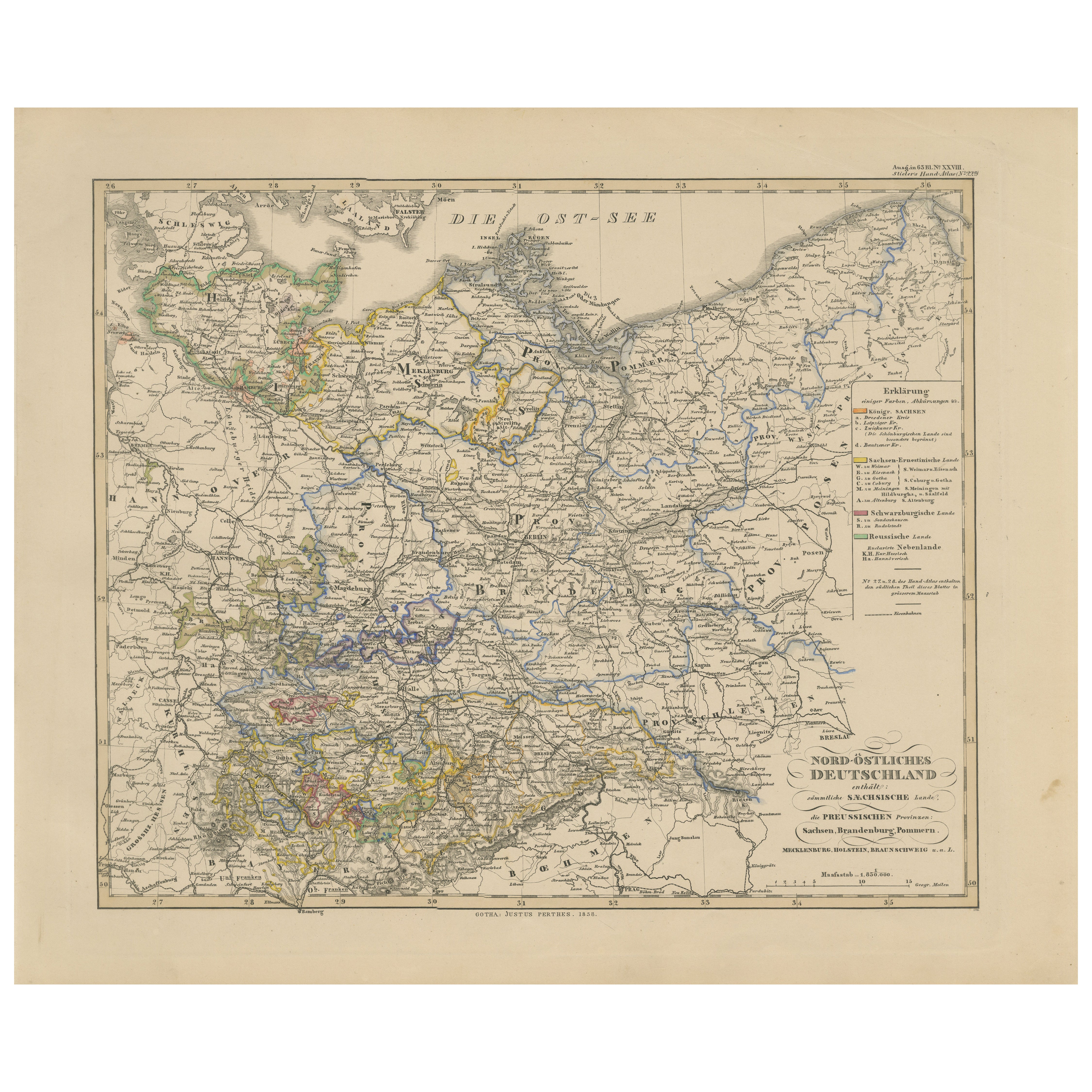
Antique Map of Northeastern Germany – Saxon
Prussian States, 1858
Located in Langweer, NL
Antique Map of Northeastern Germany – Saxon & Prussian States, 1858
Detailed and finely engraved map titled "Nord-Östliches Deutschland enthaltend die Sächsischen Länder und die Pre...
Category
Antique Mid-19th Century German Maps
Materials
Paper
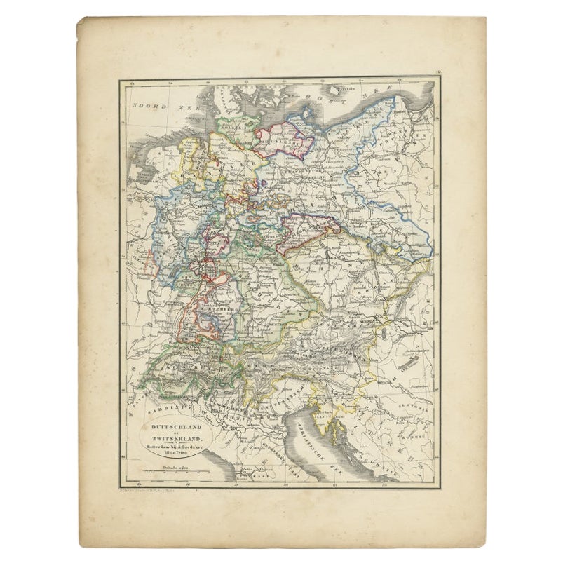
Antique Map of Germany and Switzerland from an Old Dutch School Atlas, 1852
Located in Langweer, NL
Antique map titled 'Duitschland en Zwitersland'. Map of Germany and Switzerland. This map originates from 'School-Atlas van alle deelen der Aarde' by Otto Petri. Artists and Engraver...
Category
Antique 19th Century Maps
Materials
Paper
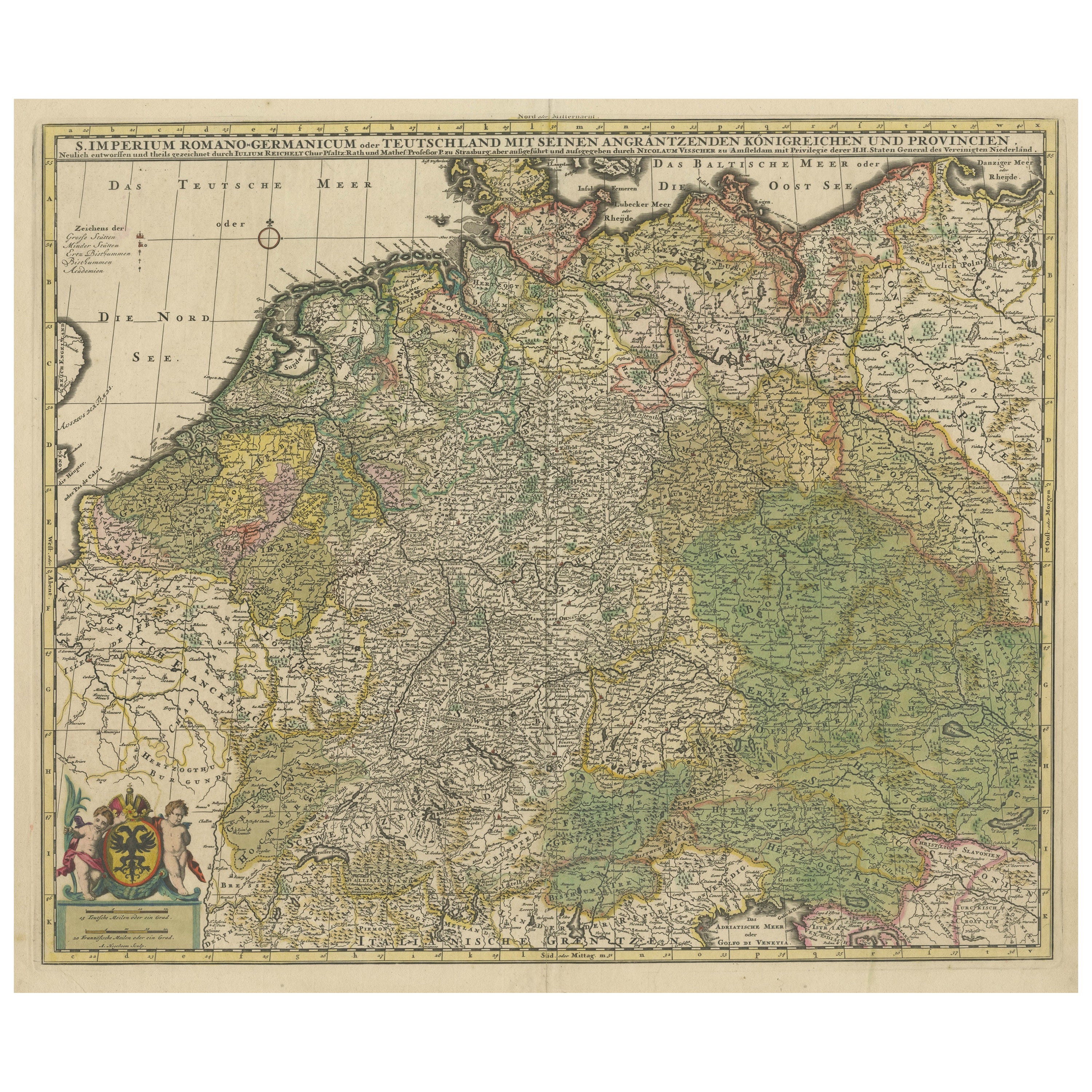
Antique Map of Germany and Central Europe, ca.1690
Located in Langweer, NL
Antique map titled 'S. Imperium Romano-Germanicum oder Teutschland mit seinen angrantzenden Königreichen und Provincien'. Original antique map of Germany...
Category
Antique Late 17th Century Dutch Maps
Materials
Paper

$1,044 Sale Price
20% Off
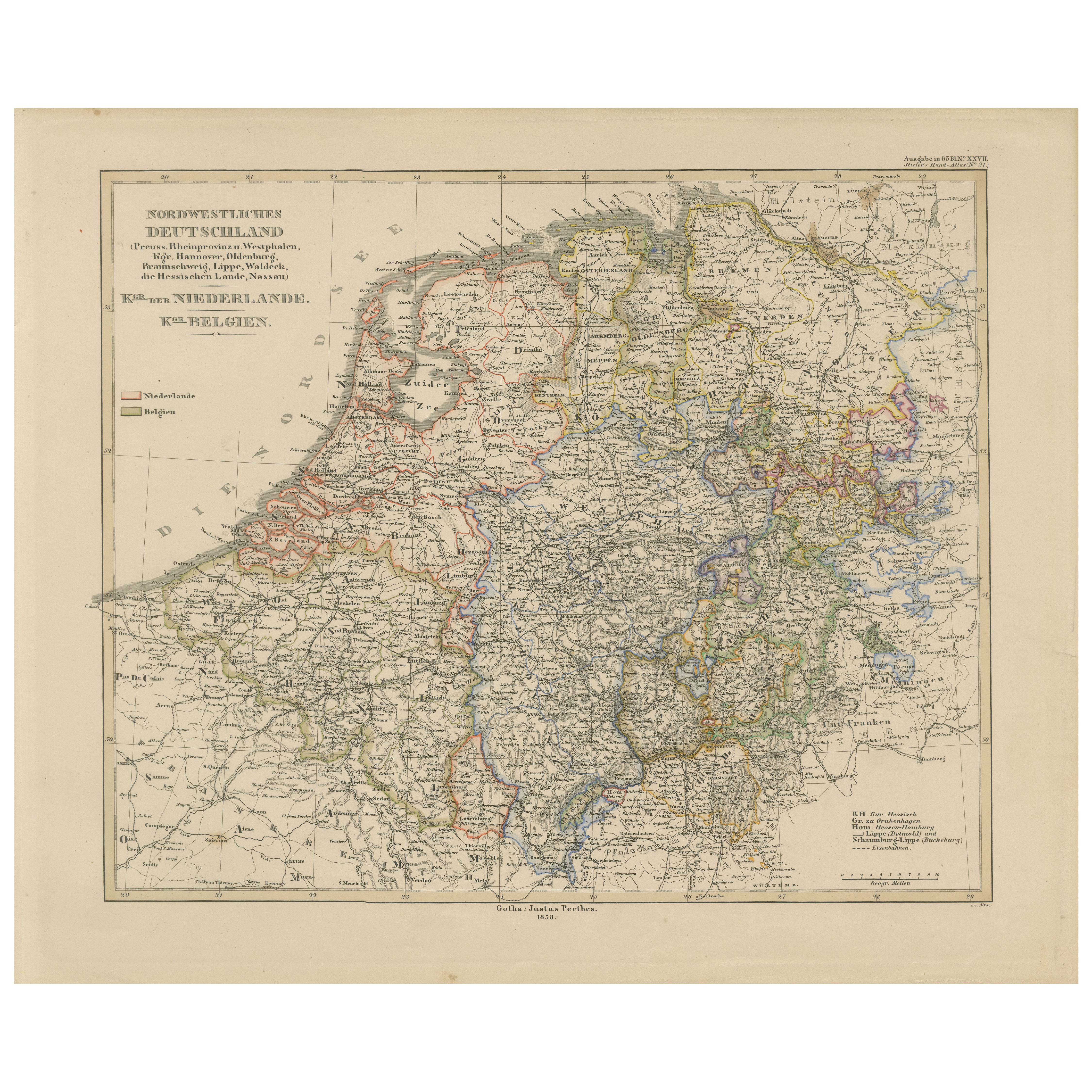
Antique Map of Prussia, Hanover, Netherlands
Belgium – 1858
Located in Langweer, NL
Antique Map of Northwestern Germany, Netherlands & Belgium – 1858
Detailed 19th-century engraved map titled "Nordwestliches Deutschland, Kgr. der Niederlande, Kgr. Belgien" (Northwe...
Category
Antique Mid-19th Century German Maps
Materials
Paper
You May Also Like
German Empire, Northern Part. Century Atlas antique vintage map
Located in Melbourne, Victoria
'The Century Atlas. German Empire, Northern Part.'
Original antique map, 1903.
Central fold as issued. Map name and number printed on the reverse corne...
Category
Early 20th Century Victorian More Prints
Materials
Lithograph

German Empire, Southwestern Part. Century Atlas antique vintage map
Located in Melbourne, Victoria
'The Century Atlas. German Empire, Southwestern Part'
Original antique map, 1903.
Central fold as issued. Map name and number printed on the reverse co...
Category
Early 20th Century Victorian More Prints
Materials
Lithograph

Austria-Hungary, Western Part. Century Atlas antique vintage map
Located in Melbourne, Victoria
'The Century Atlas. Austria-Hungary, Western Part'
Original antique map, 1903.
Central fold as issued. Map name and number printed on the reverse corners.
Sheet 40cm by 29.5cm.
Category
Early 20th Century Victorian More Prints
Materials
Lithograph

The Netherlands (Holland), Belgium and Luxemburg. Century Atlas antique map
Located in Melbourne, Victoria
'The Century Atlas. The Netherlands (Holland), Belgium and Luxemburg.'
Original antique map, 1903.
Inset maps of 'Amsterdam' and 'Brussels'.
Central fold as issued. Map name and num...
Category
Early 20th Century Victorian More Prints
Materials
Lithograph

1853 Map of "Russia in Europe Including Poland" Ric.r016
Located in Norton, MA
Description
Russia in Europe incl. Poland by J Wyld c.1853
Hand coloured steel engraving
Dimension: Paper: 25 cm W x 33 cm H ; Sight: 22 cm W x 28 cm H
Condition: Good ...
Category
Antique 19th Century Unknown Maps
Materials
Paper

France, Northern Part. Century Atlas antique map
Located in Melbourne, Victoria
'The Century Atlas. France, Northern Part.'
Original antique map, 1903.
Inset maps of 'France in Provinces' and 'Paris and Vicinity'.
Central fold as issued. Map name and number pr...
Category
Early 20th Century Victorian More Prints
Materials
Lithograph

More Ways To Browse
Bavaria Antique
German Empire
City Antique Vienna
Beni Ourain Rugs
Glass Top Wood Base Coffee Tables
T Chair
Pair Of Danish Chairs
Veneer Dining Tables
1970 Italian Armchair
Furniture Uk
House Of Denmark Table And Chairs
Louis Marble Top Side Table
Antique Russian Rugs
Baker Furniture By
For Kids
Sterling Silver Flatware Set Service For 12
Tufted Bar
Pair Of French Antique Armchairs