Items Similar to Antique Map of Haute-Marne France by Vuillemin with Decorative Insets, 1850s


Want more images or videos?
Request additional images or videos from the seller
1 of 10
Antique Map of Haute-Marne France by Vuillemin with Decorative Insets, 1850s
$262.35
£194.26
€220
CA$362.37
A$388.10
CHF 208.64
MX$4,713.65
NOK 2,636.24
SEK 2,413.67
DKK 1,676.68
About the Item
Antique Map of Haute-Marne France by Vuillemin with Decorative Insets, 1840s
This finely engraved and hand-colored map of Haute-Marne, a historical department in northeastern France, was produced by Alexandre Vuillemin and lithographed by A. Vallée around the 1840s. Published as part of the renowned mid-19th century French atlas series La France, it combines geographical detail with artistic flourishes.
The map outlines departmental boundaries in color and is embellished with vignettes and scenes relevant to Haute-Marne. These include a portrait of Jean-Baptiste Drouet, the postmaster of Sainte-Menehould famous for recognizing and halting King Louis XVI during his failed flight to Varennes, and a charming city view of Langres, a historic fortified town. The lower left features an illustrated figure of a local citizen, adding a human touch to the cartography. The departmental coat of arms appears to the right, further emphasizing regional pride.
Notable towns and locations shown (with significance):
1. Langres – fortified hilltop town, Roman walls
2. Chaumont – departmental capital, WWI US HQ
3. Joinville – medieval heritage, Renaissance château
4. Bourbonne-les-Bains – ancient Roman spa town
5. Saint-Dizier – industrial hub, WWII bombing
6. Montier-en-Der – abbey origin, marshlands
7. Wassy – 1562 massacre started French Wars of Religion
8. Bologne – known for cutlery and metalwork
9. Andelot-Blancheville – Merovingian treaty 587 AD
10. Doulaincourt – scenic village near river valleys
11. Rolampont – strategic Roman and medieval site
12. Cirey-sur-Blaise – Voltaire’s residence with Emilie du Châtelet
13. Colombey-les-Deux-Églises – General Charles de Gaulle's home and resting place
14. Châteauvillain – medieval ramparts and fairgrounds
15. Arc-en-Barrois – royal hunting lodge and game forest
16. Humes – near Langres, entry to Haute-Marne
17. Clefmont – ruined medieval castle
18. Riaucourt – Roman bridge and quiet canals
19. Fayl-Billot – center of traditional basketry
20. Maranville – birthplace of Enlightenment philosopher Diderot
21. Goncourt – forested countryside
22. Semoutiers – near Chaumont air base
23. Peigney – fortified gateway of Langres basin
24. Froncles – small town on the Marne river
25. Serqueux – rural tranquility
26. Sommevoire – sculpture foundry tradition
27. Vignory – charming Romanesque church
28. Autreville-sur-la-Renne – Renne river scenery
29. Prez-sous-Lafauche – traditional rural architecture
30. Villegusien – reservoir and nature
31. Maizières – ancient site of Gallo-Roman activity
32. Thivet – historic monastery grounds
33. Liffol-le-Petit – furniture craftsmanship region
34. Leffonds – heritage manor and landscapes
35. Osne-le-Val – architectural cast iron foundries
36. Anrosey – nestled in a green valley
37. Vaux-sous-Aubigny – birthplace of Pope Callixtus II
38. Montot-sur-Rognon – Rognon river valley
39. Is-en-Bassigny – medieval castle remains
40. Val-de-Meuse – multiple hamlets and forts
41. Melay – ancient ecclesiastical site
42. Genevrières – small pastoral village
43. Rivières-le-Bois – near river and forest
44. Mandres-la-Côte – scenic countryside
45. Poissons – baroque church and village charm
46. Brousseval – metallurgy village
47. Rimaucourt – large commune in north
48. Laville-aux-Bois – woodland area
49. Neuilly-sur-Suize – meandering Suize river
50. Vauxbons – remote and peaceful hamlet
This map is not only informative but decorative, featuring crisp engraving and clear typography. The lightly applied hand coloring on borders and rivers accentuates its appeal without overwhelming the detail.
Condition report:
Very good condition. Wide margins with some light age toning, mostly around edges. Clean central area with no tears or repairs. No visible folding line, suggesting it was never bound. Slight foxing in the left margin, not affecting the image. Plate mark clearly visible.
Framing tips:
This map would benefit from a soft ivory mat with a narrow olive or sage green inner border to echo the light hand coloring. A thin walnut or antiqued gold wooden frame would provide a classic finish suitable for both traditional and modern interiors.
Technique: Engraving with original hand coloring
Maker: Alexandre Vuillemin, Paris, circa 1840s
- Dimensions:Height: 12.8 in (32.5 cm)Width: 10.28 in (26.1 cm)Depth: 0.01 in (0.2 mm)
- Materials and Techniques:Paper,Engraved
- Place of Origin:
- Period:
- Date of Manufacture:circa 1850
- Condition:Very good condition. Wide margins with some light age toning, mostly around edges. Clean central area with no tears or repairs. Slight foxing in the left margin, not affecting the image.
- Seller Location:Langweer, NL
- Reference Number:Seller: BG-13331-511stDibs: LU3054347404272
About the Seller
5.0
Recognized Seller
These prestigious sellers are industry leaders and represent the highest echelon for item quality and design.
Platinum Seller
Premium sellers with a 4.7+ rating and 24-hour response times
Established in 2009
1stDibs seller since 2017
2,826 sales on 1stDibs
Typical response time: 1 hour
- ShippingRetrieving quote...Shipping from: Langweer, Netherlands
- Return Policy
More From This Seller
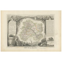
View AllAntique Map of Marne, France – Engraved by Levasseur, 1850s
Located in Langweer, NL
Antique Map of Marne, France – Engraved by Levasseur, 1850s
This beautifully detailed 19th-century engraved map of the Marne department in northeastern France was created by the ren...
Category
Antique Mid-19th Century French Maps
Materials
Paper

Antique French Map of Ille-et-Vilaine Region with Rennes, Saint-Malo, 1800s
Located in Langweer, NL
Antique Map of Ille-et-Vilaine, France by Vuillemin, 19th Century
This decorative antique map presents the French département of Ille-et-Vilaine, situated in the Brittany region of ...
Category
Antique Mid-19th Century French Maps
Materials
Paper

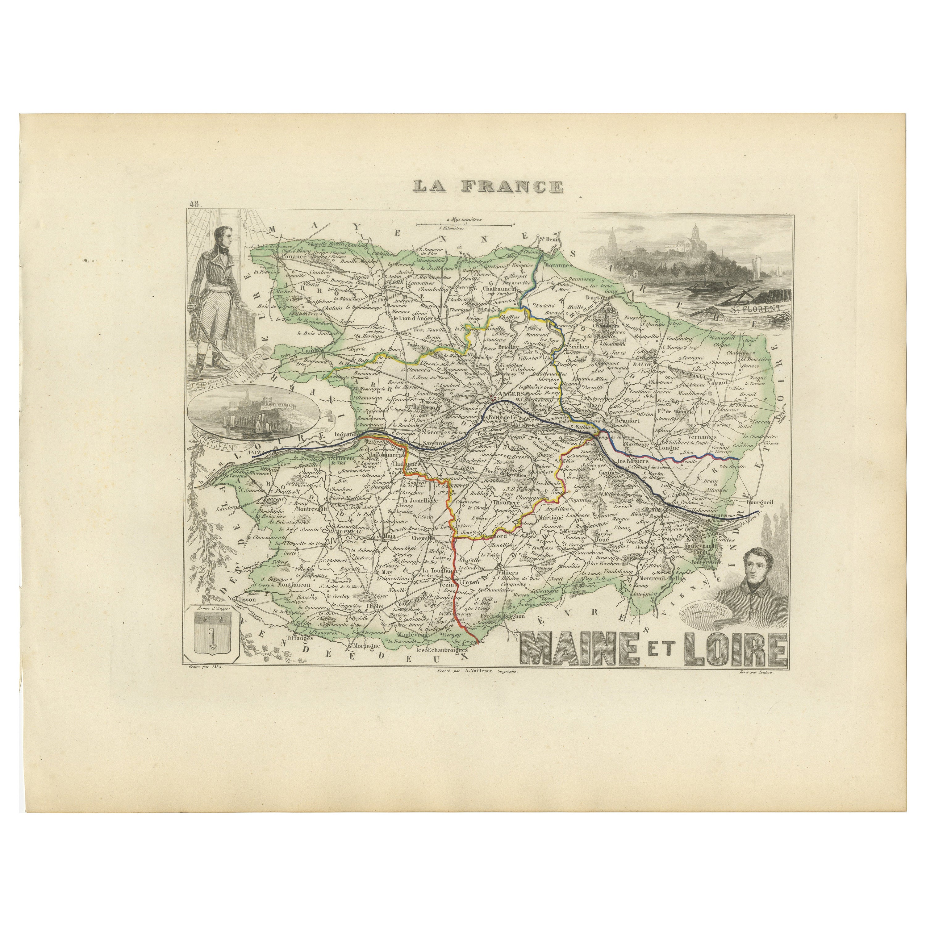
Antique Map of Maine-et-Loire with Illustrations – Vuillemin c.1850
Located in Langweer, NL
Antique Map of Maine-et-Loire with Illustrations – Vuillemin c.1850
A richly detailed 19th-century map of the Maine-et-Loire department in western France, engraved by A. Vuillemin a...
Category
Antique Mid-19th Century French Maps
Materials
Paper
Map of Loire France with Saint-Étienne and Montbrison by Vuillemin, 19th c
Located in Langweer, NL
Map of Loire France with Saint-Étienne and Montbrison by Vuillemin, 19th c
This beautifully engraved and hand-colored map of the department of Loire in east-central France is from t...
Category
Antique Mid-19th Century French Maps
Materials
Paper

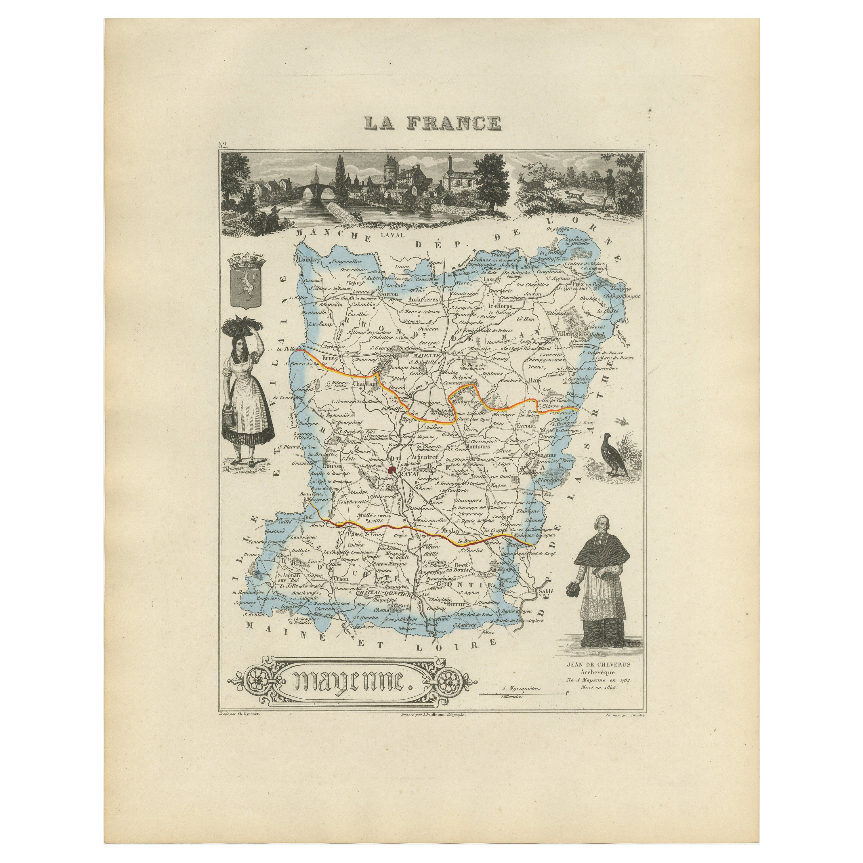
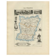
Antique Map of Mayenne – Hand-Colored Engraving by Levasseur, France c.1850
Located in Langweer, NL
Antique Map of Mayenne – Hand-Colored Engraving by Levasseur, France c.1850
This finely detailed 19th-century engraved map of the department of Mayenne in northwestern France was cr...
Category
Antique Mid-19th Century French Maps
Materials
Paper
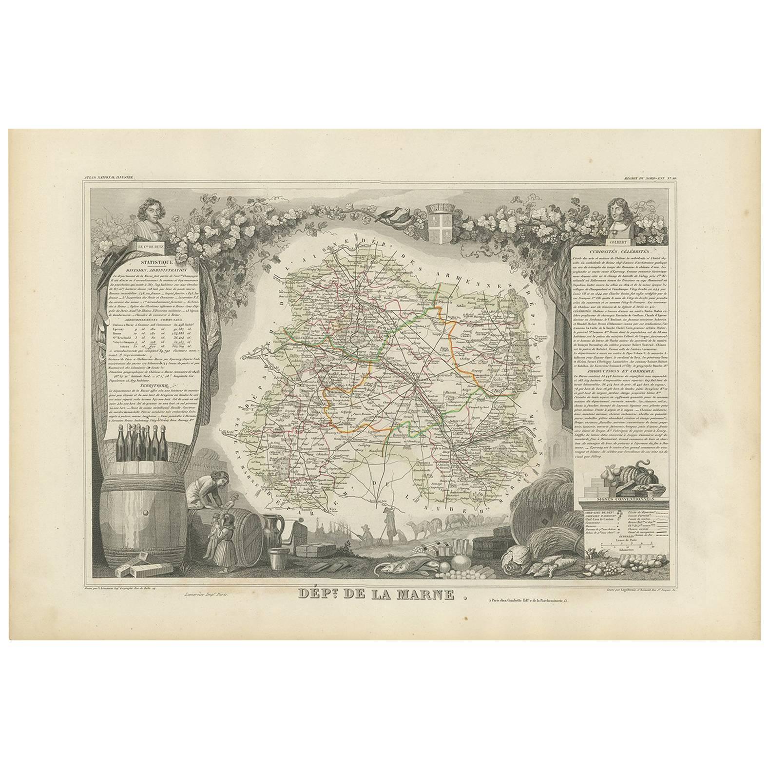
Antique Map of Marne ‘France’ by V. Levasseur, 1854
Located in Langweer, NL
Antique map titled 'Dépt. de la Marne'. Map of the French department of Marne, France. This department is home to the Champagne region where the world's finest sparkling wine is prod...
Category
Antique Mid-19th Century French Maps
Materials
Paper
$139 Sale Price
35% Off
You May Also Like
Large 19th Century Map of France
Located in Pease pottage, West Sussex
Large 19th Century Map of France.
Remarkable condition, with a pleasing age worn patina.
Recently framed.
France Circa 1874.
Category
Antique Late 19th Century French Maps
Materials
Linen, Paper

Var, France. Antique map of a French department, 1856
By Victor Levasseur
Located in Melbourne, Victoria
'Dept. du Var', steel engraving with original outline hand-colouring., 1856, from Levasseur's Atlas National Illustre.
Var covers the heart of the French Riviera or Cote d'Azur., and includes the resort cities of Cannes, Nice and San Tropez...
Category
19th Century Naturalistic Landscape Prints
Materials
Engraving

L
Herault, France. Antique map of a French department, 1856
By Victor Levasseur
Located in Melbourne, Victoria
'Dept. de Saone et Loire', steel engraving with original outline hand-colouring., 1856, from Levasseur's Atlas National Illustre.
This area is home to a wide variety of vineyards a...
Category
19th Century Naturalistic Landscape Prints
Materials
Engraving

Saone and Loire, France. Antique map of a French department, 1856
By Victor Levasseur
Located in Melbourne, Victoria
'Dept. de Saone et Loire', steel engraving with original outline hand-colouring., 1856, from Levasseur's Atlas National Illustre.
The French department of Saone et Loire is at the ...
Category
19th Century Naturalistic Landscape Prints
Materials
Engraving

Indre and Loire, France. Antique map of a French department, 1856
By Victor Levasseur
Located in Melbourne, Victoria
'Dept. d'Indre et Loire', steel engraving with original outline hand-colouring., 1856, from Levasseur's 'Atlas National Illustre'.
This area is known for its production of Chenin b...
Category
19th Century Naturalistic Landscape Prints
Materials
Engraving

Lozere, France. Antique map of a French department, 1856
By Victor Levasseur
Located in Melbourne, Victoria
'Dept. de La Lozere', steel engraving with original outline hand-colouring., 1856, from Levasseur's 'Atlas National Illustre'.
This remote mountainous part of Languedoc is rural, s...
Category
19th Century Naturalistic Landscape Prints
Materials
Engraving
