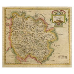
Items Similar to Antique Map of Herefordshire
England
by R. Morden, 1708
Want more images or videos?
Request additional images or videos from the seller
1 of 5
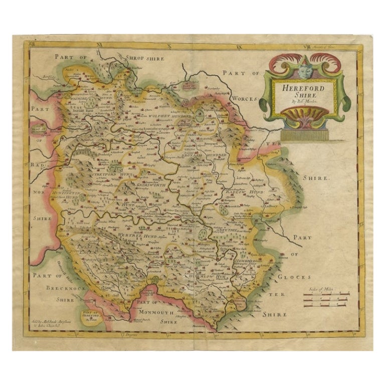
Antique Map of Herefordshire
England
by R. Morden, 1708
$284.83
£212.46
€240
CA$396.44
A$425.31
CHF 228.13
MX$5,120.62
NOK 2,875.78
SEK 2,622.32
DKK 1,828.98
About the Item
This antique County map of Herefordshire by Robert Morden was first published in 1701 in a work entitled 'The New Description and State of England', however, a subsequent edition by Herman Moll in 1708 added a compass indicator and other detail.
- Dimensions:Height: 7.88 in (20 cm)Width: 10.04 in (25.5 cm)Depth: 0.02 in (0.5 mm)
- Materials and Techniques:
- Period:
- Date of Manufacture:1708
- Condition:Please study image carefully.
- Seller Location:Langweer, NL
- Reference Number:Seller: BG-027491stDibs: LU305439343751
About the Seller
5.0
Recognized Seller
These prestigious sellers are industry leaders and represent the highest echelon for item quality and design.
Platinum Seller
Premium sellers with a 4.7+ rating and 24-hour response times
Established in 2009
1stDibs seller since 2017
2,830 sales on 1stDibs
Typical response time: 1 hour
- ShippingRetrieving quote...Shipping from: Langweer, Netherlands
- Return Policy
More From This Seller
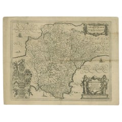
View AllAntique Map of Herefordshire by Morden, c.1700
Located in Langweer, NL
Antique map titled 'Herefordshire'. Detailed map of the county of Herefordshire embellished with a decorative title cartouche. Three scales. Imprint of Abel Swale, Awnsham Churchill ...
Category
Antique 18th Century Maps
Materials
Paper
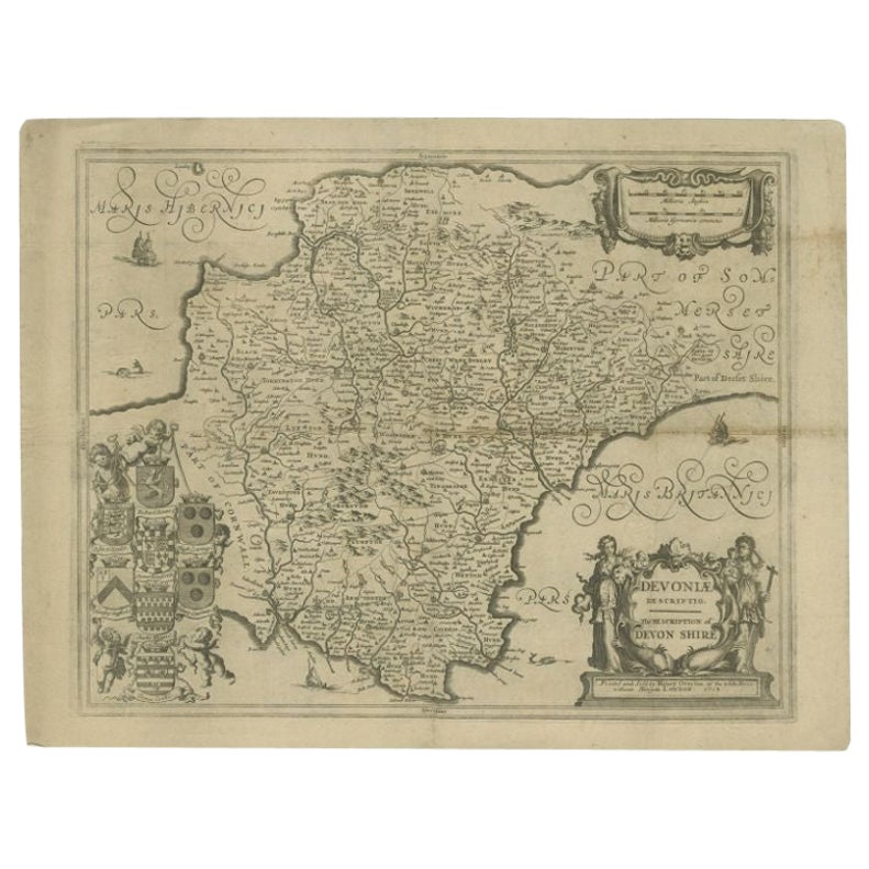
Antique Map of the County of Devon by Overton, 1713
Located in Langweer, NL
Antique map titled 'Devoniae Descriptio - The Description of Devon Shire'. Map of the County of Devon, England. This map originates from the 1713 edition of the 'Overton Atlas'. Henry Overton only revised the Devon map...
Category
Antique 18th Century Maps
Materials
Paper
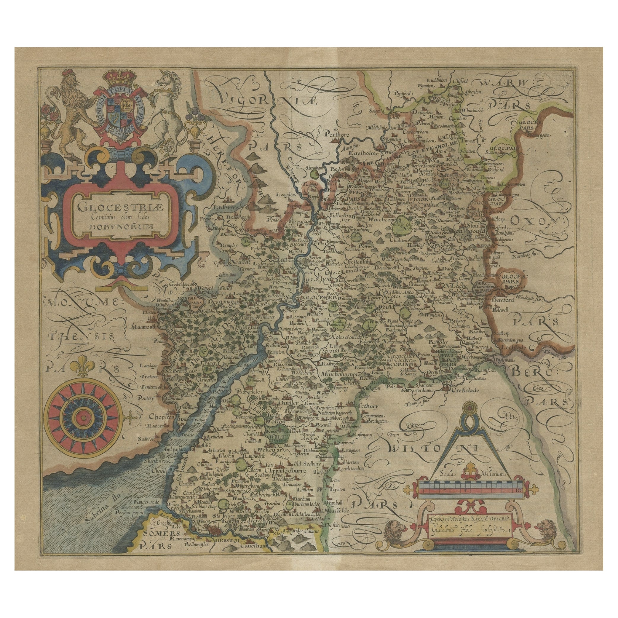
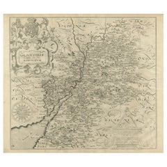
Antique Map of Gloucestershire by Camden, c.1607
Located in Langweer, NL
Antique map titled 'Glocestriae comitatus olim sedes Dobunorum'. Map of Gloucestershire, England. This map originates from Camden?s 'Britannia' ...
Category
Antique 17th Century Maps
Materials
Paper

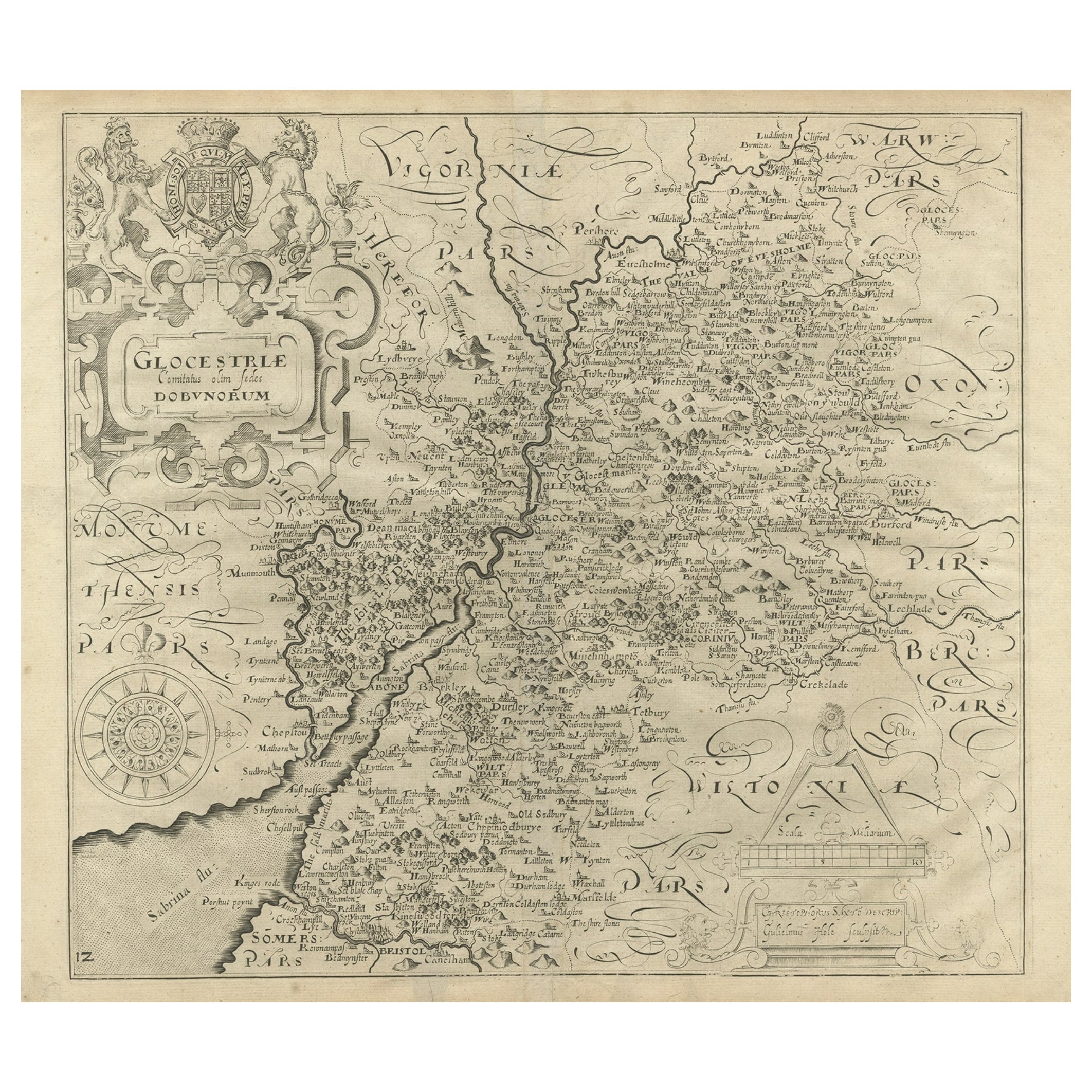
Antique Map of Gloucestershire in Britain by Camden, 1637
Located in Langweer, NL
Antique map titled 'Glocestriae comitatus olim sedes Dobunorum'. Map of Gloucestershire, England. This map originates from Camden?s 'Britannia' ...
Category
Antique 17th Century Maps
Materials
Paper
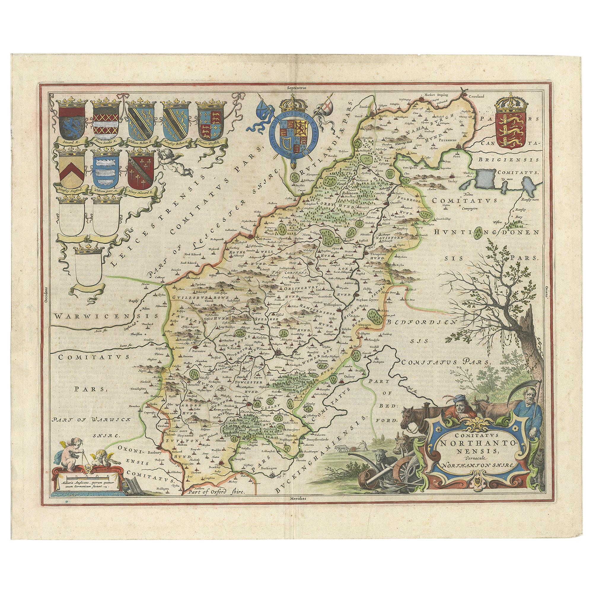
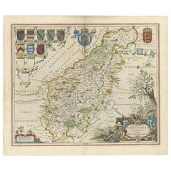
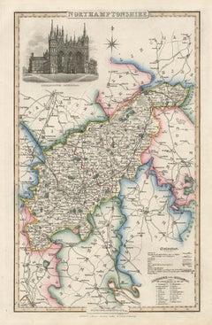
A Gold Highlighted Antique Map of Northamptonshire by Blaeu
1659
Located in Langweer, NL
Antique map titled 'Comitatus Northantonensis vernacule Northamtonshire'. Original antique map of Northamptonshire, England. This map originates from 'Atlas Universal y Cosmographico...
Category
Antique Mid-17th Century Dutch Maps
Materials
Paper
$759 Sale Price
20% Off
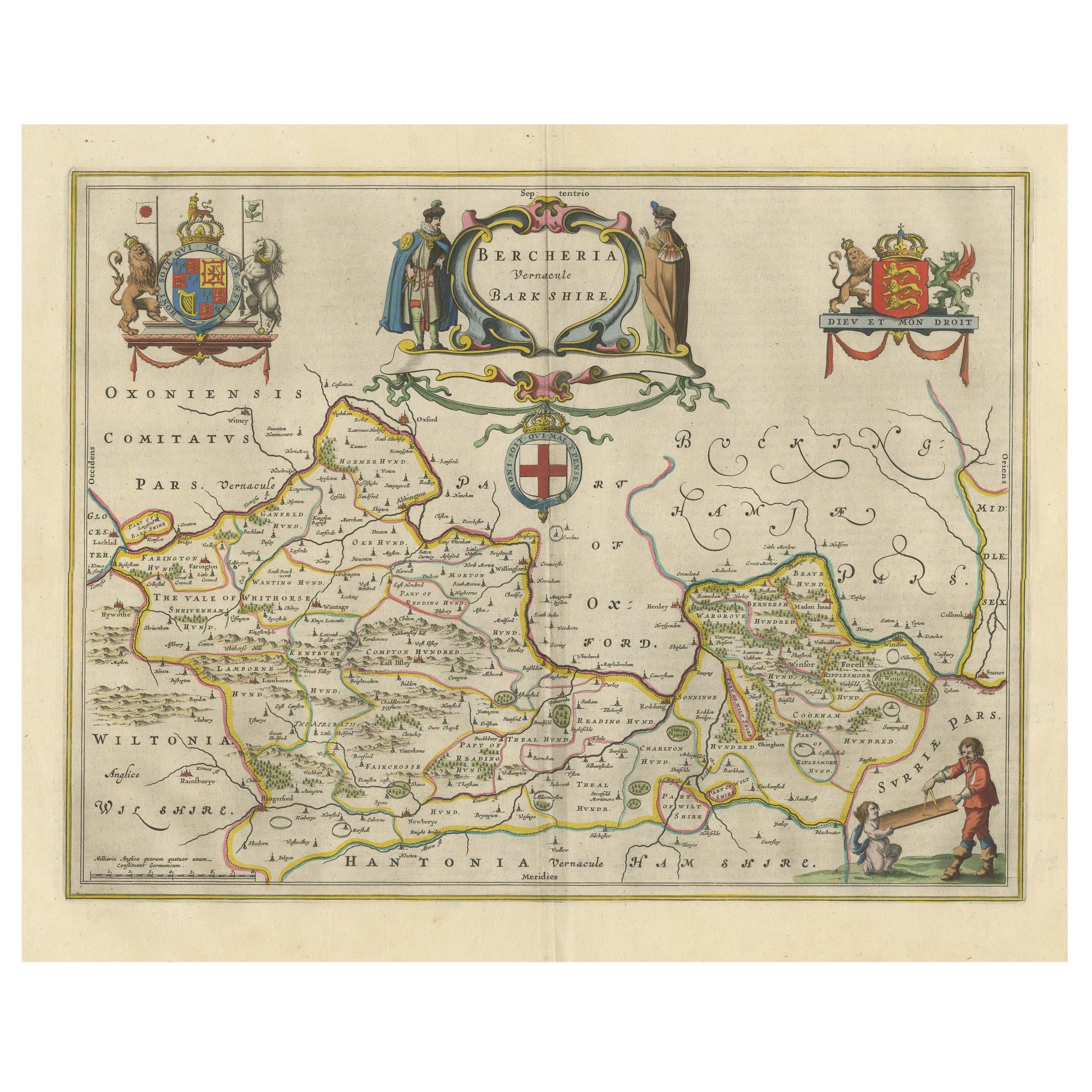
Antique Map of Berkshire, South East England
By Joan (Johannes) Blaeu
Located in Langweer, NL
Antique map titled 'Bercheria vernacule Barkshire'. Original old map of Berkshire, a historic county in South East England. Published circa 1665 by J. Blaeu. Willem Jansz. Blaeu and ...
Category
Antique Mid-17th Century Maps
Materials
Paper
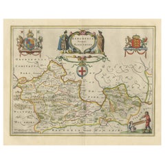
$1,139 Sale Price
20% Off
You May Also Like
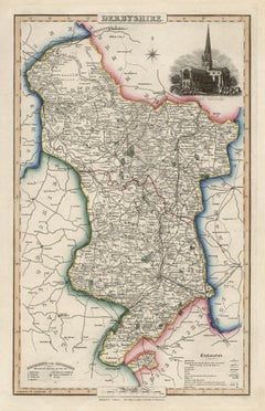
Derbyshire, English County Antique map, 1847
By Isaac Slater
Located in Melbourne, Victoria
Steel-engraved map with original outline colouring by Isaac Slater. A detailed engraved map of the English county with title, scale, and key. Decorated with an uncoloured engraved vi...
Category
19th Century Naturalistic Landscape Prints
Materials
Engraving
18th Century Emanuel Bowen Map of County of York, c.1740
By Emanuel Bowen
Located in Royal Tunbridge Wells, Kent
Antique 18th century British rare and original Emanuel Bowen (1694-1767) map of the County of York divided into its Ridings and subdivided into wapontakes, mounted in solid wood fram...
Category
Antique Early 18th Century British Maps
Materials
Paper

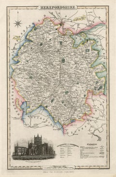
Herefordshire, English County Antique map, 1847
By Isaac Slater
Located in Melbourne, Victoria
Steel-engraved map with original outline colouring by Isaac Slater. A detailed engraved map of the English county with title, scale, and key. Decorated with an uncoloured engraved vi...
Category
19th Century Naturalistic Landscape Prints
Materials
Engraving
Antique County Map, Shropshire, English, Atlas Engraving, Richard Blome, C.1673
Located in Hele, Devon, GB
This is an antique county map of Shropshire. An English, framed atlas engraving by Richard Blome, dating to the 17th century and later.
A treat for the collector or county native, ...
Category
Antique 17th Century British Restauration Maps
Materials
Glass, Wood, Paper

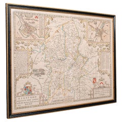
Antique Stafford County Map, English, Atlas Engraving, 17th Century, Cartography
Located in Hele, Devon, GB
This is an antique Stafford County Map. An English, framed atlas engraving of Staffordshire, dating to the 17th century and later, circa 1676.
Superb cartography reproduction of St...
Category
Antique Late 17th Century British Charles II Maps
Materials
Glass, Paper
Northamptonshire, English County Antique map, 1847
By Isaac Slater
Located in Melbourne, Victoria
Steel-engraved map with original outline colouring by Isaac Slater. A detailed engraved map of the English county with title, scale, and key. Decorated with an uncoloured engraved view of 'Peterborough...
Category
19th Century Naturalistic Landscape Prints
Materials
Engraving
More Ways To Browse
Charles Rennie Mackintosh For Cassina
Glass Salt
Vintage Resin Tables
Antique English Country Furniture
Blue Kilim Vintage
Contemporary Side Tables And Stools
Decorative Wall Plate
Mid Century Modern Corner Chair
Dining Tables With Brass Inlay
Oak Mid Century Armchair
Solid Wood Side Table Stool
Antique Marble Top Hall Table
Bird And Butterfly
Old Carpet
Porcelain Modern Hand Painted
Bent Plywood
1960 Italian Dining Set
Italian Giltwood Table