Items Similar to Antique Map of the Indre Region in France, ca. 1852
Want more images or videos?
Request additional images or videos from the seller
1 of 5
Antique Map of the Indre Region in France, ca. 1852
$269.99
£200.08
€225
CA$369
A$401.68
CHF 213.21
MX$4,833.13
NOK 2,701.71
SEK 2,475.53
DKK 1,713.89
About the Item
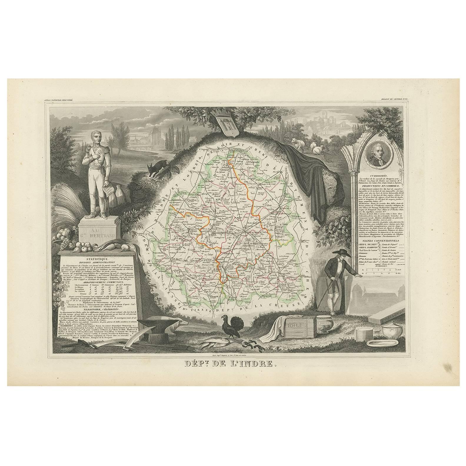
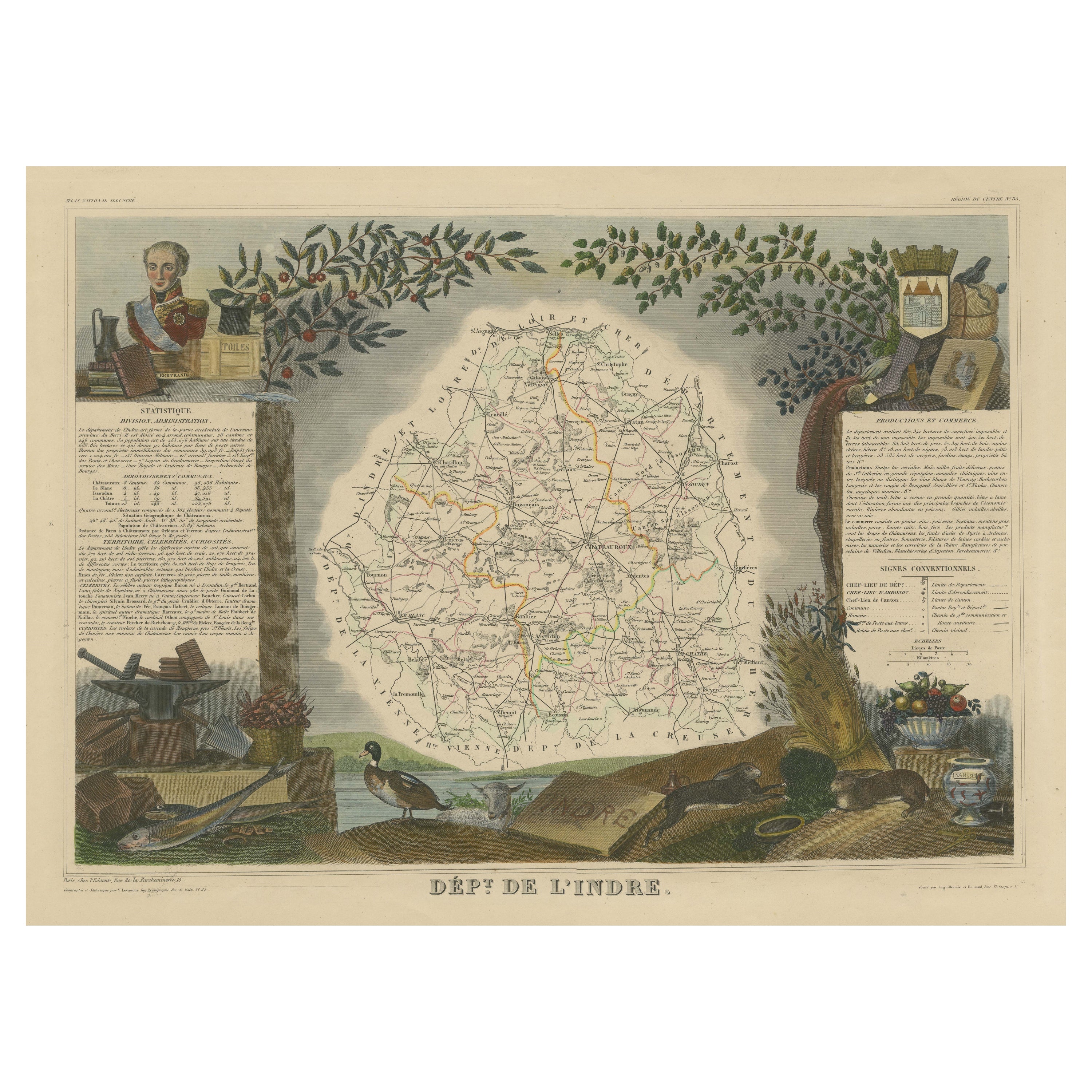
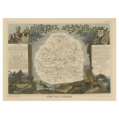
Antique map titled 'Dépt. de l'Indre'.
Map of the French department of Indre, France. Part of the Loire Valley wine region, this area is known for its production of Chinon wines, typically red, and production of Pouligny-Saint-Pierre, goats'-milk cheese. It is also the birthplace of the great philosopher Rene Descartes. The whole is surrounded by elaborate decorative engravings designed to illustrate both the natural beauty and trade richness of the land. There is a short textual history of the regions depicted on both the left and right sides of the map and a portret of Bertrand. This map originates from ‘Atlas National de la France Illustré’. Published by A. Combette, Paris, ca. 1852.
Engraved maps with contemporary outline colouring to the maps and later enhancement to the surrounding decorative vignettes, very slight overall toning.
- Dimensions:Height: 14.38 in (36.5 cm)Width: 20.28 in (51.5 cm)Depth: 0.02 in (0.5 mm)
- Materials and Techniques:
- Period:
- Date of Manufacture:circa 1852
- Condition:Wear consistent with age and use. General age-related toning. Please study image carefully.
- Seller Location:Langweer, NL
- Reference Number:Seller: BG-13216-31stDibs: LU3054328347742
About the Seller
5.0
Recognized Seller
These prestigious sellers are industry leaders and represent the highest echelon for item quality and design.
Platinum Seller
Premium sellers with a 4.7+ rating and 24-hour response times
Established in 2009
1stDibs seller since 2017
2,819 sales on 1stDibs
Typical response time: 1 hour
- ShippingRetrieving quote...Shipping from: Langweer, Netherlands
- Return Policy
More From This Seller
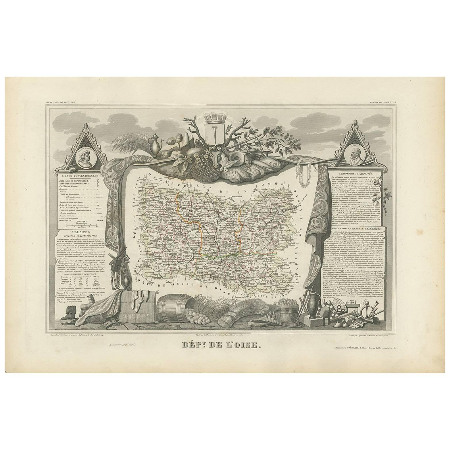
View AllAntique Map of Oise ‘France’ by V. Levasseur, 1854
By Victor Levasseur
Located in Langweer, NL
Antique map titled 'Dépt. de l'Oise'. Map of the French department of Oise, France. The map is surrounded by elaborate decorative engravings designed to illustrate both the natural b...
Category
Antique Mid-19th Century Maps
Materials
Paper

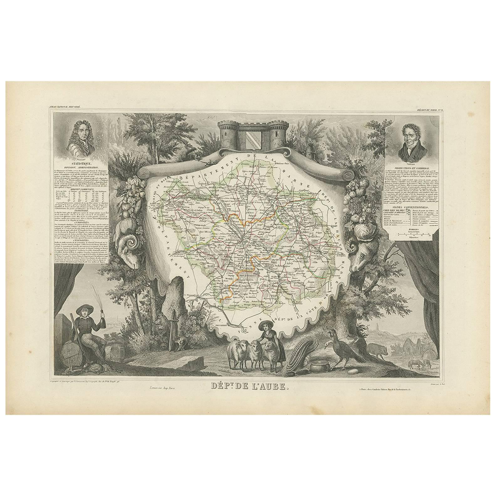
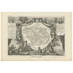
Antique Map of Aube ‘France’ by V. Levasseur, 1854
Located in Langweer, NL
Antique map titled 'Dépt. de l'Aube'. Map of the French department of Aube, France. This area of France is known for its production of Chaource, a soft and salted cheese. Aube is par...
Category
Antique Mid-19th Century Maps
Materials
Paper
Antique Map of Indre ‘France’ by V. Levasseur, 1854
Located in Langweer, NL
Antique map titled 'Dépt. de l'Indre'. Map of the French department of Indre, France. Part of the Loire Valley wine region, this area is known for its production of Chinon wines, typ...
Category
Antique Mid-19th Century Maps
Materials
Paper
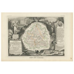
Old Map of the French Department of Indre, France
By Victor Levasseur
Located in Langweer, NL
Antique map titled 'Dept. de l'Indre'. Map of the French department of Indre, France. Part of the Loire Valley wine region, this area is known for its production of Chinon wines, typically red, and production of Pouligny-Saint-Pierre, goats'-milk cheese. It is also the birthplace of the great philosopher Rene Descartes...
Category
Antique Mid-19th Century Maps
Materials
Paper
$326 Sale Price
20% Off
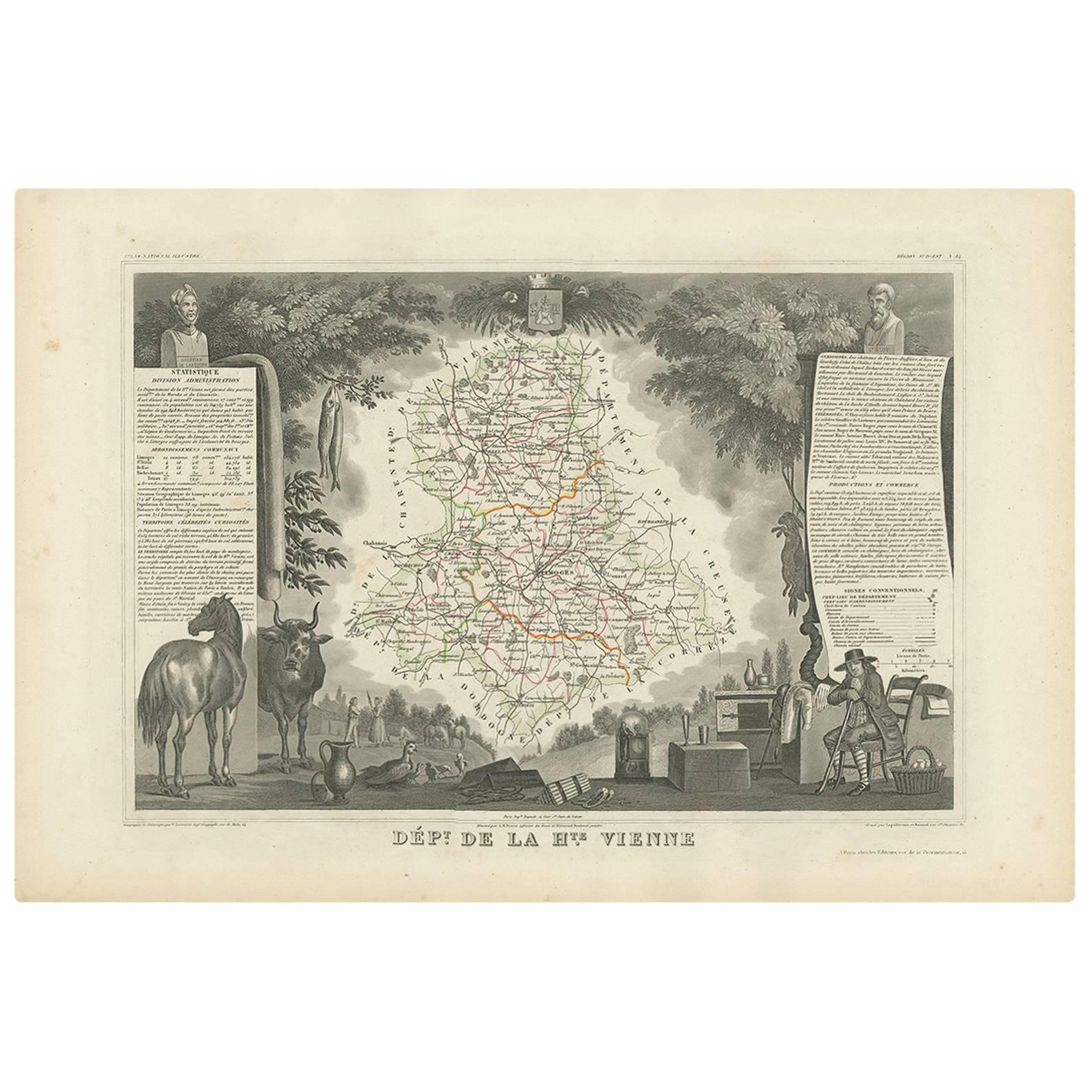
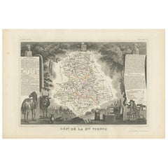
Antique Map of Upper Vienne ‘France’ by V. Levasseur, 1854
By Victor Levasseur
Located in Langweer, NL
Antique map titled 'Dépt. de La Hte. Vienne'. Antique map of Department of Upper Vienne with capital city Limoges, in the region of Limousin. This map originates from ‘Atlas National...
Category
Antique Mid-19th Century Maps
Materials
Paper
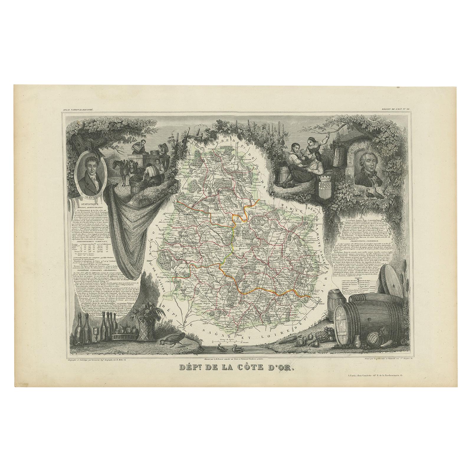
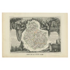
Antique Map of Côte d
Or ‘France’ by V. Levasseur, 1854
By Victor Levasseur
Located in Langweer, NL
Antique map titled 'Dépt. de la Côte d'Or'. Map of the French department of Cote D’Or, France. Part of France's Burgundy or Bourgogne wine region, a premier wine-growing region of Fr...
Category
Antique Mid-19th Century Maps
Materials
Paper
You May Also Like
Jura, France. Antique map of a French department, 1856
By Victor Levasseur
Located in Melbourne, Victoria
'Dept. du Jura', steel engraving with original outline hand-colouring., 1856, from Levasseur's 'Atlas National Illustre'.
The Jura wines are very distinctive and unusual, such as V...
Category
19th Century Naturalistic Landscape Prints
Materials
Engraving

Aude, France. Antique map of a French department, 1856
By Victor Levasseur
Located in Melbourne, Victoria
'Dept. de L' Aude', steel engraving with original outline hand-colouring., 1856, from Levasseur's 'Atlas National Illustre'.
This area of France is famous for its wide variety of v...
Category
19th Century Naturalistic Landscape Prints
Materials
Engraving

La Gironde, France. Antique map of a French department, 1856
By Victor Levasseur
Located in Melbourne, Victoria
'La Gironde', steel engraving with original outline hand-colouring., 1856, from Levasseur's 'Atlas National Illustre'.
This coastal department is the seat of the Bordeaux wine regi...
Category
19th Century Naturalistic Landscape Prints
Materials
Engraving

Indre and Loire, France. Antique map of a French department, 1856
By Victor Levasseur
Located in Melbourne, Victoria
'Dept. d'Indre et Loire', steel engraving with original outline hand-colouring., 1856, from Levasseur's 'Atlas National Illustre'.
This area is known for its production of Chenin b...
Category
19th Century Naturalistic Landscape Prints
Materials
Engraving

Lozere, France. Antique map of a French department, 1856
By Victor Levasseur
Located in Melbourne, Victoria
'Dept. de La Lozere', steel engraving with original outline hand-colouring., 1856, from Levasseur's 'Atlas National Illustre'.
This remote mountainous part of Languedoc is rural, s...
Category
19th Century Naturalistic Landscape Prints
Materials
Engraving

Aube, France. Antique map of a French department, 1856
By Victor Levasseur
Located in Melbourne, Victoria
'Dept. de L'Aube', steel engraving with original outline hand-colouring., 1856, from Levasseur's 'Atlas National Illustre'.
This area of France is known for its production of Chaou...
Category
19th Century Naturalistic Landscape Prints
Materials
Engraving

More Ways To Browse
Rene Descartes
Ancient Bible
Antique Bermuda Furniture
Antique Constellation Map
Antique Map Burgundy
Antique Map Of Hawaii
Antique Maps Of Long Island
Calcutta Map
Gibraltar Antique Map
Guyana Antique Map
Maps Of New Mexico
Saudi Arabia Map
16th Century Scotland
Antique Leather Map
Antique Map Of Argentina
Antique Map Of Colombia
Cornwall Map
Early Texas Furniture