Items Similar to Antique Map of Ireland, 1903, with Intricate County Boundaries
Coastal Details


Want more images or videos?
Request additional images or videos from the seller
1 of 10
Antique Map of Ireland, 1903, with Intricate County Boundaries
Coastal Details
$395.29
£295.59
€330
CA$544.61
A$593.97
CHF 314.64
MX$7,120.84
NOK 4,007.17
SEK 3,664.26
DKK 2,514.73
About the Item
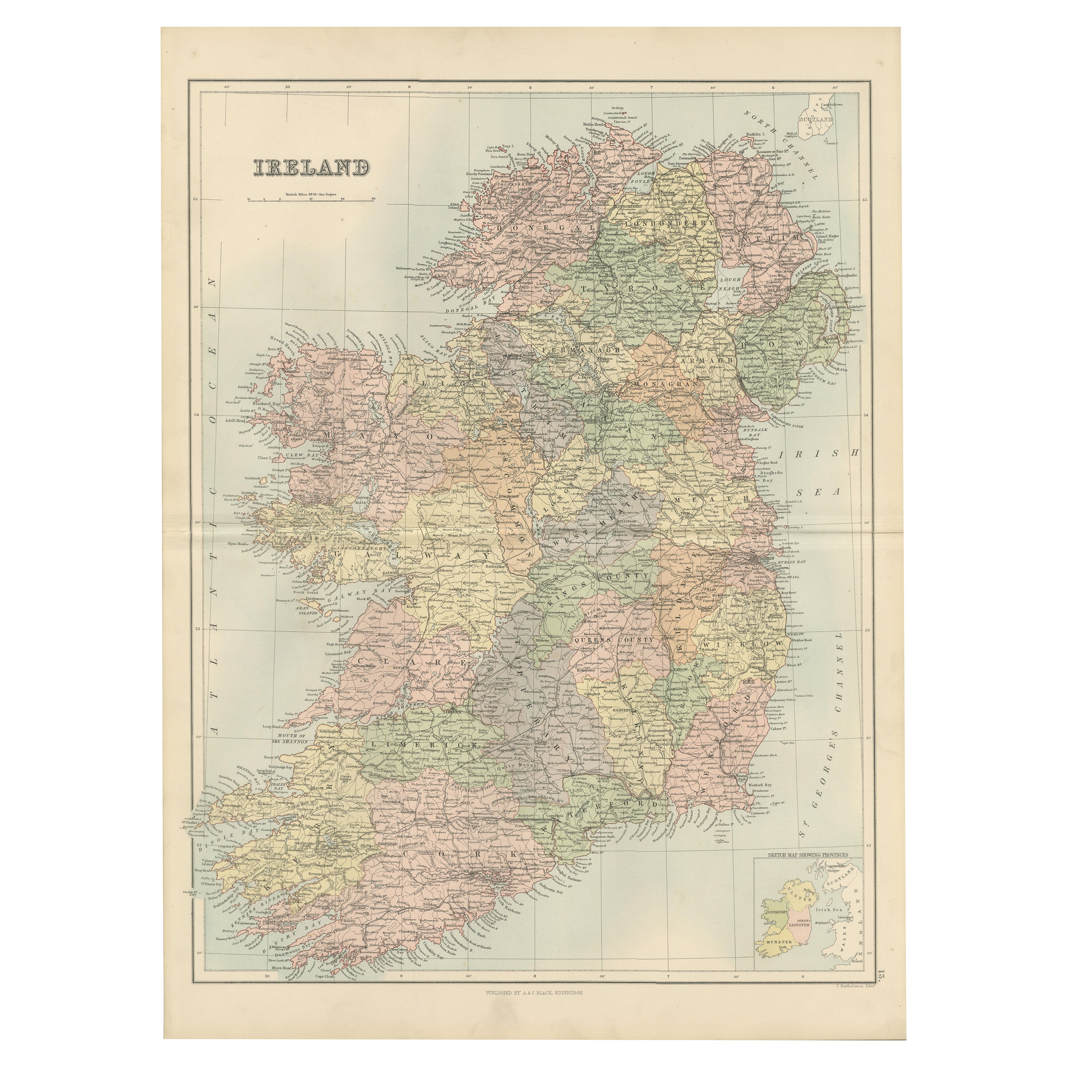
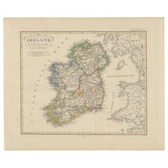
Title: Antique Map of Ireland, 1903, with Intricate County Boundaries and Coastal Detail
Description:
This antique map of Ireland, engraved and published in 1903 by the esteemed W.
A.K. Johnston firm in Edinburgh and London, is a beautifully detailed portrayal of the Emerald Isle. It offers a fascinating snapshot of Ireland’s political and geographical landscape at the turn of the 20th century.
The map captures the entire island of Ireland with exceptional clarity, extending from the rugged coastlines of Donegal in the north to the sun-warmed shores of Cork and Kerry in the south. Delicately colored in soft pastels of green, pink, and yellow, it highlights the various counties and their administrative boundaries. Rivers, mountain ranges, and major cities such as Dublin, Belfast, and Cork are all meticulously documented, reflecting the cartographic precision of Johnston’s work.
Of particular interest are the intricate networks of railways and roads that connect the towns and villages, illustrating the early 20th-century infrastructure that helped shape the social and economic fabric of Ireland. The inclusion of historical province names—Ulster, Leinster, Munster, and Connaught—adds an extra layer of cultural context, evoking Ireland’s rich and complex history.
For collectors, historians, and lovers of Irish heritage, this map is more than just a beautiful artifact. It is a tangible record of Ireland during a time of significant social and political change, just before the transformative events of the Irish struggle for independence. Its soft coloring and fine engraving make it a stunning decorative piece that also sparks historical curiosity.
Condition report:
The map is in very good antique condition, with minor age-related foxing and slight edge toning typical for its vintage. The colors remain vibrant and the paper is stable and well-preserved.
Framing tips:
A classic wooden frame in walnut or oak will bring warmth and elegance to this map. Pair with a cream or off-white matting to accentuate the pastel coloring and delicate detail, creating a timeless and sophisticated display perfect for any home or office.
- Dimensions:Height: 14.49 in (36.8 cm)Width: 18.9 in (48 cm)Depth: 0.01 in (0.2 mm)
- Materials and Techniques:
- Period:
- Date of Manufacture:1903
- Condition:The map is in very good antique condition, with minor age-related foxing and slight edge toning typical for its vintage. The colors remain vibrant and the paper is stable and well-preserved. Folding line as issued.
- Seller Location:Langweer, NL
- Reference Number:Seller: BG-13577-81stDibs: LU3054345241432
About the Seller
5.0
Recognized Seller
These prestigious sellers are industry leaders and represent the highest echelon for item quality and design.
Platinum Seller
Premium sellers with a 4.7+ rating and 24-hour response times
Established in 2009
1stDibs seller since 2017
2,788 sales on 1stDibs
Typical response time: <1 hour
- ShippingRetrieving quote...Shipping from: Langweer, Netherlands
- Return Policy
More From This Seller
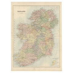
View AllAntique Ireland Map with County Divisions – Decorative Wall Chart, 1884
Located in Langweer, NL
Antique Map of Ireland with Counties – Black’s Atlas, 1884
Description:
This finely detailed engraved map of Ireland was published in the New and Revised Edition of Black’s General ...
Category
Antique 1880s Scottish Maps
Materials
Paper
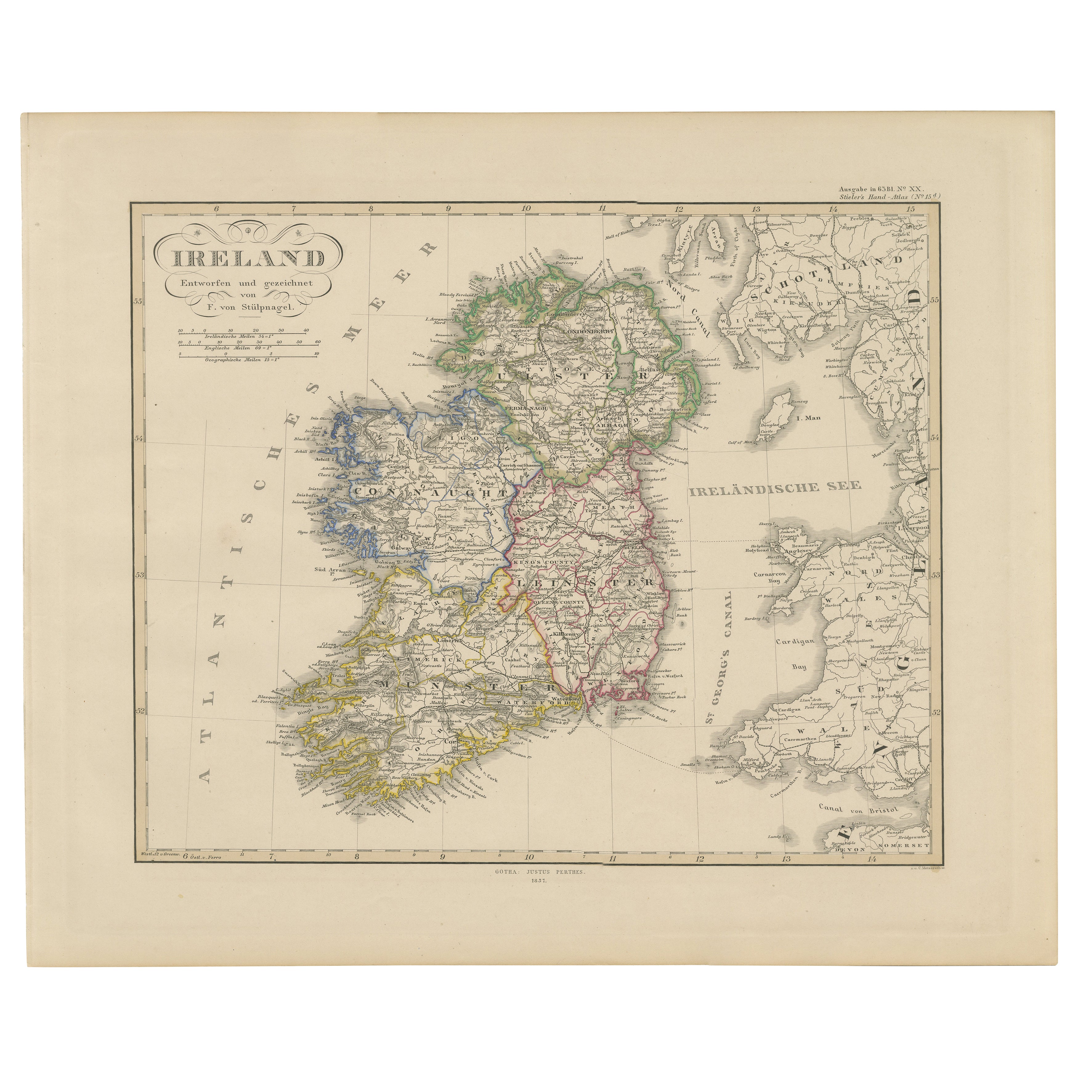
Ireland Map – Provincial and County Divisions 1851
Located in Langweer, NL
Ireland Map – Provincial and County Divisions 1851
This fine antique print shows Ireland titled simply “Ireland,” published in 1851 by Justus Perthes in Gotha as part of Adolf Stiel...
Category
Antique Mid-19th Century German Maps
Materials
Paper
1882 Cartographic Views of Ireland
s North and South Regions
Located in Langweer, NL
Title: 1882 Maps of Ireland: Northern and Southern Regions
These two maps provide a detailed representation of Ireland as it was in 1882, divided into the northern and southern regi...
Category
Antique 1880s Maps
Materials
Paper
Map of Ireland: Early 19th Century - from the 1802 Tardieu Atlas
Located in Langweer, NL
Antique Map Description
**Title:** Carte d'Irlande
**Publication Details:**
- **Atlas Title:** Nouvel Atlas Universel de Géographie Ancienne et Moderne
- **Purpose:** For the Nouve...
Category
Antique Early 1800s Maps
Materials
Paper

$421 Sale Price
20% Off
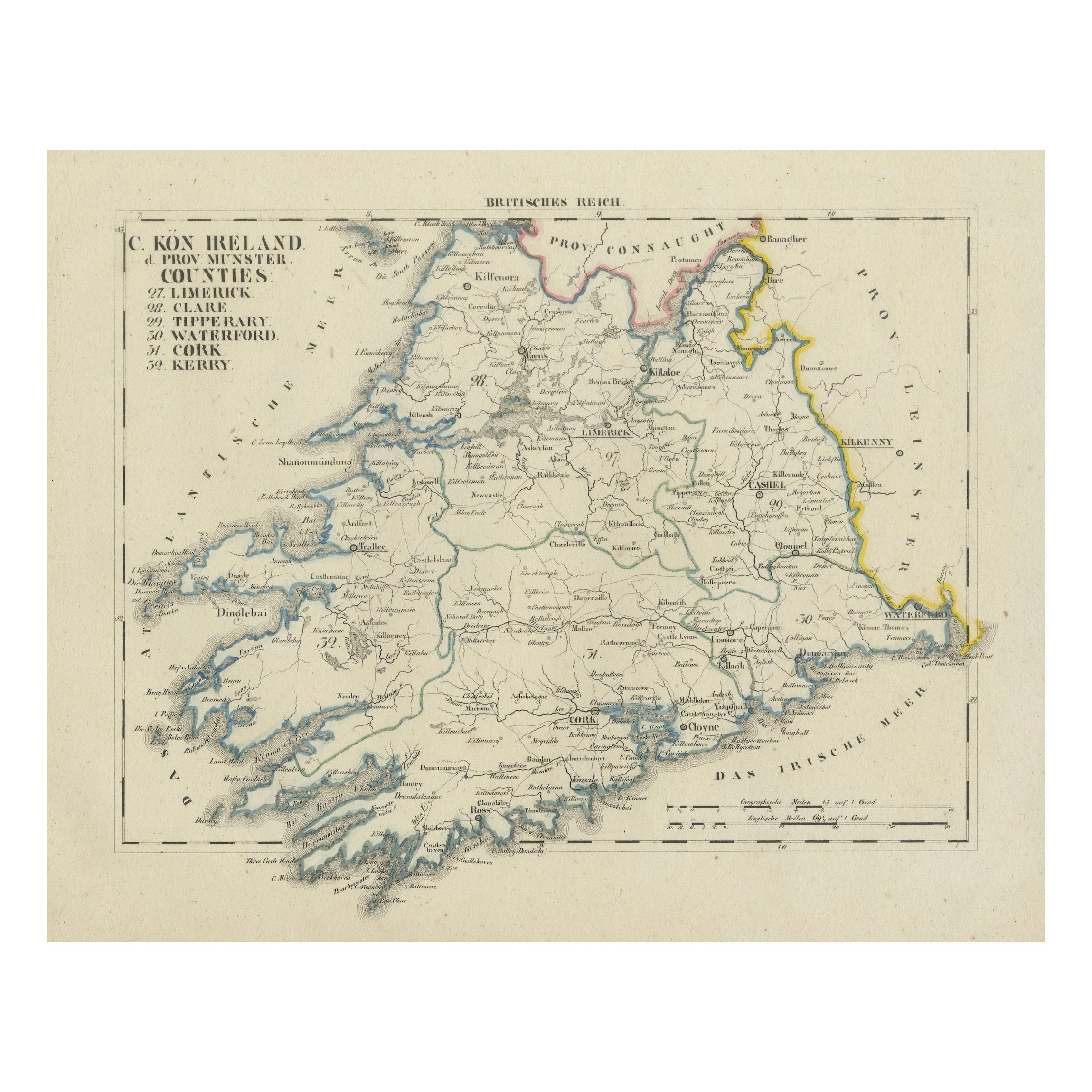
Antique 1830 Map of Munster, Ireland with Limerick, Cork, Kerry and Tipperary
Located in Langweer, NL
Title: Antique 1830 Map of Munster, Ireland with Limerick, Cork, Kerry, and Tipperary
Description: This 1830 German-language map, titled Britisches Reich – C. Kon: Ireland, focu...
Category
Antique 1830s Maps
Materials
Paper
Antique 1830 Map of Ulster, Ireland with Armagh, Down, Antrim, Donegal, Tyrone
Located in Langweer, NL
Title: Antique 1830 Map of Ulster, Ireland with Armagh, Down, Antrim, Donegal, and Tyrone
Description: This 1830 German-language map, titled Britisches Reich – C. Kon: Ireland, ...
Category
Antique 1830s Maps
Materials
Paper
You May Also Like
Large Original Antique Map of Ireland. C.1900
Located in St Annes, Lancashire
Fabulous map of Ireland
Original color.
Engraved and printed by the George F. Cram Company, Indianapolis.
Published, C.1900.
Unframed.
Free shipping.
Category
Antique 1890s American Maps
Materials
Paper

Original Antique Map of Ireland- Kerry. C.1840
Located in St Annes, Lancashire
Great map of Kerry
Steel engraving
Drawn under the direction of A.Adlard
Published by How and Parsons, C.1840
Unframed.
Category
Antique 1840s English Maps
Materials
Paper

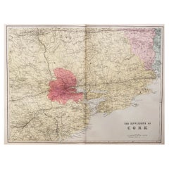
Large Original Antique Map of the Environs of Cork, Ireland, circa 1880
Located in St Annes, Lancashire
Great map of The Environs of Cork
Published circa 1880
Unframed
Free shipping.
Category
Antique 1880s Scottish Maps
Materials
Paper
Original Antique Map of Ireland- Tipperary and Waterford. C.1840
Located in St Annes, Lancashire
Great map of Tipperary and Waterford
Steel engraving
Drawn under the direction of A.Adlard
Published by How and Parsons, C.1840
Unframed.
Category
Antique 1840s English Maps
Materials
Paper

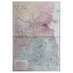
Large Original Antique Map of The Environs of Dublin, Ireland, circa 1880
Located in St Annes, Lancashire
Great map of The Environs of Dublin
Published circa 1880
Unframed
Free shipping.
Category
Antique 1880s Scottish Maps
Materials
Paper
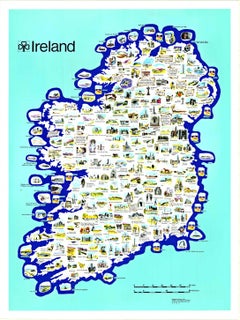
Original Ireland Pictorial Vintage Poster Travel Map linen backed
Located in Spokane, WA
Original Ireland Pictorial Map, archival linen-backed, Grade A, ready to frame. This poster has no restoration, vibrant colors, and numerous details. Browne and Nolan Limited printed...
Category
1970s American Modern Landscape Prints
Materials
Lithograph
More Ways To Browse
Antique Cork
Round Table Base
Cream Soup
Early English Silver
James Bond
Paisley Rugs and Carpets
Antique Pagoda
Black And Chrome Lounge Chair
Ceramic 1960s Italy
Vintage 1930 Dining Room Set
Antique Brass And Copper
Antique Cow
Antique Harvest
Antique Victorian Dining Tables
Environment Furniture
Italian Plastic Chairs
Made In Belgium
Black Crystal Glasses