Items Similar to Antique Map of Italy – Pre-Unification Italy by Andriveau-Goujon, Paris 1861

Want more images or videos?
Request additional images or videos from the seller
1 of 10
Antique Map of Italy – Pre-Unification Italy by Andriveau-Goujon, Paris 1861
$464.72
£346.15
€390
CA$639.96
A$696.58
CHF 369.09
MX$8,377.43
NOK 4,692.92
SEK 4,300.54
DKK 2,971.54
About the Item
Antique Map of Italy – Pre-Unification Italy by Andriveau-Goujon, Paris 1861
This antique map of Italy, titled simply “Italie,” was published in Paris in 1861 by E. Andriveau-Goujon as plate no. 11 in his Atlas Universel. The map captures the Italian Peninsula and its surrounding islands just as Italy was undergoing unification, making it a compelling historical document of the fragmented political landscape that preceded the formation of the modern Italian state.
The map shows the entire Italian Peninsula, from the Alps in the north to the tip of Sicily in the south, including Corsica, Sardinia, Elba, and the coastal regions of Dalmatia and North Africa. It reflects the pre-unification borders, with the Italian states still divided among the Kingdom of Sardinia (including Piedmont and Sardinia), the Austrian-controlled Lombardy-Venetia in yellow, the Grand Duchy of Tuscany, the Papal States in central Italy, and the Kingdom of the Two Sicilies in the south. Each political entity is delicately shaded in pastel tones, offering a clear depiction of the regional divisions of the time.
Major cities such as Milan, Venice, Florence, Rome, Naples, Palermo, and Turin are clearly marked, alongside smaller towns, rivers, and transport routes. The Adriatic and Tyrrhenian coasts are well defined, and the surrounding Mediterranean context adds both geographic and visual interest.
This map was engraved and hand-colored with precision, featuring a decorative border and fine cartographic detail typical of Andriveau-Goujon's high-quality publications. Issued at a pivotal time in European history, it stands as both a beautiful piece of cartography and an important record of Italy before its unification was completed in the 1860s.
Condition: Very good condition. Slight toning around the edges and minimal foxing in the margins. Original centerfold as issued. Bright original coloring. Plate number “11” appears in the top right corner.
Framing tips: Best displayed in a classic black or gold frame with a light ivory or cream mat. A secondary inner mat in olive green or soft red can complement the tones of the Italian territories.
Technique: Engraving with original hand coloring
Maker: E. Andriveau-Goujon, Paris, 1861
- Dimensions:Height: 27.64 in (70.2 cm)Width: 20.91 in (53.1 cm)Depth: 0.01 in (0.2 mm)
- Materials and Techniques:Paper,Engraved
- Place of Origin:
- Period:
- Date of Manufacture:1861
- Condition:Condition: Very good condition. Slight toning around the edges and minimal foxing in the margins. Original centerfold as issued. Bright original coloring. Plate number “11” appears in the top right corner.
- Seller Location:Langweer, NL
- Reference Number:Seller: BG-14099-61stDibs: LU3054346185342
About the Seller
5.0
Recognized Seller
These prestigious sellers are industry leaders and represent the highest echelon for item quality and design.
Platinum Seller
Premium sellers with a 4.7+ rating and 24-hour response times
Established in 2009
1stDibs seller since 2017
2,824 sales on 1stDibs
Typical response time: 1 hour
- ShippingRetrieving quote...Shipping from: Langweer, Netherlands
- Return Policy
More From This Seller
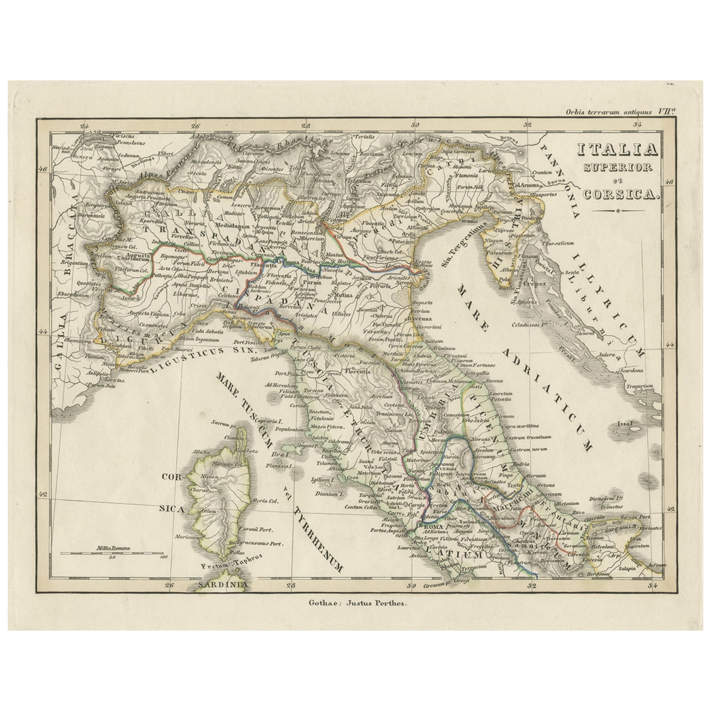
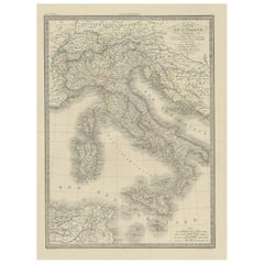
View AllAntique Map of Italy and Corse in Ancient Times, 1848
Located in Langweer, NL
Antique map titled 'Italia Superior et Corsica'.
Old map of northern Italy and Corse originating from 'Orbis Terrarum Antiquus in usum Scholarum'. Artists and Engravers: Publishe...
Category
Antique 19th Century Maps
Materials
Paper

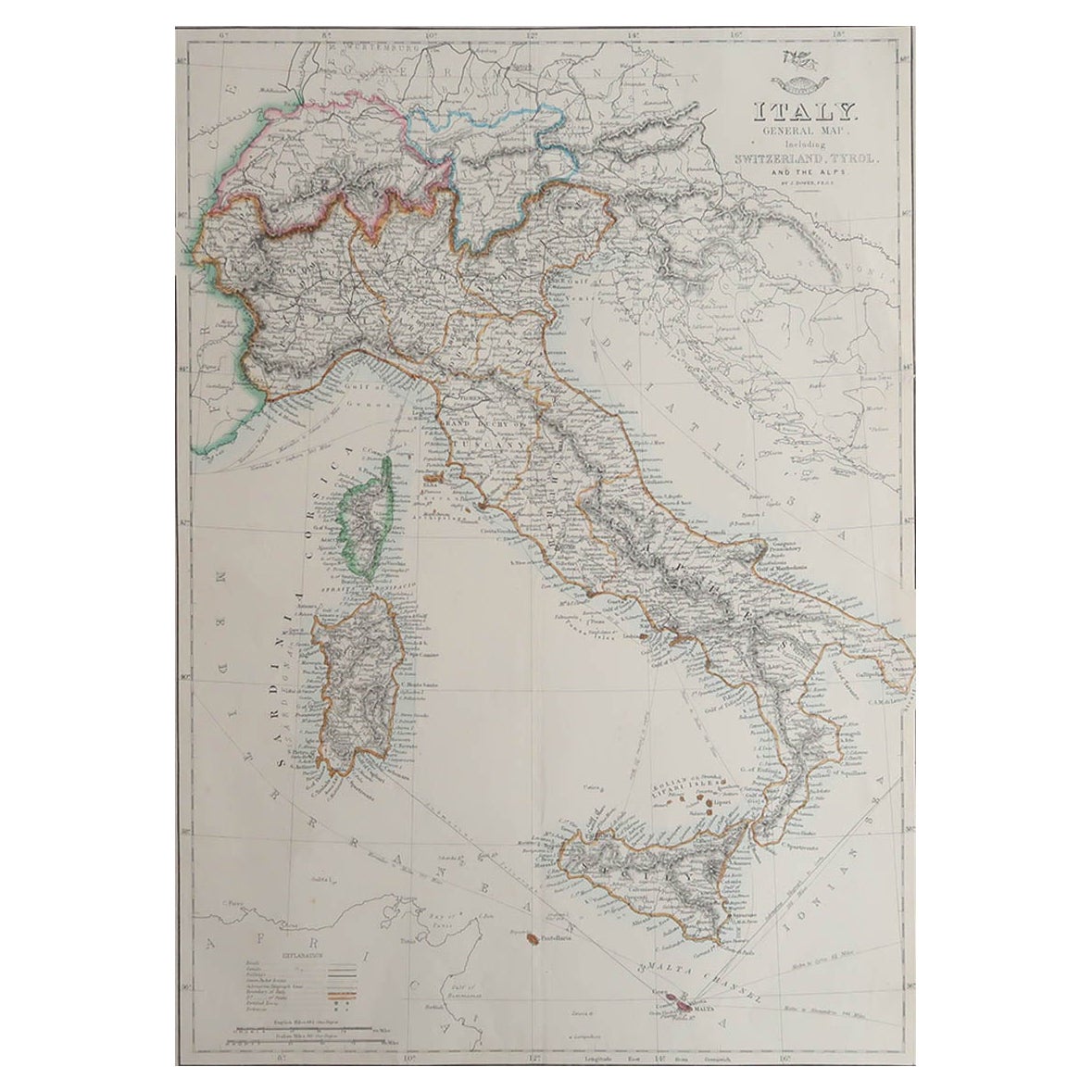
Antique Map of Northern Italy by J. Tallis, circa 1851
Located in Langweer, NL
A highly decorative mid-19th century map of Northern Italy which was drawn and engraved by John Rapkin (vignettes by A. H. Wray & J. B. Allen) and published in John Tallis & co.'s Th...
Category
Antique Mid-19th Century British Maps
Materials
Paper

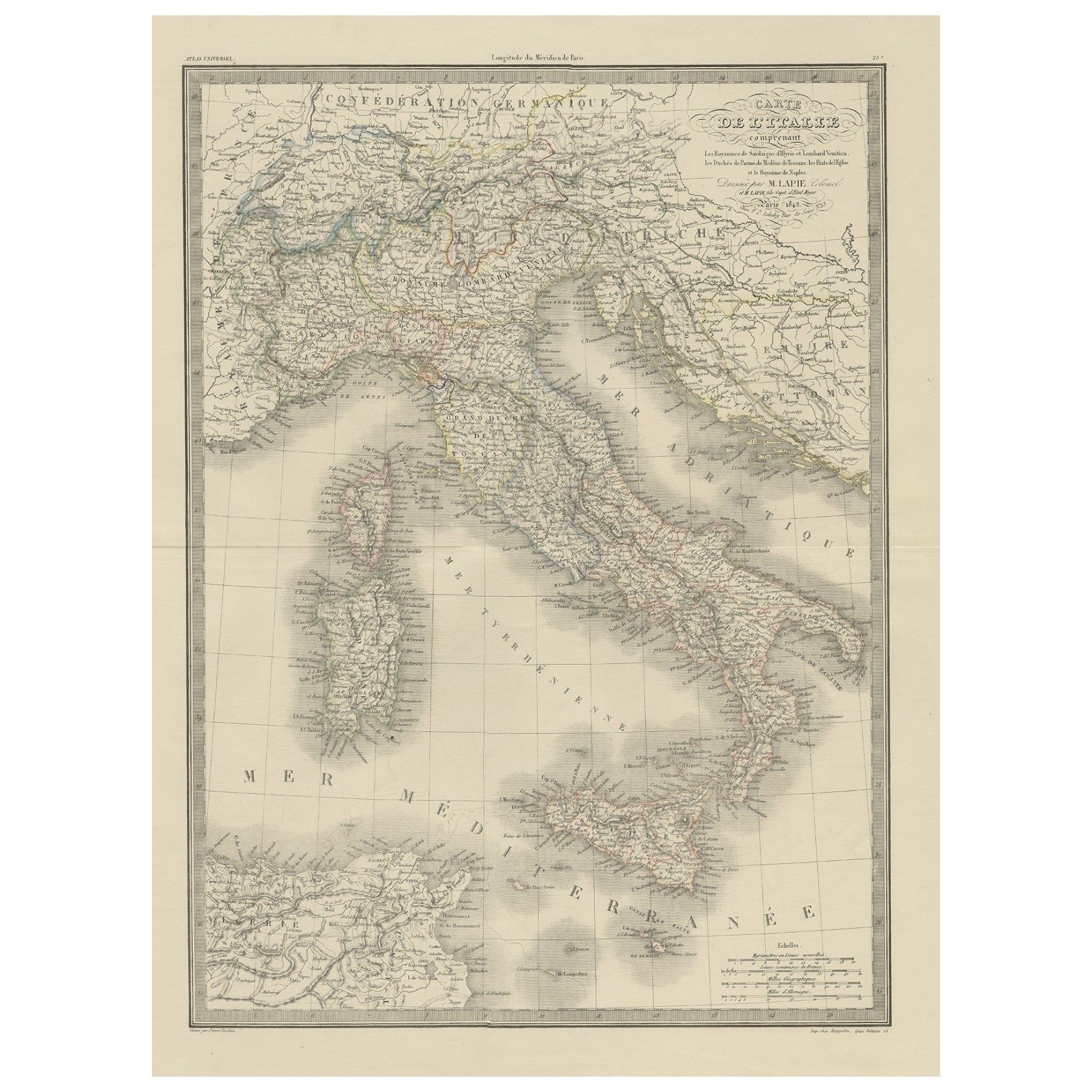
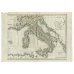
Antique Map of Italy from an Old French Atlas, 1842
Located in Langweer, NL
Antique map titled 'Carte de l'Italie'. Map of Italy.
This map originates from 'Atlas universel de géographie ancienne et moderne (..)' by Pierre M. Lapie and Alexandre E. Lapie. A...
Category
Antique 19th Century French Maps
Materials
Paper
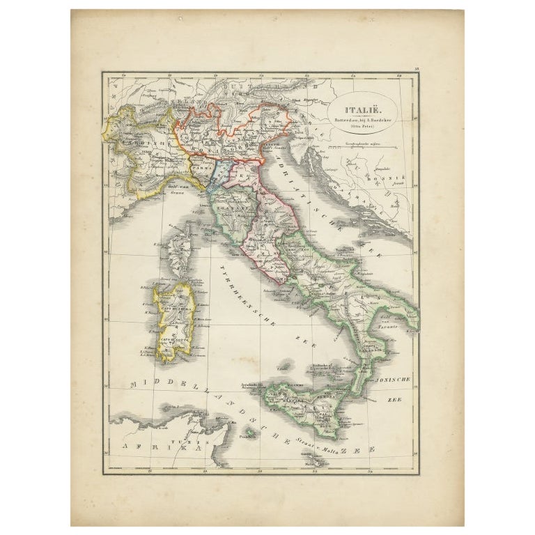
Antique Map of Italy with Hand-Colored Borders, 1852
Located in Langweer, NL
Antique map titled 'Italië'. Map of Italy. This map originates from 'School-Atlas van alle deelen der Aarde' by Otto Petri. Artists and Engravers: Published by A. Baedeker (Otto Petr...
Category
Antique 19th Century Maps
Materials
Paper

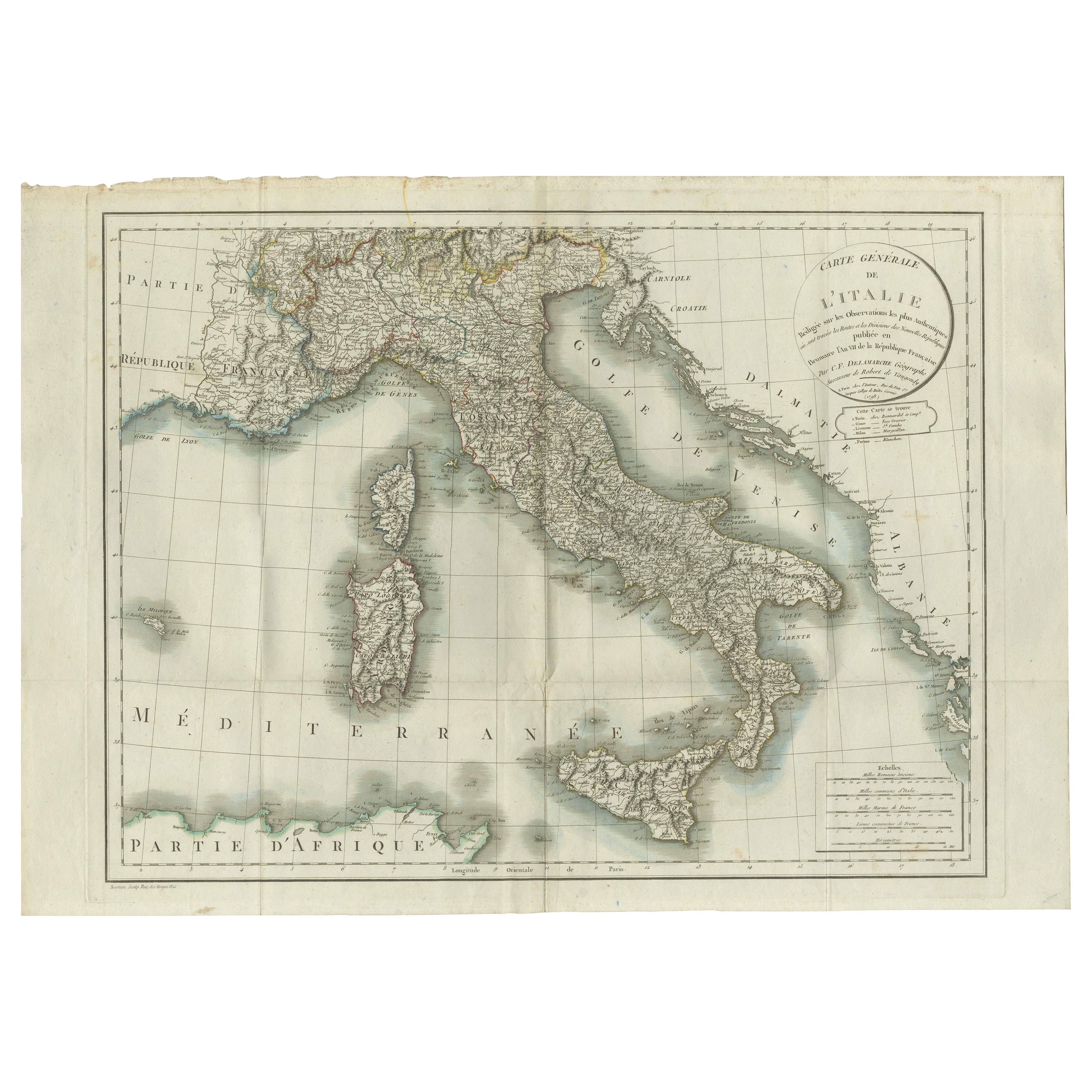
Map of Italy and Neighboring Regions by Delamarche – Antique Map, c.1800
Located in Langweer, NL
Antique Map of Italy and Surrounding Regions by Delamarche, circa 1800
This elegant and detailed antique map titled Carte Générale de l’Italie was drawn and engraved by the French g...
Category
Antique Early 1800s French Maps
Materials
Paper
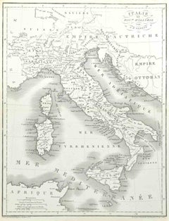
Antique Map of Italy by Pierre M. Lapie, Paper Print, Mid-19th Century
Located in Langweer, NL
Antique map titled 'Carte de l'Italie Ancienne'. Map of Italy. This map originates from 'Atlas universel de géographie ancienne et moderne (..)' by Pierre...
Category
Antique Mid-19th Century French Maps
Materials
Paper

$476 Sale Price
20% Off
You May Also Like
Large Original Antique Map of Italy. John Dower, 1861
Located in St Annes, Lancashire
Great map of Italy
Lithograph engraving by John Dower
Original colour
Published, 1861
Unframed
Good condition / repair to top right corner seen in last image
Category
Antique 1860s English Victorian Maps
Materials
Paper

Italy, Central and Southern Part. Century Atlas antique map
Located in Melbourne, Victoria
'The Century Atlas. Italy, Central and Southern Part.'
Original antique map, 1903.
Inset maps of Sicily and Naples.
Central fold as issued. Map name an...
Category
Early 20th Century Victorian More Prints
Materials
Lithograph

Italy, Northern Part. Century Atlas antique vintage map
Located in Melbourne, Victoria
'The Century Atlas. Italy, Northern Part.'
Original antique map, 1903.
Central fold as issued. Map name and number printed on the reverse corners.
Sheet 29.5cm by 40cm.
Category
Early 20th Century Victorian More Prints
Materials
Lithograph

Large Original Antique Map of The South of Italy. John Dower, 1861
Located in St Annes, Lancashire
Great map of the South of Italy
Lithograph engraving by John Dower
Original colour
Published, 1861
Unframed
Good condition
Free shipping
Category
Antique 1860s English Victorian Maps
Materials
Paper

Map of Italy - Etching by Pierre François Tardieu - 1837
Located in Roma, IT
Map of Italy is an Etching realized in 1837.
Good conditions.
The artwork is realized in a well-balanced composition. the artwork and belongs to the suite suite "AtlasBatt" realize...
Category
1830s Modern Figurative Prints
Materials
Lithograph
Antique Map of Italy Drawn
Engraved by R. Scott for Thomsons, Edinburgh 1814
Located in London, GB
This is a magnificent museum quality antique hand-coloured map of Italy, dating from 1814.
This historic and very rare antique map was drawn and engraved by R. Scott for Thomsons, New General Atlas, Edinburgh.
The map is very detailed and the various colours - yellow, grey and green - beautifully highlight the different natural and political divisions of Italy as it was before the Italian Unification...
Category
Antique 1810s Scottish Prints
Materials
Other

More Ways To Browse
Mid Century Modern Record Stand
Pair Of Danish Chairs
Veneer Dining Tables
1970 Italian Armchair
Furniture Uk
House Of Denmark Table And Chairs
Louis Marble Top Side Table
Antique Russian Rugs
Baker Furniture By
For Kids
Sterling Silver Flatware Set Service For 12
Tufted Bar
Pair Of French Antique Armchairs
1970s Brass Glass Coffee Table
Antique Column Base
Charles Rennie Mackintosh For Cassina
Glass Salt
Italian Modern Silver Vases