Items Similar to Antique Map of La Plata, Chili and Southern Brazil, 1849


Want more images or videos?
Request additional images or videos from the seller
1 of 10
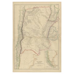
Antique Map of La Plata, Chili and Southern Brazil, 1849
$419.99
£311.24
€350
CA$574
A$624.84
CHF 331.67
MX$7,518.20
NOK 4,202.67
SEK 3,850.83
DKK 2,666.05
About the Item
Antique map titled 'La Plata - Chili and Southern Brazil'.
Old map of La Plata, Chili and Southern Brazil. This map originates from 'Sharpe's Corresponding Atlas (..)' by J. Sharpe.
Published by Chapman and Hall.
Condition: Good, age-related toning. Some creasing of the paper, please study image carefully.
Date: 1849
Overall size: 46.5 x 36 cm.
Image size: 41 x 32 cm.
- Dimensions:Height: 18.31 in (46.5 cm)Width: 14.18 in (36 cm)Depth: 0 in (0.01 mm)
- Materials and Techniques:
- Place of Origin:
- Period:
- Date of Manufacture:1849
- Condition:Condition: Good, age-related toning. Some creasing of the paper, please study image carefully.
- Seller Location:Langweer, NL
- Reference Number:Seller: BG-12038-21stDibs: LU3054326540332
About the Seller
5.0
Recognized Seller
These prestigious sellers are industry leaders and represent the highest echelon for item quality and design.
Platinum Seller
Premium sellers with a 4.7+ rating and 24-hour response times
Established in 2009
1stDibs seller since 2017
2,819 sales on 1stDibs
Typical response time: 1 hour
- ShippingRetrieving quote...Shipping from: Langweer, Netherlands
- Return Policy
More From This Seller
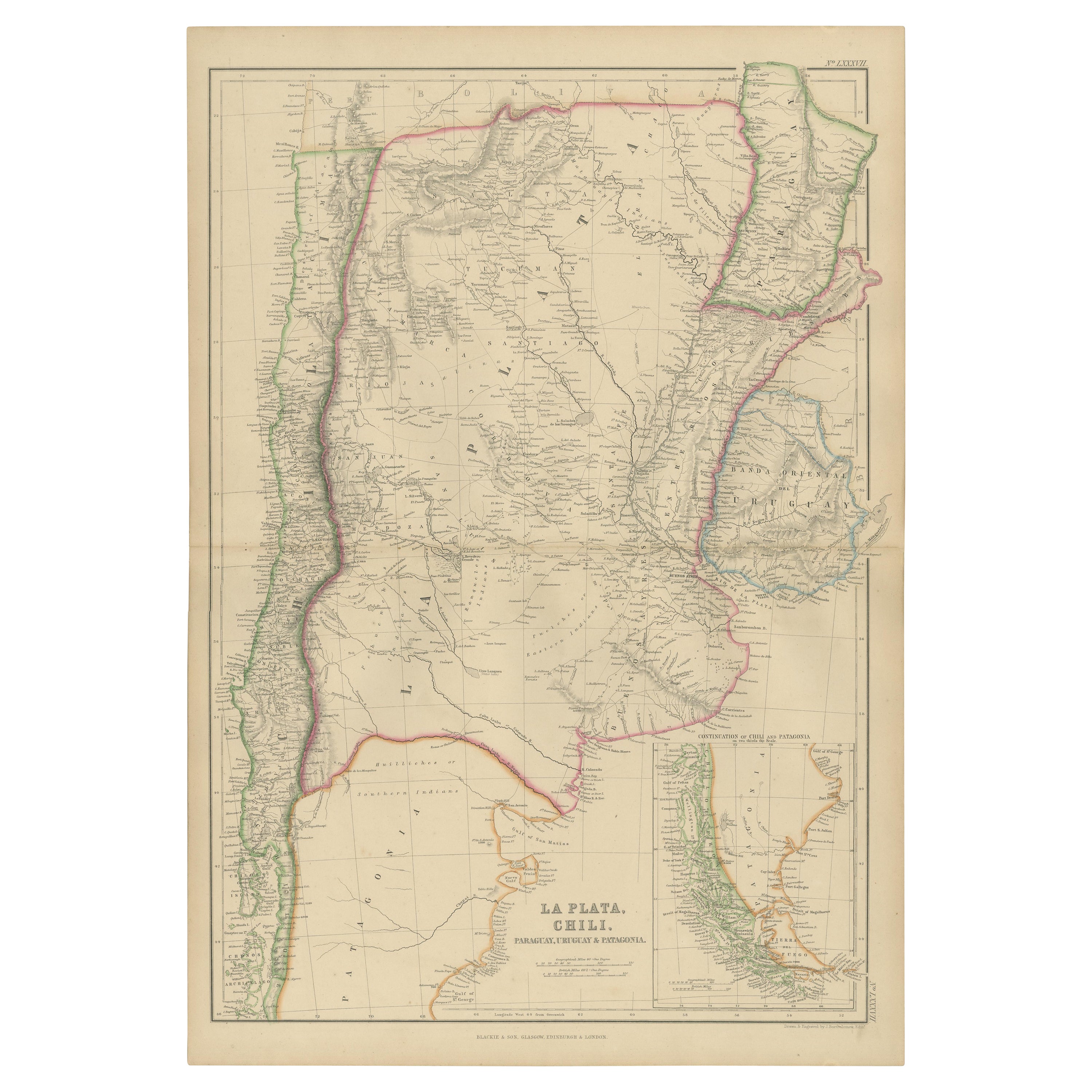
View AllAntique Map of La Plata, Chili, by W. G. Blackie, 1859
Located in Langweer, NL
Antique map titled 'La Plata, Chili, Paraguay, Uruguay and Patagonia'.
Original antique map of La Plata, Chili, Paraguay, Uruguay and Patagonia with inset m...
Category
Antique Mid-19th Century Maps
Materials
Paper
$239 Sale Price
20% Off
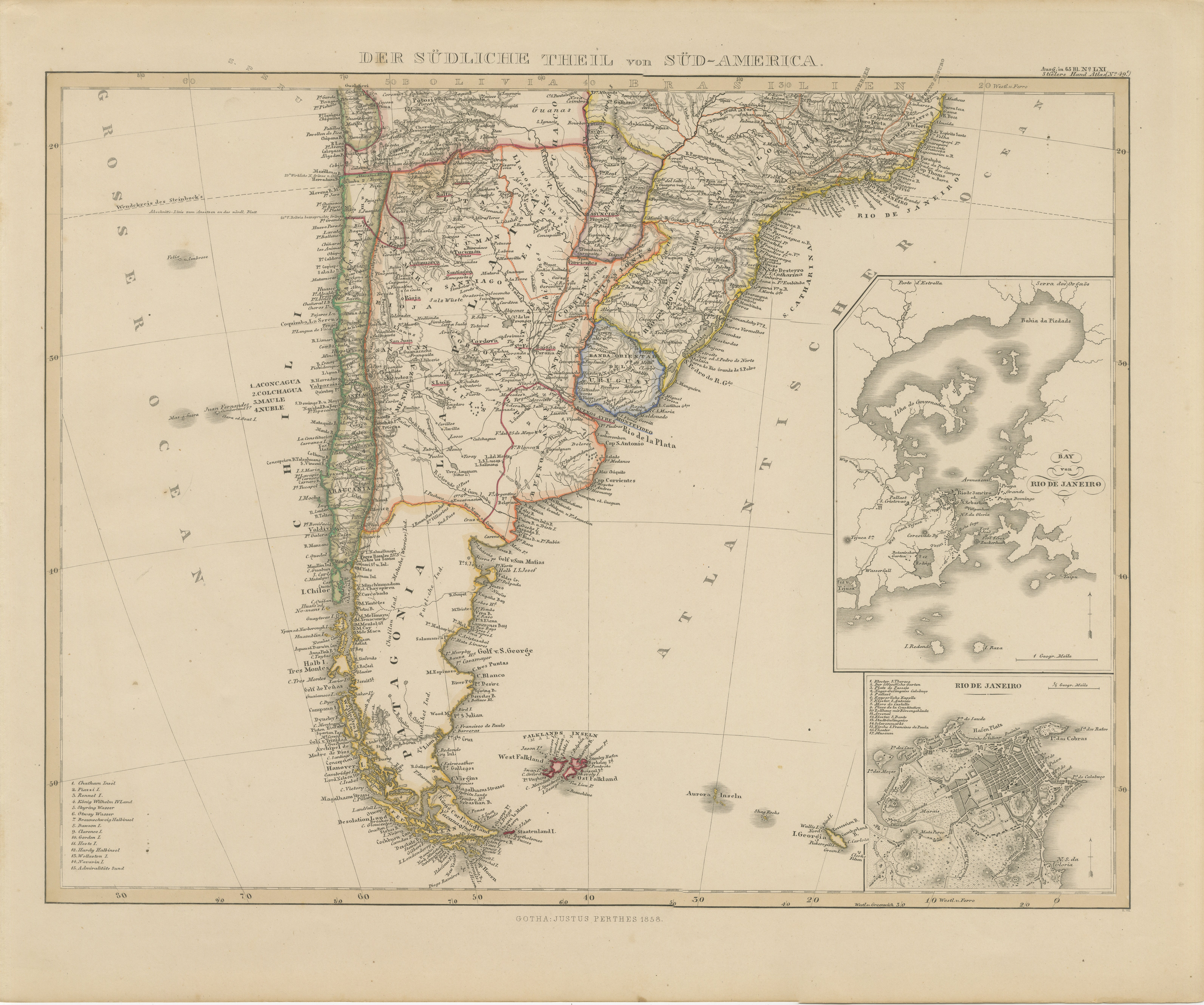
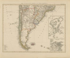
1857 Map of Southern South America – Argentina, Chile, Rio de Janeiro
Located in Langweer, NL
1857 Map of Southern South America – Argentina, Chile, Rio de Janeiro
Original antique map titled “Der Südliche Theil von Süd-America” (The Southern Part of South America), publishe...
Category
Antique Mid-19th Century German Maps
Materials
Paper
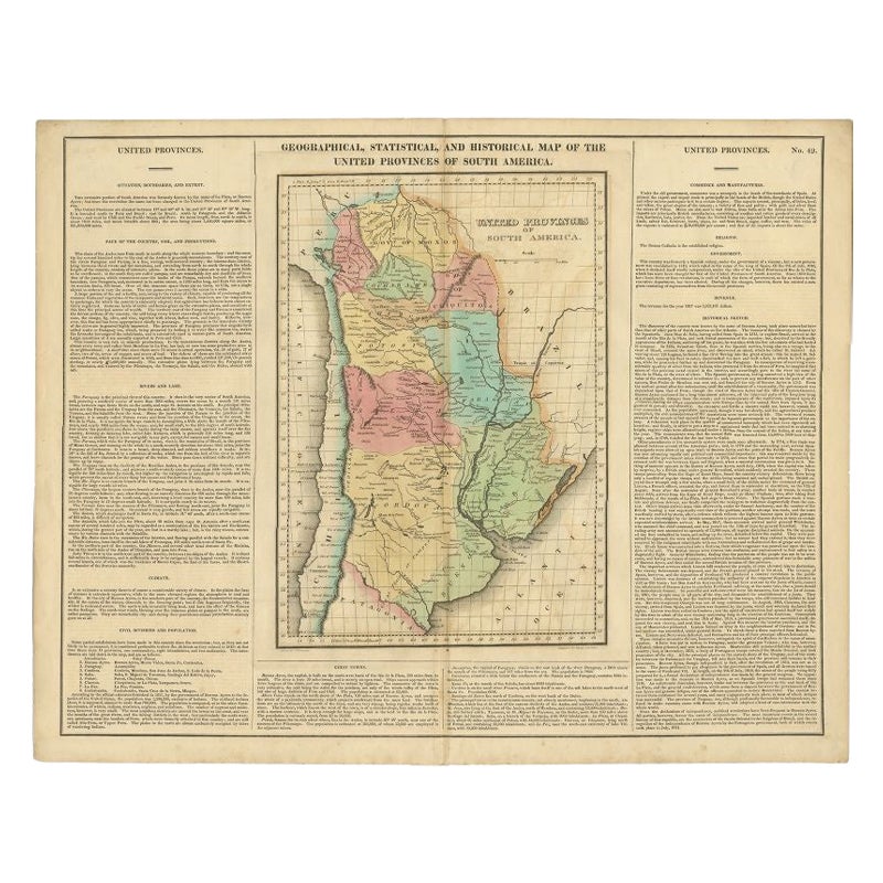
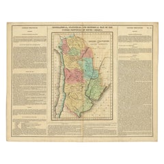
Antique Map of South America by Finlayson, 1822
Located in Langweer, NL
Antique map titled 'Geographical, Statistical and Historical Map of the United Provinces of South America'. This map depicts part of South America (including part of Brazil and Chili...
Category
Antique 19th Century Maps
Materials
Paper
$257 Sale Price
20% Off
Original Antique Map of Peru in South America, 1875
Located in Langweer, NL
Antique map titled 'Carte générale du Pérou'. Large map of Peru. This map originates from 'Atlas de Géographie Moderne Physique et Politique' by A. Levasse...
Category
Antique Late 19th Century Maps
Materials
Paper

$335 Sale Price
20% Off
Antique Map of South America by Lapie
1842
Located in Langweer, NL
Antique map titled 'Carte Générale de l'Amérique Meridionale'. Map of South America. This map originates from 'Atlas universel de géographie ancienne et moderne (..)' by Pierre M. La...
Category
Antique Mid-19th Century Maps
Materials
Paper

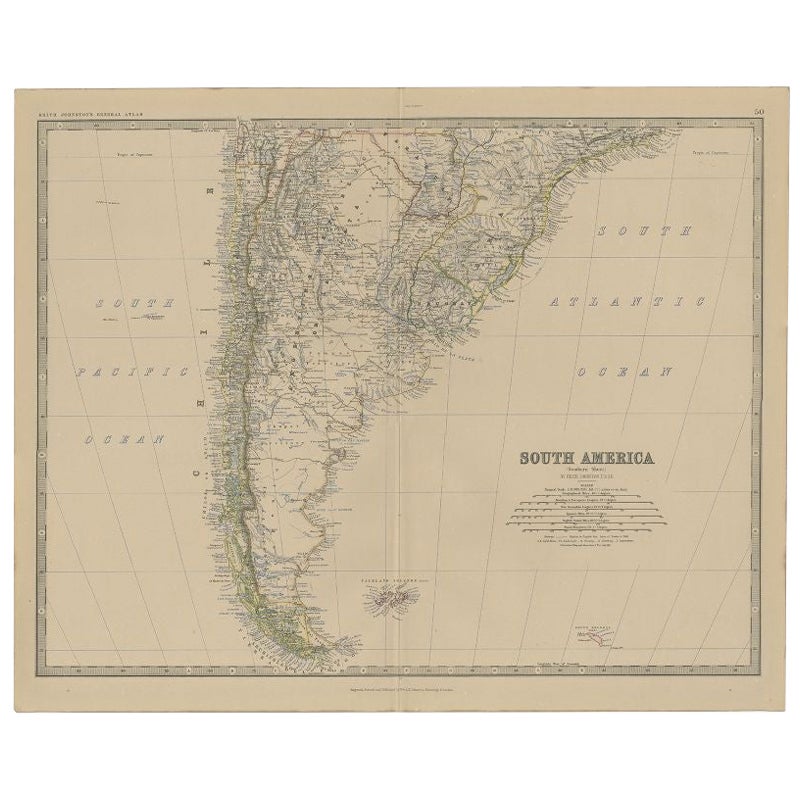
Antique Map of South America, Southern Part, 1882
Located in Langweer, NL
Antique map titled 'South America'. Old map of South America. This map originates from 'The Royal Atlas of Modern Geography, Exhibiting, in a Series of Entirely Original and Authenti...
Category
Antique 19th Century Maps
Materials
Paper
You May Also Like
Original Antique Decorative Map of South America-West Coast, Fullarton, C.1870
Located in St Annes, Lancashire
Great map of Chili, Peru and part of Bolivia
Wonderful figural border
From the celebrated Royal Illustrated Atlas
Lithograph. Original color.
Published by Fullarton, Edi...
Category
Antique 1870s Scottish Maps
Materials
Paper

South America, Eastern Part. Century Atlas antique vintage map
Located in Melbourne, Victoria
'The Century Atlas. South America. Eastern Part'
Original antique map, 1903.
Inset map 'Rio de Janeiro and Vicinity'.
Central fold as issued. Map name and number printed on the rev...
Category
Early 20th Century Victorian More Prints
Materials
Lithograph

Carte du Bresil, antique 1860s engraved map of Brazil
Located in Melbourne, Victoria
'Carte du Bresil'
Engraving with original outline colouring, circa 1860, by Alexandre Vuillemin, published in Paris.
31cm by 41cm (sheet)
21.5cm by 31.5cm (image)
Category
Late 19th Century Victorian More Prints
Materials
Lithograph

South America, North-West Part. Century Atlas antique vintage map
Located in Melbourne, Victoria
'The Century Atlas. South America, North-West Part'
Original antique map, 1903.
Central fold as issued. Map name and number printed on the reverse corners.
Sheet 40cm by 29.5cm.
Category
Early 20th Century Victorian More Prints
Materials
Lithograph

Original Antique Map of South America. C.1780
Located in St Annes, Lancashire
Great map of South America
Copper-plate engraving
Published C.1780
Two small worm holes to left side of map
Unframed.
Category
Antique Early 1800s English Georgian Maps
Materials
Paper

Charte von Sud-America (Map of South America) - Etching with Hand-Drawn Outlines
Located in Soquel, CA
Map of south America, engraved by Franz Pluth (Czech, 1800-1871), from the book "Neueste Länder - und Völkerkunde, ein geographisches Lesebuch für alle Stände" by Linder, F. L. (Prag...
Category
1820s Other Art Style More Prints
Materials
Paper, Printer s Ink, Etching

More Ways To Browse
Map Of Middle East
17th Century American Furniture
Afghanistan Map
Antique Celestial Maps
Antique Maps Virginia
Hand Drawn Map
Map Of Israel
Map Of Poland
Sicily Map
Used Durham Furniture
Antique Maps Of Israel
Antique Maps Of Russian Empire
J C Walker Map
Massachusetts Antiques
Persian Maps
Afghanistan Antique Map
Antique Furniture Delaware
Antique Furniture Wisconsin