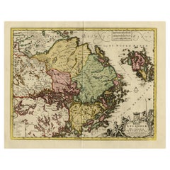
Items Similar to Antique Map of Lapland Covering all of Sweden around the Gulf of Bothnia, 1714

Want more images or videos?
Request additional images or videos from the seller
1 of 5
Antique Map of Lapland Covering all of Sweden around the Gulf of Bothnia, 1714
$816.73
£605.53
€680
CA$1,121.99
A$1,224.84
CHF 644.89
MX$14,672.11
NOK 8,247.92
SEK 7,530.49
DKK 5,181.35
About the Item
Antique map titled 'Carte de la Laponie Suedoise (..)'. Includes an inset map of Lapland covering all of Sweden around the Gulf of Bothnia. A series of small vignettes in the lower section of the plate depicts the customs of the Lapps, their nomadic existence and their favorite pastimes. Artists and Engravers: Henri Abraham Chatelain (1684-1743) was a Huguenot pastor of Parisian origins. Chatelain proved a successful businessman, creating lucrative networks in London, The Hague, and then Amsterdam. He is most well known for the 'Atlas Historique', published in seven volumes between 1705 and 1720.
Artist: Henri Abraham Chatelain (1684-1743) was a Huguenot pastor of Parisian origins. Chatelain proved a successful businessman, creating lucrative networks in London, The Hague, and then Amsterdam. He is most well known for the 'Atlas Historique', published in seven volumes between 1705 and 1720.
Condition: Good, toning of tape on verso. Please study image carefully.
Date: 1714
Overall size: 22 x 37 cm.
Image size: 21 x 35.5 cm.
- Dimensions:Height: 8.67 in (22 cm)Width: 14.57 in (37 cm)Depth: 0 in (0.01 mm)
- Materials and Techniques:
- Period:
- Date of Manufacture:1714
- Condition:Condition: Good, toning of tape on verso. Please study image carefully.
- Seller Location:Langweer, NL
- Reference Number:Seller: BG-11215-11stDibs: LU3054326362862
About the Seller
5.0
Recognized Seller
These prestigious sellers are industry leaders and represent the highest echelon for item quality and design.
Platinum Seller
Premium sellers with a 4.7+ rating and 24-hour response times
Established in 2009
1stDibs seller since 2017
2,811 sales on 1stDibs
Typical response time: 1 hour
- ShippingRetrieving quote...Shipping from: Langweer, Netherlands
- Return Policy
More From This Seller
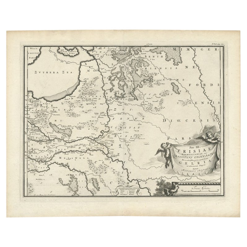
View AllAntique Map of the Dutch Province of Gelderland, 1725
Located in Langweer, NL
Antique map titled 'Frisiae Haereditariae seu Trajectini Episcopatus Gelria?. Map of the province of Gelderland, the Netherlands. This map originates from 'Atlas Descriptio, secundum...
Category
Antique 18th Century Maps
Materials
Paper
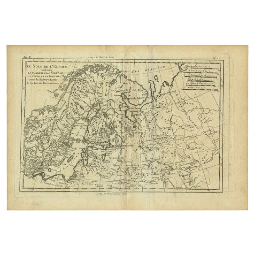
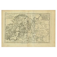
Antique Map of Northern Europe by Bonne, c.1780
Located in Langweer, NL
Antique map titled 'Le Nord de L'Europe, Contenant Le Danemark, La Norwege; La Suede et La Laponie avec la Majeure Partie de al Russie Europeenne.' Map of Northern Europe and Europea...
Category
Antique 18th Century French Maps
Materials
Paper
$113 Sale Price
30% Off
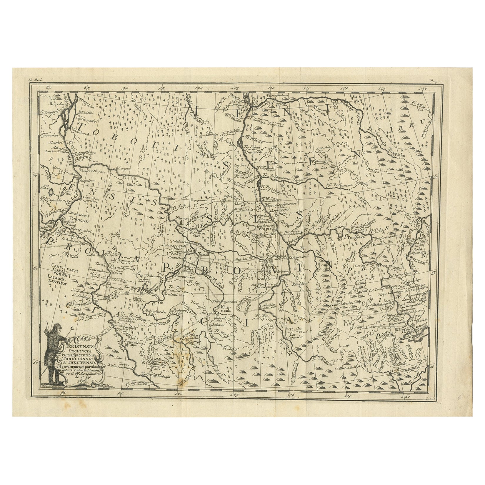
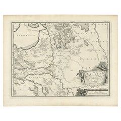
Antique Map of Part of Russia, c.1740
Located in Langweer, NL
Antique map titled 'Ienisensis Provinicia cum adjacentibus Toboliensis & Irkutensis'. Old map of part of Russia including the city of Tobolsk and others. Source unknown, to be determ...
Category
Antique 18th Century Maps
Materials
Paper
$131 Sale Price
20% Off
Southern Sweden Provinces Map – Homann’s ‘Nova Tabula Scaniae’, ca. 1730
Located in Langweer, NL
Southern Sweden Provinces Map – Homann’s ‘Nova Tabula Scaniae’, ca. 1730
Antique map titled 'Nova Tabula Scaniae in qua sunt Scania, Blekingia et Hallandia'. This decorative map sho...
Category
Antique Mid-18th Century German Maps
Materials
Paper

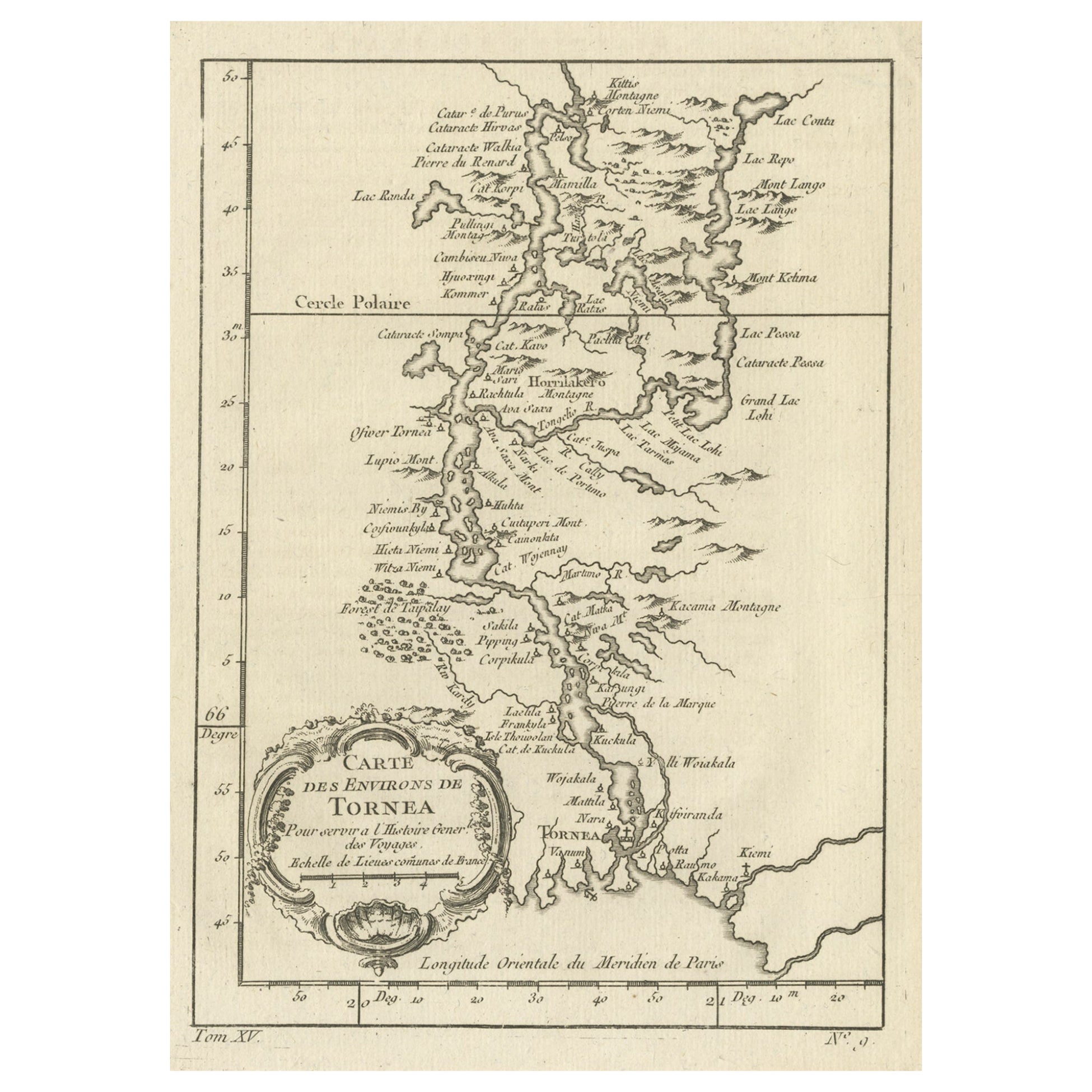
Original Antique Map of the Region of Torneå
Tornio
in Northern Finland, 1759
Located in Langweer, NL
Antique map titled 'Carte des Environs de Tornea'.
Original antique map of the region of Torneå (or Tornio), in northern Finland. This print originates from volume 19 of 'Histoir...
Category
Antique 1750s Maps
Materials
Paper
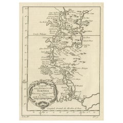
$307 Sale Price
20% Off
Original and Decorative Antique Engraved Map of Finland and Sweden, ca.1720
Located in Langweer, NL
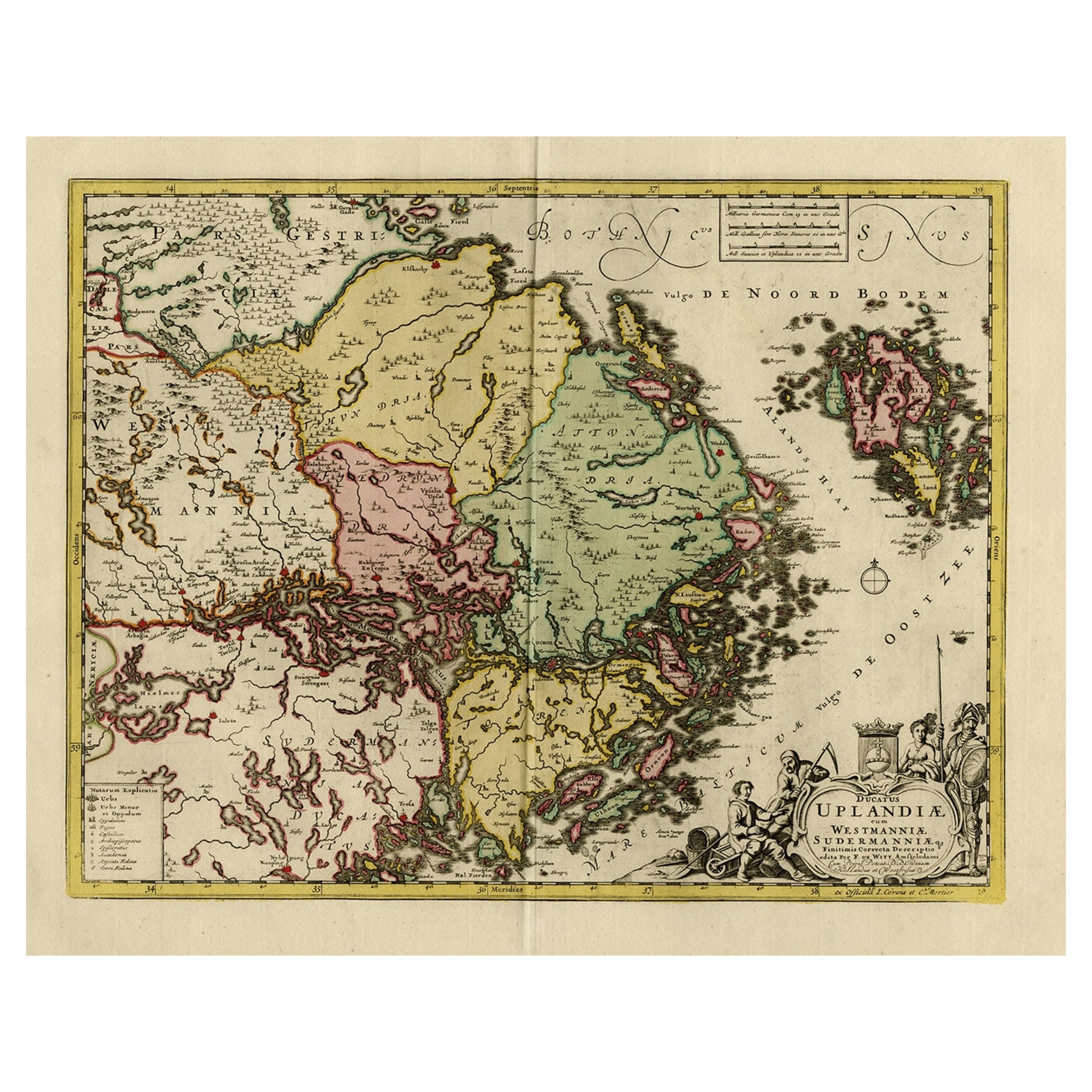
Antique map titled 'Ducatus Uplandiae cum Westmanniae Sudermanniae (..)'
This map shows parts of Finland and Sweden. Originally published by Frederick de Wit in the late 1600's. ...
Category
Antique 1720s Maps
Materials
Paper
$1,395 Sale Price
20% Off
You May Also Like
1714 Henri Chatelain "Nouvelle Carte Des Etatas Du Grand.Duc De Mos Moscovie Eur
Located in Norton, MA
A 1714 Henri Chatelain map, entitled
"Nouvelle Carte Des Etatas Du Grand Duc De Moscovie En Europe,"
Ricb001
Henri Abraham Chatelain (1684-1743) was a Huguenot pastor of Parisi...
Category
Antique Early 18th Century Dutch Maps
Materials
Paper

1657 Janssonius Map of Vermandois and Cappelle, Ric. A-004
Located in Norton, MA
1657 Janssonius map of
Vermandois and Cappelle
Ric.a004
Description: Antique map of France titled 'Descriptio Veromanduorum - Gouvernement de la Cappelle'. Two detailed maps o...
Category
Antique 17th Century Unknown Maps
Materials
Paper

1646 Jansson Map Entitled "Procinvia Connactiae, " Ric.a006
Located in Norton, MA
1646 Jansson map entitled
"Procinvia connactiae,"
Ric.a006
Description: The PROVINCE of CONNAVGT 490 x 380From vol 4 of Jansson's Atlas Novus 1646, published in Amsterdam with...
Category
Antique 17th Century Unknown Maps
Materials
Paper

Original Antique Map of Sweden, Engraved by Barlow, 1806
Located in St Annes, Lancashire
Great map of Sweden
Copper-plate engraving by Barlow
Published by Brightly & Kinnersly, Bungay, Suffolk. 1806
Unframed.
Category
Antique Early 1800s English Maps
Materials
Paper

1633 Map "La Souverainete De Sedan Et De Raucourt, Et La Prevoste Ric0011
Located in Norton, MA
1653 map entitled
"La Souverainete de Sedan et de Raucourt, et la Prevoste de Doncheri,"
Ric0011
Description:
Lovely map centered on Sedan and Doncheri and the Meuze River fr...
Category
Antique 17th Century Dutch Maps
Materials
Paper

1635 Willem Blaeu Map of Northern France"Comitatvs Bellovacvm" Ric.a08
Located in Norton, MA
1635 Willem Blaeu map of northern France, entitled.
"Comitatvs Bellovacvm Vernacule Beavvais,"
Colored
Ric.a008
“COMITATVS BELLOVACVM…” Amsterdam: W...
Category
Antique 17th Century Unknown Maps
Materials
Paper

More Ways To Browse
Antique Maps Of Cape Of Good Hope
Antique Maps Of Texas
Antique Virginia Furniture
Otto Petri
American West Antiques
Antique Furniture Brunswick
Antique Map Ceylon
Antique Map Of The Philippines
Antique Mississippi Map
Celestial Map
Map Of Middle East
17th Century American Furniture
Afghanistan Map
Antique Celestial Maps
Antique Maps Virginia
Hand Drawn Map
Map Of Israel
Map Of Poland