Items Similar to Antique Map of the Lorraine Region, c.1760


Want more images or videos?
Request additional images or videos from the seller
1 of 5
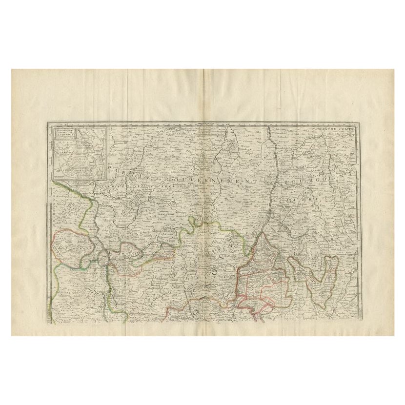
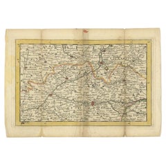
Antique Map of the Lorraine Region, c.1760
$262.15
£195.26
€220
CA$361
A$392.94
CHF 208.21
MX$4,725.73
NOK 2,647.29
SEK 2,425.95
DKK 1,676.25
About the Item
Untitled antique map of the Lorraine region, France. A cultural and historical region in north-eastern France, now located in the administrative region of Grand Est. Lorraine's name stems from the medieval kingdom of Lotharingia, which in turn was named for either Emperor Lothair I or King Lothair II. It later was ruled as the Duchy of Lorraine before the Kingdom of France annexed it in 1766.
Artists and Engravers: Anonymous. Most likely part of a two sheet map.
Condition: Fair/good, general age-related toning. Some wear and defects. Blank verso. Please study image carefully.
Date: c.1760
Overall size: 72 x 53.5 cm.
Image size: 64 x 49.5 cm.
We sell original antique maps to collectors, historians, educators and interior decorators all over the world. Our collection includes a wide range of authentic antique maps from the 16th to the 20th centuries. Buying and collecting antique maps is a tradition that goes back hundreds of years. Antique maps have proved a richly rewarding investment over the past decade, thanks to a growing appreciation of their unique historical appeal. Today the decorative qualities of antique maps are widely recognized by interior designers who appreciate their beauty and design flexibility. Depending on the individual map, presentation, and context, a rare or antique map can be modern, traditional, abstract, figurative, serious or whimsical. We offer a wide range of authentic antique maps for any budget.
- Dimensions:Height: 21.07 in (53.5 cm)Width: 28.35 in (72 cm)Depth: 0 in (0.01 mm)
- Materials and Techniques:
- Period:
- Date of Manufacture:circa 1760
- Condition:
- Seller Location:Langweer, NL
- Reference Number:Seller: BG-12390-161stDibs: LU3054327829312
About the Seller
5.0
Recognized Seller
These prestigious sellers are industry leaders and represent the highest echelon for item quality and design.
Platinum Seller
Premium sellers with a 4.7+ rating and 24-hour response times
Established in 2009
1stDibs seller since 2017
2,824 sales on 1stDibs
Typical response time: 1 hour
- ShippingRetrieving quote...Shipping from: Langweer, Netherlands
- Return Policy
More From This Seller
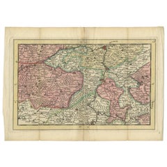
View AllAntique Map of the Lorraine Region
France
(c.1735)
Located in Langweer, NL
Antique map titled 'Carte du Duche de Lorraine - Kaart van Lotharingen'. A detailed map of the Duchy of Lorraine. The map is surrounded by thirteen vignette bird-eye view of fortifie...
Category
Antique Mid-18th Century Maps
Materials
Paper

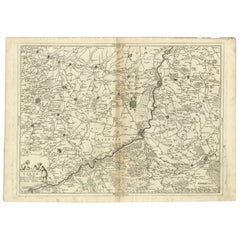
Antique Map of the Region of Lyonnais by Nolin, 1697
Located in Langweer, NL
Untitled map of the French Province of Lyonnais, with its capital at Lyon, on the upper Loire and Rhone rivers. This map is a single sheet and part of a two sheet map titled 'The Gen...
Category
Antique 17th Century Maps
Materials
Paper
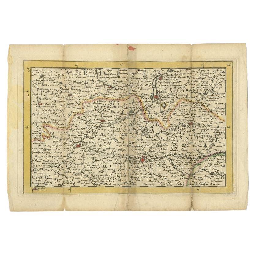
Antique Map of the Region of Soissons in France, 1737
Located in Langweer, NL
Untitled map of the region of Soissons, France. This map originates from 'Nieuw en beknopt Kaart-Boekje vertoonende de XVII. Nederlandse Provintien (..)'.
Artists and Engravers: A...
Category
Antique 18th Century Maps
Materials
Paper
Antique Map of the Region of Namur by De Lat, 1737
Located in Langweer, NL
Untitled map of the region of Namur, Charlemont, Rochefort and surroundings, Belgium. This map originates from 'Nieuw en beknopt Kaart-Boekje vertoonende de XVII. Nederlandse Provint...
Category
Antique 18th Century Maps
Materials
Paper
Antique Map of the Limoges Region in France, c.1690
Located in Langweer, NL
Antique map titled 'Le Diocèse de Limoges'. Large map of the Limoges region, France.
The map is dedicated to the bishop of Limoges, Antoine de Charpin.
Artists and Engravers:...
Category
Antique 17th Century Maps
Materials
Paper

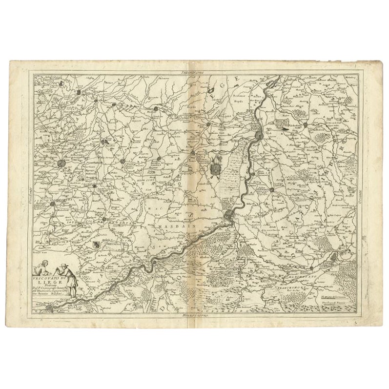
Antique Map of the Region of Liege by Coronelli, 1690
By Vincenzo Coronelli
Located in Langweer, NL
Antique map titled 'Vescovato di Liege (..)'. Map of the Belgium area centered on Liege and the course of Meuse/Maas River. Also depicts the cities of Maastricht, Namur and Tienen. O...
Category
Antique 17th Century Maps
Materials
Paper
You May Also Like
1771 Bonne Map of Poitou, Touraine and Anjou, France, Ric.a015
Located in Norton, MA
1771 Bonne Map of Poitou,
Touraine and Anjou, France
Ric.a015
1771 Bonne map of Potiou, Touraine and Anjou entitled "Carte des Gouvernements D'Anjou et du Saumurois, de la Touraine, du Poitou,du Pays d'aunis, Saintonge?Angoumois,"
Carte des gouvernements d'Anjou et du Saumurois, de la Touraine, du Poitou, du Pays d'Aunis, Saintonge-Angoumois. Projettee et assujettie au ciel par M. Bonne, Hyd. du Roi. A Paris, Chez Lattre, rue St. Jacques a la Ville de Bord(ea)ux. Avec priv. du Roi. 1771. Arrivet inv. & sculp., Atlas moderne ou collection de cartes sur toutes...
Category
Antique 17th Century Unknown Maps
Materials
Paper

1752 Vaugoundy Map of Flanders : Belgium, France, and the Netherlands, Ric.a002
Located in Norton, MA
Large Vaugoundy Map of Flanders:
Belgium, France, and the Netherlands
Colored -1752
Ric.a002
Description: This is a 1752 Didier Robert de Vaugondy map of Flanders. The map de...
Category
Antique 17th Century Unknown Maps
Materials
Paper

1657 Janssonius Map of Vermandois and Cappelle, Ric. A-004
Located in Norton, MA
1657 Janssonius map of
Vermandois and Cappelle
Ric.a004
Description: Antique map of France titled 'Descriptio Veromanduorum - Gouvernement de la Cappelle'. Two detailed maps o...
Category
Antique 17th Century Unknown Maps
Materials
Paper

Li Governi di Borgogna - Ancient Map - 1777
Located in Roma, IT
Li Governi di Borgogna is an original black and white etching on paper, printed by Antonio Zatta in Venice, 1777.
Original Title: Li Governi di Borgogna della Franca Contea e del Ly...
Category
1770s Modern Landscape Prints
Materials
Etching

Antique French Map of Asia Including China Indoneseia India, 1783
Located in Amsterdam, Noord Holland
Very nice map of Asia. 1783 Dedie au Roy.
Additional information:
Country of Manufacturing: Europe
Period: 18th century Qing (1661 - 1912)
Condition: Overall Condition B (Good Used)...
Category
Antique 18th Century European Maps
Materials
Paper

$486 Sale Price
40% Off
1839 Map of Karte Des "Russischen Reiches in Europa Und Asien" Ric.R0013
Located in Norton, MA
1839 map of Karte Des
"Russischen Reiches in Europa and Asien"
Ric.r013
Map of the European and Asian parts of Russian Empire. Karte der Russischen Reiches in Europa und Asien...
Category
Antique 19th Century Unknown Maps
Materials
Paper

More Ways To Browse
Antique Map Vietnam
Antique Maps Colorado
Antique Maps Of Kansas
Antique Marine Maps
Antique World Globe Map
Garde Corps
Marie Galante
Nevada Antique Map
Nova Scotia Antique Furniture
Patagonia Map
Antique Furniture South Carolina
Antique Map Of Boston
Antique Map Of Venice
Antique Maps Of Maryland
Charlotte Reine
Cleveland Antique Furniture
Gambia Antique Map
Johann Baptist Homann On Sale