Items Similar to Antique Map of Maine et Loire ‘France’ by V. Levasseur, 1854

Want more images or videos?
Request additional images or videos from the seller
1 of 6
Antique Map of Maine et Loire ‘France’ by V. Levasseur, 1854
$170.86
$213.5820% Off
£127.56
£159.4520% Off
€144
€18020% Off
CA$237.38
CA$296.7320% Off
A$255.34
A$319.1720% Off
CHF 136.46
CHF 170.5820% Off
MX$3,009.71
MX$3,762.1420% Off
NOK 1,720.44
NOK 2,150.5520% Off
SEK 1,572.81
SEK 1,966.0120% Off
DKK 1,097.44
DKK 1,371.8020% Off
About the Item
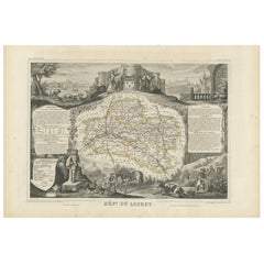
Antique map titled 'Dépt. de Maine et Loire'. Map of the French department of Maine et Loire, France. This area of France is part of the Loire Valley wine region, where nearly every wine imaginable is produced. Maine et Loire itself is home to the largest vineyard in the Loire Valley. It is also known for its production of Port-Salut, a distinctive, semi-soft cow’s milk cheese. This map originates from ‘Atlas National de la France Illustré’. Published by A. Combette, Paris, 1854.
- Dimensions:Height: 13.98 in (35.5 cm)Width: 20.67 in (52.5 cm)Depth: 0.02 in (0.5 mm)
- Materials and Techniques:
- Period:
- Date of Manufacture:1854
- Condition:General age-related toning. Please study image carefully.
- Seller Location:Langweer, NL
- Reference Number:Seller: BG-12919-491stDibs: LU3054323172802
About the Seller
5.0
Recognized Seller
These prestigious sellers are industry leaders and represent the highest echelon for item quality and design.
Platinum Seller
Premium sellers with a 4.7+ rating and 24-hour response times
Established in 2009
1stDibs seller since 2017
2,836 sales on 1stDibs
Typical response time: 1 hour
- ShippingRetrieving quote...Shipping from: Langweer, Netherlands
- Return Policy
More From This Seller
View AllAntique Map of Loire ‘France’ by V. Levasseur, 1854
Located in Langweer, NL
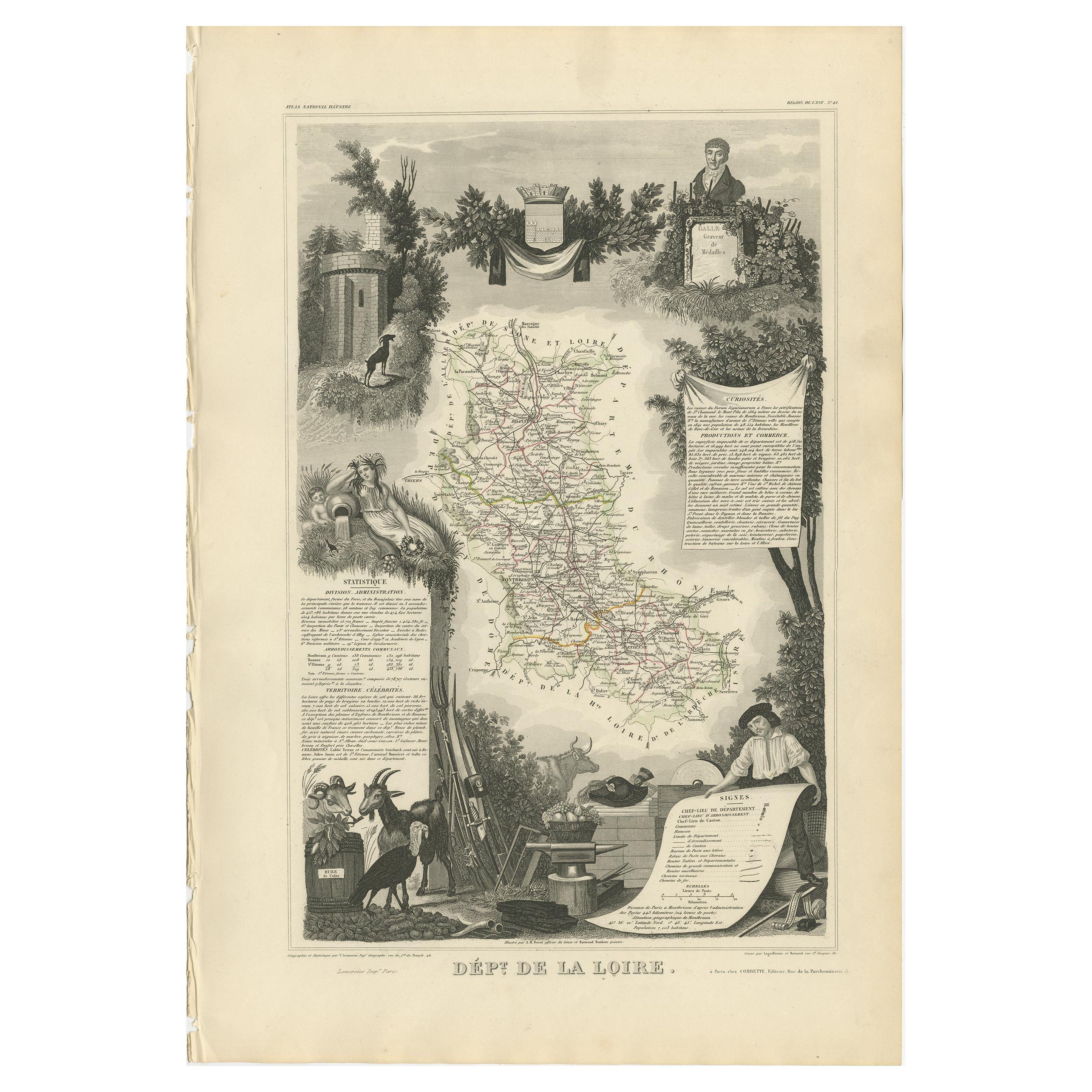
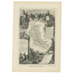
Antique map titled 'Dépt. de la Loire'. Map of the French department of Loire, France. This area of France is part of the Loire Valley wine growing region...
Category
Antique Mid-19th Century Maps
Materials
Paper
$189 Sale Price
20% Off
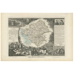
Antique Map of Loire Inferieure ‘France’ by V. Levasseur, 1854
Located in Langweer, NL
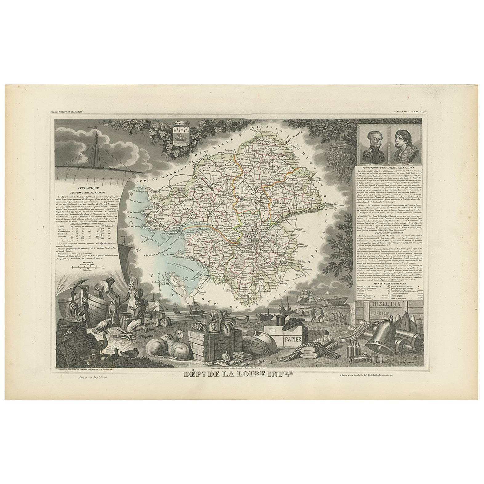
Antique map titled 'Dépt. de la Loire Inferieure'. Map of the French department of Loire Inferieure, France (currently known as Loire-Atlantique.) This area of France is part of the ...
Category
Antique Mid-19th Century Maps
Materials
Paper
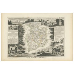
Antique Map of Ille et Vilaine ‘France’ by V. Levasseur, 1854
Located in Langweer, NL
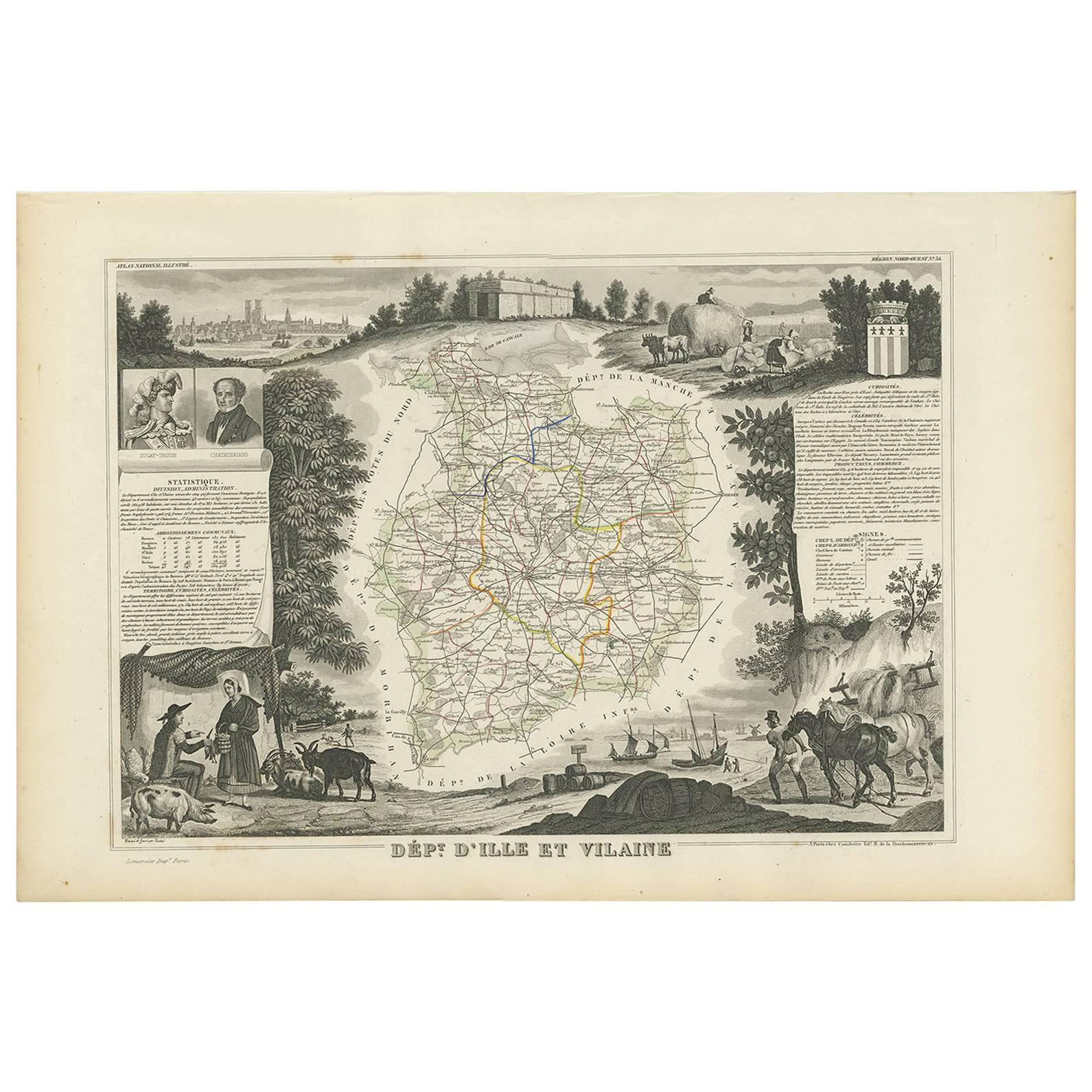
Antique map titled 'Dépt. d'Ille et Vilaine'. Map of the French department of Ille et Vilaine. France. Its coastal area is famous for its seafood, and especially its oysters. The reg...
Category
Antique Mid-19th Century Maps
Materials
Paper
Antique Map of Loiret ‘France’ by V. Levasseur, 1854
Located in Langweer, NL
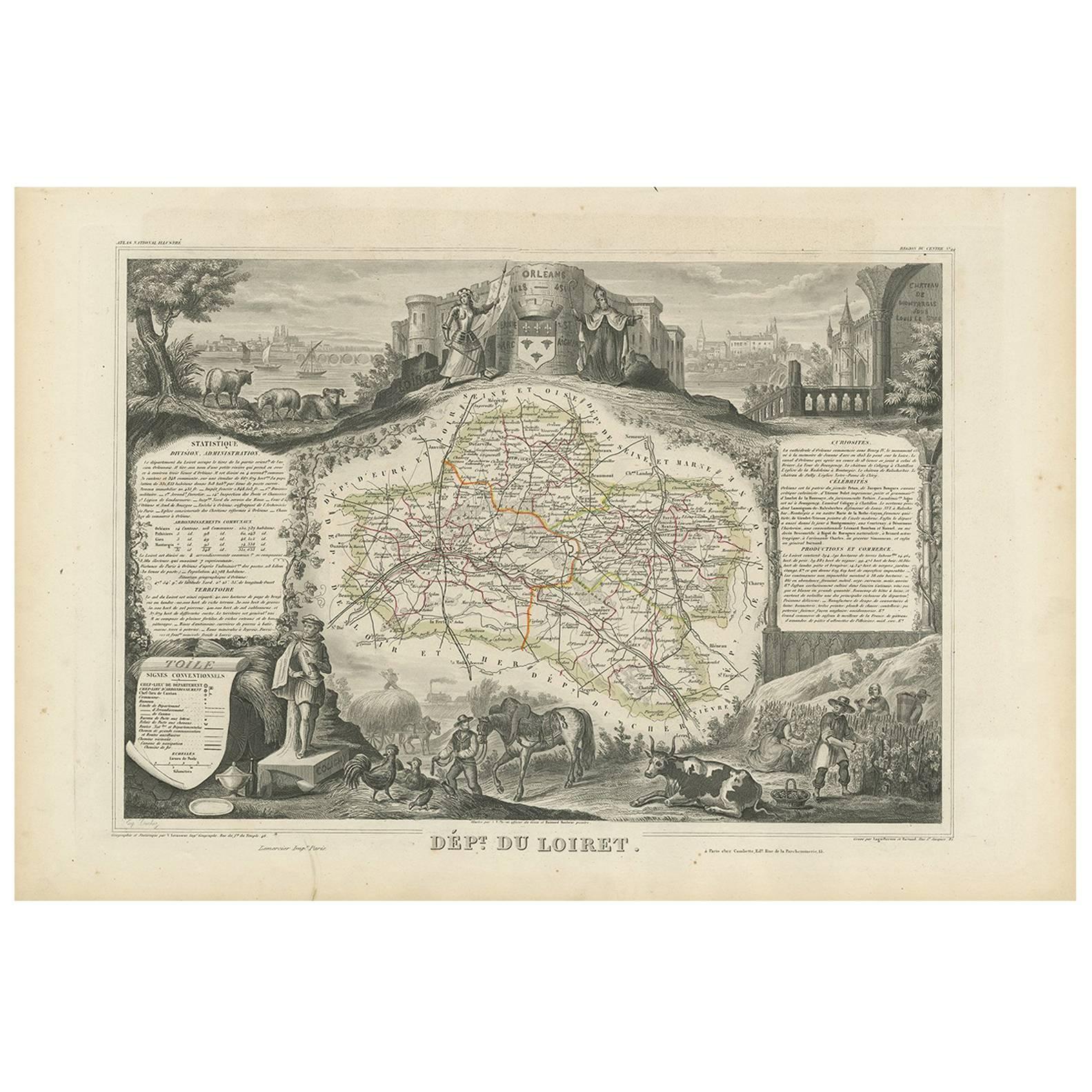
Antique map titled 'Dépt. du Loiret'. Map of the French department of Loiret, France. Surrounding the city of Orleans, Loiret is considered the heart of France and is a registered Unesco World Heritage Site. This area of France is also part of the Loire Valley wine region, and is especially known for its production of Pinot Noirs...
Category
Antique Mid-19th Century Maps
Materials
Paper
Antique Map of Loire ‘France’ by V. Levasseur, 1854
Located in Langweer, NL
Antique map titled 'Dépt. de la Loire'. Map of the French department of Loire, France. This area of France is part of the Loire Valley wine growing region. The area includes 87 appel...
Category
Antique Mid-19th Century Maps
Materials
Paper
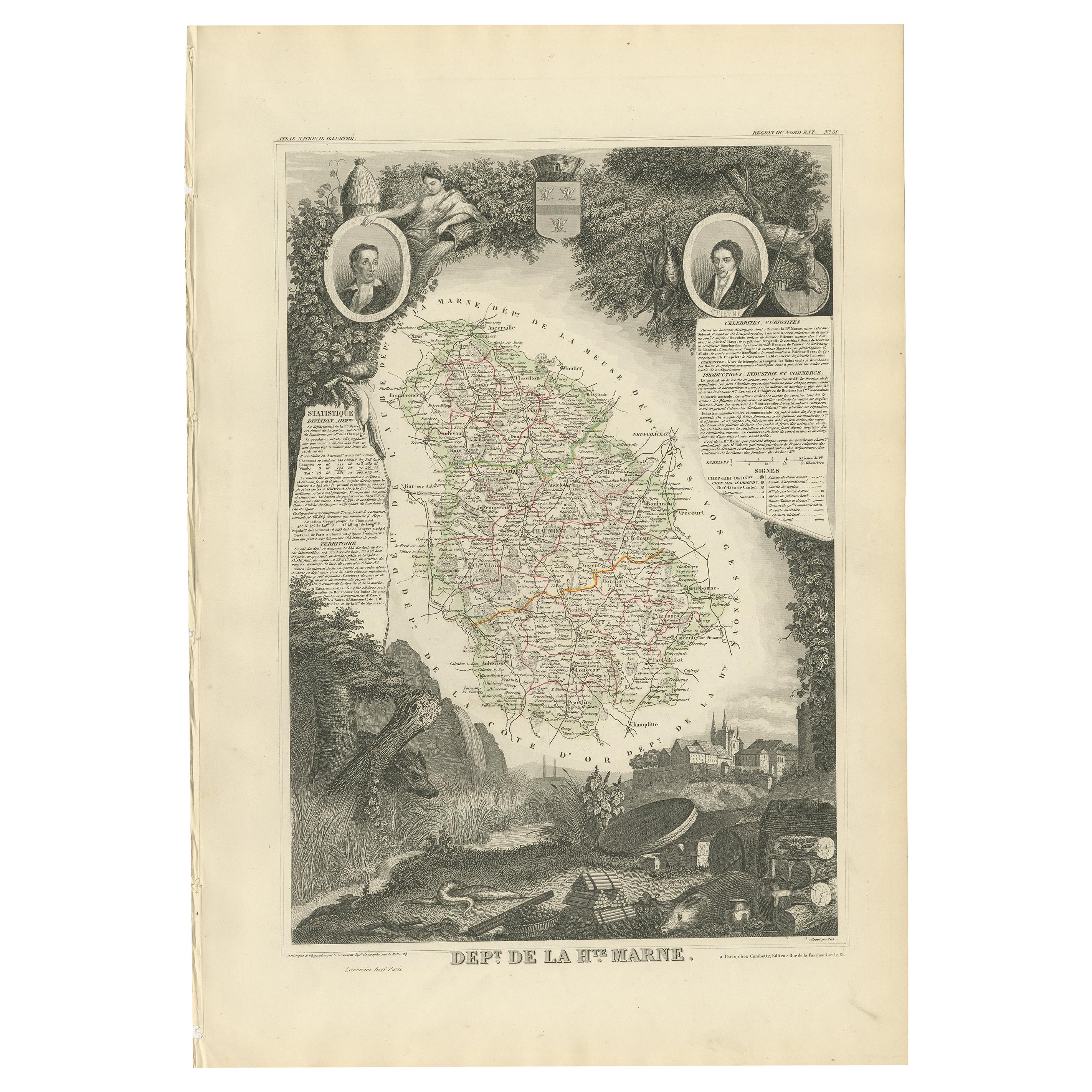
Antique Map of Haute Marne ‘France’ by V. Levasseur, 1854
Located in Langweer, NL
Antique map titled 'Dépt. de la Hte. Marne'. Map of the French department of Haute Marne, France. This department is part of the Champagne region, where the world-famous sparkling wi...
Category
Antique Mid-19th Century Maps
Materials
Paper
$170 Sale Price
20% Off
You May Also Like
Indre and Loire, France. Antique map of a French department, 1856
By Victor Levasseur
Located in Melbourne, Victoria
'Dept. d'Indre et Loire', steel engraving with original outline hand-colouring., 1856, from Levasseur's 'Atlas National Illustre'.
This area is known for its production of Chenin b...
Category
19th Century Naturalistic Landscape Prints
Materials
Engraving

La Gironde, France. Antique map of a French department, 1856
By Victor Levasseur
Located in Melbourne, Victoria
'La Gironde', steel engraving with original outline hand-colouring., 1856, from Levasseur's 'Atlas National Illustre'.
This coastal department is the seat of the Bordeaux wine regi...
Category
19th Century Naturalistic Landscape Prints
Materials
Engraving

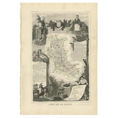
Saone and Loire, France. Antique map of a French department, 1856
By Victor Levasseur
Located in Melbourne, Victoria
'Dept. de Saone et Loire', steel engraving with original outline hand-colouring., 1856, from Levasseur's Atlas National Illustre.
The French department of Saone et Loire is at the ...
Category
19th Century Naturalistic Landscape Prints
Materials
Engraving

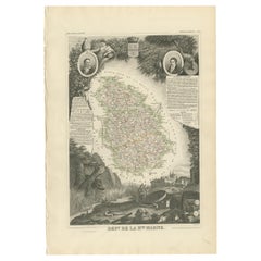
Lozere, France. Antique map of a French department, 1856
By Victor Levasseur
Located in Melbourne, Victoria
'Dept. de La Lozere', steel engraving with original outline hand-colouring., 1856, from Levasseur's 'Atlas National Illustre'.
This remote mountainous part of Languedoc is rural, s...
Category
19th Century Naturalistic Landscape Prints
Materials
Engraving

Aude, France. Antique map of a French department, 1856
By Victor Levasseur
Located in Melbourne, Victoria
'Dept. de L' Aude', steel engraving with original outline hand-colouring., 1856, from Levasseur's 'Atlas National Illustre'.
This area of France is famous for its wide variety of v...
Category
19th Century Naturalistic Landscape Prints
Materials
Engraving

Aube, France. Antique map of a French department, 1856
By Victor Levasseur
Located in Melbourne, Victoria
'Dept. de L'Aube', steel engraving with original outline hand-colouring., 1856, from Levasseur's 'Atlas National Illustre'.
This area of France is known for its production of Chaou...
Category
19th Century Naturalistic Landscape Prints
Materials
Engraving

More Ways To Browse
Milk Cow
Maine Antiques
Used Office Furniture Maine
World Map Of Trade Routes
J Walker
Mercator Map
Antique Map Of Switzerland
Albanian Antique
Antique Pamphlets
Antique Mediterranean Map
Antique Map Mexico
Antique Map Paris
Antique Puerto Rico
West Indies Antique Furniture
Map Of Ireland
Antique Indian Maps
Antique Map Ortelius
Antique Roman Map