Items Similar to Antique Map of Marne, France – Engraved by Levasseur, 1850s


Want more images or videos?
Request additional images or videos from the seller
1 of 10
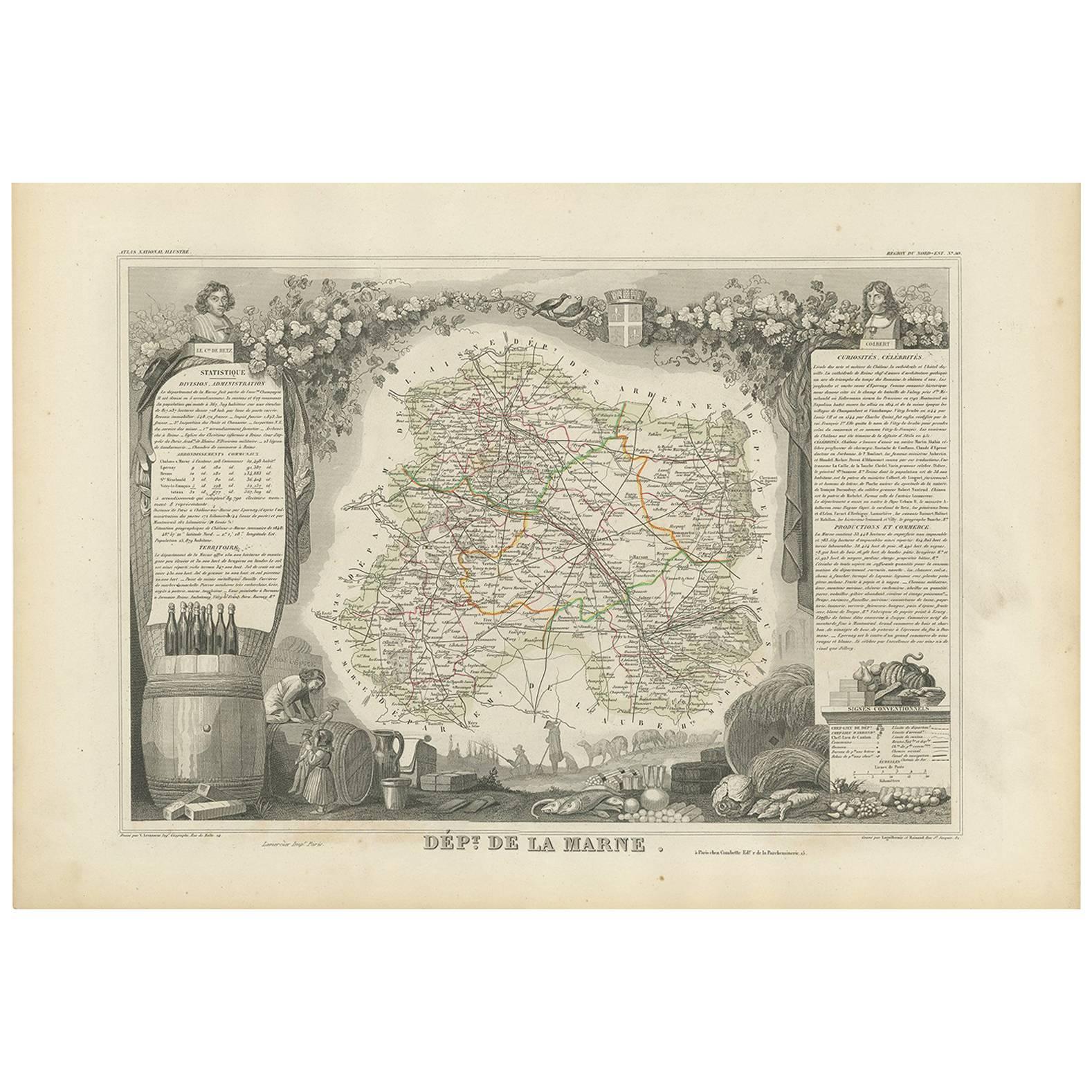
Antique Map of Marne, France – Engraved by Levasseur, 1850s
$262.35
£194.26
€220
CA$362.37
A$388.10
CHF 208.64
MX$4,713.65
NOK 2,636.24
SEK 2,413.67
DKK 1,676.68
About the Item
Antique Map of Marne, France – Engraved by Levasseur, 1850s
This beautifully detailed 19th-century engraved map of the Marne department in northeastern France was created by the renowned cartographer Victor Levasseur and printed by A. Vuillemin. It forms part of Levasseur’s celebrated atlas series “La France Illustrée”, widely admired for its harmonious blend of cartographic precision, cultural vignettes, and historical reference.
The map presents the department of Marne, bordered in soft pink and traversed by finely hand-colored roads, rivers, and administrative boundaries. It is framed with richly engraved scenes, including an illustration of the city of Châlons-sur-Marne, the figure of revolutionary postman Jean-Baptiste Drouet, and a provincial coat of arms. The backdrop also includes rural and architectural vignettes, adding depth to the cultural identity of the region.
Marne, with its capital Châlons-en-Champagne (formerly Châlons-sur-Marne), is famed for being one of the most historically and economically important areas in the Champagne region. Its fertile plains, crisscrossed by major waterways and trade routes, played a key role in France’s military and industrial history, particularly during the two World Wars.
This print is not only a valuable map but a visual chronicle of regional identity in 19th-century France.
Fifty Important Places and Why They Matter
1. Châlons-sur-Marne – departmental capital, administrative center
2. Épernay – Champagne wine hub
3. Reims – historical coronation city (just outside, noted)
4. Vitry-le-François – canal and river junction
5. Sainte-Menehould – linked to Louis XVI’s flight
6. Fismes – WWII battle significance
7. Montmirail – Napoleonic battle site
8. Dormans – Champagne vineyards
9. Suippes – French military training base
10. Sézanne – historic market town
11. Chaltrait – medieval village site
12. Anglure – agricultural importance
13. Saint-Remy-en-Bouzemont – regional fairs
14. Sompuis – rural crossroads
15. Mailly – military aviation center
16. Marson – traditional winegrowing
17. Vertus – ancient wine-producing village
18. Pogny – strategic rail point
19. Somme-Vesle – river source
20. Bouzy – renowned for Champagne Grand Cru
21. Tours-sur-Marne – wine commerce
22. Aÿ – historic Champagne house
23. Avize – premium vineyards
24. Damery – river trade and wines
25. Bisseuil – picturesque wine commune
26. Villers-Marmery – forested hill village
27. Vavray-le-Grand – Roman traces
28. Changy – medieval route town
29. Courdemanges – canal landmark
30. Écriennes – ancient monastic link
31. Sainte-Menehould – again, for Battle of Argonne
32. Jonchery-sur-Suippe – rural confluence
33. Valmy – site of pivotal French Revolution battle
34. Somme-Suippe – river origin
35. Tilloy-et-Bellay – ancient religious site
36. Athis – pre-Roman settlements
37. Saint-Mard-sur-le-Mont – military past
38. Heiltz-l'Évêque – episcopal estate
39. Frignicourt – crossroads of Champagne
40. Pringy – marshy river hamlet
41. Omey – historic commune
42. Cernay-en-Dormois – war memorial
43. Courtisols – Roman remains
44. Saint-Amand-sur-Fion – monastic heritage
45. Marson – again for vineyard history
46. Coole – route intersection
47. La Chaussée-sur-Marne – ferry village
48. Matignicourt – farming commune
49. Bassuet – Champagne foothills
50. Huiron – ecclesiastical importance
Condition
Excellent condition with original hand color. Clean impression with full margins. Very light age-toning and faint edge spotting typical for the period. No visible fold lines across the plate.
Framing Tips
A classic champagne-colored mat paired with a deep mahogany or black wooden frame would elegantly highlight the map’s subtle coloring and historical engravings. A gold inner fillet would accentuate the vignette work.
Technique: Engraving, hand-colored
Maker: Victor Levasseur, France, 1850s
- Dimensions:Height: 10.28 in (26.1 cm)Width: 12.8 in (32.5 cm)Depth: 0.01 in (0.2 mm)
- Materials and Techniques:Paper,Engraved
- Place of Origin:
- Period:
- Date of Manufacture:circa 1850
- Condition:Excellent condition with original hand color. Clean impression with full margins. Very light age-toning and faint edge spotting typical for the period. No visible fold lines across the plate.
- Seller Location:Langweer, NL
- Reference Number:Seller: BG-13331-501stDibs: LU3054347404122
About the Seller
5.0
Recognized Seller
These prestigious sellers are industry leaders and represent the highest echelon for item quality and design.
Platinum Seller
Premium sellers with a 4.7+ rating and 24-hour response times
Established in 2009
1stDibs seller since 2017
2,826 sales on 1stDibs
Typical response time: 1 hour
- ShippingRetrieving quote...Shipping from: Langweer, Netherlands
- Return Policy
More From This Seller
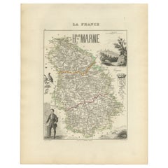
View AllAntique Map of Haute-Marne France by Vuillemin with Decorative Insets, 1850s
Located in Langweer, NL
Antique Map of Haute-Marne France by Vuillemin with Decorative Insets, 1840s
This finely engraved and hand-colored map of Haute-Marne, a historical department in northeastern France...
Category
Antique Mid-19th Century French Maps
Materials
Paper
Antique Map of Marne ‘France’ by V. Levasseur, 1854
Located in Langweer, NL
Antique map titled 'Dépt. de la Marne'. Map of the French department of Marne, France. This department is home to the Champagne region where the world's finest sparkling wine is prod...
Category
Antique Mid-19th Century French Maps
Materials
Paper
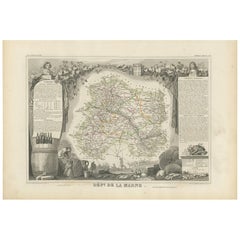
$139 Sale Price
35% Off
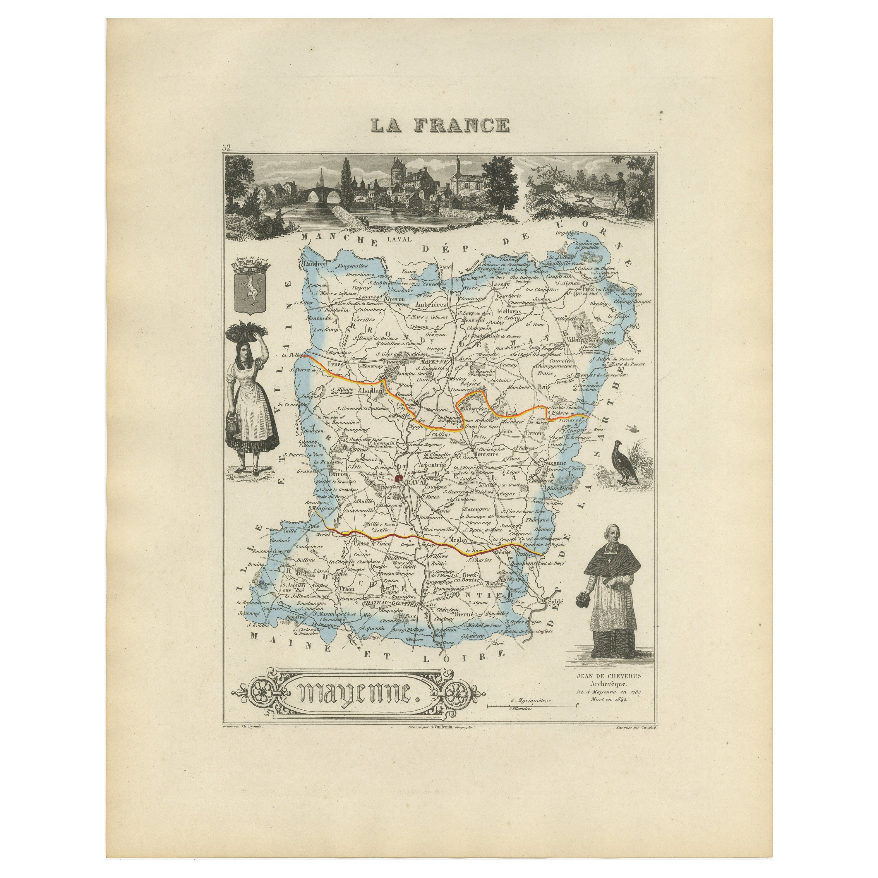
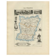
Antique Map of Mayenne – Hand-Colored Engraving by Levasseur, France c.1850
Located in Langweer, NL
Antique Map of Mayenne – Hand-Colored Engraving by Levasseur, France c.1850
This finely detailed 19th-century engraved map of the department of Mayenne in northwestern France was cr...
Category
Antique Mid-19th Century French Maps
Materials
Paper
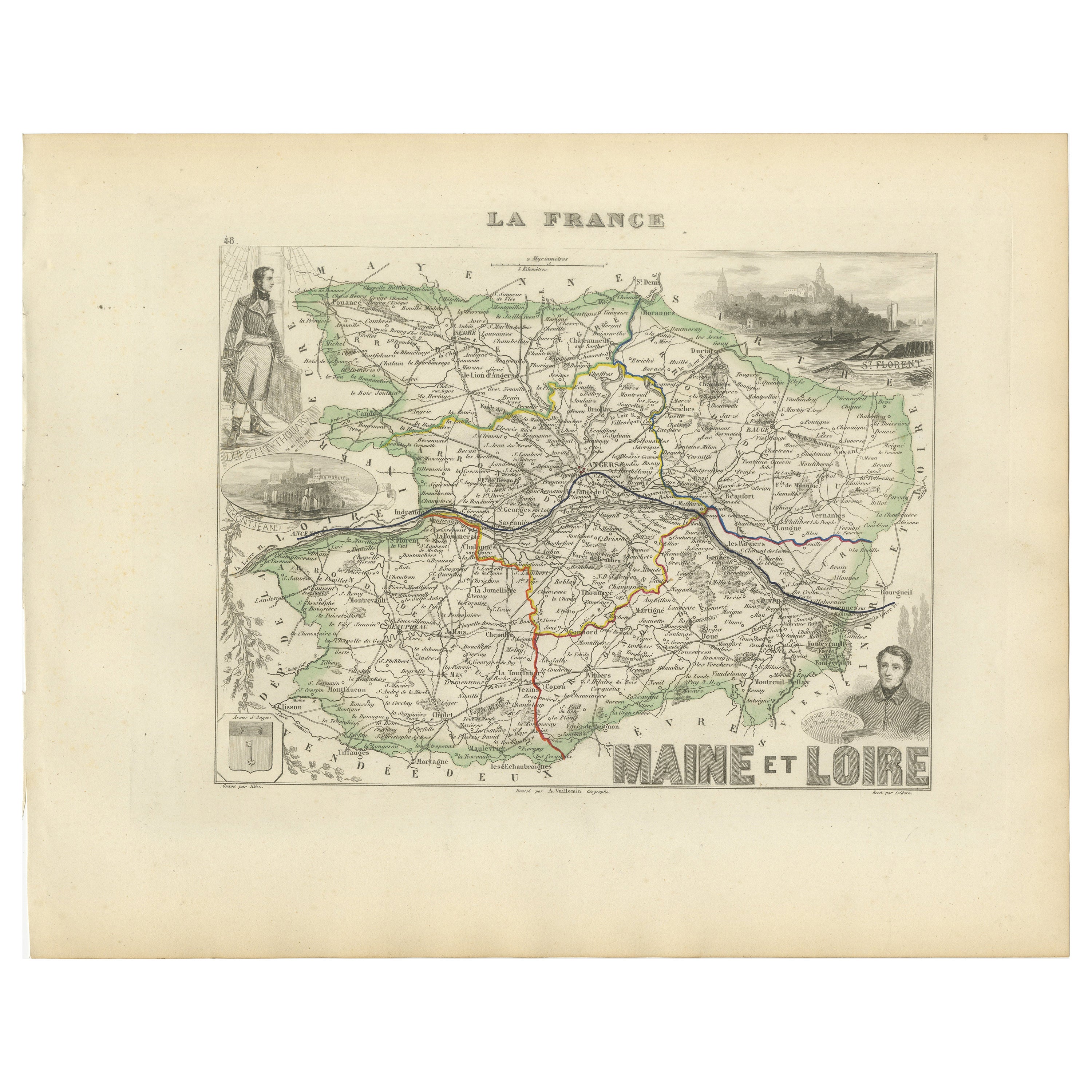
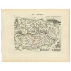
Antique Map of Maine-et-Loire with Illustrations – Vuillemin c.1850
Located in Langweer, NL
Antique Map of Maine-et-Loire with Illustrations – Vuillemin c.1850
A richly detailed 19th-century map of the Maine-et-Loire department in western France, engraved by A. Vuillemin a...
Category
Antique Mid-19th Century French Maps
Materials
Paper
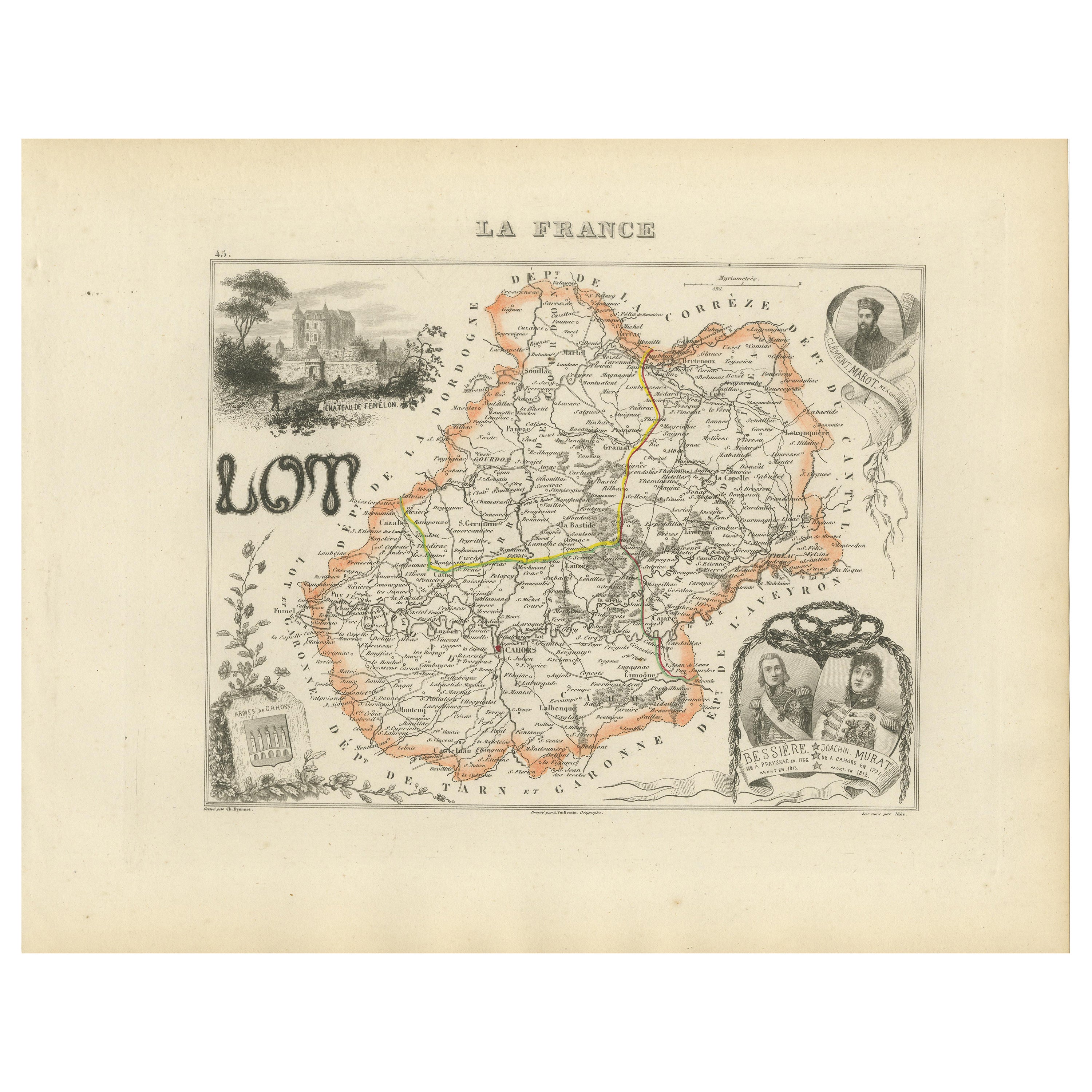
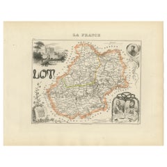
Antique Map of Lot, France – Hand-Colored Engraving by Vuillemin, c.1850
Located in Langweer, NL
Antique Map of Lot, France – Hand-Colored Engraving by Vuillemin, c.1850
This beautifully engraved 19th-century map of the French department of Lot was created by the notable French...
Category
Antique Mid-19th Century French Maps
Materials
Paper
Antique French Map of Ille-et-Vilaine Region with Rennes, Saint-Malo, 1800s
Located in Langweer, NL
Antique Map of Ille-et-Vilaine, France by Vuillemin, 19th Century
This decorative antique map presents the French département of Ille-et-Vilaine, situated in the Brittany region of ...
Category
Antique Mid-19th Century French Maps
Materials
Paper

You May Also Like
Aube, France. Antique map of a French department, 1856
By Victor Levasseur
Located in Melbourne, Victoria
'Dept. de L'Aube', steel engraving with original outline hand-colouring., 1856, from Levasseur's 'Atlas National Illustre'.
This area of France is known for its production of Chaou...
Category
19th Century Naturalistic Landscape Prints
Materials
Engraving

Saone and Loire, France. Antique map of a French department, 1856
By Victor Levasseur
Located in Melbourne, Victoria
'Dept. de Saone et Loire', steel engraving with original outline hand-colouring., 1856, from Levasseur's Atlas National Illustre.
The French department of Saone et Loire is at the ...
Category
19th Century Naturalistic Landscape Prints
Materials
Engraving

L
Isere, France. Antique map of French department, 1856
By Victor Levasseur
Located in Melbourne, Victoria
'Dept. de L'Isere', Steel engraving with original outline hand-colouring., 1856, from Levasseur's 'Atlas National Illustre'.
This area is known for its production of Bleu du Vercor...
Category
19th Century Naturalistic Landscape Prints
Materials
Engraving

Indre and Loire, France. Antique map of a French department, 1856
By Victor Levasseur
Located in Melbourne, Victoria
'Dept. d'Indre et Loire', steel engraving with original outline hand-colouring., 1856, from Levasseur's 'Atlas National Illustre'.
This area is known for its production of Chenin b...
Category
19th Century Naturalistic Landscape Prints
Materials
Engraving

Aude, France. Antique map of a French department, 1856
By Victor Levasseur
Located in Melbourne, Victoria
'Dept. de L' Aude', steel engraving with original outline hand-colouring., 1856, from Levasseur's 'Atlas National Illustre'.
This area of France is famous for its wide variety of v...
Category
19th Century Naturalistic Landscape Prints
Materials
Engraving

Map of France - Etching - 1820
Located in Roma, IT
Map of France is an Original Etching realized by an unknown artist of 19th century in 1820.
Very good condition on two sheets of white paper joined at t...
Category
1820s Modern Figurative Prints
Materials
Etching
