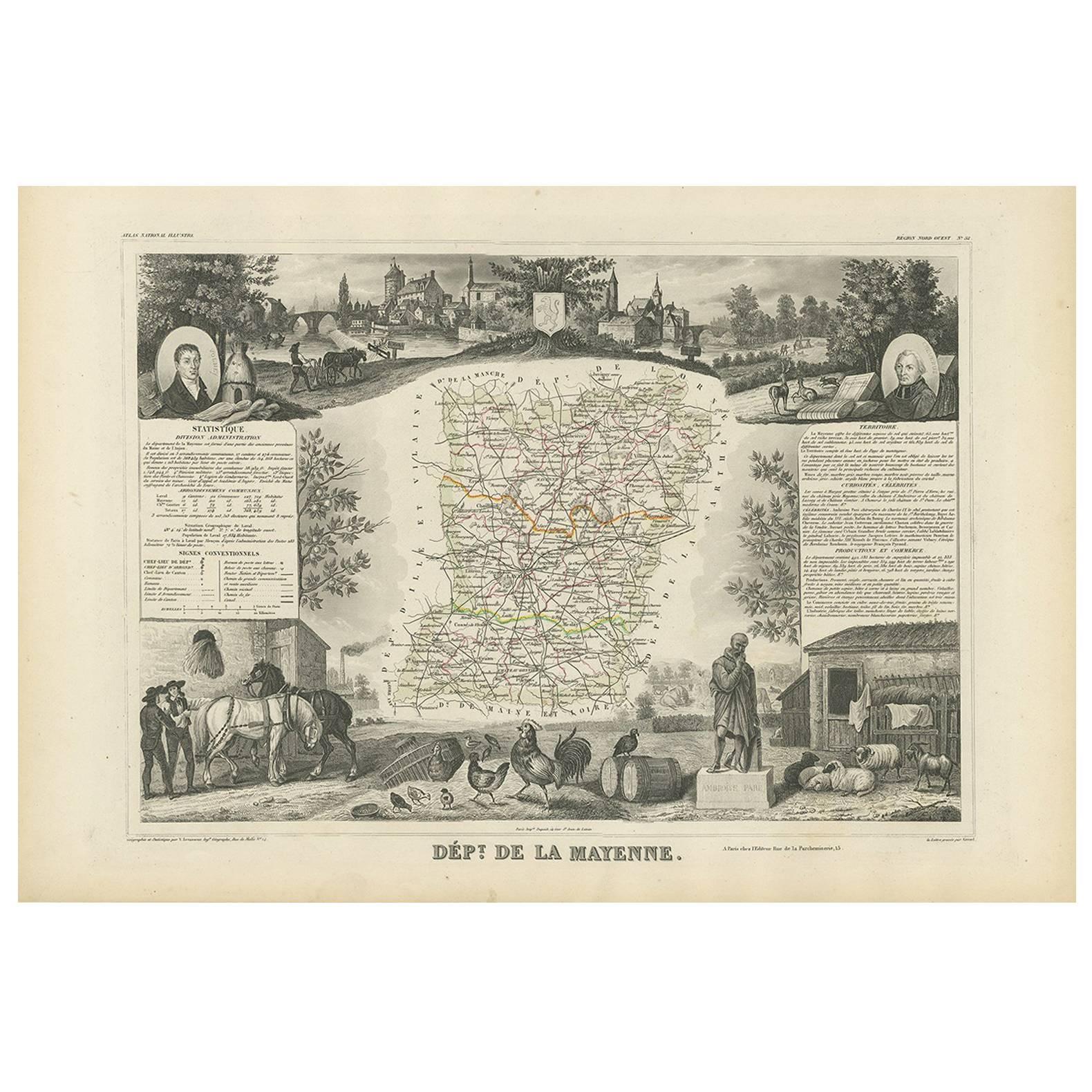
Items Similar to Antique Map of Mayenne – Hand-Colored Engraving by Levasseur, France c.1850


Want more images or videos?
Request additional images or videos from the seller
1 of 10
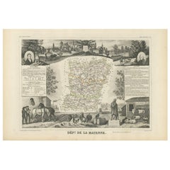
Antique Map of Mayenne – Hand-Colored Engraving by Levasseur, France c.1850
$263.28
£197.10
€220
CA$362.44
A$396.22
CHF 209.62
MX$4,741.39
NOK 2,667.08
SEK 2,441.44
DKK 1,676.13
About the Item
Antique Map of Mayenne – Hand-Colored Engraving by Levasseur, France c.1850
This finely detailed 19th-century engraved map of the department of Mayenne in northwestern France was created by the esteemed French cartographer Victor Levasseur and published around 1850 as part of his celebrated Atlas National Illustré. Known for combining accurate geography with richly decorative elements, Levasseur's maps remain among the most visually striking and collectible of the 19th century.
The map itself outlines the boundaries of Mayenne and is enhanced with original hand-coloring that highlights département borders, roads, rivers, and communes. The surrounding steel-engraved vignettes add an artistic and ethnographic dimension: at the top, a detailed townscape of Laval is shown in a scenic panoramic view; at left and right, depictions of local inhabitants in traditional dress provide insight into regional culture. In the lower right corner is a portrait of Jean de Cheverus (1768–1836), a prominent Laval-born bishop who became the first Archbishop of Boston and later Archbishop of Bordeaux.
Additional illustrations include the Mayenne coat of arms, regional flora and fauna, and agricultural motifs—emphasizing the rural and historical identity of the department. The layout is vertically oriented, with a baroque cartouche at the bottom framing the name "Mayenne" in an ornate style typical of Levasseur’s aesthetic. Printed text in the lower margin confirms the engraver as Levasseur and the publisher as A. Combette.
This map not only serves as a geographical reference but also as a visual document of French provincial life in the mid-19th century. It is ideal for collectors of historical cartography, Francophiles, or anyone with an interest in Mayenne’s local heritage.
Selected towns and why they matter:
1. Laval – departmental capital
2. Mayenne – historic town
3. Château-Gontier – commercial hub
4. Ernée – cultural center
5. Craon – medieval heritage
6. Gorron – rural economy
7. Saint-Berthevin – growing suburb
8. Evron – Romanesque architecture
9. Villaines-la-Juhel – scenic location
10. Andouillé – traditional farming
11. Pré-en-Pail – forested uplands
12. Ambrières-les-Vallées – natural park access
13. Montsûrs – historic structures
14. Meslay-du-Maine – Roman origins
15. Cossé-le-Vivien – art museum
16. Loiron – pilgrimage route
17. Saint-Pierre-des-Nids – outdoor recreation
18. Sainte-Suzanne – listed heritage site
19. Renazé – mining history
20. L'Huisserie – near Laval
21. Quelaines-Saint-Gault – rural crafts
22. Martigné-sur-Mayenne – riverside town
23. Argentré – rural landscape
24. Saint-Denis-de-Gastines – religious architecture
25. Louverné – Laval proximity
26. La Baconnière – scenic plateau
27. Landivy – border village
28. Chantrigné – regional farming
29. Congrier – local markets
30. Bouère – historic church
31. Vaiges – Roman road route
32. Bais – quiet village
33. Ballée – local traditions
34. Courbeveille – picturesque setting
35. Gesvres – forested commune
36. Bazougers – agricultural fair
37. Fromentières – traditional life
38. La Gravelle – transport junction
39. Chemazé – pastoral charm
40. Nuillé-sur-Vicoin – green countryside
41. Saint-Aignan-sur-Roë – rural heritage
42. Saint-Georges-Buttavent – artisan town
43. Sacé – natural surroundings
44. Saint-Loup-du-Dorat – farming village
45. La Bigottière – peaceful hamlet
46. Parigné-sur-Braye – fertile valley
47. Saint-Fort – near Château-Gontier
48. Saint-Mars-sur-Colmont – small community
49. Saint-Germain-d’Anxure – charming locale
50. Saint-Ouën-des-Toits – local heritage
Condition report:
Excellent condition overall. Light age toning to margins; central image clean. No visible tears, folds, or major foxing. Crisp plate mark present.
Framing tips:
This map would look especially attractive with a cream or soft grey mat and a thin black or antique gold frame to emphasize the engraved detail and blue-colored borders. A double mat with a pale blue inner line could echo the border color and bring subtle harmony to the composition.
Technique: Hand-colored engraving
Maker: V. Levasseur, Paris, c.1850
- Dimensions:Height: 12.8 in (32.5 cm)Width: 10.28 in (26.1 cm)Depth: 0.01 in (0.2 mm)
- Materials and Techniques:Paper,Engraved
- Place of Origin:
- Period:
- Date of Manufacture:circa 1850
- Condition:Excellent condition overall. Light age toning to margins; central image clean. No visible tears, folds, or major foxing. Crisp plate mark present.
- Seller Location:Langweer, NL
- Reference Number:Seller: BG-13331-521stDibs: LU3054347404562
About the Seller
5.0
Recognized Seller
These prestigious sellers are industry leaders and represent the highest echelon for item quality and design.
Platinum Seller
Premium sellers with a 4.7+ rating and 24-hour response times
Established in 2009
1stDibs seller since 2017
2,792 sales on 1stDibs
Typical response time: <1 hour
- ShippingRetrieving quote...Shipping from: Langweer, Netherlands
- Return Policy
More From This Seller
View AllAntique Map of Marne, France – Engraved by Levasseur, 1850s
Located in Langweer, NL
Antique Map of Marne, France – Engraved by Levasseur, 1850s
This beautifully detailed 19th-century engraved map of the Marne department in northeastern France was created by the ren...
Category
Antique Mid-19th Century French Maps
Materials
Paper

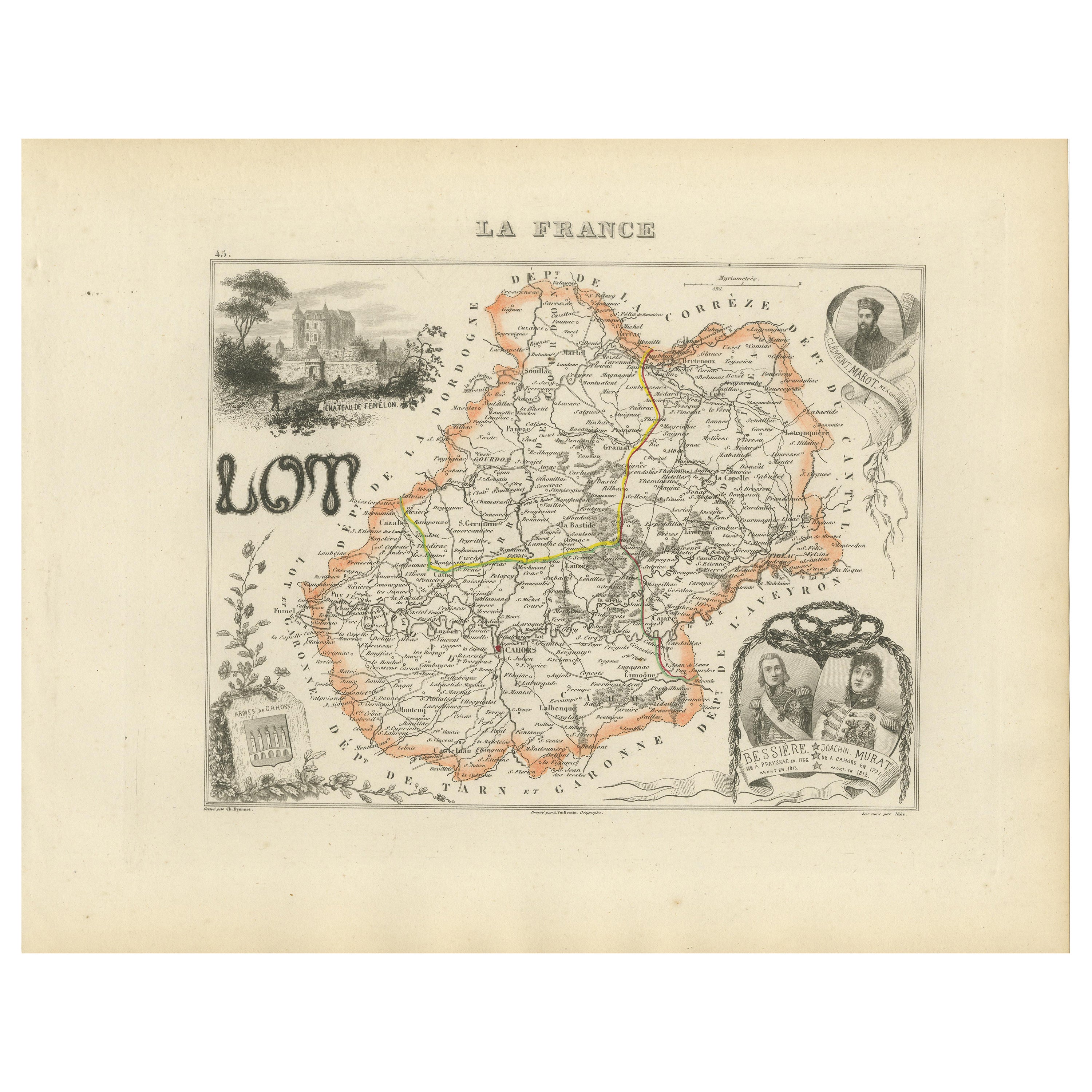
Antique Map of Lot, France – Hand-Colored Engraving by Vuillemin, c.1850
Located in Langweer, NL
Antique Map of Lot, France – Hand-Colored Engraving by Vuillemin, c.1850
This beautifully engraved 19th-century map of the French department of Lot was created by the notable French...
Category
Antique Mid-19th Century French Maps
Materials
Paper
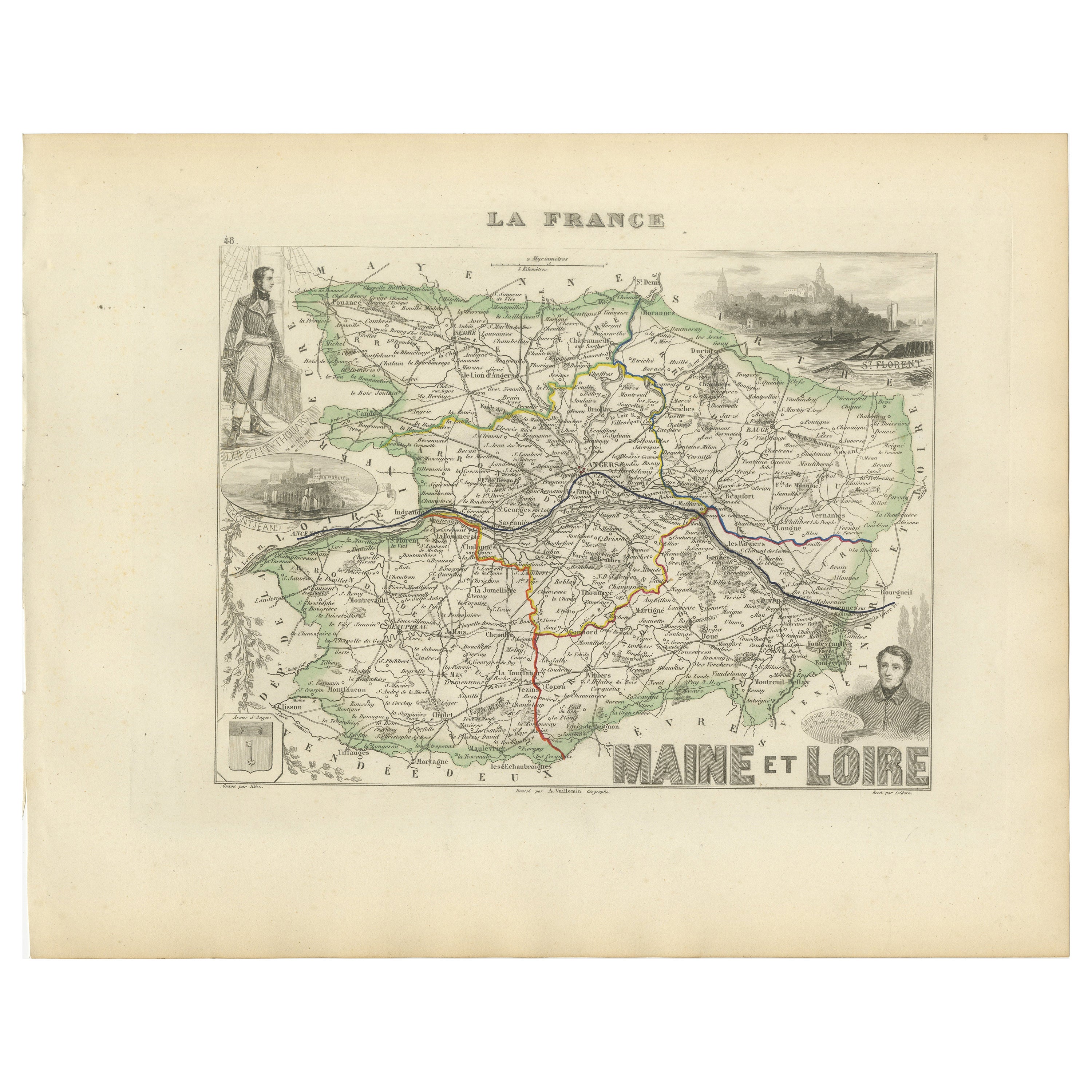
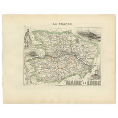
Antique Map of Maine-et-Loire with Illustrations – Vuillemin c.1850
Located in Langweer, NL
Antique Map of Maine-et-Loire with Illustrations – Vuillemin c.1850
A richly detailed 19th-century map of the Maine-et-Loire department in western France, engraved by A. Vuillemin a...
Category
Antique Mid-19th Century French Maps
Materials
Paper
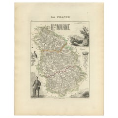
Antique Map of Haute-Marne France by Vuillemin with Decorative Insets, 1850s
Located in Langweer, NL
Antique Map of Haute-Marne France by Vuillemin with Decorative Insets, 1840s
This finely engraved and hand-colored map of Haute-Marne, a historical department in northeastern France...
Category
Antique Mid-19th Century French Maps
Materials
Paper
Antique French Map of Ille-et-Vilaine Region with Rennes, Saint-Malo, 1800s
Located in Langweer, NL
Antique Map of Ille-et-Vilaine, France by Vuillemin, 19th Century
This decorative antique map presents the French département of Ille-et-Vilaine, situated in the Brittany region of ...
Category
Antique Mid-19th Century French Maps
Materials
Paper

Antique Map of Mayenne ‘France’ by V. Levasseur, 1854
Located in Langweer, NL
Antique map titled 'Dépt. de la Mayenne'. Map of the French department of Mayenne, France. This area is part of the Loire Valley wine region. The map is surrounded by elaborate decor...
Category
Antique Mid-19th Century Maps
Materials
Paper
You May Also Like
Aube, France. Antique map of a French department, 1856
By Victor Levasseur
Located in Melbourne, Victoria
'Dept. de L'Aube', steel engraving with original outline hand-colouring., 1856, from Levasseur's 'Atlas National Illustre'.
This area of France is known for its production of Chaou...
Category
19th Century Naturalistic Landscape Prints
Materials
Engraving

Var, France. Antique map of a French department, 1856
By Victor Levasseur
Located in Melbourne, Victoria
'Dept. du Var', steel engraving with original outline hand-colouring., 1856, from Levasseur's Atlas National Illustre.
Var covers the heart of the French Riviera or Cote d'Azur., and includes the resort cities of Cannes, Nice and San Tropez...
Category
19th Century Naturalistic Landscape Prints
Materials
Engraving

Indre and Loire, France. Antique map of a French department, 1856
By Victor Levasseur
Located in Melbourne, Victoria
'Dept. d'Indre et Loire', steel engraving with original outline hand-colouring., 1856, from Levasseur's 'Atlas National Illustre'.
This area is known for its production of Chenin b...
Category
19th Century Naturalistic Landscape Prints
Materials
Engraving

France, Northern Part. Century Atlas antique map
Located in Melbourne, Victoria
'The Century Atlas. France, Northern Part.'
Original antique map, 1903.
Inset maps of 'France in Provinces' and 'Paris and Vicinity'.
Central fold as issued. Map name and number pr...
Category
Early 20th Century Victorian More Prints
Materials
Lithograph

The Normandy Region of France: A 17th C. Hand-colored Map by Sanson and Jaillot
By Nicholas Sanson d
Abbeville
Located in Alamo, CA
This large hand-colored map entitled "Le Duché et Gouvernement de Normandie divisée en Haute et Basse Normandie en divers Pays; et par evêchez, avec le Gouvernement General du Havre ...
Category
1690s Landscape Prints
Materials
Engraving

Lozere, France. Antique map of a French department, 1856
By Victor Levasseur
Located in Melbourne, Victoria
'Dept. de La Lozere', steel engraving with original outline hand-colouring., 1856, from Levasseur's 'Atlas National Illustre'.
This remote mountainous part of Languedoc is rural, s...
Category
19th Century Naturalistic Landscape Prints
Materials
Engraving
