Items Similar to Antique Map of the Moluccas by Porcacchi, circa 1620


Want more images or videos?
Request additional images or videos from the seller
1 of 10
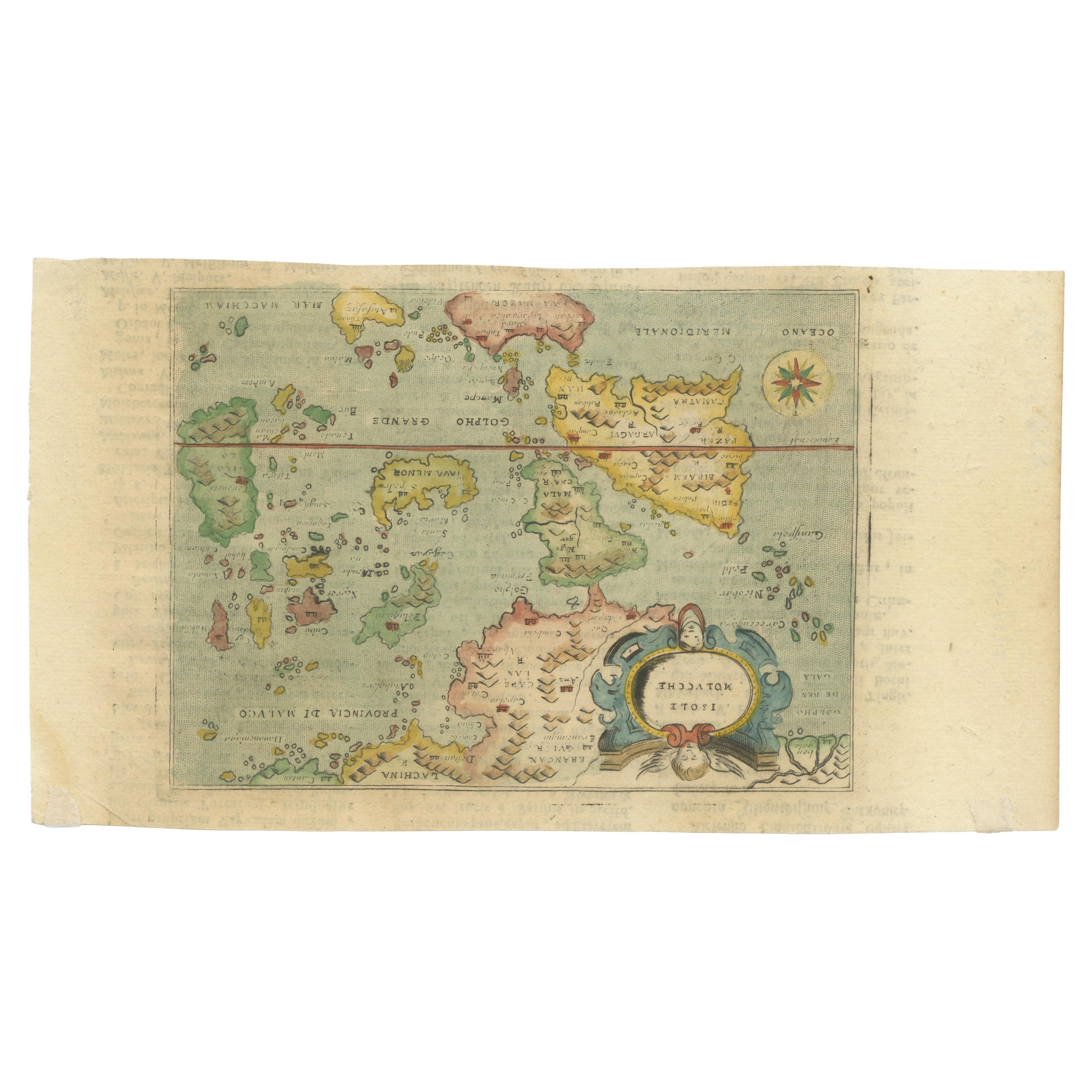
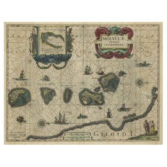
Antique Map of the Moluccas by Porcacchi, circa 1620
$646.24
$861.6525% Off
£483.78
£645.0425% Off
€540
€72025% Off
CA$889.63
CA$1,186.1725% Off
A$972.54
A$1,296.7225% Off
CHF 514.52
CHF 686.0225% Off
MX$11,637.96
MX$15,517.2925% Off
NOK 6,546.47
NOK 8,728.6325% Off
SEK 5,992.63
SEK 7,990.1825% Off
DKK 4,114.14
DKK 5,485.5125% Off
About the Item
Antique Map of the Moluccas in East Indies, Indonesia - Porro Venice c.1576
Description
This rare and finely engraved 16th-century map titled Isole Molucche depicts the Moluccan Islands and the wider East Indies at the height of the European spice trade. The map shows an expansive geographic vision stretching from the Bay of Bengal in the west to southern China and Canton in the northeast, encompassing modern-day Indonesia, the Philippines, Indochina, and surrounding island groups. Oriented to the north, the composition reflects early European attempts to understand and control one of the most economically vital regions of the early modern world.
The map originates from the celebrated Italian atlas L’Isole più famose del mondo by Tommaso Porcacchi da Castiglione, first published in Venice in 1572. The engraving is attributed to Girolamo Porro, one of the most important Venetian map engravers of the late 16th century. This work belongs to a pioneering generation of island atlases that combined geographic science, maritime ambition, and Renaissance artistic refinement. The decorative cartouche and rich hand coloring reflect the prestige and luxury of Venetian cartography at its peak.
The Moluccas, known as the “Spice Islands,” were the world’s primary source of cloves and nutmeg, making this region the strategic target of Portuguese, Spanish, and later Dutch colonial powers. Maps such as this were not merely geographic tools but economic and political instruments that shaped the global balance of power. The surrounding seas are animated with navigation routes and island groupings that reveal how Europeans visualized long-distance maritime trade in Asia.
Offered here mounted within a tasteful passe-partout, this map presents beautifully as a stand-alone display piece. It appeals equally to collectors of early cartography, Indonesian and Southeast Asian history, maritime exploration, and European Renaissance printmaking.
Condition Report
Good antique condition. Original paper with light overall toning consistent with age. Minor scattered spots and faint handling marks visible. No major tears or losses. Image strong and well-centered. Passe-partout included. Plate mark faintly visible.
Framing Tips
This map is ideally suited for a classic walnut or dark ebonized frame with a soft ivory or warm grey mat to complement the aged paper tone. Museum glass is recommended to protect the hand coloring and enhance visual clarity without glare.
Technique: Copperplate engraving with original hand coloring
Maker: Girolamo Porro after Tommaso Porcacchi, Venice, circa 1576
- Dimensions:Height: 14.57 in (37 cm)Width: 10.63 in (27 cm)Depth: 0.2 in (5 mm)
- Materials and Techniques:Paper,Engraved
- Place of Origin:
- Period:Early 17th Century
- Date of Manufacture:circa 1620
- Condition:Good antique condition. Original paper with light overall toning consistent with age. Minor scattered spots and faint handling marks visible. No major tears or losses. Image strong and well-centered. Passe-partout included. Plate mark faintly visible.
- Seller Location:Langweer, NL
- Reference Number:Seller: RK-10201stDibs: LU3054317596082
About the Seller
5.0
Recognized Seller
These prestigious sellers are industry leaders and represent the highest echelon for item quality and design.
Platinum Seller
Premium sellers with a 4.7+ rating and 24-hour response times
Established in 2009
1stDibs seller since 2017
2,792 sales on 1stDibs
Typical response time: <1 hour
- ShippingRetrieving quote...Shipping from: Langweer, Netherlands
- Return Policy
More From This Seller
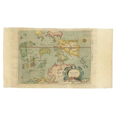
View AllAntique Miniature Map of the Maluku Islands by Lasor a Varea, 1713
Located in Langweer, NL
Antique map titled 'Isole Molucche'. Rare miniature map of the Maluku Islands or the Moluccas, Indonesia. This map originates from 'Universus Terrarum Orbis...
Category
Antique Early 18th Century Maps
Materials
Paper
$574 Sale Price
20% Off
Antique Map of the Island Java, Indonesia, c.1650
Located in Langweer, NL
Antique map titled 'Insulae Iavae cum parte insularum Boreno Sumatrae (..)'.
Beautiful map of the island of Java and part of Borneo, Bali, Madura and Sumatra. With decorative carto...
Category
Antique 17th Century Maps
Materials
Paper

$3,111 Sale Price
20% Off
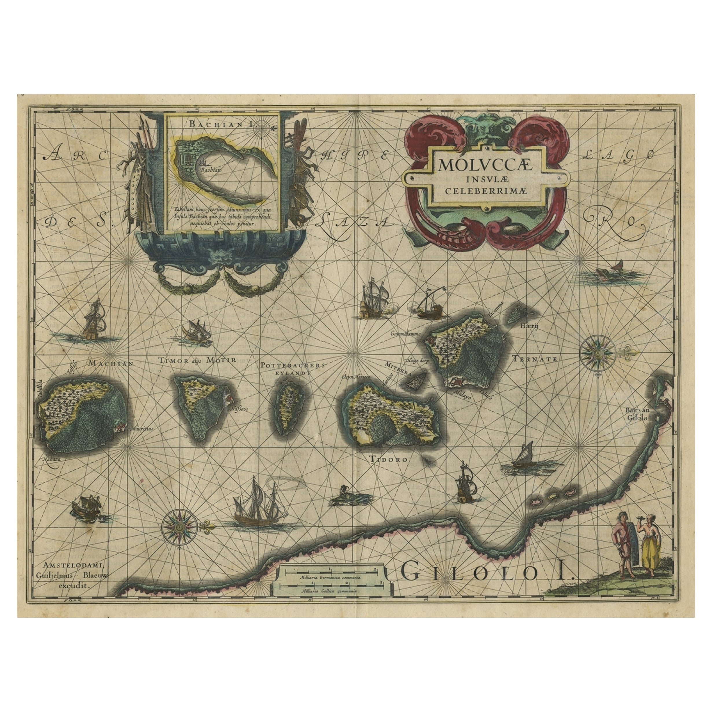
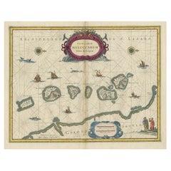
Decorative Map of the Spice Islands in the Mollucas, Indonesia, ca.1640
Located in Langweer, NL
Antique map titled 'Moluccae Insulae Celeberrimae'.
Decorative map of the Spice Islands. Inset of the Island of Bachian (Batjan) in an elaborate frame as well as a Moluccan couple in the lower right corner in Europeanized native dress.
Artists and Engravers: Willem Janszoon Blaeu (1571-1638) was a prominent Dutch geographer and publisher. Born the son of a herring merchant, Blaeu chose not fish but mathematics and astronomy for his focus. He studied with the famous Danish astronomer Tycho...
Category
Antique 1640s Maps
Materials
Paper
$813 Sale Price
28% Off
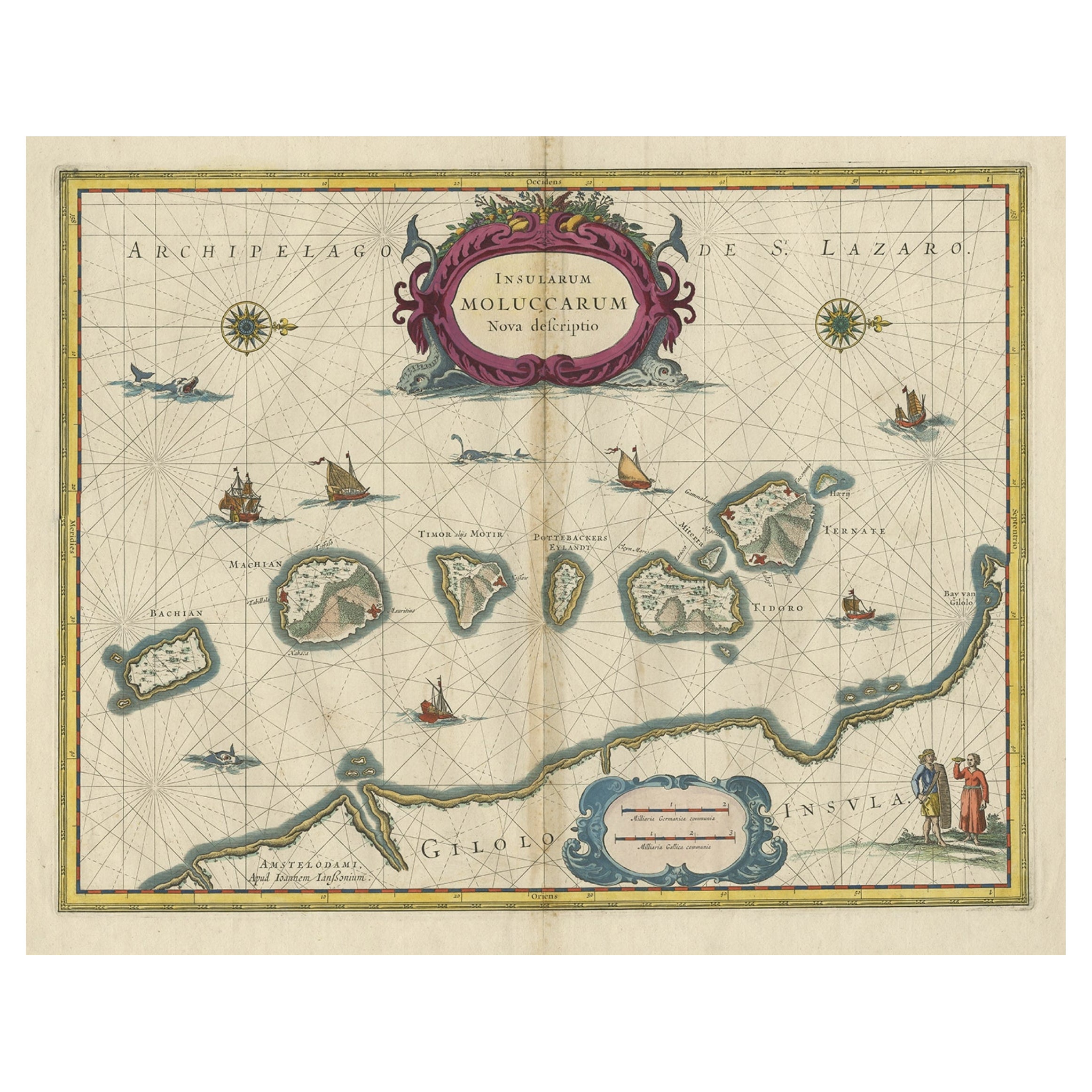
Beautiful Antique Map of the Moluccas or Spice Islands, Indonesia, ca.1650
Located in Langweer, NL
Antique map titled 'Insularum Moluccarum Nova Descriptio.'
Beautiful map of the Moluccas. The famous Spice Islands, the cornerstone of the Dutc...
Category
Antique 1650s Maps
Materials
Paper
$708 Sale Price
20% Off
Antique Map of the Sunda Islands Including Sumatra, Java, and Borneo, 1705
Located in Langweer, NL
Title: “Antique Map of the Sunda Islands Including Sumatra, Java, and Borneo”
This print is a beautifully detailed and relatively rare map of Western Indonesia, encompassing the reg...
Category
Antique Early 1700s Maps
Materials
Paper

$823 Sale Price
20% Off
Free Shipping
Antique Map of the Maluku Islands by Blaeu, c.1640
Located in Langweer, NL
Antique map titled 'Moluccae Insulae Celeberrimae'. Decorative map of the Maluku Islands, also known as the Moluccas or the Spice Islands. Inset of the island of Bachian (Batjan) in ...
Category
Antique 17th Century Maps
Materials
Paper

You May Also Like
1608 Hispaniae Novae Sive Magnae Vera Descriptio Framed Mexico Map
Located in Stamford, CT
1608 Hispaniae Novae Sive Magnae Vera Descriptio Framed Mexico Map. As found custom black wooden frame/ matting.
This map is based on the work of Abraham Ortelius as is an example o...
Category
Antique Early 1600s Mexican Spanish Colonial Maps
Materials
Glass, Wood, Paper
Greece 1660 Jan Jansson Watercolour Map Peloponesus Sive Morea I Laurenbergio
Located in West Sussex, Pulborough
We are delighted to offer for sale this Jan Jansson Date: 1660 (published) Amsterdam map of Greece.
This is an authentic antique map of Peloponnese or...
Category
Antique 1660s Danish Dutch Colonial Maps
Materials
Copper

1562 Map of Toscana Nuova Tavola by Girolamo Ruscelli
Located in Chapel Hill, NC
A 1562 map of Toscana Nuova Tavola by Girolamo Ruscelli. Tuscany is the heart of Italy & birthplace of the Italian language. Early hand-coloring. Copper plate engraving. Interestingl...
Category
Antique 16th Century Italian Renaissance Maps
Materials
Paper
$360 Sale Price
20% Off
Antique French Map of Asia Including China Indoneseia India, 1783
Located in Amsterdam, Noord Holland
Very nice map of Asia. 1783 Dedie au Roy.
Additional information:
Country of Manufacturing: Europe
Period: 18th century Qing (1661 - 1912)
Condition: Overall Condition B (Good Used)...
Category
Antique 18th Century European Maps
Materials
Paper

$486 Sale Price
40% Off
1571-1638 Willem Blaeu map entitled, "Ilcadorino, " Hand Colored Ric0009
Located in Norton, MA
Willem Blaeu map entitled,
"Ilcadorino,".
Hand colored.
Description: large, unusual, and nice antique copper engraved map of Ilcadorino, by Willem BL...
Category
Antique 16th Century Dutch Maps
Materials
Paper

1627 Hendrik Hondius Map Entitled "Vltoniae Orientalis Pars, " Ric.a009
Located in Norton, MA
1627 Hendrik Hondius map entitled
"Vltoniae orientalis pars,"
Ric.a009
Title:
Vltoniae orientalis : pars
Title (alt.) :
Ultoniae orientalis pars
Creator:
Mercator, Gerh...
Category
Antique 17th Century Dutch Maps
Materials
Paper

More Ways To Browse
Map Of India
Antique Maps Amsterdam
Antique Maps Of Russia
19th Century Map Of Africa
Map Of Britain
Railroad Furniture
Antique Malaysia
Blaeu Maps
Antique Topographic Maps
Antique Maps Of North America
Antique Maps Of Italy
Antique Navigator
Antique Maps Of Britain
Wood Furniture Bali
Scotland Map
Antique Maps Scotland
Furniture Russian 18th Century
Antique Map Of Middle East