Items Similar to Antique Map of New South Wales by Lowry, 1852


Want more images or videos?
Request additional images or videos from the seller
1 of 5
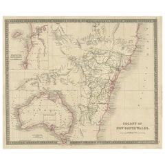
Antique Map of New South Wales by Lowry, 1852
$143.99per set
$179.99per set20% Off
£106.71per set
£133.39per set20% Off
€120per set
€150per set20% Off
CA$196.80per set
CA$246per set20% Off
A$214.23per set
A$267.79per set20% Off
CHF 113.71per set
CHF 142.14per set20% Off
MX$2,577.67per set
MX$3,222.08per set20% Off
NOK 1,440.91per set
NOK 1,801.14per set20% Off
SEK 1,320.28per set
SEK 1,650.36per set20% Off
DKK 914.08per set
DKK 1,142.59per set20% Off
About the Item
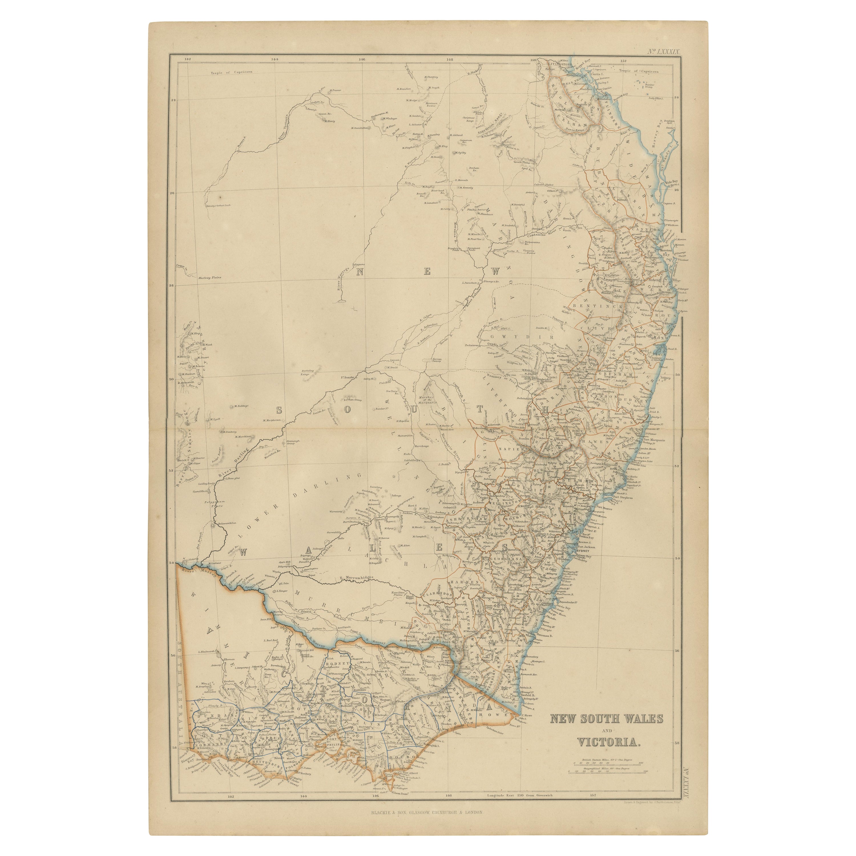
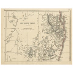
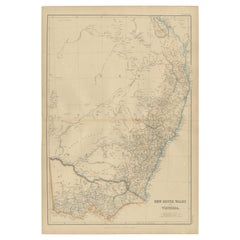
Antique map titled 'New South Wales and part of Victoria'. Two individual sheets of New South Wales and part of Victoria. This map originates from 'Lowry's Table Atlas constructed and engraved from the most recent Authorities' by J.W. Lowry. Published, 1852.
- Dimensions:Height: 9.65 in (24.5 cm)Width: 12.21 in (31 cm)Depth: 0.02 in (0.5 mm)
- Sold As:Set of 2
- Materials and Techniques:
- Period:
- Date of Manufacture:1852
- Condition:General age-related toning, blank verso. Minor wear, please study images carefully.
- Seller Location:Langweer, NL
- Reference Number:Seller: BG-12593-63 BG-12593-651stDibs: LU3054321551422
About the Seller
5.0
Recognized Seller
These prestigious sellers are industry leaders and represent the highest echelon for item quality and design.
Platinum Seller
Premium sellers with a 4.7+ rating and 24-hour response times
Established in 2009
1stDibs seller since 2017
2,816 sales on 1stDibs
Typical response time: 1 hour
- ShippingRetrieving quote...Shipping from: Langweer, Netherlands
- Return Policy
More From This Seller
View AllAntique Map of New South Wales
Australia
by Wyld
1845
Located in Langweer, NL
Antique map titled 'British Settlements in New South Wales'. Original antique map of New South Wales, Australia. This map originates from 'An Atlas of ...
Category
Antique Mid-19th Century Maps
Materials
Paper

$239 Sale Price
20% Off
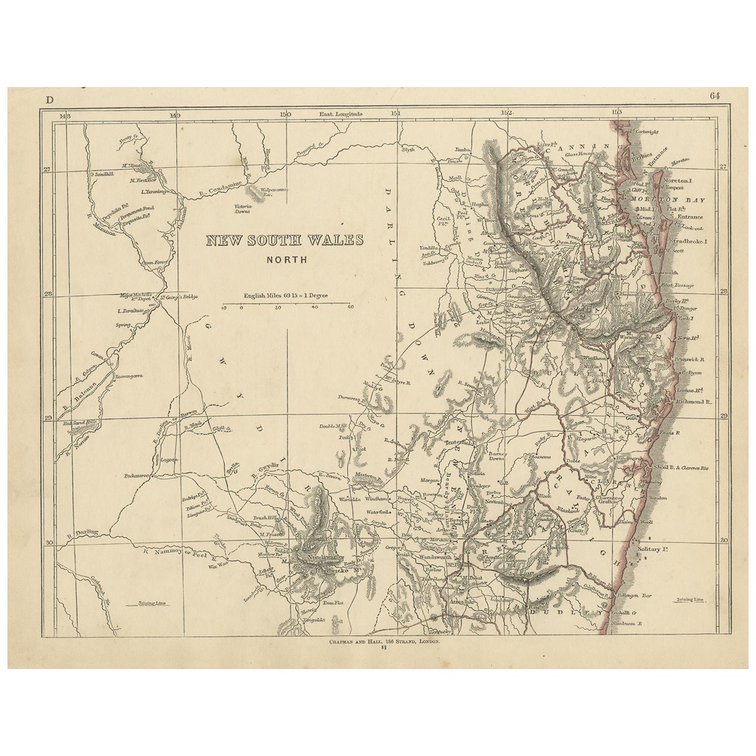
Antique Map of New South Wales by Lowry,
1852
Located in Langweer, NL
Antique map titled 'New South Wales north'. Original map of New South Wales, Australia. This map originates from 'Lowry's Table Atlas constructed and e...
Category
Antique Mid-19th Century Maps
Materials
Paper
$96 Sale Price
20% Off
Antique Map of New South Wales and Victoria by W. G. Blackie, 1859
Located in Langweer, NL
Antique map titled 'New South Wales and Victoria'. Original antique map of New South Wales and Victoria. This map originates from ‘The Imperial Atlas of Modern Geography’. Published ...
Category
Antique Mid-19th Century Maps
Materials
Paper
$239 Sale Price
20% Off
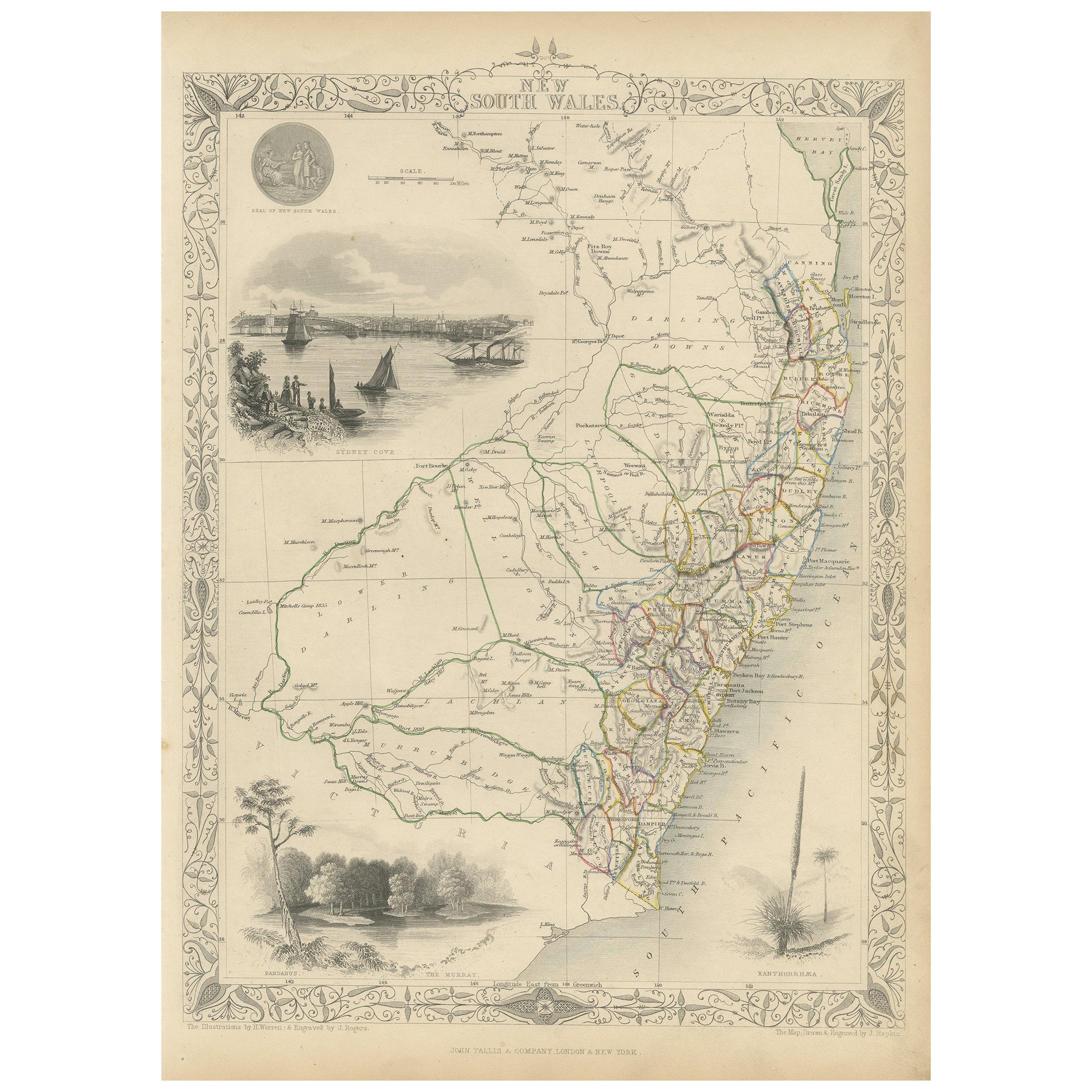
Antique Map of New South Wales by Tallis, circa 1851
Located in Langweer, NL
Antique map titled 'New South Wales'. Decorative and detailed map of New South Wales which was drawn and engraved by J. Rapkin (vignettes by H. Warren ...
Category
Antique Mid-19th Century English Maps
Materials
Paper
Antique Map of New South Wales with an Inset of Sydney, Australia, 1833
Located in Langweer, NL
Antique map of Australia titled 'New South Wales'. Old map of New South Wales, Australia. With an inset map of Sydney. Arists and Engravers: Engraved by J. & C. Walker. Published by ...
Category
Antique 19th Century Maps
Materials
Paper
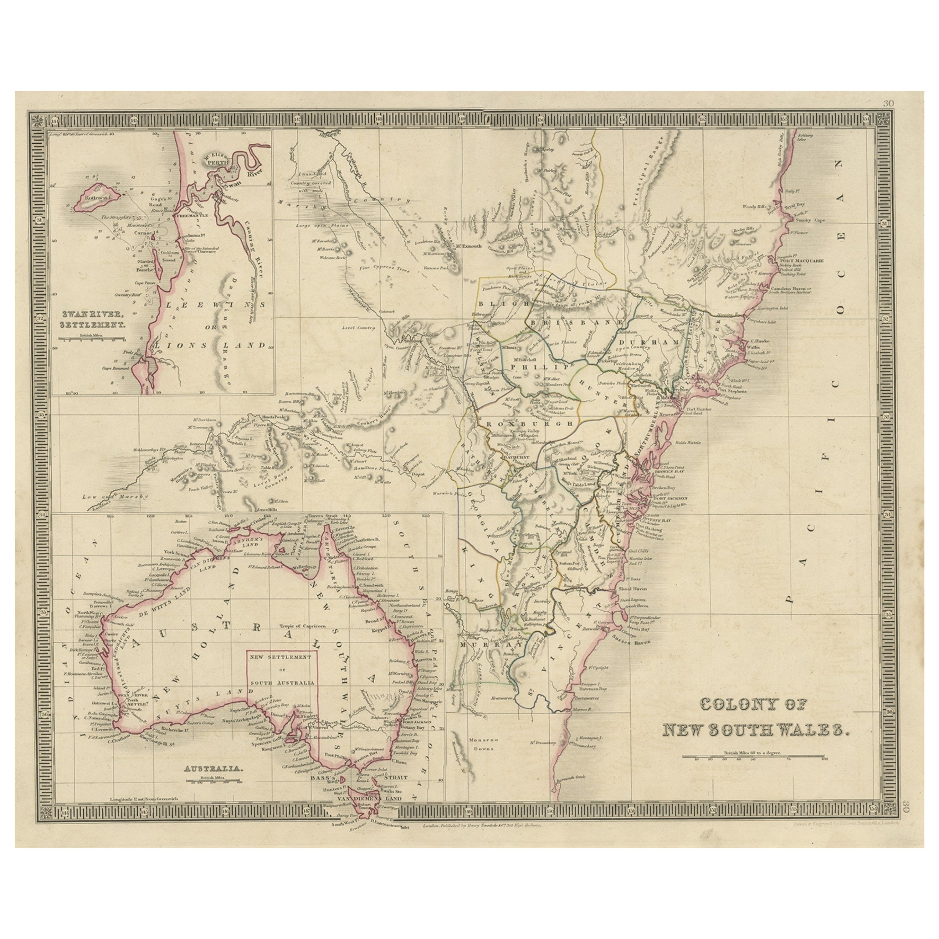
Antique Map of New South Wales with Inset Maps of Australia and Swan River, 1854
Located in Langweer, NL
Antique map titled 'Colony of New South Wales'. Map of New South Wales with inset maps of Australia and Swan River. Artists and Engravers: Drawn and engrave...
Category
Antique 19th Century Maps
Materials
Paper
You May Also Like
New South Wales, Australia, antique mid 19th century engraved John Tallis map
Located in Melbourne, Victoria
'New South Wales'
With decorative border surrounds and vignettes of 'Sydney Cove'. 'The Murray' and 'Xanthorrhea'.
'Drawn and engraved by J Rapkin'. Published by John Tallis.
375m...
Category
1840s Victorian Landscape Prints
Materials
Engraving

Original Antique Map of Australia by Dower, circa 1835
Located in St Annes, Lancashire
Nice map of Australia
Drawn and engraved by J.Dower
Published by Orr & Smith. C.1835
Unframed.
Free shipping
Category
Antique 1830s English Maps
Materials
Paper

Large Original Antique Map of Australia by Sidney Hall, 1847
Located in St Annes, Lancashire
Great map of Australia
Drawn and engraved by Sidney Hall
Steel engraving
Original colour outline
Published by A & C Black. 1847
Unframed
Free shipping.
Category
Antique 1840s Scottish Maps
Materials
Paper

Australia, Tallis antique map, 1851
Located in Melbourne, Victoria
'Australia'
With decorative border surrounds and vignettes including a view of Sydney, Kangaroos, Natives of Australia Felix, Australian Parrots and Cockatoos and Natives of the Tri...
Category
19th Century Naturalistic Landscape Prints
Materials
Engraving

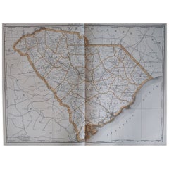
Large Original Antique Map of South Carolina, USA, 1894
By Rand McNally
Co.
Located in St Annes, Lancashire
Fabulous map of South Carolina
Original color
By Rand, McNally & Co.
Published, 1894
Unframed
Free shipping.
Category
Antique 1890s American Maps
Materials
Paper
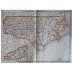
Large Original Antique Map of North Carolina, USA, 1894
By Rand McNally
Co.
Located in St Annes, Lancashire
Fabulous map of North Carolina
Original color
By Rand, McNally & Co.
Published, 1894
Unframed
Free shipping.
Category
Antique 1890s American Maps
Materials
Paper
More Ways To Browse
Antique Maps Of Wales
Antique Nautical Charts
Antique Macedonia
Hemispheres Map
Java Map
Miniature Maps
Antique Maps Of Wales
Swiss Antiques And Collectables
Map Stand
Caribbean Antique Furniture
West Indies Furniture
Railroad Collectibles
Antique Map Denmark
American West Furniture
Antique Railroad Collectibles
Gold Maps
World Map Of Trade Routes
J Walker