Items Similar to Antique Map of New Zealand by A
C. Black, 1870


Want more images or videos?
Request additional images or videos from the seller
1 of 6
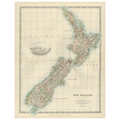
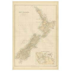
Antique Map of New Zealand by A
C. Black, 1870
$167.70
$209.6220% Off
£125.40
£156.7520% Off
€140
€17520% Off
CA$231.04
CA$288.8120% Off
A$251.99
A$314.9820% Off
CHF 133.49
CHF 166.8620% Off
MX$3,020.96
MX$3,776.2020% Off
NOK 1,700.01
NOK 2,125.0220% Off
SEK 1,554.54
SEK 1,943.1720% Off
DKK 1,066.86
DKK 1,333.5720% Off
About the Item
Antique map titled 'New Zealand'. Original antique map of New Zealand with inset Maps of Australia, New Zealand and Tasmania. This map originates from ‘Black's General Atlas of The World’. Published by A
C. Black, 1870.
- Dimensions:Height: 17.52 in (44.5 cm)Width: 13 in (33 cm)Depth: 0.02 in (0.5 mm)
- Materials and Techniques:
- Period:
- Date of Manufacture:1870
- Condition:Wear consistent with age and use. General age-related toning. some foxing, Please study image carefully.
- Seller Location:Langweer, NL
- Reference Number:Seller: BG-12784-531stDibs: LU3054325438782
About the Seller
5.0
Recognized Seller
These prestigious sellers are industry leaders and represent the highest echelon for item quality and design.
Platinum Seller
Premium sellers with a 4.7+ rating and 24-hour response times
Established in 2009
1stDibs seller since 2017
2,791 sales on 1stDibs
Typical response time: <1 hour
- ShippingRetrieving quote...Shipping from: Langweer, Netherlands
- Return Policy
More From This Seller
View AllAntique Map of New Zealand by G.F. Cram,
circa 1906
Located in Langweer, NL
Antique map titled 'New Zealand'. Large map of New Zealand with a small legend of the Chatham Islands. On the verso, a map of the North Polar regions and a map of Tasmania can be fou...
Category
20th Century Maps
Materials
Paper
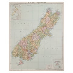
Antique Map of New Zealand, 1903, Featuring the North and South Islands and Alps
Located in Langweer, NL
Title: Antique Map of New Zealand, 1903, Featuring the North and South Islands and the Southern Alps
Description:
This antique map, titled "New Zealand," was engraved and published ...
Category
Early 20th Century Maps
Materials
Paper
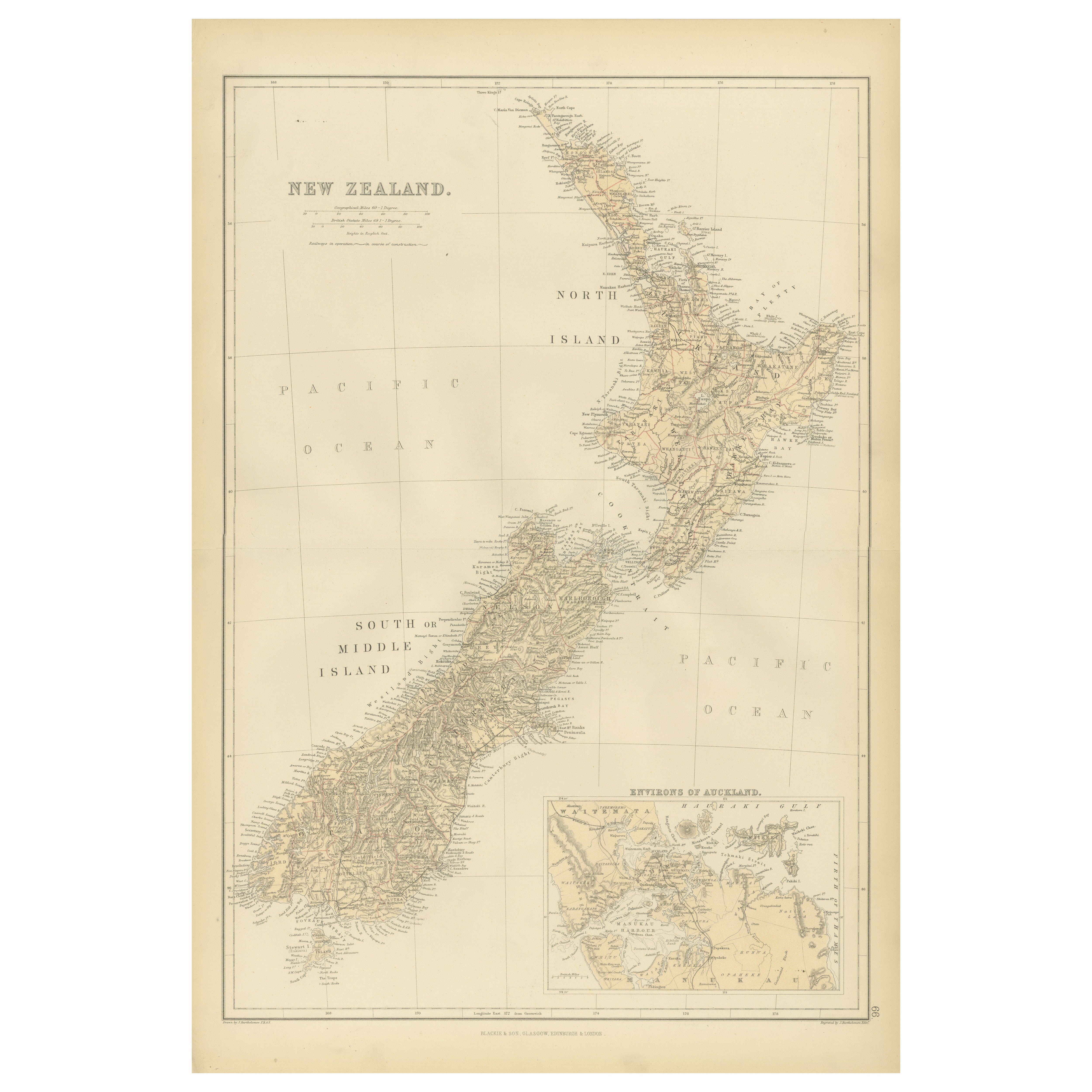
1882 Original Antique Map of New Zealand with Inset of Auckland
s Environs
Located in Langweer, NL
This 1882 map of New Zealand, published by Blackie and Son as part of the 'Comprehensive Atlas and Geography of the World,' provides a detailed representation of the North Island and...
Category
Antique 1880s Maps
Materials
Paper
Antique Map of New Zealand by Arrowsmith
1844
Located in Langweer, NL
Antique map titled 'Map of the colony of New Zealand from official documents'. A scarce map of New Zealand. First issued in the 1830s, this state sh...
Category
Antique Mid-19th Century Maps
Materials
Paper

$1,572 Sale Price
24% Off
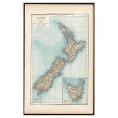
Antique Map of New Zealand and Tasmania, 1904
Located in Langweer, NL
This large antique map is taken from; 'Andrees Allgemeiner Handatlas in 126 Haupt-Und 139 Nebenkarten', Bielefeld; Leipzig: Velhagen & Klasing 1899. Andrees Allgemeiner Handatlas was...
Category
20th Century Maps
Materials
Paper
$86 Sale Price
20% Off
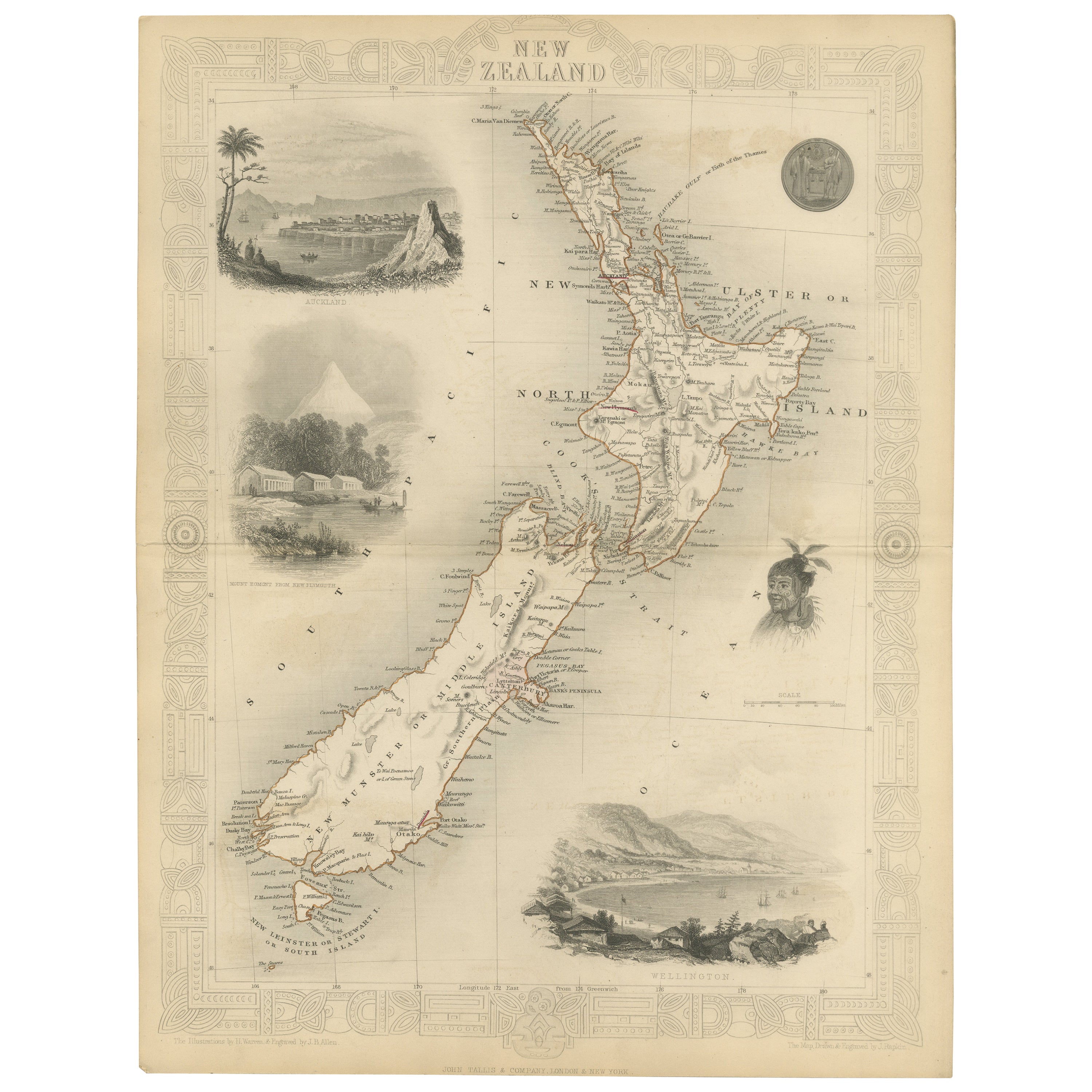
Map of New Zealand Showing Maori Culture and Early Colonial Settlements, 1851
Located in Langweer, NL
John Tallis & Company were renowned for their ornate and detailed maps in the mid-19th century. Their works often featured elaborate borders, decorative motifs, and insets of vignett...
Category
Antique 1850s Maps
Materials
Paper

$182 Sale Price
20% Off
You May Also Like
Large Original Vintage Map of New Zealand, North Island, circa 1920
Located in St Annes, Lancashire
Great map of North Island, New Zealand
Original color.
Good condition / minor foxing to right edge
Published by Alexander Gross
Unframed.
Category
Vintage 1920s English Edwardian Maps
Materials
Paper

Large Original Vintage Map of New Zealand, South Island, circa 1920
Located in St Annes, Lancashire
Great map of South Island, New Zealand
Original color.
Good condition / repair to a minor tear on right edge
Published by Alexander Gross
Unframed.
Category
Vintage 1920s English Edwardian Maps
Materials
Paper
Large Original Antique Map of Australia by Sidney Hall, 1847
Located in St Annes, Lancashire
Great map of Australia
Drawn and engraved by Sidney Hall
Steel engraving
Original colour outline
Published by A & C Black. 1847
Unframed
Free shipping.
Category
Antique 1840s Scottish Maps
Materials
Paper

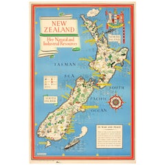
Original WWII Map of New Zealand - Natural
Industrial Resources in War
Peace
By "Leslie MacDonald ""Max"" Gill"
Located in London, GB
Original vintage World War Two pictorial map for New Zealand her natural and Industrial resources featuring a great illustration by the notable graphic designer, cartographer and artist MacDonald Gill (Leslie MacDonald Gill aka Max Gill...
Category
Vintage 1940s British Posters
Materials
Paper
Original Antique Map of Australia by Dower, circa 1835
Located in St Annes, Lancashire
Nice map of Australia
Drawn and engraved by J.Dower
Published by Orr & Smith. C.1835
Unframed.
Free shipping
Category
Antique 1830s English Maps
Materials
Paper

Large Original Antique Map of The Pacific Ocean, Fullarton, C.1870
Located in St Annes, Lancashire
Great map of The Pacific Ocean
From the celebrated Royal Illustrated Atlas
Lithograph by Swanston. Original color.
Published by Fullarton,...
Category
Antique 1870s Scottish Maps
Materials
Paper

More Ways To Browse
New Zealand Map
Antique Maps New Zealand
Map Of Egypt
Antique Ecuador
Antique Map New York
Nautical Maps
18th Century Maps America
Antique Map Of Egypt
Map Of Austria
New Zealand Map
Antique Linen Map
19th Century World Map
Antique Ohio Maps
Antique Texas Furniture
Military Map
Antique Maps New Zealand
Birds Eye View Map
North Africa Map