Items Similar to Antique Map of Northeastern France – Alsace, Lorraine
Champagne, 1858

Video Loading
Want more images or videos?
Request additional images or videos from the seller
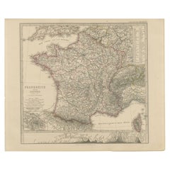
1 of 11
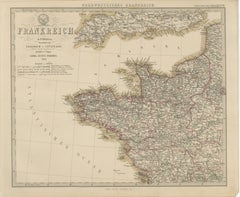
Antique Map of Northeastern France – Alsace, Lorraine
Champagne, 1858
$500.38
£371.75
€420
CA$693.81
A$746.13
CHF 398.96
MX$8,998.12
NOK 5,045.09
SEK 4,596.73
DKK 3,201.10
About the Item
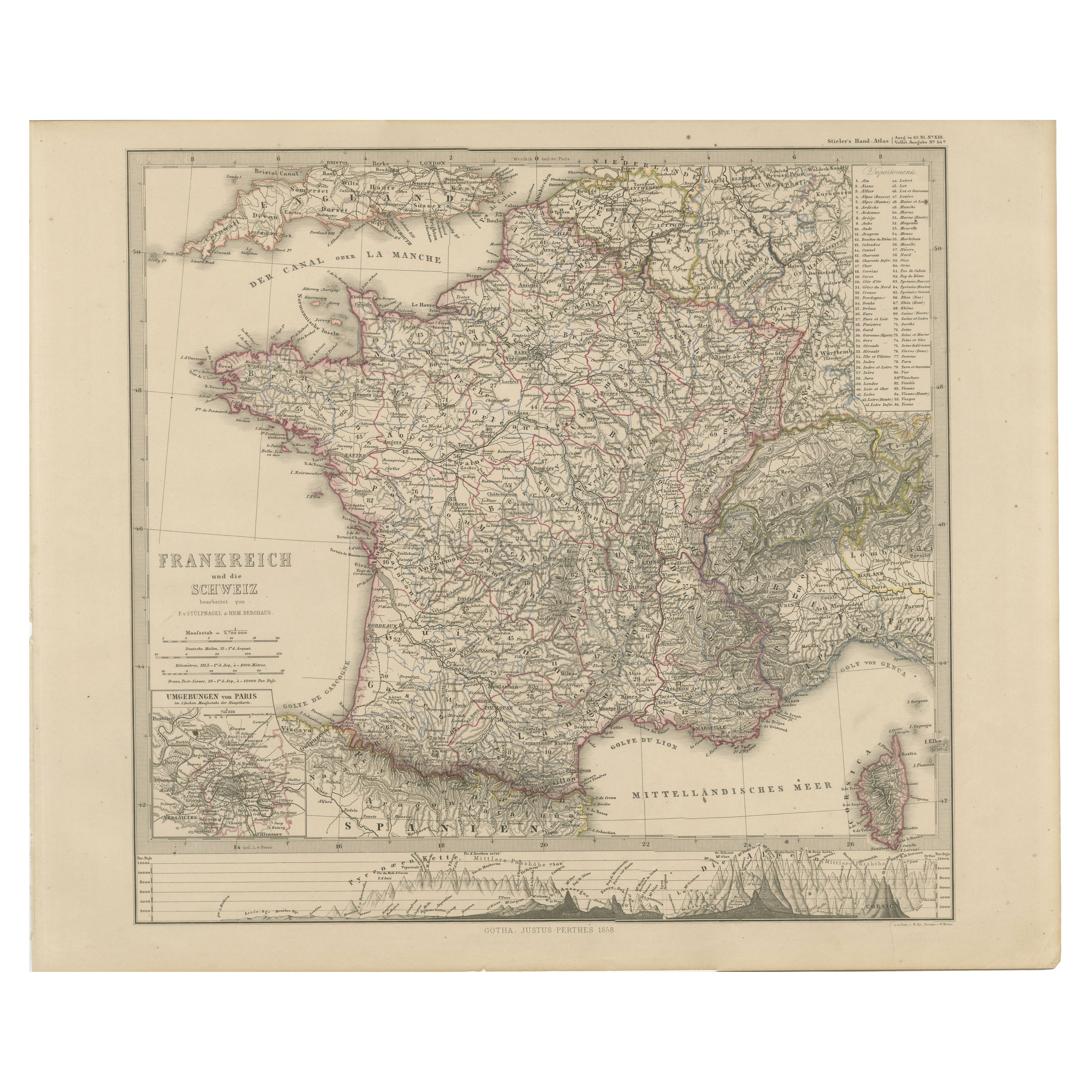
Antique Map of Northeastern France – Alsace, Lorraine
Champagne, 1858
Detailed 19th-century engraved map titled "Nordöstliches Frankreich", drawn by Friedrich von Stülpnagel and published by Justus Perthes in Gotha in 1858. This is the northeastern section of a four-sheet map of France, presenting an intricate and historically significant region that includes Alsace, Lorraine, Champagne, Burgundy, and Franche-Comté—areas that would later play pivotal roles in Franco-German conflicts.
This map captures a dense network of towns, roads, rivers, and topographical features, with the eastern border adjoining Switzerland and the German-speaking regions of Baden and Württemberg. The Rhine River runs vertically along the right margin, forming the natural boundary between France and the German states, while the Vosges Mountains, Jura, and parts of the Alps are shaded in engraved relief.
Cities such as Strasbourg, Metz, Nancy, Reims, Dijon, and Besançon are prominently marked, alongside countless smaller towns and villages. Hand-colored outlines denote departmental boundaries, with each French administrative region clearly labeled. A legend in the upper right corner explains the cartographic symbols, including markers for capitals, bishoprics, and fortresses.
This section is especially relevant for collectors interested in the shifting territorial borders between France and Germany in the 19th century—most notably before the annexation of Alsace-Lorraine by Germany in 1871 and its return to France after World War I.
Engraved with clarity and precision, the map exemplifies the high standards of the Justus Perthes publishing house and reflects the geographic and political complexities of eastern France during the era of the Second Empire.
Condition report:
Very good condition. Slight toning to the margins. Crisp impression with original hand-coloring intact. No tears or repairs. Please examine the image closely for more details.
Framing tips:
This map pairs well with a dark wood or burgundy-stained frame, complemented by a neutral mat in cream or parchment tone. Consider adding a fine red or gold inner line to reflect the departmental outlines. This piece is especially fitting for academic or historical-themed interiors.
Technique: Copperplate engraving with original hand-coloring
Maker: F. von Stülpnagel, published by Justus Perthes, Gotha, 1858
- Dimensions:Height: 14.77 in (37.5 cm)Width: 17.88 in (45.4 cm)Depth: 0.01 in (0.2 mm)
- Materials and Techniques:Paper,Engraved
- Place of Origin:
- Period:
- Date of Manufacture:1858
- Condition:Very good condition. Slight toning to the margins. Crisp impression with original hand-coloring intact. No tears or repairs. Please examine the image closely for more details.
- Seller Location:Langweer, NL
- Reference Number:Seller: BG-05552-161stDibs: LU3054346116172
About the Seller
5.0
Recognized Seller
These prestigious sellers are industry leaders and represent the highest echelon for item quality and design.
Platinum Seller
Premium sellers with a 4.7+ rating and 24-hour response times
Established in 2009
1stDibs seller since 2017
2,826 sales on 1stDibs
Typical response time: 1 hour
- ShippingRetrieving quote...Shipping from: Langweer, Netherlands
- Return Policy
More From This Seller
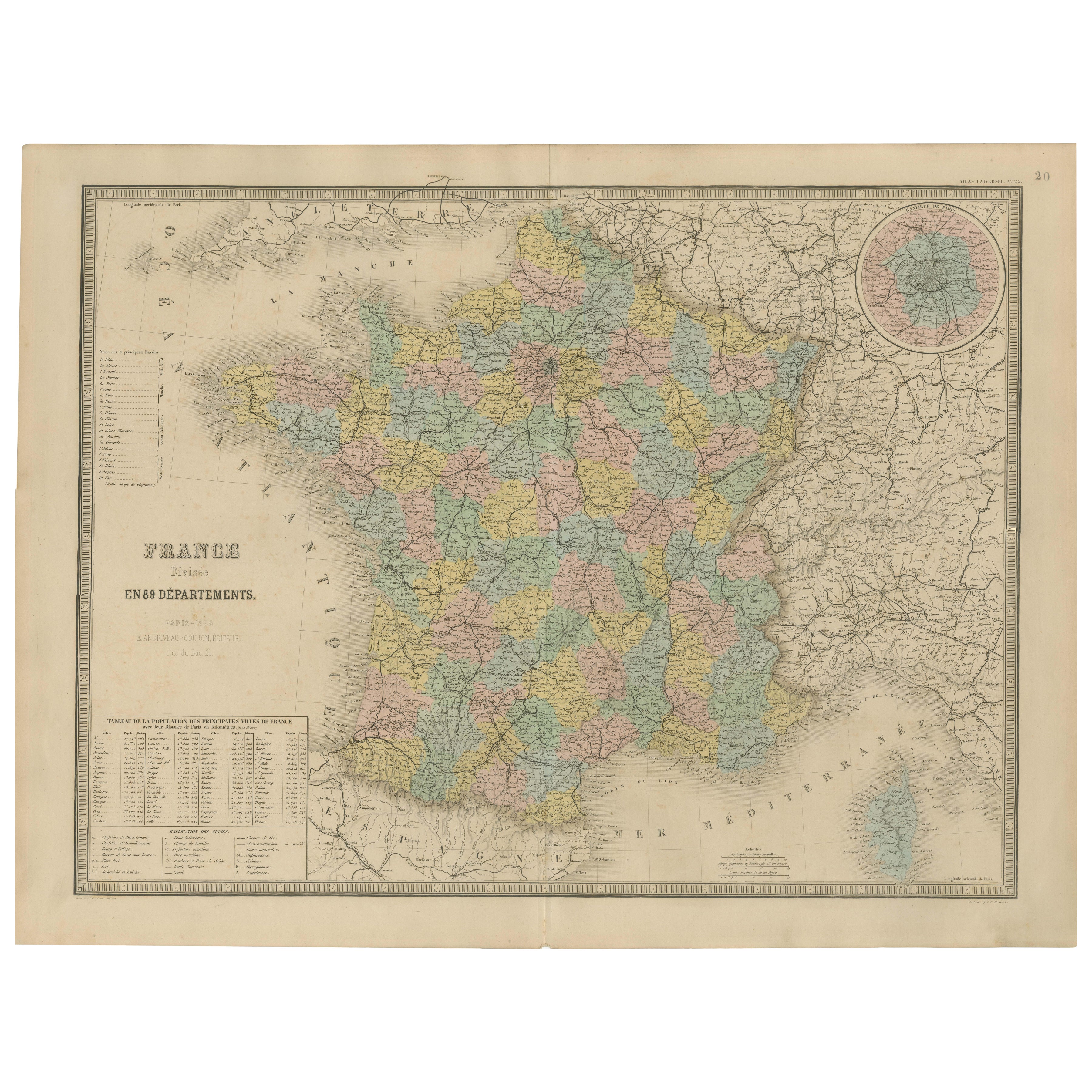
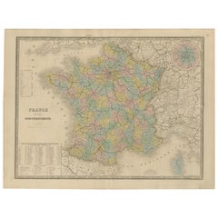
View AllAntique Map of France – Divided into 89 Departments by Andriveau-Goujon, 1861
Located in Langweer, NL
Antique Map of France – Divided into 89 Departments by Andriveau-Goujon, 1861
This finely engraved and beautifully hand-colored map titled “France divisée en 89 Départements” was pu...
Category
Antique Mid-19th Century French Maps
Materials
Paper
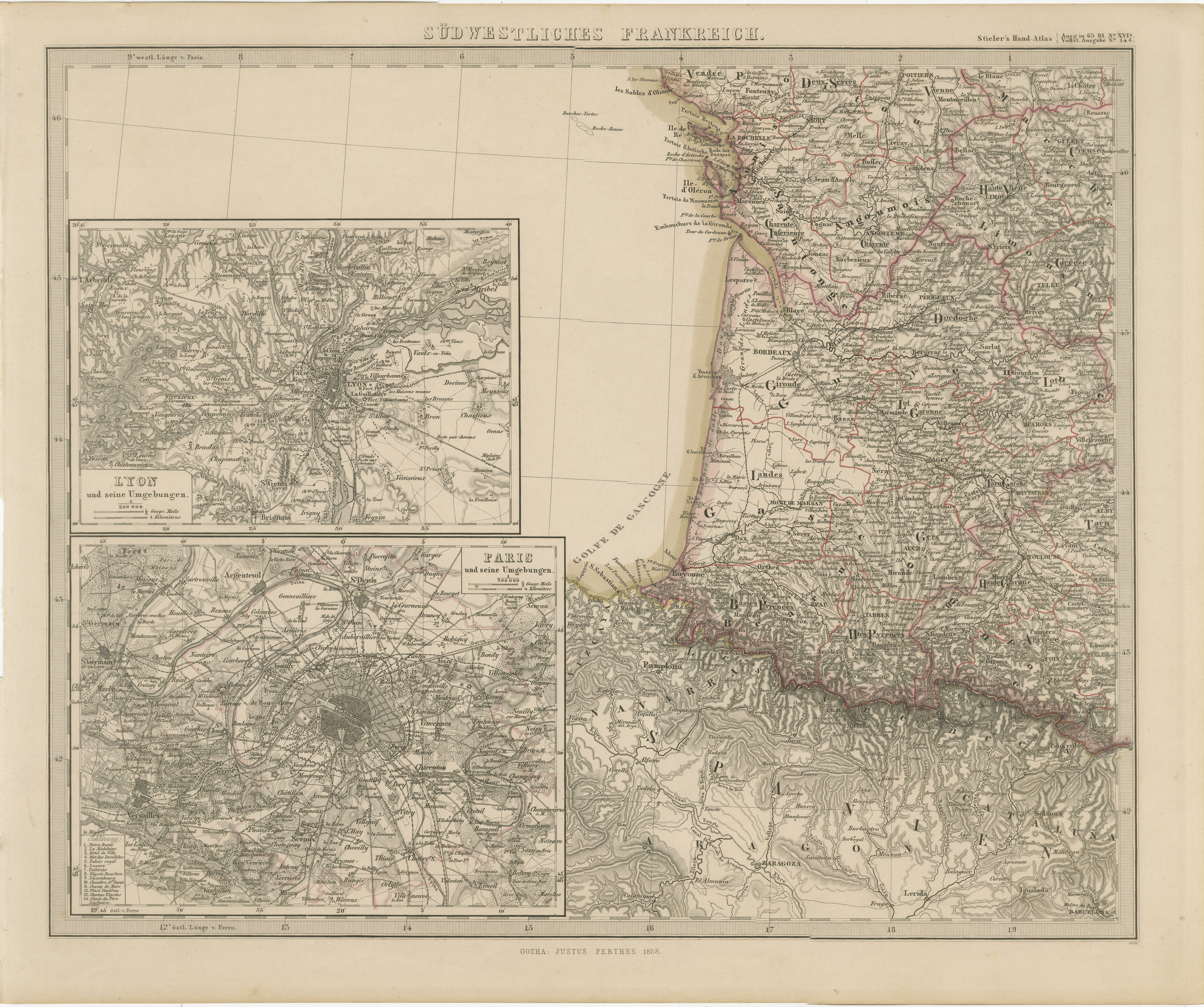
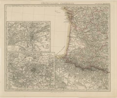
Antique Map of Southwestern France – With Insets of Paris
Lyon, 1858
Located in Langweer, NL
Antique Map of Southwestern France – With Insets of Paris & Lyon, 1858
Detailed copperplate map of "Südwestliches Frankreich" (Southwestern France), created by Friedrich von Stülpna...
Category
Antique Mid-19th Century German Maps
Materials
Paper
Decorative Antique Map of France in Departments – Collectible Print, 1884
Located in Langweer, NL
Antique Map of France in Departments – Black’s Atlas, 1884
This finely engraved and hand-colored map of France was published in the New and Revised Edition of Black’s General Atlas ...
Category
Antique 1880s Scottish Maps
Materials
Paper
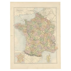
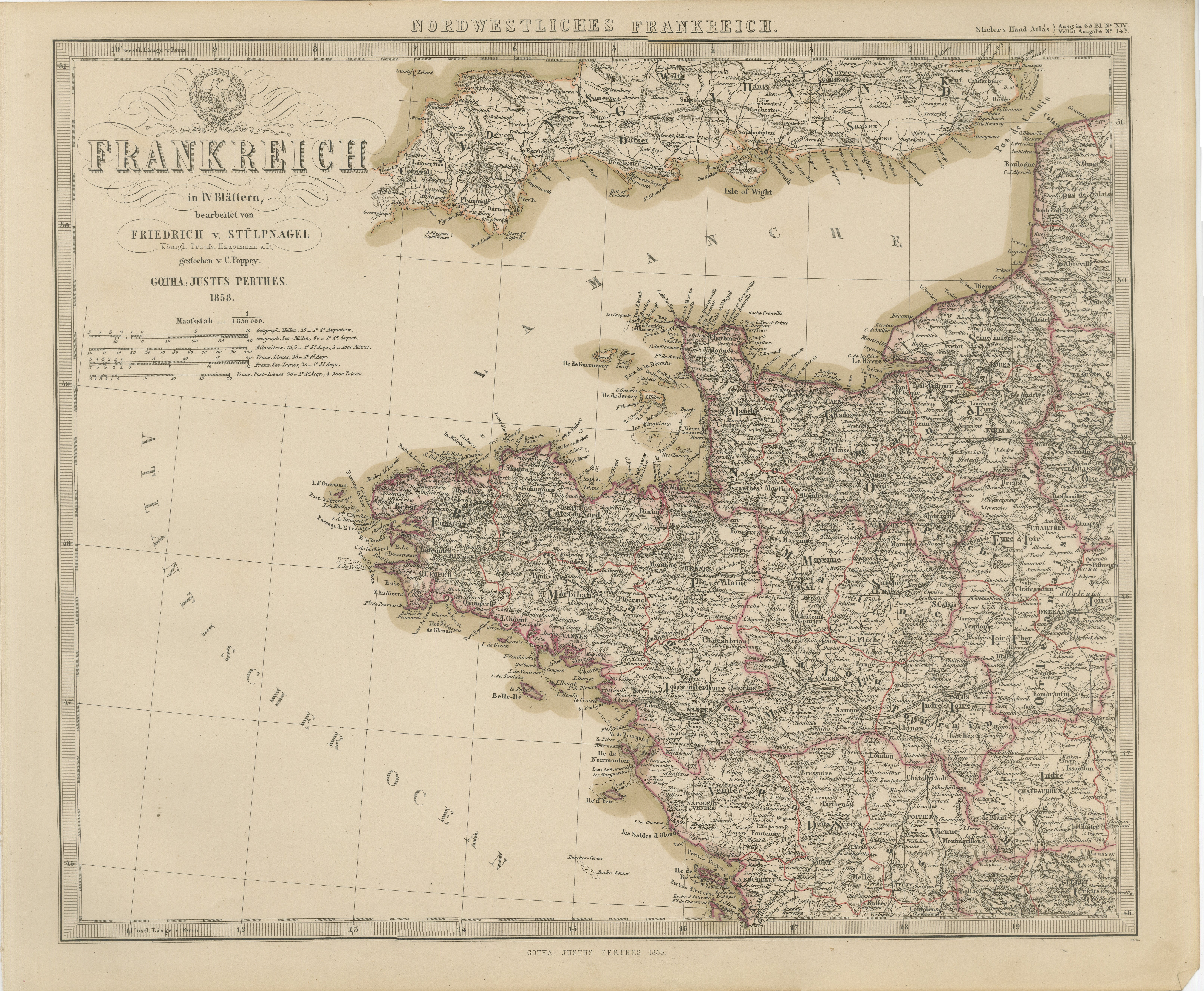
Hand-Colored Map of Northwest France – Brittany to Loire, 1858
Located in Langweer, NL
Antique Map of Northwestern France – Stülpnagel Engraving, Justus Perthes 1858
Impressively detailed mid-19th-century map of northwestern France titled "Frankreich in IV Blättern – ...
Category
Antique Mid-19th Century German Maps
Materials
Paper
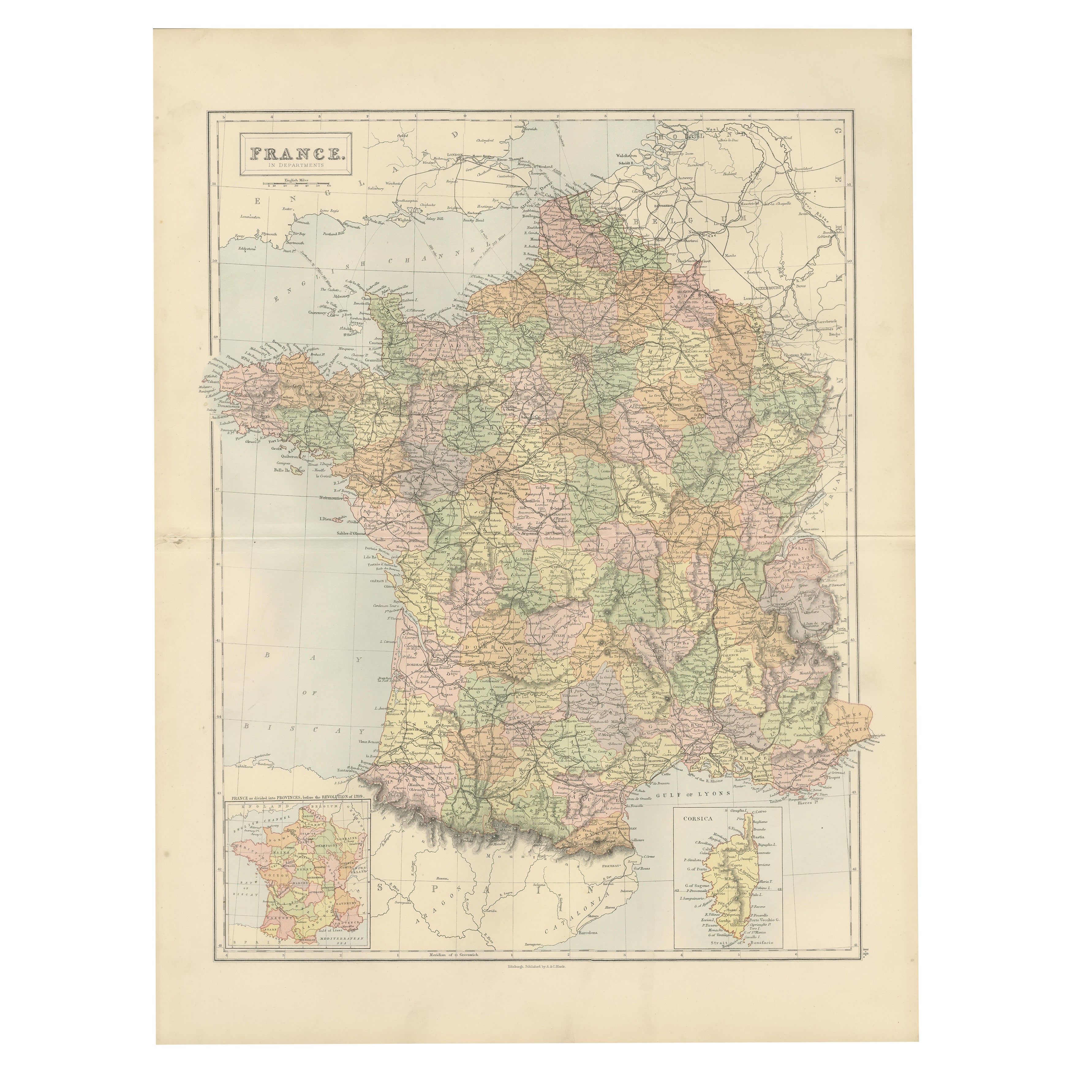
Antique Map of France by A
C. Black, 1870
Located in Langweer, NL
Antique map titled 'France'. Original antique map of France with inset map of France as divided into provinces, before the revolution of 1789 and map of Corsica...
Category
Antique Late 19th Century Maps
Materials
Paper

$262 Sale Price
20% Off
1856 France and Switzerland Map with Mountain Profiles
Located in Langweer, NL
1856 Map of France and Switzerland with Paris Inset by Stülpnagel
This finely detailed antique map of France and Switzerland was published in 1856 by the esteemed German cartographe...
Category
Antique Mid-19th Century German Maps
Materials
Paper
You May Also Like
France, Northern Part. Century Atlas antique map
Located in Melbourne, Victoria
'The Century Atlas. France, Northern Part.'
Original antique map, 1903.
Inset maps of 'France in Provinces' and 'Paris and Vicinity'.
Central fold as issued. Map name and number pr...
Category
Early 20th Century Victorian More Prints
Materials
Lithograph

Large 19th Century Map of France
Located in Pease pottage, West Sussex
Large 19th Century Map of France.
Remarkable condition, with a pleasing age worn patina.
Recently framed.
France Circa 1874.
Category
Antique Late 19th Century French Maps
Materials
Linen, Paper

Aube, France. Antique map of a French department, 1856
By Victor Levasseur
Located in Melbourne, Victoria
'Dept. de L'Aube', steel engraving with original outline hand-colouring., 1856, from Levasseur's 'Atlas National Illustre'.
This area of France is known for its production of Chaou...
Category
19th Century Naturalistic Landscape Prints
Materials
Engraving

Indre and Loire, France. Antique map of a French department, 1856
By Victor Levasseur
Located in Melbourne, Victoria
'Dept. d'Indre et Loire', steel engraving with original outline hand-colouring., 1856, from Levasseur's 'Atlas National Illustre'.
This area is known for its production of Chenin b...
Category
19th Century Naturalistic Landscape Prints
Materials
Engraving

Map of Haute Vienne - Original Lithograph - 19th Century
Located in Roma, IT
Map of Haute Vienne is an original lithograph artwork realized by an Anonymous engraver of the 19th century.
Printed in the series of "France Pittoresque".
Titled "France Pittore...
Category
19th Century Modern Figurative Prints
Materials
Lithograph

L
Isere, France. Antique map of French department, 1856
By Victor Levasseur
Located in Melbourne, Victoria
'Dept. de L'Isere', Steel engraving with original outline hand-colouring., 1856, from Levasseur's 'Atlas National Illustre'.
This area is known for its production of Bleu du Vercor...
Category
19th Century Naturalistic Landscape Prints
Materials
Engraving

More Ways To Browse
Alsace French
Beni Ourain Rugs
Glass Top Wood Base Coffee Tables
T Chair
Pair Of Danish Chairs
Veneer Dining Tables
1970 Italian Armchair
Furniture Uk
House Of Denmark Table And Chairs
Louis Marble Top Side Table
Antique Russian Rugs
Baker Furniture By
For Kids
Sterling Silver Flatware Set Service For 12
Tufted Bar
Pair Of French Antique Armchairs
1970s Brass Glass Coffee Table
Antique Column Base