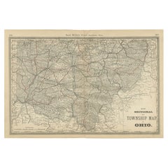
Items Similar to Antique Map of Northern Ohio – The Buckeye State with Railroads
Counties, 1888
Video Loading
Want more images or videos?
Request additional images or videos from the seller
1 of 11
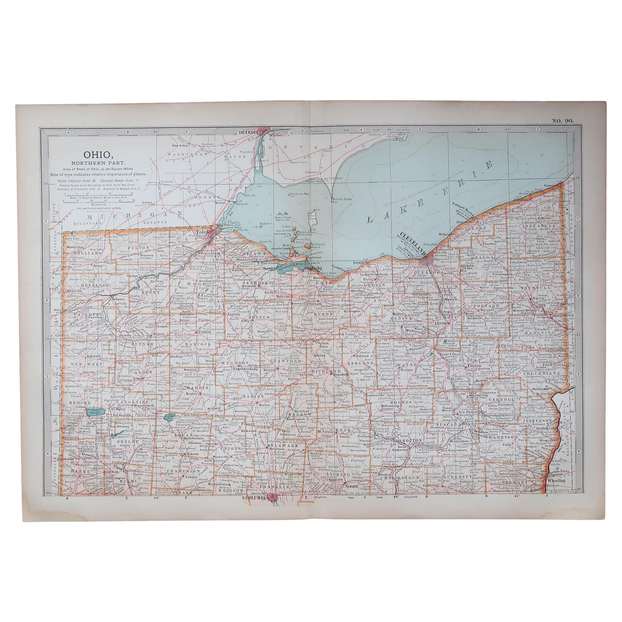
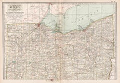
Antique Map of Northern Ohio – The Buckeye State with Railroads
Counties, 1888
$548.55
£406.18
€460
CA$757.68
A$811.47
CHF 436.24
MX$9,855.81
NOK 5,512.13
SEK 5,046.76
DKK 3,505.78
About the Item
Antique Map of Northern Ohio – The Buckeye State with Railroads
Counties, 1888
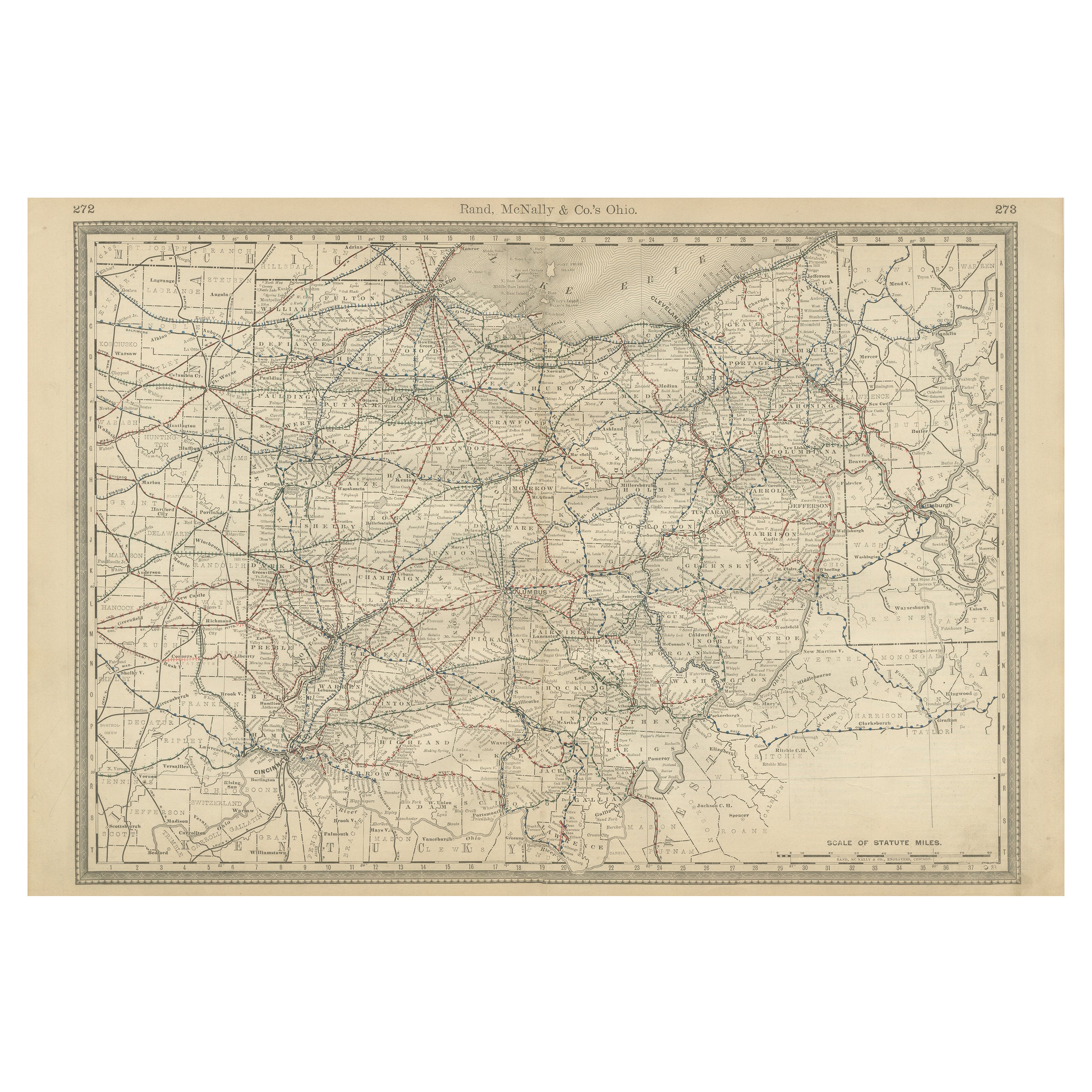
This antique engraved map of Northern Ohio, published in 1888 by Rand, McNally
Co. in Chicago for their Improved Indexed Business Atlas and Shippers Guide, offers a highly detailed view of the “Buckeye State” during the late 19th century. It captures the northern half of Ohio, including its counties, townships, towns, and the extensive railroad system that defined the region’s economic growth during the Gilded Age.
Railroads are shown in red and blue, demonstrating the density of transportation routes across northern Ohio. Major lines include the Lake Shore
Michigan Southern, the Cleveland, Columbus, Cincinnati
Indianapolis, and the Baltimore
Ohio Railroad. These routes connected Ohio’s industrial centers to Chicago, Pittsburgh, and eastern seaboard markets, reinforcing the state’s strategic role as a hub of American commerce. Cleveland, prominently marked on the shore of Lake Erie, stands out as an industrial and shipping center, while Toledo, Sandusky, Akron, Canton, and Youngstown appear as vital regional cities.
Counties such as Cuyahoga, Lucas, Summit, Stark, and Mahoning are clearly delineated, alongside numerous smaller towns and depots. The detail extends to township boundaries, rivers, and local roads, making this a practical reference tool for shippers, businessmen, and settlers in 1888. The strong presence of Lake Erie is a defining feature, emphasizing Ohio’s connection to the Great Lakes shipping trade, which carried coal, iron ore, grain, and manufactured goods.
Historically, this map represents Ohio at the height of its industrial expansion. Known as “The Buckeye State,” Ohio had developed into a powerhouse of steel, coal, and manufacturing by the late 19th century. Cleveland’s steel industry, Toledo’s glass and auto-related manufacturing, and Akron’s emerging rubber industry laid the foundation for Ohio’s 20th-century economic dominance. The map also illustrates how railroads knit together the state’s agricultural regions with its urban and industrial centers.
Engraved with precision, this Rand McNally map not only documents the transportation and settlement patterns of the era but also provides insight into the rapid transformation of Ohio into one of the most industrially advanced states in the nation.
Condition summary: Good condition overall. Mild toning and faint foxing in the margins and around the foldline. Original center fold as issued. Strong paper with crisp engraved detail, no major tears or repairs.
Framing tips: A dark walnut or cherry frame will complement the antique character. For a sharper look, a black frame with ivory matting emphasizes the fine engraved details. A double mat, ivory with a muted blue accent, highlights the importance of Lake Erie and Ohio’s railroad network.
Technique: Engraving
Maker: Rand, McNally
Co., Chicago, 1888
- Dimensions:Height: 14.18 in (36 cm)Width: 20.67 in (52.5 cm)Depth: 0.01 in (0.2 mm)
- Materials and Techniques:Paper,Engraved
- Place of Origin:
- Period:
- Date of Manufacture:1888
- Condition:Condition summary: Good condition overall. Mild toning and faint foxing in the margins and around the foldline. Original center fold as issued. Strong paper with crisp engraved detail, no major tears or repairs.
- Seller Location:Langweer, NL
- Reference Number:Seller: BG-12794-331stDibs: LU3054346402472
About the Seller
5.0
Recognized Seller
These prestigious sellers are industry leaders and represent the highest echelon for item quality and design.
Platinum Seller
Premium sellers with a 4.7+ rating and 24-hour response times
Established in 2009
1stDibs seller since 2017
2,826 sales on 1stDibs
Typical response time: 1 hour
- ShippingRetrieving quote...Shipping from: Langweer, Netherlands
- Return Policy
More From This Seller
View AllAntique Ohio Map c.1888 – Buckeye State Railroads, Towns
Settlements
Located in Langweer, NL
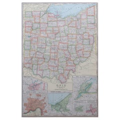
Antique Map of Ohio – Rand McNally, circa 1888
This highly detailed antique map of Ohio was published by Rand, McNally & Co. around 1888. Issued in their celebrated late 19th-centur...
Category
Antique Late 19th Century American Maps
Materials
Paper
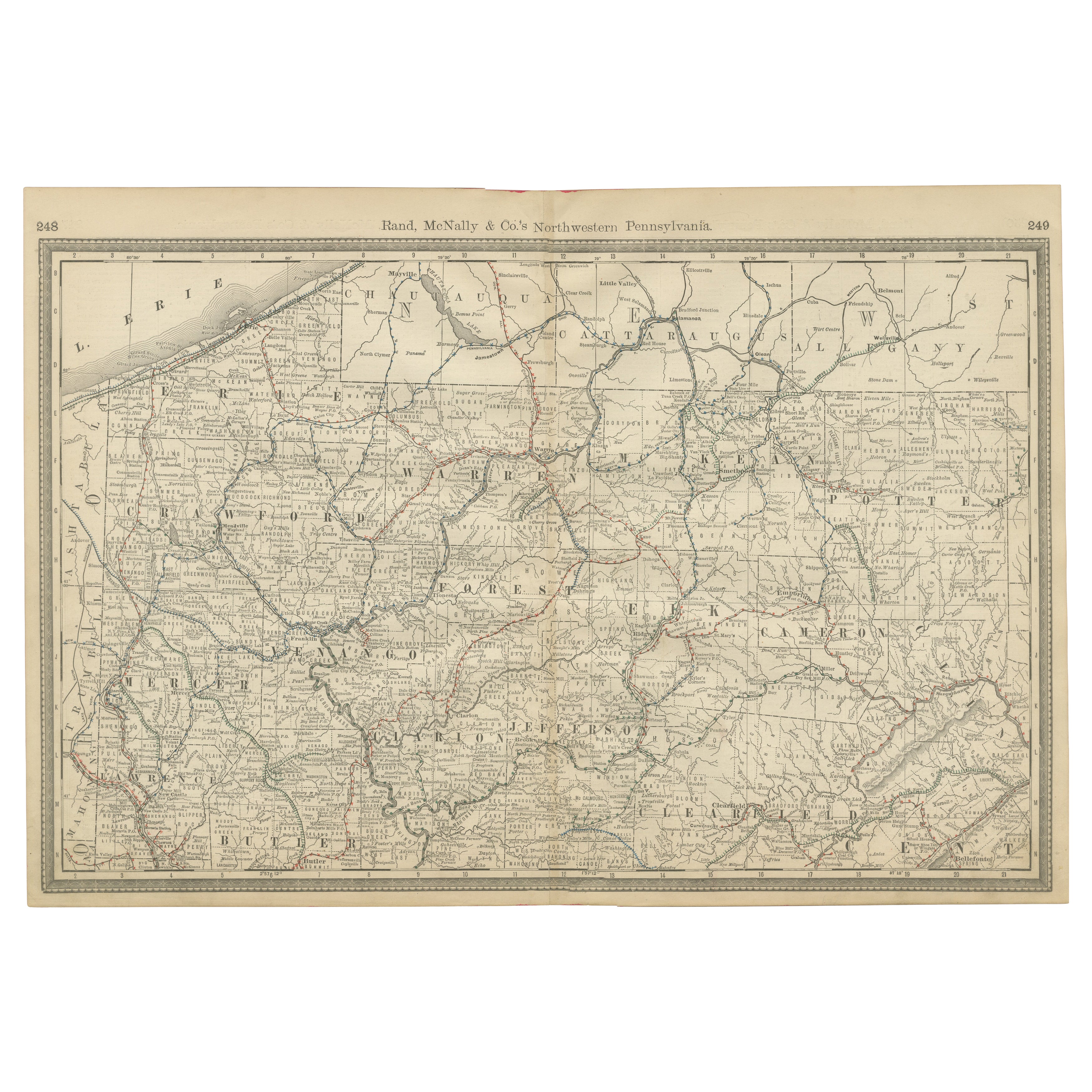
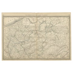
Pennsylvania Antique Map c.1888 – The Keystone State, Northwestern Counties
Located in Langweer, NL
Antique Map of Northwestern Pennsylvania – Rand McNally, circa 1888
This finely detailed antique map of northwestern Pennsylvania was published by Rand, McNally & Co. around 1888. I...
Category
Antique Late 19th Century American Maps
Materials
Paper
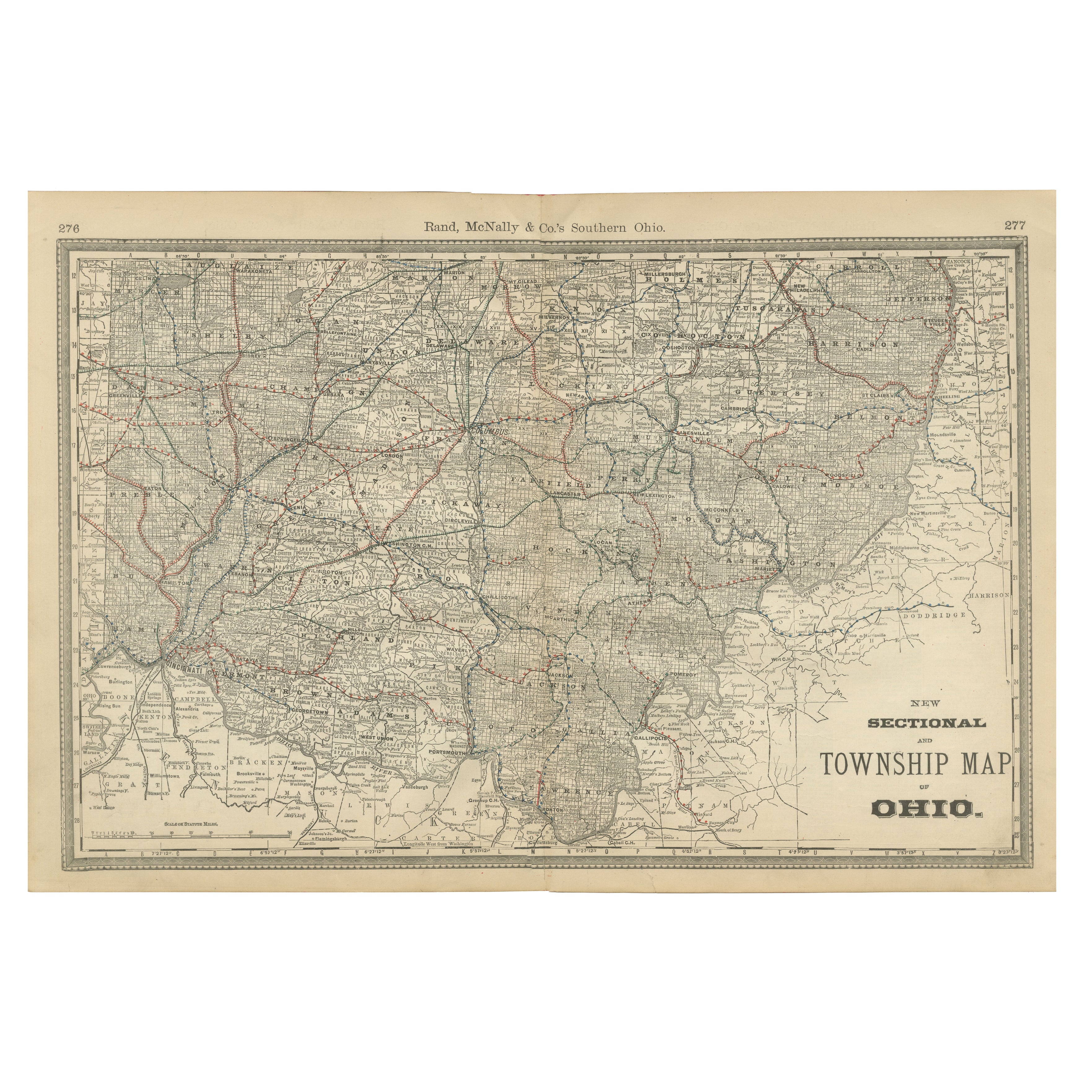
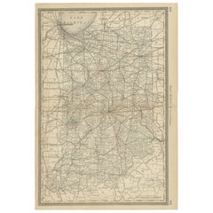
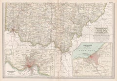
Antique Map of Southern Ohio – The Buckeye State - Railroads
Townships, 1888
Located in Langweer, NL
Antique Map of Southern Ohio – The Buckeye State with Railroads & Townships, 1888
This antique engraved map of Southern Ohio, published in 1888 by Rand, McNally & Co. in Chicago for...
Category
Antique Late 19th Century American Maps
Materials
Paper
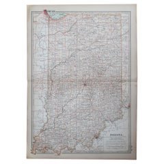
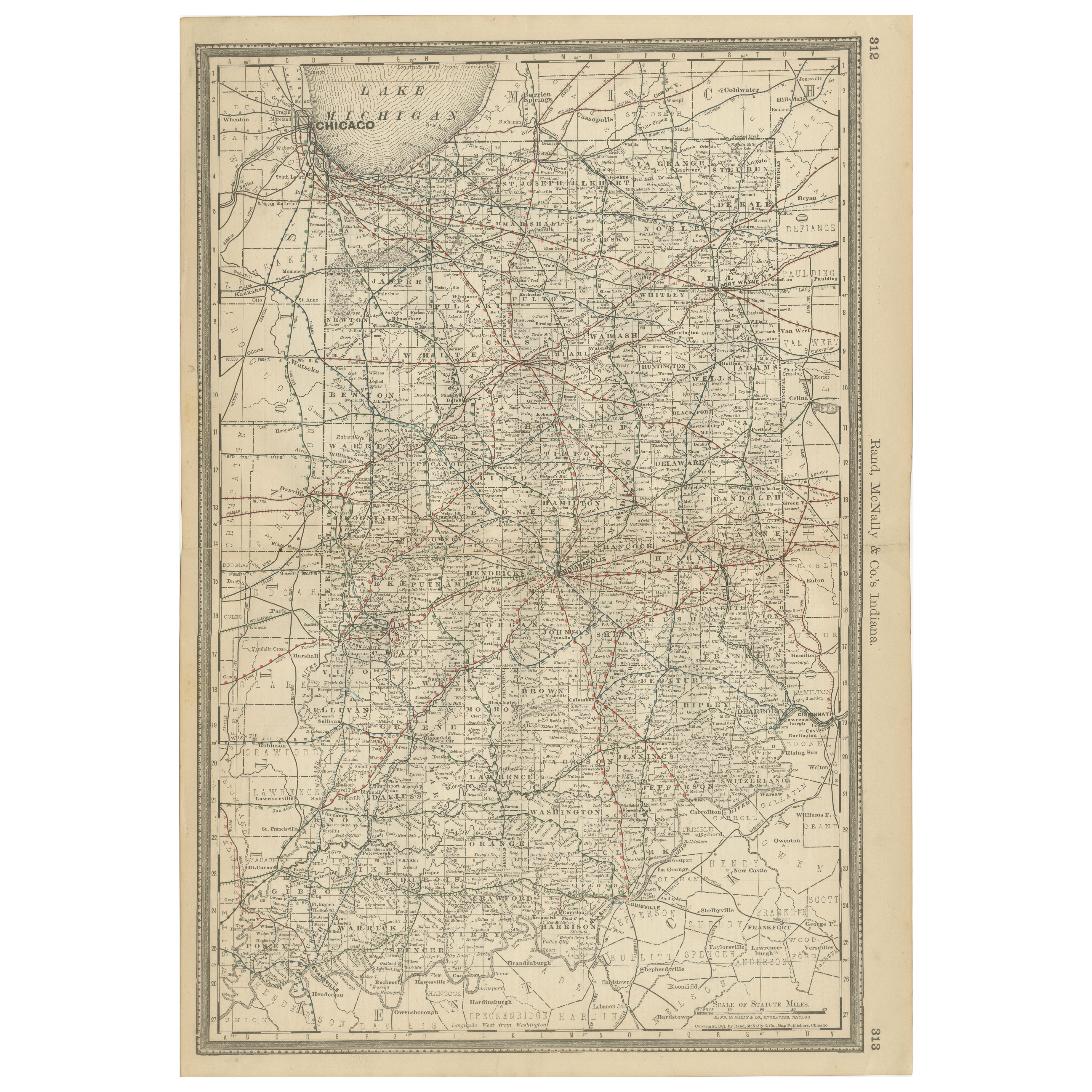
Antique Map of Indiana – The Hoosier State with Railroads
Counties, 1888
Located in Langweer, NL
Antique Map of Indiana – The Hoosier State with Railroads & Counties, 1888
This antique engraved map of Indiana, published in 1888 by Rand, McNally & Co. in Chicago for their *Impro...
Category
Antique Late 19th Century American Maps
Materials
Paper
Antique Railroad
Township Map of Ohio by C.O. Titus, Paper, 1871
Located in Langweer, NL
Antique map titled 'Railroad
Township Map of the State of Ohio'. Original antique map of the State of Ohio. This map originates from 'Atlas of Preble County Ohio' by C.O. Titus...
Category
Antique Late 19th Century American Maps
Materials
Paper

$858 Sale Price
40% Off
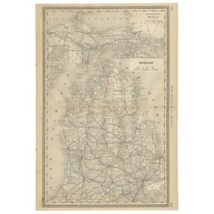
Antique Map of Michigan – The Wolverine State with Railroads
Counties, 1888
Located in Langweer, NL
Antique Map of Michigan – The Wolverine State with Railroads & Counties, 1888
This antique engraved map of Michigan, published in 1888 by Rand...
Category
Antique Late 19th Century American Maps
Materials
Paper
You May Also Like
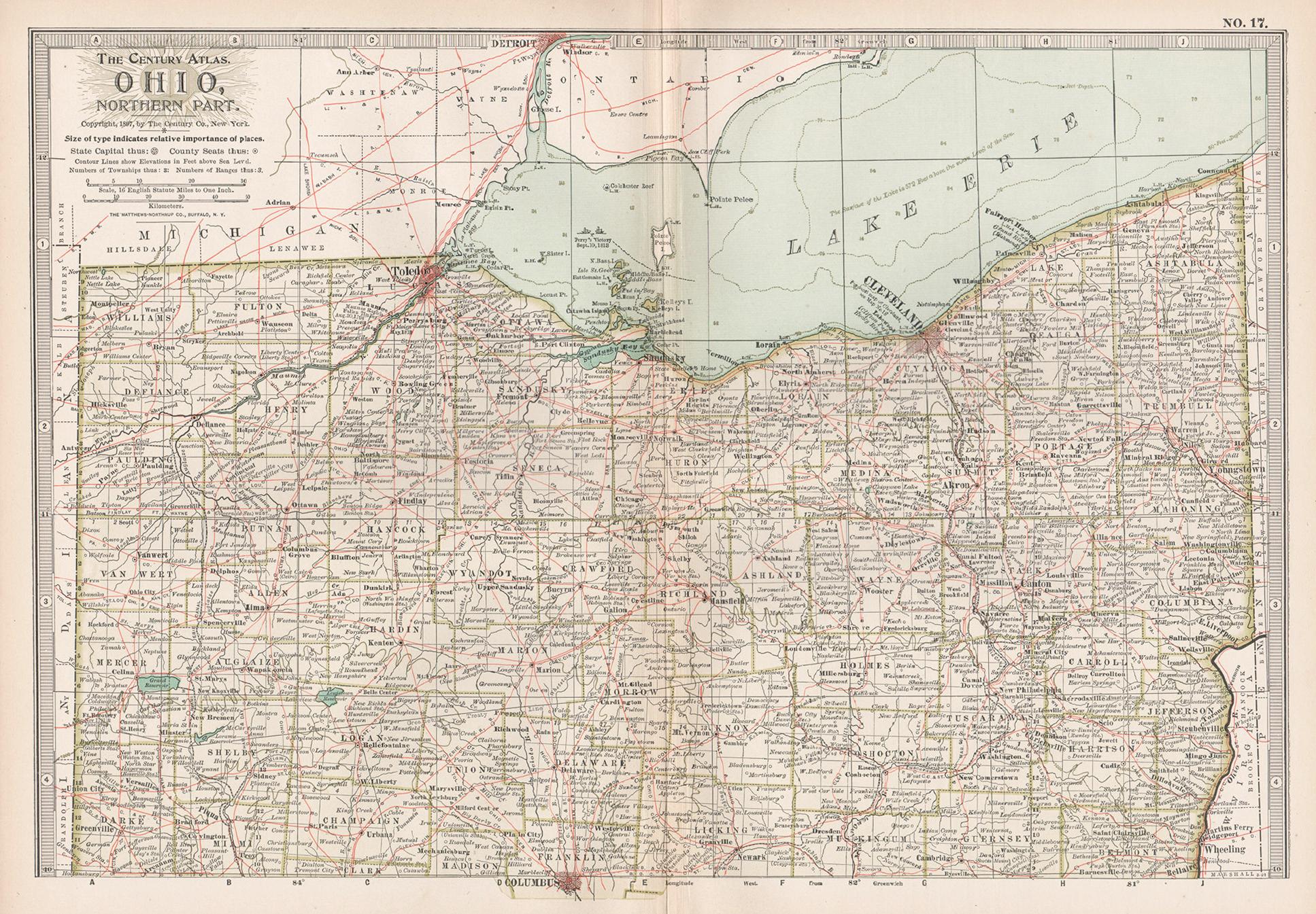
Ohio, Northern Part. USA. Century Atlas state antique vintage map
Located in Melbourne, Victoria
'The Century Atlas. Ohio, Northern Part'
Original antique map, 1903.
Central fold as issued. Map name and number printed on the reverse corners.
Sheet 29.5cm by 40cm.
Category
Early 20th Century Victorian More Prints
Materials
Lithograph
Original Antique Map of the American State of Ohio ( Northern Part ), 1903
Located in St Annes, Lancashire
Antique map of Ohio ( Northern part )
Published By A & C Black. 1903
Original colour
Good condition
Unframed.
Free shipping
Category
Antique Early 1900s English Maps
Materials
Paper

Original Antique Map of the American State of Ohio ( Southern Part ), 1903
Located in St Annes, Lancashire
Antique map of Ohio ( Southern part )
Published By A & C Black. 1903
Original colour
Good condition
Unframed.
Free shipping
Category
Antique Early 1900s English Maps
Materials
Paper

Large Original Antique Map of Ohio, Usa, C.1900
Located in St Annes, Lancashire
Fabulous map of Ohio
Original color.
Engraved and printed by the George F. Cram Company, Indianapolis.
Published, C.1900.
Unframed.
Free shipping.
Category
Antique 1890s American Maps
Materials
Paper
Ohio, Southern Part. USA. Century Atlas state antique vintage map
Located in Melbourne, Victoria
'The Century Atlas. Ohio, Southern Part'
Original antique map, 1903.
Central fold as issued. Map name and number printed on the reverse corners.
Sheet 29.5cm by 40cm.
Category
Early 20th Century Victorian More Prints
Materials
Lithograph
Original Antique Map of the American State of Indiana, 1903
Located in St Annes, Lancashire
Antique map of Indiana
Published By A & C Black. 1903
Original colour
Good condition
Unframed.
Free shipping
Category
Antique Early 1900s English Maps
Materials
Paper