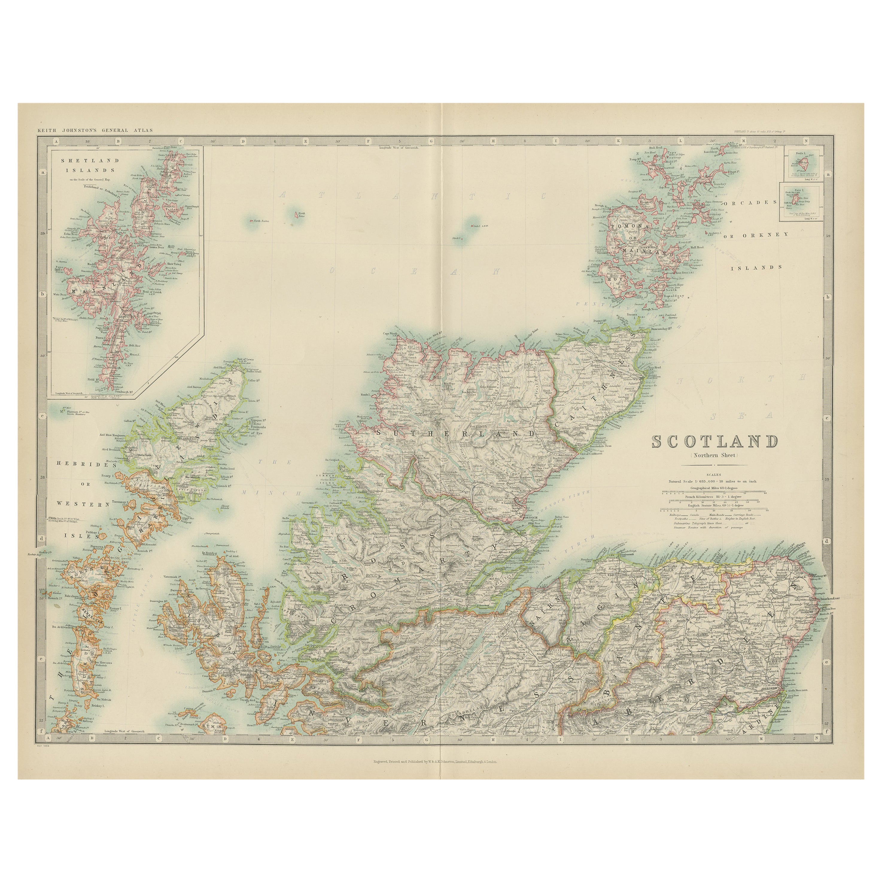
Items Similar to Antique Map of Northern Scotland, 1903, with Intricate Coastal Features

Want more images or videos?
Request additional images or videos from the seller
1 of 10
Antique Map of Northern Scotland, 1903, with Intricate Coastal Features
$336.28
£249.10
€280
CA$460.11
A$500.64
CHF 265.08
MX$6,023.04
NOK 3,365.96
SEK 3,079.62
DKK 2,133.83
About the Item
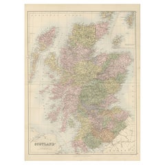
Title: Antique Map of Northern Scotland and Islands, 1903, with Intricate Coastal Features
Description:
This striking antique map, titled "Scotland (Northern Sheet I)," was engraved and published in 1903 by the renowned cartographers W.
A.K. Johnston in Edinburgh and London. It offers an exceptional and meticulously detailed view of northern Scotland and its many islands, including the Orkney and Shetland archipelagos and the rugged Hebrides.
The map is beautifully engraved and colored in soft pastel shades of pink, green, and yellow to demarcate counties and natural features. Its precision showcases the intricate geography of this stunningly scenic region, with its complex coastlines, dramatic highlands, and offshore islands. The inset of the Shetland Islands and close-up depiction of the Hebrides highlight their remote and maritime importance, offering valuable insight into a time when these islands were integral to Britain’s fishing, trade, and cultural identity.
For collectors and lovers of historical geography, this map represents the artistry and scientific rigor of the early 20th century’s cartographic tradition. It provides a fascinating look at the natural and political landscape of Scotland during a period of modernization, when railways and steamships were beginning to connect these once isolated areas to the rest of the British Isles.
Its finely engraved typography and delicate color palette make this map not just a historical record, but also a work of art suitable for any sophisticated interior. From the rich cultural history of the highlands to the strategic maritime routes of the islands, this map captures the timeless allure of Scotland’s northern reaches.
Condition report:
The map is in very good antique condition, showing slight toning and minor foxing around the edges, typical for its age. Colors remain vibrant and paper is well-preserved. Folding line as issued.
Framing tips:
A dark wood frame such as mahogany or walnut enhances the map’s rich character. Use a cream or light tan matting to highlight the soft pastel colors and intricate detailing, making this map a sophisticated focal point in any home or office.
- Dimensions:Height: 14.49 in (36.8 cm)Width: 18.9 in (48 cm)Depth: 0.01 in (0.2 mm)
- Materials and Techniques:
- Period:
- Date of Manufacture:1903
- Condition:The map is in very good antique condition, showing slight toning and minor foxing around the edges, typical for its age. Colors remain vibrant and paper is well-preserved. Folding line as issued.
- Seller Location:Langweer, NL
- Reference Number:Seller: BG-13577-61stDibs: LU3054345241202
About the Seller
5.0
Recognized Seller
These prestigious sellers are industry leaders and represent the highest echelon for item quality and design.
Platinum Seller
Premium sellers with a 4.7+ rating and 24-hour response times
Established in 2009
1stDibs seller since 2017
2,816 sales on 1stDibs
Typical response time: 1 hour
- ShippingRetrieving quote...Shipping from: Langweer, Netherlands
- Return Policy
More From This Seller
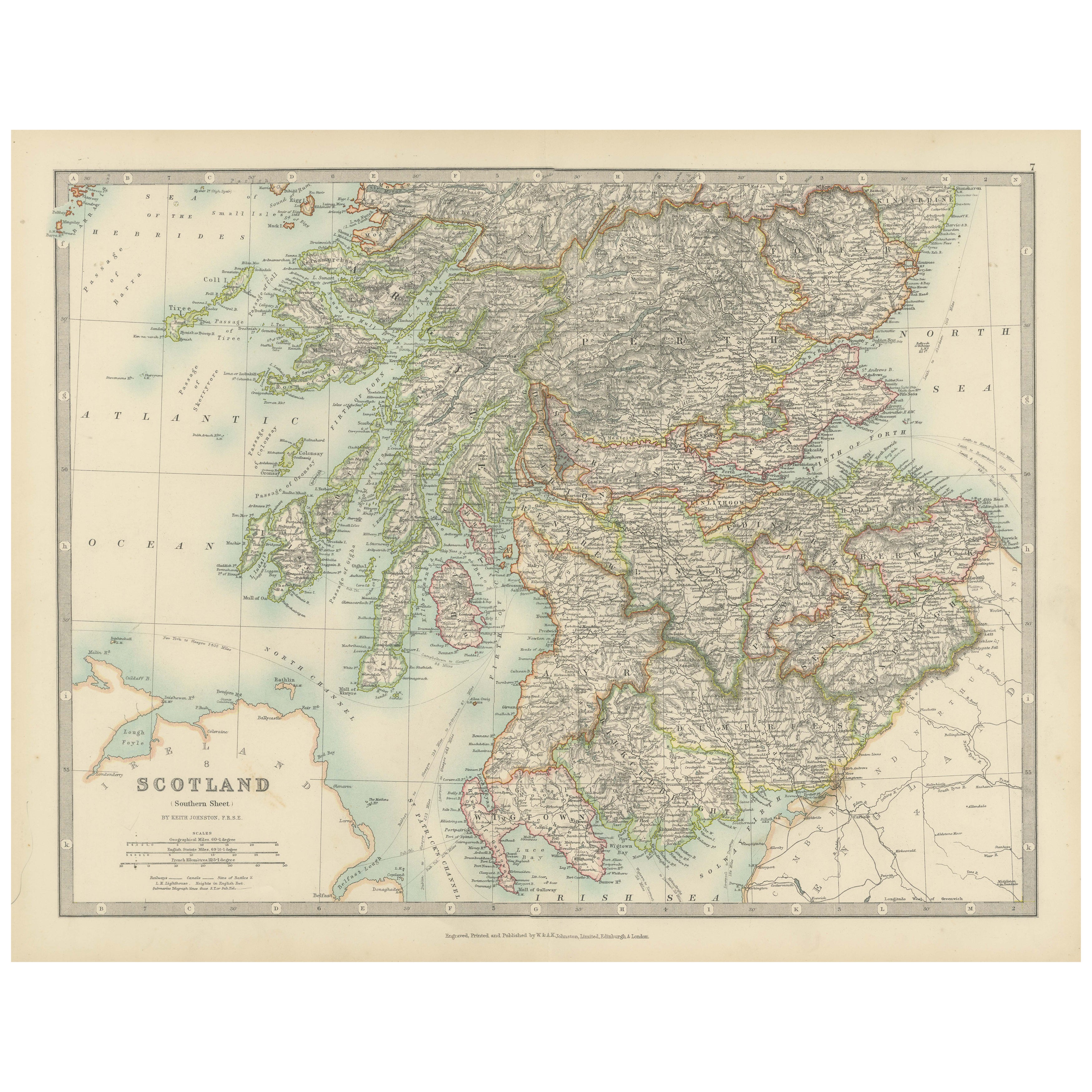
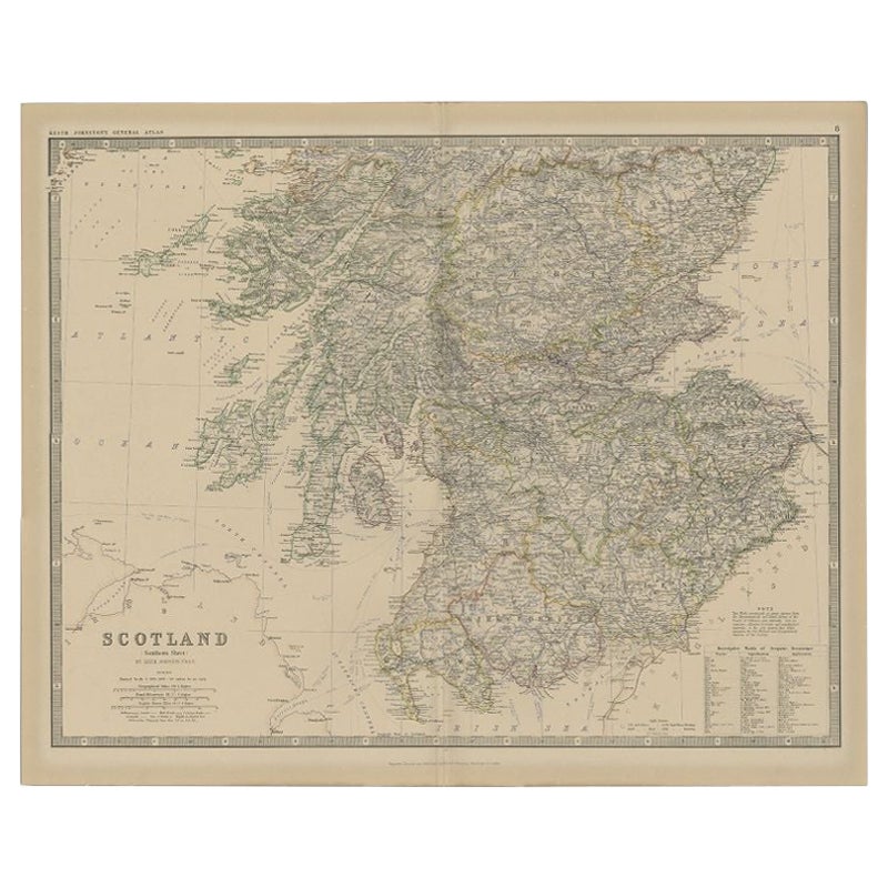
View AllAntique Map of Southern Scotland, 1903, with Coastal and Inland Details
Located in Langweer, NL
Title: Antique Map of Southern Scotland, 1903, with Coastal and Inland Details
Description:
This exquisite antique map, titled "Scotland (Southern Sheet I)," was engraved and publis...
Category
Early 20th Century Maps
Materials
Paper
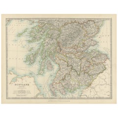
Antique Map of Scotland
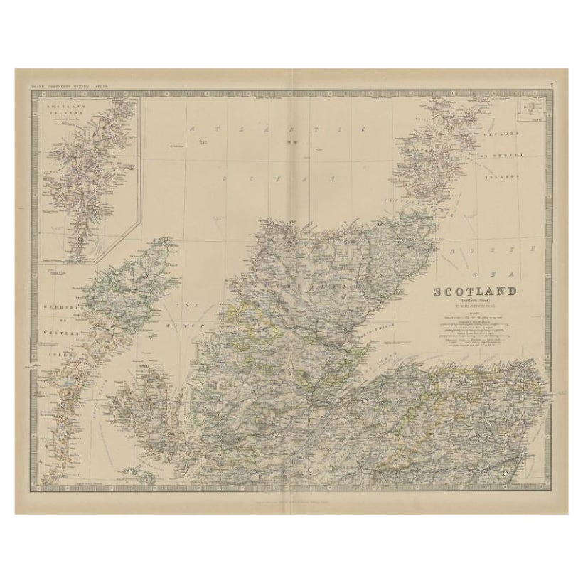
Northern
by Johnston,
1909
Located in Langweer, NL
Antique map titled 'Scotland'. Original antique map of Scotland. With inset map of the Shetland Islands. This map originates from the ‘Royal Atlas of M...
Category
Early 20th Century Maps
Materials
Paper
$240 Sale Price
20% Off
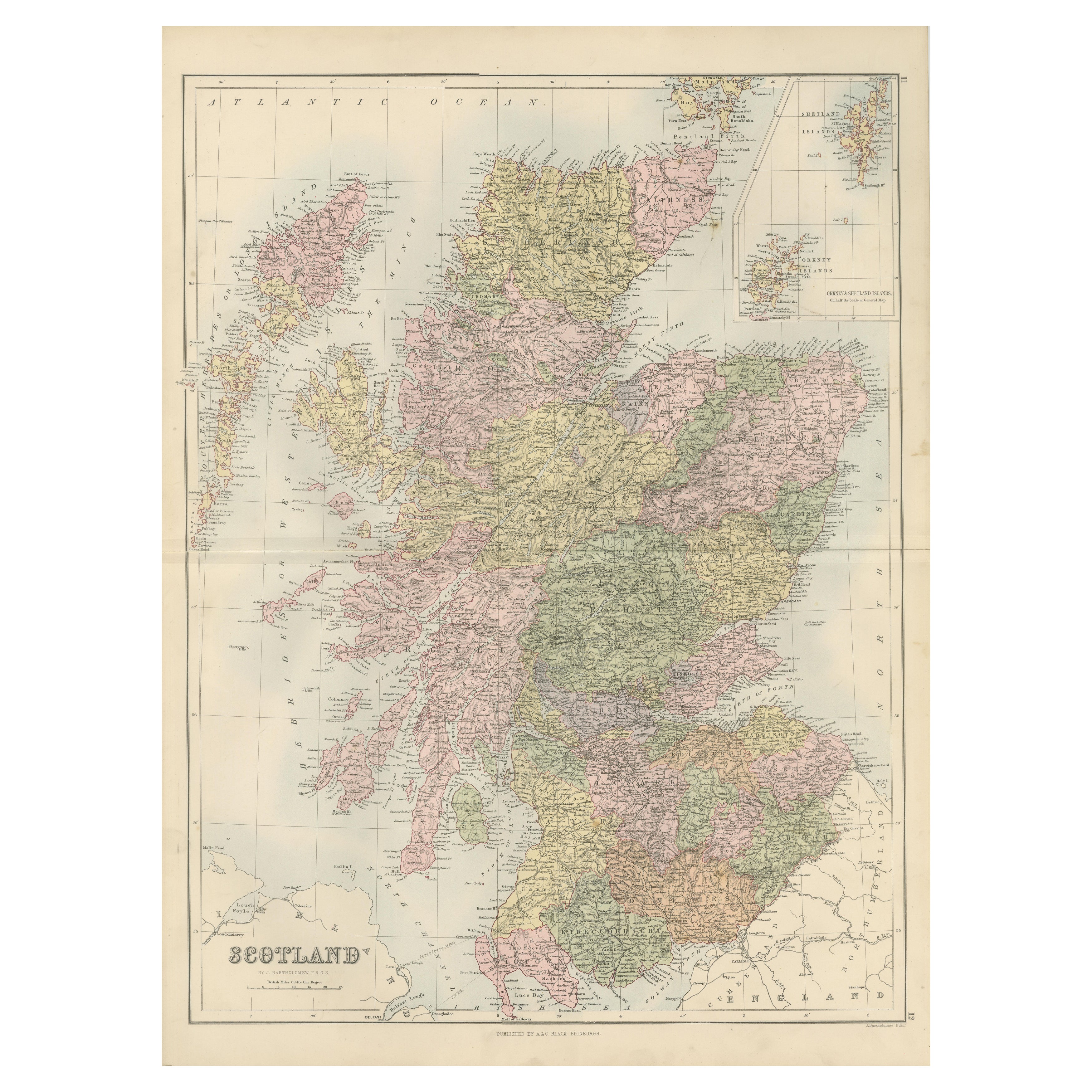
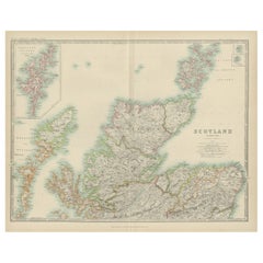
Antique Map of Northern Scotland by Johnston, 1882
Located in Langweer, NL
Antique map titled 'Scotland'. Old map of Northern Scotland. This map originates from 'The Royal Atlas of Modern Geography, Exhibiting, in a Series of Entirely Original and Authentic...
Category
Antique 19th Century Maps
Materials
Paper
$100 Sale Price
20% Off
Antique Map of Scotland with Counties and Islands – Black’s Atlas, 1884
Located in Langweer, NL
Here is a catalogue entry in your preferred format for the Scotland map you uploaded:
---
Title: Antique Map of Scotland with Counties and Islands – Bla...
Category
Antique 1880s Scottish Maps
Materials
Paper
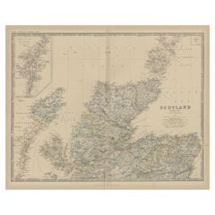
Antique Map of Southern Scotland by Johnston, 1882
Located in Langweer, NL
"Antique map titled 'Scotland'. Old map of Southern Scotland. This map originates from 'The Royal Atlas of Modern Geography, Exhibiting, in a Series of Entirely Original and Authenti...
Category
Antique 19th Century Maps
Materials
Paper
$129 Sale Price
20% Off
Antique Map of the Northern Part of Scotland by Black
1854
Located in Langweer, NL
Antique map titled 'Scotland'. Original map of the northern part of Scotland. With an inset map of the Orkney Isles. This map originates from 'General Atlas Of The World: Containing ...
Category
Antique Mid-19th Century Maps
Materials
Paper

You May Also Like
Original Antique Map of Scotland by Dower, circa 1835
Located in St Annes, Lancashire
Nice map of Scotland
Drawn and engraved by J.Dower
Published by Orr & Smith. C.1835
Unframed.
Free shipping
Category
Antique 1830s English Maps
Materials
Paper

England and Wales, Northern Part. Century Atlas antique vintage map
Located in Melbourne, Victoria
'The Century Atlas. England and Wales, Northern Part'
Original antique map, 1903.
Central fold as issued. Map name and number printed on the reverse corners.
Sheet 29.5cm by 40cm.
Category
Early 20th Century Victorian More Prints
Materials
Lithograph

Large Original Vintage Map of the United Kingdom, circa 1920
Located in St Annes, Lancashire
Great map of The United Kingdom
Unframed
Original color
By John Bartholomew and Co. Edinburgh Geographical Institute
Published, circa 1920
Free shipping.
Category
Vintage 1920s British Maps
Materials
Paper

Original Antique Decorative Map of Iceland
Faroe, Fullarton, C.1870
Located in St Annes, Lancashire
Great map of Iceland and The Faroe Islands
Wonderful figural border
From the celebrated Royal Illustrated Atlas
Lithograph. Original color.
Published by Fullarton, Edinb...
Category
Antique 1870s Scottish Maps
Materials
Paper

Denmark. Century Atlas antique vintage map
Located in Melbourne, Victoria
'The Century Atlas. Denmark'
Original antique map, 1903.
Inset maps of 'Faroe Islands', 'Iceland' and 'Copenhagen'.
Central fold as issued. Map name and number printed on the reve...
Category
Early 20th Century Victorian More Prints
Materials
Lithograph

Canada and Newfoundland. Century Atlas antique vintage map
Located in Melbourne, Victoria
'The Century Atlas. Dominion of Canada and Newfoundland.'
Original antique map, 1903.
Central fold as issued. Map name and number printed on the reverse corners.
Sheet 29.5cm by 40...
Category
Early 20th Century Victorian More Prints
Materials
Lithograph

More Ways To Browse
Round Table Base
Cream Soup
Early English Silver
James Bond
Paisley Rugs and Carpets
Antique Pagoda
Black And Chrome Lounge Chair
Ceramic 1960s Italy
Vintage 1930 Dining Room Set
Antique Brass And Copper
Antique Cow
Antique Harvest
Antique Victorian Dining Tables
Environment Furniture
Italian Plastic Chairs
Made In Belgium
Black Crystal Glasses
French Mid Century Modern Rug