Items Similar to Antique Map of Northwestern India by Weller, 1857

Want more images or videos?
Request additional images or videos from the seller
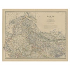
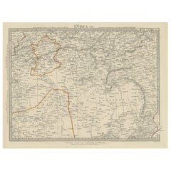
1 of 5
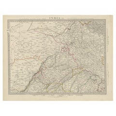
Antique Map of Northwestern India by Weller, 1857
$201.71
£150.59
€170
CA$280.24
A$301.44
CHF 161.10
MX$3,553.13
NOK 2,031.08
SEK 1,856.79
DKK 1,295.59
About the Item
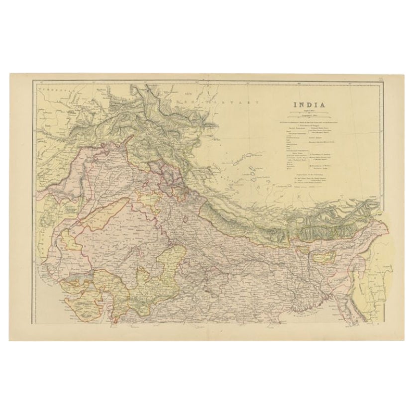
Antique map titled 'India, The North West Provinces and Oude'.Detailed map of the northwestern part of India, extending to the Himalaya Mountains. Shows part of Nepal including Dharmsala. Originates from the 'Weekly Dispatch Atlas'. Artists and Engravers: 'The Weekly Dispatch' newspaper between the years 1856 and 1862 included in each edition a map of a part of the world. During this period a total of 118 maps were issued. The maps bear the distinctive sign of a half globe with the figure of Mercury above. The engravers varied but included John Dower and Edward Weller.
Artist: 'The Weekly Dispatch' newspaper between the years 1856 and 1862 included in each edition a map of a part of the world. During this period a total of 118 maps were issued. The maps bear the distinctive sign of a half globe with the figure of Mercury above. The engravers varied but included John Dower and Edward Weller.
Antique prints have long been appreciated for both their aesthetic and investment value. They were the product of engraved, etched or lithographed plates. These plates were handmade out of wood or metal, which required an incredible level of skill, patience and craftsmanship. Whether you have a house with Victorian furniture or more contemporary decor an old engraving can enhance your living space.
- Dimensions:Height: 13.39 in (34 cm)Width: 19.49 in (49.5 cm)Depth: 0 in (0.01 mm)
- Materials and Techniques:
- Period:
- Date of Manufacture:1857
- Condition:Condition: Good, general age-related toning. Stamp in upper left corner stating the Weekly Dispatch edition. Few small tears, please study image carefully.
- Seller Location:Langweer, NL
- Reference Number:Seller: BGJC-002511stDibs: LU3054327622622
About the Seller
5.0
Recognized Seller
These prestigious sellers are industry leaders and represent the highest echelon for item quality and design.
Platinum Seller
Premium sellers with a 4.7+ rating and 24-hour response times
Established in 2009
1stDibs seller since 2017
2,836 sales on 1stDibs
Typical response time: 1 hour
- ShippingRetrieving quote...Shipping from: Langweer, Netherlands
- Return Policy
More From This Seller
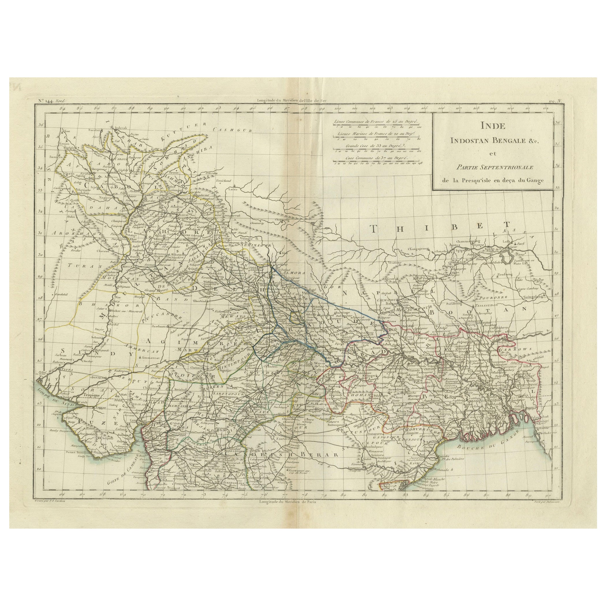
View AllAntique Map of Northern India, Bengal, and Surrounding Regions by Tardieu, 1802
Located in Langweer, NL
This is an original antique map titled "Inde, Indostan Bengale &c. et Partie Septentrionale de la Presqu'isle en deça du Gange," depicting the northern part of the Indian subcontinen...
Category
Antique Early 1800s Maps
Materials
Paper
$417 Sale Price
20% Off
Antique Map of Northern India by Blackie
Son, 1860
Located in Langweer, NL
Antique map titled 'India'. Old map depicting northern India. This map originates from 'The Comprehensive Atlas & Geography of the World, Compiled and Engraved from the most Authenti...
Category
Antique 19th Century Maps
Materials
Paper
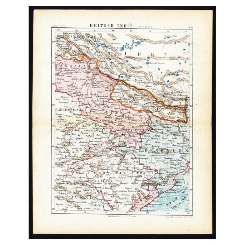
Antique Map of Northern India
British Indies
, C.1880
Located in Langweer, NL
Plate 56 : 'Britsch-Indie, Noord.' (British Indies, North). This lithographed map originates from: 'Wereld-atlas voor Kantoor en Huiskamer' (transl: World Atlas for the office and li...
Category
Antique 19th Century Maps
Materials
Paper
$61 Sale Price
20% Off
Antique Map of the Region of Delhi in India, 1833
Located in Langweer, NL
Antique map titled 'India IX'. Old steel engraved map of the region of Delhi, with great detail.
Artists and Engravers: Engraved by J. & C. Walker. Published under the superinten...
Category
Antique 19th Century Maps
Materials
Paper
$379 Sale Price
20% Off
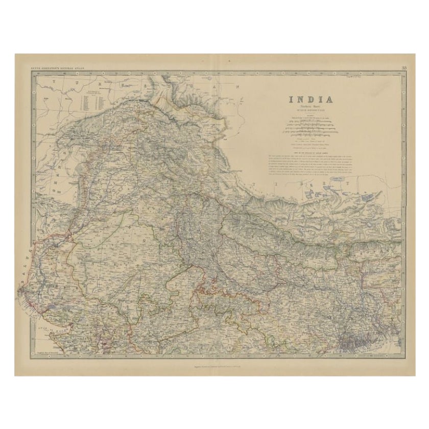
Antique Map of Northern India by Johnston, 1882
Located in Langweer, NL
Antique map titled 'India (Northern Sheet)'. Old map of Northern India. This map originates from 'The Royal Atlas of Modern Geography, Exhibiting, in a Series of Entirely Original an...
Category
Antique 19th Century Maps
Materials
Paper
$128 Sale Price
20% Off
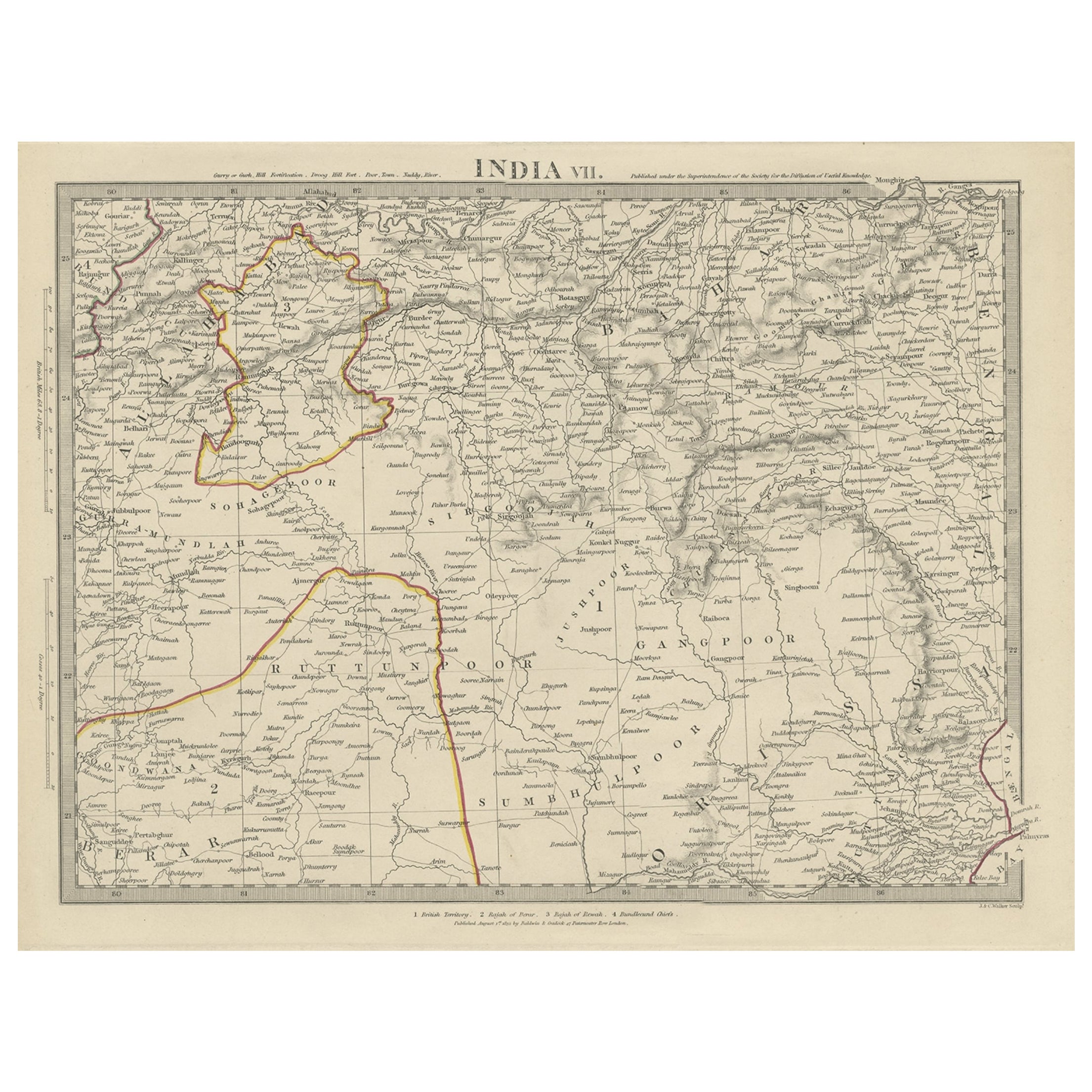
Antique Map of the Region of Berar and Rewah in India, 1832
Located in Langweer, NL
Antique map titled 'India VII'. Old steel engraved map of part of India including the Rajah of Berar, the Rajah of Rewah and British Territory.
Artists and Engravers: Engraved by...
Category
Antique 19th Century Maps
Materials
Paper
$275 Sale Price
20% Off
You May Also Like
Original Antique Map of India by Dower, circa 1835
Located in St Annes, Lancashire
Nice map of India
Drawn and engraved by J.Dower
Published by Orr & Smith. C.1835
Unframed.
Free shipping
Category
Antique 1830s English Maps
Materials
Paper

Map Of India - Original Lithograph - 19th Century
Located in Roma, IT
Map of India is an original lithograph artwork realized by an Anonymous engraver of the 19th Century.
Printed in the series of "France Pittoresque".
Titled "France Pittoresque".
...
Category
19th Century Modern Figurative Prints
Materials
Lithograph

1849 Map of "Europaische Russland",
Meyer Map of European Russia
, Ric. R017
Located in Norton, MA
1849 Map of
"Europaische Russland"
( Meyer Map of European Russia)
Ric.r017
A lovely map of European Russia dating to 1849 by Joseph Meyer. It covers the European portions of...
Category
Antique 19th Century Unknown Maps
Materials
Paper

Large Original Vintage Map of India, circa 1920
Located in St Annes, Lancashire
Great map of India
Original color.
Good condition / repair to some minor damage just above Sri Lanka. Shown in the last image.
Published by Alexander Gross
Unframed.
Category
Vintage 1920s English Maps
Materials
Paper

Antique 1803 Italian Map of Asia Including China Indoneseia India
Located in Amsterdam, Noord Holland
Antique 1803 Italian Map of Asia Including China Indoneseia India
Very nice map of Asia. 1803.
Additional information:
Type: Map
Country of Manufacturing: Europe
Period: 19th centu...
Category
Antique 19th Century European Maps
Materials
Paper

$438 Sale Price
39% Off
Large Original Antique Map of Afghanistan. Edward Weller, 1861
Located in St Annes, Lancashire
Great map of Afghanistan
Lithograph engraving by Edward Weller
Original colour
Published, 1861
Unframed
Good condition
Category
Antique 1860s English Victorian Maps
Materials
Paper

More Ways To Browse
Ptolemy Map
Antique Maps Massachusetts
Antique Maps Singapore
Antique Planisphere
Map Of Palestine
R Johnston
Santa Cruz Island
Shetland Map
Antique Alabama Map
Antique Framed Map Engravings
Antique Furniture Cheshire
Antique Great Lakes Map
Antique Map Of Michigan
Antique Map Of Turkish Empire
Antique Map Of Yorkshire
Bali Map
Bermuda Map
British Empire Map