Items Similar to Antique Map of Nubia and Abyssina by Lowry, 1852


Want more images or videos?
Request additional images or videos from the seller
1 of 5
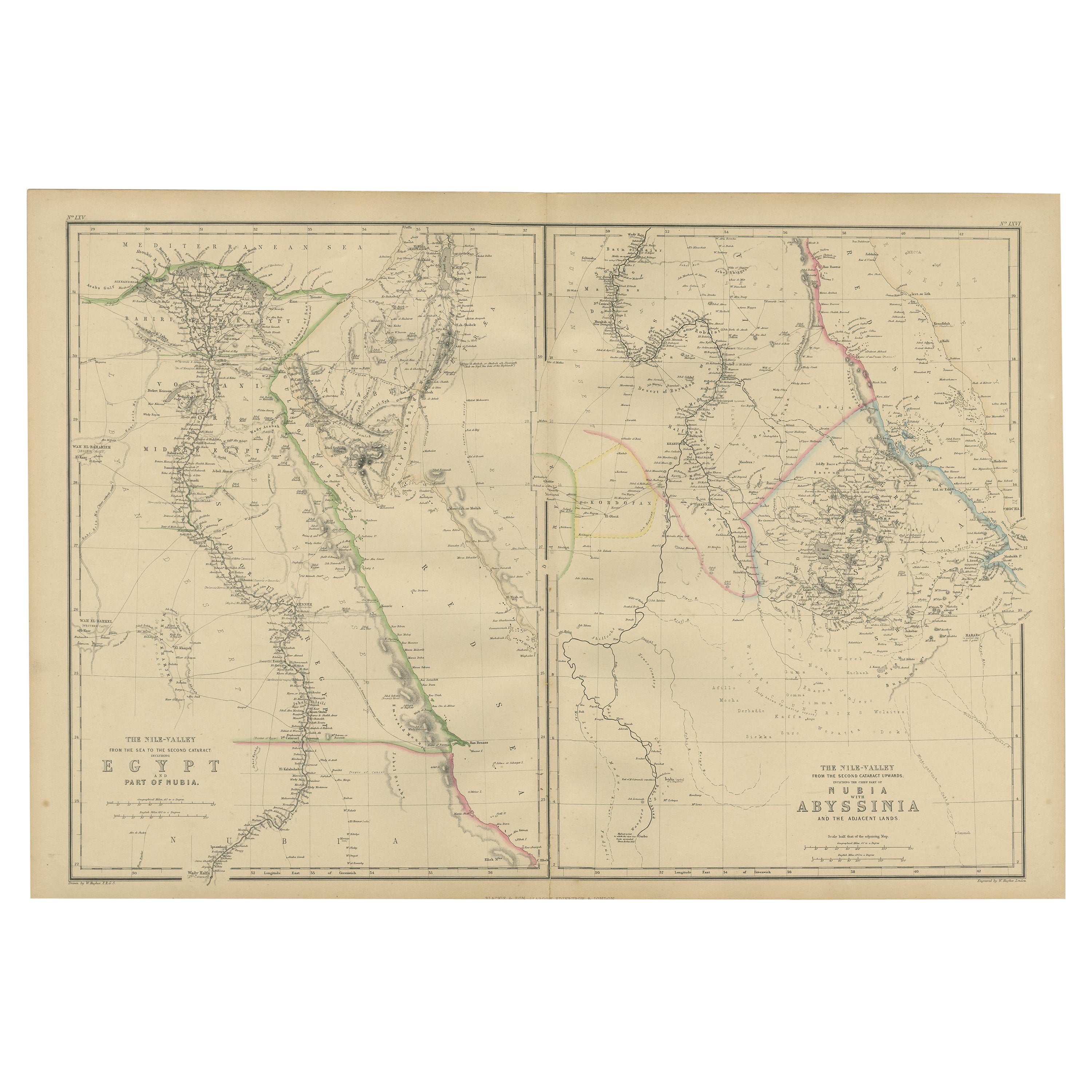
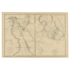
Antique Map of Nubia and Abyssina by Lowry, 1852
$143.61per set
$179.51per set20% Off
£107.51per set
£134.38per set20% Off
€120per set
€150per set20% Off
CA$197.69per set
CA$247.12per set20% Off
A$216.12per set
A$270.15per set20% Off
CHF 114.34per set
CHF 142.92per set20% Off
MX$2,586.21per set
MX$3,232.77per set20% Off
NOK 1,454.77per set
NOK 1,818.46per set20% Off
SEK 1,331.70per set
SEK 1,664.62per set20% Off
DKK 914.25per set
DKK 1,142.82per set20% Off
About the Item
Antique map titled 'Nubia and Abyssina'. Two individual sheets of Nubia and Abyssina. This map originates from 'Lowry's Table Atlas constructed and engraved from the most recent authorities' by J.W. Lowry. Published 1852.
- Dimensions:Height: 12.21 in (31 cm)Width: 9.65 in (24.5 cm)Depth: 0.02 in (0.5 mm)
- Sold As:Set of 2
- Materials and Techniques:
- Period:
- Date of Manufacture:1852
- Condition:General age-related toning, blank verso. Minor wear, please study images carefully.
- Seller Location:Langweer, NL
- Reference Number:Seller: BG-12593-66 BG-12593-671stDibs: LU3054321551012
About the Seller
5.0
Recognized Seller
These prestigious sellers are industry leaders and represent the highest echelon for item quality and design.
Platinum Seller
Premium sellers with a 4.7+ rating and 24-hour response times
Established in 2009
1stDibs seller since 2017
2,792 sales on 1stDibs
Typical response time: <1 hour
- ShippingRetrieving quote...Shipping from: Langweer, Netherlands
- Return Policy
More From This Seller
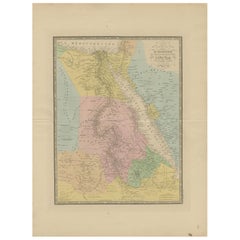
View AllAntique Map of Egypt and Abyssinia by W. G. Blackie, 1859
Located in Langweer, NL
Antique map titled 'Egypt and Abyssinia'. Original antique map of Egypt and part of Nubia and Nubia with Abyssinia. This map originates from ‘The Imperial Atlas of Modern Geography’....
Category
Antique Mid-19th Century Maps
Materials
Paper
$239 Sale Price
20% Off
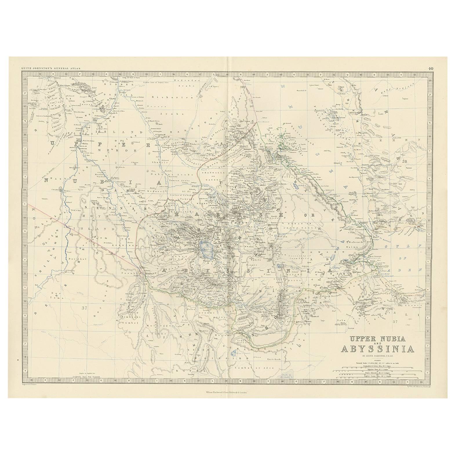
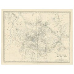
Antique Map of Upper Nubia and Abyssinia by A.K. Johnston, 1865
Located in Langweer, NL
Antique map titled 'Upper Nubia and Abyssinia'. Depicting Habesh (or Abyssinia), Arabia, Upper Nubia and more. This map originates from the ‘Royal Atlas of Modern Geography’ by Alexa...
Category
Antique Mid-19th Century Maps
Materials
Paper
Antique Map of North Africa by Lowry
1852
Located in Langweer, NL
Antique map titled 'North Africa Marocco Algiers & Tunis'. Two individual sheets of North Africa. This map originates from 'Lowry's Table Atlas constructed and engraved from the most...
Category
Antique Mid-19th Century Maps
Materials
Paper

$143 Sale Price / set
20% Off
Large Antique Map of the Lower Nile Valley Including Egypt and Nubia, 1842
Located in Langweer, NL
Antique map titled 'Carte de l'Égypte, de la Nubie, de l'Abissinie'. Map of Egypt, covering the lower Nile valley including Egypt and Nubia. This map o...
Category
Antique 19th Century Maps
Materials
Paper

Egypt
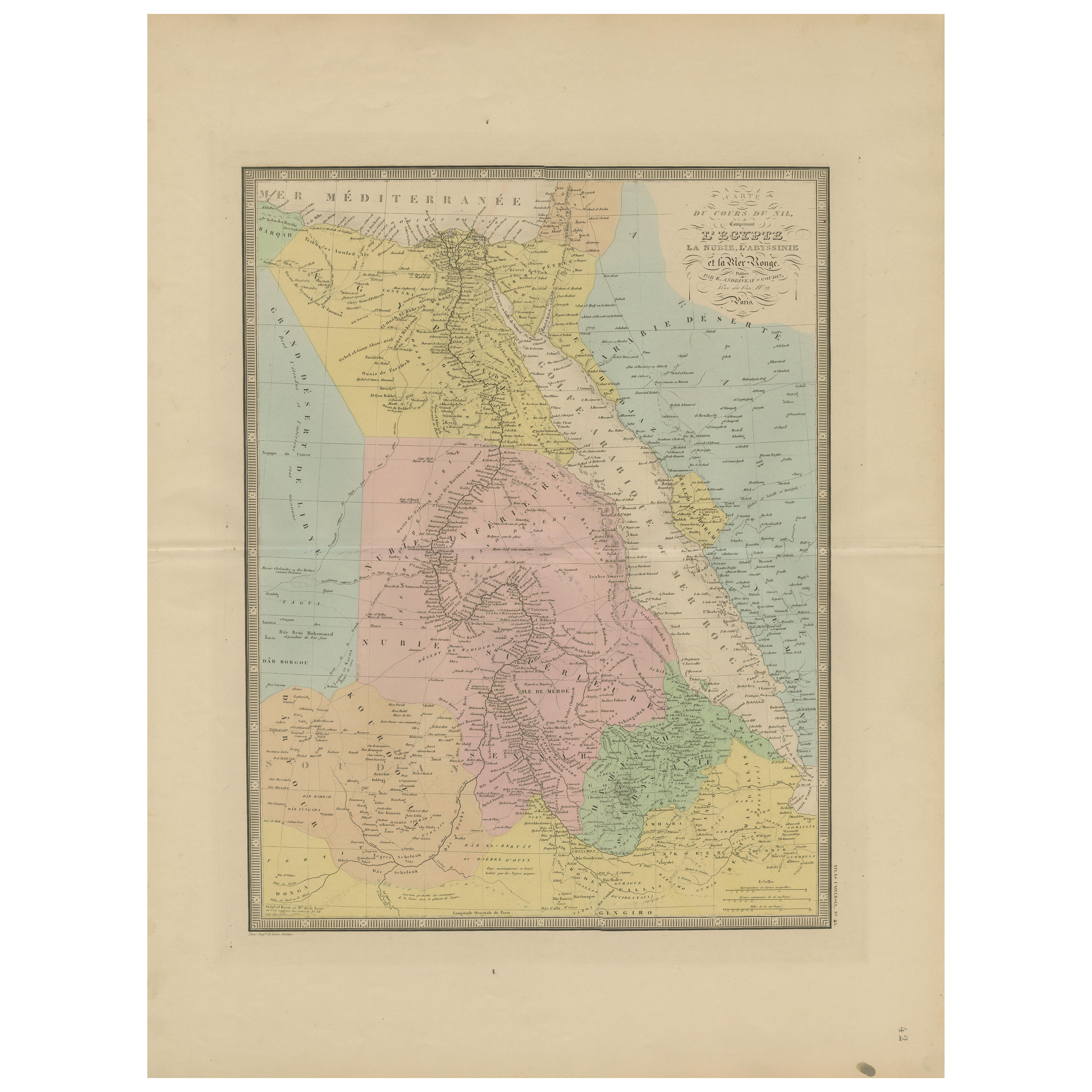
Red Sea Antique Map – Detailed 1865 Chart of Nubia and Nile Regions
Located in Langweer, NL
Antique Map of Egypt, Nubia & Red Sea Coast – Andriveau-Goujon, Paris 1865
This delicately colored antique map, titled *Partie du Cours du Nil comprenant l'Égypte, la Nubie, l'Abyss...
Category
Antique Mid-19th Century French Maps
Materials
Paper
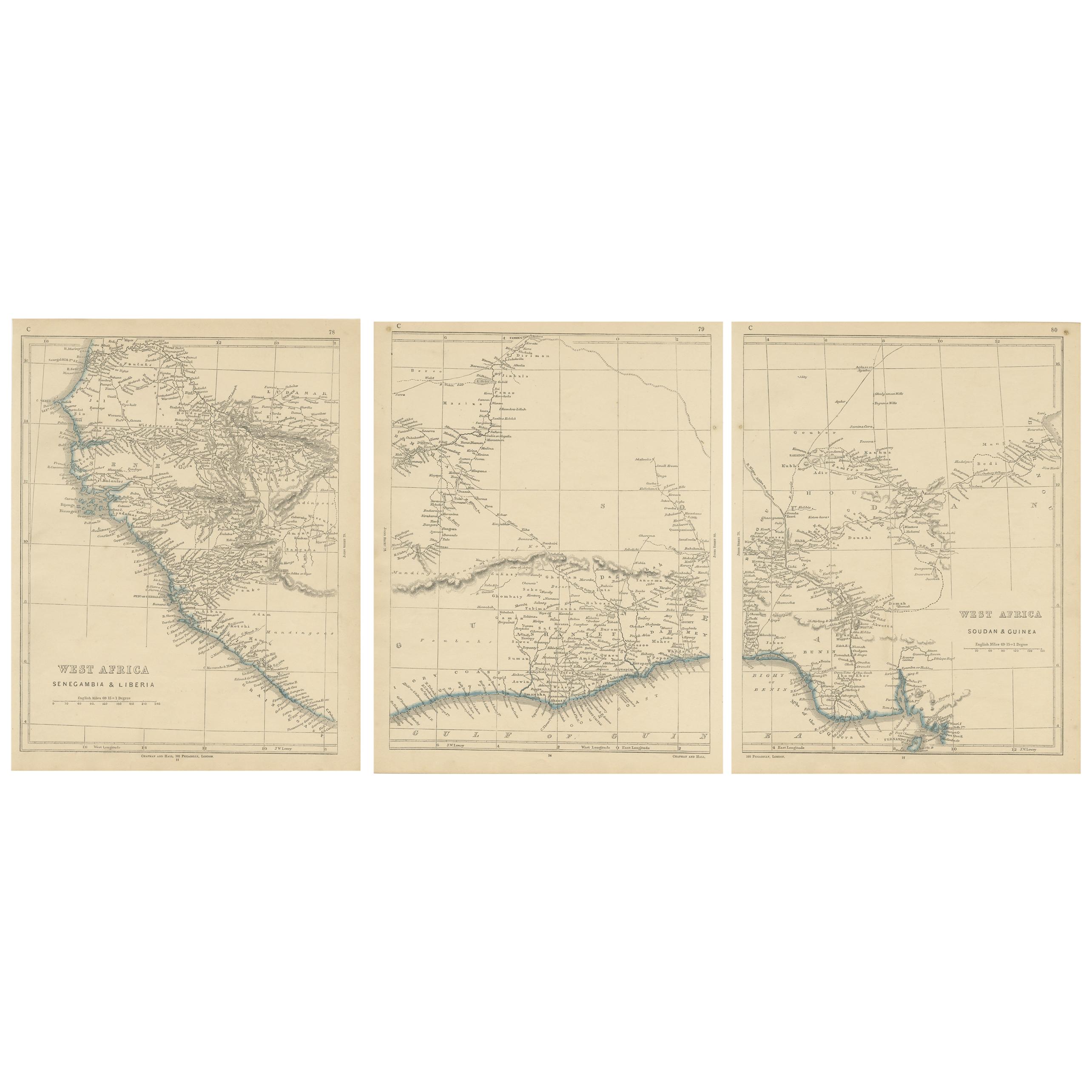
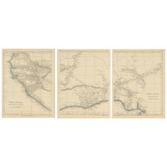
Antique Map of West Africa by Lowry, 1852
Located in Langweer, NL
Antique map titled 'West Africa'. Three individual sheets of West Africa. This map originates from 'Lowry's table Atlas constructed and engraved from the most recent authorities' by ...
Category
Antique Mid-19th Century British Maps
Materials
Paper
You May Also Like
Large Original Antique Map of Afghanistan. Edward Weller, 1861
Located in St Annes, Lancashire
Great map of Afghanistan
Lithograph engraving by Edward Weller
Original colour
Published, 1861
Unframed
Good condition
Category
Antique 1860s English Victorian Maps
Materials
Paper

Africa. North-East Part. Century Atlas antique vintage map
Located in Melbourne, Victoria
'The Century Atlas. Africa. North-East Part'
Original antique map, 1903.
Inset map of 'Nile Delta and Suez Canal'.
Central fold as issued. Map name and nu...
Category
Early 20th Century Victorian More Prints
Materials
Lithograph

Map of Nubia and Abissinia - Original Etching by Antonio Zatta - 1784
Located in Roma, IT
This Map of Nubia and Abissinia is an etching realized by Antonio Zatta in Venice in 1784.
The state of preservation of the artwork is good expect for the worn paper with some littl...
Category
1770s Landscape Prints
Materials
Etching

Africa. North-West Part. Century Atlas antique vintage map
Located in Melbourne, Victoria
'The Century Atlas. Africa. Southern Part'
Original antique map, 1903.
Central fold as issued. Map name and number printed on the reverse corners.
Sheet 40cm by 29.5cm.
Category
Early 20th Century Victorian More Prints
Materials
Lithograph

Large Original Antique Map of Morocco. Edward Weller, 1861
Located in St Annes, Lancashire
Great map of Morocco
Lithograph engraving by Edward Weller
Original colour
Published, 1861
Unframed
Good condition.
Category
Antique 1860s English Victorian Maps
Materials
Paper

Original Antique Map of Africa by Dower, circa 1835
Located in St Annes, Lancashire
Nice map of Africa
Drawn and engraved by J.Dower
Published by Orr & Smith. C.1835
Unframed.
Free shipping
Category
Antique 1830s English Maps
Materials
Paper

More Ways To Browse
Antique Nautical Charts
Antique Macedonia
Hemispheres Map
Java Map
Miniature Maps
Antique Maps Of Wales
Swiss Antiques And Collectables
Map Stand
Caribbean Antique Furniture
West Indies Furniture
Railroad Collectibles
Antique Map Denmark
American West Furniture
Antique Railroad Collectibles
Gold Maps
World Map Of Trade Routes
J Walker
Mercator Map