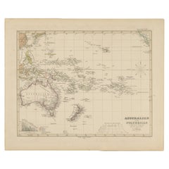
Items Similar to Antique Map of Oceania, 1903, Featuring the Pacific Islands and Australasia


Want more images or videos?
Request additional images or videos from the seller
1 of 10
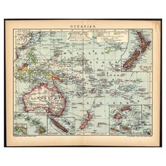
Antique Map of Oceania, 1903, Featuring the Pacific Islands and Australasia
$408.31
£302.41
€340
CA$558.54
A$607.86
CHF 322.23
MX$7,313.07
NOK 4,086.89
SEK 3,739.22
DKK 2,590.86
About the Item
Title: Antique Map of Oceania, 1903, Featuring the Pacific Islands and Australasian Region
Description:
This antique map, titled "Oceania," was engraved and published in 1903 by W.
A.K. Johnston in Edinburgh and London. It provides a comprehensive and visually captivating depiction of the vast and culturally diverse region that includes the islands of the Pacific Ocean, as well as Australia and New Zealand.
Hand-colored in soft pastel shades, the map highlights the political and geographical boundaries of the region at the turn of the 20th century. The major landmasses of Australia, New Zealand, and the Indonesian archipelago are rendered with careful detail, while the islands of Micronesia, Melanesia, and Polynesia—scattered across the Pacific—are marked with precision and clarity.
This map captures not just the geography, but also the maritime networks and colonial ambitions that defined the region at the dawn of the modern era. Trade routes, ocean currents, and key ports are included, emphasizing the interconnectedness of these far-flung lands with the broader world.
For collectors, historians, and those with a passion for the history of exploration and the rich cultures of the Pacific, this map is a window into a time when distant islands and ancient cultures were coming into closer contact with the rest of the globe. The refined engraving and soft colors of the map also make it a striking decorative piece.
Condition report:
This map is in very good antique condition, with minor foxing and gentle edge toning typical for its age. The colors remain vibrant and the paper is stable and well-preserved.
Framing tips:
A classic dark wood frame in walnut or cherry will enhance the pastel colors and maritime elegance of the map. Use a cream or off-white matting to highlight the intricate linework and create a sophisticated, timeless focal point in any home, study, or library.
- Dimensions:Height: 14.49 in (36.8 cm)Width: 18.51 in (47 cm)Depth: 0.01 in (0.2 mm)
- Materials and Techniques:
- Period:
- Date of Manufacture:1903
- Condition:This map is in very good antique condition, with minor foxing and gentle edge toning typical for its age. The colors remain vibrant and the paper is stable and well-preserved. Folding line as issued.
- Seller Location:Langweer, NL
- Reference Number:Seller: BG-13577-311stDibs: LU3054345262762
About the Seller
5.0
Recognized Seller
These prestigious sellers are industry leaders and represent the highest echelon for item quality and design.
Platinum Seller
Premium sellers with a 4.7+ rating and 24-hour response times
Established in 2009
1stDibs seller since 2017
2,813 sales on 1stDibs
Typical response time: 1 hour
- ShippingRetrieving quote...Shipping from: Langweer, Netherlands
- Return Policy
More From This Seller
View AllAntique Map of Australia, New Zealand
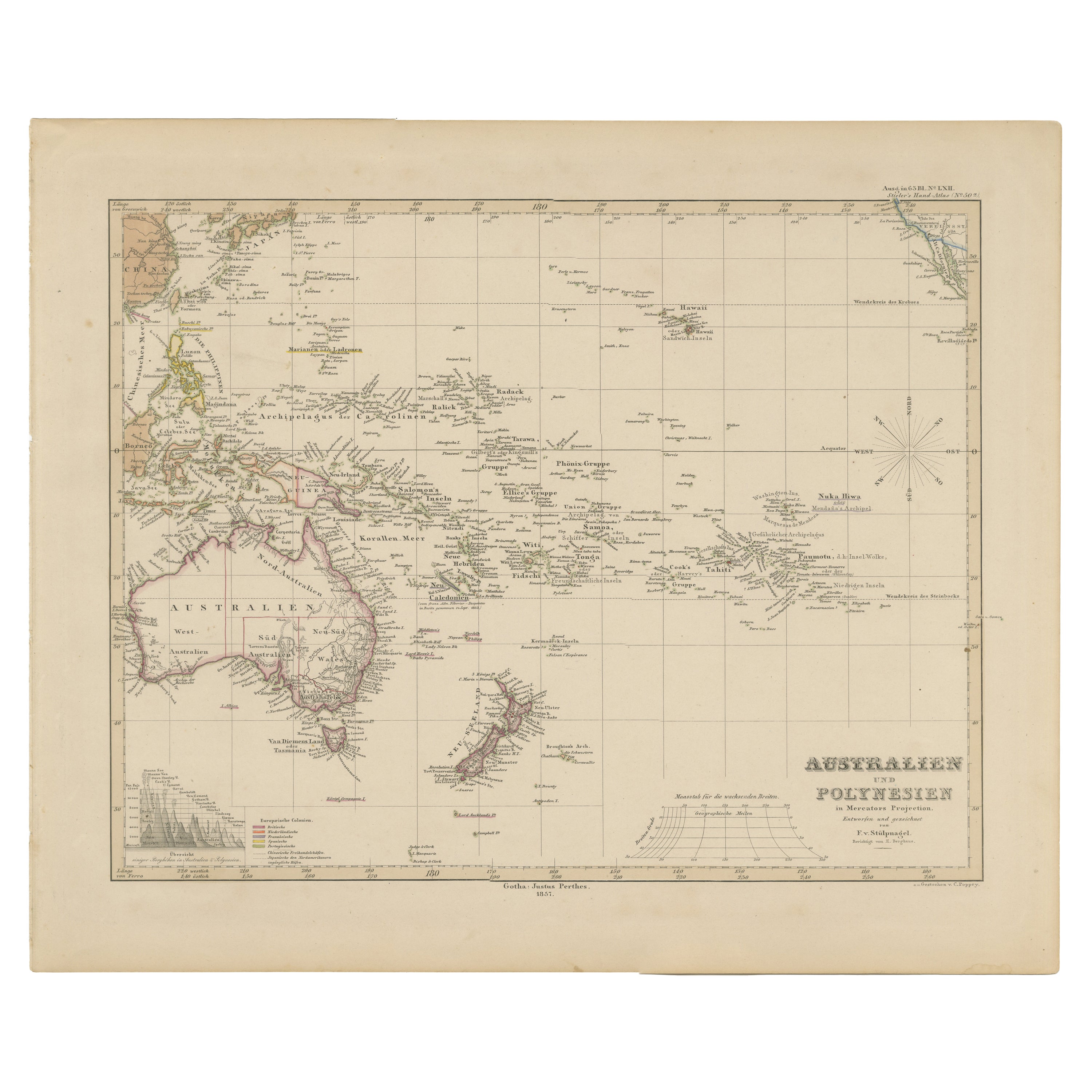
Polynesia – Stülpnagel, 1857
Located in Langweer, NL
Antique Map of Australia, New Zealand & Polynesia – Stülpnagel, 1857
Description:
This finely engraved and delicately hand-colored map titled "Australien und Polynesien in Mercator'...
Category
Antique Mid-19th Century German Maps
Materials
Paper
German Antique Map of Oceania, 1895
Located in Langweer, NL
Antique map titled 'Oceanie.' Map of Oceania. This attractive original old antique print / plate / map originates from 1885-1907 editions of a famous German encyclopedia: 'Meyers grosses Konversations-Lexikon.', published in Leipzig and Vienna. Meyers Konversations-Lexikon was a major German encyclopedia that existed in various editions from 1839 until 1984, when it merged with the Brockhaus encyclopedia. Several of the plates were also used in Dutch Encyclopedia's like Winkler Prins...
Category
Antique 19th Century Maps
Materials
Paper
$76 Sale Price
20% Off
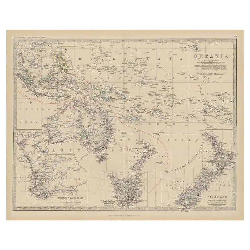
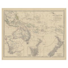
Antique Map of Oceania by Johnston, 1882
Located in Langweer, NL
Antique map titled 'Oceania'. Old map of Oceania with inset maps of Western Australia, Tasmania and New Zealand. This map originates from 'The Royal Atlas of Modern Geography, Exhibi...
Category
Antique 19th Century Maps
Materials
Paper
$124 Sale Price
20% Off
Antique Map of Australasia, New Zealand, Polynesia
the Pacific Ocean, 1840
Located in Langweer, NL
Antique map titled 'The Pacific Ocean'.
This map depicts Australasia, New Zealand, Polynesia and islands in the Pacific Ocean including the Sandwich Islands.
Artists and Engravers: Published by the Society for the Diffusion of Useful Knowledge, 1840. Engraved by J. & C. Walker.
Condition:
Good, general age-related toning. Few tiny tears...
Category
Antique 1840s Maps
Materials
Abalone, Paper

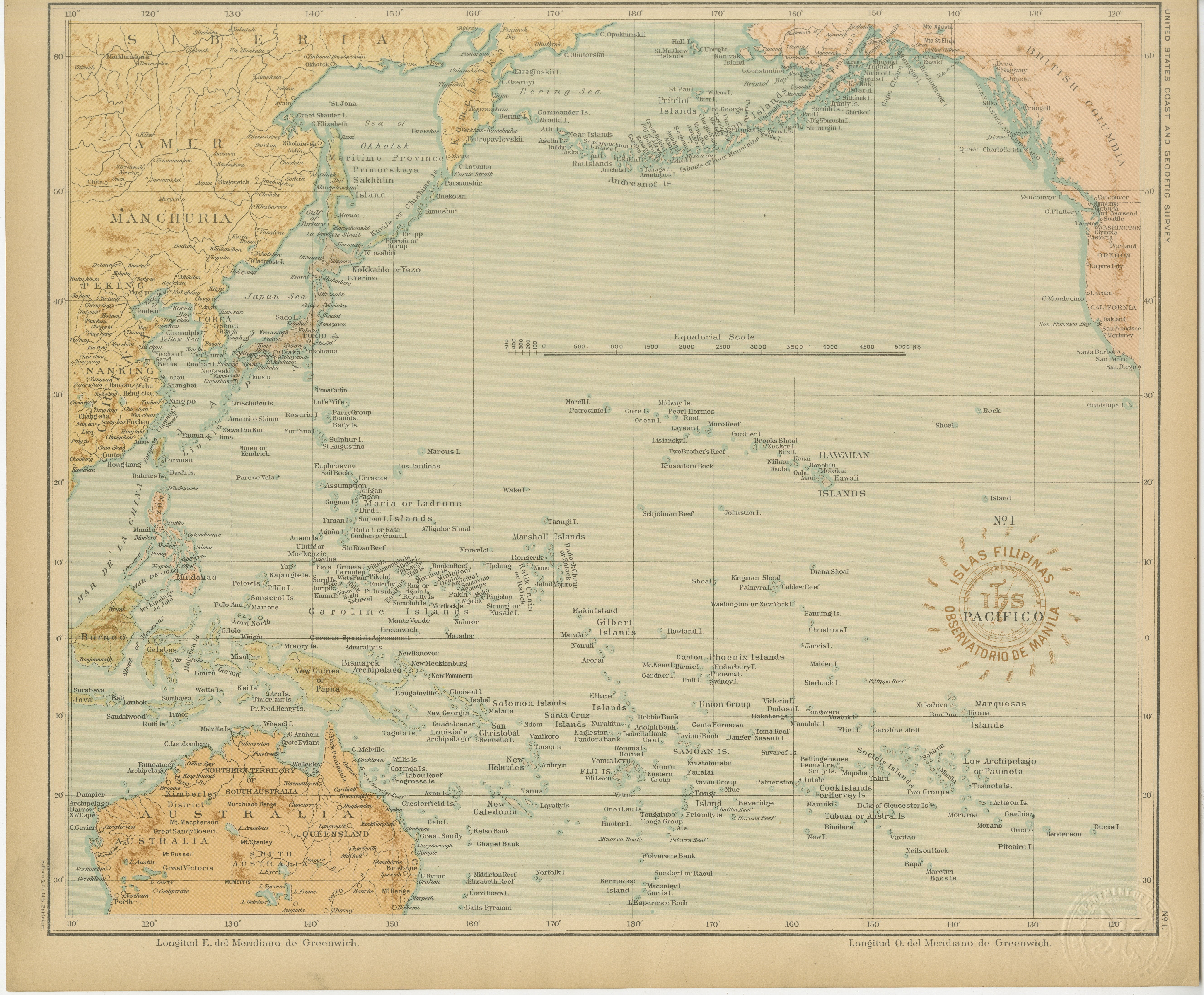
Map of the Pacific Ocean and Philippine Archipelago – Manila Observatory, 1899
Located in Langweer, NL
Title: Pacific Ocean and the Philippine Archipelago – Observatorio de Manila, 1899
Description:
This finely detailed chromolithographed map titled “Islas Filipinas – Océano Pacífico...
Category
Antique 1890s Philippine Maps
Materials
Paper
Mid-19th Century Map of Australasia by Carl Flemming - 1855
Located in Langweer, NL
Title: "Mid-19th Century Map of Australasia by Carl Flemming - 1855"
Description: This original 1855 antique map from the Sohr-Berghaus Atlas, created by Carl Flemming, is a detaile...
Category
Antique 1850s Maps
Materials
Paper

You May Also Like
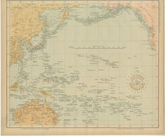
Large Original Antique Map of The Pacific Ocean, Fullarton, C.1870
Located in St Annes, Lancashire
Great map of The Pacific Ocean
From the celebrated Royal Illustrated Atlas
Lithograph by Swanston. Original color.
Published by Fullarton,...
Category
Antique 1870s Scottish Maps
Materials
Paper

Ancient Map of Oceania - Original Etching - 19th century
Located in Roma, IT
This Map of Oceania is an etching realized in the 19th century.
The state of preservation of the artwork is good. At the top of the paper, the inscription “Longitudine del Meridiano...
Category
19th Century More Prints
Materials
Etching

Large Original Vintage Map of The Pacific Islands Including Hawaii
Located in St Annes, Lancashire
Great map of The Pacific Islands
Unframed
Original color
By John Bartholomew and Co. Edinburgh Geographical Institute
Published, circa 1...
Category
Vintage 1920s British Maps
Materials
Paper

Original Antique Map of US Possessions In The Pacific Ocean, C.1900
Located in St Annes, Lancashire
Fabulous map of US possessions in the Pacific Ocean
Original color.
Engraved and printed by the George F. Cram Company, Indianapolis.
Published, C.1900.
Unframed.
Free shipping.
Category
Antique 1890s American Maps
Materials
Paper

Original Antique Map of Australia by Dower, circa 1835
Located in St Annes, Lancashire
Nice map of Australia
Drawn and engraved by J.Dower
Published by Orr & Smith. C.1835
Unframed.
Free shipping
Category
Antique 1830s English Maps
Materials
Paper

Large Original Antique Map of Australia by Sidney Hall, 1847
Located in St Annes, Lancashire
Great map of Australia
Drawn and engraved by Sidney Hall
Steel engraving
Original colour outline
Published by A & C Black. 1847
Unframed
Free shipping.
Category
Antique 1840s Scottish Maps
Materials
Paper

More Ways To Browse
Cream Soup
Early English Silver
Paisley Rugs and Carpets
Black And Chrome Lounge Chair
Vintage 1930 Dining Room Set
Antique Brass And Copper
Antique Cow
Antique Harvest
Antique Victorian Dining Tables
Environment Furniture
Italian Plastic Chairs
Made In Belgium
Black Crystal Glasses
French Mid Century Modern Rug
China Silk Rug
Chrome Glass Coffee Tables
Antique Italian Chairs
Antique Walnut Bar