Items Similar to Antique Map of Old and New Castile, Spain by Jodocus Hondius, c.1636


Video Loading
Want more images or videos?
Request additional images or videos from the seller
1 of 13
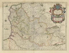
Antique Map of Old and New Castile, Spain by Jodocus Hondius, c.1636
$427.95
£318.52
€360
CA$593.52
A$638.98
CHF 342.18
MX$7,699.45
NOK 4,317.42
SEK 3,951.14
DKK 2,743.87
About the Item
Antique Map of Old and New Castile, Spain by Jodocus Hondius, c.1636
This fine antique map titled Castiliae Veteris et Novae Descriptio presents Old Castile and New Castile, historic regions of Spain. Centered on Madrid and Toledo, the map depicts towns, rivers, mountains, and political boundaries with remarkable precision and artistry. Decorative cartouches adorn the corners, and a large coat of arms adds heraldic distinction.
The map was published by Jodocus Hondius (1563–1612), one of the most influential cartographers and engravers of the Dutch Golden Age. Hondius acquired the plates of Gerardus Mercator’s atlas in the early 17th century and expanded the work by adding 36 new maps, many engraved by his own hand. His successful reissues helped cement Mercator’s reputation as one of history’s greatest mapmakers. After Hondius’ death in 1612, his sons and later his son-in-law Johannes Janssonius continued the business, reissuing the atlas with updated maps, including this plate of Castile, around 1636.
A list of important places visible on the map:
* Ponferrada
* León
* Salamanca
* Ávila
* Segovia
* Madrid
* Toledo
* Guadalajara
* Cuenca
* Plasencia
* Talavera
* Ciudad Rodrigo
* Alcalá de Henares
* Burgos
* Zamora
* Sigüenza
* Consuegra
This grouping shows the map’s dual focus on Old Castile (northwest) with León, Burgos, Zamora, Ponferrada, Salamanca, etc., and New Castile (center and south) with Madrid, Toledo, Cuenca, and Guadalajara.
This map is a superb example of early 17th-century Dutch cartography, combining geographical detail with decorative flourish. Collectors will appreciate its historical context, both as a representation of Spain’s evolving political geography and as a product of the Hondius-Mercator-Janssonius publishing dynasty.
Condition report:
Fair condition for its age. Age toning and light foxing. Original centerfold as issued. Hand-colored with period outline color.
Framing tips:
This map would display beautifully in a traditional dark walnut or ebonized wood frame. An ivory or cream mat with a thin gold or burgundy inner line will enhance both the detailed engraving and the hand-colored borders, lending a refined presentation suitable for study, library, or living space.
Technique: Engraving with original hand color
Maker: Jodocus Hondius, Amsterdam, c.1636
- Dimensions:Height: 19.1 in (48.5 cm)Width: 23.31 in (59.2 cm)Depth: 0.02 in (0.5 mm)
- Materials and Techniques:Paper,Engraved
- Place of Origin:
- Period:
- Date of Manufacture:c.1636
- Condition:Repaired: a professional repair in the lower split, outside the image. Age-related toning, shows soling. Original folding line, with repair lower margin. Fair condition for its age. Age toning and light foxing. Hand-colored with period outlining. English text on verso. Please study image carefully.
- Seller Location:Langweer, NL
- Reference Number:Seller: BG-13431-41stDibs: LU3054338206032
About the Seller
5.0
Recognized Seller
These prestigious sellers are industry leaders and represent the highest echelon for item quality and design.
Platinum Seller
Premium sellers with a 4.7+ rating and 24-hour response times
Established in 2009
1stDibs seller since 2017
2,828 sales on 1stDibs
Typical response time: 1 hour
- ShippingRetrieving quote...Shipping from: Langweer, Netherlands
- Return Policy
More From This Seller
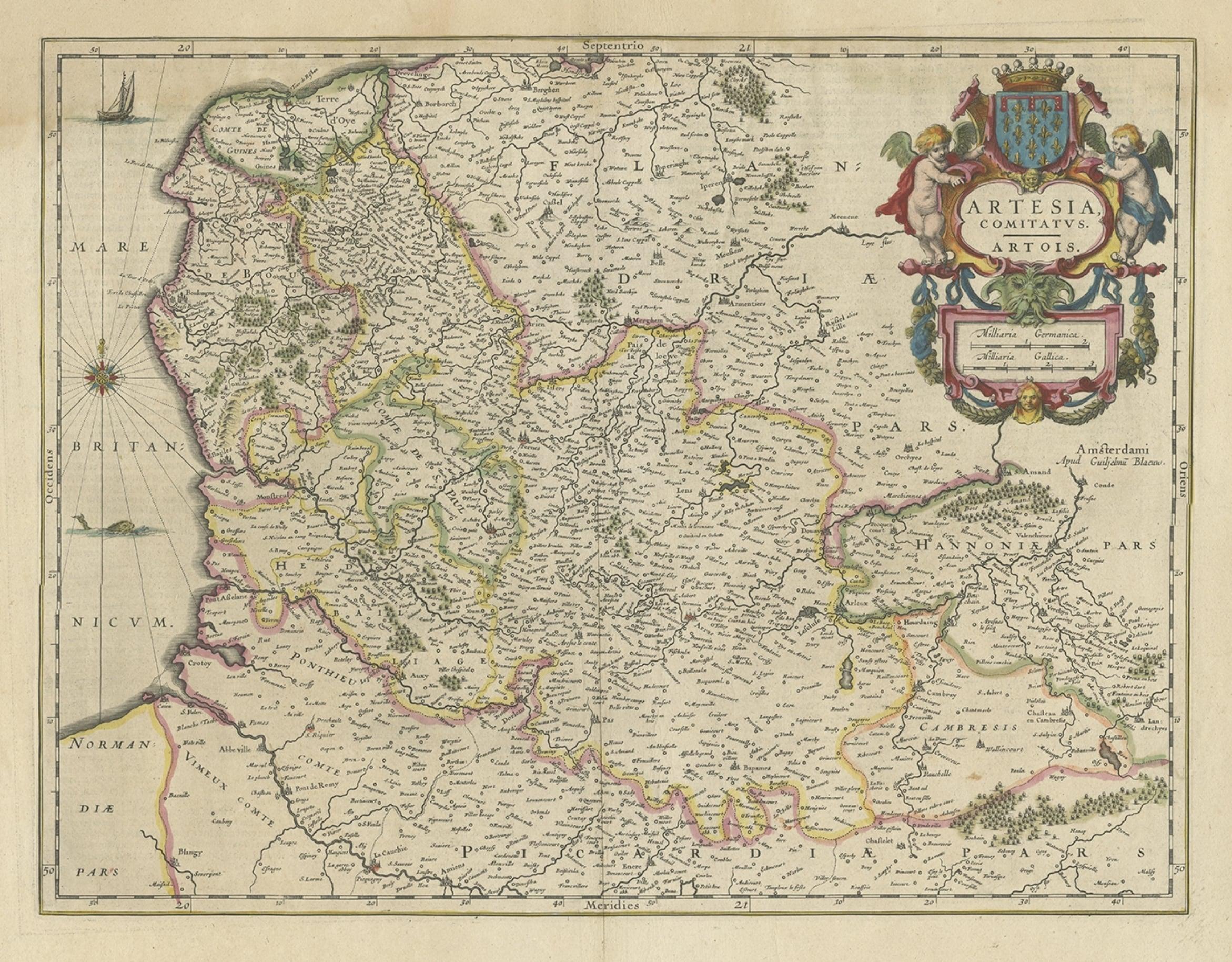
View AllAntique Map of Artois in the North of France by Famous Mapmaker Blaeu, c.1640
Located in Langweer, NL
Antique map titled 'Artesia Comitatus Artois'. Map of Artois or Artesia, France. Artois is former province located in the northwestern part of France, boarding Belgium (Flanders) on ...
Category
Antique 17th Century Maps
Materials
Paper
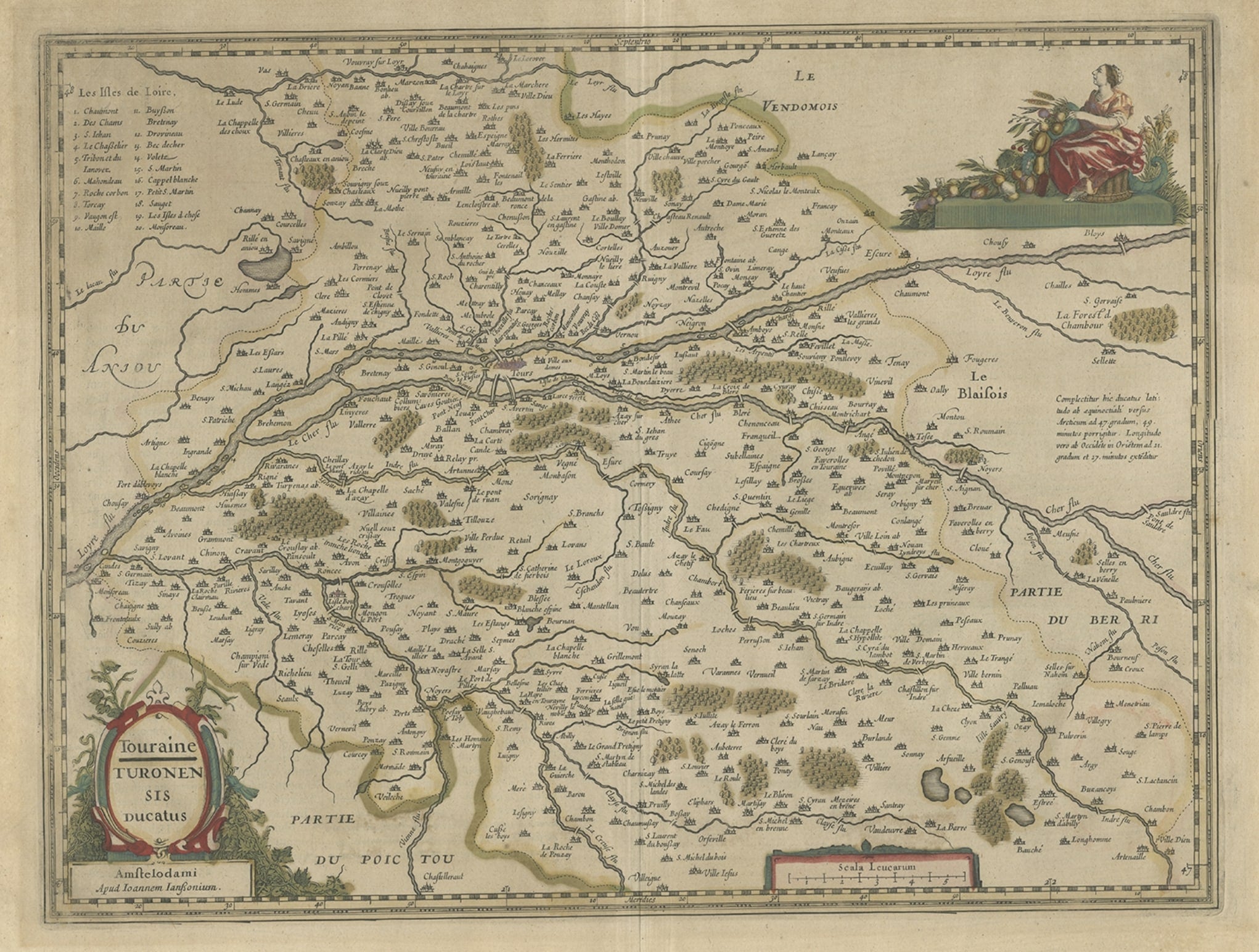
Antique Map of the Region of Touraine in France by Janssonius, 1657
By Johannes Janssonius
Located in Langweer, NL
Antique map titled 'Touraine - Turonensis Ducatus'.
Decorative map of the Touraine region. This map originates from 'Atlas Novus, Sive Theatrum Orbis Orbis Terrarum: In quo Galli...
Category
Antique 17th Century Maps
Materials
Paper
Antique Map of Northeastern Spain by Mercator, 1634
Located in Langweer, NL
Antique map titled 'Biscaia, Guipiscoa, Navarra et Asturias de Santillana'. Charming map of Northeastern Spain with the areas of Pamplona and Valladolid. This map originates from 'At...
Category
Antique 17th Century Maps
Materials
Paper
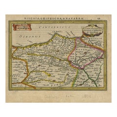
$132 Sale Price
20% Off
Antique Map of the Region of Lyon by Hondius, circa 1630
Located in Langweer, NL
Antique map titled 'Lionnois, Forest et Beauiolois'. Old map of the former region of Lyon, Vienne, Bresse, Rohan and the Rhône River. This map originates f...
Category
Antique Mid-17th Century Maps
Materials
Paper

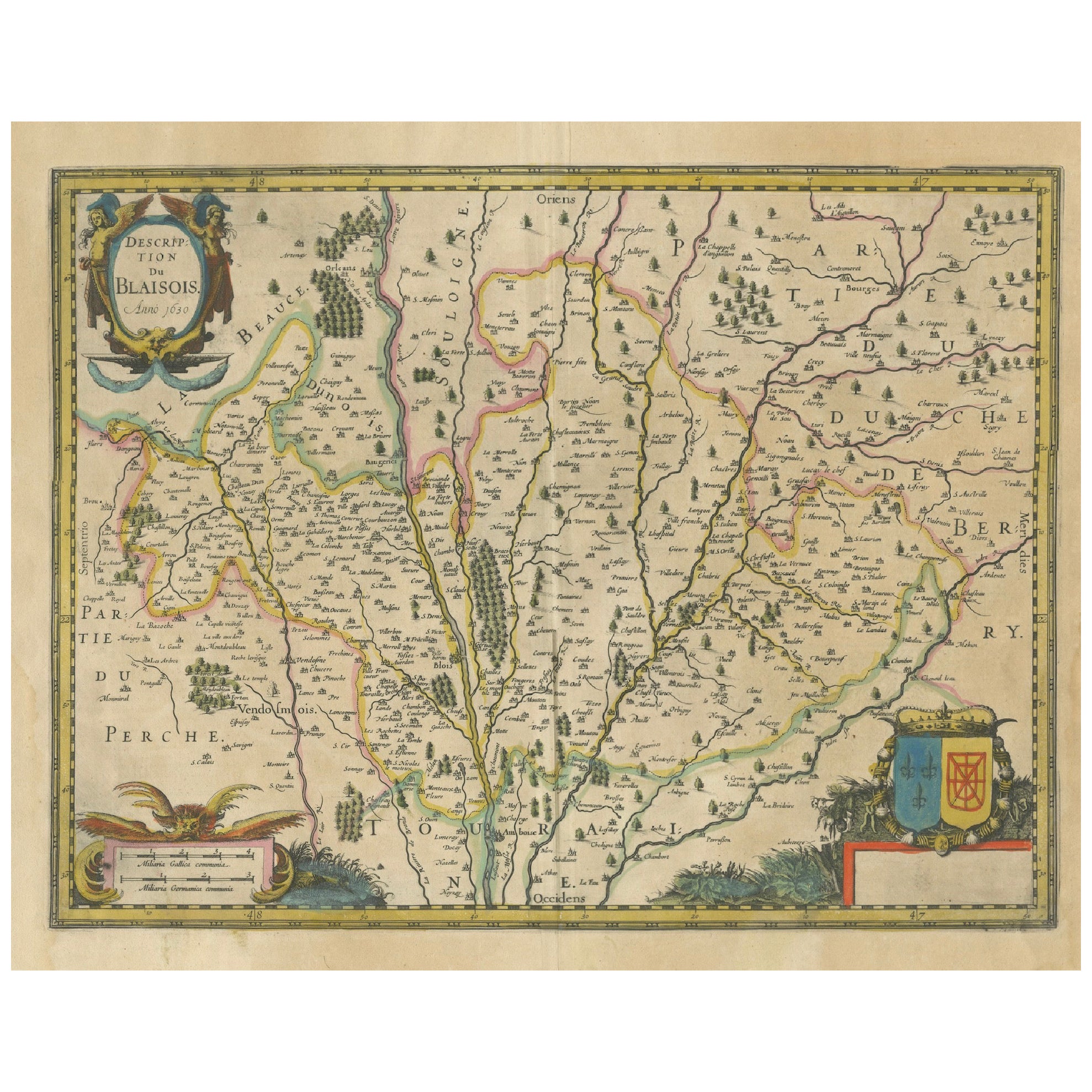
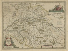
Map of Blaisois by Janssonius, 1633, Decorative Antique Map of Loire Valley
Located in Langweer, NL
Map of Blaisois by Janssonius, 1633, Decorative Antique Map of Loire Valley
This finely detailed and colorfully embellished map titled 'Description du Blaisois' was published in 163...
Category
Antique 1630s Maps
Materials
Paper
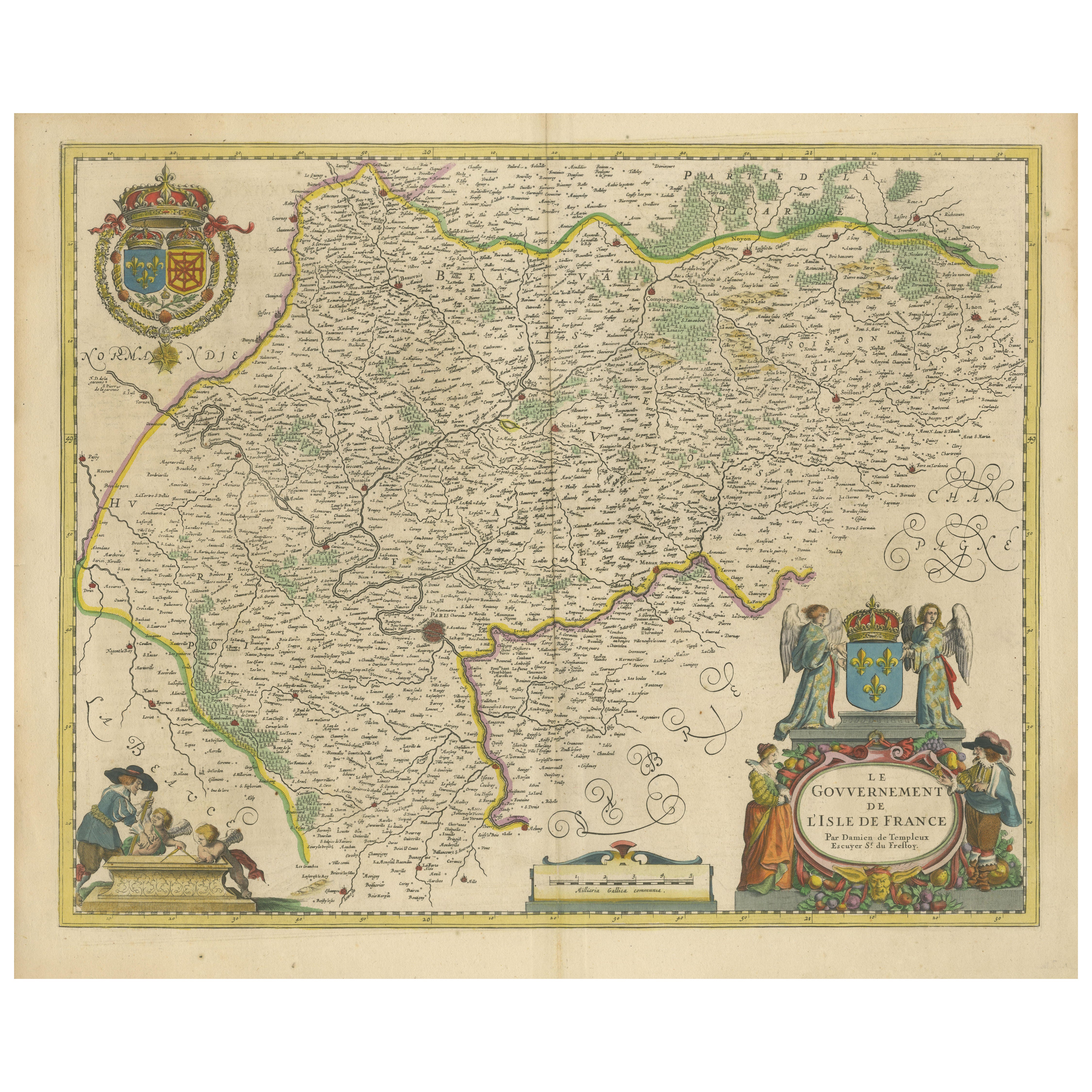
Beautiful 17th Century Map of Paris and Isle de France by Templeux, c.1650
Located in Langweer, NL
Map of Isle de France by D. de Templeux, ca. 1650, Hand-Colored and Decorative
This richly detailed antique map titled *Le Gouvernement de L'Isle de France* was engraved by Daniel d...
Category
Antique 1650s Maps
Materials
Paper

You May Also Like
Ancient Map - Macedonia - Etching by Johannes Janssonius - 1650s
By Johannes Janssonius
Located in Roma, IT
Macedonia is an ancient map realized in 1650 by Johannes Janssonius (1588-1664).
The Map is Hand-colored etching, with coeval watercoloring.
Good condit...
Category
1650s Modern Figurative Prints
Materials
Etching

1657 Janssonius Map of Vermandois and Cappelle, Ric. A-004
Located in Norton, MA
1657 Janssonius map of
Vermandois and Cappelle
Ric.a004
Description: Antique map of France titled 'Descriptio Veromanduorum - Gouvernement de la Cappelle'. Two detailed maps o...
Category
Antique 17th Century Unknown Maps
Materials
Paper

1625 Mercator Map of the Provenience of Quercy, "Quercy Cadvrcivm Ric.0013
Located in Norton, MA
1625 Mercator map of the provenience of Quercy, entitled
"Quercy Cadvrcivm,"
Ric.0013
" Authentic" - Map of the provenience of Quercy Cadvrcivm
D...
Category
Antique 17th Century French Maps
Materials
Paper

1640 Joan Bleau Map Entitled"Diocecese de rheims et le pais de rethel, " Eic.a011
Located in Norton, MA
1640 Joan Bleau map entitled
"Diocecese de rheims et le pais de rethel,"
Ric.a011
OAN BLAEU
Diocecese de Rheims, et le pais de Rethel.
Handcolored engraving, c.1640.
...
Category
Antique 17th Century Dutch Maps
Materials
Paper

1620 Map of Artois Entitled "Artesia Comitatvs Artois, " by Bleau, Ric.a012
Located in Norton, MA
1640 map of Artois entitled
"Artesia Comitatvs Artois,"
by Bleau
Colored
A-012.
Detailed map of the northern province of Artois, France on the border with Belgium. Feature...
Category
Antique 17th Century Dutch Maps
Materials
Paper

West Germany: Original Hand Colored 17th Century Map by Johannes Janssonius
By Johannes Janssonius
Located in Alamo, CA
An original hand colored copperplate engraved map entitled in Latin "Archiepiscopatus Maghdeburgensis et Anhaltinus Ducatus cum terris adjacentibus", published in Amsterdam in 1640 i...
Category
Mid-17th Century Old Masters More Prints
Materials
Engraving
