Items Similar to Antique Map of Overijssel by Brugsma, 1864
Want more images or videos?
Request additional images or videos from the seller
1 of 5
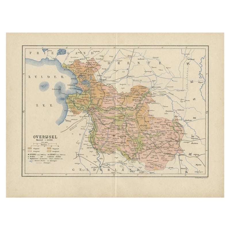
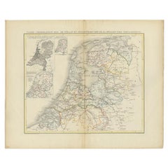
Antique Map of Overijssel by Brugsma, 1864
$120.10
$150.1220% Off
£88.96
£111.2020% Off
€100
€12520% Off
CA$164.33
CA$205.4120% Off
A$178.80
A$223.5020% Off
CHF 94.67
CHF 118.3420% Off
MX$2,151.09
MX$2,688.8620% Off
NOK 1,202.13
NOK 1,502.6620% Off
SEK 1,099.86
SEK 1,374.8320% Off
DKK 762.08
DKK 952.6020% Off
About the Item
Antique map titled 'De Provincie Overijssel'. Map of the province of Overijssel, the Netherlands. This map originates from 'F. C. Brugsma's Atlas van het Koninkrijk der Nederlanden (..)'. Artists and Engravers: Author: Frederik Carel Brugsma. Published by J.B. Wolters.
Artist: Author: Frederik Carel Brugsma. Published by J.B. Wolters.
Condition: Good, general age-related toning. Original folding line, minor wear. Blank verso. Please study image carefully.
Date: 1864
Overall size: 30.5 x 25.5 cm.
Image size: 0.001 x 23.5 x 20.5 cm.
Antique prints have long been appreciated for both their aesthetic and investment value. They were the product of engraved, etched or lithographed plates. These plates were handmade out of wood or metal, which required an incredible level of skill, patience and craftsmanship. Whether you have a house with Victorian furniture or more contemporary decor an old engraving can enhance your living space. We offer a wide range of authentic antique prints for any budget.
- Dimensions:Height: 10.04 in (25.5 cm)Width: 12.01 in (30.5 cm)Depth: 0 in (0.01 mm)
- Materials and Techniques:
- Period:
- Date of Manufacture:1864
- Condition:
- Seller Location:Langweer, NL
- Reference Number:Seller: BG-07606-101stDibs: LU3054327623222
About the Seller
5.0
Recognized Seller
These prestigious sellers are industry leaders and represent the highest echelon for item quality and design.
Platinum Seller
Premium sellers with a 4.7+ rating and 24-hour response times
Established in 2009
1stDibs seller since 2017
2,816 sales on 1stDibs
Typical response time: 1 hour
- ShippingRetrieving quote...Shipping from: Langweer, Netherlands
- Return Policy
More From This Seller
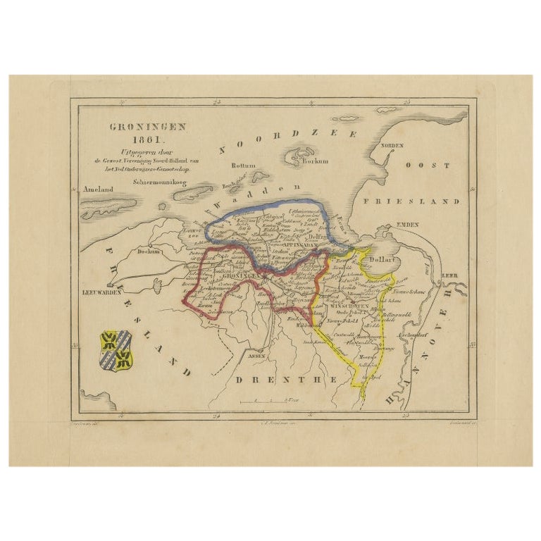
View AllAntique Map of Groningen by Veelwaard, c.1865
Located in Langweer, NL
Antique map titled 'Groningen 1861'. Map of Groningen, the Netherlands. Published by 'Gewest. Vereeniging Noord Holland van het Ned. Onderwijzers-Genootschap'. Artists and Engravers:...
Category
Antique 19th Century Maps
Materials
Paper
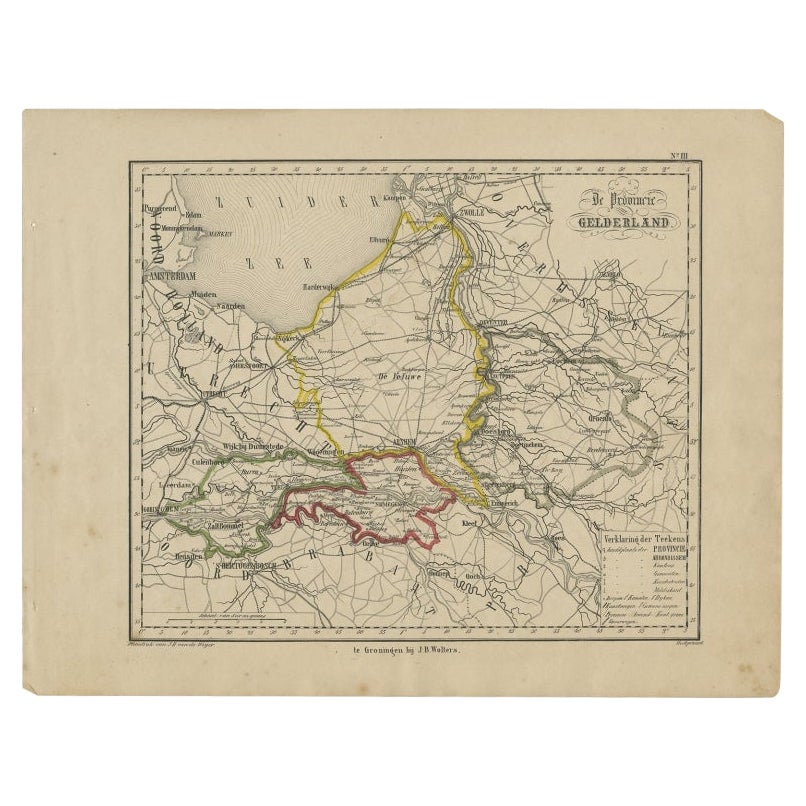
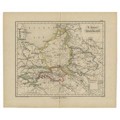
Antique Map of Gelderland, Largest Province of The Netherlands, c.1870
Located in Langweer, NL
Antique map titled 'De Provincie Gelderland'.
Map of the province of Gelderland, the Netherlands. This map originates from 'F. C. Brugsma's Atlas van het Koninkrijk der Nederland...
Category
Antique 19th Century Maps
Materials
Paper
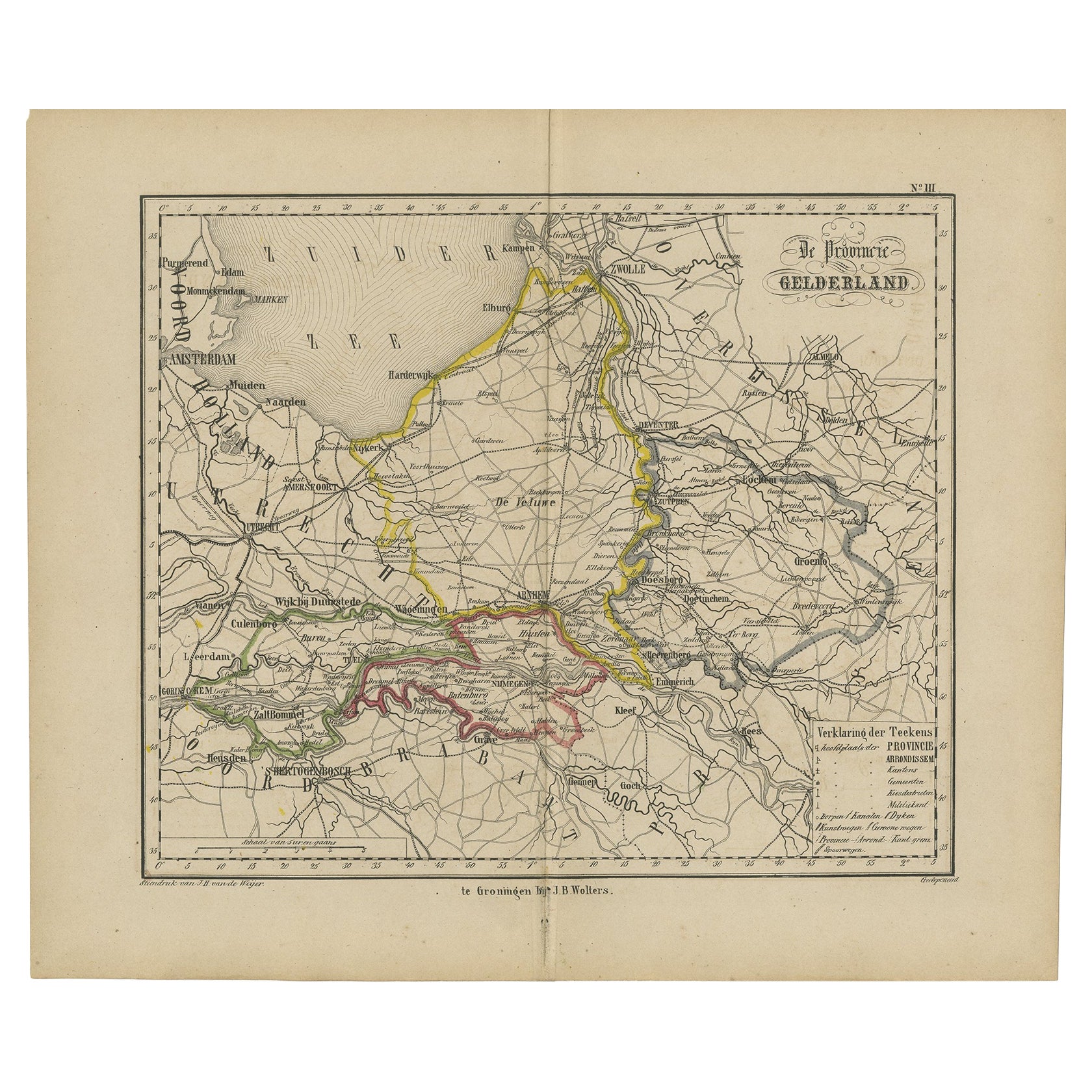
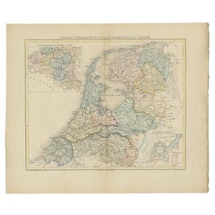
Antique Map of Gelderland with the Veluwe Etc, the Netherlands, 1864
Located in Langweer, NL
Antique map titled 'De Provincie Gelderland'. Map of the province of Gelderland, the Netherlands.
This map originates from 'F. C. Brugsma's Atlas van het Koninkrijk der Nederland...
Category
Antique 19th Century Maps
Materials
Paper
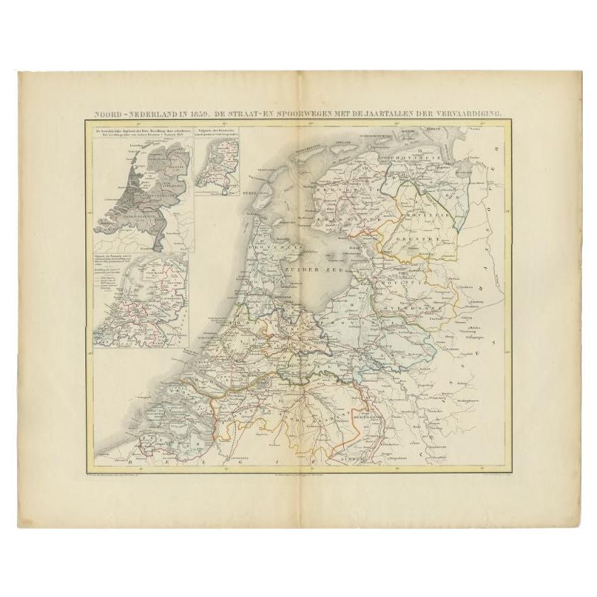
Antique Map of the Netherlands in 1859 by Mees, 1861
Located in Langweer, NL
Antique map titled 'Noord-Nederland in 1859. De Straat- en Spoorwegen met de jaartallen der vervaardiging'. Map of the Netherlands in 1859. This map originates from 'Historische Atla...
Category
Antique 19th Century Maps
Materials
Paper
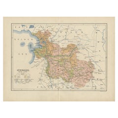
Antique Map of Overijssel by Kuyper, 1883
Located in Langweer, NL
Antique map titled 'De Provincie Overijssel'. Map of the province of Overijssel, the Netherlands. This map originates from 'F. C. Brugsma's Atlas van het Koninkrijk der Nederlanden (...
Category
Antique 19th Century Maps
Materials
Paper
$120 Sale Price
20% Off
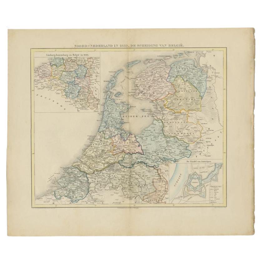
Antique Map of the Netherlands in 1839 by Mees, 1860
Located in Langweer, NL
Antique map titled 'Noord-Nederland in 1839. De scheiding van België'. Map of the Netherlands in 1839. This map originates from 'Historische Atlas van Noord-Nederland'.
Artists a...
Category
Antique 19th Century Maps
Materials
Paper
You May Also Like
1752 Vaugoundy Map of Flanders : Belgium, France, and the Netherlands, Ric.a002
Located in Norton, MA
Large Vaugoundy Map of Flanders:
Belgium, France, and the Netherlands
Colored -1752
Ric.a002
Description: This is a 1752 Didier Robert de Vaugondy map of Flanders. The map de...
Category
Antique 17th Century Unknown Maps
Materials
Paper

Original Antique English County Map, Huntingdonshire, J
C Walker, 1851
Located in St Annes, Lancashire
Great map of Huntingdonshire
Original colour
By J & C Walker
Published by Longman, Rees, Orme, Brown & Co. 1851
Unframed.
Category
Antique 1850s English Other Maps
Materials
Paper

Original Antique English County Map, Nottinghamshire, J
C Walker, 1851
Located in St Annes, Lancashire
Great map of Nottinghamshire
Original colour
By J & C Walker
Published by Longman, Rees, Orme, Brown & Co. 1851
Unframed.
Category
Antique 1850s English Other Maps
Materials
Paper

Original Antique English County Map, Cambridgeshire, J
C Walker, 1851
Located in St Annes, Lancashire
Great map of Cambridgeshire
Original colour
By J & C Walker
Published by Longman, Rees, Orme, Brown & Co. 1851
Unframed.
Category
Antique 1850s English Other Maps
Materials
Paper

The Netherlands (Holland), Belgium and Luxemburg. Century Atlas antique map
Located in Melbourne, Victoria
'The Century Atlas. The Netherlands (Holland), Belgium and Luxemburg.'
Original antique map, 1903.
Inset maps of 'Amsterdam' and 'Brussels'.
Central fold as issued. Map name and num...
Category
Early 20th Century Victorian More Prints
Materials
Lithograph

Original Antique English County Map - Monmouthshire. J
C Walker. 1851
Located in St Annes, Lancashire
Great map of Monmouthshire
Original colour
By J & C Walker
Published by Longman, Rees, Orme, Brown & Co. 1851
Unframed.
Category
Antique 1850s English Other Maps
Materials
Paper

More Ways To Browse
Ptolemy Map
Antique Maps Massachusetts
Antique Maps Singapore
Antique Planisphere
Map Of Palestine
R Johnston
Santa Cruz Island
Shetland Map
Antique Alabama Map
Antique Framed Map Engravings
Antique Furniture Cheshire
Antique Great Lakes Map
Antique Map Of Michigan
Antique Map Of Turkish Empire
Antique Map Of Yorkshire
Bali Map
Bermuda Map
British Empire Map