Items Similar to Antique Map of Palestine with Biblical Tribal Divisions – Black’s Atlas, 1884


Want more images or videos?
Request additional images or videos from the seller
1 of 9
Antique Map of Palestine with Biblical Tribal Divisions – Black’s Atlas, 1884
$462.76
£345.47
€390
CA$642.91
A$691.54
CHF 369.58
MX$8,151.30
NOK 4,659.53
SEK 4,259.70
DKK 2,972.24
About the Item
Antique Map of Palestine with Biblical Tribal Divisions – Black’s Atlas, 1884
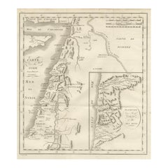
This finely engraved and hand-colored map titled “Palestine” was published in the New and Revised Edition of Black’s General Atlas of the World, Edinburgh, 1884, and was drawn by J. Bartholomew, F.R.G.S. It presents a detailed geographical and historical view of Palestine, combining modern 19th-century cartography with biblical territorial references.
The map covers the region from the Mediterranean coast eastward across the Jordan River and the Dead Sea, extending into Transjordan. It clearly shows major cities, towns, rivers, mountain ranges, roads, and ancient sites, including Jerusalem, Jaffa, Gaza, Hebron, Nazareth, Jericho, and Damascus to the north. The physical geography is carefully rendered, with hill shading emphasizing the rugged terrain of Judea, Samaria, and Galilee, as well as the deep rift of the Jordan Valley.
A notable feature of this map is the delineation of the biblical tribal territories, identified by Roman numerals and explained in a reference table listing the Twelve Tribes of Israel. These divisions are shown alongside contemporary political and geographic features, reflecting the 19th-century scholarly interest in biblical geography and historical topography. Subtle original hand coloring distinguishes the regions while maintaining clarity and elegance.
Produced during a period of heightened European interest in the Holy Land, this map reflects both academic study and religious engagement with the region. It served as an important visual aid for historians, theologians, and travelers, and today stands as a compelling historical document illustrating how Palestine was understood and mapped in the late Victorian era.
Condition report:
Very good condition. Original hand coloring remains clear and well balanced. Light toning and faint age-related spotting to the margins, consistent with atlas maps of this period. Plate mark visible. No tears or losses.
Framing tips:
This map displays particularly well with an archival mat in ivory or light cream, which enhances the delicate coloring and dense engraved detail. A dark walnut or black frame provides strong contrast, while a restrained gilt frame emphasizes its scholarly and historical character. UV-protective glass is recommended to preserve the original coloring.
Technique: Engraving with original hand coloring
Maker: Black’s General Atlas, Edinburgh, 1884
- Dimensions:Height: 17.76 in (45.1 cm)Width: 12.84 in (32.6 cm)Depth: 0.01 in (0.2 mm)
- Materials and Techniques:
- Place of Origin:
- Period:
- Date of Manufacture:1884
- Condition:Very good condition. Original hand coloring remains clear and well balanced. Light toning and faint age-related spotting to the margins, consistent with atlas maps of this period. Plate mark visible. No tears or losses.
- Seller Location:Langweer, NL
- Reference Number:Seller: BG-13601-3-221stDibs: LU3054348279802
About the Seller
5.0
Recognized Seller
These prestigious sellers are industry leaders and represent the highest echelon for item quality and design.
Platinum Seller
Premium sellers with a 4.7+ rating and 24-hour response times
Established in 2009
1stDibs seller since 2017
2,836 sales on 1stDibs
Typical response time: 1 hour
- ShippingRetrieving quote...Shipping from: Langweer, Netherlands
- Return Policy
More From This Seller
View AllPalestine
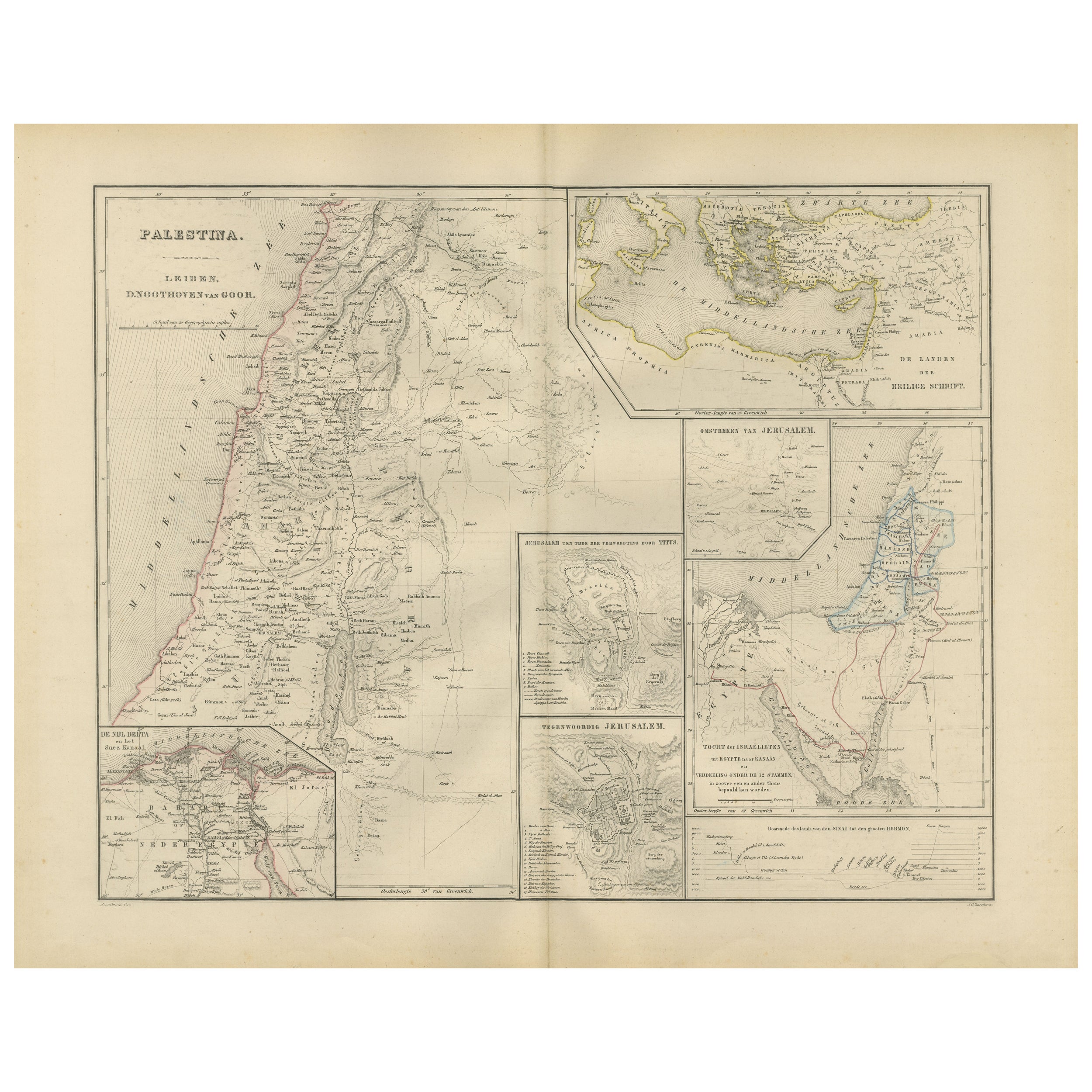
Holy Land Map with Jerusalem Insets – Nieuwe Hand-Atlas, 1876
Located in Langweer, NL
Palestine & Holy Land Map with Jerusalem Insets – Nieuwe Hand-Atlas, 1876
This detailed 19th-century map titled “Palestina” offers a comprehensive cartographic portrait of the Holy ...
Category
Antique 1870s Dutch Maps
Materials
Paper
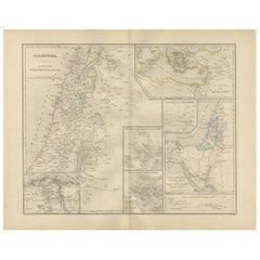
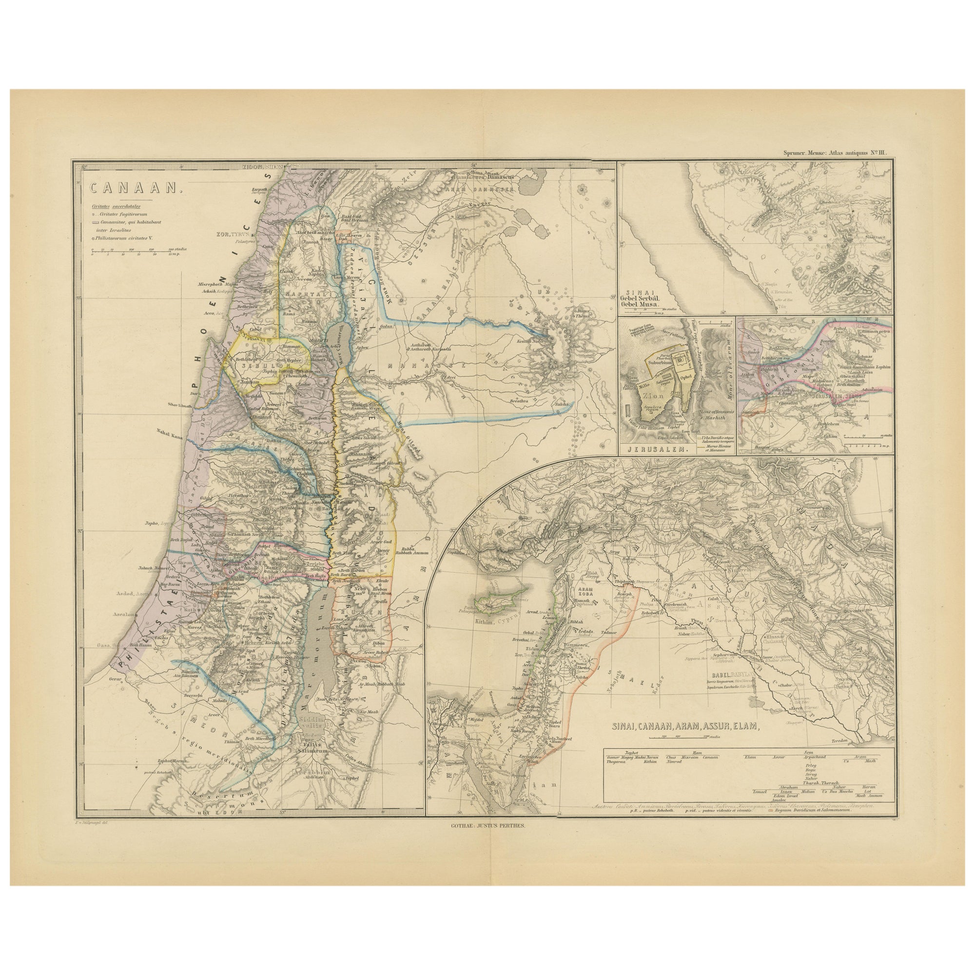
Historical Map of Canaan with Insets of Jerusalem and Surrounding Regions, 1880
Located in Langweer, NL
The map titled "CANAAN" depicts the historical region known as Canaan, located in the Levant, which corresponds to modern-day Israel, Palestinian territories, Lebanon, and parts of S...
Category
Antique 1880s Maps
Materials
Paper
$351 Sale Price
20% Off
Free Shipping
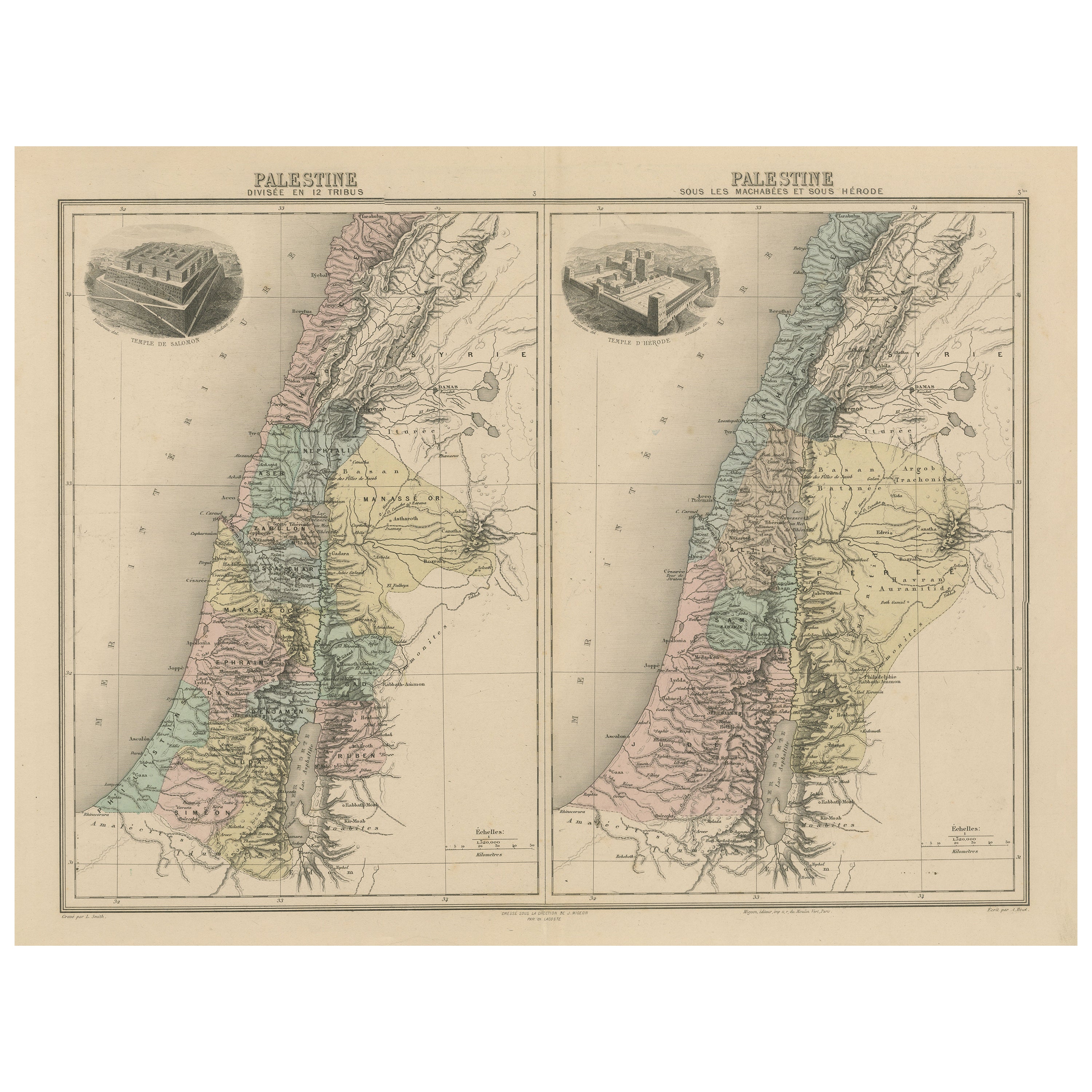
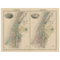
Palestine: Tribes
Maccabees – Antique Map by Migeon, Paris, 1892
Located in Langweer, NL
Palestine Divided into Tribes & Under the Maccabees – Antique Map by Migeon, 1892
This detailed antique map features two historical views of the Holy Land side by side: Palestine di...
Category
Antique Late 19th Century Maps
Materials
Paper
$322 Sale Price
20% Off
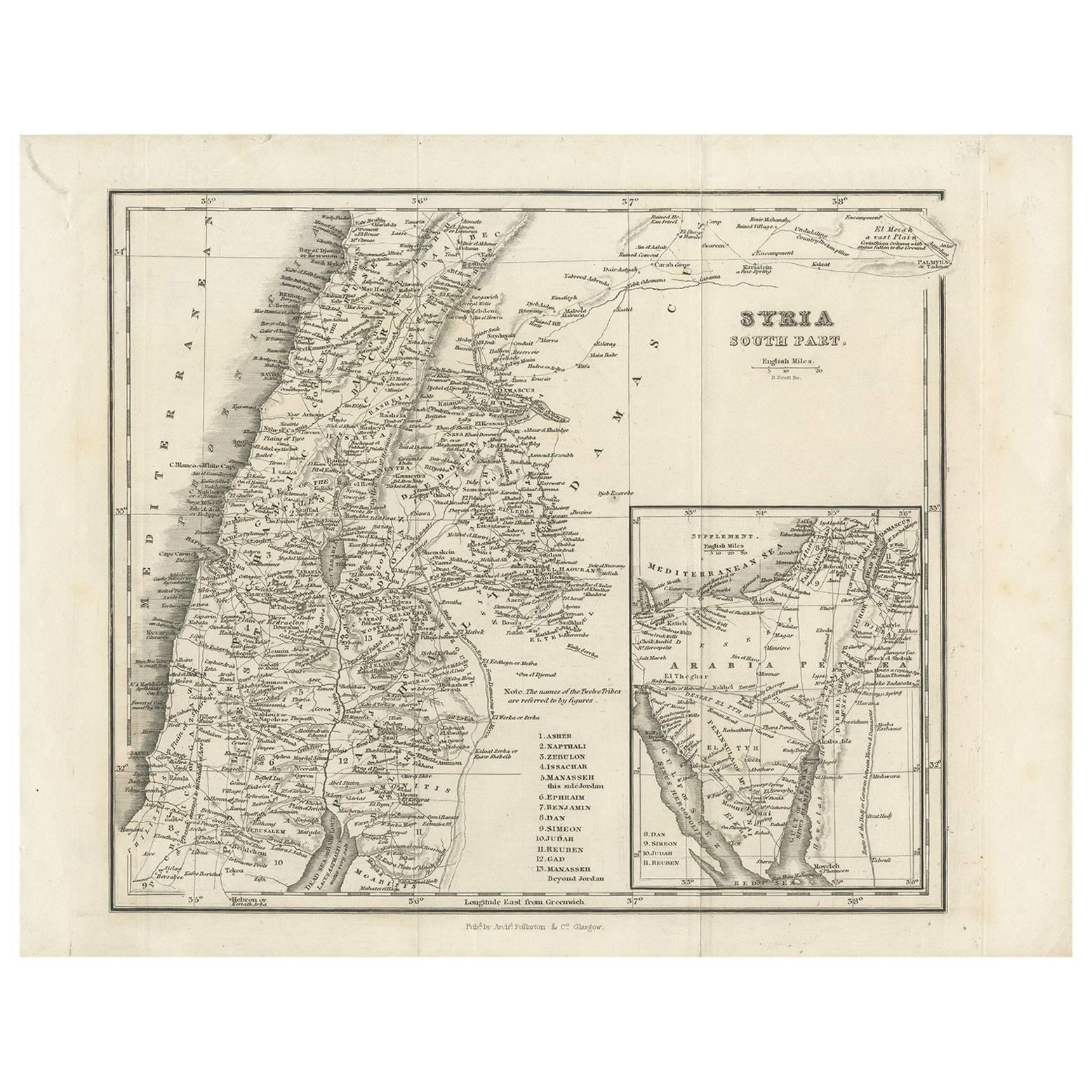
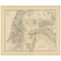
Antique Map of Southern Syria by Fullarton
Co, circa 1860
Located in Langweer, NL
Antique map titled 'Syria south part'. Published by Fullarton & Co, Glasgow, circa 1860.
- Title: Syria South Part
- Publisher: Fullarton & Co, Glasgow
- Date of Publication: Circa ...
Category
Antique Mid-19th Century English Maps
Materials
Paper
Antique Map of Egypt and Palestina by H. Kiepert, circa 1870
By Heinrich Kiepert
Located in Langweer, NL
Antique map titled 'Aegyptus, Phoenice et Palestina'. With inset maps of Tyrus, Alexandria and Hierosolyma. This map originates from 'Atlas Antiquus. Zwölf Karten zur Alten Geschicht...
Category
Antique Late 19th Century German Maps
Materials
Paper

$151 Sale Price
20% Off
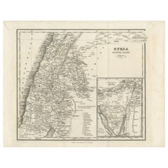
Antique Map of Syria, Mount Lebanon and Palestine – circa 1760
Located in Langweer, NL
Map of Syria and Mount Lebanon – “Carte de la Syrie”, c.1760
This finely engraved 18th-century map, titled Carte de la Syrie nouvellement corrigée, presents the region of Syria and ...
Category
Antique Mid-18th Century French Maps
Materials
Paper
You May Also Like
Large Original Vintage Map of Israel, circa 1920
Located in St Annes, Lancashire
Great map of Israel
Original color.
Good condition
Published by Alexander Gross
Unframed.
Category
Vintage 1920s English Edwardian Maps
Materials
Paper

Africa. North-West Part. Century Atlas antique vintage map
Located in Melbourne, Victoria
'The Century Atlas. Africa. Southern Part'
Original antique map, 1903.
Central fold as issued. Map name and number printed on the reverse corners.
Sheet 40cm by 29.5cm.
Category
Early 20th Century Victorian More Prints
Materials
Lithograph

Map of the Holy Land "Carte de la Syrie et de l
Egypte" by Pierre M. Lapie
By Pierre M. Lapie
Located in Alamo, CA
An early 19th century map of ancient Syria and Egypt entitled "Carte de la Syrie et de l'Egypte anciennes/dressée par M. Lapie, Colonel d'Etat Major, et...
Category
Antique Early 19th Century French Maps
Materials
Paper

Map of the Holy Land "Carte de la Syrie et de l
Egypte" by Pierre Lapie
By Pierre M. Lapie
Located in Alamo, CA
This is an early 19th century map of ancient Syria and Egypt entitled "Carte de la Syrie et de l'Egypte anciennes/dressée par M. Lapie, Colonel d'Etat M...
Category
1830s Landscape Prints
Materials
Engraving

Circa 1825 original engraving of the map of Syria by Giraldon Bovinet
Located in PARIS, FR
The circa 1825 original engraving of "Syrie" by Giraldon Bovinet, based on the work of L. Vivien, is a historically significant map that reflects early 19th-century cartographic tech...
Category
1820s Prints and Multiples
Materials
Paper, Engraving

Africa. North-East Part. Century Atlas antique vintage map
Located in Melbourne, Victoria
'The Century Atlas. Africa. North-East Part'
Original antique map, 1903.
Inset map of 'Nile Delta and Suez Canal'.
Central fold as issued. Map name and nu...
Category
Early 20th Century Victorian More Prints
Materials
Lithograph
