Items Similar to Antique Map of Persia, Afghanistan and Beloochistan – Black’s Atlas, 1884


Want more images or videos?
Request additional images or videos from the seller
1 of 10
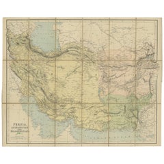
Antique Map of Persia, Afghanistan and Beloochistan – Black’s Atlas, 1884
$391.56
£292.32
€330
CA$544
A$585.15
CHF 312.72
MX$6,897.25
NOK 3,942.68
SEK 3,604.36
DKK 2,514.97
About the Item
Here is a catalogue entry in your preferred format for the Persia map you uploaded, in plain text and without using *:
---
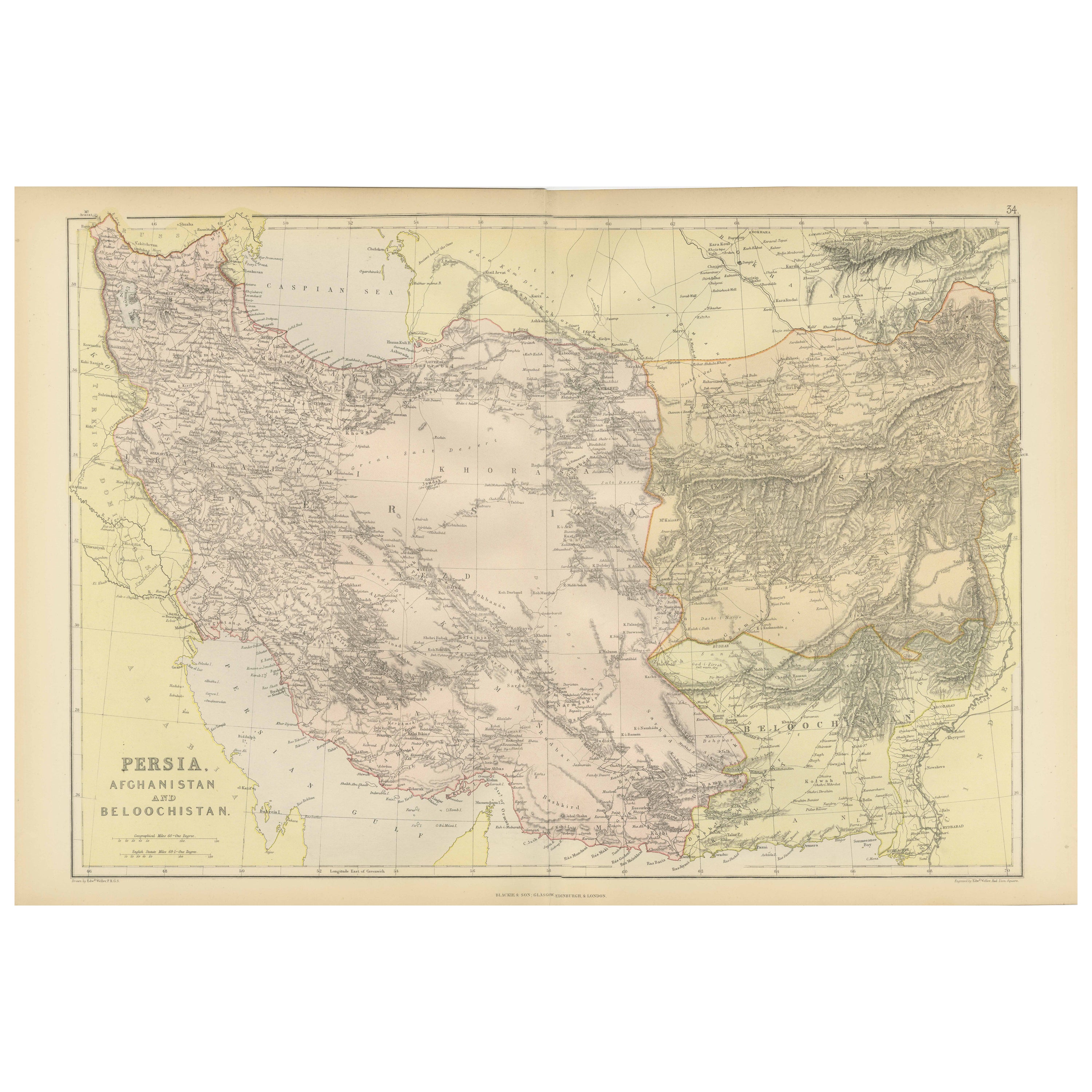
Title: Antique Map of Persia, Afghanistan and Beloochistan – Black’s Atlas, 1884
Description:
This finely engraved and hand-colored map titled “Persia, Afghanistan
Beloochistan” was published in the New and Revised Edition of Black’s General Atlas of the World, Edinburgh, 1884. It presents a detailed political and geographical view of the Iranian plateau and its surrounding regions during the height of 19th-century imperial rivalry in Central and South Asia.
The map covers Persia (modern Iran) in its full extent, bordered by the Caspian Sea to the north and the Persian Gulf and Arabian Sea to the south. To the east, Afghanistan and Beloochistan are shown in detail, while parts of Central Asia and British India appear along the margins. Political boundaries are clearly delineated and enhanced with subtle original hand coloring, distinguishing the major regions and spheres of influence of the period.
Mountain ranges such as the Zagros and Elburz are rendered with careful hill shading, while deserts including the Great Salt Desert and surrounding arid regions are clearly identified. Rivers, caravan routes, towns, and cities are finely engraved, including Tehran, Isfahan, Shiraz, Tabriz, Mashhad, Herat, Kandahar, and Kabul. Coastal details along the Persian Gulf are especially well drawn, emphasizing the strategic maritime importance of the region.
This map reflects the geopolitical realities of the late 19th century, when Persia stood at the center of the so-called Great Game between British and Russian interests. It provides a valuable historical snapshot of borders, trade routes, and regional geography before the major political transformations of the 20th century.
Condition report:
Very good condition. Original hand coloring remains clear and harmonious. Light marginal toning and faint age-related spotting consistent with atlas maps of this period. No tears or losses.
Framing tips:
This map benefits from an archival mat in ivory or light cream to complement the muted pastel coloring. A dark walnut or black frame enhances contrast and legibility, while a restrained gilt frame highlights its late Victorian character. UV-protective glass is recommended to preserve the original hand coloring.
Technique: Engraving with original hand coloring
Maker: Black’s General Atlas, Edinburgh, 1884
- Dimensions:Height: 12.84 in (32.6 cm)Width: 17.76 in (45.1 cm)Depth: 0.01 in (0.2 mm)
- Materials and Techniques:
- Place of Origin:
- Period:
- Date of Manufacture:1884
- Condition:Very good condition. Original hand coloring remains clear and harmonious. Light marginal toning and faint age-related spotting consistent with atlas maps of this period. No tears or losses.
- Seller Location:Langweer, NL
- Reference Number:Seller: BG-13601-3-231stDibs: LU3054348283902
About the Seller
5.0
Recognized Seller
These prestigious sellers are industry leaders and represent the highest echelon for item quality and design.
Platinum Seller
Premium sellers with a 4.7+ rating and 24-hour response times
Established in 2009
1stDibs seller since 2017
2,836 sales on 1stDibs
Typical response time: 1 hour
- ShippingRetrieving quote...Shipping from: Langweer, Netherlands
- Return Policy
More From This Seller
View AllAntique Map of Persia and Afghanistan, 1903, with Delicate Pastel Borders
Located in Langweer, NL
Title: Antique Map of Persia and Afghanistan, 1903, with Delicate Pastel Borders and Detailed Topography
Description:
This antique map, titled "Persia and Afghanistan," was engraved...
Category
Early 20th Century Maps
Materials
Paper
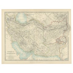
Antique Map of Persia and Afghanistan by Johnston
1909
Located in Langweer, NL
Antique map titled 'Persia and Afghanistan'. Original antique map of Persia and Afghanistan. This map originates from the ‘Royal Atlas o...
Category
Early 20th Century Maps
Materials
Paper

$237 Sale Price
20% Off
Antique Map of Persia and Afghanistan by Johnston, 1882
Located in Langweer, NL
Antique map titled 'Persia and Afghanistan'.
Old map of Persia and Afghanistan. This map originates from 'The Royal Atlas of Modern Geography, Exhibiting, in a Series of Entirely O...
Category
Antique 19th Century Maps
Materials
Paper

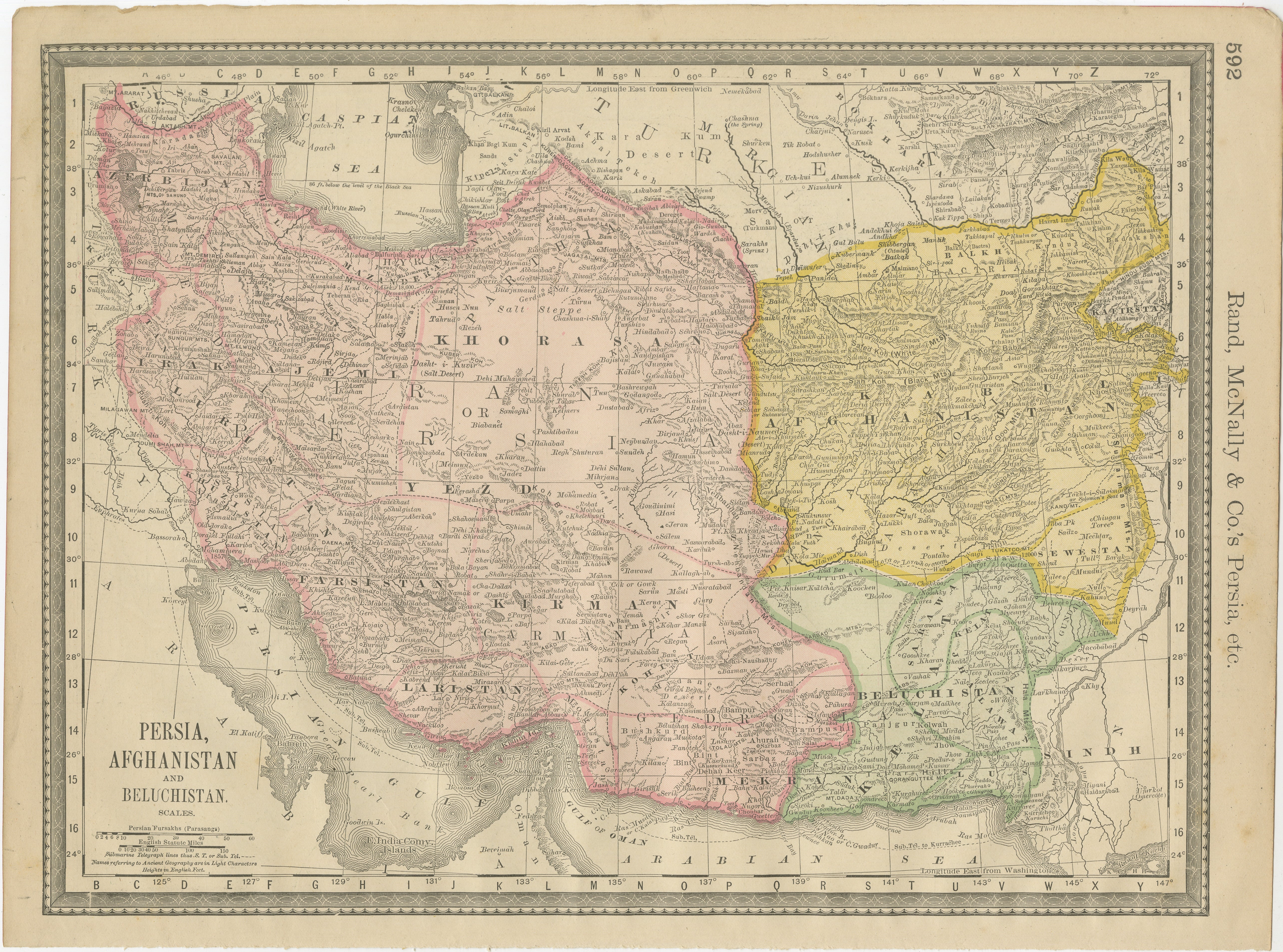
Antique Persia Map Wall Art – Iran Afghanistan Beluchistan, Rand McNally, c.1888
Located in Langweer, NL
Antique Persia Map Wall Art – Iran Afghanistan Beluchistan, Rand McNally
Description:
This finely colored antique atlas map presents Persia (modern-day Iran), Afghanistan, and Beluc...
Category
Antique Late 19th Century American Maps
Materials
Paper
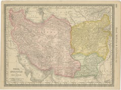
Oriental Realms: A Detailed Map of Persia, Afghanistan, and Beloochistan, 1882
Located in Langweer, NL
This historical map from the 1882 atlas published by Blackie & Son is a comprehensive depiction of Persia (modern-day Iran), Afghanistan, and Baluchistan (the region that includes pa...
Category
Antique 1880s English Maps
Materials
Paper

Antique Map of West Asia, circa 1900
Located in Langweer, NL
Antique map titled 'Persia, Afghanistan and Beloochistan'. Folding map on linen.
Published circa 1900. Stamp below title.
Category
Early 20th Century Maps
Materials
Paper
You May Also Like
Map of Persia - Original Etching - Late 19th Century
Located in Roma, IT
This Map of Persia is an etching realized by an anonymous artist.
The state of preservation of the artwork is good with some small diffused stains.
Sheet dimension: 25.5 x 44
At t...
Category
Late 19th Century Modern Figurative Prints
Materials
Etching
Large Original Antique Map of Afghanistan. Edward Weller, 1861
Located in St Annes, Lancashire
Great map of Afghanistan
Lithograph engraving by Edward Weller
Original colour
Published, 1861
Unframed
Good condition
Category
Antique 1860s English Victorian Maps
Materials
Paper

Large Original Vintage Map of Persia / Iran, circa 1920
Located in St Annes, Lancashire
Great maps of Persia.
Unframed.
Original color.
By John Bartholomew and Co. Edinburgh Geographical Institute.
Published, circa 1920.
Free shipping.
Category
Vintage 1920s British Maps
Materials
Paper

Original Antique Map of India by Dower, circa 1835
Located in St Annes, Lancashire
Nice map of India
Drawn and engraved by J.Dower
Published by Orr & Smith. C.1835
Unframed.
Free shipping
Category
Antique 1830s English Maps
Materials
Paper

Africa. North-East Part. Century Atlas antique vintage map
Located in Melbourne, Victoria
'The Century Atlas. Africa. North-East Part'
Original antique map, 1903.
Inset map of 'Nile Delta and Suez Canal'.
Central fold as issued. Map name and nu...
Category
Early 20th Century Victorian More Prints
Materials
Lithograph

Persia, Armenia
Adjacent Regions: A 17th Century Hand-colored Map by De Wit
By Frederick de Wit
Located in Alamo, CA
A large 17th century hand colored copperplate engraved map entitled "Novissima nec non Perfectissima Scandinaviae Tabula comprehendens Regnorum Sueciae, Daniae et Norvegiae distincte...
Category
Antique Late 17th Century Dutch Maps
Materials
Paper
