Items Similar to Antique Map of the Peter the Great Gulf by Reclus, 1881
Want more images or videos?
Request additional images or videos from the seller
1 of 5
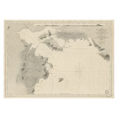
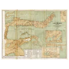
Antique Map of the Peter the Great Gulf by Reclus, 1881
$106.50
£79.55
€89
CA$146.72
A$159.90
CHF 84.68
MX$1,920.62
NOK 1,072.02
SEK 985.62
DKK 678.03
About the Item
Antique map titled 'Le Golfe de Pierre-Le-Grand.' This map shows the Peter The Great Gulf in the Sea of Japan adjoining the coast of Russia's Primorski Krai. This original old antique print / plate originates from: 'Nouvelle Geographie Universelle La Terre et les Hommes VI : L' Asie Russe' by Jacques Elisee Reclus. Published in Paris by Hachette
Cie.. 1881.
Artists and Engravers: Jacques Elisee Reclus was a renowned French geographer. writer and anarchist. He produced his 19-volume masterwork La Nouvelle Geographie universelle. la terre et les hommes ('Universal Geography'). over a period of nearly 20 years (1875 � 1894).
Condition: Good. General age related toning and soiling. Please study image carefully.
Date: 1881
Overall size: 34 x 26.5 cm.
Image size: 29 x 22 cm.
We sell original antique maps to collectors, historians, educators and interior decorators all over the world. Our collection includes a wide range of authentic antique maps from the 16th to the 20th centuries. Buying and collecting antique maps is a tradition that goes back hundreds of years. Antique maps have proved a richly rewarding investment over the past decade, thanks to a growing appreciation of their unique historical appeal. Today the decorative qualities of antique maps are widely recognized by interior designers who appreciate their beauty and design flexibility. Depending on the individual map, presentation, and context, a rare or antique map can be modern, traditional, abstract, figurative, serious or whimsical. We offer a wide range of authentic antique maps for any budget.
- Dimensions:Height: 10.44 in (26.5 cm)Width: 13.39 in (34 cm)Depth: 0 in (0.01 mm)
- Materials and Techniques:
- Period:
- Date of Manufacture:1881
- Condition:
- Seller Location:Langweer, NL
- Reference Number:Seller: PCT-280791stDibs: LU3054327872502
About the Seller
5.0
Recognized Seller
These prestigious sellers are industry leaders and represent the highest echelon for item quality and design.
Platinum Seller
Premium sellers with a 4.7+ rating and 24-hour response times
Established in 2009
1stDibs seller since 2017
2,786 sales on 1stDibs
Typical response time: <1 hour
- ShippingRetrieving quote...Shipping from: Langweer, Netherlands
- Return Policy
More From This Seller
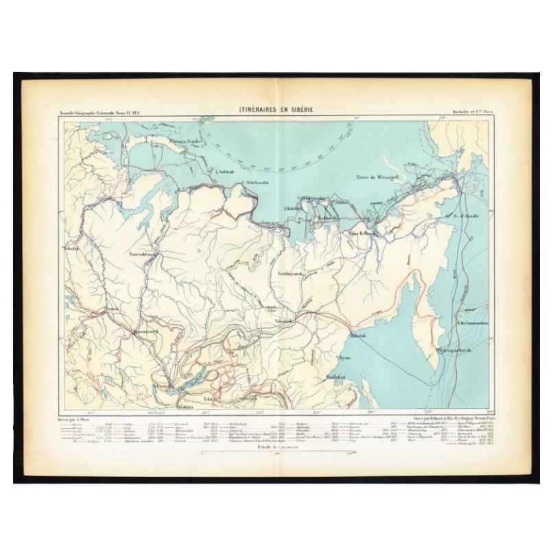
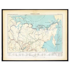
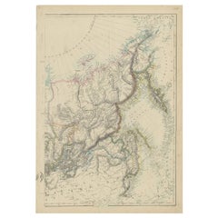
View AllAntique Map of Siberia by Reclus, 1881
Located in Langweer, NL
Antique map titled 'Itineraires en Siberie.' This map shows the itineraries of famous explorers in Siberia between 1648 and 1879. This original old antique print / plate originates f...
Category
Antique 19th Century Maps
Materials
Paper
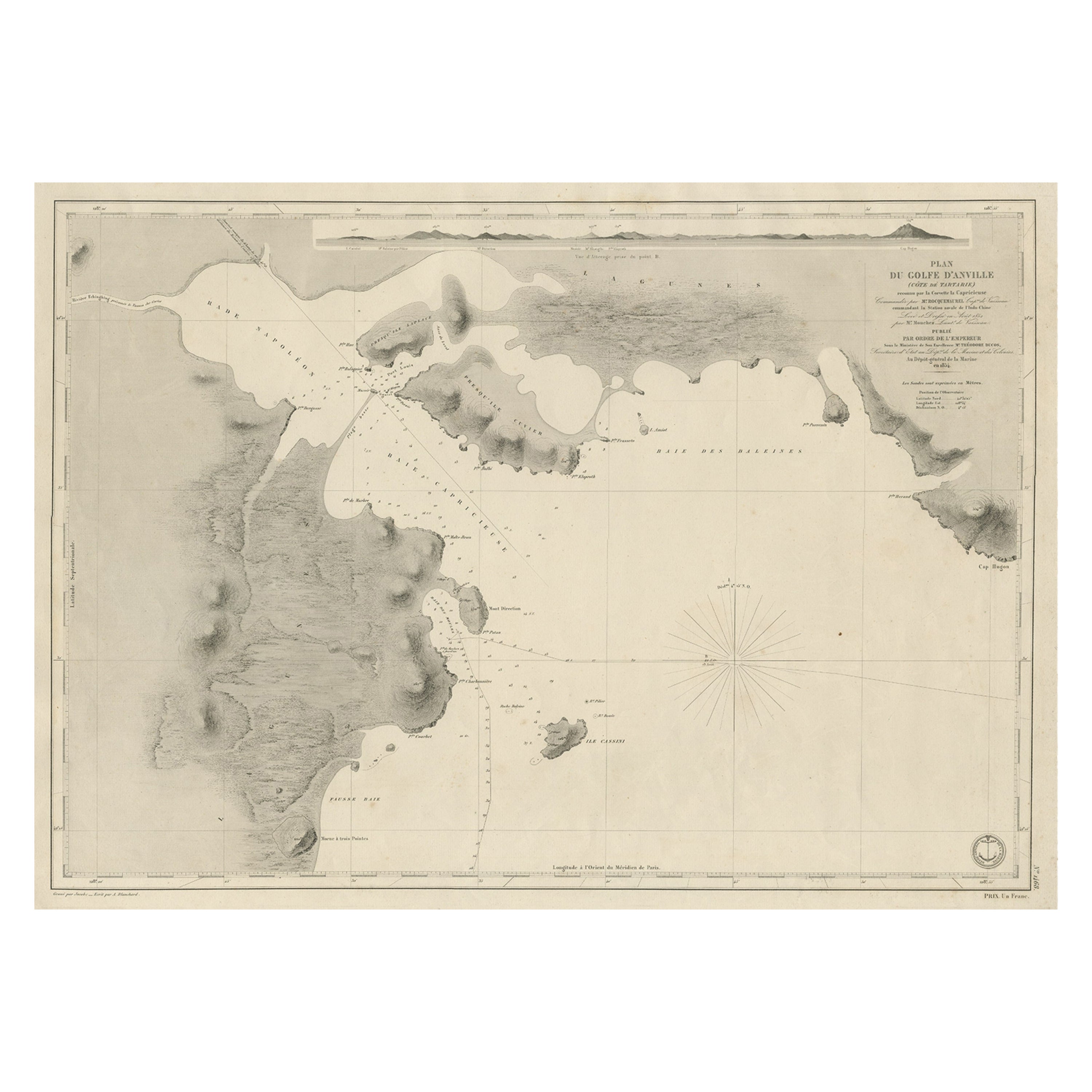
Antique Map of Part of the Chinese Coast, Explored by the French, Ca.1852
Located in Langweer, NL
Antique map titled 'Plan du Golfe D'Anville (Côte de Tartarie)'.
Old map of part of the Chinese coast, explored with the French corvette 'Caprieuse'. The Capricieuse was a late 2...
Category
Antique 1850s Maps
Materials
Paper
$661 Sale Price
34% Off
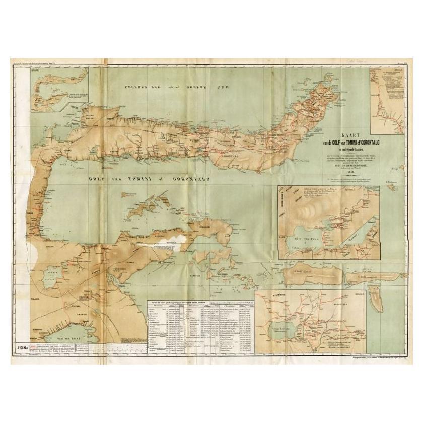
Antique Map of the Gulf of Tomini by Winkler Prins, 1878
Located in Langweer, NL
Antique map titled 'Kaart van de Golf van Tomini of Gorontalo.' (Map of the Gulf of Tomini or Gorontalo.) This map shows the Gulf of Tomini near the Island of Sulawesi, Indonesia. Wi...
Category
Antique 19th Century Maps
Materials
Paper
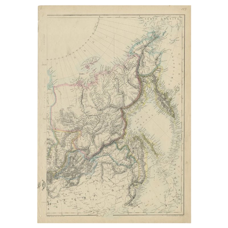
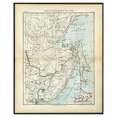
Antique Map of Russia in Asia by Lowry, c.1865
Located in Langweer, NL
Antique map titled 'Russia in Asia, E Sheet'. Old map of Russia originating from the 'Weekly Dispatch Atlas'. Artists and Engravers: Engraved by J.W. Lowry.
Artist: Engraved by J....
Category
Antique 19th Century Maps
Materials
Paper
$85 Sale Price
20% Off
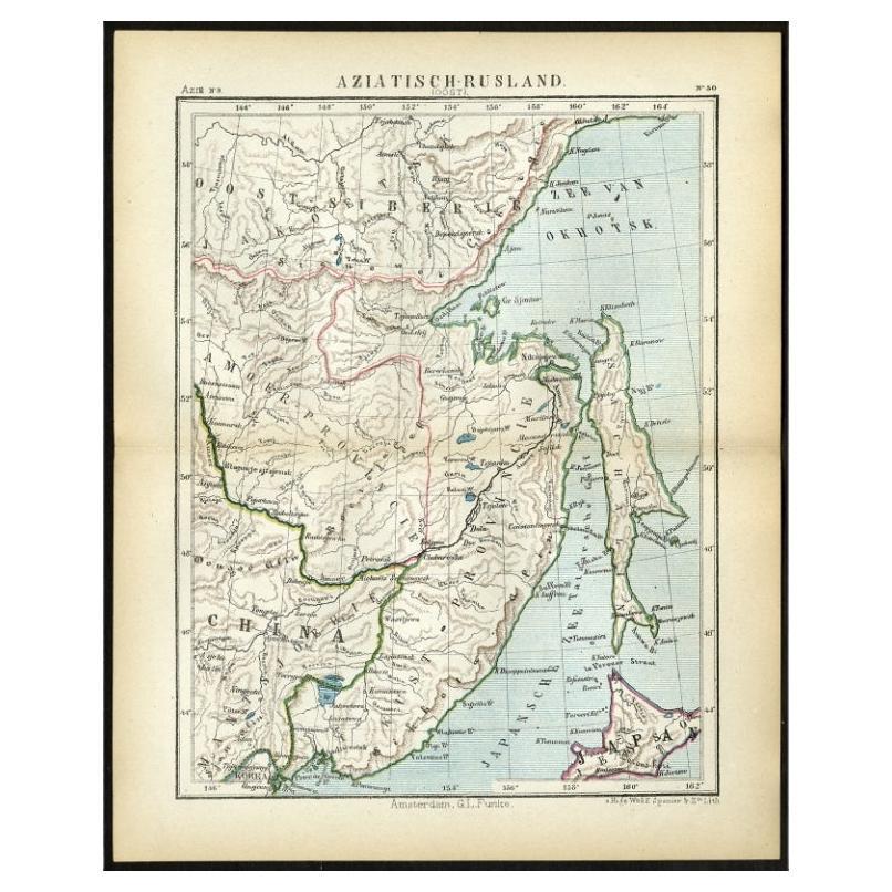
Antique Map of Eastern Russia in Asia by Kuyper, 1880
Located in Langweer, NL
Antique map titled 'Aziatisch Rusland. Oost'. Original antique map of Eastern Russia in Asia. This lithographed map originates from: 'Wereld-atlas voor ...
Category
Antique 19th Century Maps
Materials
Paper
$62 Sale Price
20% Off
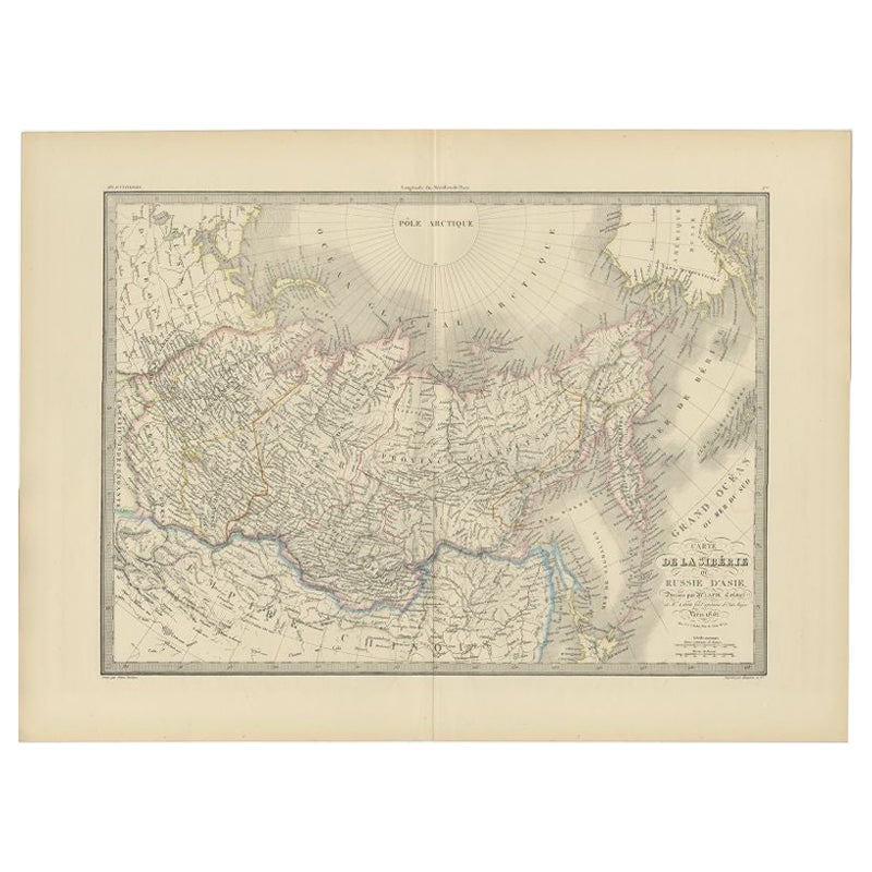
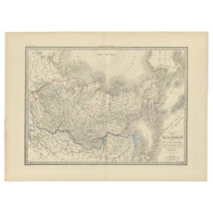
Antique Map of Siberia by Lapie, 1842
Located in Langweer, NL
Antique map titled 'Carte de la Sibérie ou Russie d'Asie'. Map of Siberia. This map originates from 'Atlas universel de géographie ancienne et moderne (..)' by Pierre M. Lapie and Al...
Category
Antique 19th Century Maps
Materials
Paper
You May Also Like
1860 Large Map "Carte De La Siberie Russie D
asie, " Ric.R0001
Located in Norton, MA
Large 1860 map "Carte De La Siberie Russie D'Asie," R-0001
" Authentic" - 1860 map "Carte De La Siberie Russie D'Asie,"
Dimension: Paper: 68 cm W x 51 cm H ; Sight: 51cm W x 4...
Category
Antique 19th Century Unknown Maps
Materials
Paper

Antique Lithography Map, Black Sea, English, Framed, Cartography, Victorian
Located in Hele, Devon, GB
This is an antique lithography map of the Black Sea region. An English, framed atlas engraving of cartographic interest by John Rapkin, dating to the early Victorian period and later...
Category
Antique Mid-19th Century British Early Victorian Maps
Materials
Wood

Large Original Antique Map of The Greek Islands. 1894
Located in St Annes, Lancashire
Superb Antique map of The Greek Islands
Published Edward Stanford, Charing Cross, London 1894
Original colour
Good condition
Unframed.
Free shipping
Category
Antique 1890s English Maps
Materials
Paper

Large Original Antique Map of The Pacific Ocean, Fullarton, C.1870
Located in St Annes, Lancashire
Great map of The Pacific Ocean
From the celebrated Royal Illustrated Atlas
Lithograph by Swanston. Original color.
Published by Fullarton,...
Category
Antique 1870s Scottish Maps
Materials
Paper

Large1852 Map "Russian Empire" Ric.r0011
Located in Norton, MA
Large
1852 map "Russian Empire"
George Phillips & Son 1852
Ric.r0011
Dimension: Paper: 67 cm W x 52 cm H ; Sight: 60cm W x 50 cm H
Condition: Good Condition with aged tonin...
Category
Antique 19th Century Unknown Maps
Materials
Paper

China and Japan, English antique map by Alexander Keith Johnston, 1901
Located in Melbourne, Victoria
'China and Japan', antique lithographic map by Keith Johnston.
Central vertical fold as issued.
495mm by 625mm (sheet)
Alexander Keith Johnston FRS...
Category
Early 20th Century Victorian More Prints
Materials
Lithograph

More Ways To Browse
Johann Baptist Homann On Sale
Magellan Map
Map Of Puerto Rico
Map Ukraine
Papua New Guinea Antique Map
Serbia Antique Map
Stanford Antique Furniture
Tipu Sultan
Used Office Furniture Cornwall
Vintage Wooden Roller
Albania Antique Map
Ancient Bible
Antique Bermuda Furniture
Antique Constellation Map
Antique Map Burgundy
Antique Map Of Hawaii
Antique Maps Of Long Island
Calcutta Map