Items Similar to Antique Map of the Region of Bolsward and Sneek by Von Reilly, 1791


Want more images or videos?
Request additional images or videos from the seller
1 of 5
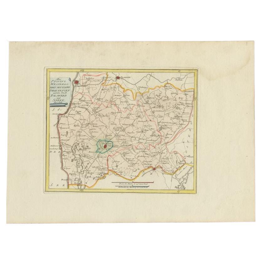
Antique Map of the Region of Bolsward and Sneek by Von Reilly, 1791
$189.74
£140.53
€158
CA$259.56
A$282.48
CHF 149.74
MX$3,398.43
NOK 1,899.20
SEK 1,737.64
DKK 1,203.99
About the Item
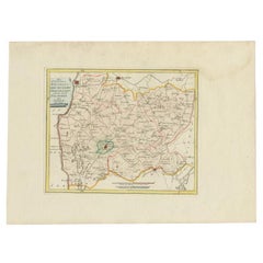
Antique map titled 'Der Provinz Westergo drey mittlere Grietenyen mit der Stadt Bolsward und Sneek'. Map of the region of Bolsward and Sneek, Friesland, the Netherlands. This map orginates from 'Schauplatz der fünf Theile der Welt'.
Artists and Engravers: Franz Joseph Johann von Reilly (1766-1820) was a Vienna based art dealer. He is also known as the author of two atlases. The maps were engraved by Ignaz Alberti (also Ignaz Albrecht, 1760-1794). Ignaz was an Austrian illustrator, publisher and engraver.
Date: 1791
Overall size: 39.5 x 29 cm.
Image size: 24 x 20 cm.
We sell original antique maps to collectors, historians, educators and interior decorators all over the world. Our collection includes a wide range of authentic antique maps from the 16th to the 20th centuries. Buying and collecting antique maps is a tradition that goes back hundreds of years. Antique maps have proved a richly rewarding investment over the past decade, thanks to a growing appreciation of their unique historical appeal. Today the decorative qualities of antique maps are widely recognized by interior designers who appreciate their beauty and design flexibility. Depending on the individual map, presentation, and context, a rare or antique map can be modern, traditional, abstract, figurative, serious or whimsical. We offer a wide range of authentic antique maps for any budget.
- Dimensions:Height: 11.42 in (29 cm)Width: 15.56 in (39.5 cm)Depth: 0 in (0.01 mm)
- Materials and Techniques:
- Period:
- Date of Manufacture:1791
- Condition:Condition: Good, general age-related toning. Original/contemporary hand coloring. Blank verso. Please study image carefully.
- Seller Location:Langweer, NL
- Reference Number:Seller: PCT-7361stDibs: LU3054327871682
About the Seller
5.0
Recognized Seller
These prestigious sellers are industry leaders and represent the highest echelon for item quality and design.
Platinum Seller
Premium sellers with a 4.7+ rating and 24-hour response times
Established in 2009
1stDibs seller since 2017
2,816 sales on 1stDibs
Typical response time: 1 hour
- ShippingRetrieving quote...Shipping from: Langweer, Netherlands
- Return Policy
More From This Seller
View AllBolsward
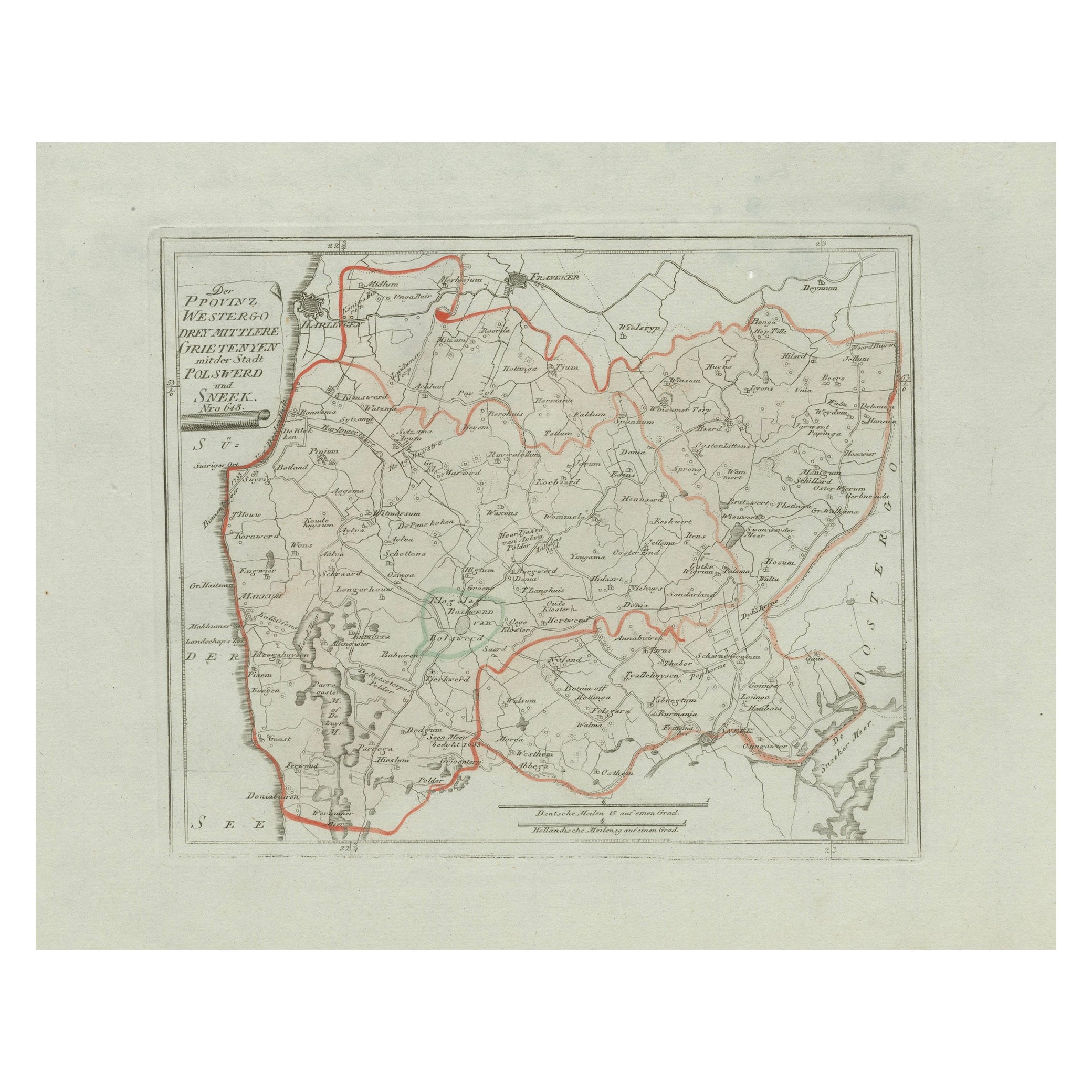
Sneek, Westergo (Friesland) – von Reilly antique map, 1791
Located in Langweer, NL
Title: Bolsward & Sneek, Westergo (Friesland) – von Reilly antique map, 1791
Description:
Crisp late-18th-century map of the Westergo region in Friesland focusing on the “drey mittl...
Category
Antique 18th Century Austrian Maps
Materials
Paper
Antique Map of Sneek and Bolsward, Friesland – Dutch Provincial Map, 1791
Located in Langweer, NL
Antique Map of Sneek and Bolsward, Friesland by von Reilly, 1791
Original engraved map titled Der Provinz Westergo drey mittlere Grietenyen, mit der Stadt Bolsward und Sneek No. 641...
Category
Antique 18th Century Austrian Maps
Materials
Paper

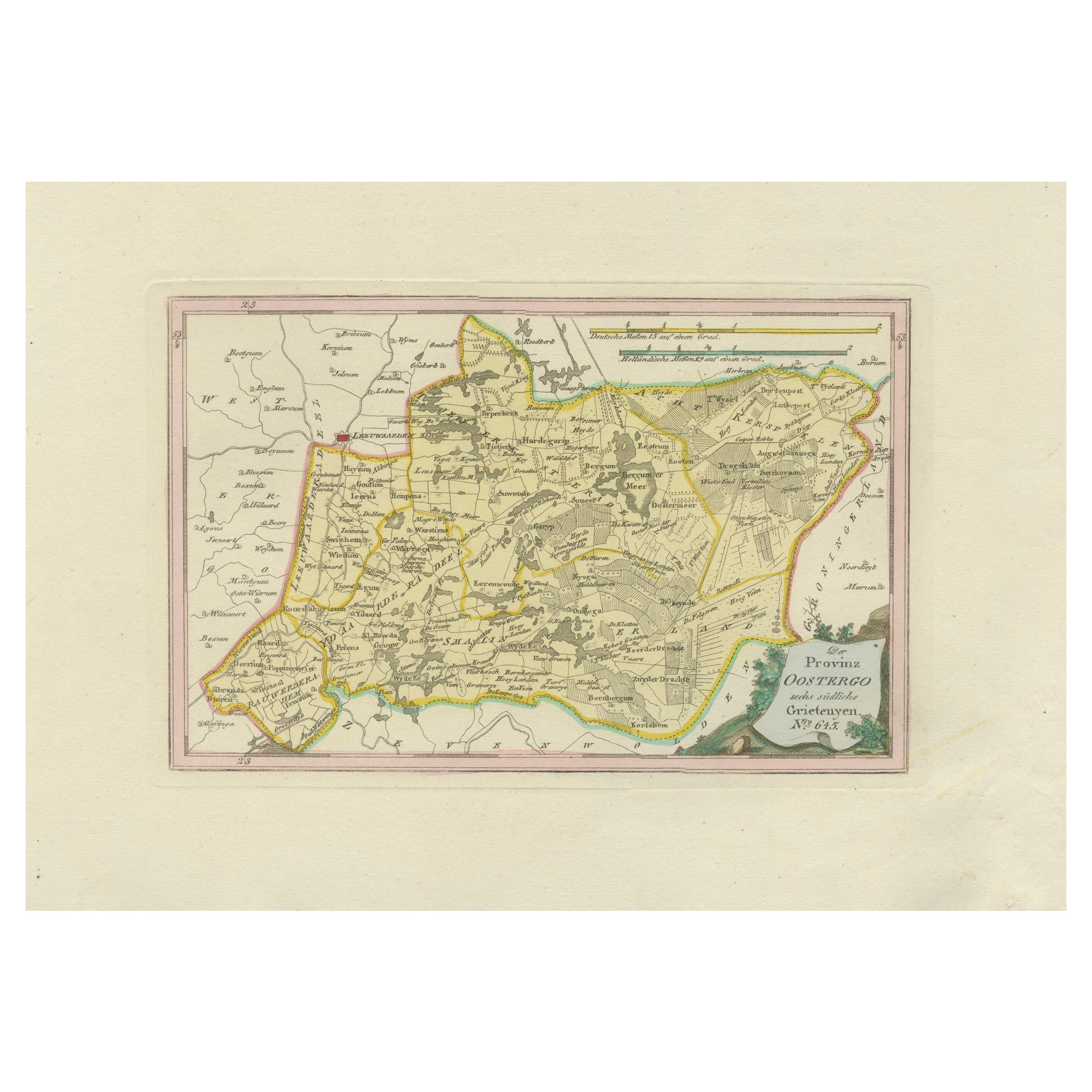
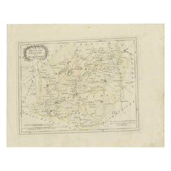
Antique Map of Eastern Oostergo, Friesland by von Reilly, 1791
Located in Langweer, NL
Antique Map of Eastern Oostergo, Friesland by von Reilly, 1791
Original engraved map titled Der Provinz Oostergo sechs östliche Grietenyen No. 643, published in Vienna in 1791. This...
Category
Antique 18th Century Austrian Maps
Materials
Paper
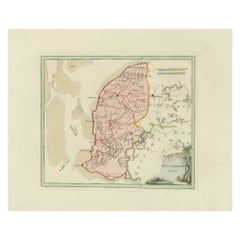
Rare 1791 von Reilly Map of Franeker and Harlingen, Friesland, Netherlands
Located in Langweer, NL
Antique Map of Franeker and Harlingen by von Reilly, 1791
Fine original map titled Der Provinz Westergo vier nördliche Grietenyen mit der Stadt Franeker und Harlingen, published in ...
Category
Antique 18th Century Austrian Maps
Materials
Paper

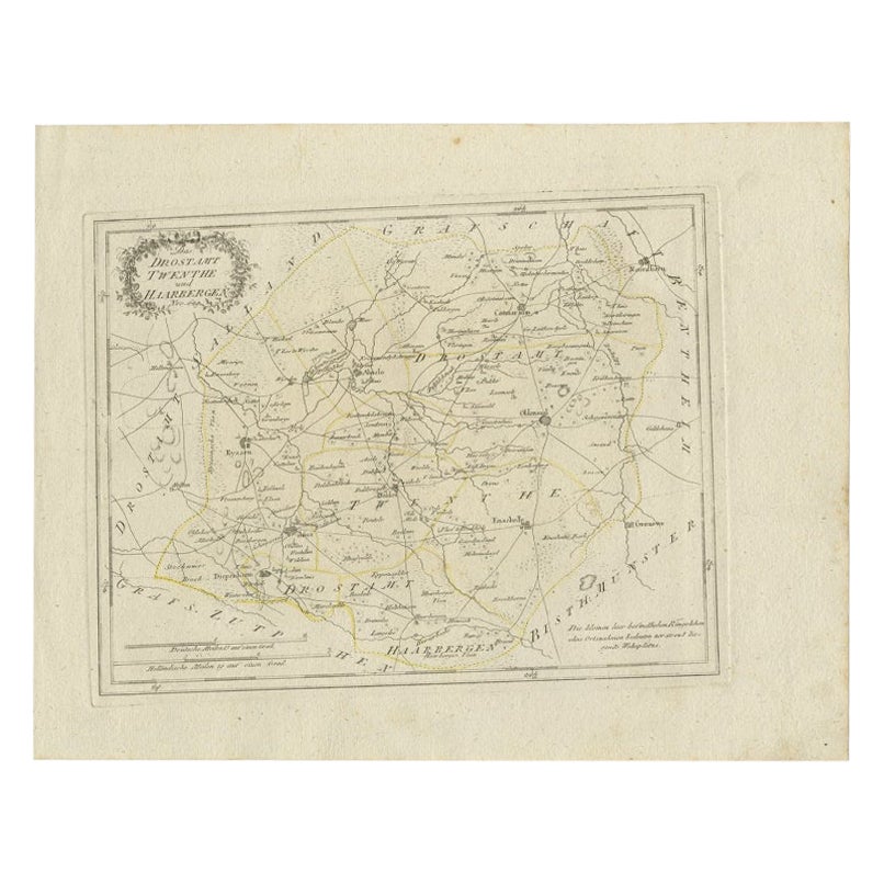
Antique Map of Part of Overijssel by Von Reilly, 1792
Located in Langweer, NL
Antique map titled 'Das Drostamt Twenthe und Haarbergen'. This map depicts part of The Netherlands (Overijssel). This map originates from 'Schauplatz der fünf Theile der Welt' publis...
Category
Antique 18th Century Maps
Materials
Paper
$120 Sale Price
20% Off
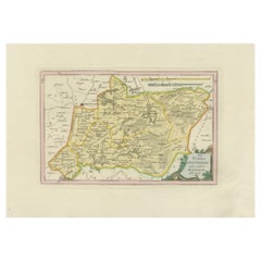
Antique Map of Southern Westergo, Friesland by von Reilly, 1791
Located in Langweer, NL
Antique Map of Southern Westergo, Friesland by von Reilly, 1791
Original engraved map titled Westergoo Norde, published in Vienna in 1791. This sheet depicts the southern and coasta...
Category
Antique 18th Century Austrian Maps
Materials
Paper
You May Also Like
1752 Vaugoundy Map of Flanders : Belgium, France, and the Netherlands, Ric.a002
Located in Norton, MA
Large Vaugoundy Map of Flanders:
Belgium, France, and the Netherlands
Colored -1752
Ric.a002
Description: This is a 1752 Didier Robert de Vaugondy map of Flanders. The map de...
Category
Antique 17th Century Unknown Maps
Materials
Paper

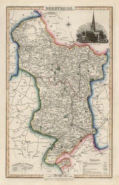
Derbyshire, English County Antique map, 1847
By Isaac Slater
Located in Melbourne, Victoria
Steel-engraved map with original outline colouring by Isaac Slater. A detailed engraved map of the English county with title, scale, and key. Decorated with an uncoloured engraved vi...
Category
19th Century Naturalistic Landscape Prints
Materials
Engraving
1771 Bonne Map of Poitou, Touraine and Anjou, France, Ric.a015
Located in Norton, MA
1771 Bonne Map of Poitou,
Touraine and Anjou, France
Ric.a015
1771 Bonne map of Potiou, Touraine and Anjou entitled "Carte des Gouvernements D'Anjou et du Saumurois, de la Touraine, du Poitou,du Pays d'aunis, Saintonge?Angoumois,"
Carte des gouvernements d'Anjou et du Saumurois, de la Touraine, du Poitou, du Pays d'Aunis, Saintonge-Angoumois. Projettee et assujettie au ciel par M. Bonne, Hyd. du Roi. A Paris, Chez Lattre, rue St. Jacques a la Ville de Bord(ea)ux. Avec priv. du Roi. 1771. Arrivet inv. & sculp., Atlas moderne ou collection de cartes sur toutes...
Category
Antique 17th Century Unknown Maps
Materials
Paper

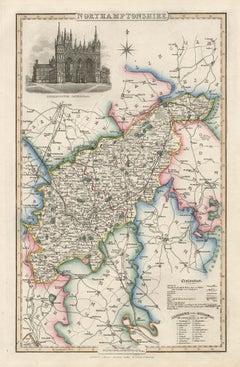
Northamptonshire, English County Antique map, 1847
By Isaac Slater
Located in Melbourne, Victoria
Steel-engraved map with original outline colouring by Isaac Slater. A detailed engraved map of the English county with title, scale, and key. Decorated with an uncoloured engraved view of 'Peterborough...
Category
19th Century Naturalistic Landscape Prints
Materials
Engraving
Original Antique English County Map, Cambridgeshire, J
C Walker, 1851
Located in St Annes, Lancashire
Great map of Cambridgeshire
Original colour
By J & C Walker
Published by Longman, Rees, Orme, Brown & Co. 1851
Unframed.
Category
Antique 1850s English Other Maps
Materials
Paper

1635 Willem Blaeu Map of Northern France"Comitatvs Bellovacvm" Ric.a08
Located in Norton, MA
1635 Willem Blaeu map of northern France, entitled.
"Comitatvs Bellovacvm Vernacule Beavvais,"
Colored
Ric.a008
“COMITATVS BELLOVACVM…” Amsterdam: W...
Category
Antique 17th Century Unknown Maps
Materials
Paper

More Ways To Browse
Franz Joseph
Johann Baptist Homann On Sale
Magellan Map
Map Of Puerto Rico
Map Ukraine
Papua New Guinea Antique Map
Serbia Antique Map
Stanford Antique Furniture
Tipu Sultan
Used Office Furniture Cornwall
Vintage Wooden Roller
Albania Antique Map
Ancient Bible
Antique Bermuda Furniture
Antique Constellation Map
Antique Map Burgundy
Antique Map Of Hawaii
Antique Maps Of Long Island