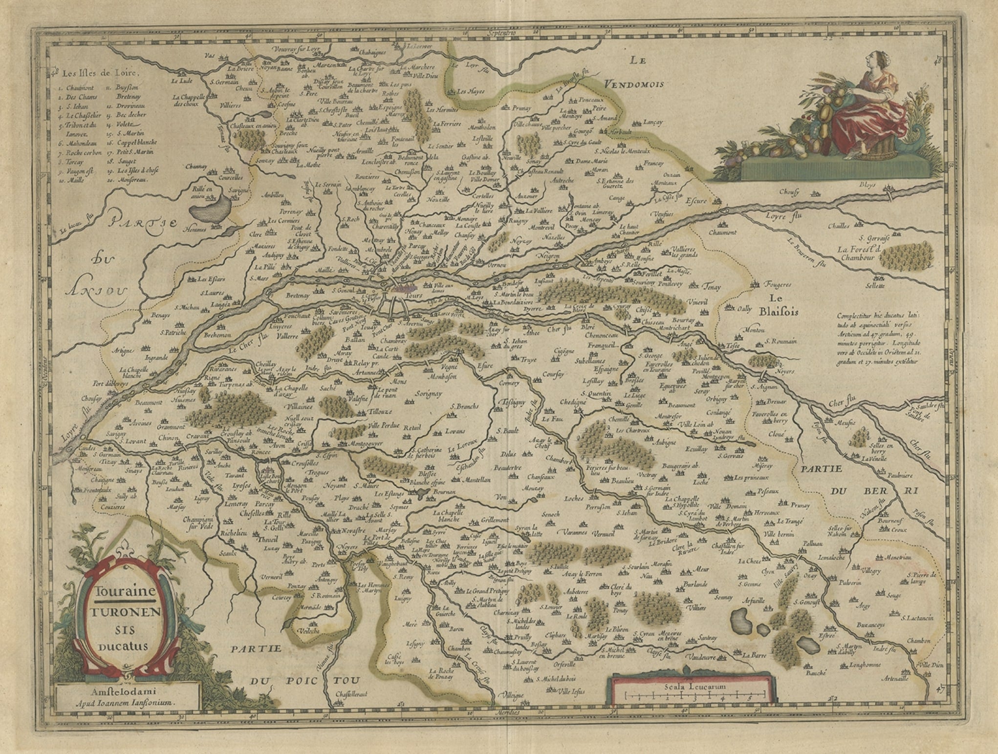
Items Similar to Antique Map of the Region of Touraine by Janssonius
circa 1650


Want more images or videos?
Request additional images or videos from the seller
1 of 5
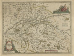
Antique Map of the Region of Touraine by Janssonius
circa 1650
$536.22
£399.40
€450
CA$738.41
A$803.75
CHF 425.88
MX$9,666.26
NOK 5,414.91
SEK 4,962.16
DKK 3,428.70
About the Item
Antique map of France titled 'Touraine - Turonensis Ducatus'. Decorative map of the Touraine region, France. It shows the cities of Tours, Amboise and others. Published by J. Janssonius.
- Creator:Johannes Janssonius (Artist)
- Dimensions:Height: 19.69 in (50 cm)Width: 23.23 in (59 cm)Depth: 0.02 in (0.5 mm)
- Materials and Techniques:
- Period:Mid-17th Century
- Date of Manufacture:circa 1650
- Condition:General age-related toning. Minor wear, Dutch text on verso. Please study images carefully.
- Seller Location:Langweer, NL
- Reference Number:Seller: BG-12390-451stDibs: LU3054318012252
About the Seller
5.0
Recognized Seller
These prestigious sellers are industry leaders and represent the highest echelon for item quality and design.
Platinum Seller
Premium sellers with a 4.7+ rating and 24-hour response times
Established in 2009
1stDibs seller since 2017
2,824 sales on 1stDibs
Typical response time: 1 hour
- ShippingRetrieving quote...Shipping from: Langweer, Netherlands
- Return Policy
More From This Seller
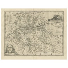
View AllAntique Map of the Region of Touraine, France by Janssonius, 1657
By Johannes Janssonius
Located in Langweer, NL
Antique map of France titled 'Touraine - Turonensis Ducatus'. Decorative map of the Touraine region. This map originates from 'Atlas Novus, Sive Theatrum Orbis Orbis Terrarum: In quo...
Category
Antique 17th Century Maps
Materials
Paper
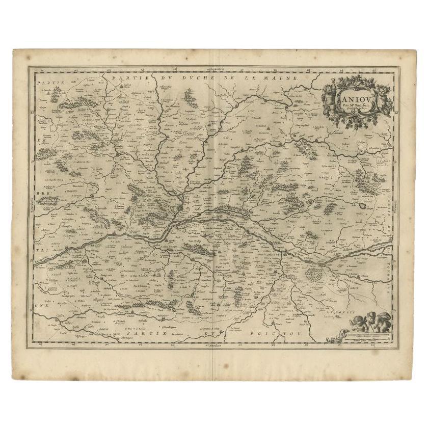
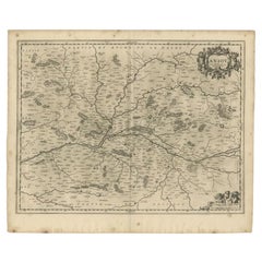
Antique Map of the Region of the Loire Valley by Janssonius, 1657
By Johannes Janssonius
Located in Langweer, NL
Antique map of France titled 'Aniou'. Decorative map centered on the Loire valley, France. This map originates from 'Atlas Novus, Sive Theatrum Orbis Orbis Terrarum: In quo Galliae, ...
Category
Antique 17th Century Maps
Materials
Paper
Antique Map of the Region of Périgord by Janssonius, 1657
By Johannes Janssonius
Located in Langweer, NL
Antique map of France titled 'Le Comte de Perigort'. Decorative map of the Périgord region. Périgord is a natural region and former province of France, which corresponds roughly to t...
Category
Antique 17th Century Maps
Materials
Paper

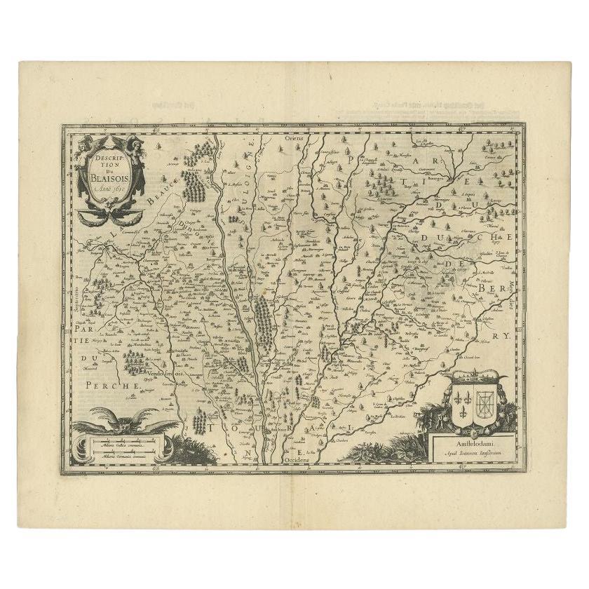
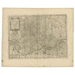
Antique Map of the Region of Blois by Janssonius, c.1650
Located in Langweer, NL
Antique map titled 'Description du Blaisois'. Old map of the region of Blois, France. It shows the city of Blois, Amboise, the Loire River and more.
Artists and Engravers: Johann...
Category
Antique 17th Century Maps
Materials
Paper

Antique Map of the Region of Touraine in France by Janssonius, 1657
By Johannes Janssonius
Located in Langweer, NL
Antique map titled 'Touraine - Turonensis Ducatus'.
Decorative map of the Touraine region. This map originates from 'Atlas Novus, Sive Theatrum Orbis Orbis Terrarum: In quo Galli...
Category
Antique 17th Century Maps
Materials
Paper
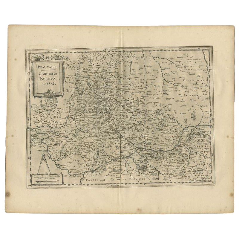
Antique Map of the Region of Beauvais by Janssonius, 1657
Located in Langweer, NL
Antique map of France titled 'Beauvaisis Comitatus Belovacium'. Detailed map of the region centered on Beauvais. This map originates from 'Atlas Novus, Sive Theatrum Orbis Orbis Terr...
Category
Antique 17th Century Maps
Materials
Paper
You May Also Like
1657 Janssonius Map of Vermandois and Cappelle, Ric. A-004
Located in Norton, MA
1657 Janssonius map of
Vermandois and Cappelle
Ric.a004
Description: Antique map of France titled 'Descriptio Veromanduorum - Gouvernement de la Cappelle'. Two detailed maps o...
Category
Antique 17th Century Unknown Maps
Materials
Paper

1640 Joan Bleau Map Entitled"Diocecese de rheims et le pais de rethel, " Eic.a011
Located in Norton, MA
1640 Joan Bleau map entitled
"Diocecese de rheims et le pais de rethel,"
Ric.a011
OAN BLAEU
Diocecese de Rheims, et le pais de Rethel.
Handcolored engraving, c.1640.
...
Category
Antique 17th Century Dutch Maps
Materials
Paper

1635 Willem Blaeu Map of Northern France"Comitatvs Bellovacvm" Ric.a08
Located in Norton, MA
1635 Willem Blaeu map of northern France, entitled.
"Comitatvs Bellovacvm Vernacule Beavvais,"
Colored
Ric.a008
“COMITATVS BELLOVACVM…” Amsterdam: W...
Category
Antique 17th Century Unknown Maps
Materials
Paper

1771 Bonne Map of Poitou, Touraine and Anjou, France, Ric.a015
Located in Norton, MA
1771 Bonne Map of Poitou,
Touraine and Anjou, France
Ric.a015
1771 Bonne map of Potiou, Touraine and Anjou entitled "Carte des Gouvernements D'Anjou et du Saumurois, de la Touraine, du Poitou,du Pays d'aunis, Saintonge?Angoumois,"
Carte des gouvernements d'Anjou et du Saumurois, de la Touraine, du Poitou, du Pays d'Aunis, Saintonge-Angoumois. Projettee et assujettie au ciel par M. Bonne, Hyd. du Roi. A Paris, Chez Lattre, rue St. Jacques a la Ville de Bord(ea)ux. Avec priv. du Roi. 1771. Arrivet inv. & sculp., Atlas moderne ou collection de cartes sur toutes...
Category
Antique 17th Century Unknown Maps
Materials
Paper

1656 Jansson Map Metz Region of France Entitled "Territorium Metense" Ric0014
Located in Norton, MA
1656 Jansson map Metz Region of France entitled "Territorium Metense."
Ric0014
" Authentic" - Map of the historical region surrounding Metz, in Lorraine, France.
Oriented with ...
Category
Antique 17th Century Dutch Maps
Materials
Paper

1625 Mercator Map of the Provenience of Quercy, "Quercy Cadvrcivm Ric.0013
Located in Norton, MA
1625 Mercator map of the provenience of Quercy, entitled
"Quercy Cadvrcivm,"
Ric.0013
" Authentic" - Map of the provenience of Quercy Cadvrcivm
D...
Category
Antique 17th Century French Maps
Materials
Paper

More Ways To Browse
Blaeu Maps
Antique Topographic Maps
Antique Maps Of North America
Antique Maps Of Italy
Antique Navigator
Antique Maps Of Britain
Wood Furniture Bali
Scotland Map
Antique Maps Scotland
Furniture Russian 18th Century
Antique Map Of Middle East
London Antique Maps
Map Colorful
Maps Of Australia
Antique Railroad Furniture
Map Of London
Antique Galleon
Antique Maps Australia