Items Similar to Antique Map of The Regions of Italy and Sicily during the Roman Empire, 1880


Want more images or videos?
Request additional images or videos from the seller
1 of 8
Antique Map of The Regions of Italy and Sicily during the Roman Empire, 1880
$352.71
$440.8920% Off
£262.72
£328.4020% Off
€296
€37020% Off
CA$485.71
CA$607.1420% Off
A$528.69
A$660.8620% Off
CHF 280.13
CHF 350.1620% Off
MX$6,358.25
MX$7,947.8220% Off
NOK 3,561.81
NOK 4,452.2620% Off
SEK 3,264
SEK 4,08020% Off
DKK 2,255.32
DKK 2,819.1620% Off
About the Item
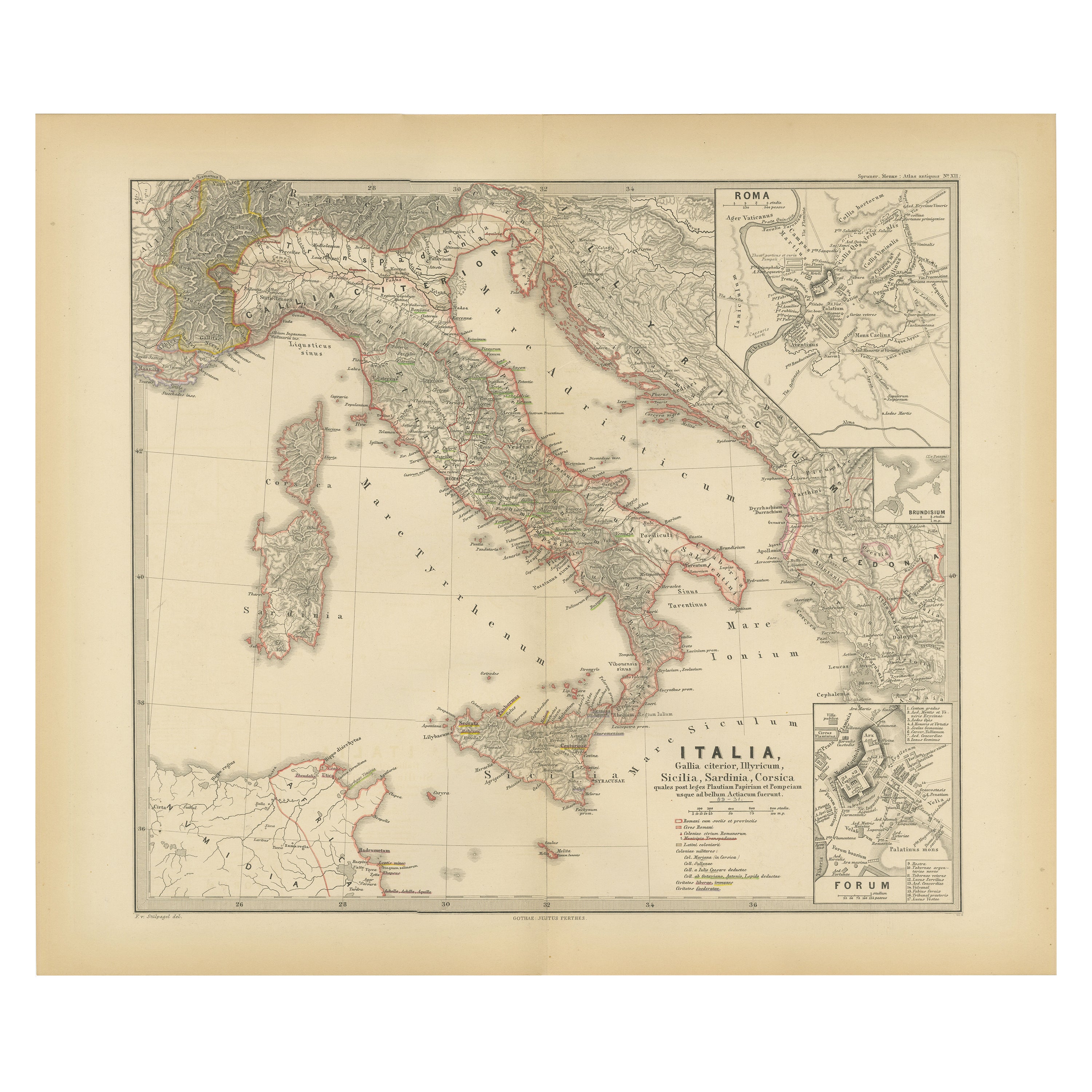
This map is an original antique engraving titled "ITALIAE REGIONES IIII SICILIA," which translates to "The Regions of Italy and Sicily." This detailed historical map portrays the regions of ancient Italy along with the island of Sicily.
Key features of this map include:
1. **Mainland Italy**: The Italian peninsula is divided into several regions, likely corresponding to the administrative divisions during the Roman Empire. These regions are distinguished by different colors outlining their boundaries.
2. **Topography**: The map illustrates mountain ranges, valleys, and plains, with shading and contour lines to indicate elevation. Rivers and lakes are also marked, adding to the geographical detail.
3. **Inset Maps**: There are several inset maps:
- **Sicily (SICILIA)**: A detailed map of Sicily, with topographical features and important cities of the time.
- **Pompeii (POMPEII)**: A detailed plan of the ancient city of Pompeii, providing an archaeological layout of the city that was buried by the eruption of Mount Vesuvius in 79 AD.
- **Corsica and Sardinia**: Smaller maps of the islands of Corsica and Sardinia, also detailed with topographical features and regional divisions.
- **Campanian Plains (CAMPANIAE PARS)**: A focused map of the Campania region around the Bay of Naples, an area rich in ancient history and the site of cities like Pompeii and Herculaneum.
4. **Roads and Cities**: The map likely shows ancient roads such as the famous Roman roads (e.g., the Via Appia) and includes symbols to denote the location of major Roman cities, towns, and possibly villas or other notable sites.
5. **Latin Labels**: The map features Latin nomenclature for all geographical and historical features, staying true to the period it represents.
6. **Ancient Sites**: The location of significant archaeological and historical sites, such as battlefields, important villas, and cultural landmarks, might be indicated.
7. **Geographical Legends**: The map includes legends that provide explanations for the symbols used, the scale, and possibly notes on the historical significance of certain areas.
As with the other maps from the "Spruner-Menke Atlas Antiquus," this map would be an important educational tool for the study of the geography and history of ancient Italy and its regions during the Roman era. It combines detailed cartography with historical insights, making it a valuable resource for understanding the complexities of ancient Roman geography.
- Dimensions:Height: 18.51 in (47 cm)Width: 15.56 in (39.5 cm)Depth: 0 in (0.02 mm)
- Materials and Techniques:
- Period:
- Date of Manufacture:1880
- Condition:Good, given age. General age-related toning, especially around the edges. Vertical folding line as issued. Please study scan carefully.
- Seller Location:Langweer, NL
- Reference Number:Seller: BG-13686-2-91stDibs: LU3054338539902
About the Seller
5.0
Recognized Seller
These prestigious sellers are industry leaders and represent the highest echelon for item quality and design.
Platinum Seller
Premium sellers with a 4.7+ rating and 24-hour response times
Established in 2009
1stDibs seller since 2017
2,824 sales on 1stDibs
Typical response time: 1 hour
- ShippingRetrieving quote...Shipping from: Langweer, Netherlands
- Return Policy
More From This Seller
View AllOriginal Antique Map of Italy with an Inset of Sardinia, 1882
Located in Langweer, NL
Embark on a historical odyssey with an original Antique Map of Italy from the esteemed 'Comprehensive Atlas and Geography of the World,' meticulously crafted in 1882. This captivatin...
Category
Antique 1880s Maps
Materials
Paper

$200 Sale Price
20% Off
Map of The Italian Peninsula with the islands of Sicily, Sardinia, Corsica, 1880
Located in Langweer, NL
This map, titled "ITALIA, Sicilia, Sardinia, Corsica," represents the Italian Peninsula along with the islands of Sicily, Sardinia, and Corsica. Inset maps offer detailed views of "R...
Category
Antique 1880s Maps
Materials
Paper

$352 Sale Price
20% Off
Free Shipping
Roman Italy and Provinces: A Cartographic Snapshot, 1880
Located in Langweer, NL
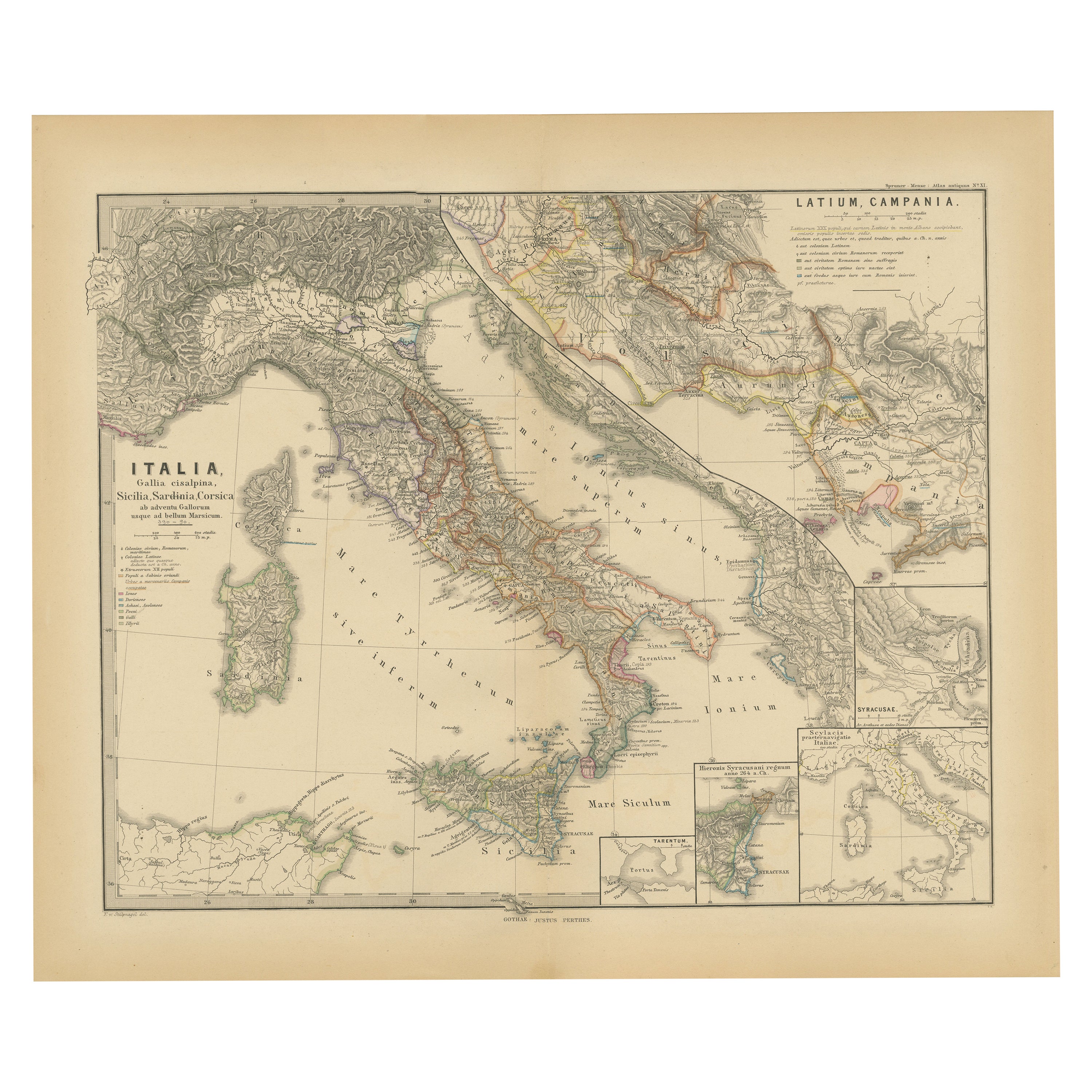
The map titled "ITALIA, Gallia Cisalpina, Sicilia, Sardinia, Corsica" focuses on Italy and its surrounding regions during Roman times. It offers a detailed depiction of the Italian peninsula, the Po Valley (Gallia Cisalpina), and the islands of Sicily, Sardinia, and Corsica.
Produced as part of the "Spruner-Menke Atlas Antiquus" by Karl Spruner von Merz and edited by Theodorus Menke, this map reflects the 19th-century European scholarship on ancient geography and history.
The period represented is likely during the Roman Republic or early Roman Empire, suggested by the level of detail in regions like Latium and Campania, which were central to Roman culture and power. This era was marked by Roman expansion and consolidation of the Italian peninsula, as well as the Punic Wars, which led to Roman dominance over the Mediterranean.
What makes this map interesting is its:
1. **Rich Detail**: The map delineates the intricate network of Roman roads, cities, and colonies, showing the infrastructure that facilitated Roman administration and control.
2. **Strategic Locations**: It identifies strategic locations like harbors and passes, crucial for trade and military campaigns.
3. **Geographic Accuracy**: It reflects the geographical knowledge of the time, with an accurate representation of the topography that shaped the development of these regions.
4. **Cultural and Historical Sites**: Insets of important sites like Syracuse offer a closer look at places of historical significance.
5. **Educational Purpose**: The map was designed to aid in the study of Roman history, providing a visual tool for understanding the ancient world...
Category
Antique 1880s Maps
Materials
Paper
Antique Map of South Italy and the Island of Sardinia by Johnston (1909)
Located in Langweer, NL
Antique map titled 'South Italy and the Island of Sardinia'. Original antique map of South Italy and the Island of Sardinia. With inset map of Naples. Th...
Category
Early 20th Century Maps
Materials
Paper
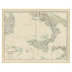
$238 Sale Price
20% Off
Antique Map of Southern Italy and Sardinia by Johnston, 1882
Located in Langweer, NL
"Antique map titled 'South Italy and the Island of Sardinia'. Old map of Southern Italy and the island of Sardinia. With an inset map of the Bay ...
Category
Antique 19th Century Maps
Materials
Paper
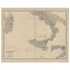
$95 Sale Price
20% Off
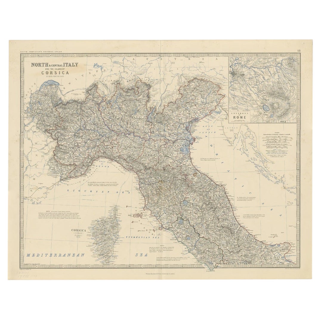
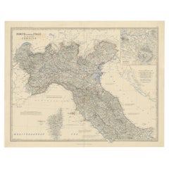
Antique Map of North and Central Italy and the Island of Corsica, c.1860
Located in Langweer, NL
Antique map titled 'North & Central Italy and the Island of Corsica'.
Old map of North and Central Italy, and the island of Corsica. With an inset map of the region of Rome. Orig...
Category
Antique 19th Century Maps
Materials
Paper
You May Also Like
Large Original Antique Map of The South of Italy. John Dower, 1861
Located in St Annes, Lancashire
Great map of the South of Italy
Lithograph engraving by John Dower
Original colour
Published, 1861
Unframed
Good condition
Free shipping
Category
Antique 1860s English Victorian Maps
Materials
Paper

Italy, Central and Southern Part. Century Atlas antique map
Located in Melbourne, Victoria
'The Century Atlas. Italy, Central and Southern Part.'
Original antique map, 1903.
Inset maps of Sicily and Naples.
Central fold as issued. Map name an...
Category
Early 20th Century Victorian More Prints
Materials
Lithograph

Large Original Antique Map of Italy. John Dower, 1861
Located in St Annes, Lancashire
Great map of Italy
Lithograph engraving by John Dower
Original colour
Published, 1861
Unframed
Good condition / repair to top right corner seen in last image
Category
Antique 1860s English Victorian Maps
Materials
Paper

Italy, Northern Part. Century Atlas antique vintage map
Located in Melbourne, Victoria
'The Century Atlas. Italy, Northern Part.'
Original antique map, 1903.
Central fold as issued. Map name and number printed on the reverse corners.
Sheet 29.5cm by 40cm.
Category
Early 20th Century Victorian More Prints
Materials
Lithograph

Geographical Map of Italy
Located in Alessandria, Piemonte
BOLIS Publishing House - Bergamo.
A beautiful large map of Italy, on paper but suitably reinforced to preserve it correctly. The maps were usually p...
Category
Mid-20th Century Italian Other Prints
Materials
Paper

$953 Sale Price
20% Off
Map of the Republic of Genoa
Located in New York, NY
Framed antique hand-coloured map of the Republic of Genoa including the duchies of Mantua, Modena, and Parma.
Europe, late 18th century.
Dimension: 25...
Category
Antique Late 18th Century European Maps

More Ways To Browse
Mount Vesuvius
19th Century Round Dining Table
Carved Chinese Tables
Mid Century Modern Danish Teak Dining Tables
Long Rug Runners
Pair Arm Chairs
Sterling Silver Dinner Sets
United Chair Company
British Antiques
Italian Beech Chairs
Shirvan Rugs
Spain Marble
Vintage Brown Bottles
Vintage Danish Tables And Chairs
1960s Glass Top Coffee Table
Black Glass Coffee Tables
Burnt Wood
Mid Century Wrought Iron Chairs