Items Similar to Antique Map of Scotland with Counties and Islands – Black’s Atlas, 1884

Video Loading
Want more images or videos?
Request additional images or videos from the seller
1 of 11
Antique Map of Scotland with Counties and Islands – Black’s Atlas, 1884
$432.68
£320.50
€360
CA$591.90
A$645.14
CHF 341.08
MX$7,766.23
NOK 4,329.13
SEK 3,968.93
DKK 2,743
About the Item
Here is a catalogue entry in your preferred format for the Scotland map you uploaded:
---
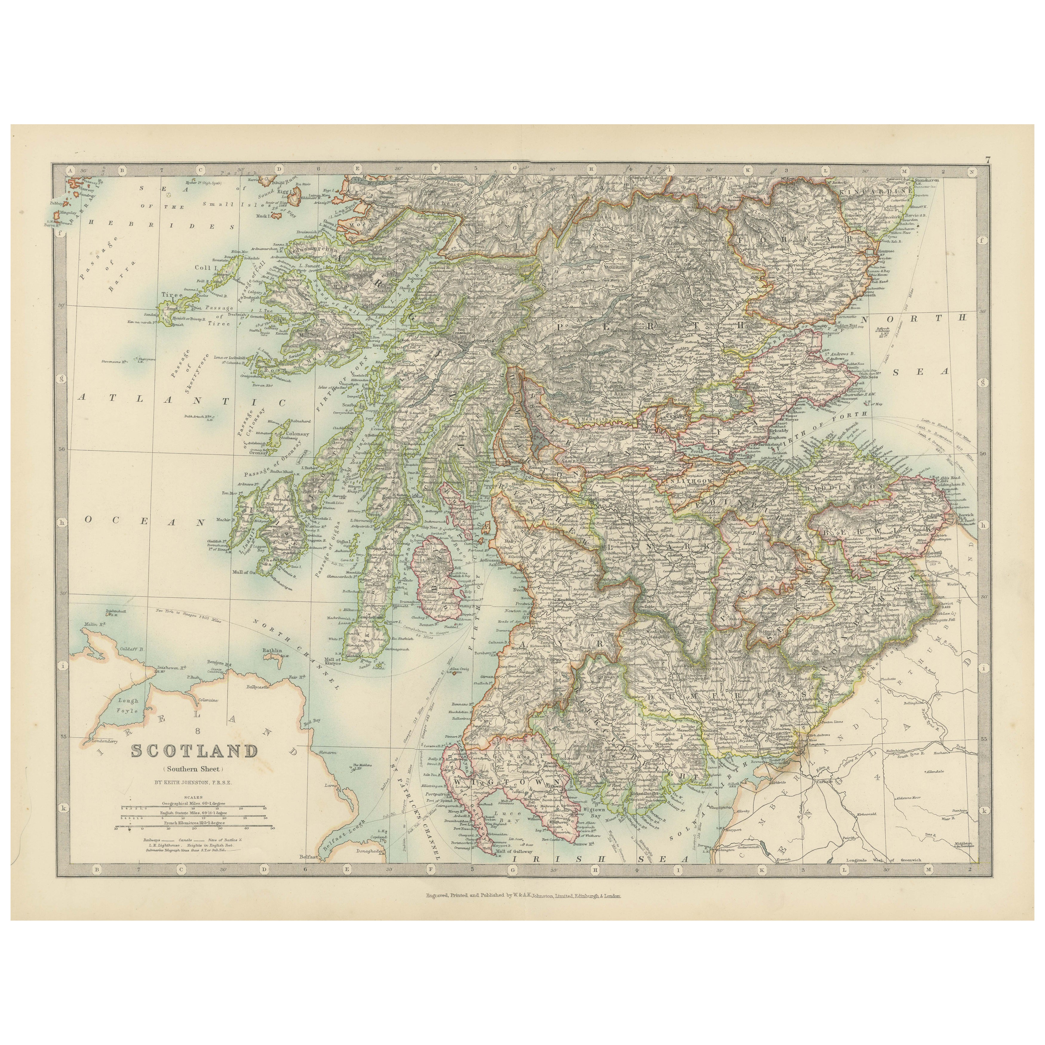
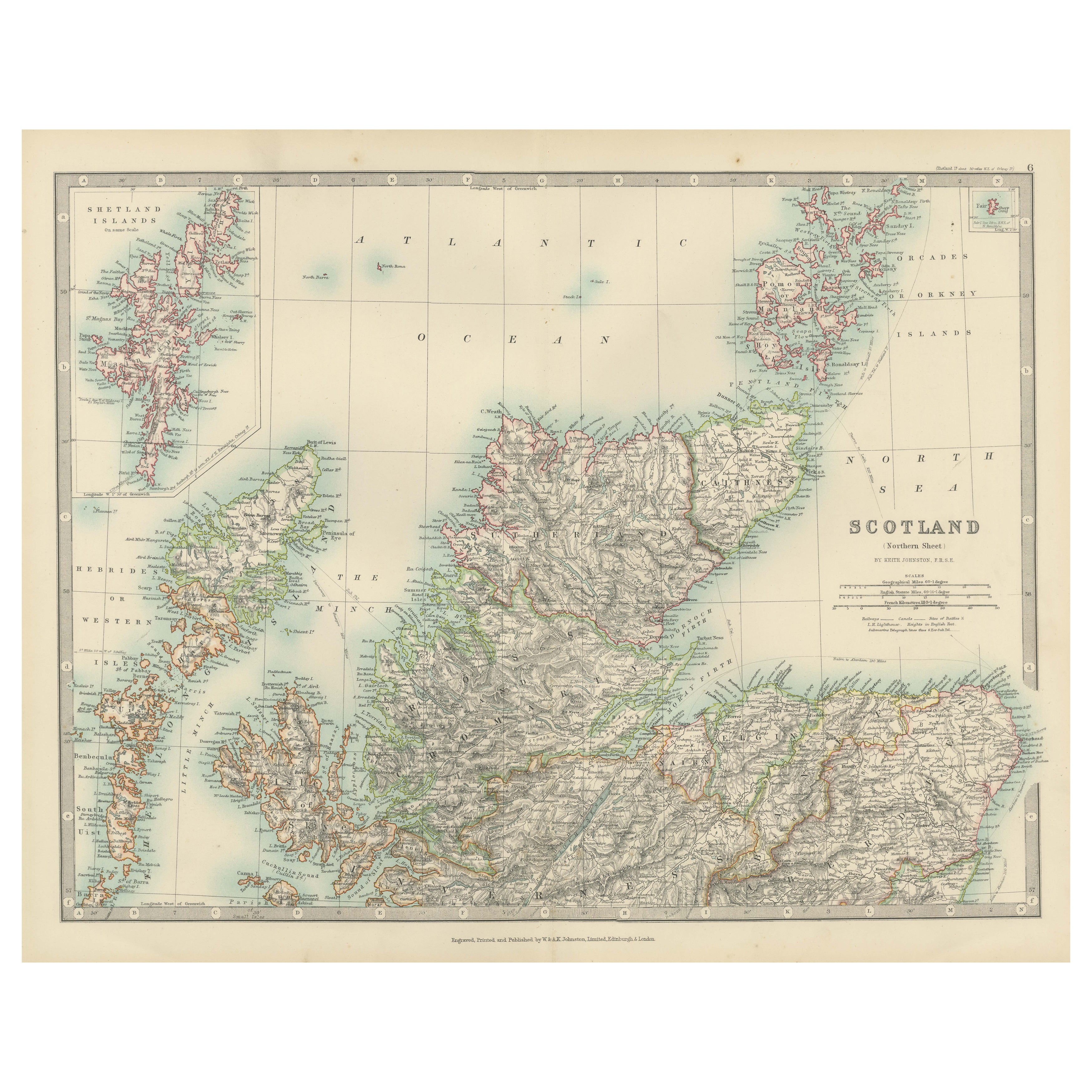
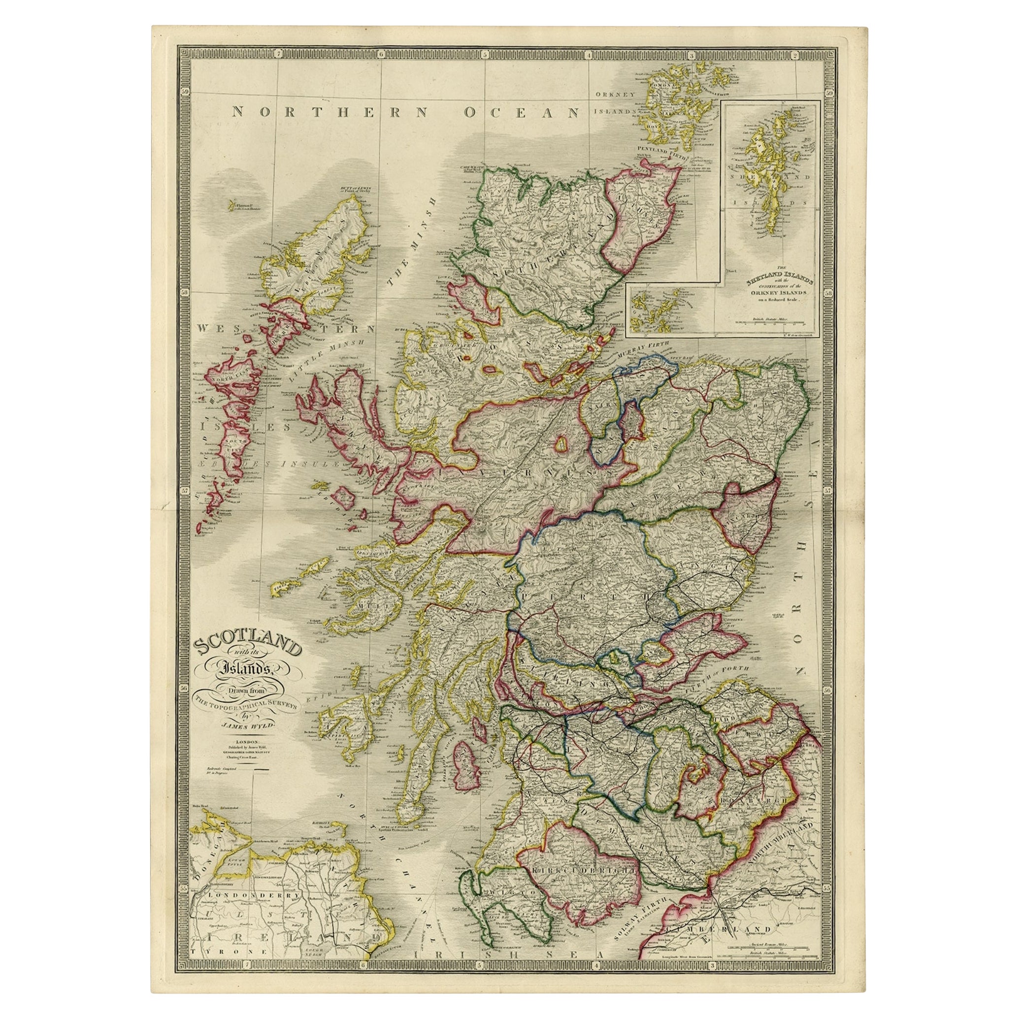
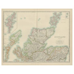
Title: Antique Map of Scotland with Counties and Islands – Black’s Atlas, 1884
Description:
This finely engraved and hand-colored map of Scotland was published in the New and Revised Edition of Black’s General Atlas of the World, Edinburgh, 1884. It presents Scotland in remarkable detail, with its counties carefully outlined in contrasting colors and a wealth of geographical and topographical information.
The map covers the entirety of mainland Scotland along with its numerous islands. To the west, the Hebrides are depicted, while the inset in the upper right shows the Orkney and Shetland Islands in greater detail. Each county is shaded separately, clearly distinguishing political divisions of the late 19th century. Major towns, villages, roads, rivers, and mountain ranges are all precisely engraved. Coastal features, including firths, lochs, and islands, are meticulously labeled, reflecting Scotland’s strong connection to the sea.
This map is not only a geographic record but also a cultural and historical artifact, produced at a time when Scotland was experiencing industrial growth while retaining its distinct regional identities. The careful coloring and fine engraving highlight the craftsmanship typical of Black’s atlas productions, which were regarded among the most detailed and accurate of their time.
Collectors will appreciate this piece for its historical insight, decorative appeal, and its representation of Scotland’s landscape and political divisions before major 20th-century changes.
Condition report:
Very good condition. Original hand coloring remains clear and vibrant. Center fold as issued. Minor toning and light age patina to margins. No tears or major blemishes.
Framing tips:
This map is especially attractive when displayed in an archival mat of soft ivory or light cream to highlight the pastel county colors. A dark oak or walnut frame provides warmth, while a gilt frame enhances its Victorian character. UV-protective glass is recommended to preserve its freshness.
Technique: Engraving with original hand coloring
Maker: Black’s General Atlas, Edinburgh, 1884
- Dimensions:Height: 24.1 in (61.2 cm)Width: 17.84 in (45.3 cm)Depth: 0.01 in (0.2 mm)
- Materials and Techniques:
- Place of Origin:
- Period:
- Date of Manufacture:1884
- Condition:Very good condition. Original hand coloring remains clear and vibrant. Center fold as issued. Minor toning and light age patina to margins. No tears or major blemishes.
- Seller Location:Langweer, NL
- Reference Number:Seller: BG-13601-3-71stDibs: LU3054346514632
About the Seller
5.0
Recognized Seller
These prestigious sellers are industry leaders and represent the highest echelon for item quality and design.
Platinum Seller
Premium sellers with a 4.7+ rating and 24-hour response times
Established in 2009
1stDibs seller since 2017
2,813 sales on 1stDibs
Typical response time: 1 hour
- ShippingRetrieving quote...Shipping from: Langweer, Netherlands
- Return Policy
More From This Seller
View AllAntique Map of Southern Scotland, 1903, with Coastal and Inland Details
Located in Langweer, NL
Title: Antique Map of Southern Scotland, 1903, with Coastal and Inland Details
Description:
This exquisite antique map, titled "Scotland (Southern Sheet I)," was engraved and publis...
Category
Early 20th Century Maps
Materials
Paper
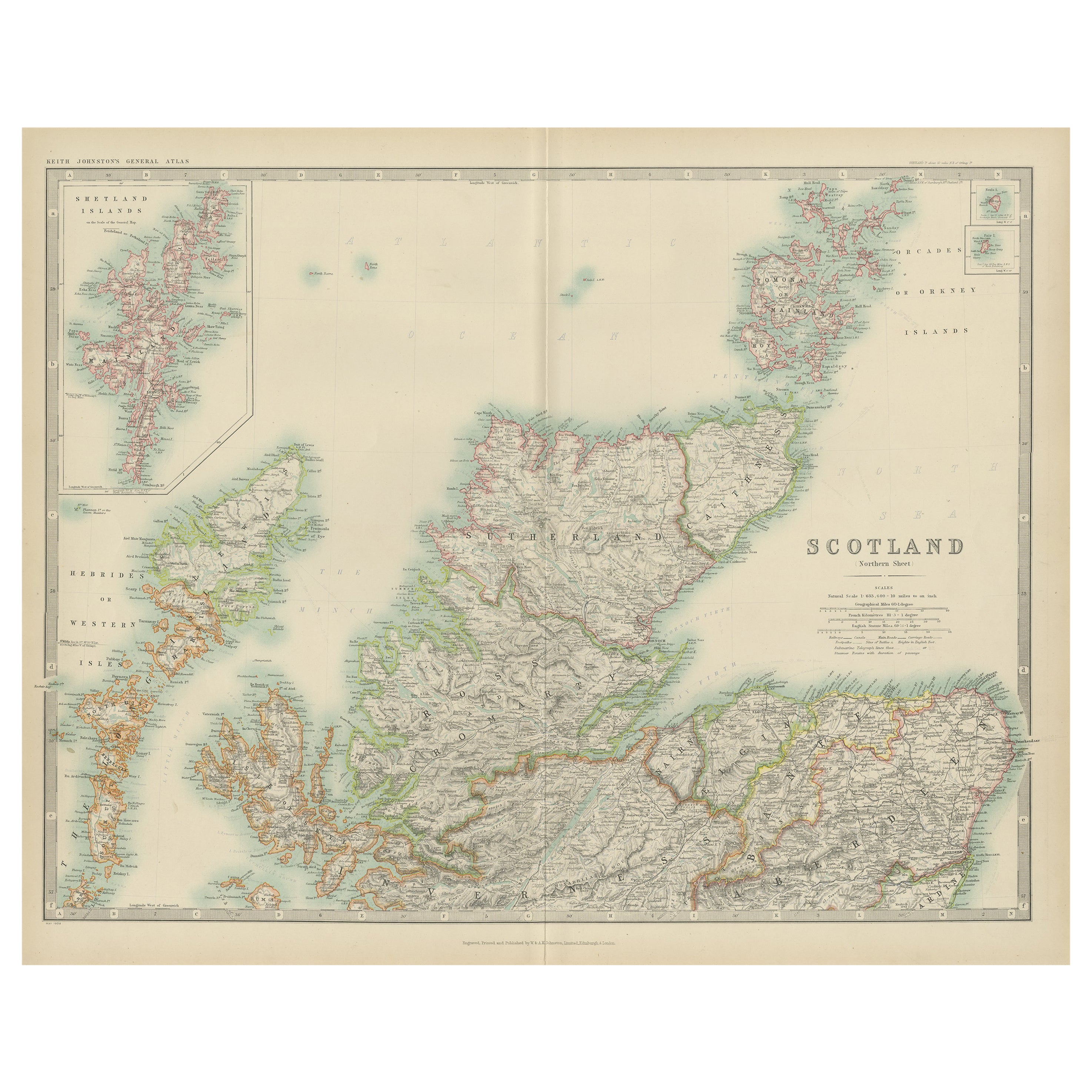
Antique Map of Northern Scotland, 1903, with Intricate Coastal Features
Located in Langweer, NL
Title: Antique Map of Northern Scotland and Islands, 1903, with Intricate Coastal Features
Description:
This striking antique map, titled "Scotland (Northern Sheet I)," was engraved...
Category
Early 20th Century Maps
Materials
Paper
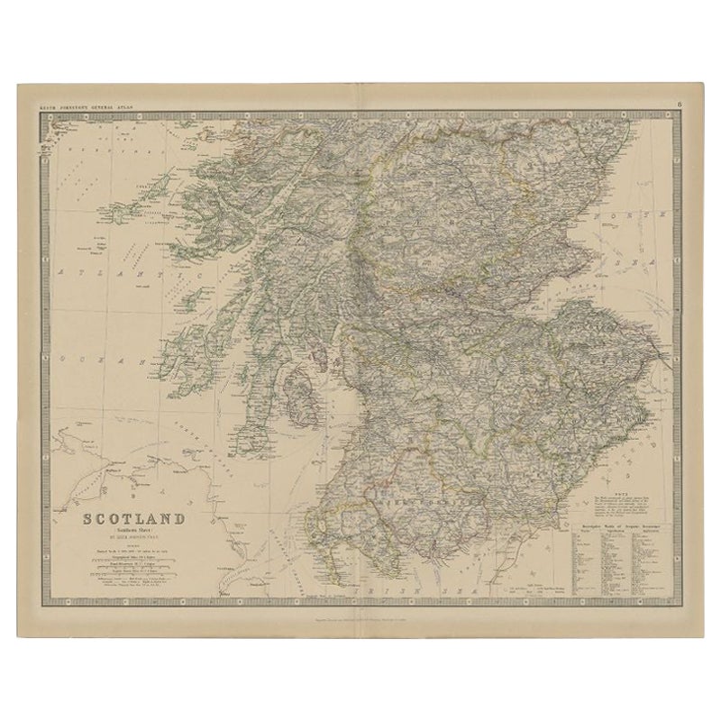
Antique Map of Southern Scotland by Johnston, 1882
Located in Langweer, NL
"Antique map titled 'Scotland'. Old map of Southern Scotland. This map originates from 'The Royal Atlas of Modern Geography, Exhibiting, in a Series of Entirely Original and Authenti...
Category
Antique 19th Century Maps
Materials
Paper
$129 Sale Price
20% Off
Antique Map of Scotland
Northern
by Johnston,
1909
Located in Langweer, NL
Antique map titled 'Scotland'. Original antique map of Scotland. With inset map of the Shetland Islands. This map originates from the ‘Royal Atlas of M...
Category
Early 20th Century Maps
Materials
Paper
$240 Sale Price
20% Off
Antique Map of the Northern Part of Scotland by Black
1854
Located in Langweer, NL
Antique map titled 'Scotland'. Original map of the northern part of Scotland. With an inset map of the Orkney Isles. This map originates from 'General Atlas Of The World: Containing ...
Category
Antique Mid-19th Century Maps
Materials
Paper

Antique Map of Scotland With an Inset Map of the Shetland Islands, 1854
Located in Langweer, NL
Stunning Map of Scotland that will look beautiful in any setting framed on the wall.
Description: Large Antique map titled 'Scotland with its Islands, drawn from the Topographical surveys...
Category
Antique 1850s Maps
Materials
Paper

You May Also Like
Original Antique Map of Scotland by Dower, circa 1835
Located in St Annes, Lancashire
Nice map of Scotland
Drawn and engraved by J.Dower
Published by Orr & Smith. C.1835
Unframed.
Free shipping
Category
Antique 1830s English Maps
Materials
Paper

England and Wales, Northern Part. Century Atlas antique vintage map
Located in Melbourne, Victoria
'The Century Atlas. England and Wales, Northern Part'
Original antique map, 1903.
Central fold as issued. Map name and number printed on the reverse corners.
Sheet 29.5cm by 40cm.
Category
Early 20th Century Victorian More Prints
Materials
Lithograph

Large Original Vintage Map of the United Kingdom, circa 1920
Located in St Annes, Lancashire
Great map of The United Kingdom
Unframed
Original color
By John Bartholomew and Co. Edinburgh Geographical Institute
Published, circa 1920
Free shipping.
Category
Vintage 1920s British Maps
Materials
Paper

Large Original Antique Map of Ireland. C.1900
Located in St Annes, Lancashire
Fabulous map of Ireland
Original color.
Engraved and printed by the George F. Cram Company, Indianapolis.
Published, C.1900.
Unframed.
Free shipping.
Category
Antique 1890s American Maps
Materials
Paper

England, Scotland
Ireland: A Hand Colored Map of Great Britain by Tirion
By Isaak Tirion
Located in Alamo, CA
This is a hand-colored double page copperplate map of Great Britain entitled "Nieuwe Kaart van de Eilanden van Groot Brittannien Behelzende de Kon...
Category
Antique Mid-18th Century Dutch Maps
Materials
Paper

$700 Sale Price
20% Off
Antique County Map, Lancashire, English, Framed Lithography, Cartography, C.1860
Located in Hele, Devon, GB
This is an antique lithography map of Lancashire. An English, framed atlas engraving of cartographic interest, dating to the mid 19th century and later.
Superb lithography of Lanca...
Category
Antique Mid-19th Century British Victorian Maps
Materials
Glass, Wood, Paper
