Items Similar to Antique Map of the Siege of Groningen by Le Clerc, 1730


Want more images or videos?
Request additional images or videos from the seller
1 of 7
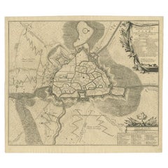
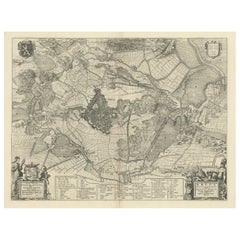
Antique Map of the Siege of Groningen by Le Clerc, 1730
$144.11
$180.1320% Off
£106.73
£133.4220% Off
€120
€15020% Off
CA$197.13
CA$246.4220% Off
A$214.54
A$268.1820% Off
CHF 113.73
CHF 142.1620% Off
MX$2,581.08
MX$3,226.3520% Off
NOK 1,442.43
NOK 1,803.0420% Off
SEK 1,319.72
SEK 1,649.6520% Off
DKK 914.42
DKK 1,143.0320% Off
About the Item
Plate : 'Het Belegh der Stadt Groningen in den Jaere MDXCIV '. (The siege of Groningen in the year 1594.) This plate shows the fortified city of Groningen, The Netherlands. With legend. This attractive original old antique print / plate was published in several works by Hugo de Groot ('Nederlandtsche Jaerboeken' published in 1681.), P.C. Hooft ('Nederlandsche Historien ...', published 1703-1704.), P.C. Bor ('Oorsprongk, begin, en vervolgh der Nederlandsche oorlogen', published in 1680.)or Jean Le Clerc. This print originates from: 'Histoire des Provinces-Unies des Pays Bas...', or 'Geschiedenissen der Vereenigde Nederlanden...' by Jean Le Clerc, 1723-1728 or 1730.
Artists and Engravers: The author of this work is Jean Le Clerc / Joannes Clericus (1657-1736). From Hugenot origin, he studied filosophy, hebrew and theology in Geneva and travelled in Europe. He objected the calvinistic orthodoxie and influenced by Grotius, Episcopius, Van Limborch and others, he moved to Amsterdam, where he became a Remonstrant. He became a professor at the Remonstrant seminary, a writer and publisher.
Condition: Good. General age related toning and light to medium soiling. Large tear in middle fold restored and backed by paper. Please study image carefully.
Date: 1730
Overall size: 38 x 31 cm.
Image size: 34.5 x 27 cm.
We sell original antique maps to collectors, historians, educators and interior decorators all over the world. Our collection includes a wide range of authentic antique maps from the 16th to the 20th centuries. Buying and collecting antique maps is a tradition that goes back hundreds of years. Antique maps have proved a richly rewarding investment over the past decade, thanks to a growing appreciation of their unique historical appeal. Today the decorative qualities of antique maps are widely recognized by interior designers who appreciate their beauty and design flexibility. Depending on the individual map, presentation, and context, a rare or antique map can be modern, traditional, abstract, figurative, serious or whimsical. We offer a wide range of authentic antique maps for any budget.
- Dimensions:Height: 12.21 in (31 cm)Width: 14.97 in (38 cm)Depth: 0 in (0.01 mm)
- Materials and Techniques:
- Period:
- Date of Manufacture:1730
- Condition:Good, given age. A few spots in the margins. Original folds as issued. General age-related toning and/or occasional minor defects from handling. Please study image carefully.
- Seller Location:Langweer, NL
- Reference Number:Seller: PCT-202631stDibs: LU3054329637402
About the Seller
5.0
Recognized Seller
These prestigious sellers are industry leaders and represent the highest echelon for item quality and design.
Platinum Seller
Premium sellers with a 4.7+ rating and 24-hour response times
Established in 2009
1stDibs seller since 2017
2,813 sales on 1stDibs
Typical response time: 1 hour
- ShippingRetrieving quote...Shipping from: Langweer, Netherlands
- Return Policy
More From This Seller
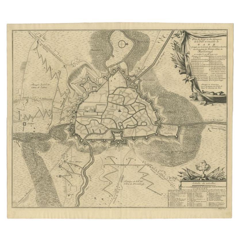
View AllAntique Map of the Siege of Gent by Dumont, 1729
By Dumont
Located in Langweer, NL
Antique map titled 'Plan of the Siege and Attacks of the City and Citadel of Ghent'. Large map depicting the siege of the Belgian city of Gent in 1708 during the war of the Spanish S...
Category
Antique 18th Century Maps
Materials
Paper
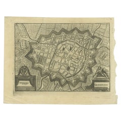
Antique Map of the City of Groningen Made After Harrewijn, C.1750
Located in Langweer, NL
Antique map titled 'Groeningue'. Old map of the city of Groningen, the Netherlands. Source unknown, to be determined.
Artists and Engravers: Most likely made after J. Harrewijn.
...
Category
Antique 18th Century Maps
Materials
Paper
Antique Map of The Siege of Gennep, the Netherlands, c.1650
Located in Langweer, NL
Antique map titled 'Belagerung des Besten Schloss und Passes Gennep'. Old map of the Siege of Gennep, the Netherlands. This map originates from 'Theatrum Europaeum' by M. Merian. Art...
Category
Antique 17th Century Maps
Materials
Paper

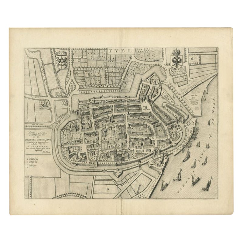
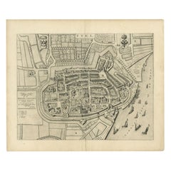
Antique Map of the City of Tiel by Blaeu, 1649
Located in Langweer, NL
Antique map titled 'Tyel'. Beautiful map of the city of Tiel, The Netherlands. With a coat of arms and key of various locations. Originates from 'Toneel der Steeden' published by Joa...
Category
Antique 17th Century Maps
Materials
Paper
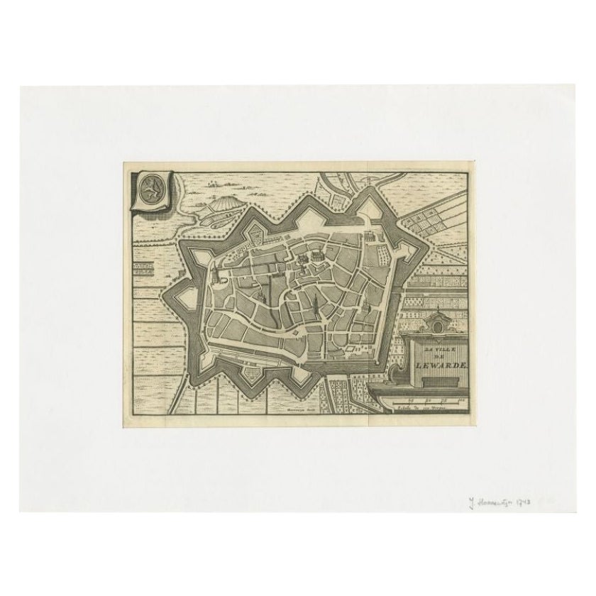
Antique Map of the City of Leeuwarden by Harrewijn, 1743
Located in Langweer, NL
Antique map titled 'La Ville de Lewarde'. Old map of the city of Leeuwarden, Friesland. Originates from 'Les Délices des Pays-Bas' by Widow Foppens.
Artists and Engravers: Engrav...
Category
Antique 18th Century Maps
Materials
Paper
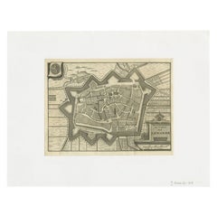
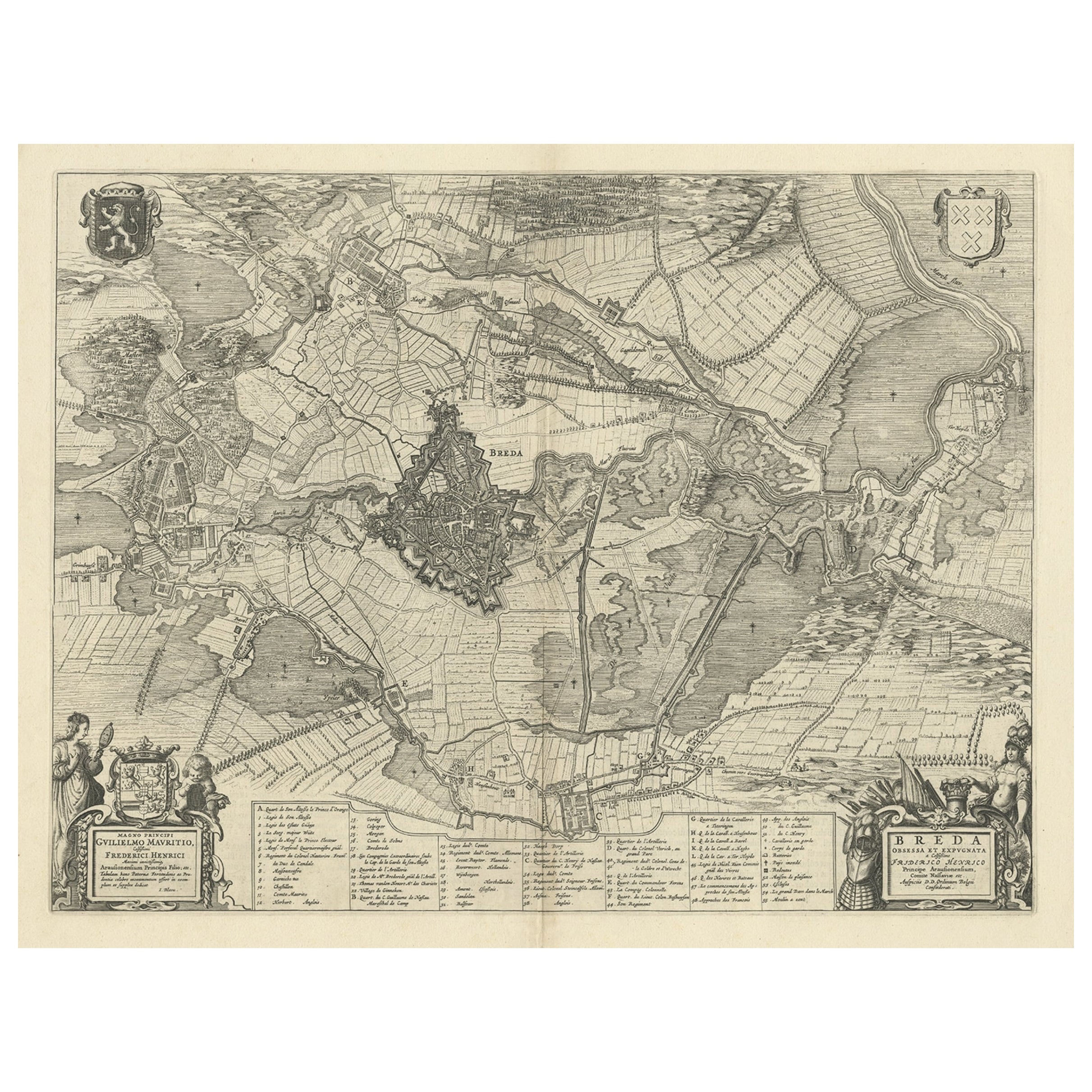
Antique Map of the Siege of Breda, City in the Netherlands by Blaeu, 1649
Located in Langweer, NL
Antique map titled 'Breda obsessa et expugnata a Celsissimo Frederico Henrico'.
Old map of the city of Breda, the Netherlands. It shows the Siege of Breda in 1637. Originates fro...
Category
Antique 17th Century Maps
Materials
Paper
You May Also Like
Map of Groningen - Etching by George Braun - Late 16th Century
Located in Roma, IT
This map of Groninga is an original etching realized by George Braun and Franz Hogenberg, and part of the series "Civitates Orbis Terrarum".
The state of preservation of the artwork...
Category
16th Century Figurative Prints
Materials
Etching

Utrecht, Antique Map from "Civitates Orbis Terrarum"
By Franz Hogenberg
Located in Roma, IT
Braun G., Hogenberg F., Traiectum or Utrecht, from the collection Civitates Orbis Terrarum, Cologne, T. Graminaeus, 1572-1617.
Very fine B/W aquatint showing a view of Utrecht, with...
Category
16th Century Landscape Prints
Materials
Etching

1752 Vaugoundy Map of Flanders : Belgium, France, and the Netherlands, Ric.a002
Located in Norton, MA
Large Vaugoundy Map of Flanders:
Belgium, France, and the Netherlands
Colored -1752
Ric.a002
Description: This is a 1752 Didier Robert de Vaugondy map of Flanders. The map de...
Category
Antique 17th Century Unknown Maps
Materials
Paper

18th Century Map Engraving - Newport, a Strong Sea-Port Town in Flanders
Located in Corsham, GB
A map of Nieuwpoort, anglicised to 'Newport', in northern Belgium. There is a panorama in the upper quarter depicting major landmarks. Below is a plan of the town, including its strong defences and ships at the port in the lower register. Inscribed with the title in plate to the lower edge, 'Newport a Strong Sea-Port Town...
Category
18th Century More Prints
Materials
Engraving

$269 Sale Price
20% Off
Original Antique Map or City Plan of Amsterdam, Netherlands. Circa 1835
Located in St Annes, Lancashire
Nice map of Amsterdam
Drawn and engraved by J.Dower
Published by Orr & Smith. C.1835
Unframed.
Free shipping
Category
Antique 1830s English Maps
Materials
Paper

1748 Map of Richmond Upon Thames by John Roque
Located in Gloucestershire, GB
A 1748 map of Richmond-Upon-Thames by famed surveyor and cartographer, John Roque. Placed in a simple black and gilt frame. The map is in fair condition but there are small sections ...
Category
Antique Mid-18th Century English Maps
Materials
Wood, Paper

More Ways To Browse
Siege Antique
James Cook Map
Kentucky Antiques
Map Of Mexican California
Montreal Map
Mughal Map
Napoleon Map
Rand Mcnally Vintage Maps
Tunisia Antique Map
Used Office Furniture Rhode Island
Antique Chesapeake Bay Map
Antique Copper Australia
Antique Furniture Pondicherry
Antique Map Of Cornwall
Antique Maps Dublin
Antique Maps Of Malta
Antique Saudi Arabia
Armenia Map