Items Similar to Antique Map of Southeast Asia by J. Ottens, 1710


Want more images or videos?
Request additional images or videos from the seller
1 of 6
Antique Map of Southeast Asia by J. Ottens, 1710
$1,008
$1,720.8341% Off
£766.94
£1,283.6341% Off
€883.67
€1,45041% Off
CA$1,431.04
CA$2,395.1441% Off
A$1,535.25
A$2,569.5541% Off
CHF 823.48
CHF 1,378.2641% Off
MX$18,484.26
MX$30,937.0841% Off
NOK 10,380.92
NOK 17,374.5341% Off
SEK 9,465.96
SEK 15,843.1741% Off
DKK 6,602.21
DKK 11,050.1041% Off
About the Item
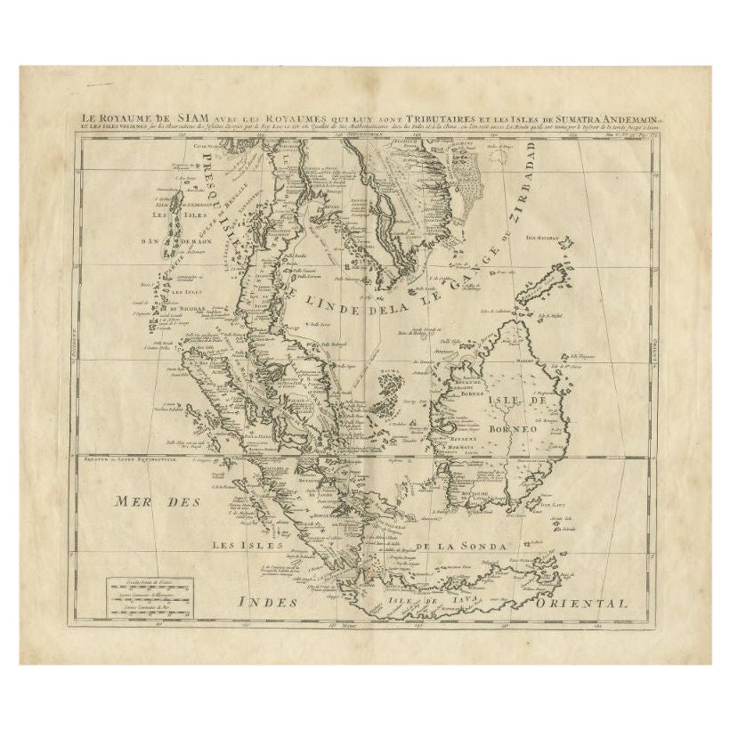
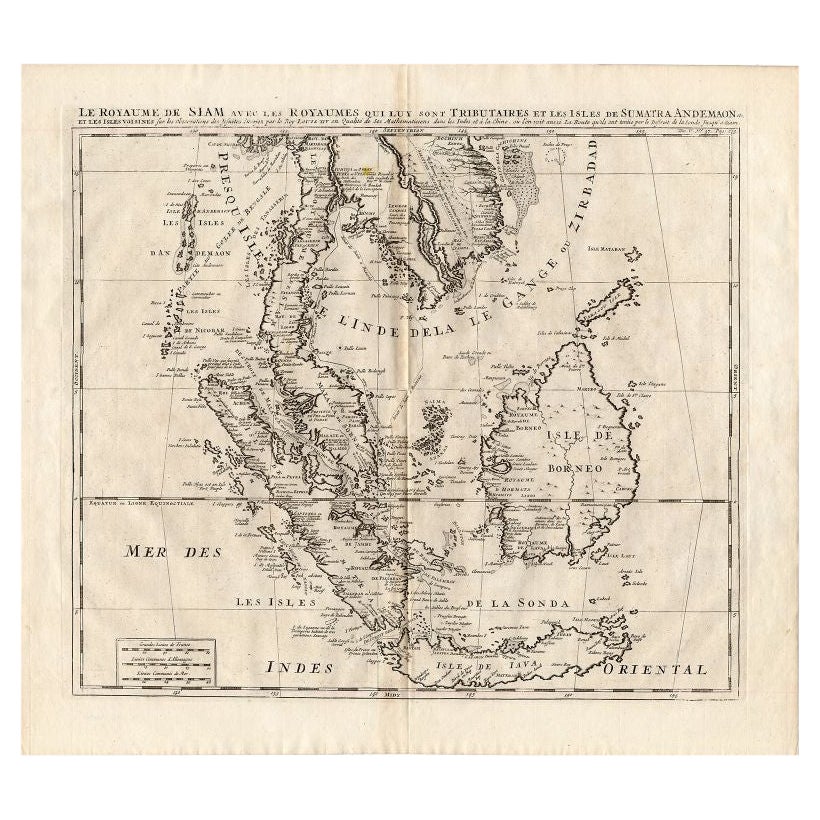
Antique map titled 'Le Royaume de Siam avec Les Royaumes Qui Luy sont Tributaries'. Influential map of Southeast Asia. Ottens incorporated information provided by the French Jesuits and charts the route of the French Embassy to and from Siam in 1685-1686 through the Straits of Banca and the Gulf of Siam. This map is the upper part of another map by J. Ottens. The upper map focuses on the territories currently occupied by modern day Thailand, Cambodia, Vietnam, northern Borneo, and northern Malaysia.
- Dimensions:Height: 20.16 in (51.2 cm)Width: 24.81 in (63 cm)Depth: 0.02 in (0.5 mm)
- Materials and Techniques:
- Period:
- Date of Manufacture:1710
- Condition:Please study image carefully. Some small tears along the edges of the paper.
- Seller Location:Langweer, NL
- Reference Number:Seller: BG-041811stDibs: LU305439548733
About the Seller
5.0
Recognized Seller
These prestigious sellers are industry leaders and represent the highest echelon for item quality and design.
Platinum Seller
Premium sellers with a 4.7+ rating and 24-hour response times
Established in 2009
1stDibs seller since 2017
2,830 sales on 1stDibs
Typical response time: 1 hour
- ShippingRetrieving quote...Shipping from: Langweer, Netherlands
- Return Policy
More From This Seller
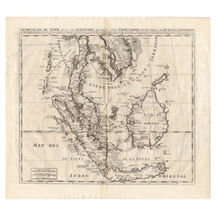
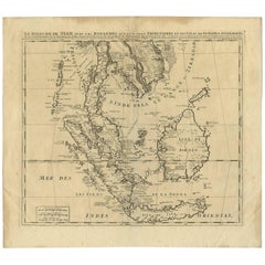
View AllAntique Map of Southeast Asia by Chatelain, c.1732
Located in Langweer, NL
"Antique map titled 'La Royaume de Siam avec les Royaumes qui luy sont Tributaires et les Isles de Sumatra Andemaon'. It shows: Southeast Asia; Borneo, Java, Siam (Thailand), Malacca...
Category
Antique 18th Century Maps
Materials
Paper

$735 Sale Price
20% Off
Antique Map of Southeast Asia by Chatelain, c.1732
Located in Langweer, NL
"Antique map titled 'La Royaume de Siam avec les Royaumes qui luy sont Tributaires et les Isles de Sumatra Andemaon'. It shows: Southeast Asia; Borneo, Java, Siam (Thailand), Malacca...
Category
Antique 18th Century Maps
Materials
Paper
$765 Sale Price
25% Off
Antique Map of Southeast Asia from Persia to the Timor Island, 1712
Located in Langweer, NL
Antique map titled 'A New Map of the East Indies'.
Old map covering all of Southeast Asia from Persia to the Timor Island, inclusive of the modern day nations of India, Ceylon, T...
Category
Antique 1710s Maps
Materials
Paper

$750 Sale Price
20% Off
Antique Map of Southeast Asia by H. Chatelain, circa 1720
By Henri-Abraham Chatelain
Located in Langweer, NL
Antique map titled 'Le Royaume de Siam aves les Royaumes qui luy sont Tributaires et les Isles de Sumatra Andemaon'. Influential map of Southeast Asia, including modern day Thailand, southern Vietnam, Cambodia, Malaysia, Singapore, Borneo, Sumatra and Java. Chatelain incorporated information provided by the French Jesuits and charts the route of the French Embassy to and from Siam in 1685-1686 through the Straits of Banca and the Gulf of Siam.
With good detail of the Andaman Islands, the Gulf of Thailand (Golfe de Siam) and coastal Vietnam. In the Kingdom of Siam, this map shows the fortress of Bangkok, the ancient Siamese capital of Ayutthaya, royal palace, and the Dutch trading colony. In Cambodia, it details the village of Ponompingn (Phnom Penh...
Category
Antique Early 18th Century Maps
Materials
Paper
$1,376 Sale Price
20% Off
Antique Map of India and Southeast Asia by Sanson
1654
Located in Langweer, NL
Antique map titled 'Partie Meridionale de l'Inde'. Early map of India and Southeast Asia. The map shows most of modern India, Bangladesh and Burma, the whole of Sri Lanka, Thailand, ...
Category
Antique Mid-17th Century Maps
Materials
Paper

Large Antique Map of Asia including All of Southeast Asia, c.1792
Located in Langweer, NL
Antique map titled 'L' Asie Divisee en ses Empires, Royaumes, et Etats'. Attractive, large map of Asia including all of Southeast Asia. The cartography is archaic for the period with...
Category
Antique 18th Century Maps
Materials
Paper

You May Also Like
Antique 1803 Italian Map of Asia Including China Indoneseia India
Located in Amsterdam, Noord Holland
Antique 1803 Italian Map of Asia Including China Indoneseia India
Very nice map of Asia. 1803.
Additional information:
Type: Map
Country of Manufacturing: Europe
Period: 19th centu...
Category
Antique 19th Century European Maps
Materials
Paper

$438 Sale Price
39% Off
Antique French Map of Asia Including China Indoneseia India, 1783
Located in Amsterdam, Noord Holland
Very nice map of Asia. 1783 Dedie au Roy.
Additional information:
Country of Manufacturing: Europe
Period: 18th century Qing (1661 - 1912)
Condition: Overall Condition B (Good Used)...
Category
Antique 18th Century European Maps
Materials
Paper

$486 Sale Price
40% Off
Original Antique Map of South East Asia by Thomas Clerk, 1817
Located in St Annes, Lancashire
Great map of South East Asia
Copper-plate engraving
Drawn and engraved by Thomas Clerk, Edinburgh.
Published by Mackenzie And Dent, 1817
Unframed.
Category
Antique 1810s English Maps
Materials
Paper

Large Original Vintage Map of S.E Asia, with a Vignette of Singapore
Located in St Annes, Lancashire
Great map of South East Asia
Original color. Good condition
Published by Alexander Gross
Unframed.
Category
Vintage 1920s English Maps
Materials
Paper

Map of the East Indies: An Original 18th Century Hand-colored Map by E. Bowen
Located in Alamo, CA
This is an original 18th century hand-colored map entitled "An Accurate Map of the East Indies Exhibiting the Course of the European Trade both on the Continent and Islands" by Emanu...
Category
Mid-18th Century Old Masters Landscape Prints
Materials
Engraving

Asia Declineatio: A 17th Century Hand-colored Map of Asia by Justus Danckerts
Located in Alamo, CA
This is a scarce 17th century beautifully hand-colored copperplate engraved map of Asia entitled “Exactissima Asiae Delineatio in Praecipuas Regiones Caerterasque Partes divisa et de...
Category
Late 17th Century Old Masters Landscape Prints
Materials
Engraving

More Ways To Browse
Charles Rennie Mackintosh For Cassina
Glass Salt
Vintage Resin Tables
Antique English Country Furniture
Blue Kilim Vintage
Contemporary Side Tables And Stools
Decorative Wall Plate
Mid Century Modern Corner Chair
Dining Tables With Brass Inlay
Oak Mid Century Armchair
Solid Wood Side Table Stool
Antique Marble Top Hall Table
Bird And Butterfly
Old Carpet
Porcelain Modern Hand Painted
Bent Plywood
1960 Italian Dining Set
Italian Giltwood Table