Items Similar to Antique Map of Southeastern New York by Rand McNally, Lithograph, 1888
Video Loading
Want more images or videos?
Request additional images or videos from the seller
1 of 12
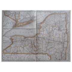
Antique Map of Southeastern New York by Rand McNally, Lithograph, 1888
$552.49
£409.62
€460
CA$758.99
A$828.57
CHF 436.25
MX$9,925.25
NOK 5,579.48
SEK 5,094.15
DKK 3,505.03
About the Item
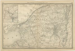
Antique Map of Southeastern New York – Rand McNally, circa 1888
This antique map of southeastern New York was published by Rand, McNally
Co. around 1888. It offers a detailed depiction of the Hudson River Valley, the Catskills, Albany, and the greater New York metropolitan area, drawn at a time of rapid industrial and urban expansion.
The map highlights counties including Albany, Rensselaer, Greene, Ulster, Dutchess, Orange, Rockland, and Westchester, extending southward to Long Island and the approaches to New York Harbor. Important towns and cities such as Albany, Poughkeepsie, Kingston, and Newburgh are clearly marked, while the railroads connecting them to New York City are traced in red and blue.
A particularly attractive feature is the inset of New York City and Brooklyn, showing the detailed street grid, ferry routes, and the rapidly expanding urban area. This makes the map valuable both as a record of southeastern New York and as a snapshot of Manhattan and Brooklyn before the consolidation of Greater New York in 1898.
The Hudson River is finely engraved, dominating the map as a historic transportation artery. The Catskill Mountains are depicted with careful hachures, reflecting the growing popularity of the region as a resort destination in the late 19th century.
This map stands as a historically significant and decorative plate, combining the political and industrial heart of New York State with the metropolitan influence of New York City. Collectors of New York history, Hudson Valley ephemera, or urban cartography will find this piece especially appealing.
Condition report:
Very good condition with light toning and minor handling wear. Original center fold as issued. Plate mark visible. Strong impression with excellent engraved detail.
Framing tips:
This map is best displayed in a dark wood or black frame with a cream mat. A double mat with ivory outer and pale blue inner will emphasize the Hudson River and New York Harbor inset, making for a balanced presentation.
Technique: Lithograph with original outline color
Maker: Rand, McNally
Co., Chicago, circa 1888
- Dimensions:Height: 20.67 in (52.5 cm)Width: 14.18 in (36 cm)Depth: 0.01 in (0.2 mm)
- Materials and Techniques:Paper,Engraved
- Place of Origin:
- Period:
- Date of Manufacture:1888
- Condition:Very good condition with light toning and minor handling wear. Original center fold as issued. Plate mark visible. Strong impression with excellent engraved detail.
- Seller Location:Langweer, NL
- Reference Number:Seller: BG-12794-171stDibs: LU3054346449812
About the Seller
5.0
Recognized Seller
These prestigious sellers are industry leaders and represent the highest echelon for item quality and design.
Platinum Seller
Premium sellers with a 4.7+ rating and 24-hour response times
Established in 2009
1stDibs seller since 2017
2,810 sales on 1stDibs
Typical response time: <1 hour
- ShippingRetrieving quote...Shipping from: Langweer, Netherlands
- Return Policy
More From This Seller
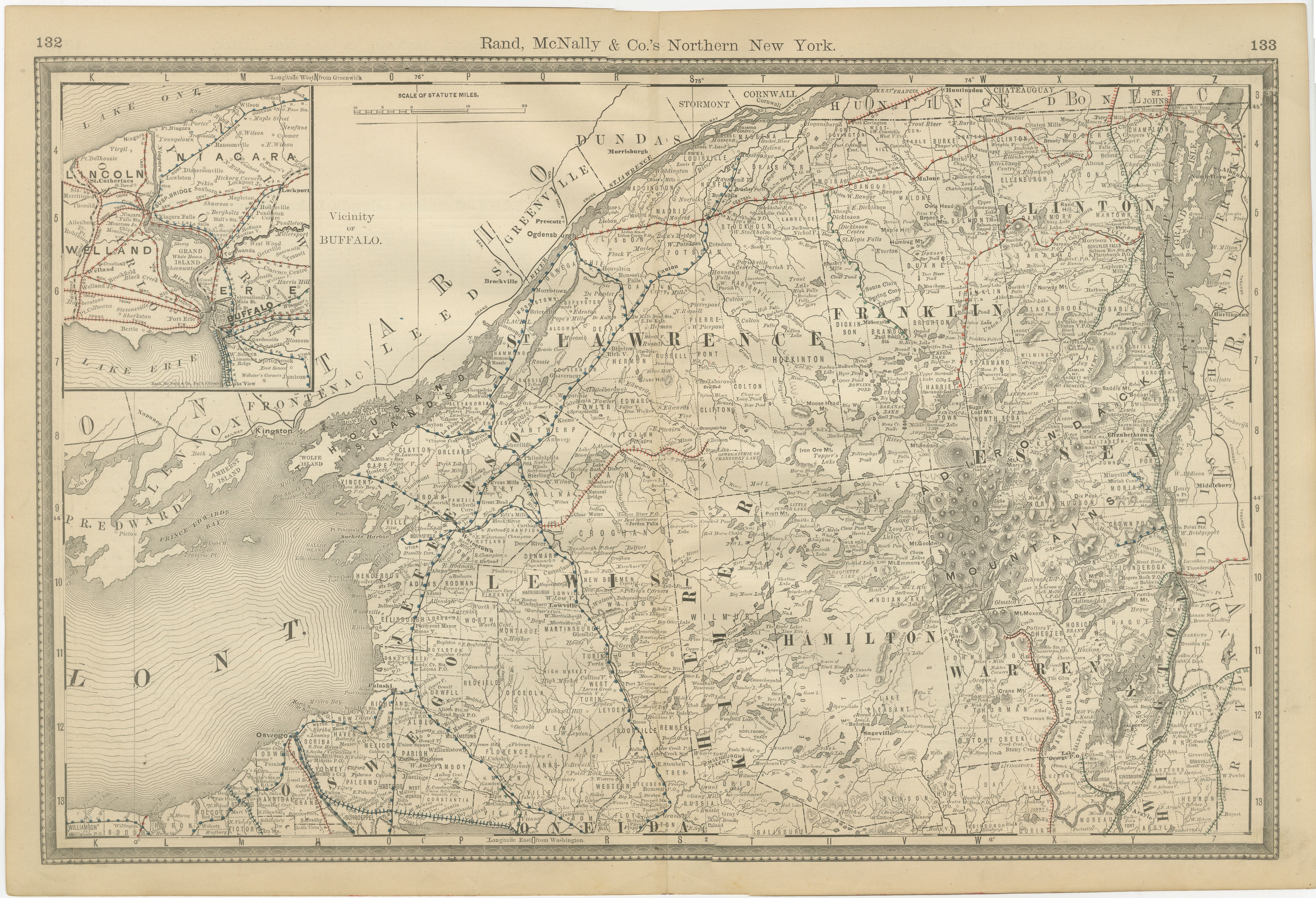
View AllAntique Map of Northern New York – Rand McNally, circa 1888
Located in Langweer, NL
Antique Map of Northern New York – Rand McNally, circa 1888
This antique map of northern New York was published by Rand, McNally & Co. around 1888. Taken from one of their late 19th...
Category
Antique Late 19th Century American Maps
Materials
Paper
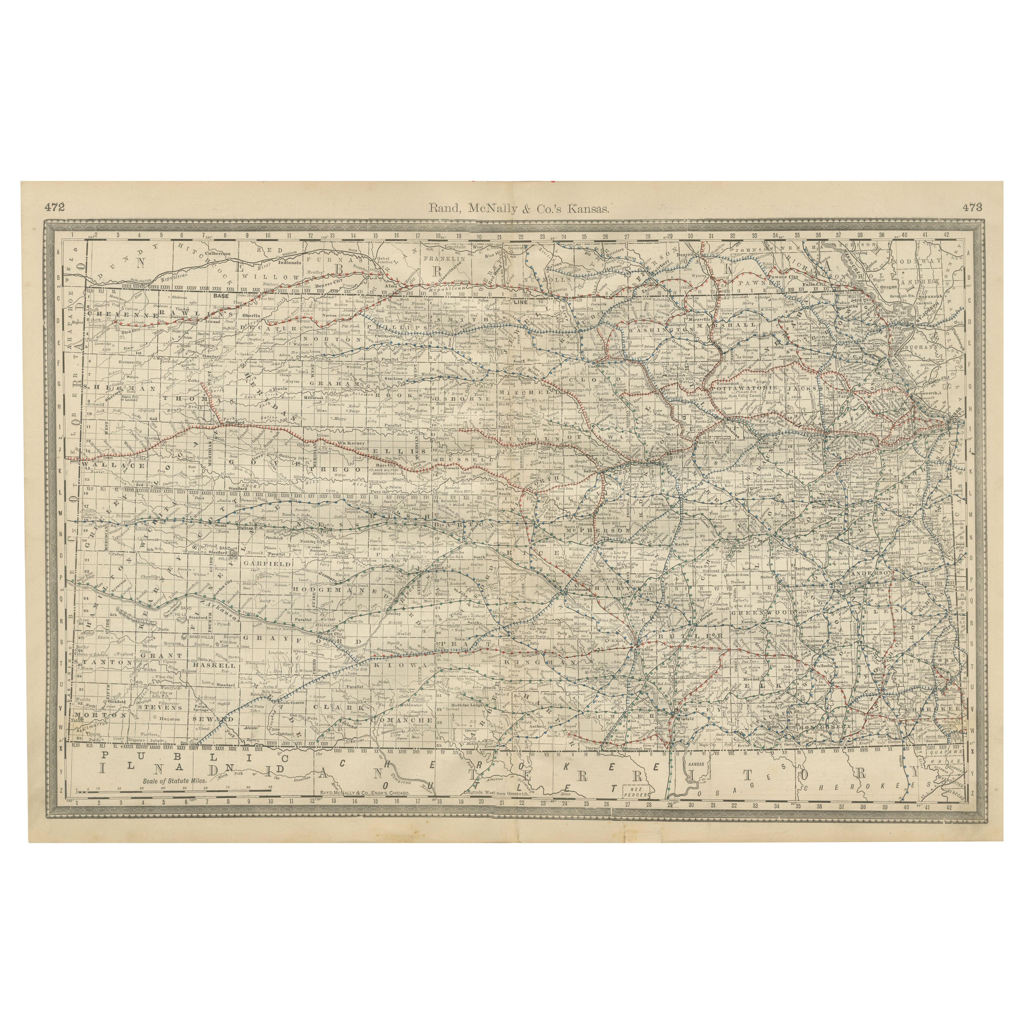
Kansas Railroad Map 1888 – Rand McNally Antique Lithograph
Located in Langweer, NL
Kansas Railroad Map 1888 – Rand McNally Antique Lithograph
This antique 1888 map of Kansas by Rand, McNally & Co. offers a detailed view of the state during a period of rapid expans...
Category
Antique Late 19th Century American Maps
Materials
Paper
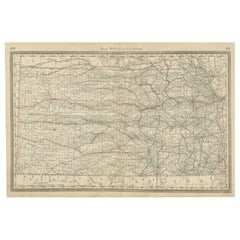
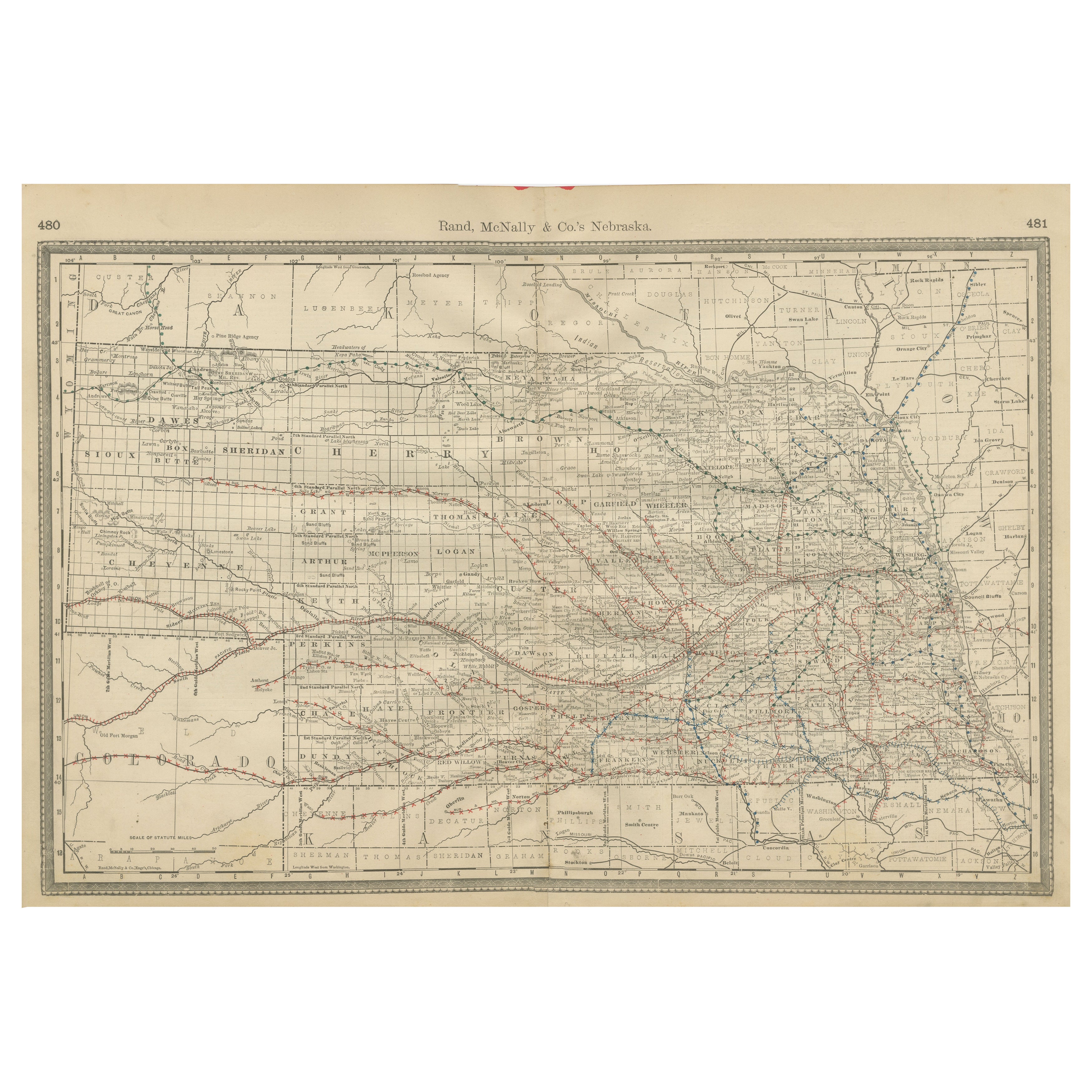
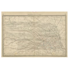
Nebraska Railroad Map 1888 – Rand McNally Antique Lithograph
Located in Langweer, NL
Nebraska Railroad Map 1888 – Rand McNally Antique Lithograph
This finely detailed map of Nebraska, published by Rand, McNally & Co. in 1888, provides an excellent overview of the st...
Category
Antique Late 19th Century American Maps
Materials
Paper
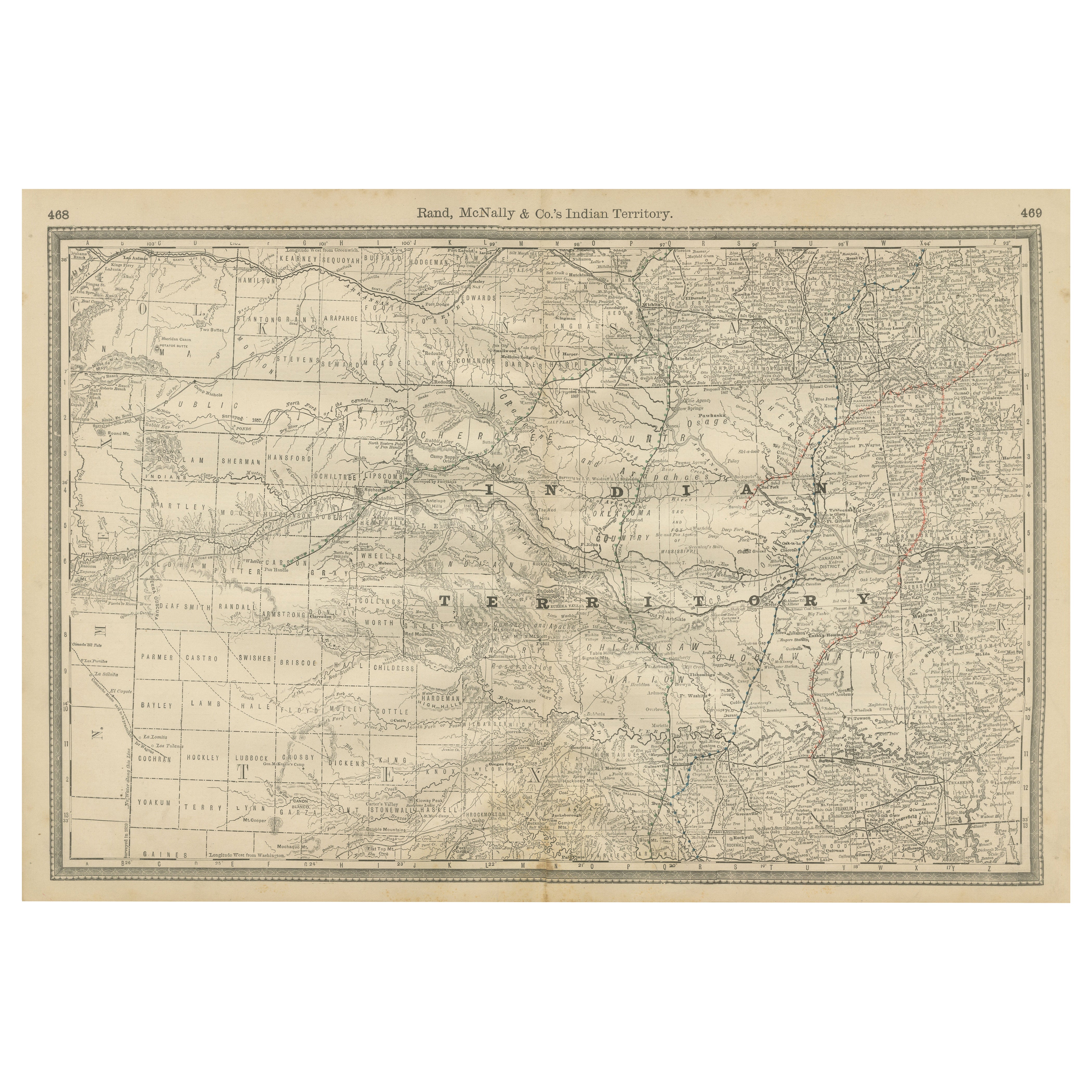
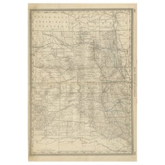
Indian Territory Map 1888 – Rand McNally Antique Lithograph
Located in Langweer, NL
Indian Territory Map 1888 – Rand McNally Antique Lithograph
This antique 1888 map of Indian Territory, published by Rand, McNally & Co., is a remarkable record of the region that wo...
Category
Antique Late 19th Century American Maps
Materials
Paper
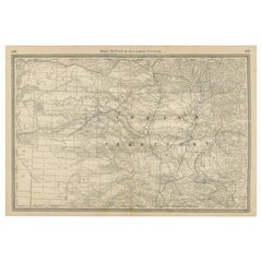
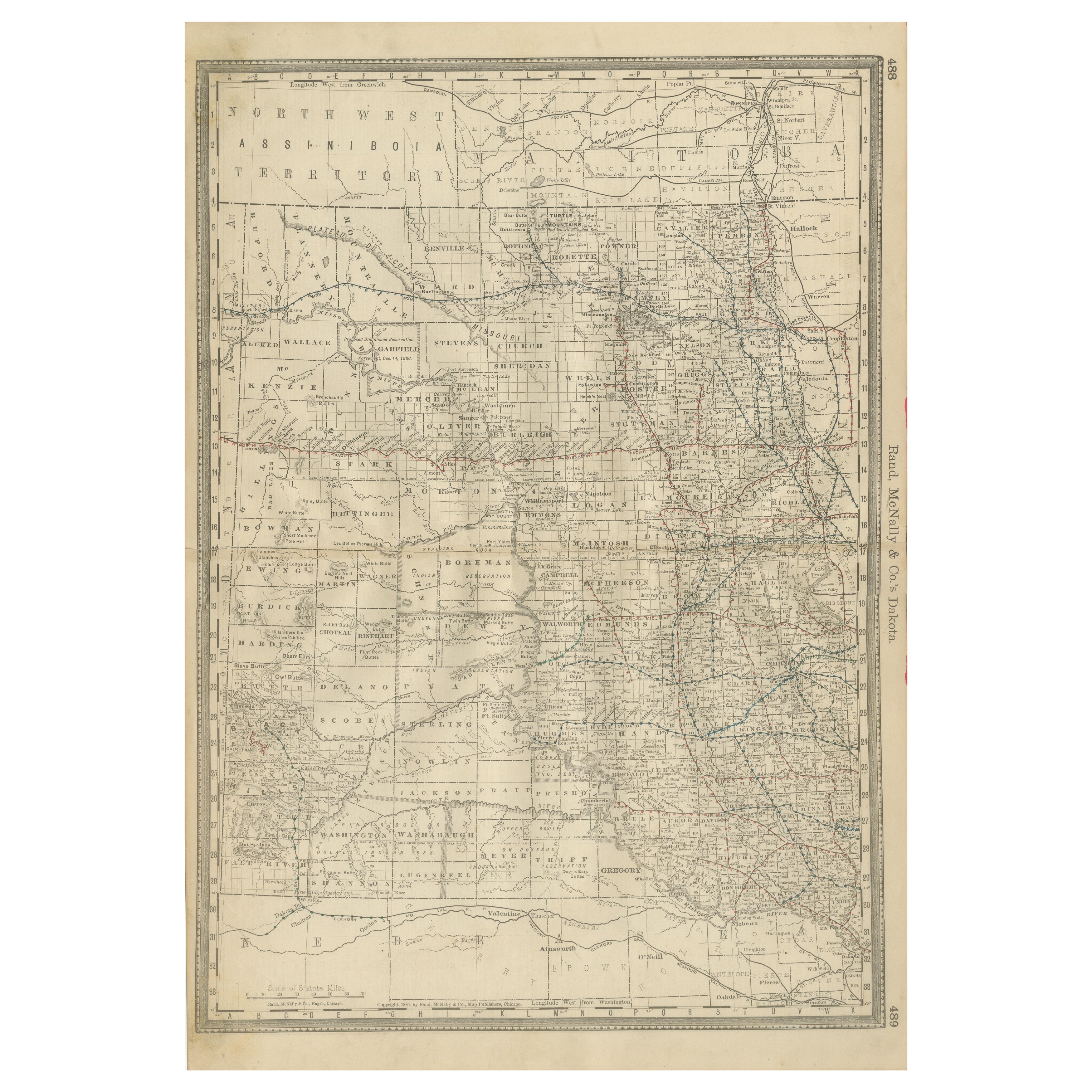
Dakota Territory Railroad Map 1888 – Rand McNally Antique Lithograph
Located in Langweer, NL
Antique Map of Dakota Territory – Rand McNally Railroad Map, 1888
This detailed 1888 map of Dakota by Rand, McNally & Co. captures the region in the final year before its division i...
Category
Antique Late 19th Century American Maps
Materials
Paper
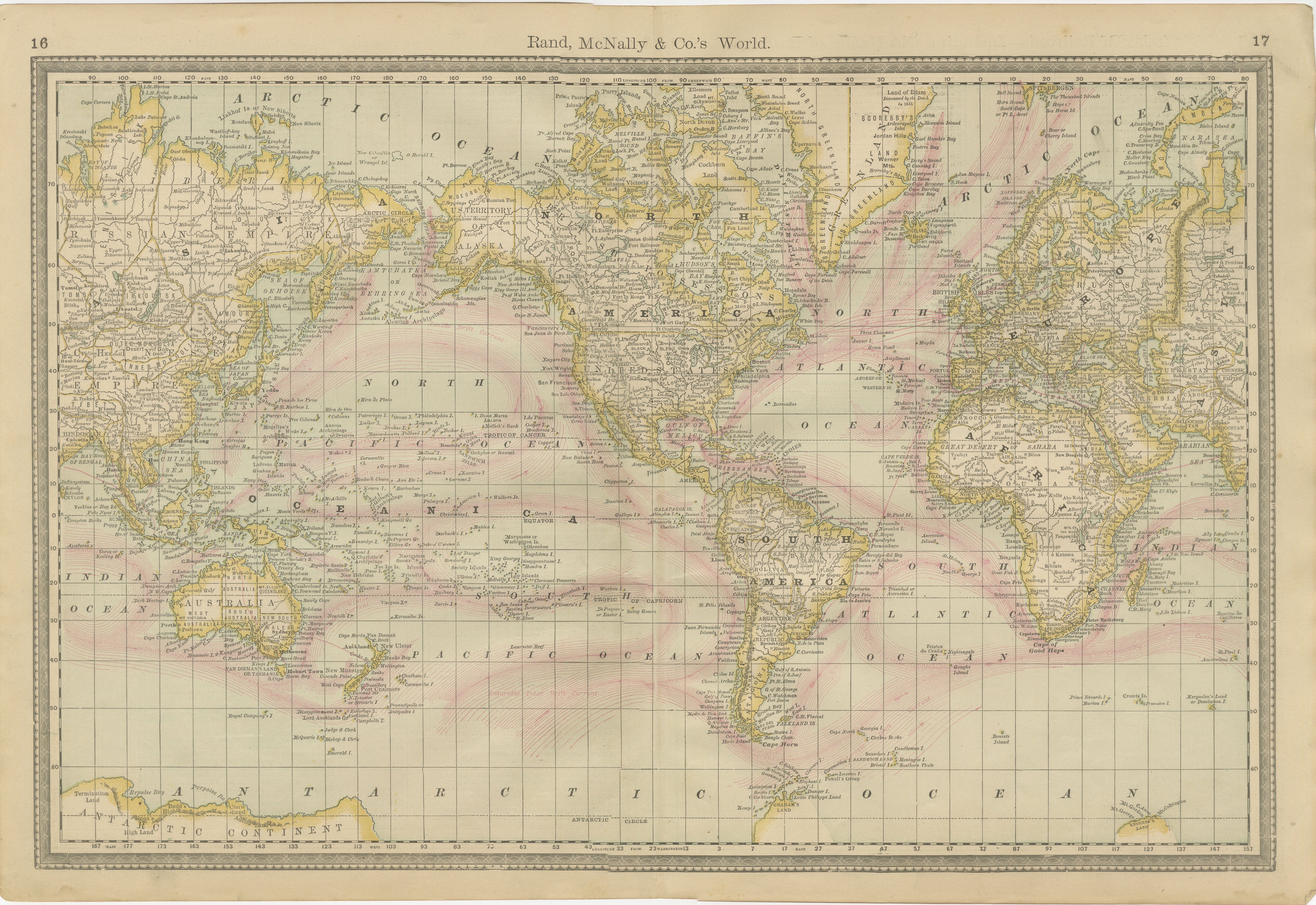
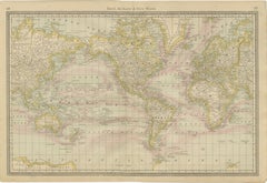
World Antique Map c.1888 – Rand McNally, Continents
Territories
Located in Langweer, NL
Antique Map of Mexico – Rand McNally, circa 1888
This antique map titled “Rand, McNally & Co.’s Mexico” was published around 1888 and depicts Mexico in the late 19th century, a peri...
Category
Antique Late 19th Century American Maps
Materials
Paper
You May Also Like
Large Original Antique Map of Arkansas by Rand McNally, circa 1900
By Rand McNally
Co.
Located in St Annes, Lancashire
Fabulous monochrome map with red outline color
Original color
By Rand, McNally & Co.
Published, circa 1900
Unframed
Minor edge tears.
Category
Antique Early 1900s American Edwardian Maps
Materials
Paper

Original Antique Map of South Dakota by Rand McNally, circa 1900
By Rand McNally
Co.
Located in St Annes, Lancashire
Fabulous monochrome map with red outline color
Original color
By Rand, McNally & Co.
Published, circa 1900
Unframed
Minor edge tears.
Category
Antique Early 1900s American Edwardian Maps
Materials
Paper

19th Century Lithograph Map of Lower Manhattan, New York
Located in Haddonfield, NJ
1859 hand colored map of Lower Manhattan or New Amsterdam by George H. Moore.
Category
Antique 19th Century English Folk Art Maps
Materials
Paper

$620 Sale Price
20% Off
Large Original Antique Map of New York, USA, 1894
By Rand McNally
Co.
Located in St Annes, Lancashire
Fabulous map of New York.
Original color.
By Rand, McNally & Co.
Published, 1894
Unframed
Free shipping.
Category
Antique 1890s American Maps
Materials
Paper
Diminutive 19th C Globe on Stand by Rand McNally
By Rand McNally
Co.
Located in New York, NY
Exceptional antique globe on stand, by Rand McNally.
The 6” diameter globe is supported by the half circle brass meridian, which is mounted t...
Category
Antique 19th Century American Campaign Models and Miniatures
Materials
Iron
17th Century Nicolas Visscher Map of Southeastern Europe
Located in Hamilton, Ontario
A beautiful, highly detailed map of southeastern Europe by Nicolas Visscher. Includes regions of Northern Italy (showing the cities Bologna, Padua, and Venice), Bohemia, Austria (sho...
Category
Antique 17th Century Dutch Maps
Materials
Paper

$1,350 Sale Price
38% Off