Items Similar to Antique Map of Southern India – French Engraving by D’Anville, 18th Century
Want more images or videos?
Request additional images or videos from the seller
1 of 10
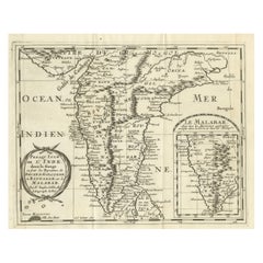
Antique Map of Southern India – French Engraving by D’Anville, 18th Century
$581.41
£434.05
€490
CA$807.76
A$868.86
CHF 464.34
MX$10,241.38
NOK 5,854.29
SEK 5,351.93
DKK 3,734.35
About the Item
This finely detailed antique map presents the southern portion of India, engraved in the 18th century by the renowned French cartographer Jean-Baptiste Bourguignon d’Anville.
It depicts the region south of the Krishna River, covering the territories of the Carnatic, Mysore (Maissour), Malabar, and Coromandel coasts, extending down to the Cape Comorin (modern Kanyakumari) at the southern tip. The map includes the territories of major kingdoms and states of the period, such as the Kingdom of Mysore, the Carnatic region under various rulers, and the coastal trading hubs influenced by European powers. Place names are given in their French transliterations of local names, reflecting geographical and political knowledge from missionary and colonial sources of the time.
Prominently featured are key cities such as Goa, Mangalore, Calicut, Cochin, Madras (Chennai), Pondicherry, and Trichinopoly (Tiruchirappalli), along with smaller settlements, river systems, and coastal features. The Coromandel and Malabar coasts are clearly distinguished, showing their importance in 18th-century trade and politics. The engraving reflects the French interest in the region, both through their colonial settlement in Pondicherry and through the influence of Jesuit missionaries, whose manuscript maps informed this work.
D’Anville’s cartography was celebrated for its accuracy, rejecting speculative geography in favor of data from travelers, missionaries, and official surveys. This map is an excellent example of his precise and uncluttered style, with finely engraved lines and subtle hachuring to indicate relief. It not only served as a geographical reference but also as a visual record of European engagement with the Indian subcontinent during a time of significant political change and conflict.
Condition: Good for its age, with light toning and some minor spotting. Vertical and horizontal folds as issued. Slight edge wear and small marginal tears not affecting the engraved area. Strong, clear impression on sturdy paper.
Framing tips: This map would display beautifully in a dark wood or black frame with a cream or light tan archival mat, which would enhance its historical tones and crisp engraving. A double mat with a thin inner line in a muted earth color could further complement the antique aesthetic.
Technique: Engraving
Maker: Jean-Baptiste Bourguignon d’Anville, France, 18th century
- Dimensions:Height: 15.12 in (38.4 cm)Width: 11.03 in (28 cm)Depth: 0.01 in (0.2 mm)
- Materials and Techniques:Paper,Engraved
- Place of Origin:
- Period:
- Date of Manufacture:circa 1780
- Condition:Condition: Good for its age, with light toning and some minor spotting. Vertical and horizontal folds as issued. Slight edge wear and small marginal tears not affecting the engraved area. Strong, clear impression on sturdy paper.
- Seller Location:Langweer, NL
- Reference Number:Seller: BG-14078-451stDibs: LU3054346220272
About the Seller
5.0
Recognized Seller
These prestigious sellers are industry leaders and represent the highest echelon for item quality and design.
Platinum Seller
Premium sellers with a 4.7+ rating and 24-hour response times
Established in 2009
1stDibs seller since 2017
2,836 sales on 1stDibs
Typical response time: 1 hour
- ShippingRetrieving quote...Shipping from: Langweer, Netherlands
- Return Policy
More From This Seller
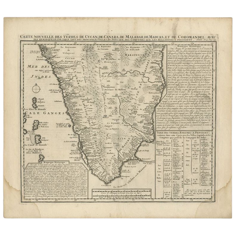
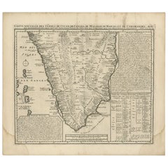
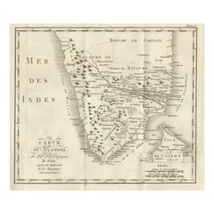
View AllAntique Map of Southern India by Chatelain, c.1720
Located in Langweer, NL
"Antique map titled 'Carte Nouvelle des Terres de Cucan, de Canara, de Malabar, de Madura, et de Coromandel'. Map of the southern portion of India, originating from Chatelain's 'Atla...
Category
Antique 18th Century Maps
Materials
Paper
$294 Sale Price
20% Off
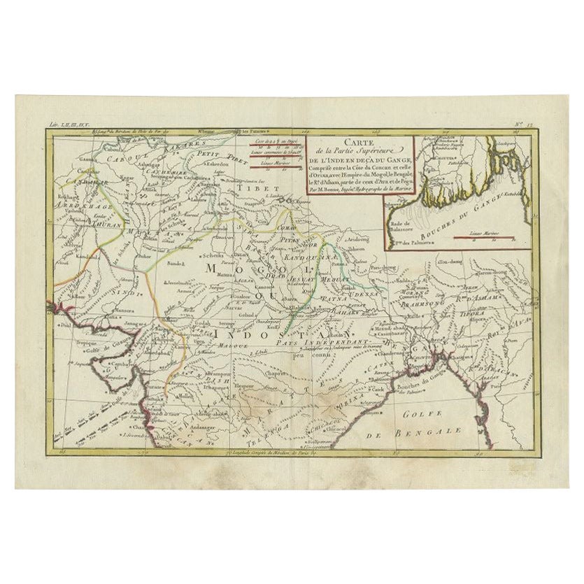
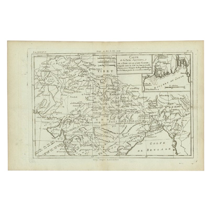
Antique Map of Northern India by Bonne, 1780
Located in Langweer, NL
Antique map titled 'Carte de la partie Supérieure de l'Inde (..)'. A fine example of Rigobert Bonne and Guilleme Raynal?s 1780 map of northern India. Covers the northern part of Indi...
Category
Antique 18th Century Maps
Materials
Paper
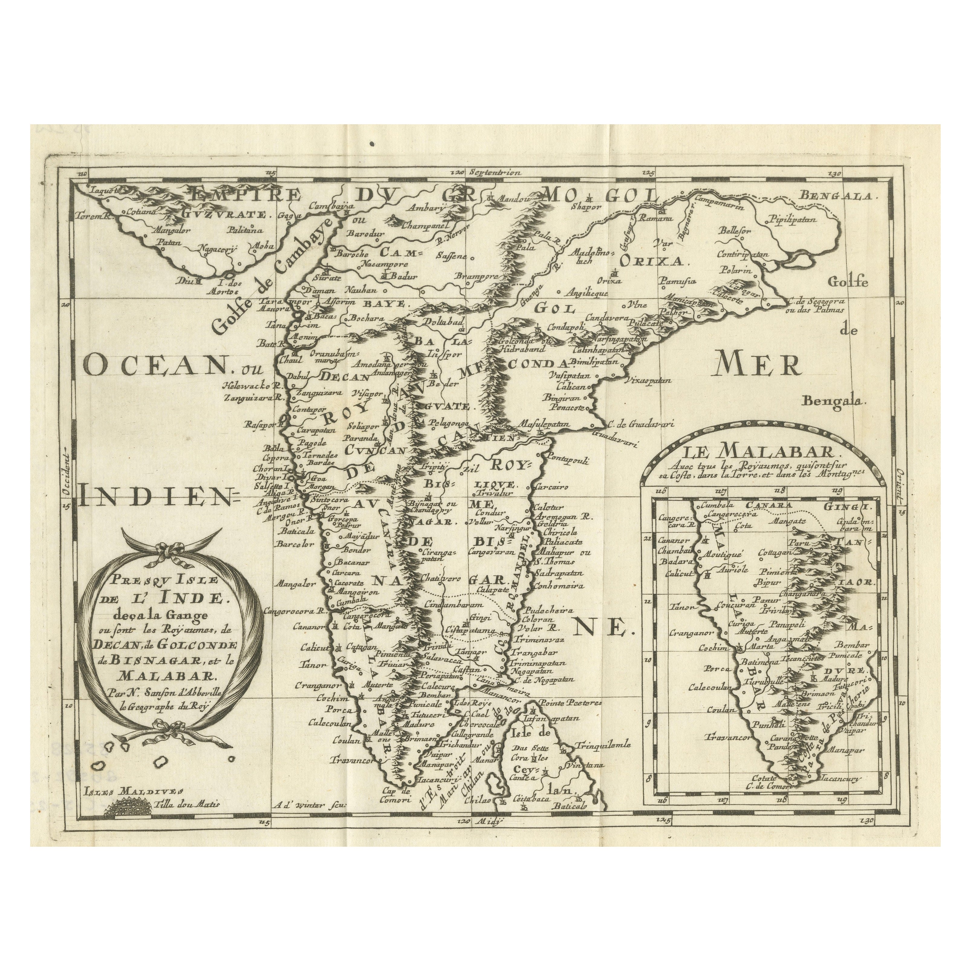
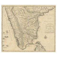
Southern India Map, Deccan
Malabar, Nicolas Sanson, 1683
Located in Langweer, NL
Southern India Map, Deccan
Malabar, Nicolas Sanson, 1683
This engraved map depicts the Indian Peninsula, extending from Gujarat and the Bay of Bengal in the north to Cape Como...
Category
Antique Late 17th Century Dutch Maps
Materials
Paper
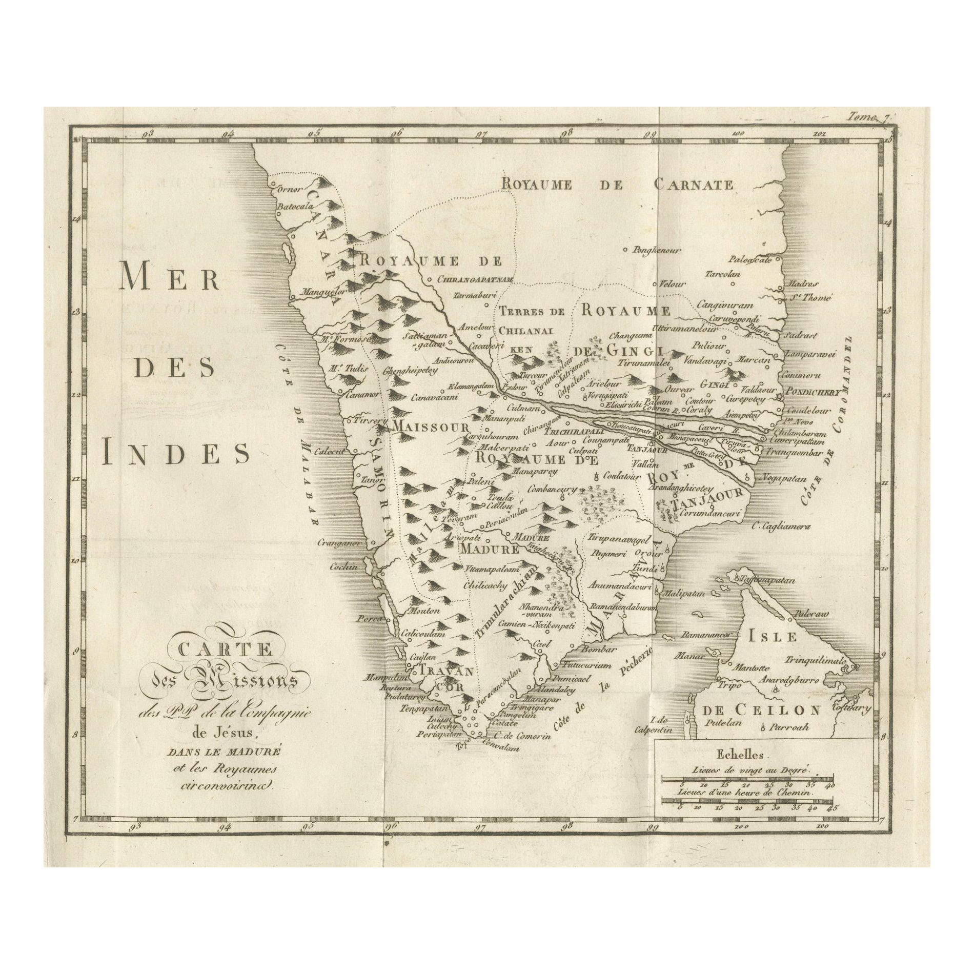
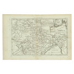
Antique Map of the Jesuit Missions in Madurai and Surrounding Kingdoms, c.1760
Located in Langweer, NL
Antique Map of the Jesuit Missions in Madurai and Surrounding Kingdoms, c.1760
This 18th-century copperplate map, titled Carte des Missions du P.P. de la Compagnie de Jésus dans le ...
Category
Antique Early 18th Century French Maps
Materials
Paper
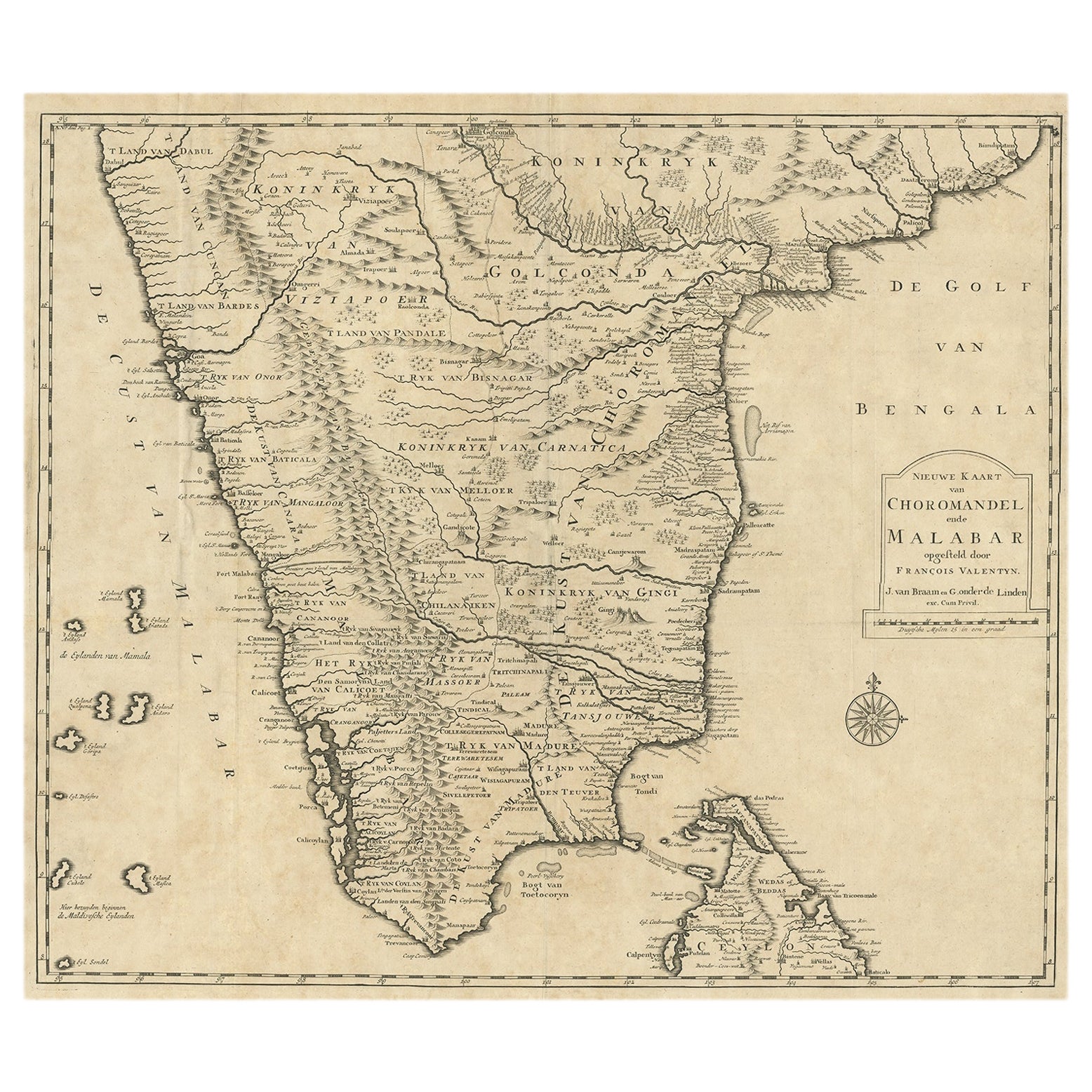
Old Original Map of Chormandel
Malabar, India
Ceylon, Now Sri Lanka, 1726
Located in Langweer, NL
Antique map titled 'Nieuwe Kaart van Choromandel ende Malabar'.
Antique map depicting the southern part of India and the northern tip of Ceylon, Sri Lanka. This map originates from...
Category
Antique 1720s Maps
Materials
Paper
$522 Sale Price
20% Off
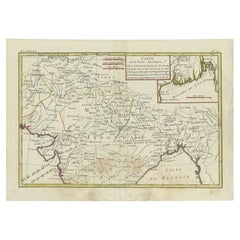
Antique Map of Part of Southern Asia by Bonne, c.1780
Located in Langweer, NL
Antique map titled 'Carte de la Partie Superieure de l'Inde en deca du Gange. Comprise entre la Cote du Concan et celle d'Orixa, avec l'Empire du Mogol, le Bengale, le R. d'Asham, pa...
Category
Antique 18th Century Maps
Materials
Paper
$118 Sale Price
20% Off
You May Also Like
Original Antique Map of India by Dower, circa 1835
Located in St Annes, Lancashire
Nice map of India
Drawn and engraved by J.Dower
Published by Orr & Smith. C.1835
Unframed.
Free shipping
Category
Antique 1830s English Maps
Materials
Paper

Map Of India - Original Lithograph - 19th Century
Located in Roma, IT
Map of India is an original lithograph artwork realized by an Anonymous engraver of the 19th Century.
Printed in the series of "France Pittoresque".
Titled "France Pittoresque".
...
Category
19th Century Modern Figurative Prints
Materials
Lithograph

Antique French Map of Asia Including China Indoneseia India, 1783
Located in Amsterdam, Noord Holland
Very nice map of Asia. 1783 Dedie au Roy.
Additional information:
Country of Manufacturing: Europe
Period: 18th century Qing (1661 - 1912)
Condition: Overall Condition B (Good Used)...
Category
Antique 18th Century European Maps
Materials
Paper

$486 Sale Price
40% Off
Antique 1765 Wine Country Folding Map of France, Bordeau etc.
Located in Paonia, CO
Route du Carosse de Bordeaux, part de Paris tous les Mardis a 11 matin. a et pafse 1765 is a comprehensive map with two routes through the wine country of France starting in Paris going south...
Category
1760s Other Art Style Landscape Prints
Materials
Etching

Original Antique Map of South Africa, Arrowsmith, 1820
Located in St Annes, Lancashire
Great map of South Africa.
Drawn under the direction of Arrowsmith.
Copper-plate engraving.
Published by Longman, Hurst, Rees, Orme and Br...
Category
Antique 1820s English Maps
Materials
Paper

Map of Campaign of 1814 - Etching by Pierre François Tardieu - 1837
Located in Roma, IT
Map of Campaign of 1814 is an Etching realized by Pierre François Tardieu in 1837.
Good conditions.
The artwork is realized in a well-balanced composition. the artwork and belongs ...
Category
1830s Modern Figurative Prints
Materials
Lithograph

More Ways To Browse
Antique French Engravings
Antique Manuscript
18th Century French Engraving
Krishna Antique
India Engraving
1970 Italian Armchair
House Of Denmark Table And Chairs
Louis Marble Top Side Table
Antique Russian Rugs
Baker Furniture By
For Kids
Sterling Silver Flatware Set Service For 12
Tufted Bar
Pair Of French Antique Armchairs
1970s Brass Glass Coffee Table
Antique Column Base
Charles Rennie Mackintosh For Cassina
Glass Salt