Items Similar to Antique Map of Sri Lanka – Taprobanae Insulae Descriptio by Mercator, 1607
Want more images or videos?
Request additional images or videos from the seller
1 of 9
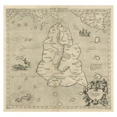
Antique Map of Sri Lanka – Taprobanae Insulae Descriptio by Mercator, 1607
$398.16per item
£291.80per item
€330per item
CA$546.50per item
A$577.47per item
CHF 310.57per item
MX$6,913.36per item
NOK 3,891.02per item
SEK 3,563.61per item
DKK 2,514.01per item
Quantity
About the Item
Taprobanae Insulae Descriptio ex Ptolemaeo – Antique Map of Sri Lanka by Mercator, c.1607
This fine original copperplate engraving, titled Taprobanae Insulae Descriptio ex Ptolemaeo, was created by Gerardus Mercator and published posthumously by his son Rumold Mercator in the early 17th century (circa 1607). The map represents the island of Taprobana, the ancient name used by classical geographers for Sri Lanka—or sometimes the broader Indian Ocean region south of India—based on descriptions by Claudius Ptolemy from the 2nd century CE.
Mercator’s depiction shows the island oriented with north at the top and labeled with classical place names such as Malaca Mons, Elephantum Pagus, and Regnum Pandionis. Decorative elements include an elegant title cartouche at the bottom, framed by allegorical figures representing trade and navigation, and small sailing ships on the surrounding seas. The map’s composition reflects the Renaissance fascination with rediscovering the geographical knowledge of antiquity, while also illustrating Europe’s early modern curiosity about the exotic lands of Asia.
This plate originally appeared in Mercator’s Ptolemaic Atlas, published in Duisburg and later included in editions of the Mercator-Hondius Atlas after 1606. It represents one of the earliest printed cartographic interpretations of Sri Lanka (or Taprobana) and is of particular interest for its blend of mythological geography and early scientific mapping.
The engraving combines precision and elegance, with delicate hatching in the sea and beautifully engraved lettering. It stands as a historical testament to the evolution of geographical understanding during the Age of Discovery and the enduring influence of Ptolemaic cosmography on European mapmaking.
Condition report:
Very good impression on strong laid paper with visible plate mark. Mild toning and very faint marginal foxing, otherwise clean and well preserved. Mounted on board and matted with archival materials.
Framing tips:
This piece displays beautifully in a dark walnut or gold-leaf frame with a natural or cream mat. Floating the map to reveal the plate mark enhances its authenticity and antique character.
Technique: Copperplate engraving on laid paper
Maker: Gerardus Mercator (1512–1594), published by Rumold Mercator, Duisburg/Amsterdam, circa 1607
- Dimensions:Height: 15.2 in (38.6 cm)Width: 12.41 in (31.5 cm)Depth: 0.08 in (2 mm)
- Materials and Techniques:Paper,Engraved
- Place of Origin:
- Period:Early 17th Century
- Date of Manufacture:1607
- Condition:Good impression on strong laid paper with visible plate mark. Top right border shows repair or extra support. Mild toning and very faint marginal foxing, otherwise clean and well preserved. Mounted on board and matted with archival materials.
- Seller Location:Langweer, NL
- Reference Number:Seller: BG-135111stDibs: LU3054346953652
About the Seller
5.0
Recognized Seller
These prestigious sellers are industry leaders and represent the highest echelon for item quality and design.
Platinum Seller
Premium sellers with a 4.7+ rating and 24-hour response times
Established in 2009
1stDibs seller since 2017
2,852 sales on 1stDibs
Typical response time: 1 hour
- ShippingRetrieving quote...Shipping from: Langweer, Netherlands
- Return Policy
More From This Seller
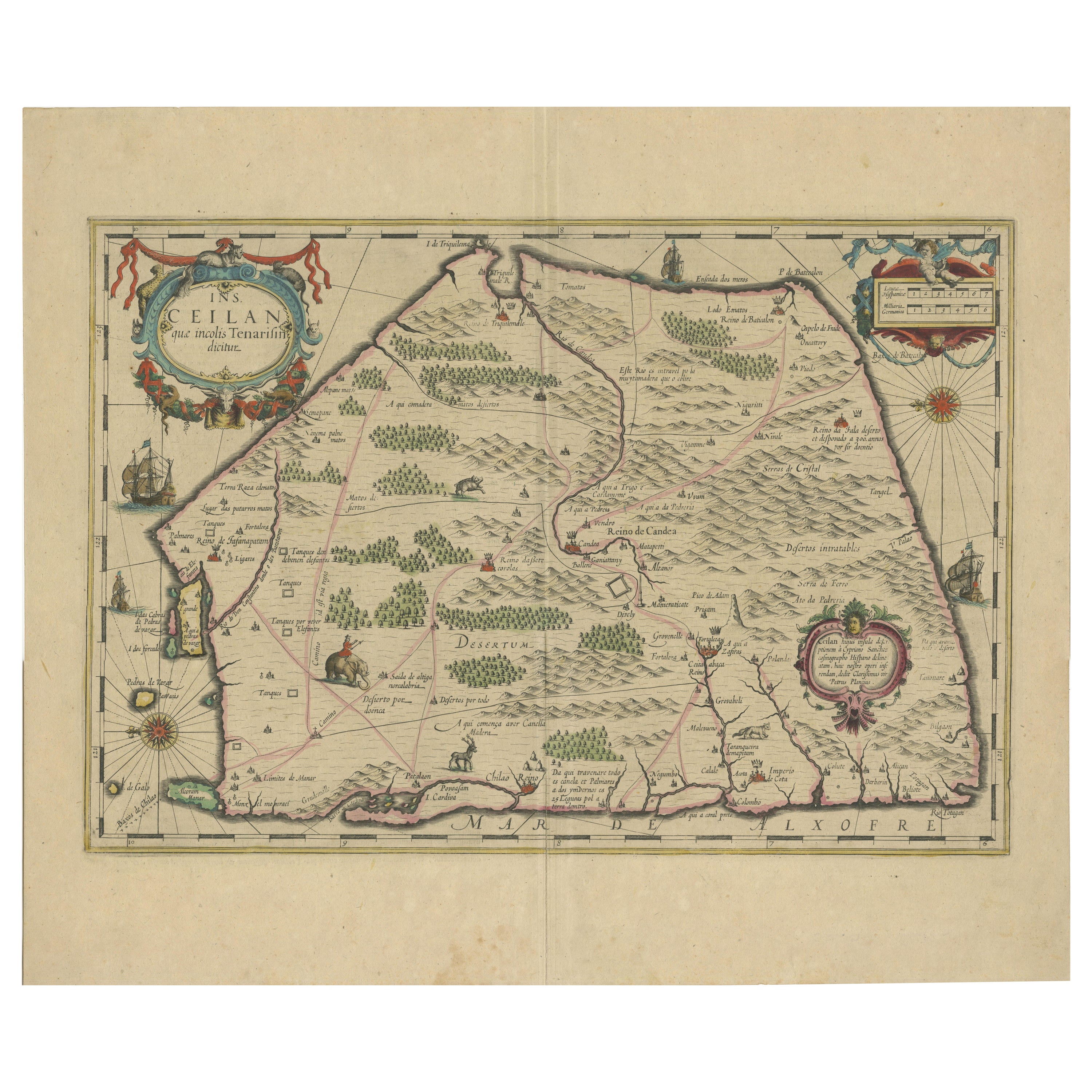
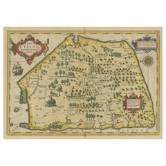
View All1638 Plancius Detailed Map of Sri Lanka or Ceylon with Decorative Cartouches
Located in Langweer, NL
"1638 Plancius Detailed Map of Sri Lanka with Decorative Cartouches"
This beautifully detailed map of Sri Lanka, titled "Ins. Ceilan," was engraved by P. Plancius from a design by C...
Category
Antique 1630s Maps
Materials
Paper
$1,389 Sale Price
20% Off
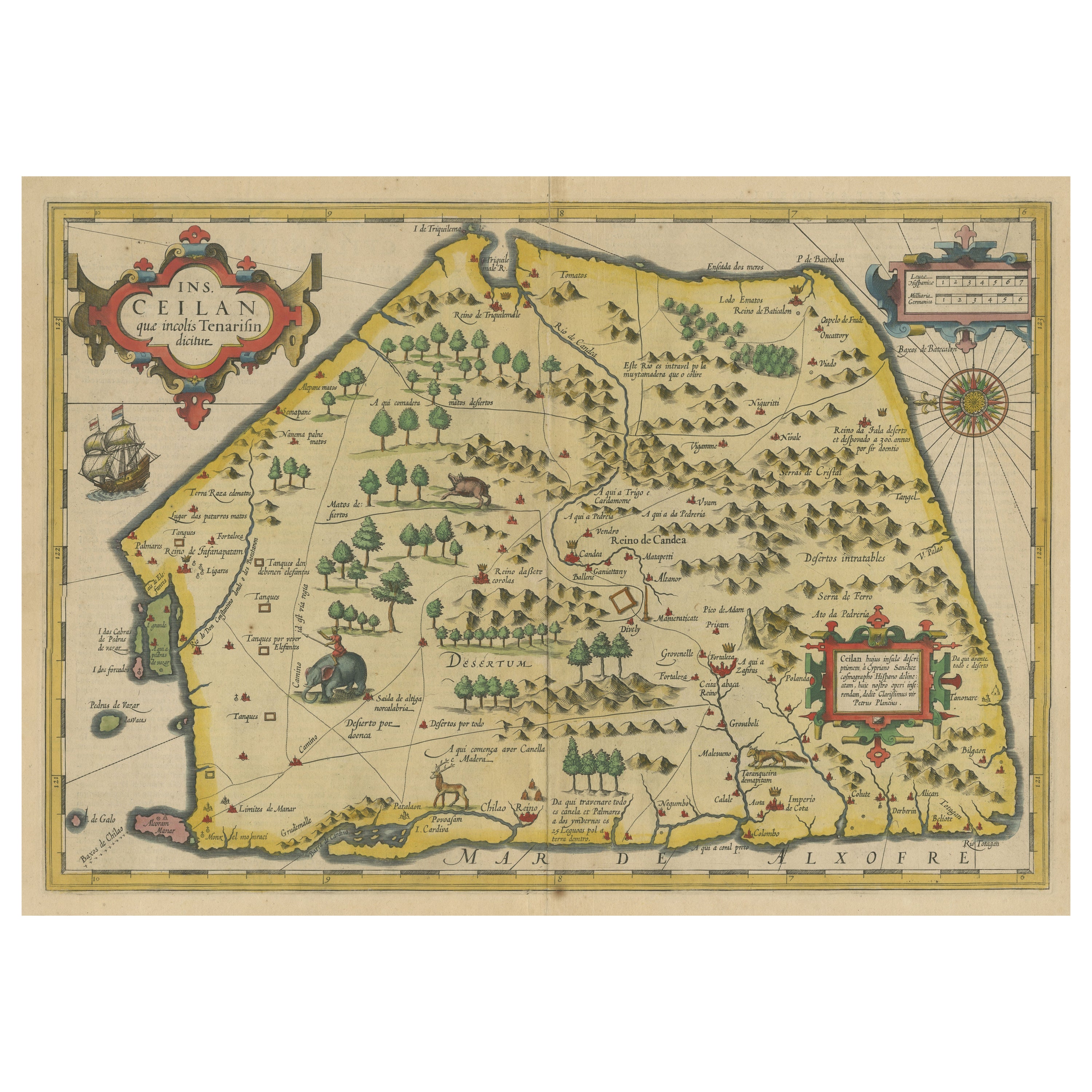
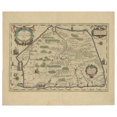
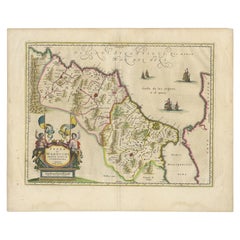
Antique Map of Sri Lanka with an unusual five-sided shape, circa 1606
Located in Langweer, NL
Antique map titled 'Ins. Ceilan quae incolis Tenarisin dicitur'. This exquisite, early map of Sri Lanka is shown with an unusual five-sided shape. North is oriented to the left by an...
Category
Antique Early 17th Century Maps
Materials
Paper
$617 Sale Price
20% Off
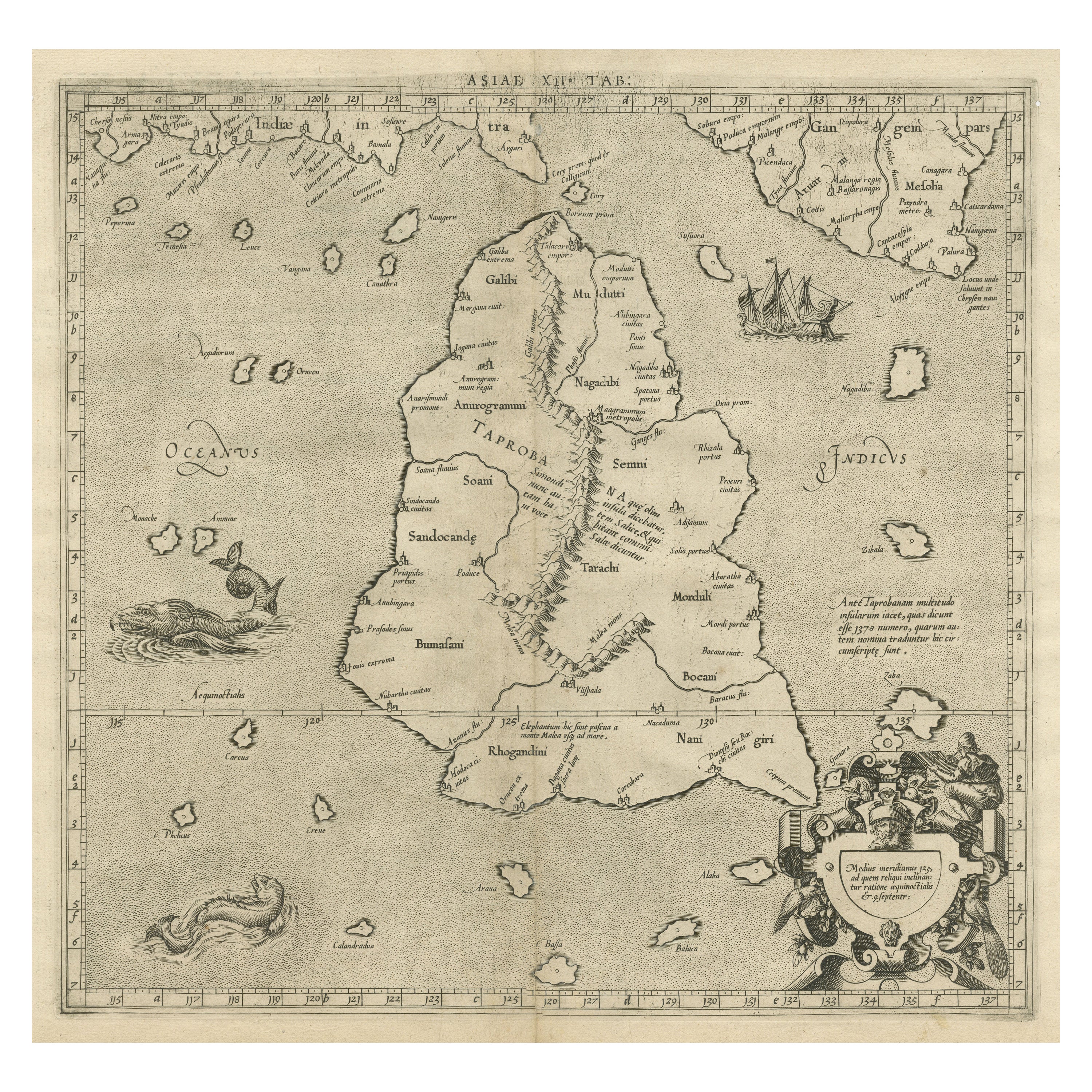
Mercator
s Ptolemaic map of Taprobana, (Ceylon) Sri Lanka
Located in Langweer, NL
Antique map titled 'Asiae XII Tab'. Mercator's Ptolemaic map of Taprobana. The map shows Ptolemy's erroneous location of the island of Sri Lanka near the equator, with a bit of India...
Category
Antique 16th Century Maps
Materials
Paper
$559 Sale Price
20% Off
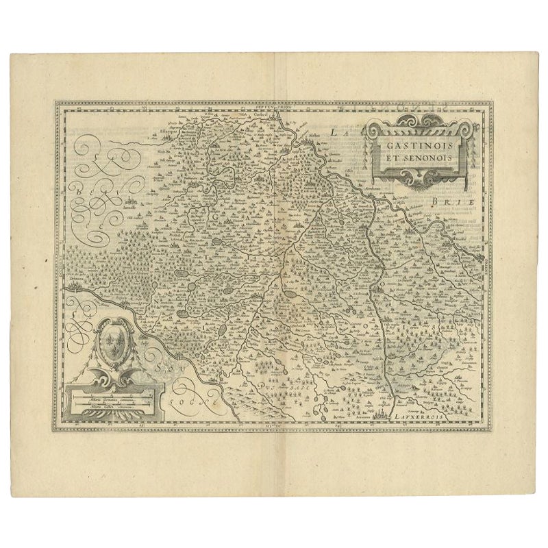
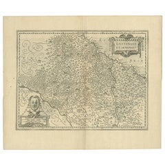
Antique Map of the Region of Étampes and Sens by Janssonius, c.1650
Located in Langweer, NL
Antique map titled 'Gastinois et Senonois'. Old map of the region of Étampes and Sens, France. It shows the cities of Sens, Melun, Étampes, Orleans, Fontainebleau, Montargis and othe...
Category
Antique 17th Century Maps
Materials
Paper
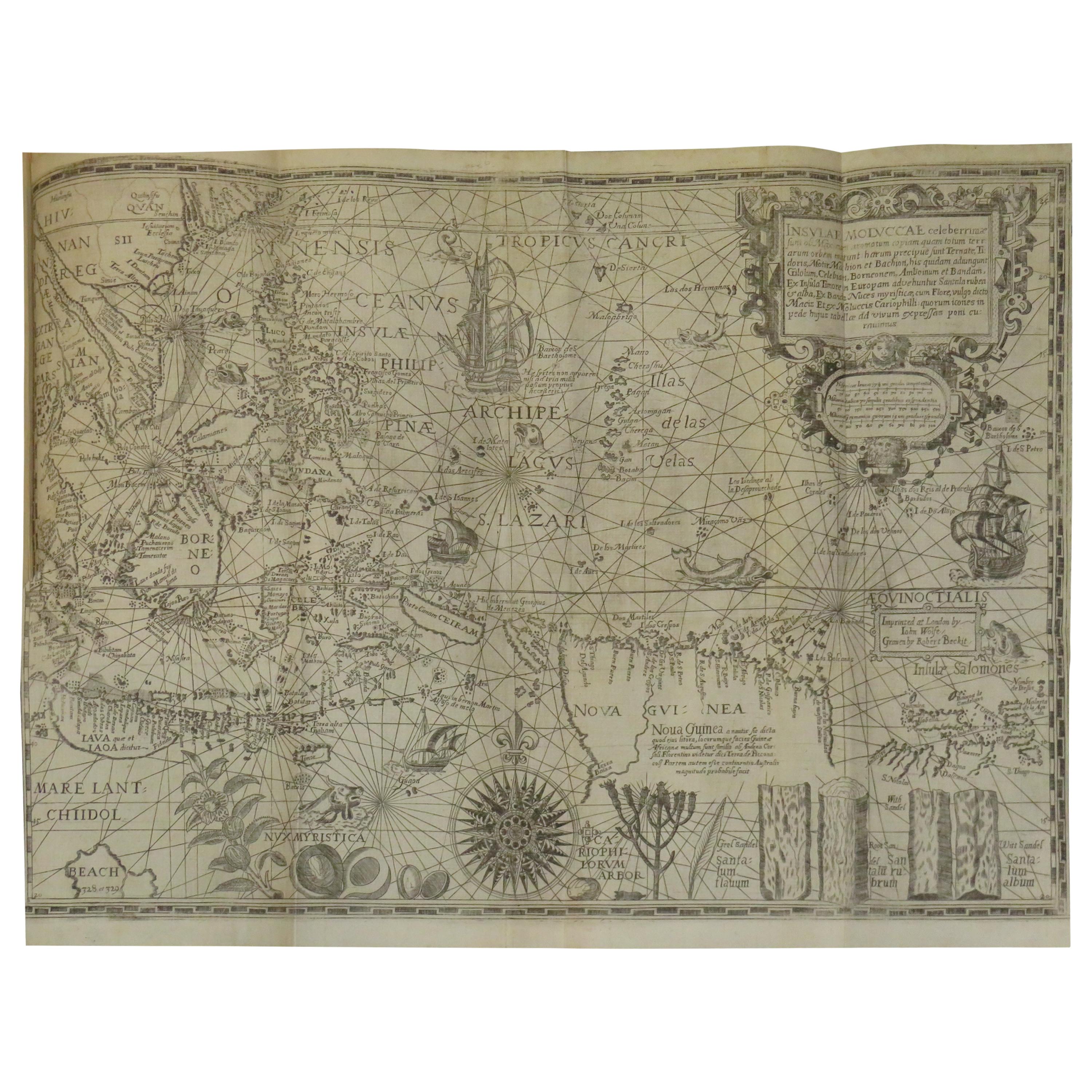
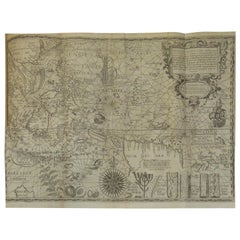
Antique Map of the Spice Islands by Van Linschoten, 1598
Located in Langweer, NL
Antique map titled 'INSVLAE MOLVCCAE celeberrimae/funt ob Maximan aromatum copiam quam totum terr:/arum orbem mittunt: harum precipue funt Ternate, Ti:/doris, Motir machion et Bachion, his quidam adiungunt/Giloolum, Celebiant, Borneonem, Amboinum et Bandam,/Ex Infula Timore in Europam adevehuntur Santala rubea/& alba , Ex Banda Nuces myrifticae, cum Flore, vulgo dicto/Macis Et ex Moluccis Cariophilli:quorum icons in/pede hujus tabellae ad vivum expreffas poni cu:rauimus'.
The map, Insulae Moluccae, is the rarest and most valuable of the printed maps of the Spice Islands...
Category
Antique 16th Century Maps
Materials
Paper
Price Upon Request
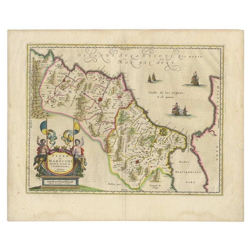
Antique Map of Morocco Showing Towns of Marakesh, Taradant and Fez, 1636
Located in Langweer, NL
Antique map titled 'Fezzae et Marocchi regna Africae Celeberrima'. Map of Morocco, showing large fortified towns of Marakesh, Taradante and Fez, towns, mountains, rivers, lakes, etc....
Category
Antique 17th Century Dutch Maps
Materials
Paper
$1,055 Sale Price
30% Off
You May Also Like
Ancient Map - Zeilan - Etching by Johannes Janssonius - 1650s
By Johannes Janssonius
Located in Roma, IT
Ancient Map - Zeilan is an ancient map realized in 1650 by Johannes Janssonius (1588-1664).
The Map is Hand-colored etching, with coeval watercoloring.
...
Category
1650s Modern Figurative Prints
Materials
Etching

Antique Map - Gallia - Etching by Johannes Janssonius - 1650s
By Johannes Janssonius
Located in Roma, IT
Antique Map - Gallia is an antique map realized in 1650 by Johannes Janssonius (1588-1664).
The Map is Hand-colored etching, with coeval watercoloring.
Good conditions with slight ...
Category
1650s Modern Figurative Prints
Materials
Etching

Ancient Map - Macedonia - Etching by Johannes Janssonius - 1650s
By Johannes Janssonius
Located in Roma, IT
Macedonia is an ancient map realized in 1650 by Johannes Janssonius (1588-1664).
The Map is Hand-colored etching, with coeval watercoloring.
Good condit...
Category
1650s Modern Figurative Prints
Materials
Etching

Thesssalia Map - Etching by Johannes Janssonius - 1650s
By Johannes Janssonius
Located in Roma, IT
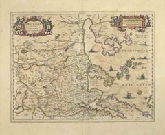
Thessalia Map is an ancient map realized in 1650 by Johannes Janssonius (1588-1664).
The Map is Hand-colored etching, with coeval watercoloring.
Good conditions.
From Atlantis maj...
Category
1650s Modern Figurative Prints
Materials
Etching
Antique Map - Mar Di Athiopia - Etching by Johannes Janssonius - 1650s
By Johannes Janssonius
Located in Roma, IT
Antique Map - Mar Di Athiopia is an antique map realized in 1650 by Johannes Janssonius (1588-1664).
The Map is Hand-colored etching, with coeval watercolorang.
Good conditions wit...
Category
1650s Modern Figurative Prints
Materials
Etching

Antique Map - Archipela Meridionalis - Etching by Johannes Janssonius - 1650s
By Johannes Janssonius
Located in Roma, IT
Antique Map - Archipela Meridionalis is an antique map realized in 1650 by Johannes Janssonius (1588-1664).
The Map is Hand-colored etching, with coeval watercolorang.
Good conditi...
Category
1650s Modern Figurative Prints
Materials
Etching
