Items Similar to Antique Map of Stavoren, Bolsward and Hindeloopen by Merian, c.1650
Want more images or videos?
Request additional images or videos from the seller
1 of 5
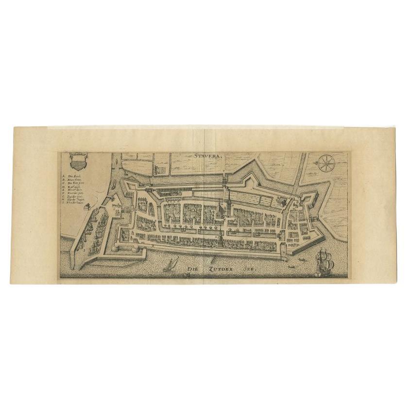
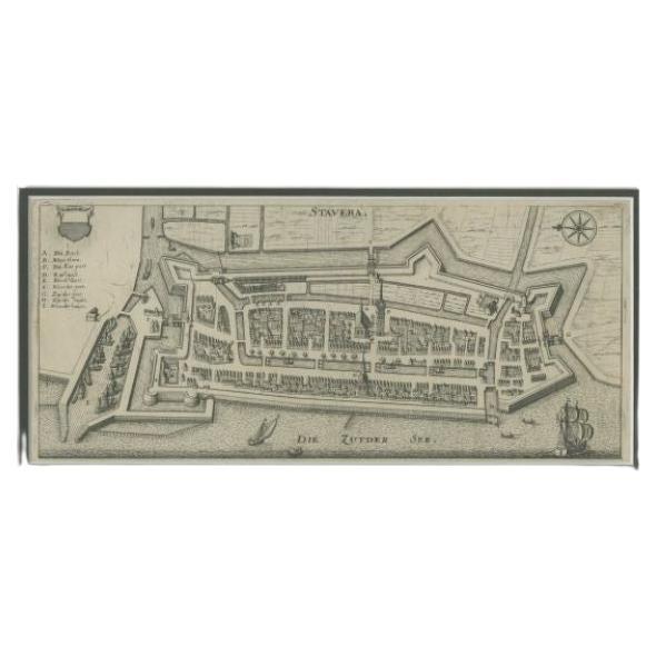
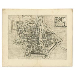
Antique Map of Stavoren, Bolsward and Hindeloopen by Merian, c.1650
$166.12
$207.6520% Off
£124.02
£155.0220% Off
€140
€17520% Off
CA$230.79
CA$288.4920% Off
A$248.25
A$310.3120% Off
CHF 132.67
CHF 165.8420% Off
MX$2,926.11
MX$3,657.6320% Off
NOK 1,672.65
NOK 2,090.8220% Off
SEK 1,529.12
SEK 1,911.4020% Off
DKK 1,066.96
DKK 1,333.7020% Off
About the Item
Antique map titled 'Stavera, Bolzvardia, Hindelopia'. Three maps on one sheet depicting Stavoren, Bolsward and Hindeloopen (Friesland, The Netherlands). With German legend. Artists and Engravers: Made after Braun
Hogenberg by M. Merian.
Artist: Made after Braun
Hogenberg by M. Merian.
Condition: Good. General age-related toning and some marginal tears. Please study image carefully.
Date: c.1650
Overall size: 38.2 x 33.5 cm.
Image size: 0.001 x 29.3 x 26 cm.
Antique prints have long been appreciated for both their aesthetic and investment value. They were the product of engraved, etched or lithographed plates. These plates were handmade out of wood or metal, which required an incredible level of skill, patience and craftsmanship. Whether you have a house with Victorian furniture or more contemporary decor an old engraving can enhance your living space. We offer a wide range of authentic antique prints for any budget.
- Dimensions:Height: 13.19 in (33.5 cm)Width: 15.04 in (38.2 cm)Depth: 0 in (0.01 mm)
- Materials and Techniques:
- Period:
- Date of Manufacture:circa 1650
- Condition:
- Seller Location:Langweer, NL
- Reference Number:Seller: BG-003201stDibs: LU3054327771532
About the Seller
5.0
Recognized Seller
These prestigious sellers are industry leaders and represent the highest echelon for item quality and design.
Platinum Seller
Premium sellers with a 4.7+ rating and 24-hour response times
Established in 2009
1stDibs seller since 2017
2,836 sales on 1stDibs
Typical response time: 1 hour
- ShippingRetrieving quote...Shipping from: Langweer, Netherlands
- Return Policy
More From This Seller
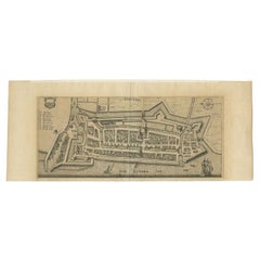
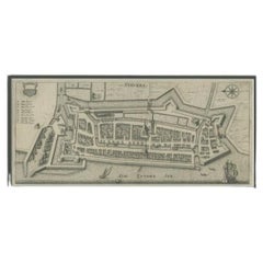
View AllAntique Map of Stavoren by Merian, c.1650
Located in Langweer, NL
Antique map titled 'Stavera'. Map of the city of Stavoren, Friesland. With German legend. Trimmed, originally published on one sheet with a map of Bolsward and Hindeloopen. Artists a...
Category
Antique 17th Century Maps
Materials
Paper
$132 Sale Price
20% Off
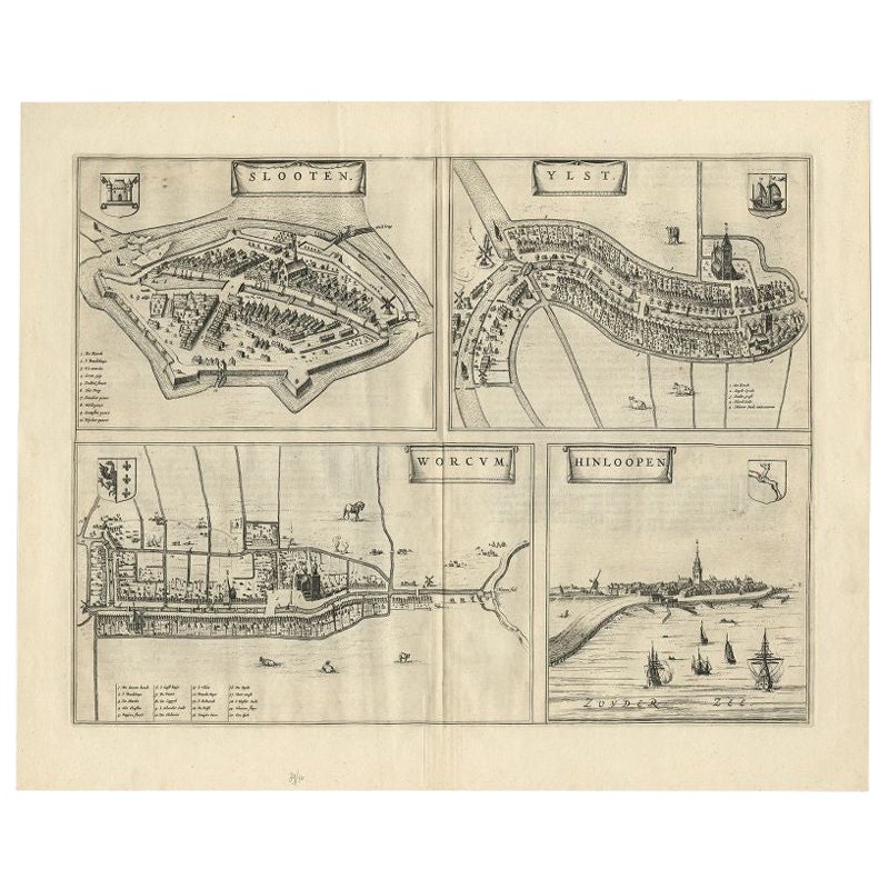
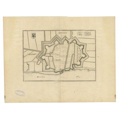
Antique Map of Sloten, IJlst, Workum
Hindeloopen by Blaeu, 1652
Located in Langweer, NL
Antique map titled: 'Sloten - Ylst - Worcum - Hinloopen.' - Three plans and a bird's eye view on one sheet. The plans show the Frisian cities Sloten, IJlst, Workum and the view shows...
Category
Antique 17th Century Maps
Materials
Paper

$493 Sale Price
20% Off
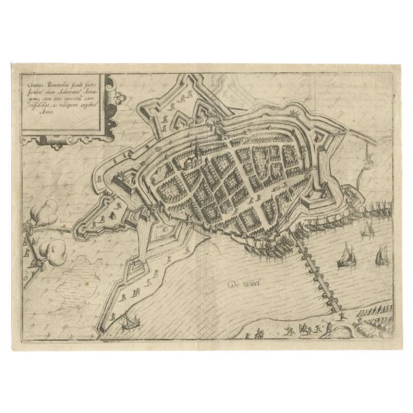
Antique Map of Zaltbommel in the Netherlands, by Guicciardini, 1613
Located in Langweer, NL
Antique print titled 'Civitas Bommelia (..)'. Beautiful plan of Zaltbommel, Gelderland (the Netherlands). This map originates from 'Discrittione di tutti i Paesi Bassi' by L. Guiccia...
Category
Antique 17th Century Maps
Materials
Paper
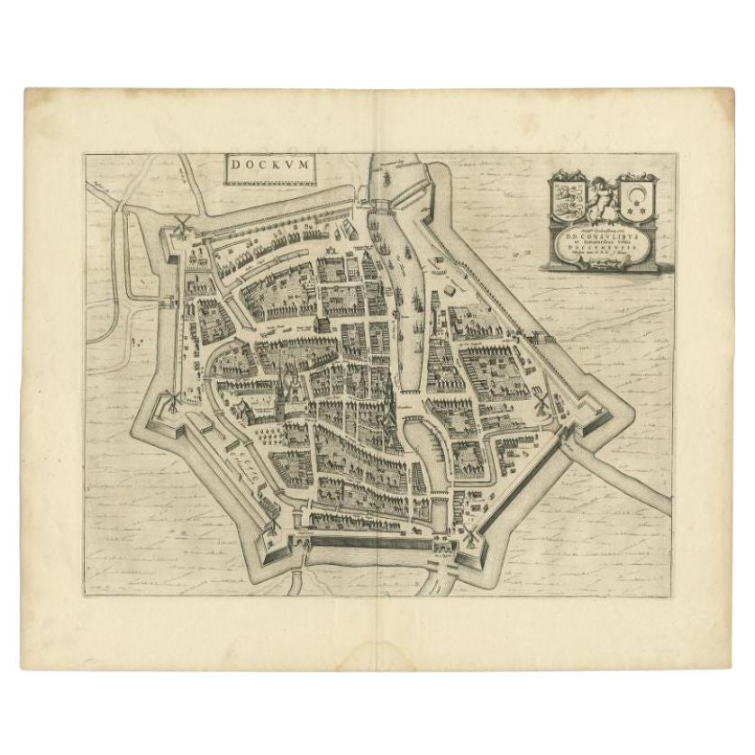
Antique Map of the City of Dokkum by Blaeu, c.1650
Located in Langweer, NL
Antique map titled 'Dockum'. Large map of the city of Dokkum, Friesland, The Netherlands. Originates from 'Toneel der Steden', published by Joan Blaeu, Amsterdam. Artists and Engrave...
Category
Antique 17th Century Dutch Maps
Materials
Paper
Antique Map of Stavoren by Merian, c.1650
Located in Langweer, NL
Antique map titled 'Stavera'. Map of the city of Stavoren, Friesland. With German legend. Trimmed, originally published on one sheet with a map of Bolsward and Hindeloopen. Artists a...
Category
Antique 17th Century Maps
Materials
Paper
$154 Sale Price
20% Off
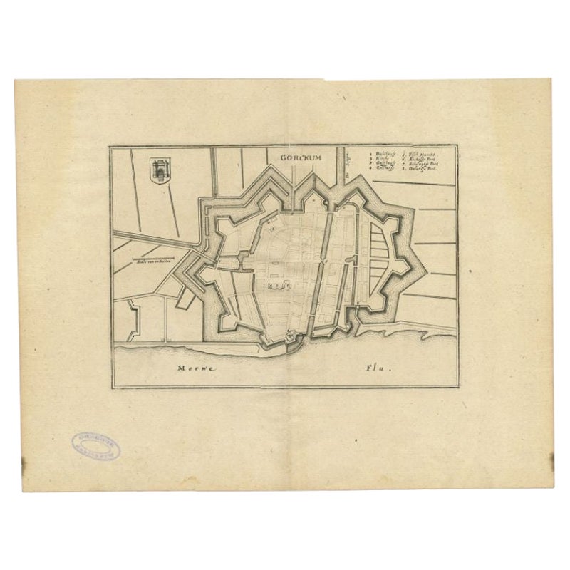
Antique Map of the City of Gorinchem by Merian, 1659
Located in Langweer, NL
Antique map titled 'Gorckum'. This print depicts the city of Gorinchem (or Gorcum/Gorkum, The Netherlands). This print originates from 'Topographia Germaniae Inferioris (..)' by C. M...
Category
Antique 17th Century Maps
Materials
Paper
You May Also Like
18th Century Map Engraving - Newport, a Strong Sea-Port Town in Flanders
Located in Corsham, GB
A map of Nieuwpoort, anglicised to 'Newport', in northern Belgium. There is a panorama in the upper quarter depicting major landmarks. Below is a plan of the town, including its strong defences and ships at the port in the lower register. Inscribed with the title in plate to the lower edge, 'Newport a Strong Sea-Port Town...
Category
18th Century More Prints
Materials
Engraving

Map of the Netherlands - Etching by G. Braun and F. Hogenberg -Late 16th Century
By Franz Hogenberg
Located in Roma, IT
Map of the Netherlands is an original etching realized by George Braun and Franz Hogenberg, as part of the "Civitates Orbis Terrarum".
The “Civitates Orbis Terrarum” (Atlas of Citi...
Category
16th Century Figurative Prints
Materials
Etching

Map of Dordrecht - Etching by G. Braun/F. Hogenberg - Late 16th Century
Located in Roma, IT
Map od Dordrecht is an artwork realized by Braun and Hogemberg in the late 16th century.
Hand watercolored etching.
40x54 cm.
Good conditions.
Braun Hoghemberg (1541-1622) was a ...
Category
16th Century Old Masters Figurative Prints
Materials
Etching

Map of Kampen, Netherlands - by G. Braun and F. Hogenberg - Late 16th Century
By Franz Hogenberg
Located in Roma, IT
This map of Kampen (the ancient Campensis) is an original etching realized by George Braun and Franz Hogenberg as part of the famous Series "Civitates Orbis Terrarum".
The “Civita...
Category
16th Century Figurative Prints
Materials
Etching

Map of Antwerp - Etching by G.Braun and F. Hogenberg -Late 16th century
By Franz Hogenberg
Located in Roma, IT
This Map of Anverpia is an original etching hand colored realized by George Braun and Franz Hogenberg as part of the famous Atlas "Civitates Orbis Ter...
Category
16th Century Old Masters Figurative Prints
Materials
Etching

18th Century Map Engraving - Mechlin, or Malines
Located in Corsham, GB
A map of Mechelen, known as Malines in French and Mechlin in English, a city and municipality in the province of Antwerp in the Flemish Region of Belgium. A birds-eye view plan of th...
Category
18th Century More Prints
Materials
Engraving

More Ways To Browse
Hindeloopen Furniture
Antique Maps Singapore
Antique Planisphere
Map Of Palestine
R Johnston
Santa Cruz Island
Shetland Map
Antique Alabama Map
Antique Framed Map Engravings
Antique Furniture Cheshire
Antique Great Lakes Map
Antique Map Of Michigan
Antique Map Of Turkish Empire
Antique Map Of Yorkshire
Bali Map
Bermuda Map
British Empire Map
Caucasus Map