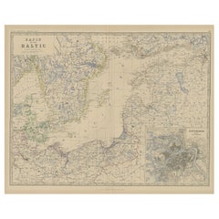
Items Similar to Antique Map of the Surroundings of the Baltic Sea by A.K. Johnston, 1865

Want more images or videos?
Request additional images or videos from the seller
1 of 5
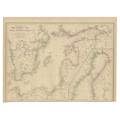
Antique Map of the Surroundings of the Baltic Sea by A.K. Johnston, 1865
$358.40
£267.85
€300
CA$494.43
A$541.56
CHF 285.13
MX$6,463.32
NOK 3,633.73
SEK 3,321.78
DKK 2,286.64
About the Item
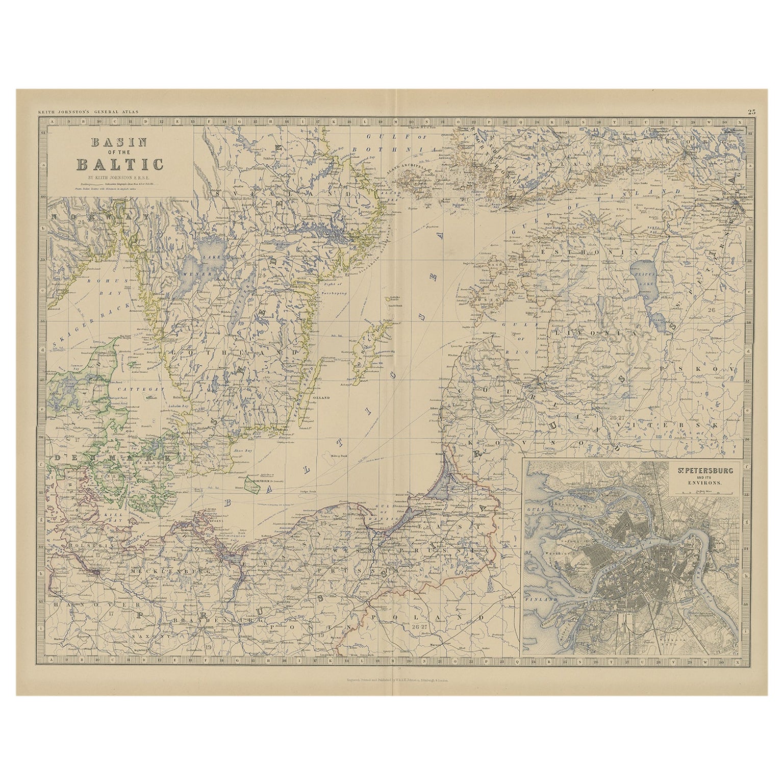
Antique map titled 'Basin of the Baltic'. Depicting, Denmark, Sweden, Finland, Estonia, Poland, Prussia and more. With an inset map of St. Peterburg and environments. This map originates from the ‘Royal Atlas of Modern Geography’ by Alexander Keith Johnston. Published by William Blackwood and Sons, Edinburgh and London, 1865.
- Dimensions:Height: 19.1 in (48.5 cm)Width: 24.41 in (62 cm)Depth: 0.02 in (0.5 mm)
- Materials and Techniques:
- Period:
- Date of Manufacture:1865
- Condition:General age-related toning. Please study image carefully.
- Seller Location:Langweer, NL
- Reference Number:Seller: BG-05553/251stDibs: LU3054310726613
About the Seller
5.0
Recognized Seller
These prestigious sellers are industry leaders and represent the highest echelon for item quality and design.
Platinum Seller
Premium sellers with a 4.7+ rating and 24-hour response times
Established in 2009
1stDibs seller since 2017
2,806 sales on 1stDibs
Typical response time: 1 hour
- ShippingRetrieving quote...Shipping from: Langweer, Netherlands
- Return Policy
More From This Seller
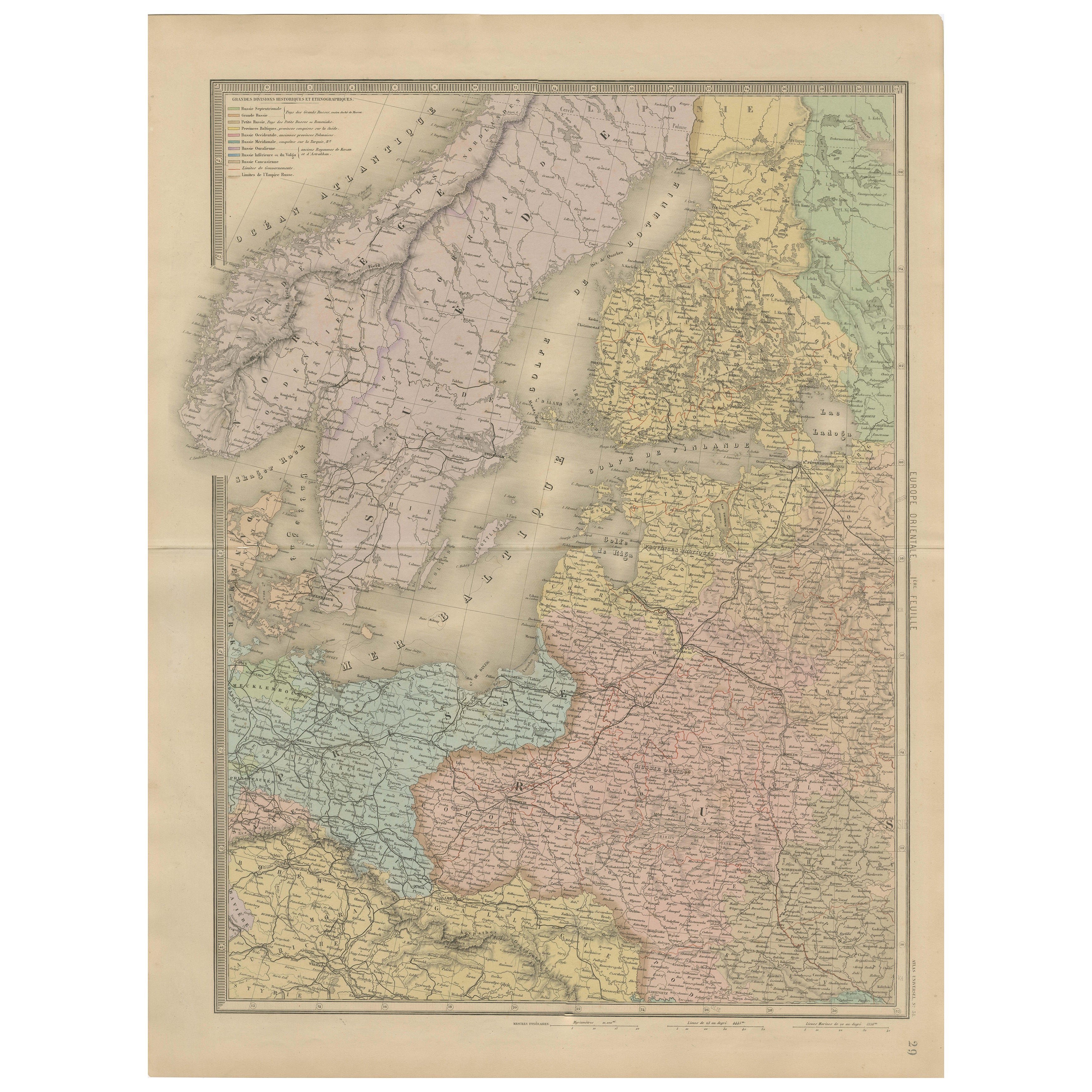
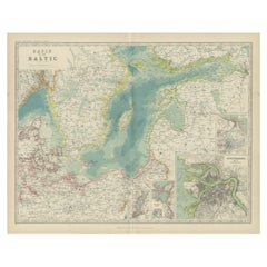
View AllOld Map of the the Baltic Sea Region, Inset of St. Petersburg, 1882
Located in Langweer, NL
Description: antique map titled 'Basin of the Baltic'. Old map of the regiona round the Baltic Sea. Includes an inset map of St. Petersburg. This map originates from 'The Royal Atlas...
Category
Antique 1880s Prints
Materials
Paper
Antique Map of the Baltic Sea by Johnston,
1909
Located in Langweer, NL
Antique map titled 'Basin of the Baltic'. Original antique map of Baltic Sea. With inset maps of Kiel, Stettin, Danzig and St Petersburg. This map originate...
Category
Early 20th Century Maps
Materials
Paper
$238 Sale Price
20% Off
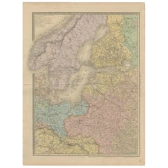
Antique Map of Scandinavia and the Baltic – Andriveau-Goujon, circa 1860s
Located in Langweer, NL
Antique Map of Scandinavia and the Baltic – Andriveau-Goujon, circa 1860s
This impressive antique map presents Northern Europe, focusing on the Scandinavian Peninsula, the Baltic re...
Category
Antique Mid-19th Century French Maps
Materials
Paper
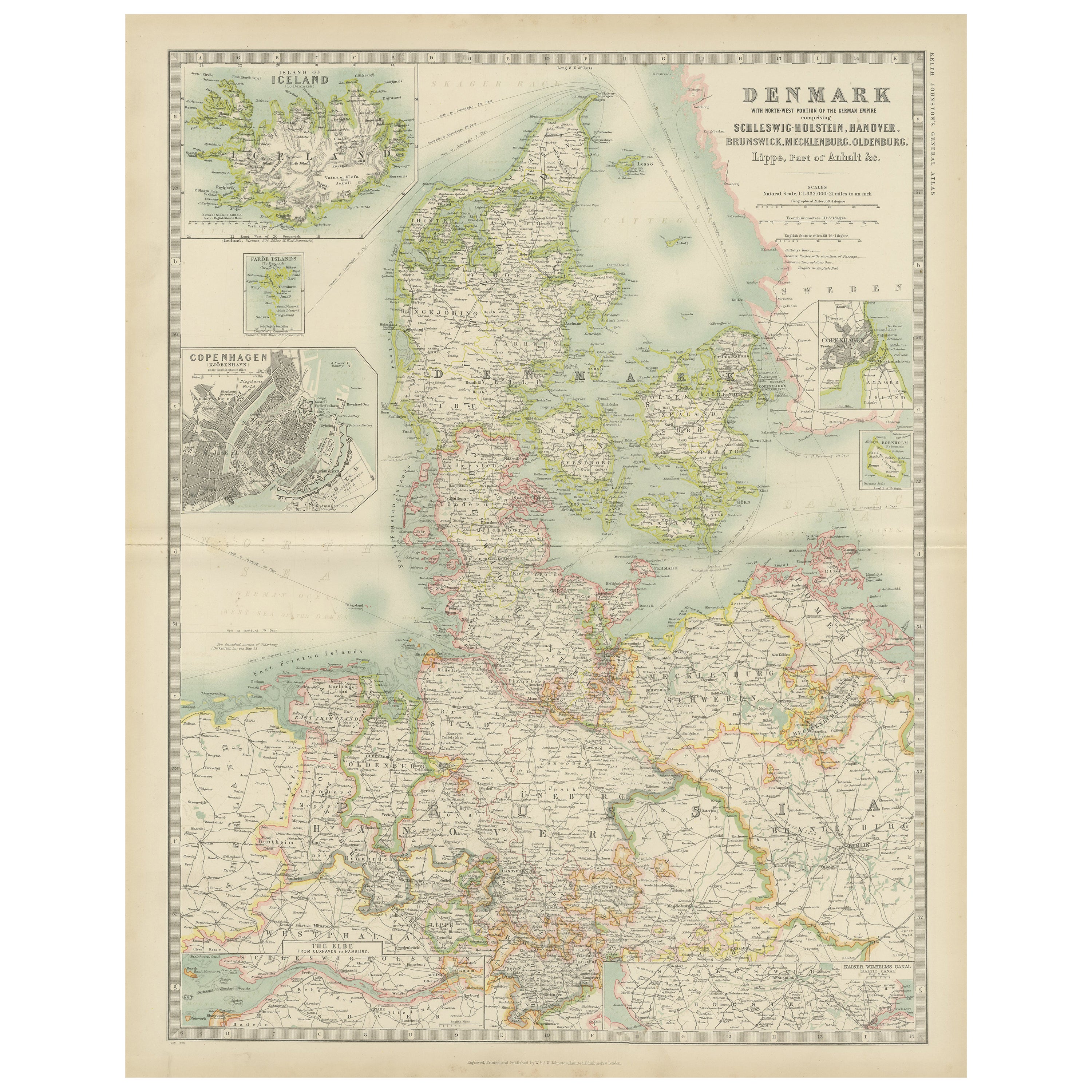
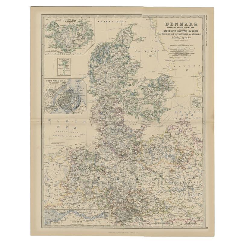
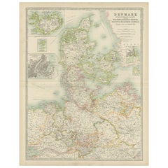
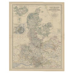
Antique Map of Denmark by Johnston
1909
Located in Langweer, NL
Antique map titled 'Denmark'. Original antique map of Denmark. With inset maps of Iceland, Faroe Island, and Copenhagen. This map originates from the ‘Royal Atlas of Modern Geography...
Category
Early 20th Century Maps
Materials
Paper
$238 Sale Price
20% Off
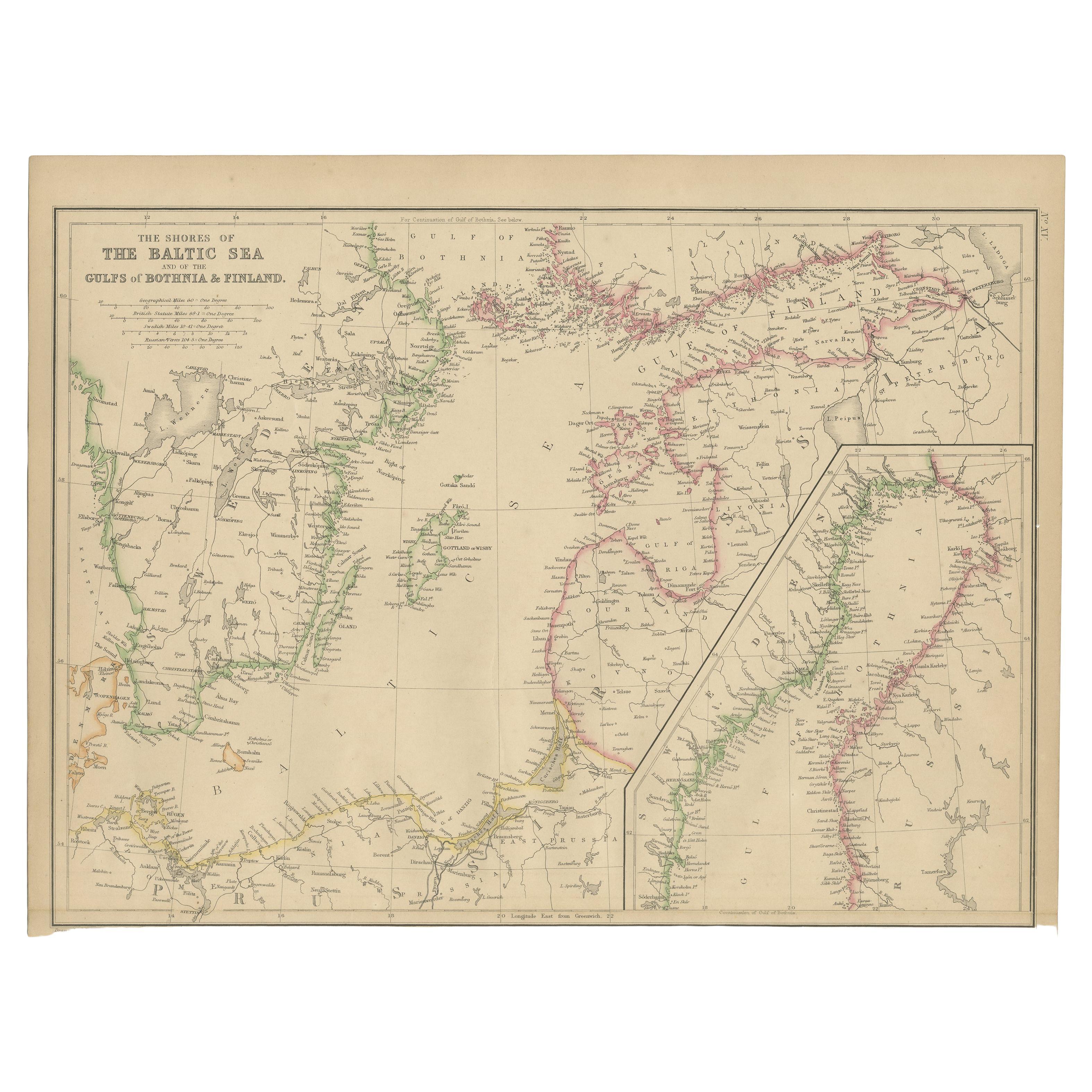
Antique Map of the Shores of The Baltic Sea by W. G. Blackie, 1859
Located in Langweer, NL
Antique map titled 'The shores of The Baltic sea and of the Gulfs of Bothnia & Finland'. Original antique map of the Shores of the Baltic Sea. This map originates from ‘The Imperial ...
Category
Antique Mid-19th Century Maps
Materials
Paper
$167 Sale Price
20% Off
Denmark
German Empire – Antique Map by A.K. Johnston, 1882 Atlas Edition
Located in Langweer, NL
Denmark & German Empire – Antique Map by A.K. Johnston, 1882 Atlas Edition
This detailed antique map titled Denmark with North-West portion of the German Empire comprising Schleswig...
Category
Antique 19th Century English Maps
Materials
Paper
$229 Sale Price
20% Off
You May Also Like
Russia in Europe with Poland and Finland. Century Atlas antique vintage map
Located in Melbourne, Victoria
'The Century Atlas. Russia in Europe with Poland and Finland'
Original antique map, 1903.
Central fold as issued. Map name and number printed on the reverse corners.
Sheet 40cm by ...
Category
Early 20th Century Victorian More Prints
Materials
Lithograph

Large Original Antique Map of Poland by Sidney Hall, 1847
Located in St Annes, Lancashire
Great map of Poland
Drawn and engraved by Sidney Hall
Steel engraving
Original colour outline
Published by A & C Black. 1847
Unframed
...
Category
Antique 1840s Scottish Maps
Materials
Paper

Original Antique Map of Sweden, Engraved by Barlow, 1806
Located in St Annes, Lancashire
Great map of Sweden
Copper-plate engraving by Barlow
Published by Brightly & Kinnersly, Bungay, Suffolk. 1806
Unframed.
Category
Antique Early 1800s English Maps
Materials
Paper

1853 Map of "Russia in Europe Including Poland" Ric.r016
Located in Norton, MA
Description
Russia in Europe incl. Poland by J Wyld c.1853
Hand coloured steel engraving
Dimension: Paper: 25 cm W x 33 cm H ; Sight: 22 cm W x 28 cm H
Condition: Good ...
Category
Antique 19th Century Unknown Maps
Materials
Paper

Russia, Western and Southern Part. Century Atlas antique vintage map
Located in Melbourne, Victoria
'The Century Atlas. Russia, Western and Southern Part'
Original antique map, 1903.
Inset map tilted 'St Petersburg and Environs'.
Central fold as issued. Map name and number printe...
Category
Early 20th Century Victorian More Prints
Materials
Lithograph

1832 Large Map "Russian
Poland" Ric. R0012
Located in Norton, MA
Large map 1832
"Russian & Poland"
Ric.r0012
Russia & Poland, by J. Arrowsmith. London, pubd. 15 Feby. 1832 by J. Arrowsmith, 35 Essex Street, Strand., ...
Category
Antique 19th Century Unknown Maps
Materials
Paper

More Ways To Browse
Illustrated Map
Antique World Maps
Antique Southern Furniture
Map Of Europe
Antique Maps Of Holland
Compass Rose Antique
Antique Furniture Portugal
Antique Maps Of Europe
Mexican Antiques
Map Of Africa
Mississippi Antique
Antique Furniture Plans
Ancient Collectibles
Antique Wood Coat Of Arms
Antique Quadrant
Antique Maps Of Africa
Antique Map India
Antique Map Of The South Of France