Items Similar to Antique Map of Syria, Mount Lebanon and Palestine – circa 1760


Want more images or videos?
Request additional images or videos from the seller
1 of 10
Antique Map of Syria, Mount Lebanon and Palestine – circa 1760
$643.95
£476.82
€540
CA$889.45
A$952.60
CHF 512.11
MX$11,569.86
NOK 6,470.76
SEK 5,924.46
DKK 4,115.48
About the Item
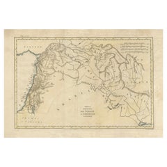
Map of Syria and Mount Lebanon – “Carte de la Syrie”, c.1760
This finely engraved 18th-century map, titled Carte de la Syrie nouvellement corrigée, presents the region of Syria and Lebanon along the eastern Mediterranean coast. The map extends from the island of Cyprus (Isle de Cypre) and the Gulf of Alexandretta in the north to the area south of Gaza in the south, encompassing major historical and biblical sites.
Coastal cities such as Antioch, Tripoli, Beirut, Sidon, Tyre, Acre, Jaffa, and Gaza are marked, along with inland locations including Damascus, Aleppo, Homs, and Jerusalem. Mountain ranges are shown pictorially, including the Lebanon (Liban) and Anti-Lebanon ranges. Rivers, including the Orontes and Jordan, are carefully traced.
An inset at lower right titled Description du Mont Liban et du Kesroan focuses on the Mount Lebanon region, showing towns, monasteries, and the Keserwan district, a historical Maronite Christian stronghold. This inset offers greater detail on the mountainous terrain and settlements compared to the main map.
The map includes scale bars in French, Spanish, and Arabian leagues, reflecting its use for both scholarly and navigational purposes. Engraved by A. Porlier (A. Porlier Sculp.), it is marked “Tome 1, N° 1,” indicating its inclusion in a large multi-volume Enlightenment-era historical and geographical series.
In the 18th century, the Levant was of strategic interest to European powers for trade, pilgrimage, and missionary activity. Maps like this one served as both practical references and visual representations of a region rich in ancient history and religious significance.
Condition: Very good for age, with central folds as issued. Minor toning and light handling marks. Strong plate impression with crisp detail in both coastal and inland features.
Framing tips: A black or dark walnut frame with a cream mount will highlight the fine engraving. For thematic displays, this piece pairs well with other 18th-century maps of the Eastern Mediterranean or biblical lands.
Technique: Copperplate engraving
Maker: A. Porlier, French school, c.1760
- Dimensions:Height: 12.6 in (32 cm)Width: 11.23 in (28.5 cm)Depth: 0.01 in (0.2 mm)
- Materials and Techniques:Paper,Engraved
- Place of Origin:
- Period:
- Date of Manufacture:circa 1760
- Condition:Condition: Very good for age, with central folds as issued. Minor toning and light handling marks. Strong plate impression with crisp detail in both coastal and inland features.
- Seller Location:Langweer, NL
- Reference Number:Seller: BG-14078-351stDibs: LU3054346218602
About the Seller
5.0
Recognized Seller
These prestigious sellers are industry leaders and represent the highest echelon for item quality and design.
Platinum Seller
Premium sellers with a 4.7+ rating and 24-hour response times
Established in 2009
1stDibs seller since 2017
2,826 sales on 1stDibs
Typical response time: 1 hour
- ShippingRetrieving quote...Shipping from: Langweer, Netherlands
- Return Policy
More From This Seller
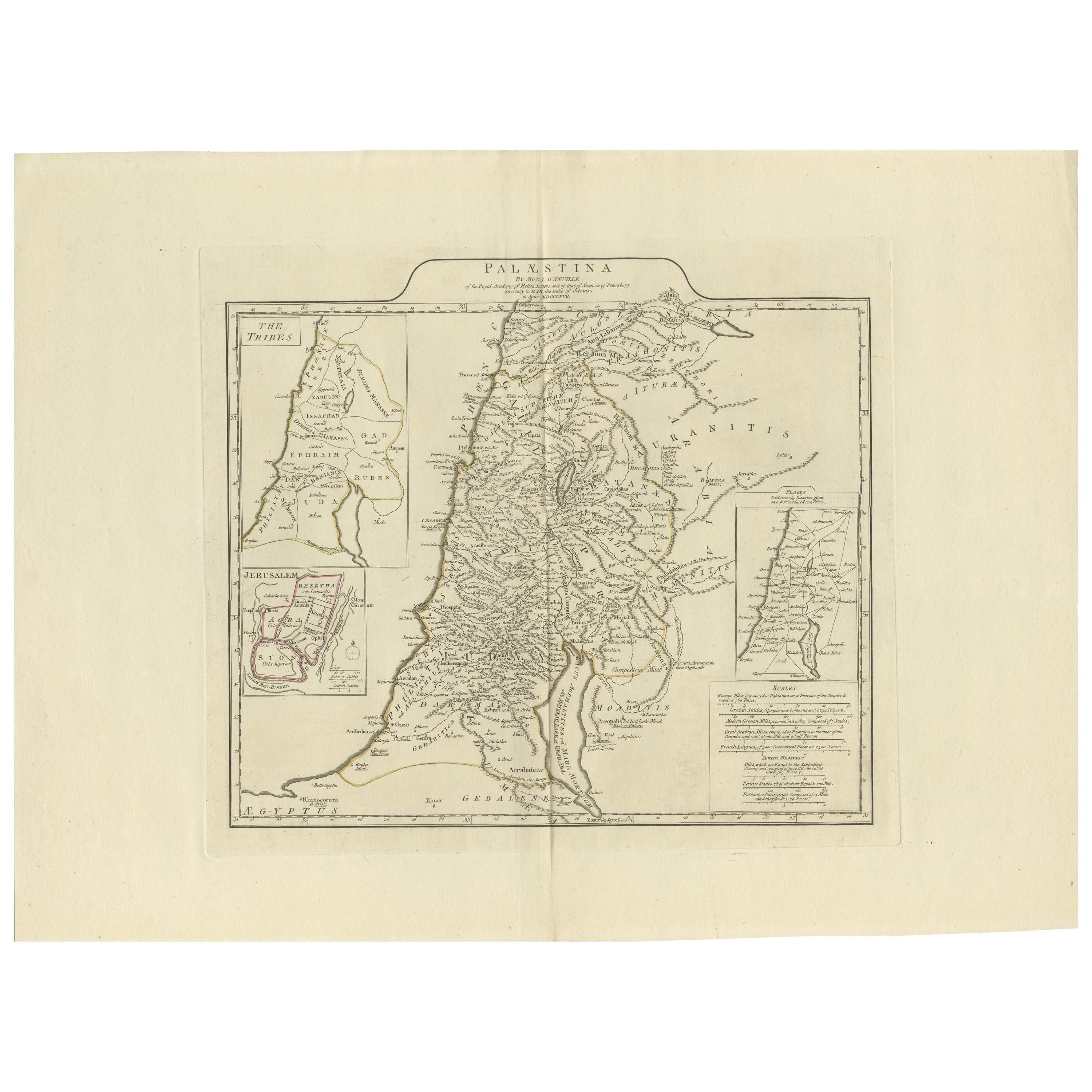
View All1767 D’Anville Map of the Holy Land: Ancient Divisions and Biblical Geography
Located in Langweer, NL
Ancient Map of Palestine or the Holy Land by D'Anville (1767)
This detailed map, created by the renowned French cartographer Jean Baptiste Bourguignon d'Anville in 1767, depicts the...
Category
Antique 1670s Maps
Materials
Paper
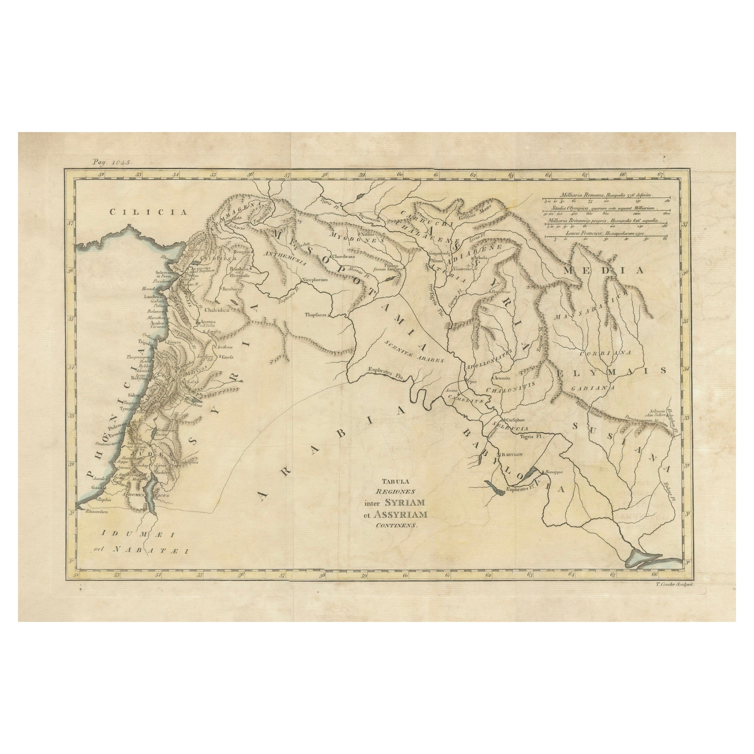
Antique 19th Century Map of Ancient Syria
Assyria - Historical Regions, c.1802
Located in Langweer, NL
19th Century Map of Ancient Syria and Assyria: 'Tabula Regiones inter Syriam et Assyriam continens'"*
This beautifully detailed 18th-century map, titled...
Category
Antique Early 1800s Maps
Materials
Paper
$295 Sale Price
20% Off
Detailed Original Old Map of the Southern Region of the Kingdom of Algiers 1773
Located in Langweer, NL
Antique map titled 'Kaart van het Zuidelyk Gedeelte van het Ryk Algiers'.
Old map of the southern region of the Kingdom of Algiers, Algeria. Originates from the first Dutch edito...
Category
Antique 18th Century Maps
Materials
Paper

Original Antique Map of Syria Phoenice by Van Dùren
1749
Located in Langweer, NL
Interesting Antique map published in Germany titled 'Neue Vorstellung von Phoenice und Syrien (..)' This map is engraved with a lot of details. It is an original antique map of Syria...
Category
Antique Mid-18th Century Maps
Materials
Paper

$286 Sale Price
20% Off
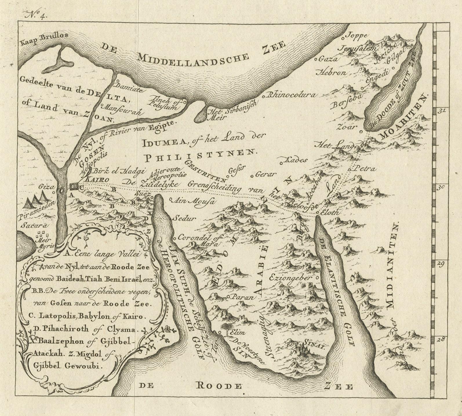
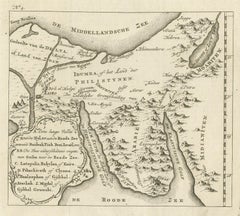
Antique Map of Edom, an Ancient Kingdom in Transjordan, 1773
Located in Langweer, NL
Antique print titled 'Idumea, of thet Land der Philistynen'. Old map of Edom, an ancient kingdom in Transjordan located between Moab to the northeast, the Arabah to the west and the ...
Category
Antique 18th Century Maps
Materials
Paper
Antique Map of the Holy Land by Van Luchtenburg, c.1720
Located in Langweer, NL
Antique map titled 'Heylige Land verdeeld in de Twaalf Stammen Israels (..).' Highly detailed map of the Holy Land divided into 12 tribes of Israel...
Category
Antique 18th Century Maps
Materials
Paper

You May Also Like
Circa 1825 original engraving of the map of Syria by Giraldon Bovinet
Located in PARIS, FR
The circa 1825 original engraving of "Syrie" by Giraldon Bovinet, based on the work of L. Vivien, is a historically significant map that reflects early 19th-century cartographic tech...
Category
1820s Prints and Multiples
Materials
Paper, Engraving

Map of the Holy Land "Carte de la Syrie et de l
Egypte" by Pierre Lapie
By Pierre M. Lapie
Located in Alamo, CA
This is an early 19th century map of ancient Syria and Egypt entitled "Carte de la Syrie et de l'Egypte anciennes/dressée par M. Lapie, Colonel d'Etat M...
Category
1830s Landscape Prints
Materials
Engraving

Original Antique Map of Ancient Greece, Achaia, Corinth, 1786
Located in St Annes, Lancashire
Great map of Ancient Greece. Showing the region of Thessaly, including Mount Olympus
Drawn by J.D. Barbie Du Bocage
Copper plate engraving by P.F Tardieu
Original hand color...
Category
Antique 1780s French Other Maps
Materials
Paper

Map of the Holy Land "Carte de la Syrie et de l
Egypte" by Pierre M. Lapie
By Pierre M. Lapie
Located in Alamo, CA
An early 19th century map of ancient Syria and Egypt entitled "Carte de la Syrie et de l'Egypte anciennes/dressée par M. Lapie, Colonel d'Etat Major, et...
Category
Antique Early 19th Century French Maps
Materials
Paper

Original Antique Map of Ancient Greece- Boeotia, Thebes, 1787
Located in St Annes, Lancashire
Great map of Ancient Greece. Showing the region of Boeotia, including Thebes
Drawn by J.D. Barbie Du Bocage
Copper plate engraving by P.F T...
Category
Antique 1780s French Other Maps
Materials
Paper

Large Original Vintage Map of Israel, circa 1920
Located in St Annes, Lancashire
Great map of Israel
Original color.
Good condition
Published by Alexander Gross
Unframed.
Category
Vintage 1920s English Edwardian Maps
Materials
Paper

More Ways To Browse
Antique Syrian
Palestine Antique
Antique Syrian Furniture
Antique Furniture Lebanon
Lebanese Antiques
1970 Italian Armchair
House Of Denmark Table And Chairs
Louis Marble Top Side Table
Antique Russian Rugs
Baker Furniture By
For Kids
Sterling Silver Flatware Set Service For 12
Tufted Bar
Pair Of French Antique Armchairs
1970s Brass Glass Coffee Table
Antique Column Base
Charles Rennie Mackintosh For Cassina
Glass Salt