Items Similar to Antique Map of Tartary, Siberia
China – Tirion, Amsterdam c.1730


Want more images or videos?
Request additional images or videos from the seller
1 of 10
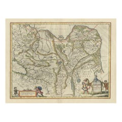
Antique Map of Tartary, Siberia
China – Tirion, Amsterdam c.1730
$643.95
£476.82
€540
CA$889.45
A$952.60
CHF 512.11
MX$11,569.86
NOK 6,470.76
SEK 5,924.46
DKK 4,115.48
About the Item
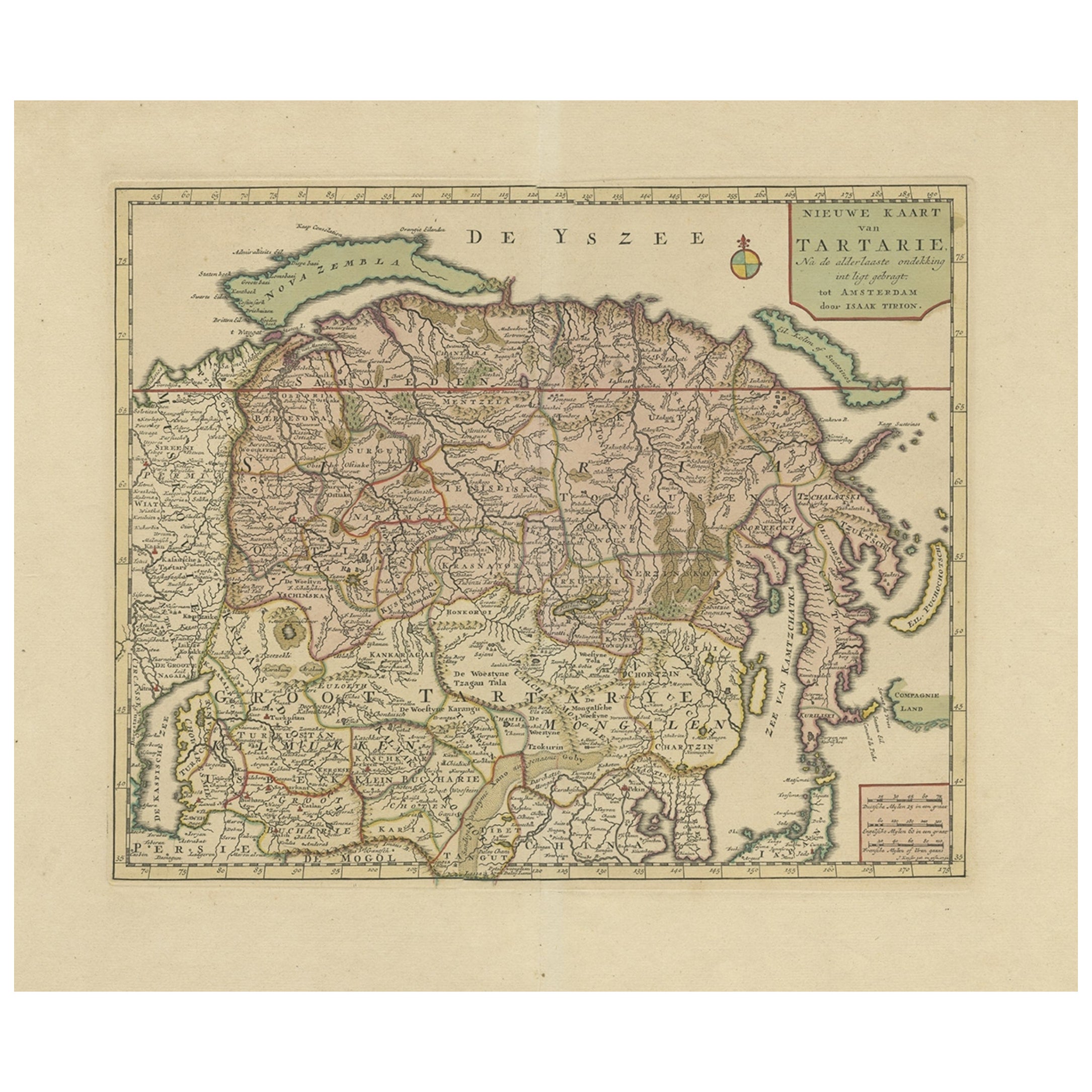
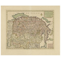
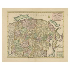
Antique Map of Tartary – “Nieuwe Kaart van Tartarie” by Isaak Tirion, Amsterdam c.1730
This finely engraved 18th-century map titled “Nieuwe Kaart van Tartarie” (New Map of Tartary) presents a detailed and expansive view of Northern and Central Asia as understood by European geographers in the early 1700s. Published in Amsterdam by Isaak Tirion, a prominent Dutch cartographer and publisher, this map illustrates vast regions of what was historically referred to as Tartary—a term broadly used in Europe to describe the territories stretching from the Caspian Sea across Siberia and Mongolia to the Pacific.
The map encompasses an extraordinary geographic range, including parts of present-day Russia, Mongolia, China, Central Asia, and Korea. It features numerous tribal regions, rivers, mountain ranges, and settlements labeled in Dutch, such as “Groot Tartarije,” “Mongolen,” “Siberien,” and “Kalmukken.” Coastal areas along the “Zee van Japan” (Sea of Japan) and “De Yszzee” (Ice Sea, referring to the Arctic Ocean) are also clearly delineated.
Notably, in the lower right corner appears the enigmatic “Compagnie Land,” a mythical or speculative landmass once thought to exist northeast of Japan. This inclusion reflects the exploratory uncertainty and cartographic curiosity of the era—typical of early 18th-century European maps when distant Asia remained partially unverified by Western surveys.
Tirion’s maps are well-regarded for their precision, aesthetic clarity, and strong engravings, typically included in atlases intended for both scientific and educational use. This particular map showcases his characteristic neat border work, typographic clarity, and topographical detail, serving as a valuable artifact of early Enlightenment-era geographic understanding.
Condition: Very good condition. A strong impression on hand-laid paper with wide margins. Vertical and horizontal folds as issued. Slight toning to the sheet and minor edge wear.
Framing tips: This historically rich map would be well-suited to a classic black or dark walnut frame, paired with an ivory or pale cream mat. For a more antique feel, consider a gold-accented frame or use museum glass to protect the aged paper and display its texture.
Technique: Copperplate engraving
Maker: Isaak Tirion, Amsterdam, circa 1730
- Dimensions:Height: 14.57 in (37 cm)Width: 14.69 in (37.3 cm)Depth: 0.01 in (0.2 mm)
- Materials and Techniques:Paper,Engraved
- Place of Origin:
- Period:
- Date of Manufacture:circa 1730
- Condition:Condition: Good condition. A strong impression on hand-laid paper with wide margins, except where it was bound in atlas. Vertical and horizontal folds as issued. Slight toning to the sheet and minor edge wear.
- Seller Location:Langweer, NL
- Reference Number:Seller: BG-11491-51stDibs: LU3054346152282
About the Seller
5.0
Recognized Seller
These prestigious sellers are industry leaders and represent the highest echelon for item quality and design.
Platinum Seller
Premium sellers with a 4.7+ rating and 24-hour response times
Established in 2009
1stDibs seller since 2017
2,826 sales on 1stDibs
Typical response time: 1 hour
- ShippingRetrieving quote...Shipping from: Langweer, Netherlands
- Return Policy
More From This Seller
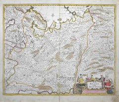
View AllAntique Map of Siberia and Chinese Tartary, Incl Nova Zembla, ca.1732
Located in Langweer, NL
Antique map of Tartary titled 'Nieuwe Kaart van Tartarie na de alderlaatste ondekking int ligt gebracht tot Amsterdam door Isaak Tirion'.
Map op Siberia and Chinese tartary. In t...
Category
Antique 1730s Maps
Materials
Paper
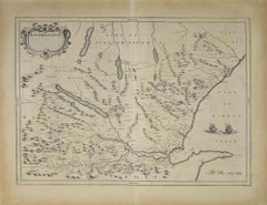
Antique Map of Tartary and Northeast Asia, c.1750
Located in Langweer, NL
Antique map titled 'Carte de la tartarie occidentale'. An interesting map of Tartary and northeast Asia, from Lake Baykal, Partie du Siberia in the north, Pays des Kalkas at the cent...
Category
Antique 18th Century Maps
Materials
Paper

$124 Sale Price
20% Off
Map of Tartary by Isaak Tirion: Detailed Cartography of Northern Asia, ca.1740
Located in Langweer, NL
This is an antique map titled "Nieuwe Kaart van Tartarie," which translates to "New Map of Tartary." The map was created by Isaak Tirion, a prominent Dutch cartographer and publisher...
Category
Antique 1740s Maps
Materials
Paper
$629 Sale Price
20% Off
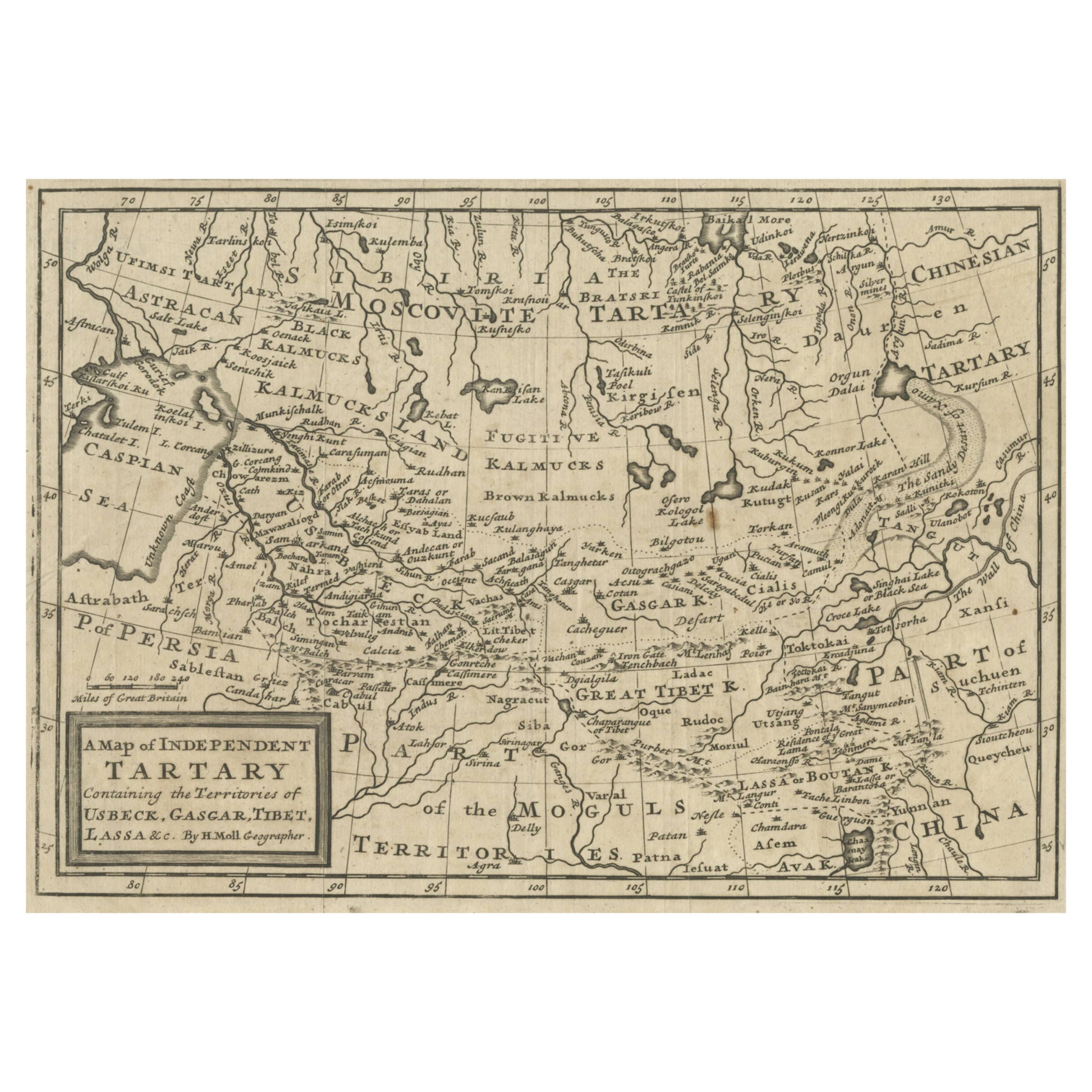
Old Map of Tartary with Persia, Siberia, the Mogul Territories
China, ca.1717
Located in Langweer, NL
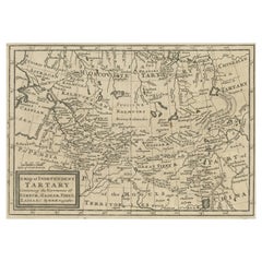
Antique map titled 'A Map of Independent Tartary, containing the territories of Usbeck, Gasgar, Tibet, Lassa & c'.
Old map depicting east of the Caspian Sea with parts of Persia, Siberia, the Mogul territories and on to western China...
Category
Antique 1710s Maps
Materials
Paper
$333 Sale Price
20% Off
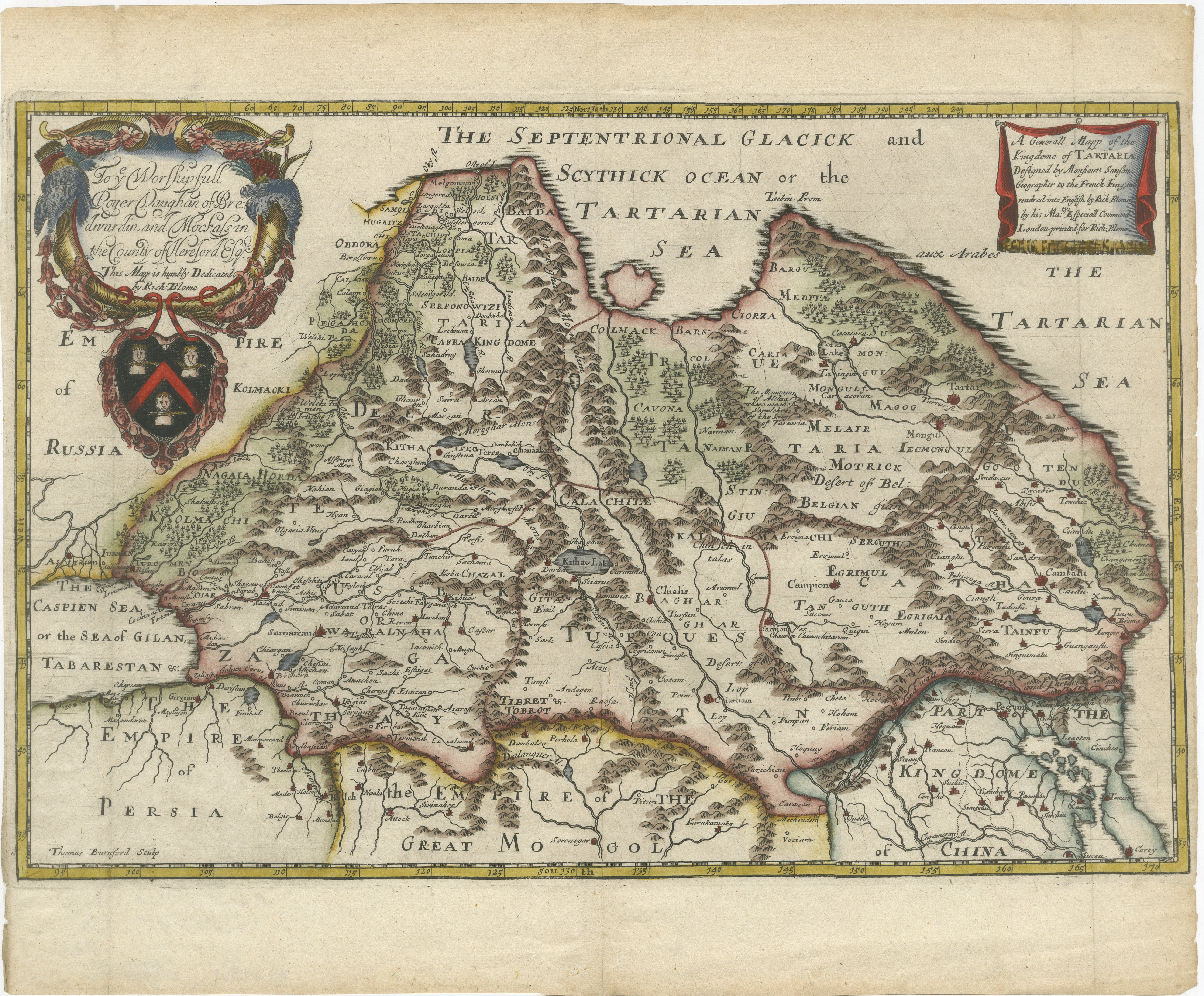
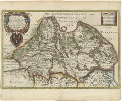
Rare 1670 Map of Tartary by Richard Blome after Sanson, Hand-colored Engraving
Located in Langweer, NL
Rare 1670 Map of Tartary by Richard Blome after Sanson, hand-colored engraving
This striking and highly decorative map, titled *A Generall Mapp of the Kingdome of Tartaria*, was pub...
Category
Antique 1670s Maps
Materials
Paper
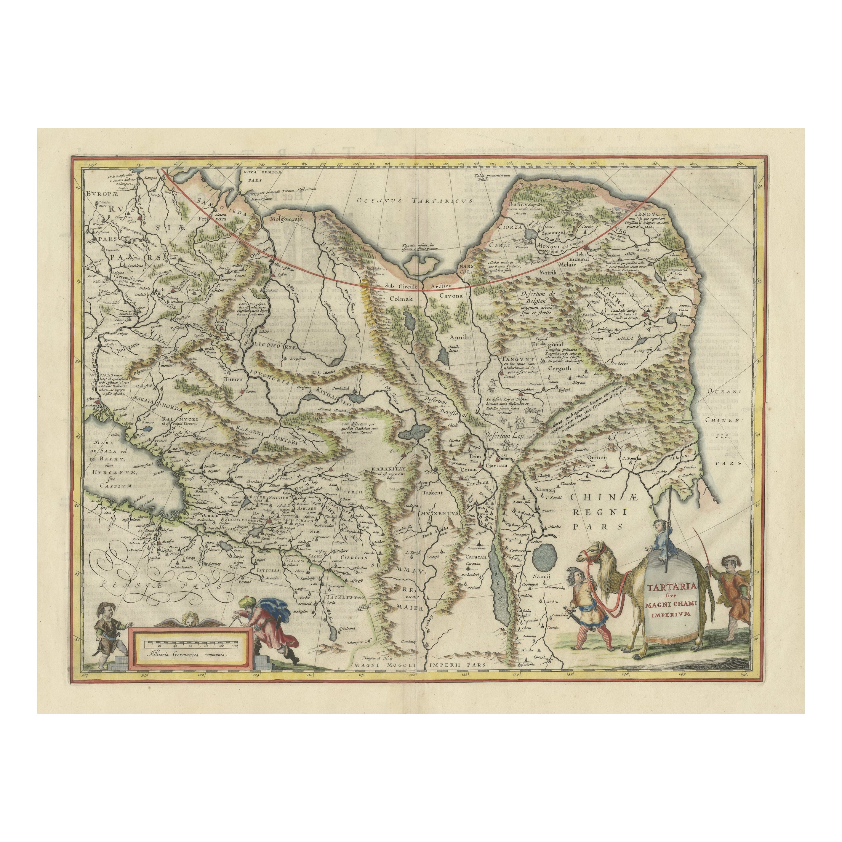
Old Genuine Antique Map of Tartary in the Russian Far East
Located in Langweer, NL
Original antique map titled 'Tartaria sive Magni Chami Imperium'. This great map of Tartary covers all of eastern Asia between the Caspian Sea and northern China and Manchuria. Being...
Category
Antique Mid-17th Century Maps
Materials
Paper
$1,335 Sale Price
20% Off
You May Also Like
Tabula Russia Vulgo Moscovia - Etching by Frederick de Wit - 1680ca
By Frederick de Wit
Located in Roma, IT
This double-page etching with contemporary coloring, entitled Tabula Russia vulgo Moscovia, was realized by the cartographer Frederick de Wit for the famous Atlas published in Amster...
Category
1680s Modern Figurative Prints
Materials
Etching
Map of the Russian Empire: An Original 18th Century Hand-colored Map by E. Bowen
Located in Alamo, CA
This is an original 18th century hand-colored map entitled "A New & Accurate Map of The Whole Russian Empire, As Contain'd Both In Europe and Asia, Drawn from Authentic Journals, Sur...
Category
Mid-18th Century Old Masters Landscape Prints
Materials
Engraving

Antique French Map of Asia Including China Indoneseia India, 1783
Located in Amsterdam, Noord Holland
Very nice map of Asia. 1783 Dedie au Roy.
Additional information:
Country of Manufacturing: Europe
Period: 18th century Qing (1661 - 1912)
Condition: Overall Condition B (Good Used)...
Category
Antique 18th Century European Maps
Materials
Paper

$486 Sale Price
40% Off
Ancient Map - Macedonia - Etching by Johannes Janssonius - 1650s
By Johannes Janssonius
Located in Roma, IT
Macedonia is an ancient map realized in 1650 by Johannes Janssonius (1588-1664).
The Map is Hand-colored etching, with coeval watercoloring.
Good condit...
Category
1650s Modern Figurative Prints
Materials
Etching

1790 Thomas Stackhouse Map, Entitled "Russia in Europe, " , Ric.a004
Located in Norton, MA
1790 Thomas Stackhouse map, entitled
"Russia in Europe"
Ric.a004
Stackhouse, Thomas
Russia in Europe [map]
London: T. Stackhouse, 1783. Map. Matted hand-colored copper engraving. Image size: 14.5 x 15.25 inches. Mat size: 22.75 x 23.75 inches. A beautiful example of this map of Eastern Europe...
Category
Antique 17th Century Unknown Maps
Materials
Paper

Map of Scotland - Etching by Johannes Blaeu - 1650s
Located in Roma, IT
Map of Scotland is an geographic map realized by Johannes Blaeu.
Etching, printed in 1660 ca.
Copper engraving, colored (coeval coloring), on paper, with center fold;
Latin text. ...
Category
1650s Modern Figurative Prints
Materials
Etching
$447 Sale Price
20% Off
More Ways To Browse
Mongolia Antique
Pair Of Danish Chairs
Veneer Dining Tables
1970 Italian Armchair
Furniture Uk
House Of Denmark Table And Chairs
Louis Marble Top Side Table
Antique Russian Rugs
Baker Furniture By
For Kids
Sterling Silver Flatware Set Service For 12
Tufted Bar
Pair Of French Antique Armchairs
1970s Brass Glass Coffee Table
Antique Column Base
Charles Rennie Mackintosh For Cassina
Glass Salt
Italian Modern Silver Vases