Items Similar to Antique Map of Tibet and Region West of Turfan by D’Anville, Paris, 1737


Want more images or videos?
Request additional images or videos from the seller
1 of 9
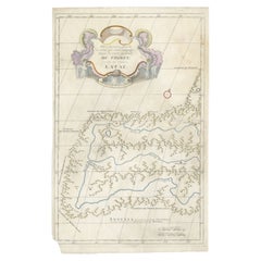
Antique Map of Tibet and Region West of Turfan by D’Anville, Paris, 1737
$407.99
£302.34
€340
CA$557.60
A$606.99
CHF 322.19
MX$7,303.39
NOK 4,082.59
SEK 3,740.81
DKK 2,589.88
About the Item
Antique Map of Tibet and Region West of Turfan by D’Anville, Paris, 1737
This finely engraved map is one of the detailed sheets from Jean-Baptiste Bourguignon d’Anville’s Carte générale du Thibet, issued in Paris in 1737 as part of his groundbreaking Nouvel Atlas de la Chine, de la Tartarie Chinoise et du Thibet. The richly decorated title cartouche reads “D’une Carte Générale du Thibet qui contient en Particulier le Païs qui est au couchant de Tourfan,” identifying this map as covering the territories west of Turfan in present-day Xinjiang, Central Asia.
The engraving documents a vast and remote region bordering Chinese Tartary and Tibet. Mountain ranges are shown in stylized relief, interspersed with rivers and settlements such as Casomo, Erminkaphtan, Tchachan, Harloupe Pira, and Tourfan itself. The detail reflects the Jesuit missionary surveys undertaken at the request of the Kangxi Emperor, which formed the empirical basis for D’Anville’s work. Unlike earlier maps of Asia that relied heavily on conjecture, D’Anville’s atlas was revolutionary in its accuracy and reliance on reliable data.
The map is further embellished with a brilliantly hand-colored rococo cartouche, decorated with martial and ornamental motifs including a plumed helmet, quiver of arrows, and elaborate foliage, all typical of the elegant French engraving style of the early 18th century. A scale bar is enclosed in its own decorative frame, with measures in Stades Chinois and Lignes Françoises, underscoring the map’s bridging of European and Chinese geographic traditions.
As part of the atlas, this sheet contributed to Europe’s most authoritative depiction of Tibet and Central Asia in the 18th century. Today, it remains an important artifact of Enlightenment cartography, combining geographical precision with artistic refinement.
Condition report:
Good condition with a crisp impression and vivid original hand-coloring of the cartouches. Minor age toning and faint handling marks in margins.Wide margins preserved.
Framing tips:
A wide ivory or cream mat will enhance the delicately hand-colored cartouche. A gilt or dark wood frame with a slim inner fillet is recommended to highlight the decorative elegance while maintaining focus on the engraved detail.
Technique: Engraving with hand-coloring
Maker: Jean-Baptiste Bourguignon d’Anville, Paris, 1737
- Dimensions:Height: 20.67 in (52.5 cm)Width: 13.12 in (33.3 cm)Depth: 0.01 in (0.2 mm)
- Materials and Techniques:Paper,Engraved
- Place of Origin:
- Period:1730-1739
- Date of Manufacture:1737
- Condition:Good condition with a crisp impression and vivid original hand-coloring of the cartouches. Minor age toning and faint handling marks in margins.Wide margins preserved.
- Seller Location:Langweer, NL
- Reference Number:Seller: BG-13457-21stDibs: LU3054346743712
About the Seller
5.0
Recognized Seller
These prestigious sellers are industry leaders and represent the highest echelon for item quality and design.
Platinum Seller
Premium sellers with a 4.7+ rating and 24-hour response times
Established in 2009
1stDibs seller since 2017
2,816 sales on 1stDibs
Typical response time: 1 hour
- ShippingRetrieving quote...Shipping from: Langweer, Netherlands
- Return Policy
More From This Seller
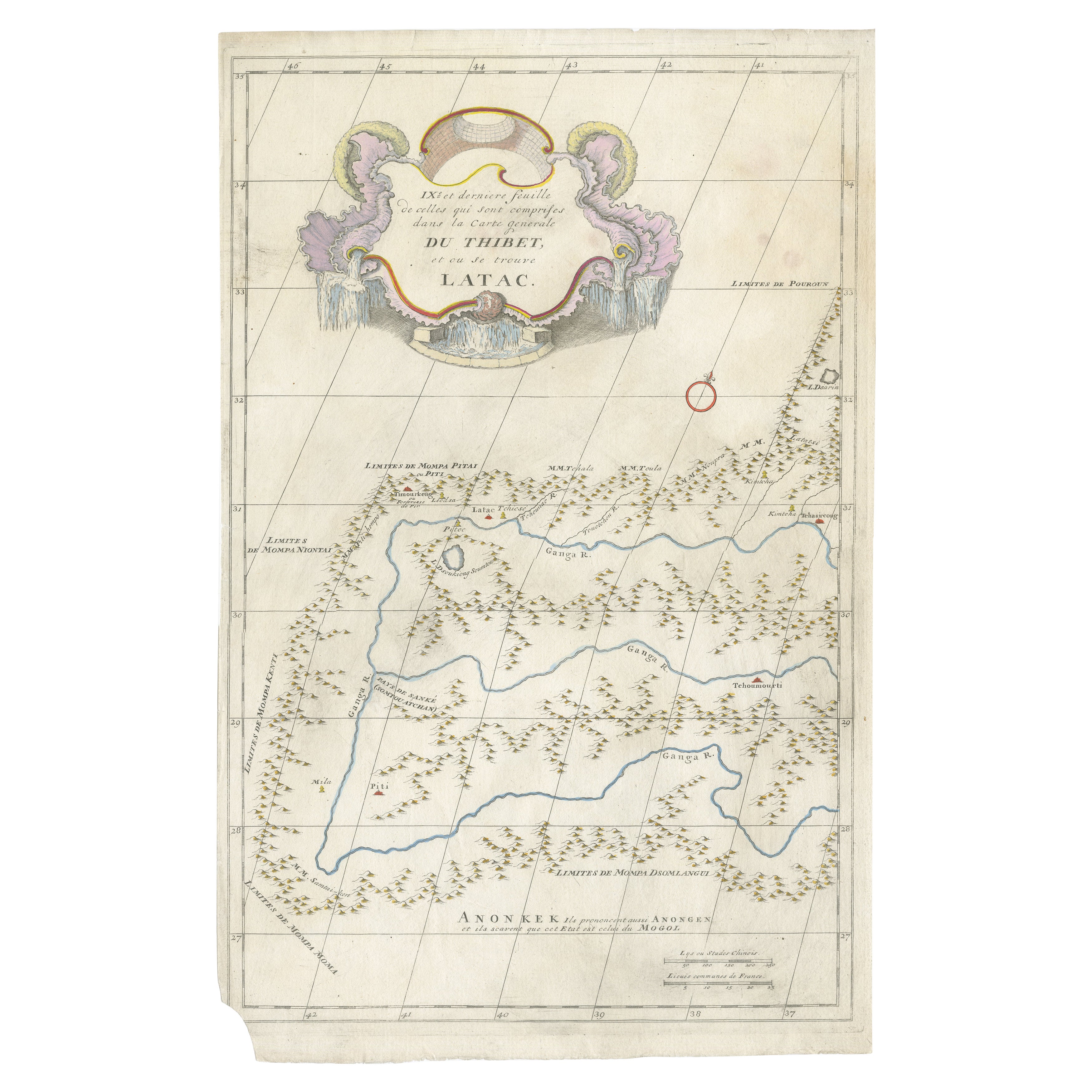
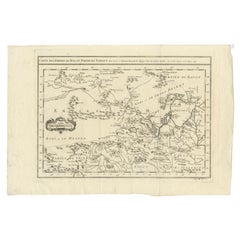
View AllAntique Map of Tibet and Latac by D’Anville, Paris, 1737
Located in Langweer, NL
Antique Map of Tibet and Latac by D’Anville, Paris, 1737
This antique engraved map is the ninth and final sheet of Jean-Baptiste Bourguignon d’Anville’s monumental Carte générale du...
Category
Antique 1730s European Maps
Materials
Paper
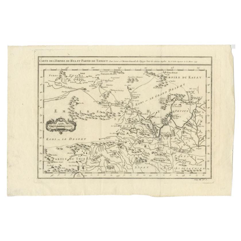
Antique Map of Tibet, The Gobi Desert and China by Bellin, circa 1764
Located in Langweer, NL
Antique map titled 'Carte de l'Empire de Hya et Partie de Tangut'. Old map of Tibet, Gobi desert and China depicting the Great Wall of China and caravan routes. Originates from Prevo...
Category
Antique 18th Century French Maps
Materials
Paper
Antique Map of Northern China and Far Eastern Russia Around the Amur River, 1754
Located in Langweer, NL
Antique map titled 'Carte De La Tartarie Orientale (..)'. A map for this far eastern portion of what is present day northern China and far eastern Russia...
Category
Antique 1750s Maps
Materials
Paper

Antique Map of Western Tartary and the Gobi Desert of the Russian Empire, c.1750
Located in Langweer, NL
Antique map titled 'A Map of Western Tartary Drawn from the Survey of the Jesuits and Mr. Kyrillow's Map of the Russian Empire'. Map of the Gobi Desert and the eastern portion of the...
Category
Antique 18th Century Maps
Materials
Paper

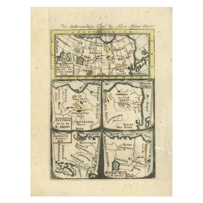
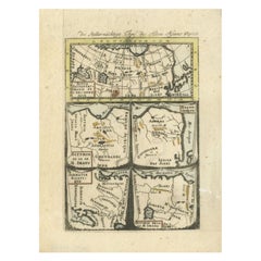
Antique Map of Northern Asia by Mallet, 1719
Located in Langweer, NL
Antique map titled 'Das Mitternächtige Theil des Alten Asien'. This sheet of five miniature maps describes the northern part of Asia in classical times, perhaps circa 150 AD. At the top, an overview map shows the main regions and territories, which are pictured in more detail below. From left to right, the four maps below depict Scythia east of the Imaus (Pamir) Mountains, Serica, Sychia west of the Pamir mountains, and Sarmatia, the last of which borders the Black Sea. Originates from Alain Manesson Mallet's 'Description de l 'Univers' (German edition). Artists and Engravers: Alain Manesson Mallet (1630-1706) was a French cartographer and engineer. He started his career as a soldier in the army of Louis XIV, became a Sergeant-Major in the artillery and an Inspector of Fortifications. He also served under the King of Portugal, before returning to France, and his appointment to the court of Louis XIV. His military engineering and mathematical background led to his position teaching mathematics at court. His major publications were Description de L'Univers (1683) in 5 volumes, and Les Travaux de Mars ou l'Art de la Guerre (1684) in 3 volumes. His Description de L'Universe contains a wide variety of information, including star maps...
Category
Antique 18th Century Maps
Materials
Paper
$93 Sale Price
20% Off
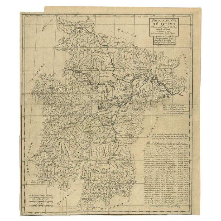
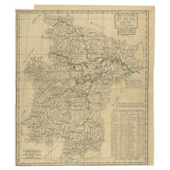
Antique Map of the Huguang Province of China by Du Halde, 1738
Located in Langweer, NL
Antique map titled 'Province VI Hu-Quang'. Old map depicting the Huguang province of China. Originates from 'A description of the Empire of China and Chinese-Tartary' by by J.B. du H...
Category
Antique 18th Century Maps
Materials
Paper
You May Also Like
Antique French Map of Asia Including China Indoneseia India, 1783
Located in Amsterdam, Noord Holland
Very nice map of Asia. 1783 Dedie au Roy.
Additional information:
Country of Manufacturing: Europe
Period: 18th century Qing (1661 - 1912)
Condition: Overall Condition B (Good Used)...
Category
Antique 18th Century European Maps
Materials
Paper

$486 Sale Price
40% Off
Antique Map - Mar Di Athiopia - Etching by Johannes Janssonius - 1650s
By Johannes Janssonius
Located in Roma, IT
Antique Map - Mar Di Athiopia is an antique map realized in 1650 by Johannes Janssonius (1588-1664).
The Map is Hand-colored etching, with coeval watercolorang.
Good conditions wit...
Category
1650s Modern Figurative Prints
Materials
Etching

Antique Map - Mare Pacificum - Etching by Johannes Janssonius - 1650s
By Johannes Janssonius
Located in Roma, IT
Mare Pacificum is an antique map realized in 1650 by Johannes Janssonius (1588-1664).
The Map is Hand-colored etching, with coeval watercolorang.
Good conditions with slight foxing...
Category
1650s Modern Figurative Prints
Materials
Etching

Original Antique Map of South America. C.1780
Located in St Annes, Lancashire
Great map of South America
Copper-plate engraving
Published C.1780
Two small worm holes to left side of map
Unframed.
Category
Antique Early 1800s English Georgian Maps
Materials
Paper

Siberia as Explored by Behring: Original 18th Century Hand-colored Map by Bowen
Located in Alamo, CA
This is an original 18th century hand-colored map entitled "An Exact Chart of all the Countries through which Capt. Behring Travelled from Tobolski, Capital of Siberia to the Country...
Category
Mid-18th Century Old Masters Landscape Prints
Materials
Engraving

California, Alaska and Mexico: 18th Century Hand-Colored Map by de Vaugondy
By Didier Robert de Vaugondy
Located in Alamo, CA
This is an 18th century hand-colored map of the western portions of North America entitled "Carte de la Californie et des Pays Nord-Ouest separés de l'Asie par le détroit d'Anian, ex...
Category
Antique 1770s French Maps
Materials
Paper
